You’ll find eight authentic ghost towns within 60 miles of Baker City, each preserving Eastern Oregon’s 1860s-1940s gold rush legacy. Sumpter features a massive 1935 dredge at its state heritage area, while remote Cornucopia showcases 36 miles of mining tunnels that once produced 66% of Oregon’s gold. Greenhorn stands as Oregon’s highest incorporated town at 6,296 feet, and Bourne’s ruins tell stories of boom-era hotels before the devastating 1937 flood. The following sections detail specific access routes, historical highlights, and exploration recommendations for each site.
Key Takeaways
- Sumpter features a preserved 1935 gold dredge at a state heritage area, showcasing massive mining equipment from the early 1900s.
- Cornucopia produced $7 million in gold and silver from 1885 to 1942, with thirty-six miles of underground tunnels still visible.
- Greenhorn stands at 6,296 feet as Oregon’s highest incorporated town, with zero current residents despite intact municipal status.
- Bourne flourished from 1895 until a 1937 flood and exhausted ore deposits led to ghost town status by 1950.
- Access varies by season; Sumpter serves as the main starting point for exploring multiple ghost towns in full-day trips.
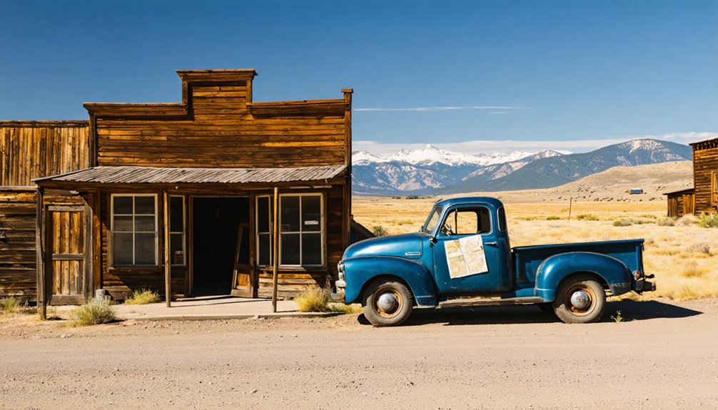
Sumpter: Gold Mining Heritage and the Valley Dredge
In 1862, gold discovery transformed Sumpter into one of Oregon’s most productive mining districts, though prospector Henry Griffin had already found gold in the region a year earlier.
Between 1862 and the early 1900s, placer and lode miners extracted $16 million from the Powder River and Elkhorn areas.
Placer and lode miners pulled $16 million in gold from the Powder River and Elkhorn areas over four decades.
The Sumpter Dredges revolutionized gold extraction when three massive machines arrived in 1912, 1915, and 1935. Each dredge featured 72 one-ton buckets that processed nine cubic feet of material per minute, operating continuously except Christmas and Fourth of July. A three-man crew worked each shift to keep the dredges running 24 hours a day.
From 1913 to 1954, these mechanical giants traveled eight miles through the valley, recovering $10-$12 million in gold. The dredges operated on shallow hulls, requiring minimal water depth to function effectively.
You’ll find the preserved 1935 dredge at Sumpter Valley Dredge State Heritage Area, which opened in 1994 with museum exhibits and historic photographs.
Cornucopia: Remote Mountain Mining Community
You’ll find Cornucopia tucked into a rugged mountain valley at 4,000 feet above sea level, approximately 50 miles northeast of Baker City near the Idaho border.
This remote mining camp produced an estimated $7,000,000 in gold and silver between 1885 and 1942, earning its reputation as potentially Oregon’s richest precious metal operation.
The town’s boom-and-bust cycles saw its population swing from 700 residents in the early 1900s to just 10 after the 1929 stock market crash, before mining ceased entirely during World War II when the government prohibited gold extraction.
The town’s name comes from Cornucopia, Nevada, drawing from the Latin “Horn of Plenty” to reflect the area’s mineral wealth.
Originally established in the 1880s near the Cornucopia mine, the settlement grew into one of the largest mining hubs in the United States before being fully abandoned in the 1970s.
Mining History and Operations
Around 1880, prospectors discovered gold-bearing veins in the Cornucopia district, setting in motion what would become one of Oregon’s most significant mining operations.
You’ll find that commercial operations began in 1885, rapidly expanding into a complex network of thirty-six miles of tunnels throughout the Cornucopia Mine Group.
The mining techniques evolved dramatically over the decades. Early stamp mills recovered just 65% of gold values, but later cyanide processes achieved 90% recovery rates.
By 1922, a 20-stamp mill crushed 60 tons daily using electricity—a technological leap for remote mountain mining.
The economic impact proved remarkable. In 1939, Cornucopia mines produced sixty-six percent of Oregon’s total gold output, with monthly profits reaching $100,000 by 1938.
Operations continued until World War II forced closure in 1942. The Union-Companion and Last Chance mines served as the primary producers in the district, generating over $2,500,000 by 1915.
At its peak, the Union-Companion mine employed up to 700 men, making it the largest employer in the region.
Accessing the Townsite Today
Reaching Cornucopia requires traversing the Cornucopia Highway from the south, beginning in the small community of Halfway on Oregon Route 86.
This solitary access route winds twelve miles through Jimtown and Carson before arriving at the ghost town, positioned 5.5 miles beyond Carson. You’ll navigate steep terrain within Wallowa National Forest, climbing to 4,741 feet elevation.
Seasonal access dramatically shapes your visit—winter brings approximately 75 inches of snowfall, rendering the route challenging or impassable. Summer opens the townsite for exploration, when you can freely hike to abandoned mines along Pine, Elk, and Panter Creeks.
The remote location, 56 miles northeast of Baker City on the Eagle Cap Wilderness’s southern edge, demands self-reliance and proper preparation regardless of season. The town’s name reflects its horn of plenty origins, as early prospectors believed the rich mineral deposits would provide unending wealth similar to the mythological symbol of abundance. This goat’s horn shaped symbol has represented prosperity for thousands of years across different cultures.
Remaining Structures and Features
The scattered remnants of Cornucopia’s mining heyday greet visitors with stark evidence of a once-thriving mountain community that extracted an estimated $20 million in gold and silver since 1880.
You’ll discover thirty-six miles of tunnels and shafts with darkened passages where rotting timbers and rusty ore carts remain frozen in time.
The remaining structures showcase vernacular mining architecture adapted to 7,000-foot elevation, featuring steeply-pitched roofs designed for heavy snowfall.
Cornucopia’s historical significance extends beyond the Union-Companion mine‘s heavy production along the mother lode.
You can examine the foundation of the 20-stamp mill, once powered by steam boilers, and explore buildings constructed from Baker County lumber hauled by horse-drawn waggers into this remote canyon through the 1920s.
Among the old ruins, you’ll find tailings piles composed of rock from the mining operations, with gold specks still visible in some specimens.
The post office closed in 1942, marking the end of an era when mining operations ceased and families abandoned this isolated mountain settlement.
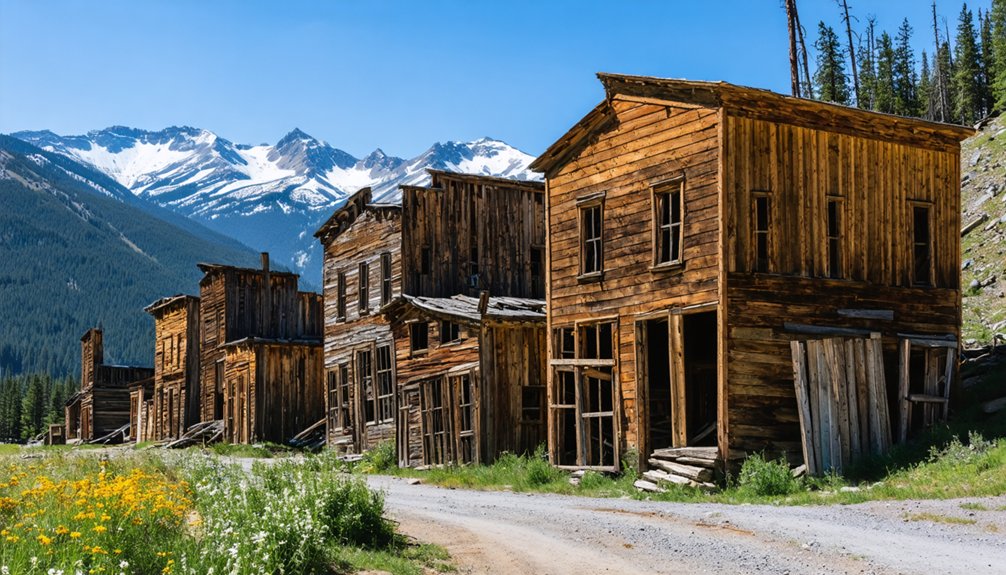
Granite: Historic Buildings Along the Elkhorn Scenic Byway
Perched along the Elkhorn Scenic Byway at an elevation where snow lingers into late spring, Granite stands as Oregon’s most authentic ghost town, a weathered memorial to the 1862 gold strike at Bull Run Creek that once drew over 5,000 miners to these remote mountains west of Baker City.
Today’s 30 residents share space with unrestored wooden cabins, sagging storefronts, and rusting mining equipment that evoke sepia-toned photographs from the boom years. Ghost town preservation here means leaving structures largely untouched—no tourist polish obscures the genuine decay.
Authentic decay without tourist polish—weathered cabins and rusting equipment stand untouched, preserving history through genuine deterioration rather than restoration.
You’ll find rock walls built by Chinese miners along Granite Creek, their handiwork surviving 160 years of mountain winters. The Granite history lives in every weathered board and abandoned building.
No services exist here, so fuel up before exploring this authentic remnant of Oregon’s mining frontier.
Greenhorn: Oregon’s Highest Incorporated Town
At 6,296 feet above sea level, Greenhorn claims the title of Oregon’s highest incorporated city—a geographic oddity that’s matched only by its legal peculiarity as a municipality that’s recorded zero residents yet never dissolved.
Greenhorn history traces back to the 1860s gold rush, with the town officially platting in 1904 after the Bonanza Mine’s shaft reached 1,000 feet—Oregon’s deepest at the time.
During its 1910-1915 boom, you’d have found two hotels, waterworks, saloons, and general stores serving 500 miners.
The 2000 and 2010 censuses recorded zero population, though seasonal residents now number around 15-18 during summer months.
You’ll reach this remote settlement via Greenhorn Road, six miles from Sumpter, where two habitable buildings remain standing without electricity or sewer service.
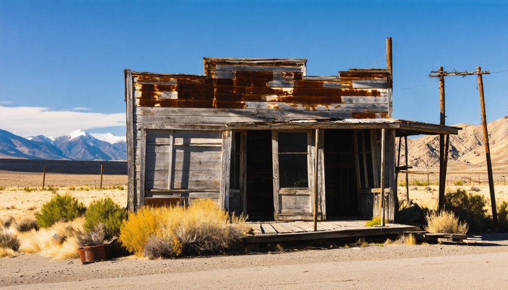
Bourne: Sumpter’s Neighboring Ghost Town
Just six miles from Sumpter along Cracker Creek, you’ll find Bourne—a mining camp established in 1895 that took its name from Massachusetts lawyer and future U.S. Senator Jonathan Bourne after he purchased the lucrative E and E mine in 1899.
The town flourished through the early 1900s with hotels, saloons, and a post office serving a robust mining community, but exhausted ore deposits and a devastating 1937 flood reduced it to ghost town status by 1950.
Today you can explore the weathered remnants of this once-prosperous camp, where a few surviving structures stand among the pines as evidence of eastern Oregon’s volatile mining heritage.
Historic Mining Camp Origins
When gold gleamed in Cracker Creek in 1888, eastern Oregon’s remote valleys transformed into a bustling frontier destination.
You’ll find this camp’s roots actually stretch back to the 1870s, when placer mining techniques first drew prospectors to establish Cracker City. Along a short main street, saloons and businesses sprouted to serve several thousand residents chasing promising deposits.
The town development accelerated despite largely unproductive claims. By the time the post office opened in 1895, officials renamed it Bourne after Massachusetts lawyer Jonathan Bourne Jr., who’d shown interest in the district’s potential.
His 1899 purchase of the Eureka and Excelsior mine proved prescient—it became one of the region’s richest producers, validating the faith that built this lively settlement near Sumpter.
Accessing Bourne Today
Today’s adventurers will find Bourne along forest roads that branch from Sumpter, roughly 9 miles northwest of Baker City’s historic neighbor.
You’ll navigate gravel and dirt paths following Cracker Creek’s historic route, where four-wheel drive proves essential for final segments. Highway 8 provides your approach from Baker City through Sumpter before forest roads lead deeper into Blue Mountain terrain.
Ghost town exploration here rewards those seeking historical significance beyond typical tourist stops.
Plan your visit during dry seasons when flood risks diminish and road conditions stabilize. You’ll encounter no facilities or services—just weathered cabins standing among pines, mining debris scattered through overgrowth, and Cracker Creek’s persistent sound.
Respect private land boundaries where posted, and you’re free to explore this abandoned settlement that time and nature have reclaimed since 1950.
Notable Structures and Remnants
Gold discovery along Cracker Creek in 1888 transformed this remote canyon into a bustling settlement that locals first called Cracker City.
Today’s Bourne remnants tell the story of eastern Oregon’s gold rush through weathered structures scattered among towering pines.
What You’ll Find at Bourne:
- Weathered cabins from the 1890s mining boom positioned along the original townsite
- Mining artifacts near the E and E mine area, once the district’s richest producer
- Structural foundations where saloons occupied every corner during peak operations
- Post-1937 flood survivors—the few buildings that withstood catastrophic destruction
The 1937 flood eliminated most buildings, leaving minimal physical traces of Jonathan Bourne’s namesake town.
No residents remained by 1950, cementing its ghost town status amid the wilderness.
Geiser: Early 20th Century Mining Settlement
Near the Cracker Creek district in Baker County’s Blue Mountains gold belt, Geiser emerged as an early 20th century mining settlement after Albert Geiser operated its profitable quartz mine for seven years before selling the operation for $500,000 in 1897.
The settlement contributed to regional production that shifted from placer operations to advanced quartz mining techniques during the final decade of the 19th century, supporting Baker City’s identity as the Queen City of the Mines through the 1920s.
Today, Geiser’s legacy survives primarily through the restored Geiser Grand Hotel, which Albert Geiser purchased and renamed in 1900.
The 1889 hotel featured the third elevator west of the Mississippi and connected via underground tunnels to the city’s red-light district.
Ghost stories now circulate about reported hauntings at the National Register property.
Whitney: Forgotten Town in the Blue Mountains
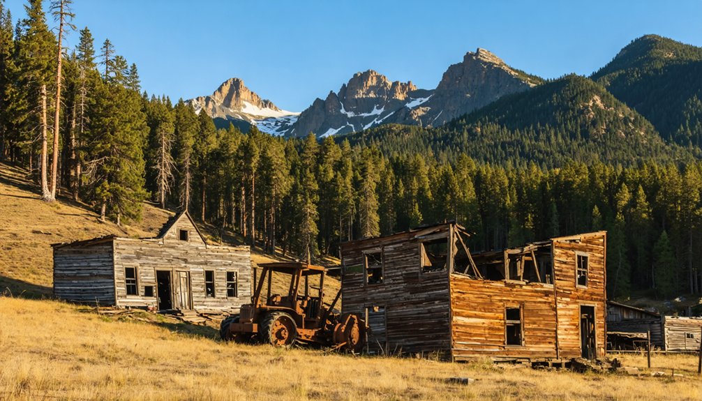
Deep in the Blue Mountains’ Whitney Valley, the lumber company town of Whitney emerged in 1900 when the Nibley Lumber Company established operations and named the settlement after pioneer C.H. Whitney.
Understanding Whitney history reveals a strategic location where the Sumpter Valley Railroad arrived in 1901, transforming the settlement into an essential freight hub.
The logging industry thrived here for decades, supporting over 150 residents and powering regional development:
- Steam donkeys and machinery replaced primitive tools, hauling massive timber loads
- A large sawmill operated south of town from 1911 until fire destroyed it in 1918
- Logging railroads extended in all directions for twenty years
- The town supplied lumber to mining operations throughout the northwestern United States
You’ll find remnants accessible via Highway 7 from Sumpter, 35 miles west of Baker City.
Galena: One of Oregon’s Oldest Mining Sites
Along the Middle Fork of the John Day River in eastern Oregon’s Blue Mountains, Galena stands as one of the region’s earliest mining settlements, established in 1865 when prospectors discovered promising gold deposits in this remote district.
Named after the lead ore mineral, the camp attracted several hundred miners who employed both placer and lode mining techniques to extract precious metals from local veins.
The settlement’s historical significance stems from its role during Oregon’s gold rush era, contributing to regional production records throughout the late 1800s.
You’ll find the site accessible via forest roads from Baker City, though profitability declined by the 1890s, leading to abandonment.
Today, only mining remnants remain among the surrounding national forest lands, drawing history enthusiasts to explore this authentic ghost town.
Planning Your Ghost Town Road Trip From Baker City
Before starting your ghost town exploration from Baker City, you’ll want to map out a strategic route that maximizes your access to eastern Oregon’s most important mining settlements. The 106-mile Elkhorn Scenic Byway offers the most extensive loop, connecting multiple sites while showcasing diverse terrain from Powder River farmlands to mountain lakes.
Consider these essential planning factors:
- Summer months provide ideal conditions for high-elevation roads and ghost town photography
- SH 7 northwest to Sumpter (30 miles) serves as your primary access corridor to Bourne
- Granite sits 60 miles west, requiring separate expedition through Elkhorn Mountains
- Historical preservation varies greatly—Sumpter’s restored dredge contrasts with Granite’s authentic decay
Allow full days for thorough exploration, as these remote settlements reward unhurried discovery of their architectural remnants and mining heritage.
Frequently Asked Questions
Are Any Ghost Towns Near Baker City Privately Owned or Off-Limits?
Most ghost towns near Baker City lack explicit private ownership or access restrictions in public records. You’ll find Sumpter, Cornucopia, Greenhorn, and Bourne openly accessible to visitors, though some active mining claims may limit specific areas.
What’s the Best Time of Year to Visit These Ghost Towns?
Strike while the iron’s hot—summer’s your best season for exploring Baker County’s ghost towns. Weather conditions deliver dry roads, minimal precipitation, and ideal 70-85°F temperatures. You’ll access remote sites like Greenhorn and Bourne freely without winter’s restrictive snowpack.
Do I Need a 4WD Vehicle to Reach These Locations?
You won’t need 4WD for these ghost towns. Standard 2WD vehicles handle the paved highways and maintained forest roads to Sumpter, Bourne, Granite, and Greenhorn. Cornucopia’s mountain route may require high-clearance, but 4WD isn’t essential.
Can I Camp Near These Ghost Towns Overnight?
You can camp overnight near all these ghost towns through dispersed camping in Wallowa-Whitman National Forest. Ghost town amenities are minimal to nonexistent, so check current camping regulations with the Forest Service before your trip.
Are There Guided Tours Available for Baker City Ghost Towns?
Yes, you’ll find guided tour options through local tour operators in Baker City specializing in Oregon Trail and ghost town excursions. Local tour guides also offer interpretive services through the National Historic Oregon Trail Interpretive Center.
References
- https://en.wikipedia.org/wiki/List_of_ghost_towns_in_Oregon
- https://www.tripadvisor.com/Attractions-g51757-Activities-c47-t14-Baker_City_Oregon.html
- https://thatoregonlife.com/2016/04/road-trip-ghost-towns-eastern-oregon/
- https://www.pdxmonthly.com/travel-and-outdoors/oregon-ghost-towns
- https://pnwphotoblog.com/sumpter-oregon-ghost-town-history/
- https://www.obbg.org/blog/2023/06/elkhorn-scenic-byway-and-oregon-ghost-towns-2/
- https://traveloregon.com/things-to-do/culture-history/ghost-towns/
- https://bakercityherald.com/2021/11/03/the-towns-that-drowned/
- https://crookcountyhistorycenter.org/2023/08/sumpter-valley-gold-dredge/
- https://en.wikipedia.org/wiki/Sumpter_Valley_Gold_Dredge


