You’ll find at least eight ghost towns within striking distance of Chico, each telling stories of California’s Gold Rush past. Enterprise and Nelson Bar lie submerged beneath Lake Oroville—their foundations visible only during severe droughts when water levels drop dramatically. Cherokee’s hydraulic mining scars remain visible 20 miles northeast, while Bidwell’s Bar’s relocated suspension bridge still stands as a monument to 1850s engineering. Forbestown and Big Bend offer accessible ruins along backcountry roads, and what remains of these communities reveals the dramatic boom-and-bust cycles that shaped Northern California’s mining heritage.
Key Takeaways
- Enterprise and Nelson Bar were Gold Rush towns submerged by Lake Oroville in 1968, visible only during droughts.
- Cherokee, located 20 miles northeast of Chico, operated hydraulic mining from 1870-1894, extracting over $15 million in gold.
- Bidwell’s Bar served as county seat until 1856 and featured California’s first western suspension bridge from 1855.
- Forbestown began in 1850 as a mining camp, transitioning from placer to hard-rock mining by 1888.
- Magalia originated as Dogtown in 1849, renamed in 1861, and maintains remnants of its Gold Rush heritage.
Enterprise: A Town Lost Beneath Lake Oroville
While most ghost towns gradually fade into decay above ground, Enterprise met a more dramatic fate—swallowed entirely by the rising waters of Lake Oroville in the 1960s.
You’ll find this settlement’s Enterprise history rooted in the 1850s, when miners called it both Enterprise and Mountain Spring. Built six miles northwest of Chico along the Feather River, it supported over 3,000 prospectors chasing gold deposits discovered at nearby Bidwell Bar.
Born from Gold Rush fever in the 1850s, Enterprise housed over 3,000 miners before disappearing beneath Lake Oroville’s waters.
The Gold Rush impact transformed this remote canyon into a bustling supply hub.
Today, you can only glimpse Enterprise’s foundations when drought drops the reservoir to historic lows. What government planners saw as progress, you might view differently—an entire community erased beneath engineered waters, its stories preserved only in archival records and occasional underwater revelations.
The Oroville Dam construction, which began in 1957 and was completed in 1968, created California’s second-largest reservoir and permanently submerged Enterprise along with hundreds of other archaeological sites from both the Gold Rush era and earlier indigenous settlements. The Bidwell Bar suspension bridge, designated as California Historical Landmark 314 and recognized as the state’s first suspension bridge, was relocated before the flooding to preserve this engineering landmark from the pioneer era.
Bidwell’s Bar and Its Historic Suspension Bridge
Before Enterprise vanished beneath the reservoir, another settlement claimed the title of Butte County’s most historically significant submerged site—Bidwell’s Bar, where John Bidwell struck gold in July 1848 and launched the Feather River country’s first major mining boom.
You’ll find Bidwell’s Bar served as county seat from 1853 until Oroville claimed that distinction in 1856. The town’s 2,000 residents witnessed construction of the Mississippi’s first western suspension bridge in 1855, just as placer deposits ran dry.
Though fire devastated the settlement in August 1854, residents rebuilt within months. A post office established in 1851 served the community through its peak mining years of 1856-1857. Historic preservation efforts saved the suspension bridge before Lake Oroville’s 1968 flooding submerged the courthouse grounds forever.
You can still cross that relocated footbridge today, 1.5 miles downstream from where miners once bartered with Native Americans for California’s freedom and fortune. The courthouse site now submerged beneath Lake Oroville once stood 120 yards west of the current California Historical Landmark 330 marker.
Nelson Bar and the Drowned Communities of the Feather River Canyon
If you’ve explored Bidwell’s Bar, you’ve only scratched the surface of Lake Oroville’s drowned history.
Nelson Bar—a mining camp named for Benjamin Nelson, who struck gold here around 1850—once bustled with prospectors on both banks of the West Branch, connected by ferry and later a toll bridge that formed part of the main route between Paradise and Oroville.
When engineers completed Oroville Dam in 1968, the reservoir swallowed not only Nelson Bar but an entire network of canyon settlements, their bridge pilings and road grades now visible only when drought draws the lake down.
Today, a historical marker along Lime Sand Road, dedicated in 1979 by E Clampus Vitus, commemorates the site where this Gold Rush settlement once stood. Like Nevada’s ghost town collections, these drowned communities offer a glimpse into living history, their stories preserved beneath the surface of modern infrastructure.
Life Before the Flood
When Benjamin Nelson struck gold along the sandbars of the West Branch in 1850, he couldn’t have imagined his discovery would anchor a thriving settlement that would eventually vanish beneath reservoir waters.
You’d find miners working both riverbanks, employing mining techniques from simple panning to hydraulic operations that occasionally yielded spectacular finds—like that 54-pound nugget in 1859.
The community dynamics centered on basic necessities: general stores, modest homes, and the critical ferry crossings that connected isolated families. The river sustained everything—transportation, gold extraction, daily survival.
These weren’t fancy establishments, just hardworking people carving existence from canyon walls. By 1849, the toll bridge already collected fees from prospectors chasing California dreams through treacherous terrain where rockslides and floods tested their resolve.
The last bridge connecting Nelson Bar’s riverbanks was lost to the water in 1967, marking the final chapter before Lake Oroville’s creation transformed the canyon forever.
Lake Oroville’s Drowned History
The California State Water Project authorized the Oroville Dam in 1951, sealing the fate of Nelson Bar and dozens of other canyon communities that had clung to the Feather River‘s edge for over a century.
Between 1961 and 1968, construction crews diverted the river and raised the massive embankment while families packed belongings from homesteads, mining camps, and river crossings soon to vanish beneath rising waters.
By the late 1960s, Lake Oroville‘s initial filling created drowned landscapes where roads, bridges, and settlements disappeared under millions of acre-feet. The reservoir eventually reached a capacity of over 3.5 million acre-feet, making it California’s second-largest reservoir.
During drought years you’ll witness this submerged history resurface—ghostly foundations, road grades, and bridge piers emerging from receding waters, tangible proof that the state’s water ambitions erased entire communities your grandparents might’ve visited. In February 2017, the Feather River watershed received an entire year’s average runoff in just 50 days, raising the reservoir to levels that threatened downstream communities and triggered massive evacuations.
Exploring Remnants Today
Unlike most ghost towns where you can still walk among foundations and peer through window frames, Nelson Bar offers only open water and the occasional glimpse of what lies beneath.
During exceptionally low reservoir levels, you’ll spot road cuts and former shoreline features emerging from Lake Oroville’s receding waters. The submerged structures—bridge abutments, foundations, and transport corridors—rest approximately 974 feet below normal pool elevation.
You won’t find standing ruins here. Instead, access modern overlooks and boat launches offering vantage points toward the drowned landscape.
Bathymetric maps and historic photograph overlays help pinpoint where Benjamin Nelson’s 1850 discovery once sparked a thriving river crossing. The historical significance lives on through regional archives documenting this vanished Gold Rush transport hub, even as the physical townsite remains entombed beneath Oroville Dam’s waters. The settlement was located 5 miles southeast of Paradise before the reservoir submerged the area.
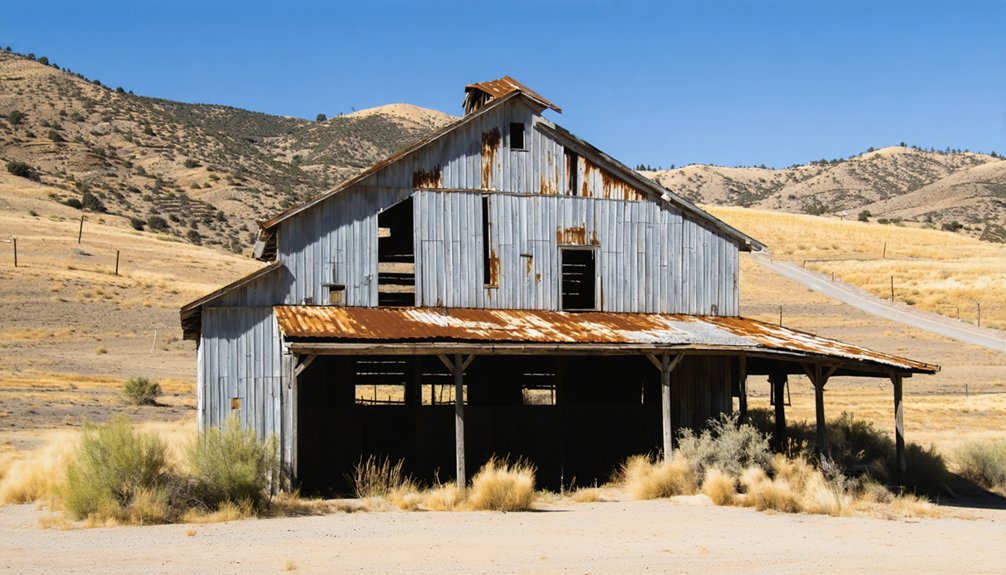
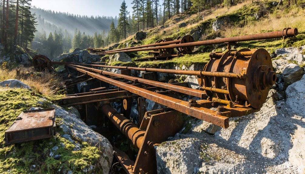
Cherokee: Hydraulic Mining Heritage in the Foothills
Just twenty miles northeast of Chico, you’ll find Cherokee—a reflection of California’s most ambitious and destructive mining technology.
Between 1870 and 1894, the Spring Valley Mining Company operated eighteen massive water cannons here, blasting ancient riverbeds with 400-foot jets and extracting over $15 million in gold from Table Mountain’s gravels.
Today you can walk among the scoured hillsides and remnant flumes where 500 workers once manned this industrial-scale operation, now reduced to scattered foundations and the hydraulic scars that still mark the landscape.
Historic Mining Operations
Gold’s discovery at Cherokee in the early 1850s transformed a remote foothill location north of Oroville into one of Butte County’s most ambitious hydraulic mining operations.
You’ll find evidence of Cherokee mining in the extensive waterworks that once channeled Sierra Nevada snowmelt through over 100 miles of ditches and flumes. The hydraulic innovations here were remarkable—eighteen massive monitors shot pressurized water 400 feet, blasting ancient gravel beds to expose gold deposits worth more than $15 million.
When surface placers played out, miners consolidated their claims, financing capital-intensive drift operations.
The Spring Valley Mining Company‘s incorporation in 1870 with $800,000 from San Francisco investors enabled construction of California’s largest hydraulic infrastructure, including a 300-acre reservoir at Concow that powered this engineering marvel until litigation shut it down in 1887.
Visiting Cherokee Today
Today’s Cherokee sits atop Table Mountain thirteen miles north of Oroville on Highway 70, where fewer than 50 residents maintain what remains of a town that once housed over a thousand miners.
You’ll find no services or accommodations here—just authentic Cherokee history waiting in skeletal buildings and stone foundations twenty feet deep.
The Cherokee Museum, relocated in 1878 from Upper Town, still opens with its original brass key. Inside, you’ll discover mining relics and artifacts from President Hayes’s 1880 visit.
Outside, hydraulic monitors stand silent beneath Sugar Loaf Mountain’s scarred slopes.
Visit during the Fourth of July celebration or Hayes Day near September 24 when festivals breathe temporary life into these ruins.
The pioneer cemetery holds hundreds of former residents whose weathered headstones tell stories no guidebook captures.
Forbestown: From Gold Rush Camp to Rural Outpost
Nestled fifteen miles east of Oroville in the South Fork Feather River drainage, Forbestown sprang to life in 1850 when merchant Ben F. Forbes established his supply store for placer miners.
You’ll find Forbestown history written in the South Fork’s rich gravels, where early prospectors pulled fortunes from streamside deposits.
By 1888, operations shifted underground—the Gold Bank mine alone extracted $2 million worth of ore through hard-rock methods before closing in 1904.
Gold mining techniques evolved from simple panning to complex drift operations targeting north-trending quartz veins in greenstone bedrock.
Though concentrated sulfides occasionally yielded $100-per-ton pockets, most milling ore ran disappointingly lean at 0.2 ounces per ton.
Today’s Forbestown survives as scattered homesteads among forested foothills, its boom-era streetscape reduced to fading photographs and archival records.
Inskip: High-Elevation Mining Settlement in the Pines
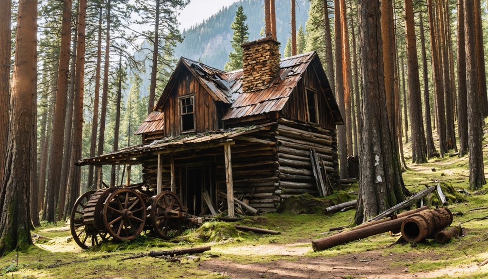
Higher up in Butte County’s pine-forested mountains at 4,808 feet, Inskip emerged from a different template than Forbestown’s riverside diggings.
You’ll find a settlement born from 1850s gold strikes that swelled to 1,000 souls, named for sawmill operator Edward “Doc” Watts Inskeep.
Pat Kelley’s 1857 hotel served the Oroville-Susanville stage route—a lifeline that outlasted the mining boom.
The Inskip Hotel, rebuilt after an 1868 fire, stands as the town’s Historical Significance made tangible.
By 1975, it’d operated continuously for over a century, pivoting from miners to skiers and hunters as you’d adapt to survive.
Today’s 300 residents inhabit what archival records confirm as a strategic midway station on 140 rugged miles of mountain road.
The hotel’s rumored ghost reportedly hunts arsonists through rooms that’ve witnessed countless transformations.
Magalia and the Legacy of Dogtown
A 54-pound gold nugget—the legendary Dogtown Nugget—rewrote Butte County’s mining map when it surfaced in what miners had christened Dogtown, a rough camp clinging to Paradise Ridge above Chico.
You’ll find the settlement’s roots in 1849, when prospectors staked claims around a dog-breeding operation that lent the Mining Camp its peculiar name. By 1861, residents had adopted “Magalia”—from Latin for “dwellings”—signaling the shift from tents to permanence.
From gold rush tents clustered near kennels to permanent dwellings bearing a Latin name—twelve years that transformed rough Dogtown into rooted Magalia.
The 1903 Butte County Railroad depot anchored commerce here, hauling lumber and ore down to Chico.
Today you can trace false-front storefronts in faded photographs and visit the depot-turned-café, designated Historic Point 575. Much of old Dogtown burned or collapsed, leaving ghostly gaps between modern homes—a half-erased chronicle of gold fever.
Big Bend: Remote River Access and Mining History
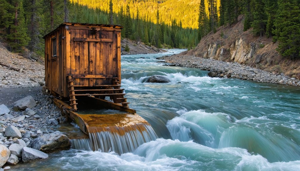
Sixty miles northeast of Chico, where Highway 70 threads through the Feather River Canyon, Big Bend clings to a canyoned reach of the North Fork at 1,400 feet elevation—part mining relic, part hydroelectric outpost, part forgotten river access.
You’ll navigate unimproved roads to gravel bars where Gold Rush placer crews worked the cobbles, their rock walls and tailings still visible along steep canyon paths.
Today’s river recreation draws anglers chasing trout through PG&E-controlled flows and paddlers reading boulder-strewn runs between pools.
Spring releases turn hazardous; summer heat bakes exposed bars.
The settlement’s mining heritage survives in scattered adits and hydraulic scars above the water, while a handful of residents occupy what remains—a landscape demanding backcountry skills and rewarding those comfortable with remoteness.
Planning Your Ghost Town Exploration From Chico
From river-bottom ruins like Big Bend, your ghost-town circuit shifts inland to planning and logistics—the unglamorous work that separates productive fieldwork from wasted daylight.
Productive fieldwork demands unglamorous preparation—the planning that separates meaningful discovery from squandered hours in the backcountry.
You’ll need high-clearance transport for rough Sierra foothill routes, paper maps when cell towers vanish, and enough fuel to complete loops through Cherokee, Forbestown, and Inskip without rationing.
Check CAL FIRE restrictions before departure—wildfire closures can strand you mid-itinerary.
Winter snow seals higher camps; summer heat along the Feather canyon demands dawn starts and doubled water rations.
Ghost town history rewards preparation: layering USGS topos over modern apps reveals obliterated townsites, while archival mining-claim maps pinpoint hidden adits.
Travel safety isn’t cautionary theater; it’s the difference between documenting vanished communities and becoming a cautionary tale yourself.
Frequently Asked Questions
Are Any Ghost Towns Near Chico Accessible Only by Boat?
Don’t chase waterways—you won’t find boat access to Chico’s ghost towns. Cherokee, Inskip, and Oregon City hold significant historical significance as gold-mining settlements, but they’re all reachable by land routes through Butte County’s backcountry roads today.
Which Ghost Towns Have Remaining Historic Cemeteries to Visit?
You’ll find historic graveyards at Helltown, where six 19th-century marked graves remain on the hillside, and Bidwell’s Bar’s relocated cemetery. Both sites offer authentic cemetery tours connecting you to Butte County’s Gold Rush heritage and pioneer freedoms.
Can You Explore Drowned Towns at Low Reservoir Levels?
You’ll hit a thousand legal walls before reaching drowned history. Most California reservoir agencies restrict submerged exploration when towns re-emerge—trespassing laws, safety closures, and artifact protection mean you can’t freely wander exposed ruins.
What Archival Sources Document Ghost Towns Now Under Lake Oroville?
You’ll find archival maps and historical photographs documenting drowned Lake Oroville towns in Butte County Historical Society collections, DWR relicensing studies, Sanborn fire insurance maps, and Arcadia Publishing’s “Lost Communities” volumes with firsthand accounts.
Do Any Ghost Towns Offer Camping or Overnight Accommodations Nearby?
You won’t find camping options at ghost towns near Chico—most sites like those beneath Lake Oroville are submerged or day-use only. Calico Ghost Town offers no overnight stays. Explore nearby Mojave Desert campgrounds instead for accommodations.
If you’re willing to venture a little further, consider ghost towns near Eureka California, where you can immerse yourself in the history of abandoned communities. These locations provide a unique backdrop for exploration and photography, perfect for those looking to capture the haunting beauty of the past. Many of these sites are accessible during the day, allowing for a scenic adventure without the need for overnight camping.
References
- https://en.wikipedia.org/wiki/List_of_ghost_towns_in_California
- https://www.visitcalifornia.com/road-trips/ghost-towns/
- https://www.youtube.com/watch?v=VKp0OYP6gLg
- https://californiathroughmylens.com/calico-ghost-town/
- https://www.savetheredwoods.org/blog/spooky-redwoods-ghost-town-remains-a-presence/
- https://www.tripadvisor.com/ShowTopic-g28926-i29-k2980376-Northern_CA_ghost_towns-California.html
- https://www.ghosttowns.com/states/ca/cabutte.html
- https://www.atlasobscura.com/places?page=611&search=
- https://en.wikipedia.org/wiki/Lake_Oroville
- https://www.orovilleca.gov/333/History


