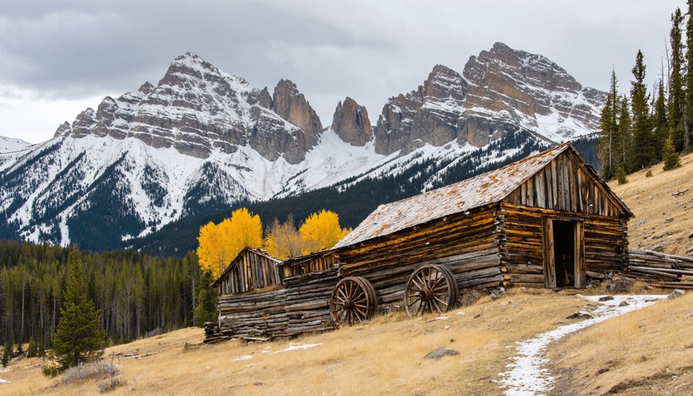
Within 40 miles of Frisco, you’ll discover eight authentic ghost towns from Colorado’s mining era, including Montezuma (a semi-ghost town with fifteen historic structures at 10,200 feet), Masontown (accessible via a 2-mile hike above Frisco), and Geneva City (requiring 4WD at 12,000 feet elevation). You’ll also find Dyersville near Breckenridge, the Climax molybdenum settlement on Fremont Pass, and Winfield’s preserved 1880s mining camp. Visit between late June and early October when mountain roads are passable and temperatures remain comfortable. The following sections provide detailed directions, access requirements, and essential preparation tips for exploring each site.
Key Takeaways
- Eight ghost towns exist within 40 miles of Frisco, accessible via paved highways, graded dirt roads, and 4×4 tracks.
- Montezuma features fifteen preserved historic structures from 1865, while Masontown requires a 2-mile roundtrip hike above Frisco.
- Geneva City sits at 12,000 feet with abandoned cabins and requires four-wheel drive or hiking for access.
- Best visiting window is late June through early October, with July-September ideal for high-elevation sites like Geneva City.
- Morning exploration is recommended to avoid afternoon thunderstorms; bring offline GPS, layered clothing, and adequate water supplies.
Masontown: Frisco’s Closest Ghost Town Adventure
Perched on the slopes of Peak 1 just above Frisco, Masontown represents Summit County’s most accessible ghost town experience—a modest 2-mile roundtrip hike that delivers both alpine scenery and Colorado mining history.
This company camp served the Victoria Mine during the late 1800s boom, when prospectors chased gold and silver through Summit’s high country. Avalanche impact proved catastrophic in 1926, destroying the settlement and leaving minimal visible remains today.
You’ll find foundation outlines and scattered mining equipment, including rusted metal piles marking the main site.
Blair Miller’s 2022 book “Masontown: Frisco’s Victoria Mine & Ghost Town” separates verified Masontown history from local lore through archival research. The book includes a detailed hiking guide to help visitors navigate the old town site.
Miller’s archival research distinguishes documented facts from folklore, providing the first comprehensive historical account of Frisco’s Victoria Mine settlement.
For hiking tips: leash dogs on the lower trail, extend your ghost town exploration toward Mount Royal, and check with Frisco Historic Park for guided interpretive hikes. The site reflects the challenges faced by mining towns throughout Colorado’s mountainous terrain, where harsh conditions and natural disasters often determined a settlement’s fate.
Montezuma: A Living Piece of Mining History
Unlike Masontown’s scattered foundations, Montezuma maintains its foothold as Summit County’s most substantial semi-ghost town—a living artifact where fifteen historic structures still stand along unpaved streets at 10,200 feet elevation.
You’ll discover authentic mining heritage here, where sixty-five residents still call this 1865 settlement home.
Prospector John Coley founded Montezuma following his silver discovery near Argentine Pass. By 1884, over one-hundred buildings filled this incorporated town, complete with hotels, stores, and the Mill Run newspaper.
The 1893 Sherman Silver Purchase Act repeal devastated silver operations, yet the community survived.
Devastating fires in 1920, 1949, and 1958 claimed dozens of structures, including the Summit House Hotel. Five fires over the years have hindered historic preservation efforts throughout the town’s existence.
Despite these losses, Montezuma’s historical significance endures through preserved buildings like Rocky Mountain House—accessible year-round via the original Post Road No. 40. Nearby Saints John, originally known as Colleyville, was founded by prospector John Column in 1863 and later renamed in 1870 with Freemason connections to Saint John the Baptist and Saint John the Evangelist.
Geneva City: Remote Ruins in the High Country
Deep within Pike National Forest at 12,000 feet elevation, Geneva City’s remote ruins challenge modern visitors with the same harsh conditions that kept this mining camp seasonal even during its 1860s heyday.
You’ll need a four-wheel drive vehicle to navigate Forest Service Road 119’s steep grades and tight turns from Duck Creek Picnic Area, or you can hike in.
The abandoned structures—century-old log cabins, a boarding house, and saloon—stand as evidence of Colorado’s mining heritage.
Weathered log structures from the 1800s preserve the rugged spirit of Colorado’s high-altitude mining legacy.
Dense iron deposits still attract severe electrical storms, adding authenticity to ghost town lore. Miners worked steadily here until the 1960s, extracting gold, silver, and iron.
Access remains limited to July through September.
Expect weekend crowds at this popular camping destination, though fallen timber and thick vegetation hide many historical remnants requiring thorough exploration. Visitors have discovered old pack saddles and mineral specimens scattered throughout the site. A local smelter once operated nearby to process the extracted minerals from the surrounding claims.
Dyersville: Gold Rush Remnants Along Boreas Pass
About six miles southeast of Breckenridge along Indiana Gulch, you’ll find Dyersville—a ghost town established in January 1881 by Methodist minister John Lewis “Father” Dyer as a satellite community to nearby Warrior’s Mark Mine on Boreas Pass.
The settlement’s brief heyday centered on servicing miners working claims at the 10,880-foot elevation, though the town never secured its own post office and collapsed after the mine closed around 1908.
Dyer, who came to Colorado in 1861, preached strict Methodist teachings against drinking, gambling, and dancing, creating inevitable conflict with the settlement’s more libertine elements.
Today you can hike or bike to the ruins, where nearly a dozen log structures—including the walls of Jerry Krigbaum’s “Angels Rest” saloon—stand as evidence of high-alpine mining ambitions that couldn’t outlast harsh winters and dwindling ore. Dyer’s legacy lives on through Father Dyer Peak and Dyer Mountain, both named in his honor.
History and Discovery
Nestled at 10,880 feet in Indiana Gulch, six miles southeast of Breckenridge, Dyersville sprang to life in January 1881 when Methodist circuit-riding minister John Lewis “Father” Dyer hammered together a 17-foot-square cabin on the upper reaches of Indiana Creek.
He envisioned a morally upright settlement linked to his Warrior’s Mark Mine, deliberately distanced from Breckenridge’s rowdy saloon culture. Yet community dynamics quickly undermined his vision.
Saloonkeeper Jerry Krigbaum’s “Angels Rest” became the social hub, hosting notorious Christmas and New Year’s parties in 1881 that transformed the camp into a standard boomtown.
The name Dyersville itself honored early landowner James Dyer, following a common 19th-century practice of naming settlements after their founders or prominent benefactors.
Dyer’s legacy persists through regional toponyms—Father Dyer Peak, Dyer Mountain, and Breckenridge’s Father Dyer United Methodist Church—but the settlement itself lasted only a few years before miners abandoned the alpine outpost.
Remaining Structures Today
Though Father Dyer’s vision of a morally upright community faded within years of Dyersville’s 1881 founding, nearly a dozen deteriorating log cabins remain scattered along Indiana Gulch near the old mining road, their roofless walls and collapsed footprints outlining the settlement’s rough layout.
These abandoned structures cluster near the Warrior’s Mark Mine approach road, forming a loose “main street” corridor you’ll recognize immediately.
The site’s historical significance reveals itself through:
- A 17-foot-square pile of rotting logs marking Father Dyer’s original cabin
- Hand-hewn log walls from an 1880s livery stable and boarding house
- Rusting mining equipment fragments scattered throughout the townsite
- Foundation lines extending into the tree line, showing the community’s former reach
The ghost town sits on the north side of Boreas Pass, where prospectors once traveled the wagon road widened in 1866 to reach Breckenridge’s gold fields.
Forest Service Road 593 off Boreas Pass still provides access to explore these gold-rush remnants independently.
Getting There Safely
Reaching Dyersville requires traversing Boreas Pass Road and a rougher spur into Indiana Gulch, approximately 6 miles southeast of Breckenridge at 10,880 feet elevation.
While Boreas Pass Road remains graded dirt passable for most passenger vehicles during dry summer conditions, the final half-mile demands high-clearance 4WD due to rocks, ruts, and uneven surfaces.
Vehicle requirements increase considerably on the narrow Indiana Creek track—SUVs or trucks handle these conditions best.
For road safety, plan visits between late spring and early autumn when snow doesn’t block access; afternoon thunderstorms create slick, muddy surfaces that challenge low-clearance rigs.
Navigate using the Forest Service “Indiana Creek, Pennsylvania Creek” sign where the spur branches from Boreas Pass Road, ensuring you’re prepared for seasonal closures and rapidly changing mountain weather.
Climax: The Molybdenum Mining Ghost Town
Perched at 11,360 feet on Fremont Pass, Climax earned its name from its position at the summit of the grade along present-day CO-91 between Leadville and Copper Mountain. The Climax Mine began shipping ore in 1915, transforming this remote summit into the highest inhabited settlement in America.
At its peak, molybdenum production here supplied three-quarters of the world’s supply, a critical alloy for hardened steel in aircraft and wartime applications.
This self-contained company town housed workers and their families until a 1959 miners’ strike triggered its rapid abandonment. By 1965, entire houses rode flatbed trucks down to Leadville:
- School and hospital stood empty at oxygen-thin elevations
- Over 65,000 workers cycled through, many lasting just months
- Railway station marked America’s highest
- Industrial tunnels earned records as earth’s largest mining passages
Vicksburg: Step Back Into the 1800s
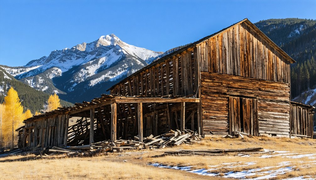
A comedy of errors launched Vicksburg’s mining legacy in 1867, when prospectors from Leadville lost their pack burros in Clear Creek Canyon and stumbled upon gold while tracking the wayward animals downstream.
Silver and lead deposits followed, transforming the camp into a permanent settlement named for merchant Vick Keller. Vicksburg history peaked at 600–700 residents with forty buildings housing two hotels, saloons, an assay office, and daily stagecoach service.
The mining heritage proved short-lived—exhausted ore bodies shuttered the post office by 1885.
Today you’ll find a dozen preserved structures along the poplar-lined main street, still irrigated by original ditches. The Clear Creek Canyon Historical Society safeguards this authentic townsite, accessible via County Road 390, eight miles from Highway 24.
Winfield: A Preserved Mining Camp Experience
You’ll find Winfield roughly 14–15 miles west of Highway 24 near Granite in Chaffee County, accessible via County Road 390 from Clear Creek Reservoir.
The preserved townsite retains its original 1880s layout along the main street, with the restored schoolhouse—complete with period furnishings and an unusual false front—now operating as a museum alongside the Ball cabin.
These structures represent one of Colorado’s better-preserved mining camps, maintaining much of their original character from the 1890 heyday when 1,500 residents supported three saloons, hotels, stores, and full mining infrastructure.
Historic Structures and Schoolhouse
Unlike many ghost towns reduced to foundations and rubble, Winfield preserves a remarkable collection of original buildings that allow you to walk directly into Colorado’s mining past.
The 1889 schoolhouse stands as the centerpiece of this historic preservation effort, operated by the Clear Creek Canyon Historical Society with period desks, chalkboards, and a recorded narration of camp life.
Across the street, Ball Cabin houses mining artifacts from the era when 1,500 souls called this canyon home.
You’ll encounter:
- Original false-front commercial buildings from the boom years
- Private cabins still seasonally occupied by modern stewards
- On-site interpretive signs explaining daily hardships and triumphs
- Cemetery burials documenting the human cost of frontier ambition
Respect private property boundaries while exploring this authentic window into 1880s Colorado.
Getting There From Frisco
From Frisco, reaching Winfield requires a 60-mile journey that crosses the Continental Divide via Fremont Pass before dropping into the Arkansas River Valley.
You’ll descend into Leadville, then continue 19 miles south on US Highway 24. Turn right onto Lake County Road 390 (Clear Creek Road) and travel 11 miles on this washboard dirt route to reach the preserved mining camp.
Scenic routes through high-altitude terrain deliver expansive mountain vistas throughout your drive. While 2WD vehicles can navigate CR 390 with caution, high-clearance or 4×4 vehicles provide ideal safety on this dirt road.
The initial miles cross private property—stay on the designated route. Plan this excursion between May and October when seasonal accessibility is reliable, giving you freedom to explore Colorado’s authentic mining heritage.
Planning Your Ghost Town Expedition
When mapping a ghost town circuit from Frisco, you’re choosing from eight principal sites within a 40-mile radius, each demanding its own route calculus.
Combine paved highways with graded dirt roads and 4×4 tracks to maximize discoveries while matching your vehicle’s capability. Altitude above 9,000 feet compounds hazards—pack layers, food, water, and offline topo maps for intermittent cell coverage.
Respect mixed land ownership. Many ruins sit on National Forest or private mining claims requiring vigilance at posted boundaries.
Ghost town preservation depends on your restraint:
- Leave every timber, nail, and artifact untouched
- Never enter adits, shafts, or collapsing cabins
- Share trip plans and fuel up before high-country roads
- Honor mining history by documenting, not disturbing
Navigate responsibly, and these fragments of Colorado’s past remain for generations ahead.
Best Times to Visit Summit County Ghost Towns
You’ll find the most reliable access to Summit County’s ghost towns from late June through early October, when snowmelt has cleared high-elevation roads and before consistent snowfall returns.
Summer and early fall offer the longest daylight windows and the firmest trail surfaces, though you should start morning explorations early to avoid afternoon thunderstorms that frequently build over exposed ridgelines in July and August.
Road conditions vary dramatically by season—late spring mud and lingering snowpack often render remote sites unreachable, while winter access typically requires snowshoes, skis, or snowmobiles due to unplowed forest roads and avalanche terrain.
Summer and Early Fall
Summit County’s ghost towns reveal themselves most fully between late June and early October, when seasonal snowmelt opens high-elevation corridors and Forest Service gates swing wide on mountain passes.
You’ll find comfortable daytime temperatures in the 60s and 70s°F at townsites like Montezuma (10,200 ft), perfect for seasonal exploration without heat stress. Early fall delivers Colorado’s legendary aspen color, transforming ghost town photography with gold-hued backdrops against weathered cabins and mining relics.
Your summer and early fall experience offers:
- Morning exploration before afternoon monsoon thunderstorms roll through mountain valleys
- Crisp, dry air in September with reduced lightning risk and clearer sightlines
- Lush alpine meadows framing Boreas Pass ruins in vivid green
- Extended daylight hours for unhurried discovery among historic structures
Plan morning visits during July and August to beat thunderstorm buildup.
Road Condition Considerations
Before you load your vehicle for Summit County’s backcountry, understand that mountain road conditions—not just weather—dictate which ghost towns you’ll actually reach.
Boreas Pass follows a graded gravel railroad grade accessible to most vehicles, while Georgia Pass and Dyersville demand high-clearance 4WD for final approaches.
Road safety deteriorates rapidly after thunderstorms, when ruts deepen and embedded rocks emerge on unimproved dirt segments. Freeze-thaw cycles create soft shoulders and uneven surfaces near drainage crossings.
Vehicle recommendations favor true off-road capability over crossovers—rental contracts often exclude unpaved routes entirely. Narrow single-lane segments require slow speeds and careful passing.
Heavy rain transforms manageable gravel into challenging terrain within hours, raising clearance requirements and eliminating access for standard vehicles.
Know your route’s current condition before departing.
Weather and Accessibility Risks
When planning your ghost town excursions near Frisco, elevation—not calendar date—controls accessibility, with most sites sitting between 9,000 and 11,500 feet where snowpack dictates a narrow late-June through September visitation window.
Weather patterns in Summit County’s high country shift rapidly, demanding self-reliance and preparation:
- Multi-story snow depths bury historic structures through winter, forcing ski or snowshoe approaches
- Afternoon thunderstorms during July–August monsoon bring lightning strikes to exposed ridgelines and alpine meadows
- Windchill plunges below 0°F at exposed townsites, creating frostbite risk even between storms
- Morning freezes and warm afternoons on summer days require layered clothing systems
Accessibility challenges include snowed-in roads, creek surges from downpours, and altitude sickness above 9,000 feet.
Morning starts reduce lightning exposure while maximizing stable conditions.
What to Bring on Your Ghost Town Adventure
Exploring abandoned mining camps in the mountains surrounding Frisco requires thorough preparation due to the region’s elevation range of 9,000 to 13,000 feet, unpredictable alpine weather, and remote access conditions.
Your gear essentials should include a layered clothing system, sturdy hiking boots with ankle support, and sun protection for intense UV exposure at altitude. Pack printed maps and offline GPS coordinates since cell service remains unreliable near sites like Montezuma and Mayflower Gulch.
Adventure preparation demands an extensive first-aid kit, adequate water with purification capability, and emergency shelter materials. Bring communication tools with backup power, and always leave your itinerary with someone reliable.
Respect private property boundaries and practice Leave No Trace ethics—use cameras rather than collecting artifacts to document Colorado’s mining heritage without compromising these fragile historical resources.
Frequently Asked Questions
Are Pets Allowed on Ghost Town Hiking Trails Near Frisco?
You’ll find no Instagram-worthy pet policy signage posted at these historic sites. Contact Frisco’s authorities directly about pet safety regulations, as available sources don’t document restrictions. Always practice proper trail etiquette when exploring Colorado’s backcountry ghost towns with your companion.
Do Any Ghost Towns Near Frisco Require Entrance Fees or Permits?
Most ghost towns near Frisco don’t require entrance fees or permits—Masontown, Montezuma, and Vicksburg remain free to explore. However, South Park City’s museum charges $10 admission, so check entrance requirements and permit details beforehand.
Can I Camp Overnight Near Ghost Town Sites Around Frisco?
Like leaves scattered across public land, you’ll find dispersed camping allowed near most ghost towns on Forest Service or BLM ground, though overnight permits aren’t required—just follow camping regulations protecting historic structures.
Are Ghost Town Sites Near Frisco Wheelchair or Stroller Accessible?
Most ghost town sites near Frisco aren’t wheelchair accessible due to hiking trails and uneven terrain. South Park City Museum in Fairplay offers the most stroller friendly routes with compact grounds, though wheelchair accessibility remains limited throughout historic structures.
Is Cell Phone Service Available at Ghost Towns Near Frisco?
Cell coverage varies dramatically by location and terrain. You’ll find usable service near Montezuma and trailheads, but expect dead zones at remote sites like Dyersville and Geneva City regardless of service providers.
References
- https://www.uncovercolorado.com/ghost-towns-near-me-colorado/
- https://coloradoinfo.com/blog_post/explore-ghost-towns-in-colorado/
- https://www.colorado.com/articles/colorado-ghost-towns
- https://en.wikipedia.org/wiki/List_of_ghost_towns_in_Colorado
- https://www.townoffrisco.com/discover/blog/4-ghost-town-adventures-near-frisco/
- https://www.uniquetravelphoto.com/animas-forks-ghost-town-in-silverton-colorado/
- https://www.allsummitcounty.com/history_museums/montezuma_ghost_town.php
- https://www.tripadvisor.com/ShowTopic-g143048-i3489-k7776808-Ghost_towns-Rocky_Mountain_National_Park_Colorado.html
- https://phantomranch.net/ghostown/articles/ghosts-of-list.htm
- https://blairfmiller.com/publications-1


