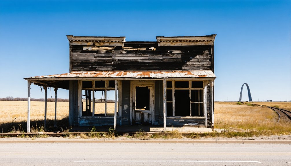
You’ll find Times Beach just 20 miles west of the Gateway Arch—a complete town abandoned in 1983 after dioxin contamination 300 times above safe levels forced federal buyouts of all 2,000 residents. The site became Route 66 State Park, where trails now wind through what was once residential streets. Nearby, the Hamburg Trail marks three river communities—Hamburg, Howell, and Toonerville—erased by eminent domain in 1941 for wartime munitions production. Each location offers distinct insights into Missouri’s displaced communities and environmental history.
Key Takeaways
- Times Beach, located 20 miles west of Gateway Arch, became a ghost town after dioxin contamination led to federal evacuation in 1983.
- Route 66 State Park now occupies the former Times Beach site, featuring trails and historical exhibits about the contamination disaster.
- Hamburg, Howell, and Toonerville were displaced in 1941 when the federal government seized land for military logistics during World War II.
- Arlington declined after Interstate 44 bypassed the town in 1967, following earlier Route 66 upgrades that reduced local access and traffic.
- The Hamburg Trail preserves the memory of vanished communities, with markers documenting the towns displaced for the St. Charles Engineer Depot.
Times Beach: Missouri’s Most Notorious Abandoned Town
Times Beach began as an unlikely real estate venture in 1925, when the St. Louis Times newspaper incorporated this Meramec River community as a subscription promotion. You’d have gotten a six-month newspaper subscription plus land for $67.50.
What started as a summer resort transformed into a lower-middle-class suburb after World War II.
Between 1972 and 1976, contractor Russell Bliss sprayed waste oil containing dioxin on roads for dust control. When EPA testing in 1982 revealed soil contamination 300 times above safe levels, the December flood spread toxins throughout town.
President Reagan’s task force investigated, leading to a federal buyout in February 1983. The government purchased the entire community for $32 million, relocating over 2,000 residents and incinerating contaminated materials before disincorporating Times Beach in 1985.
Today, Route 66 State Park occupies the former town site, opening in October 1999 with a visitor center housed in a 1935 roadhouse that once operated as Steinys Inn. Former residents hold reunions at the park to reminisce about their lost community.
Route 66 State Park: Where a Ghost Town Became Public Land
The federal government’s $32 million buyout didn’t erase Times Beach from the map permanently—it transformed the contaminated townsite into Route 66 State Park, which opened to the public in 1999 after one of America’s most extensive environmental remediation projects.
From abandoned ghost town to public parkland—Times Beach’s contaminated past became an unexpected symbol of environmental restoration.
A massive onsite incinerator burned 265,000 tons of dioxin-tainted material between 1995 and 1997, costing $200 million. The EPA deleted the site from its Superfund National Priorities List in 2001, certifying cleanup completion.
You’ll find 419 acres of trails, river access, and Route 66 history along the Meramec River, seventeen miles southwest of St. Louis. The former roadhouse—once an EPA field office—now serves as a visitor center documenting dioxin contamination, evacuation, and environmental recovery. The visitor center operates from March to November, closing during winter months.
A grass-covered mound conceals demolished town structures beneath reclaimed public land. Take exit 265 from eastbound I-44 to reach the park entrance.
Hamburg, Howell, and Toonerville: River Communities Erased by War
While Route 66 State Park preserves the memory of Times Beach’s dioxin disaster, three Missouri River communities vanished under circumstances that left even fewer traces—condemned by the U.S. government during World War II to build the St. Charles Engineer Depot.
Hamburg, Howell, and Toonerville occupied fertile bottomland near the confluence of the Missouri and Mississippi Rivers, supporting a few hundred residents through farming and river commerce.
In the early 1940s, federal authorities invoked eminent domain to seize thousands of acres for military logistics infrastructure. The federal government’s use of eminent domain echoed the earlier condemnation of St. Louis riverfront properties in 1939, when $6.2 million was distributed to landowners displaced for what would become the Gateway Arch site. Homes, churches, and stores were demolished or repurposed into warehouses and rail sidings.
The wartime impact erased entire communities almost overnight, displacing families without the public outcry that later surrounded Times Beach. The arch, which commemorates the Louisiana Purchase and westward expansion, now stands on land that required similar displacement of property owners just decades earlier.
Today, scattered foundations buried under depot grounds are the only archaeological evidence of this river town history.
The Weldon Spring Ordnance Works and Its Lost Towns
If you drive thirty miles west of the Gateway Arch to St. Charles County, you’ll encounter the site of the Weldon Spring Ordnance Works—a 17,232-acre TNT and DNT production complex that displaced entire communities when the U.S. Army acquired the land in 1940–1941.
The wartime facility’s four TNT and two DNT production lines discharged nitroaromatic wastes directly into Missouri and Mississippi River watersheds, while a nearby limestone quarry served as a burn pit for explosives residues and, decades later, as a dump for uranium and thorium from the subsequent Atomic Energy Commission chemical plant. The quarry’s location just 0.75 miles from a drinking water source serving approximately 70,000 people made its contamination particularly concerning.
After the Army manufactured explosives from 1941 to 1945, the site was transferred to the U.S. Atomic Energy Commission in 1956 for uranium processing operations that continued until 1966.
Today, you can visit this remediated Superfund landscape where conservation areas, a training facility, and a massive disposal cell mark the transformation of farmsteads and towns into a monument to military-industrial environmental legacy.
Wartime Acquisition and Displacement
Between 1940 and 1941, the U.S. government acquired 17,232 acres of rural land in St. Charles County, Missouri, displacing three communities for munitions production. The wartime impact devastated Hamburg, Howell, and Toonerville, forcing 576-700 citizens from their ancestral homes.
You’ll find these communities demonstrated remarkable community resilience despite losing:
- Established neighborhoods where generations built their lives
- Local businesses and economic independence
- Churches, schools, and civic institutions
- Family cemeteries and irreplaceable historical landmarks
The displaced populations scattered beyond the ordnance works boundary by 1941.
Atlas Powder Company operated four TNT and two DNT production lines until 1945, leaving nitroaromatic contamination in soil, groundwater, and nearby springs.
Post-war, Missouri received 15,000 acres for conservation areas, while the Army retained portions as training grounds. The site was added to the Superfund National Priorities List on February 21, 1990, due to persistent environmental contamination.
Environmental Contamination and Cleanup
After the Atlas Powder Company ceased TNT production in 1945, the Weldon Spring site became home to a uranium feed materials plant operated by Mallinckrodt Chemical Company and the Atomic Energy Commission from 1957 to 1966.
Decades of explosives manufacturing and uranium processing left behind TNT, DNT, uranium, thorium, and radium contaminating soil, groundwater, and surface water. Unlined lagoons and raffinate pits created contaminant pathways through fractured limestone toward the Missouri River and municipal wells serving 70,000 residents.
The EPA designated portions as Superfund sites in the 1980s. Remediation strategies under CERCLA divided cleanup into four operable units.
You’ll find a 41-acre engineered disposal cell completed in 2001 now isolates 1.48 million cubic yards of contaminated material onsite, where towns once stood. Despite federal agency oversight, groundwater conditions have not improved and state regulators have criticized the ineffectiveness of current cleanup remedies.
Visiting the Remediated Landscape
When you walk the Hamburg Trail today, you trace the footprint of a river-bottom community that vanished in 1941 under eminent domain. The Weldon Spring Site Interpretive Center documents both the ordnance works’ historical significance and decades of remediation efforts that transformed contaminated industrial land into accessible conservation areas.
Trail markers and exhibits preserve the names of displaced towns—Hamburg, Howell, Toonerville—erased for wartime TNT production.
What disappeared beneath federal urgency:
- 576 residents forced from farms, homes, and businesses they’d built over generations
- Twenty-seven cemeteries relocated, fenced, or restricted from descendant access
- Churches and schools demolished to clear 17,232 acres for explosives manufacturing
- River-bottom communities whose existence now survives only in interpretive materials
You’re free to explore this layered landscape where WWII industry, Cold War cleanup, and conservation converge.
Arlington and the Decline of Route 66 Roadside Communities
Founded in 1867 along the Pacific Railroad and Little Piney Creek, Arlington began as a rural resort and milling settlement that capitalized on Stony Dell’s springs and natural amenities to draw regional tourists decades before the automobile age.
When Route 66 passed through in 1926, the village supported hotels, fuel stations, and campgrounds serving Chicago–Los Angeles traffic.
Yet you’ll find that prosperity proved fleeting. Four-lane upgrades in 1952–1953 straightened the highway, removing direct access.
Arlington’s brief golden age ended when road engineers chose efficiency over community, bypassing the town that Route 66 had created.
Interstate 44’s 1967 bypass severed Arlington completely, burying original roadbeds under concrete.
Community decline accelerated rapidly—businesses shuttered by mid-century, and the last operator closed in 2008.
Today Arlington stands as archival evidence of how federal highway engineering reshaped—and abandoned—small roadside economies across the American West.
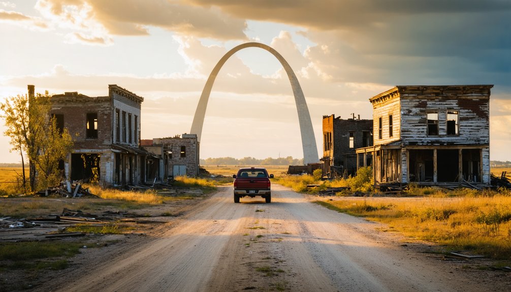
Missouri’s Ghost Town Landscape: A Regional Overview

When you examine Missouri’s ghost town landscape, you’ll find abandonment patterns driven by railroad route changes, river commerce decline, and extractive industry collapse rather than single catastrophic events.
The state’s documented sites—ranging from completely vanished settlements to partial structures—require careful navigation of private property boundaries and seasonal access limitations.
Environmental displacement from reservoir construction and flood control projects particularly shaped the Gateway Arch region, where entire communities were systematically relocated to create modern infrastructure between 1935 and 1970.
Causes of Town Abandonment
Across Missouri’s river valleys and rural crossroads, towns that once thrived have emptied for reasons ranging from environmental catastrophe to gradual economic obsolescence.
You’ll find abandonment driven by forces both sudden and slow—each stripping communities of their essentiality and residents of their autonomy.
Key drivers of town disappearance:
- Environmental hazards like Times Beach’s dioxin contamination, forcing 800 families into federal relocation and permanent abandonment.
- Economic decline when highways bypassed Route 66 stopover towns, draining traffic and commerce.
- Resource depletion after mines, quarries, and timber operations exhausted local deposits.
- Chronic flooding that made rebuilding costlier than retreat, especially on vulnerable river floodplains.
These patterns show how external decisions—regulatory mandates, infrastructure realignments, industrial consolidation—often override local choice, turning settled places into vacant land.
Documented Sites and Access
Within thirty miles of the Gateway Arch’s stainless steel curves, Route 66’s Missouri corridor preserves a concentrated cluster of abandoned settlements—each documented through state park designations, structural remnants, and navigational coordinates that transform historical abstraction into tangible geography.
You’ll find Times Beach within Route 66 State Park boundaries, its infrastructure still visible alongside Piney Creek. Arlington’s historic buildings stand marked with preserved signage, while John’s Modern Cabins’ ruins remain observable at Devil’s Elbow, where the river bends sharply.
These ghost towns carry historical significance beyond nostalgic roadside Americana—they’re accessible through deliberate navigation of dead-end roads and Highway 44 exits.
Exploring ghost towns near Glacier National Park reveals remnants of a bygone era, where the echoes of former inhabitants linger in the air. Dotted with dilapidated buildings and rusted machinery, these sites offer a glimpse into the challenges and triumphs of early settlers. The contrast between the haunting beauty of the landscape and the stark history of these towns captivates both adventurers and historians alike.
YouTube documentation and travel blogs provide timestamped verification, cross-referencing official Route 66 State Park records with physical coordinates you can actually reach.
Environmental Displacement Legacy
Physical markers and historical plaques chart where these ghost towns once stood, yet environmental catastrophe—not economic decline or highway rerouting—drove Missouri’s most dramatic chapter of community erasure.
Times Beach’s 2,000 residents faced permanent relocation after dioxin contamination and the 1982 Meramec flood forced disincorporation, reshaping environmental policy nationwide.
The displacement legacy reveals:
- 265,354 tons of contaminated material from 27 eastern Missouri sites incinerated where a town once thrived
- Homes, businesses, and infrastructure demolished and buried in a “town mound”
- Entire street grids erased, converted to unmarked conservation land
- Community resilience tested as regional toxic plumes created zones of informal disinvestment
Superfund responses centralized cleanup at this sacrificed landscape, establishing templates for managed retreat along flood-vulnerable river corridors.
Planning Your Ghost Town Road Trip From the Gateway Arch
Since Times Beach sits approximately 20 miles west of Gateway Arch National Park along Route 66, it serves as the ideal starting point for your ghost town exploration through Missouri’s abandoned settlements.
You’ll find Route 66 State Park occupying the former contaminated townsite, where subtle tree-planting patterns reveal the original street grid despite complete demolition in the early 1990s.
Continue westward to Devil’s Elbow, where John’s Modern Cabins and the iconic curved bridge remain accessible.
For historical preservation enthusiasts, Arlington displays original buildings with period signage along the Route 66 corridor.
You can explore Hamburg, Howell, and Toonerville’s former locations within Weldon Spring Ordnance Works, all absorbed during World War II.
Document Allenton’s remaining structures on Eureka’s west side, capturing evidence of economic decline from neighboring city expansion.
What to Expect When Visiting These Historic Sites Today
What remains of Times Beach today bears little resemblance to the residential community that once housed nearly 2,000 residents along the Meramec River. Route 66 State Park now occupies this 419-acre site where dioxin contamination forced complete evacuation in the 1980s.
You’ll find minimal visible remnants, as demolition crews cleared most structures in the early 1990s.
When you visit, you’ll discover:
- Subtle street grids and tree-planting patterns marking where homes once stood
- A restored natural environment replacing the contaminated landscape
- Historical markers documenting the community’s rise and forced abandonment
- Educational displays explaining the dioxin contamination crisis
The surrounding corridor contains additional ghost towns near Eureka, creating interconnected exploration opportunities.
These accessible sites preserve Missouri’s Route 66 heritage while allowing unrestricted public access.
Frequently Asked Questions
Are Any Original Times Beach Residents Still Living in the Area?
No original residents live at Times Beach itself—it’s now Route 66 State Park—but you’ll find many former residents still in the broader St. Louis area, sharing Times Beach history and former residents’ stories at regular reunions.
Can You Enter Buildings at These Ghost Town Sites?
You cannot enter most ghost-town buildings near Gateway Arch; Times Beach’s structures were demolished due to dioxin contamination. Building access remains restricted on private land, though historical preservation sites like Bollinger Mill welcome visitors legally.
Is It Legal to Take Artifacts From Abandoned Missouri Towns?
No, removing artifacts from Missouri ghost towns isn’t legal. You’ll face legal consequences including theft and trespassing charges, while undermining artifact preservation efforts on state, federal, or private land regardless of abandonment status.
Which Ghost Town Is Safest for Families With Young Children?
Route 66 State Park at former Times Beach offers the best ghost town safety for families with young children. You’ll find maintained trails, remediated grounds, and family friendly activities within a managed day-use setting near emergency services.
Do Any Ghost Towns Near the Arch Offer Guided Tours?
No formal guided ghost tours operate at these locations. You’ll find ghost town experiences through self-exploration along Route 66’s historic corridor, with Times Beach and Arlington offering the most accessible remnants for independent discovery near the arch.
References
- https://en.wikipedia.org/wiki/List_of_ghost_towns_in_Missouri
- https://www.youtube.com/watch?v=wiF41PIwD74
- https://www.youtube.com/watch?v=qu3r4Vf6fG4
- https://www.youtube.com/watch?v=OPNh93z9dNE
- https://www.youtube.com/watch?v=nPjiYSXozlI
- https://www.stlmag.com/news/Route-66-State-Park-A-Ghost-Town-Reborn-and-Repurposed/
- https://www.legendsofamerica.com/mo-timesbeach/
- https://www.myleaderpaper.com/news/times-beach-turns-100-years-old/article_5e0a00c7-72f7-4e58-8c8a-bee494639bba.html
- https://www.unionprogress.com/2025/04/21/one-womans-defiant-remembering-keeps-the-tragic-story-of-times-beach-alive/
- https://www.theroute-66.com/times-beach.html


