You’ll find several significant ghost towns within easy driving distance of Great Basin National Park, including Osceola, a 1870s hydraulic mining settlement that once housed 1,500 residents and extracted $5 million in gold, and Belmont, whose 1876 courthouse remains Nevada’s best-preserved mining-era civic structure. These sites feature weathered cemeteries, original architectural elements like Tiffany lamps, and mill ruins that document the region’s silver and gold rush history. Road conditions range from paved highways to graded gravel requiring high-clearance vehicles, and exploring these locations reveals the engineering ingenuity, economic prosperity, and ultimate abandonment patterns that shaped Nevada’s mining frontier.
Key Takeaways
- Osceola, established in 1872, extracted nearly $5 million in gold using hydraulic mining techniques with an 18-mile water conveyance system.
- Belmont features Nevada’s best-preserved mining-era courthouse, built in 1876, with guided tours available May through September by appointment.
- Ward Charcoal Ovens are accessible via paved roads, while Osceola requires graded gravel and Belmont may need high-clearance or 4WD vehicles.
- Osceola’s population declined from 1,500 to 100 by the early 1900s; a 1940s fire destroyed most structures except the Pioneer Cemetery.
- Allocate three to five hours for exploration; bring offline GPS coordinates, extra supplies, and check NDOT and BLM advisories for closures.
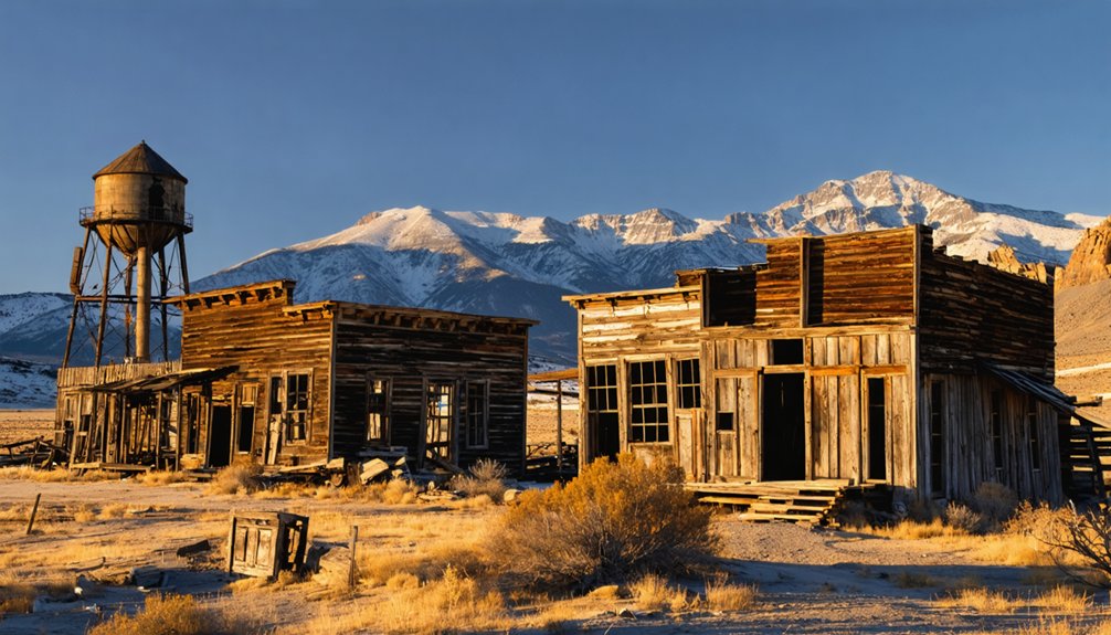
Osceola: a Canyon Mining Settlement From the 1870S
Though Osceola’s remote canyon location sits just three miles west of present-day Great Basin National Park, the settlement’s story began in 1872 when prospectors James Matteson and Frank Heck traced gold deposits to a massive 12-mile quartz vein running through the drainage.
Initial placer operations gave way to hydraulic mining techniques during the 1880s, transforming the canyon into Nevada’s most productive White Pine County gold producer. High-pressure water jets moved sediment through the Osceola West Ditch and Osceola East Ditch systems that directed mountain runoff to the mining operations. Community growth peaked at 1,500 residents who extracted nearly $5 million in gold, plus significant silver, lead, and tungsten deposits.
An 1886 discovery of a $6,000 nugget reignited prospecting fervor, sustaining operations through the century’s end. Water shortages ultimately forced cessation around 1900, leaving today’s visitors with one fenced building and a cemetery—silent monuments to White Pine’s longest-lived placer camp. A significant fire in the 1940s destroyed most remaining buildings, reducing the population from 1,500 to around 100 residents.
Hydraulic Mining Techniques and Water Infrastructure
Osceola’s extraordinary gold yields depended entirely on hydraulic mining technology, the method that transformed this canyon settlement from a modest placer camp into Nevada’s most productive White Pine County operation.
You’ll find remnants of the elaborate water conveyance system that once powered the giants—monitors that blasted hillsides with streams strong enough to dislodge entire gravel banks.
The infrastructure required substantial engineering:
- West Ditch carried water over 18 miles from mountain creeks
- Wooden flumes bridged ravines and unstable slopes
- Iron penstocks converted elevation into crushing nozzle pressure
This gravity-fed network allowed miners to process hundreds of cubic yards daily, replacing backbreaking hand methods.
The system’s scale reveals how hydraulic technology enabled independent operators to work claims that would’ve otherwise remained inaccessible. These operations emerged from early experiments with canvas hoses that miners conducted before developing the sophisticated water delivery infrastructure. Despite the engineering achievements, water scarcity initially limited mining operations to approximately two hours per day until the completion of additional ditches.
The Devastating Fire and Decline of Population
While Osceola had already dwindled from its 1880s peak of 1,500 residents to roughly 100 by the early 1900s, the catastrophic fire that swept through the canyon settlement in the 1940s delivered the final blow to any hope of recovery.
You’ll find that limited firefighting resources and the town’s remote location west of Baker prevented containment of the blaze, which destroyed most remaining commercial and residential structures.
This devastation compounded years of economic decline following exhausted placer deposits and diminishing hydraulic mining returns. The fire eliminated essential infrastructure—stores, lodging, and service buildings—removing any incentive for rebuilding or reinvestment.
Without community resilience to overcome such complete destruction, remaining residents migrated elsewhere seeking employment, transforming Osceola into the scattered ruins you can explore today.
Similar patterns of decline affected other mining towns across the region, as fires often marked the beginning of decline for communities that had rapidly expanded during boom periods. Goldfield experienced comparable devastation when a devastating fire in 1923 leveled 53 city blocks, accelerating the town’s transformation from a population of 20,000 to just 200 residents.
What Remains: Cemetery Sites and Historic Structures
You’ll find Osceola’s Pioneer Cemetery positioned on elevated ground overlooking Spring Valley, where gravestone markers document the harsh realities faced by miners and their families during the 1870s gold rush.
The burial ground serves as the town’s most intact historical feature, having survived the devastating 1940s fire that claimed most structures along the main settlement area.
Standing among the weathered headstones, you’re accessing primary source material that records birth dates, death ages, and occasional cause-of-death inscriptions—evidence of mining accidents, disease, and the unforgiving conditions that characterized Nevada’s desert frontier.
Tuscarora’s cemetery, located along Highway 226, similarly preserves the stories of its boom period through picturesque grave markers dating from the 1870-1890 era.
Pioche’s Boot Hill Cemetery offers another window into the violent history of Nevada’s mining era, situated near the original aerial tramway where street shootouts and lawlessness defined daily life.
Osceola’s Pioneer Cemetery
Perched on a hillside overlooking the remnants of Osceola’s townsite, the pioneer cemetery stands as one of the most enduring relics of the mining district, located 12–15 miles west of Great Basin National Park in White Pine County.
You’ll find weathered headstones marking pioneer burials from the 1870s–1880s gold rush, when the settlement peaked at 1,000–1,500 residents. The grave markers reveal patterns of frontier hardship:
- Family plots showing multi-generational losses
- Varied headstone quality reflecting economic disparities among miners and merchants
- High mortality inscriptions documenting dangerous hydraulic mining conditions
While most town structures have collapsed, this graveyard remains visible alongside the stone store, offering unmediated access to Osceola’s boom-and-bust narrative. Historical societies dedicated to preserving artifacts and heritage have documented similar cemetery sites throughout the American West, ensuring these frontier narratives endure for future generations.
Tilting markers and scattered enclosures convey the authentic decay of an isolated Great Basin mining community.
Architectural Features and Preservation
Osceola’s cemetery represents just one thread in a wider fabric of architectural survival across Great Basin ghost towns.
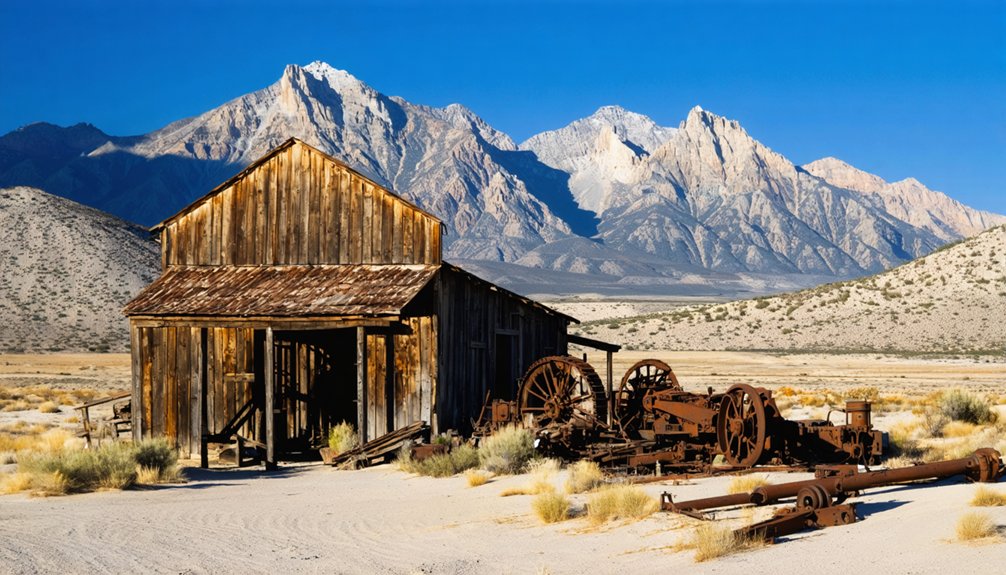
You’ll find Berlin’s stamp mill complex frozen in arrested decay, its timber superstructure and ore bins still standing through careful stabilization work. Belmont’s 1870s courthouse dominates the landscape with thick masonry walls, while Eureka preserves brick commercial blocks on the National Register.
These sites illustrate how mining heritage persists through intentional architectural preservation—Nevada State Parks has reinforced Berlin’s structures, and Utah’s Tintic District maintains original headframes and civic buildings.
From Grafton’s Mormon schoolhouse to Latuda’s concrete foundations, each ruin tells a specific story of adaptation, abandonment, and the ongoing effort to retain authentic material culture against relentless desert weathering. Fort Pearce Cemetery holds particularly significant historical weight as the site of a Paiute attack in 1860, with notable burials including Private John Conley and Julia Cassidy marking the violent conflicts that shaped early settlement patterns.
Belmont Courthouse: Nevada’s Best-Preserved Mining Architecture

When you step inside the 1876 Belmont Courthouse, you’ll encounter J.K. Winchell’s original brick-and-cupola design largely intact, complete with period furnishings that reflect the wealth flowing through Nye County’s $15 million mining district.
The building’s interior preserves remnants of frontier-era opulence—including rumored Tiffany lamps funded by silver boom prosperity—alongside the stark iron jail cells that once confined lawbreakers in this remote seat of territorial justice.
Friends of the Belmont Courthouse now coordinate seasonal guided tours that interpret both the architectural achievement and the ghost stories embedded in Nevada’s best-preserved mining-era civic structure.
Historic Architectural Features
Rising from Belmont’s dusty main street, the two-story brick courthouse stands as Nevada’s finest surviving example of mining-era civic architecture. Built in 1876 for $3,400, this Italianate-influenced building showcases frontier adaptation of refined Eastern styles using local materials.
You’ll notice three defining features demonstrating the building’s architectural significance:
- Square wooden cupola crowning the symmetrical façade as symbol of county authority
- Segmental-arched windows with original wood sash framing
- Simple brick cornice detailing executed with limited frontier resources
Historic preservation efforts since the 1974 state designation have maintained structural integrity while protecting original wood floors, plastered walls, and the remarkably intact roof shingles.
The Friends of the Belmont Courthouse continues safeguarding this “crown jewel” against high-desert exposure, ensuring future generations experience authentic mining-district governance architecture.
Tiffany Lamps and Wealth
Behind the courthouse’s modest brick façade, Belmont’s silver wealth manifested in unexpected ways that contradicted its frontier setting. The $15 million mining wealth that flowed through this remote Nevada outpost during its boom years enabled unprecedented luxuries for territorial government.
Original Tiffany lamps once illuminated courtroom proceedings, their intricate stained glass reflecting the community’s prosperity when high-grade ores commanded $3,000 per ton. This juxtaposition—expensive artistic fixtures within rough-hewn brick walls 200 miles from civilization—embodied the mining frontier’s peculiar character.
You’ll find carved inscriptions inside revealing how visiting officials and citizens marked their presence in this unexpected bastion of refined taste. Such extravagances disappeared after 1905 when county operations relocated, yet they demonstrate how quickly mineral discoveries transformed wilderness into centers of wealth and governance.
Guided Ghost Tour Options
Though Belmont’s 1875–1876 courthouse stands isolated 45 minutes northeast of Tonopah, the Friends of the Belmont Courthouse opens Nevada’s finest mining-era civic building for guided interpretation on select weekends May through September.
You’ll explore ghost town history spanning Belmont’s 29-year tenure as Nye County seat (1876–1905), when $15 million in silver ore supported a diverse boom-town community complete with Chinatown, schools, and newspapers.
Guided tours emphasize three preservation priorities:
- Original architectural fabric, including the square wooden cupola and historic jail cells returned from Gabbs
- Mining-era law and order narratives interpreting frontier justice and civic evolution
- Authentic ghost-town character through minimally commercialized access and visible ruins
The nonprofit-state partnership maintains this 1974-designated historic site as an archival resource, pairing courthouse visits with self-guided walks past Dirty Dick’s Saloon and remaining mill structures.
Current Access and Road Conditions for Visitors
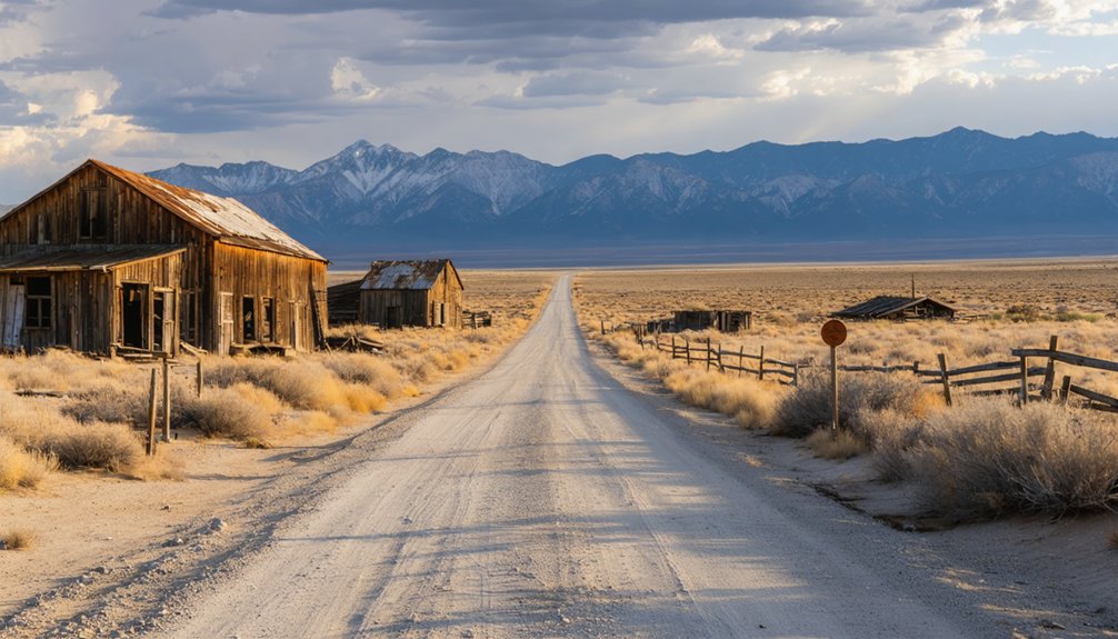
When planning visits to ghost towns near Great Basin National Park, you’ll encounter a spectrum of road conditions ranging from maintained pavement to unmaintained two-track that shifts dramatically with the seasons.
Ward Charcoal Ovens offer paved access from Ely via US-50 and NV-844, though winter ice demands caution.
Osceola Ghost Town requires graded gravel roads 50 miles southeast of Ely—expect mud in spring and washouts after monsoons.
Road safety along the “Loneliest Road” corridor dictates carrying extra fuel, water, and offline maps; cellular coverage disappears completely in backcountry.
Vehicle recommendations favor high-clearance or 4WD for post-storm conditions at Belmont Mill and similar sites.
Check NDOT, Nevada State Parks, and BLM advisories before departure—temporary closures happen without warning in this remote country.
Photography Opportunities Throughout the Region
From Osceola’s weathered cabins perched against sagebrush hillsides to the stark headframes silhouetted above Belmont’s canyon, the ghost towns orbiting Great Basin National Park offer photographers a concentrated archive of high-desert abandonment spanning nearly a century and a half.
Similarly, the ghost towns near Great Sand Dunes tell stories of resilience and hardship etched into the landscape. Each derelict building and crumbling foundation invites exploration, revealing remnants of lives once lived in this remote region. As the sun sets behind the dunes, these forgotten places transform, casting long shadows that whisper the secrets of their past.
These ghost towns preserve weathered cabins, stark headframes, and high-desert ruins documenting nearly 150 years of Nevada mining history.
You’ll find arrested-decay interiors with furnishings intact, pioneer cemeteries displaying carved headstones, and rusted machinery that rewards macro work.
Equipment recommendations for multi-day shoots include:
- Wide-angle and tilt-shift lenses for architectural documentation
- Telephoto glass (200–400 mm) for fenced or distant ruins
- Fast primes and sturdy tripods for International Dark Sky astrophotography
Photographic techniques spanning light painting on façades, blended Milky Way exposures anchored by mine structures, and close-up studies of peeling paint let you craft documentary or abstract portfolios under Nevada’s expansive skies.
Planning Your Ghost Town Tour From Great Basin National Park
How do you transform a visit to Great Basin National Park into a multi-layered journey through Nevada’s mining heritage without getting stranded on a washboard road or wasting daylight hunting for ghost towns that exist only on obsolete maps?
Tour planning begins in Ely, where you’ll fuel up and stock supplies before heading east. Base your half-day route suggestions around the Baker-to-Osceola loop—26 miles each way on mixed pavement and graded roads.
Pack offline GPS coordinates, extra water, and recovery gear; cellular coverage vanishes beyond the highway. High-clearance vehicles handle washboards and ruts better than sedans. Check weather forecasts religiously—thunderstorms spawn flash floods in canyons.
Allocate three to five hours for Osceola’s cemetery and roadside ruins, more if you’re weaving in US-50 corridor stops for a full-day exploration.
Frequently Asked Questions
Are There Any Restaurants or Gas Stations Near Osceola Ghost Town?
You won’t find a single gas station location or dining option in Osceola—it’s completely deserted. Instead, you’ll need to fuel up and eat in Ely, 34 miles west, before venturing down this remote historic road.
What Time of Year Is Best to Visit Ghost Towns Near the Park?
Late spring and early fall are your best seasons for exploring ghost towns near the park. You’ll enjoy mild weather, passable roads, and excellent photography conditions while avoiding summer’s heat and winter’s isolation risks.
Do I Need a Four-Wheel Drive Vehicle to Reach Osceola?
You don’t need four-wheel drive in dry summer conditions, but vehicle requirements change with weather. The graded dirt road handles standard cars carefully driven, though high clearance improves your safety margin on washboarded segments.
Can I Camp Overnight Near Any of the Ghost Town Sites?
You can’t camp directly at Osceola’s ruins due to private property and camping regulations, but dispersed camping’s allowed on nearby BLM land. Ghost town amenities don’t exist—you’ll need complete self-sufficiency for overnight stays.
Are There Entrance Fees to Visit Osceola or Belmont Ghost Towns?
No entrance fees apply—both ghost towns offer free accessibility on public land. You’re free to explore Osceola’s BLM sites and Belmont’s historic streets without charge, though courthouse tours may request modest donations.
References
- https://findingnevadawild.com/goldfield-the-old-west-lives-in-nevadas-best-ghost-town/
- https://www.visittheusa.com/experience/6-nevada-ghost-towns-explore-if-you-dare
- https://travelnevada.com/ghost-town/osceola-ghost-town/
- https://roadtrippers.com/magazine/dark-skies-and-ghost-towns-stops-on-a-spooky-nevada-road-trip/
- https://nvtami.com
- https://www.youtube.com/watch?v=Bp2IcEQsWEM
- https://wheninyourstate.com/nevada/7-unique-ghost-towns-in-nevadas-great-basin-that-time-forgot/
- https://www.shakaguide.com/tours/nevada/great-basin-national-park-tour/stops/osceola-ghost-town
- https://www.youtube.com/watch?v=QrjcjYBw1NY
- https://historical-markers-of-the-world.com/2024/11/13/osceola-ghost-town-historical-marker-ely-nevada/


