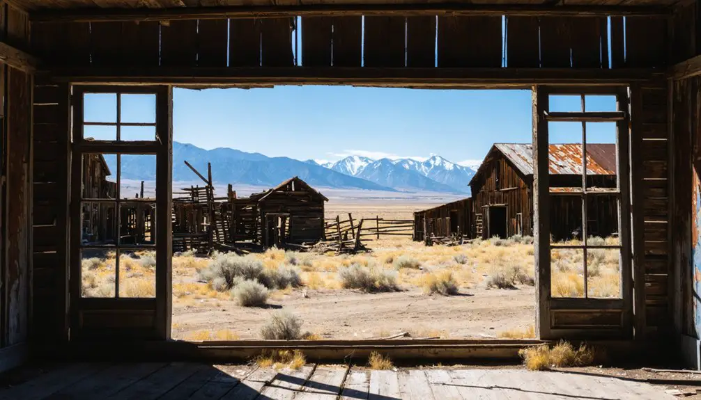
You’ll find several remarkable ghost towns within an hour of Helena, each preserving Montana’s mining heritage. Elkhorn State Park, just 30 miles south, protects two original structures from an 1870s silver camp. Marysville, 20 miles northwest, maintains about 80 year-round residents among its false-front buildings. Rimini sits 16 miles southwest with 1880s architecture still standing, while Comet requires a longer drive northeast toward Butte. Bannack State Park, Montana’s first territorial capital with over 50 preserved buildings, makes an excellent full-day excursion to understand what shaped these abandoned communities.
Key Takeaways
- Four major ghost towns are within 30-60 minutes of Helena: Marysville, Rimini, Elkhorn State Park, and Comet.
- Marysville, 20 miles northwest, features false-front buildings and historic church from the 1876 Drumlummon lode discovery era.
- Rimini, 16 miles southwest, displays log cabins, false-front buildings, and the 1904 Rimini School with interpretive signs.
- Elkhorn State Park preserves Fraternity Hall and Gillian Hall from the 1868 silver mining boom peaking at 2,500 residents.
- Comet, 40 miles northeast near Butte, requires high-clearance vehicles and contains weathered structures on private land.
Elkhorn State Park: Montana’s Smallest Ghost Town Preserve
The discovery of silver in the Elkhorn Mountains came in 1868 when Swiss miner Peter Wys struck rich veins that would soon draw thousands to this remote corner of Montana Territory.
By 1872, Helena entrepreneur Anton M. Holter platted the townsite, and Elkhorn history began in earnest as a family-oriented mining camp that peaked at 2,500 residents.
The Silver Panic of 1893 and a devastating diphtheria epidemic between 1884–1889 emptied the town by century’s end.
The mine produced approximately $30,000 in silver monthly, equivalent to $900,000 today, before closing in 1900.
Today, Elkhorn State Park preserves just two iconic false-front structures—Fraternity Hall and Gillian Hall—on less than one acre, making it Montana’s smallest state park.
Visitors can explore Fraternity Hall’s second floor, which remains accessible to the public and offers an intimate glimpse into the lives of miners who once gathered there.
This ghost town architecture stands as an authentic frontier museum you’ll find roughly an hour south of Helena.
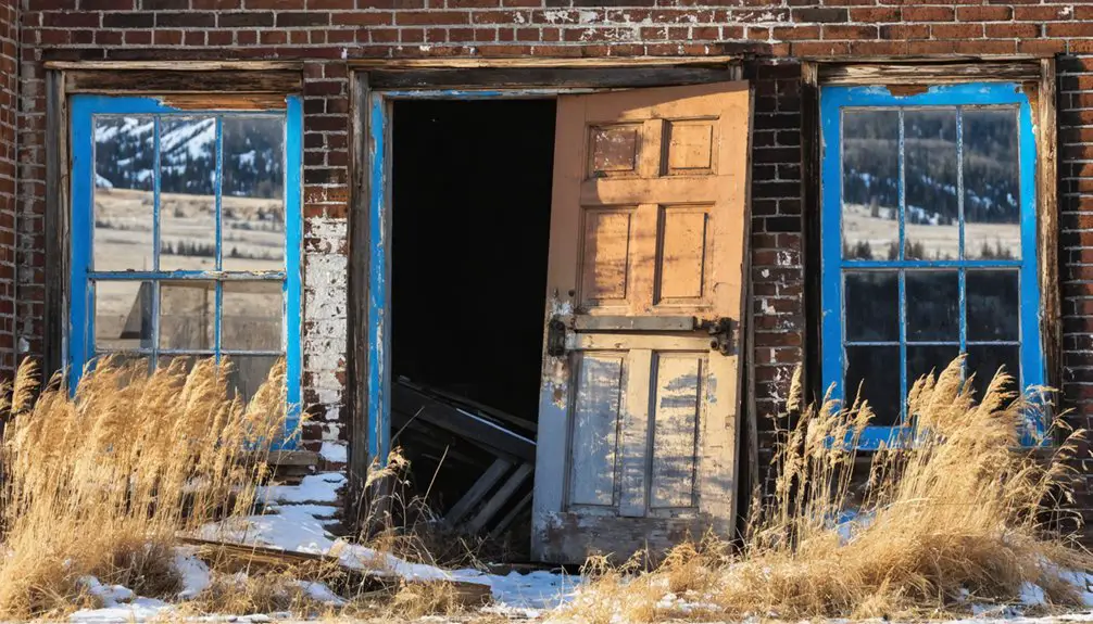
Marysville: A Semi-Ghost Town at the Foot of Mount Belmont
Twenty miles northwest of Helena, Marysville clings to the slopes of Mount Belmont as Montana’s most accessible semi-ghost town—a place where roughly 80 year-round residents share dirt streets with dozens of weathered false-front buildings that once served 3,000 gold-rush inhabitants.
Marysville history begins with Thomas Cruse’s 1876 discovery of the Drumlummon lode, transforming Mary Ralston’s namesake camp into one of Montana’s premier gold centers by the 1890s.
Thomas Cruse’s 1876 Drumlummon discovery launched Mary Ralston’s modest camp toward becoming one of Montana’s richest gold-producing centers within two decades.
Drumlummon significance can’t be overstated—the mine produced tens of millions in precious metals before flooding and litigation forced closure. Cruse sold the mine in 1884 for $1.5 million in cash and stock to an English company that expanded operations dramatically.
What you’ll find today:
- Intact brick Catholic church dominating the historic district
- Miles of underground workings beneath Mount Belmont
- Active small businesses alongside abandoned storefronts
- Ski operations and recreation areas attracting year-round visitors
- The 1886 Methodist Episcopal church, listed in the National Register of Historic Places
You’re free to explore genuine mining architecture without visitor restrictions.
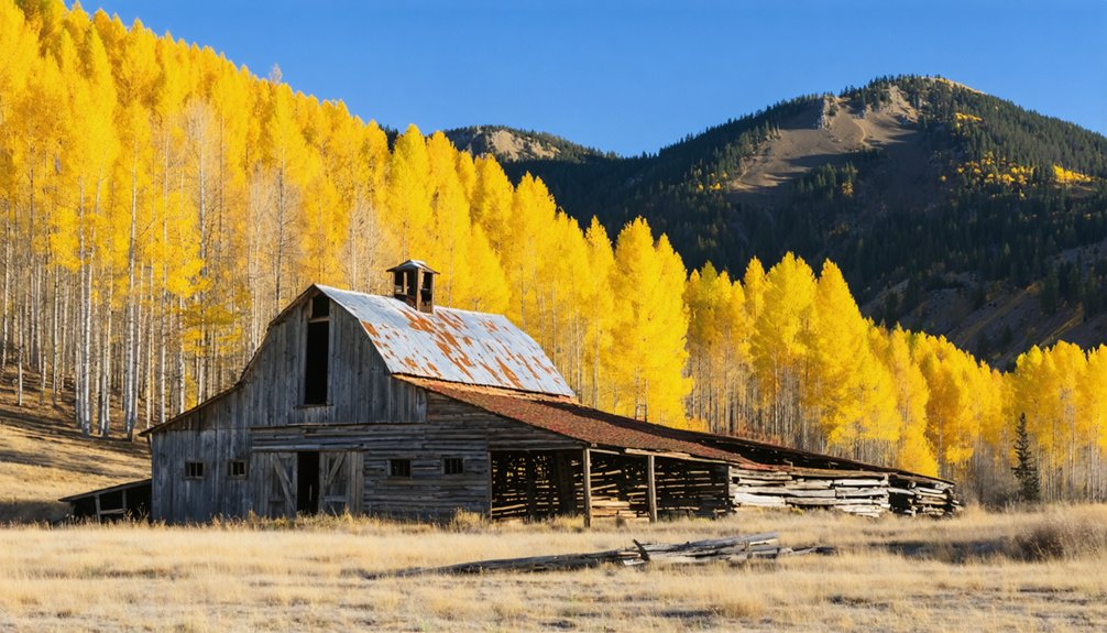
Rimini: Exploring Silver and Lead Ruins in the Elkhorn Mountains
Sixteen miles southwest of Helena, Rimini sprawls along Moose Creek in the Elkhorn Mountains—a living ghost town where century-old log cabins and false-front buildings line a maintained forest road accessible year-round.
Established in 1864 as Young Ireland, Rimini mining operations boomed during the 1880s when Northern Pacific’s branch line enabled bulk shipment of silver-lead ores from the Porphyry Dike and neighboring lodes.
The town’s historical architecture showcases frontier ingenuity: log structures fitted with frame false fronts, weathered boarding houses, and the 1904 Rimini School—now a community hall listed on the National Register.
Nearby stands the 1908 Moose Creek Ranger Station, where a CCC camp later trained Arctic search-and-rescue dogs during World War II. The ranger station was established alongside the creation of Helena National Forest, reflecting the early conservation efforts of the U.S. Forest Service.
The mining district generated approximately $7 million in total production before operations declined in the early 20th century.
Interpretive signs guide unescorted exploration through this accessible, semi-inhabited remnant of Montana’s silver rush.
Comet: Photogenic Mining Camp Between Helena and Butte
You’ll find Comet roughly 40 miles northeast of Butte on the east slope of the Boulder Mountains, where John W. Russell’s 1869 discovery of silver galena ore on High Ore Creek sparked a mining operation that would produce over $20 million in metals before abandonment in 1941.
Reaching the site requires taking Interstate 15 to exit 160, then driving about 5 miles on gravel High Ore Road into terrain that once supported a concentrator, smelter tramway, and a town of several hundred residents during the 1880s and 1920s boom periods. The town was surveyed and platted in 1876, with a post office opening the following year as development gradually accelerated.
The photogenic ruins you’ll explore today include remnants from multiple development phases—from Alta-Montana Company’s original 1870s infrastructure through Basin Montana Tunnel Company’s 200-ton flotation mill built in 1926–1927. At its peak, the mine employed 75 workers, with 40 miners earning $3.50 per day and 35 others at $3 per day during full production periods.
Comet Mine History Overview
Though prospectors had combed the mountains between Helena and Butte since the 1860s gold rush, the Comet Mine‘s story truly began in 1869 when John W. Russell staked his claim in what would become the High Ore Mining District.
The site’s historical significance emerged through distinct operational phases:
- 1874–1879: Alta-Montana Company invested over $500,000, building a 40-ton concentrator but struggled with transportation costs.
- 1883–1913: Helena Mining and Reduction Company constructed Wickes smelter and rope tramway, expanding output to 120 tons daily before ore depletion. The Northern Pacific Railroad opened a line between Helena and Wickes, significantly boosting the efficiency of mining operations.
- 1927–1941: Basin Montana Tunnel Company’s “most modern” 200-ton flotation mill ranked Comet as Montana’s second-largest operation after Butte.
- Total production: Exceeded $20 million in polymetallic ores before 1941 closure.
The town was named after the Comet Mine, which became the richest producer in the entire district.
Accessing the Remote Site
Reaching Comet requires traversing a straightforward but uncommitted gravel route that begins at Interstate 15 Exit 160, roughly midway between Boulder and Basin in Jefferson County.
High Ore Road carries you five miles north through High Ore Gulch—graded gravel that develops washboards and ruts in dry spells, mud after rain. Standard cars manage in fair weather; high-clearance vehicles handle shoulder seasons better. Road conditions shift with Montana’s temperament.
The townsite sits on private land with permissive public access, so tread lightly. GPS coordinates 46.30972° N, 112.16667° W guide you to 6,401 feet elevation, where deteriorating structures and open shafts demand caution.
Access routes extend beyond: the nearby Comet/Mount Thompson Loop offers high-clearance 4×4 exploration through Deerlodge National Forest when snow clears.
Exploring Ruins and Structures
Where Comet’s industrial past meets Montana sky, more than two dozen weathered structures create one of the state’s most photogenic ghost-town streetscapes.
You’ll find authentic decay here—no historic preservation efforts mean sagging roofs, exposed interiors, and raw timber textures that capture abandonment’s visual power. The ruins chronicle mining technology evolution from 1880s operations through the “most modern” 200-ton concentrator built in 1927.
Key features to explore:
- Concentrator foundations – massive concrete remnants of the $20-million-producing Comet Mine’s processing plants
- Residential cabins – weathered worker housing providing foreground subjects against mountain backdrops
- Commercial buildings – false-front structures along former main streets
- Industrial debris – ore bins, tramway grades, and rusted machinery connecting to the Wickes smelter network
Three people still call Comet home, preserving its unrestored character.
Bannack State Park: A Day Trip to Montana’s First Territorial Capital
When you visit Bannack State Park, you’ll walk through Montana’s first territorial capital where gold was discovered on Grasshopper Creek on July 28, 1862.
The strike brought over 3,000 prospectors within a year and extracted more than $500,000 worth of gold in the first twelve months alone.
Today, over 50 original log and frame buildings still stand along Main Street, including the 1863 Governor’s Mansion, preserved as a National Historic Landmark since the Beaverhead County Museum Association donated the property to Montana in 1954.
Gold Strike and Boom
On July 28, 1862, a group of prospectors from Colorado’s gold fields struck gold along Grasshopper Creek—originally called Willards Creek—and triggered Montana’s first major gold rush.
You’ll find that Bannack’s explosive growth reflects the untamed spirit of frontier opportunity. By fall 1862, approximately 400 hardy souls braved harsh conditions despite being woefully unprepared.
The settlement’s remarkable expansion included:
- Population surge to 5,000 residents by spring 1863
- Over $500,000 in gold extracted during the first year
- Post office establishment in 1863 for administrative needs
- Territorial capital designation in 1864 under Governor Sidney Edgerton
This mining legacy transformed a remote creek into Montana Territory’s seat of power, though Bannack’s independent streak attracted both entrepreneurs and outlaws seeking fortune beyond government control.
Preserved Buildings and Structures
Walking down Bannack’s Main Street today, you’ll encounter over 50 original log and frame buildings that have weathered more than a century of Montana winters.
Most doors remain accessible, allowing you to explore these frontier structures at your own pace with ranger-provided guidebooks detailing each building’s history.
The architectural significance becomes evident at the Hendricks/Apex Mill, one of only two intact mills open to Montana’s public.
Constructed in 1918, this cyanide processing facility represents the technological infrastructure that sustained gold extraction operations.
Historic preservation efforts began in the late 1940s when concerned citizens purchased properties to protect them from demolition.
The Beaverhead County Museum Association transferred these holdings to Montana on January 23, 1954, establishing the state park with mandates against commercialization.
Visitor Information and Tours
Anyone planning a visit to Bannack State Park will find the grounds accessible year-round, though operating hours shift with Montana’s dramatic seasonal changes.
The Visitor Center operates Memorial Day through Labor Day from 10 a.m. to 6 p.m., serving as the starting point for Guided Tours led by knowledgeable rangers who share stories about the 1860s gold rush and pioneer life.
Admission and Access:
- Drive-in day fee costs $8.00 per vehicle, walk-in $4.00
- Park hours extend from 8 a.m. to 9 p.m. during summer months
- Payment drop boxes accept fees when staff aren’t present
- Pets accompany visitors on leashes
You’ll discover exceptional programming during Bannack Days—the third weekend of July—featuring historical reenactments, gold panning demonstrations in Grasshopper Creek, and traditional craft displays including blacksmithing and leather working.
Planning Your Helena-Area Ghost Town Loop
When planning an efficient ghost town circuit from Helena, you’ll find four major sites positioned within a 30- to 60-minute radius, each offering distinct historical remnants from Montana’s 1870s mining boom.
Start with Marysville, 30 minutes northwest via Highway 279, where you’ll access the 1886 church with standard vehicles.
Rimini’s mining camp structures remain reachable by regular cars, making it your second stop.
For transportation tips, tackle Elkhorn State Park‘s 48-53 mile distance last—it’s Montana’s crown jewel, featuring the photographed Fraternity Hall and Gillian Hall from 1893.
The historical significance of these sites stems from gold and silver strikes that drew nearly 2,500 inhabitants before inevitable decline.
Season-dependent road conditions warrant local consultation before departure.
What to Bring When Exploring Abandoned Mining Towns
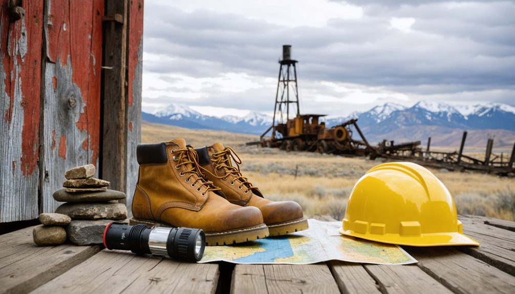
When you venture into the remote gulches and high-elevation districts surrounding Helena, you’ll need reliable navigation tools and safety equipment that 19th-century prospectors lacked—topographic maps, GPS backup, and extensive first-aid supplies for terrain that hasn’t changed much since the 1880s boom years.
Historical accounts from the Helena Independent frequently documented accidents in these districts, from shaft falls to sudden weather exposure, making emergency gear non-negotiable for modern explorers.
Beyond survival essentials, you’ll want photography equipment and documentation tools to capture the collapsing headframes, hand-hewn log cabins, and rusted machinery that tell the story of Montana’s mining frontier before these structures disappear entirely.
Abandoned mining towns around Helena present hazards that 19th-century prospectors never anticipated—deteriorating structures, unstable tailings piles, and ventilation-starved adits that have claimed the lives of modern explorers who entered unprepared.
Your safety gear and guiding tools form the baseline between self-reliant exploration and becoming a search-and-rescue statistic.
Essential equipment includes:
- P100 respirator and safety goggles to filter asbestos, silica dust, and mold in collapsed headframes and assay offices
- Topographic map, compass, and offline GPS for charting trackless gulches where cell signals vanish
- High-lumen headlamp with spare batteries preventing disorientation in dark mine portals
- Cut-resistant gloves and sturdy boots protecting against broken glass, rusted nails, and jagged timbers
Pack a whistle and power bank—communication failures have stranded explorers for days.
Photography and Documentation Equipment
The crumbling assay offices and weathered headframes of Helena’s mining district demand specialized imaging equipment that can perform under conditions far harsher than the controlled environments most cameras see.
You’ll need a weather-sealed body to withstand blowing tailings and Montana’s unpredictable mountain storms. Equipment essentials include a wide-angle lens for cramped mill interiors, a 24-70mm for versatile documentation, and a telephoto to isolate details without approaching unstable structures.
Bring multiple batteries—cold high-elevation air drains them fast. Fast memory cards and redundant storage protect irreplaceable archival research images.
Photography techniques like HDR bracketing require a carbon-fiber tripod and remote release. A compact LED panel illuminates dark spaces without flash, while polarizing filters cut glare on weathered surfaces and enhance sky contrast above abandoned townsites.
Understanding Private Property and Access Restrictions
Before you set out to explore ghost towns near Helena, you’ll need to understand that most historic townsites exist as mosaics of land ownership—federal parcels managed by the Bureau of Land Management or U.S. Forest Service, state historic sites, and private patented mining claims.
Property rights remain enforceable even at abandoned locations, and Montana law requires landowner permission before entering private land. Access regulations vary dramatically between sites:
- Elkhorn State Park limits public access to Fraternity Hall and Gillian Hall; surrounding structures remain private.
- Comet sits entirely on private property with no legal access beyond public roads.
- BLM lands generally permit hiking but still require permission when crossing private inholdings.
- Semi-inhabited ghost communities maintain active residences where trespass laws apply fully.
Always verify ownership before exploring.
Best Times of Year to Visit Southwest Montana Ghost Towns
Timing your visit can mean the difference between photographing weathered clapboard under blue skies and turning back from impassable snowdrifts two miles short of your destination.
Spring weather brings mud and melting snow on unpaved roads, though you’ll encounter fewer tourists than peak season.
Summer crowds peak in July and August at Virginia City and Bannack, but you’ll enjoy maximum daylight and reliable access to remote sites like Coolidge.
Fall foliage transforms September and October into prime ghost town months—stable roads, pleasant temperatures, and considerably lighter crowds after Labor Day.
Winter access shuts down high-elevation towns entirely; most dirt spurs become impassable from November through March, while seasonal facilities like Crystal Park close by mid-October.
Combining Ghost Town Exploration With Outdoor Recreation
Southwest Montana’s ghost towns occupy a recreation-rich landscape where you’ll find yourself pivoting from photographing weathered headframes to lacing hiking boots or unloading mountain bikes within the same afternoon.
Multi-sport itineraries within Helena’s mining belt:
- Summit scrambles from Elkhorn traverse volcanic rubble and open ridgelines to Crow Peak and Elkhorn Peak, where log books record your ascent through unique geology shaped by ancient eruptions.
- Rimini’s ATV network links abandoned mining roads with forest drainages, offering motorized exploration among ruins where local wildlife—elk, deer, and black bears—reclaim old tailings.
- Marysville-to-ski-area combinations let you walk historic streets, then catch afternoon runs at Great Divide.
- Boulder Hot Springs post-hike soaks pair Elkhorn visits with mineral pools, turning dusty history days into recovery sessions.
Frequently Asked Questions
Are Any Helena-Area Ghost Towns Accessible in Winter Conditions?
You’ll find Marysville and Rimini accessible during winter conditions, as both maintain plowed access roads. Winter accessibility depends on snow conditions—Marysville benefits from ski area traffic, while Rimini’s main route receives regular maintenance for year-round residents.
Can I Camp Overnight Near Elkhorn or Other Ghost Town Sites?
You’ll find dispersed camping on nearby National Forest lands around Elkhorn, but camping regulations prohibit overnight stays within the state park townsite itself. Always check fire restrictions and watch for local wildlife like black bears before setting up camp.
Do Any Ghost Towns Near Helena Offer Guided Tours?
No ghost towns near Helena offer traditional guided tours. Elkhorn State Park provides ranger-led seasonal programs emphasizing historical significance, while Rimini and Marysville remain self-guided. You’ll explore independently using interpretive signs and your own research.
Are There Restaurants or Services Available in Semi-Ghost Towns Like Marysville?
You’ll find Marysville House restaurant serving meals in a preserved historic building, offering the town’s primary Marysville dining and local services. It draws visitors year-round, especially during ski season near Great Divide.
Is Cell Phone Coverage Available at Most Ghost Town Locations?
Most ghost towns near Helena have little to no cell service. Signal strength drops sharply once you leave highways. You’ll find coverage unreliable even at more accessible sites like Marysville, so plan accordingly.
References
- https://www.roamingnearandfar.com/montana-ghost-towns-near-helena/
- https://en.wikipedia.org/wiki/List_of_ghost_towns_in_Montana
- https://southwestmt.com/pdfs/Southwest-Montana-Ghost-Towns-Printable-Map.pdf
- https://www.gonomad.com/232995-ghost-towns-of-montana
- https://visitmt.com/things-to-do/ghost-towns
- https://fwp.mt.gov/stateparks/granite-ghost-town
- https://www.youtube.com/watch?v=J38tAc_Z5rw
- https://www.atlasobscura.com/places/elkhorn-ghost-town
- https://www.montanaoutdoor.com/2024/12/montanas-tiny-ghost-town-with-big-history/
- https://passionsandplaces.com/elkhorn-montana-ghost-town/