You’ll find a remarkable concentration of abandoned coal camps within 20 miles of Helper, Utah, scattered through Carbon County’s Book Cliffs. Spring Canyon hosts Peerless and Standardville, while Consumers Wash features Coal City (Dempseyville), Consumers, and National—ghost towns that once housed hundreds of miners between 1912 and the 1960s. Latuda, established in 1917, sits farther along with its haunting “Woman in White” legend. These sites collectively produced over 53 million tons of coal before economic decline left behind foundations, company store ruins, and weathered structures that tell compelling stories of Utah’s industrial past.
Key Takeaways
- Spring Canyon in Carbon County contains multiple ghost towns from coal mining operations that ran between 1912 and the late 1950s.
- Coal City, founded in 1921, and Consumers camp housed around 300 residents before abandonment, with foundations and artifacts still visible.
- Latuda, established in 1917, closed in 1966 following labor violence and features local ghost legends like the “Woman in White.”
- Standardville displays extensive ruins including a massive concrete retaining wall, basements, and underground tunnel systems connecting former buildings.
- Access requires high-clearance vehicles via Spring Canyon Road; visitors should bring offline maps, extra fuel, and respect property boundaries.
Spring Canyon’s Coal Mining Legacy: Peerless, Standardville, and Beyond
Just west of Helper, Spring Canyon cuts into Carbon County’s Book Cliffs and tells the story of Utah’s coal boom in microcosm.
Between 1912 and the late 1950s, company towns dotted this narrow valley every couple of kilometers, each exploiting the same rich seams. Jesse Knight’s Spring Canyon Coal Company pioneered 2,000 acres in 1912, establishing Storrs—the original camp that by 1940 had become Utah’s fourth-largest coal producer.
Standardville infrastructure followed that same year, offering workers housing, schools, and stores. Peerless operations launched in 1917 just down-canyon, adding another link to the chain.
Together with Latuda, Rains, and Mutual, these closely spaced camps extracted roughly 53 million tons before demand shifted and seams played out, leaving you ruins and memories today. The D&RGW railroad built the Spring Canyon Branch from Peerless to Mutual, with coal companies covering construction costs through fuel payments. The 1975 razing of Spring Canyon erased all but remnants of the tipple trestle, completing the transformation from bustling mining hub to ghost town.
Exploring the Consumers Wash Ghost Towns: Coal City, Consumers, and National
Southwest of Helper, the narrow canyons feeding Gordon Creek sheltered a different kind of coal rush—one that arrived later and burned out faster than the Spring Canyon camps.
Coal City sprang up in 1921 in Consumers Wash, about twenty miles southwest of Helper, nicknamed “Dempseyville” after boxer Jack Dempsey’s local ties.
Nearby, Consumers camp—originally called Gibson—housed roughly 300 residents at its 1920s peak, boasting company housing, a hospital, and an amusement hall.
Blue Blaze Coal Company ran operations through the 1930s before declining demand shuttered the mines.
The neighboring town of Sweet shared a post office and school with National and Consumers, reaching a population of 200 after Will Sweet discovered coal there in 1928.
Today you’ll find foundations, rubble, and scattered artifacts along rough dirt roads branching west from Highway 6.
These ghost towns reward exploration with tangible evidence of small-scale mining ventures that couldn’t outlast economic shifts. Like many Utah County ghost towns, these communities suffered economic decline from technological advancements that rendered their industries obsolete.
Latuda: From Liberty to Abandonment and the Woman in White

While the Consumers Wash camps faded into quiet obscurity, Latuda’s story carries a darker weight—one written in avalanche snow, labor violence, and stubborn stone walls that refuse to fall.
Latuda history begins in 1917 when Francisco Latuda and Charles Picco purchased 326 acres of coal land. Initially called Liberty, the camp shipped its first coal in January 1918.
By the 1920s, you’d find 35 houses, a school, and that distinctive stone mine office—part company headquarters, part hotel. A modern four-track steel tipple was completed in 1928, dramatically increasing the mine’s capacity.
Then came February 16, 1927. Snow slides buried houses and killed two miners.
Union battles in 1922 brought strikebreakers and National Guard troops. The mine finally closed in 1966. By 1967, the last resident had departed, leaving Latuda completely abandoned.
Today, locals whisper about the Woman in White—a ghostly figure wandering those stone ruins at 6,700 feet elevation.
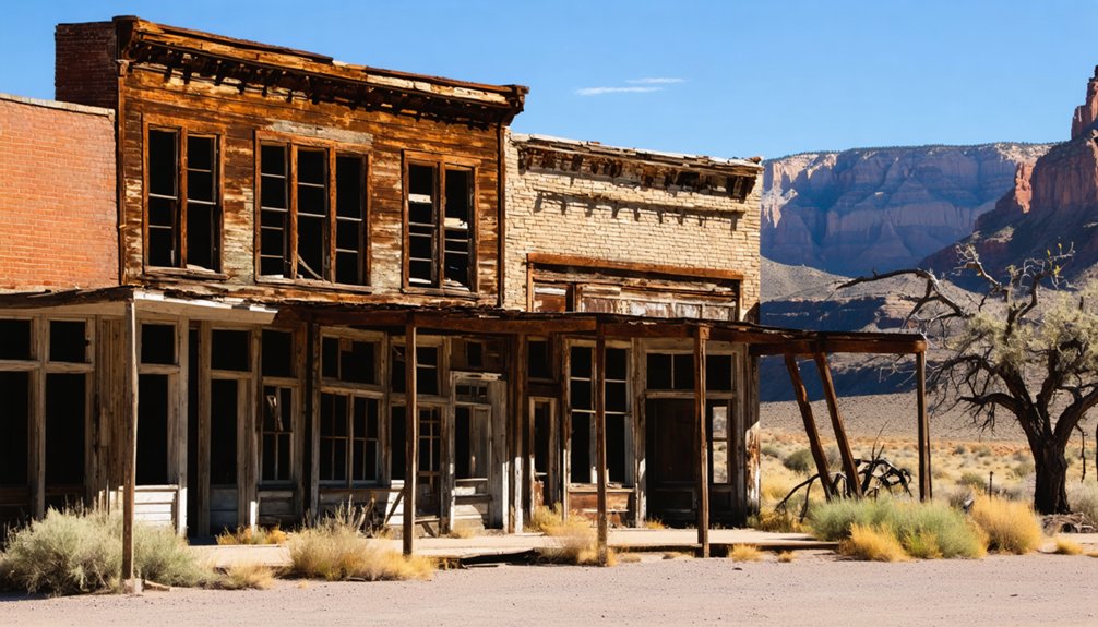
What Remains: Ruins, Structures, and Industrial Archaeology
Standardville’s dressed-rock and plaster-faced red-brick walls**** stand as Spring Canyon’s most extensive architectural remnants—roofless masonry shells that still map out their original floor plans with stubborn clarity.
A massive curved concrete retaining wall anchors the site, while clustered foundations enable detailed ruins documentation of the camp’s spatial organization.
You’ll find Coal City’s cut-rock store perched on its rise, a topless cistern hazard nearby, and scattered wooden residential piles showing early construction methods.
The Mutual company store dominates mile 5.6, weathered by graffiti but unmistakable.
Foundation clusters mark where Rains and Little Standard once pressed close together.
Though private property limits access, these sites preserve enough evidence for industrial mapping—each concrete pad and trestle support telling its coal-hauling story from the roadside.
Many buildings feature basements that connect to a tunnel system beneath the mining communities, remnants of the underground infrastructure that once served these canyon towns.
Latuda and Storrs contribute additional ghost town remains farther up the canyon, their crumbling buildings and foundations scattered among the overlapping town sites.
Visiting Carbon County’s Ghost Town Belt: Access, Safety, and Modern Exploration
Because these ghost towns cluster along narrow canyons that still follow century-old coal-haul routes, reaching them demands the same attention to terrain that early freight drivers once paid.
Spring Canyon Road and Consumers Road form your primary access routes, threading past Standardville, Peerless, Coal City, and National—though broken pavement, washboarding, and steep grades make high-clearance vehicles essential.
Snowmelt and summer cloudbursts trigger rockfall and flash-flood debris, while winter ice blocks higher elevations entirely. Many sites sit on active mining leases or private land, so respect gates and signage.
Seasonal hazards and active mining claims demand vigilance—watch for weather threats, honor property boundaries, and heed posted warnings at every turn.
Cell coverage disappears in the canyons, making offline maps and extra fuel mandatory safety precautions. Heritage rules prohibit artifact removal.
Scout conditions before you roll, conserve daylight, and remember: freedom here means self-reliance. At Standardville, watch for rusty nails and unstable foundations as you explore remnants of homes and offices. Utah’s ghost towns offer excellent day adventures for history buffs and photographers drawn to remnants of frontier life.
Frequently Asked Questions
Were Any Famous Labor Strikes or Mine Disasters Recorded in Helper Area Camps?
You’ll find labor history marked by unfortunate workplace incidents throughout Helper’s mining camps. The 1903-1904 and 1922 strikes brought violence and National Guard intervention, while mining accidents claimed countless lives in these demanding coal operations.
Can You Still Find Coal Seams or Mining Equipment in These Ghost Towns?
You’ll spot mining equipment remnants—foundations, tipple footings, scattered metal—across Spring Canyon and Consumers ghost towns, but coal seam exploration reveals only weathered fragments in waste piles; accessible veins are worked out or buried.
Are Any Spring Canyon Ghost Towns Privately Owned or Off-Limits to Visitors?
Available sources don’t specify private ownership or visitor restrictions for Spring Canyon’s ghost towns. You’ll find publicly accessible roads, parking areas, and pit toilets serving these nostalgic mining settlements, though caution near active operations remains wise.
Did Helper Itself Decline or Does It Still Function as a Town Today?
Helper still functions as an incorporated town with around 2,100 residents today. You’ll find it has weathered economic factors from its coal mining town history, maintaining active city services despite modest population decline over recent decades.
What Other Ghost Towns Exist in Carbon County Beyond the Helper Area?
You’ll find over a dozen abandoned mining camps scattered across Carbon County’s canyons, including Castle Gate, Scofield, Winter Quarters, and Consumers—each preserving haunting ghost town history from Utah’s deadly yet prosperous coal era.
References
- https://en.wikipedia.org/wiki/List_of_ghost_towns_in_Utah
- https://www.visitutah.com/things-to-do/history-culture/ghost-towns
- https://www.utah.com/things-to-do/attractions/old-west/ghost-towns-in-utah/
- https://freepages.history.rootsweb.com/~gtusa/ontheroad/us6g.htm
- https://www.roadtripryan.com/go/t/utah/carbon-county/spring-canyon
- https://www.youtube.com/watch?v=EPg5C5WaCQU
- https://www.legendsofamerica.com/spring-canyon-utah/
- https://utahrails.net/utahcoal/spring-canyon-mines.php
- https://utahrails.net/utahcoal/spring-canyon-coal.php
- https://www.uen.org/utah_history_encyclopedia/c/COAL_MINING_IN_UTAH.shtml


