You’ll find the densest cluster of ghost towns near hot springs along Wyoming’s coal corridor between Thermopolis and Gebo, where abandoned mine camps sit within twenty miles of natural thermal pools. South Dakota’s Black Hills also pair mineral-spring resorts like Hot Springs with nearby coal-camp ruins accessible via unpaved county roads. Montana’s Garnet Range adds high-elevation mining settlements near warm-water creeks. Most sites require traversing public–private land boundaries, and winter access varies dramatically from summer conditions—factors that shape how you’ll plan routes, timing, and what remains visible on the ground.
Key Takeaways
- Hot Springs, South Dakota sits in the Black Hills where geothermal activity and historic coal mining created a unique landscape of ruins and resorts.
- Coal company towns like Gebo-Crosby and Kirby flourished along rail spurs from 1907-1938 before post-WWII surface mining caused widespread abandonment.
- Ghost town clusters mark former rail corridors, with ruins accessible via county roads though many lack preservation, stabilization, or interpretive signage.
- Peak visitation runs June through September for walking tours and outdoor soaking; winter access to ghost towns is limited by unplowed roads.
- Hot Springs’ thermal waters attracted health-seekers and veterans, creating dual economies that outlasted single-industry coal camps dependent on rail transport.
Where the Great Plains Meet Thermal Waters: Geographic Context
Where the Great Plains stretch endlessly across the American interior, thermal waters emerge at an unexpected geological anomaly: the Black Hills of South Dakota.
You’ll find Hot Springs nestled against this dome-like uplift, where crystalline igneous and metamorphic rocks punch through surrounding sedimentary layers, rising 2,000-3,000 feet above the prairie floor.
These thermal anomalies deviate sharply from the standard heat flow patterns defining the broader plains. The Black Hills’ exposed crystalline core generates localized geothermal energy, creating warm springs unique to this region.
The Black Hills’ crystalline bedrock disrupts regional heat flow, driving thermal springs that distinguish this uplift from the surrounding plains.
Meanwhile, the semi-arid climate—shaped by Pacific air masses losing moisture over western ranges—produces the dry grasslands and extreme weather that once challenged settlers.
These geological formations created both opportunity and hardship for frontier communities seeking refuge in thermal waters. The region sits within the vast Interior Plains physiographic division that extends across central North America, linking the Black Hills to a broader system of sedimentary basins and uplifts.
The flat terrain of the surrounding Great Plains acted as an expressway for air masses, allowing both tropical air from the south and Arctic air from the north to converge unimpeded over these settlements.
Coal, Rails, and Mineral Springs: Economic Forces Behind Settlement Patterns
You’ll find that coal seams 4.5–12 feet thick drove the platting of dozens of company towns across Kansas, Wyoming, Colorado, and New Mexico—camps like Dawson and Gebo where corporate owners controlled every storefront and bunkhouse.
These settlements depended on rail spurs to move tonnage to market; when tracks reached isolated deposits, populations surged, but when stops ceased or seams played out, residents left en masse.
Meanwhile, mineral springs along the same rail corridors attracted health-seekers to bathhouses and hotels, creating dual economies that sometimes outlasted the coal boom and sometimes vanished alongside it. Coalmont emerged when prospectors discovered low-sulfur bituminous coal in North Park during the early 20th century, though the town ultimately succumbed to cheaper fuel alternatives and a destructive coal seam fire. Inland towns lacking railroad access faced competitive disadvantages that often doomed them from the start, unable to ship goods or attract settlers at the same pace as their rail-connected neighbors.
Coal Camps Fuel Decline
Across the Great Plains and adjacent Rockies, coal companies erected entire settlements as company towns, owning not just the mines but the houses, stores, and civic buildings that sheltered their workforce.
You’d find miners who didn’t own the land beneath their feet, paid in scrip redeemable only at company stores—a system that strangled local capital formation and choked off economic dependency alternatives.
Railroads like Union Pacific sited these camps strategically along tracks, creating settlement patterns tied entirely to locomotive fuel demand.
European immigrants and Civil War veterans concentrated in these districts, binding population distribution to mine viability.
When post-WWII Wyoming shifted to surface mining, coal output crashed 70% between 1953 and 1958.
Dieselization killed railroad coal markets, and Union Pacific’s 1960s closures transformed dozens of camps into ghost towns.
Hot Springs Draw Tourism
When federal surveyors set aside Arkansas’s Hot Springs Reservation in 1832, they recognized thermal springs as economic engines capable of anchoring permanent settlement in otherwise marginal terrain.
You’ll find that these mineral-rich waters drew health-seekers willing to pay for lodging, meals, and bathhouse treatments—cash flows that funded street grids, hotels, and commercial districts where crude camps once stood.
Federal leases stabilized property rights, encouraging private capital to build large-scale bathhouse facilities employing local labor.
After the Civil War and World War II, veterans flooded hot springs resorts seeking therapeutic benefits for rheumatism and battle wounds, swelling populations and tax revenues.
Railroads integrated these towns into regional tourism circuits, supporting livery stables, retail shops, and entertainment halls that diversified income beyond water cures alone.
The 55-mile journey from Little Rock via U.S. 70 compressed what once required two-day stagecoach trips in the 1830s, making Hot Springs accessible to automobile tourists by mid-century.
By 1970, developers like John A. Cooper Sr. recognized the region’s potential to transform raw acreage into planned resort communities, establishing Hot Springs Village as a gated retreat spanning 20,000 acres across Garland and Saline Counties.
Rails Link Boom Towns
Railroad companies didn’t simply lay tracks through Arkansas’s thermal districts—they engineered entire settlement systems by linking coalfields, mineral springs, and agricultural hinterlands into profit-driven networks.
Railroad expansion transformed scattered wagon mines into fully industrial mining towns, with corporate subsidiaries controlling both extraction rights and townsite plats. You’ll find these abandoned settlements clustered along abandoned spurs where freight rate structures once favored rail-served collieries over isolated operations.
Key forces shaping these ghost towns:
- Corporate landholding concentrated coal reserves, town lots, and commercial property under single ownership
- Single-industry dependence made communities vulnerable to mine closures and fuel-market shifts
- Capital-intensive infrastructure—shafts, tipples, sidings—required rapid population inflows that reversed just as quickly
- Mechanized surface mining displaced underground labor, undermining earlier settlement patterns entirely
Mining companies maintained total financial control through company stores and scrip systems that trapped workers in cycles of debt, preventing the wealth accumulation necessary for community stability when mines eventually closed. Congressional tariffs protected American coal producers from foreign competition, artificially sustaining these remote operations until domestic market forces and mechanization made them obsolete.
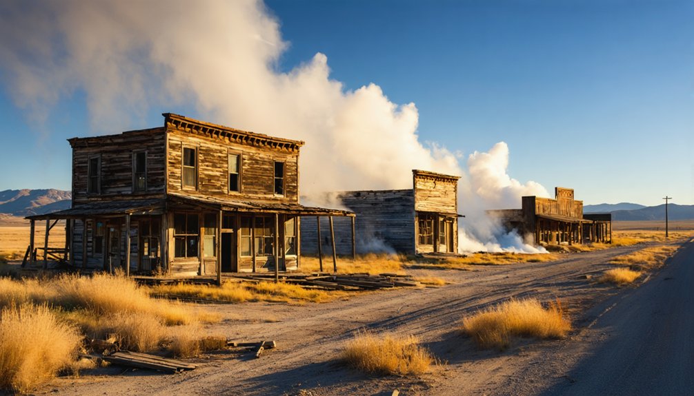
Gebo and the Thermopolis Region: Wyoming’s Ghost Town–Hot Springs Corridor
You’ll find Gebo’s ruins about fifteen miles southeast of Thermopolis, where over 2,000 residents once extracted coal that powered locomotives across the nation from 1907 until operations ceased in 1938.
The abandoned townsite preserves mining structures, boarding house foundations, and a cemetery with headstones dating to the early 1900s—all managed by the Bureau of Land Management as the Gebo-Crosby Historic Mining District.
This corridor between Hot Springs County’s thermal waters and coal camps reveals how Wyoming’s settlement patterns followed both extractive industries and therapeutic tourism, creating a concentrated landscape of boom-and-bust communities within a twenty-mile radius.
Gebo’s Coal-Mining Legacy
Anchored by the Jones Mine—later known as Gebo No. 1—the coal camp of Gebo sprang to life about 1906–1907 roughly 11–12 miles north of Thermopolis, where the Owl Creek Coal Company had formed to exploit seams yielding fuel of exceptional quality.
Gebo’s history reflects a regional energy boom driven by coal that burned hot and left only 3 percent ash. Mining techniques evolved rapidly as the 1914 rail link to Kirby opened eastern markets, while World War I demand pushed Gebo coal into ships and locomotives nationwide.
Gebo’s coal-mining legacy includes:
- Peak population exceeding 1,200—possibly 2,000—making it Hot Springs County’s largest town
- Workforce representing as many as 16 nationalities in the Bighorn Basin’s most diverse community
- Federal investigations targeting coal-land irregularities beginning around 1910–1912
- Company-town model providing free rent and $1-per-truckload heating coal
Reaching the Abandoned Townsite
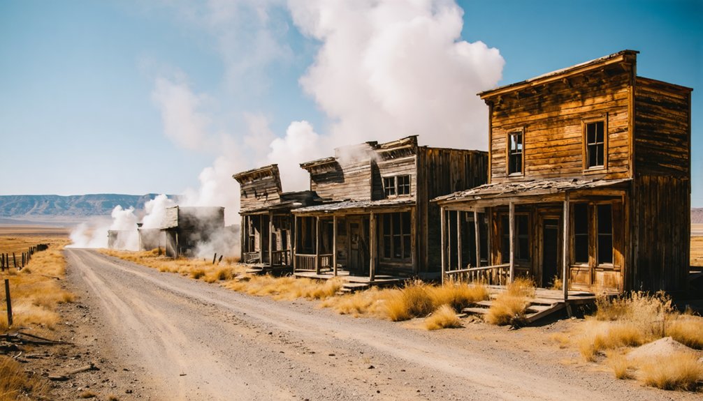
Today that legacy sits silent on high-plains ground roughly eleven miles north of Thermopolis, where Gebo Road branches west from Wyoming Highway 20 near Kirby and climbs toward the Gebo–Crosby Historic Mining District.
Exploring accessibility hinges on vehicle clearance—graded dirt deteriorates into ruts and washboard after storms—and self-reliance; you’ll find no services, signage, or facilities beyond the entry interpretive panel.
Maneuvering through ruins demands caution: foundations crumble, depressions hide subsidence, and rubble fields sprawl without barriers. The BLM manages this landscape for cultural protection, not convenience, so bring water, maps, and awareness that you’re threading between public parcels and private holdings.
A windswept cemetery crowns the hillside above scattered walls and basement voids, rewarding those willing to accept dirt roads and isolation.
Regional Ghost Town Circuit
Within a thirty-mile radius of Thermopolis, the legacy of northern Wyoming’s coal economy converges with one of the state’s oldest tourism draws, creating an unusual heritage corridor where boardwalks and bathhouses share the same county grid as crumbling mine foundations.
Your circuit includes:
- Gebo–Crosby historic district — BLM-stewarded ruins featuring foundations, cemetery markers, and industrial archaeology from Wyoming’s largest Hot Springs County coal town
- Kirby coal area — Secondary camp remnants illustrating the Owl Creek Coal Company’s regional footprint between 1907 and 1938
- Hot Springs State Park — Thermopolis’s geothermal anchor, contextualizing concurrent settler tourism development alongside mining boom cycles
- Cemetery interpretive sites — Sixteen nationalities documented in burial grounds, revealing immigrant labor demographics and mortality patterns
This compact pairing exemplifies ghost town preservation intersecting with cultural heritage tourism infrastructure.
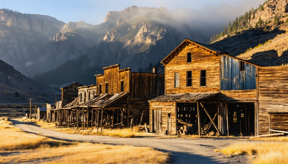
Garnet Range Road: Montana’s Circuit of Abandoned Mining Camps
Cutting through the Garnet Mountains between Montana Highway 200 and Interstate 90, Garnet Range Road forms a 13-mile circular route that strings together five historic mining camps—Reynolds City, Springtown, Beartown, Coloma, and Garnet—into what amounts to a compact ghost-town loop.
At 6,000 feet elevation, you’ll find Garnet’s twenty standing structures representing peak Garnet history from 1898, when a thousand miners extracted millions in gold from quartz veins laced with red garnets.
The mining heritage extends north to Coloma’s “Mystery Camp,” where $250,000 in ore funded narrow-gauge rail lines between 1893 and 1906.
Bureau of Land Management access runs roughly May through January for wheeled vehicles, with winter snowmobile routes connecting these weathered reminders of Montana’s boom-and-bust frontier.
Judith Mountains Island Ranges: Gilt Edge, Maiden, and Warm Springs Creek Canyon
Rising from Montana’s central plains like a geological afterthought, the Judith Mountains harbor three interconnected ghost towns whose fortunes hinged on an 1879 gold strike at the head of Warm Spring Creek Canyon.
Maiden materialized in 1881, swelling to 1,200 residents by decade’s end. Gilt Edge history began in 1883 with discoveries on eastern slopes, though formal townsite establishment didn’t occur until 1893. Combined production yielded 400,000 ounces of gold before inevitable decline.
What you’ll encounter:
- Nearly twenty structures at Maiden, from total ruins to remodeled dwellings
- Privately preserved Maginnis stamp mill from 1884
- Gilt Edge’s scattered remains: stone storefronts, wooden jail, brick buildings
- Roads traversing original town centers on historical routes
Maiden preservation efforts saved key structures. Fire devastated Maiden’s business district in 1905; most property remains privately held.
Access, Preservation, and What Remains on the Ground Today
Reaching these Judith Mountains sites requires traversing a patchwork of public and private land that complicates even the most straightforward visit.
County roads shift from gravel to two-track without warning, and posted fences appear where maps show open routes. Gilt Edge’s stamp-mill foundations and Maiden’s collapsed storefronts sit partly on BLM parcels, partly on ranch holdings—you’ll need to verify access before stepping off the roadway.
Ghost town preservation here is minimal: no stabilization budgets, no interpretive kiosks, just weathering log walls and open shafts reclaimed by juniper and prairie grass.
Visitor etiquette becomes your primary tool—close gates, pack out refuse, photograph rather than pocket artifacts. What remains today degrades faster than bureaucracies can catalog, making respectful exploration essential to prolonging these fragile records.
Scenic Drive Culture: Pairing Soaks and Ruins in Regional Tourism
Across the northern plains and their mountain borderlands, tourism offices have stitched ghost towns and hot springs into deliberate scenic-drive products that promise dual payoffs: dusty exploration followed by therapeutic soaking.
Heritage roads now package abandonment and rejuvenation as a single journey—ghost-town dust washed away by mineral-fed pools at sunset.
You’ll find routes like Wyoming’s Gebo–Thermopolis corridor and Colorado’s U.S. 350 “Santa Fe Trail drive” marketed explicitly as heritage-by-car experiences. These pairings layer historical narratives—abandoned coal camps, wagon ruts, crumbling schoolhouses—against restorative evening soaks, creating a contrast that appeals to photographers, history buffs, and off-the-beaten-path travelers.
Featured loop characteristics:
- Minimal traffic on lonely high-plains highways with cinematic vistas toward distant ranges
- Self-guided interpretation at ghost-town sites requiring no permits or fees
- Low-cost public soaking areas in hot-spring communities after daylong drives
- Story density per mile: frontier ruins, tribal spring traditions, and atmospheric decay
Seasonality, Winter Cabins, and Year-Round Visitation Patterns
Those scenic-drive itineraries promise year-round discovery, but the reality on the ground shifts dramatically with the calendar.
Great Plains hot springs see peak seasonal tourism June through September, when ghost-town walking tours and outdoor soaking align.
Winter accessibility tells a different story: plowed highways reach established resorts in Hot Springs, Thermopolis, and Saratoga, but unplowed county roads leave many ruins snowbound until spring.
You’ll find modern cabins open year-round near commercial springs, yet historic ghost-town structures remain closed—too fragile, too remote, too costly to heat or patrol.
Winter visitors typically make brief roadside photo stops, drawn by dramatic light and emptiness, then retreat to indoor museums and heated pools before windchill and short daylight end the day.
Data Gaps and the Challenge of Mapping Plains Ghost Towns Near Hot Springs
When you plot ghost towns near Great Plains hot springs on a regional map, you quickly discover how incomplete the underlying data really are.
Documentation gaps plague even well-known thermal districts: African American and immigrant settlements vanish from official records, railroad townsites shift coordinates with track realignments, and “living ghost towns” fall outside strict abandonment definitions.
Mapping challenges multiply when private land blocks verification and historical names disappear from modern base layers.
Core obstacles you’ll encounter:
- Fragmented inventories scattered across state societies, tourism lists, and hobbyist forums with no standardized criteria
- Competing definitions that exclude partially inhabited service centers or new declines not yet “ghost” enough
- Spatial imprecision from shifted townsites, generalized maps, and large rural census units masking exact locations
- Cultural erasure leaving minority hot-spring communities poorly documented and unmapped
Frequently Asked Questions
Are Any Hot Springs Still Operating Near These Ghost Towns Today?
Yes, you’ll find Thermopolis Hot Springs thriving near Gebo’s ruins, where mineral waters once drew miners still draw freedom-seekers today. Archival records reveal the historical significance linking abandoned camps to these steaming pools steeped in local legends.
Can I Camp Overnight at Ghost Town Sites in Wyoming or Montana?
Yes, you’ll find overnight camping permitted at Montana ghost town sites under specific camping regulations. BLM lands allow 14-day stays near Garnet, while state trust lands permit 16 days per month. Follow ghost town etiquette by respecting historical structures.
What Wildlife Hazards Should Visitors Expect in These Remote Areas?
You’ll face bears, mountain lions, rattlesnakes, and moose during wildlife encounters at remote ghost town sites. Take safety precautions: carry bear spray, make noise on trails, watch for snakes in ruins, and maintain distance from all animals.
Do Cell Phones Work Near Ghost Towns in the Great Plains?
You’ll find cell service reliability severely compromised near Great Plains ghost towns, where terrain disrupts signals more than urban signal interference does. Many emerging ghost towns from North Dakota to Texas report zero cellular coverage entirely.
Which Ghost Towns Charge Admission Fees or Require Permits to Visit?
You’ll find most Great Plains ghost towns don’t charge admission fees—they’re public land where you’re free to explore. Coincidentally, that’s changing as some private owners now require permits. Check local archives for specific restrictions.
References
- https://en.wikipedia.org/wiki/List_of_ghost_towns_in_Colorado
- https://www.colorado.com/articles/colorado-ghost-towns
- https://glaciermt.com/ghost-towns
- https://www.montanahikes.com/judith-mountains-and-their-ghost-towns/
- https://www.grandcountyutah.net/388/Ghost-Towns-Communities
- https://bighorndrifters.com/elementor-2633/
- https://visitmt.com/things-to-do/ghost-towns
- https://southwestmt.com/pdfs/Southwest-Montana-Travel-Guide-2022.pdf
- https://en.wikipedia.org/wiki/Great_Plains
- https://www.nalms.org/wp-content/uploads/2018/09/31-4-4.pdf


