
You’ll find Montana’s Garnet Ghost Town—preserved by the BLM with thirteen saloons still standing—just miles from thermal springs along Garnet Range Road, where the same Laramide-era faults that drove Samuel Ritchie’s 1895 gold strike still push geothermal water to the surface. Nevada’s Seven Troughs and Humboldt City once relied on nearby hot springs for year-round water during the 1860s silver boom. The geological corridor linking these sites stretches through Eastern California’s Bodie and into Utah’s volcanic country, where deep fault systems continue shaping both heritage and landscape.
Key Takeaways
- Garnet Ghost Town in Montana’s Garnet Range peaked at 1,000 residents in 1898 and is now preserved as Montana’s most intact ghost town.
- Nevada ghost towns like Pine Grove, Seven Troughs, and Humboldt City were established near thermal springs for year-round water access during mining operations.
- Hot springs formed through geothermal gradients along faults from the Laramide orogeny, depositing travertine terraces and silica sinter around vents.
- Access to Garnet Range sites requires seasonal planning, with standard vehicles allowed spring through fall and snowmobiles required in winter.
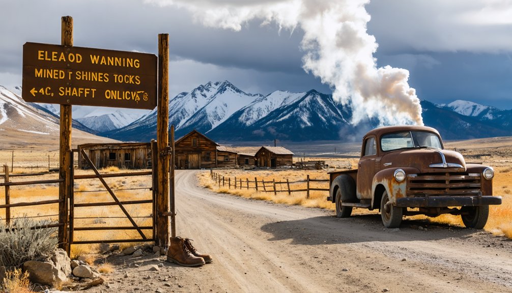
- Visitors face safety risks from abandoned mine shafts, unstable structures, and scalding thermal pools exceeding 180°F near unregulated vents.
Where Geology Creates Both Ore and Hot Water
When the Laramide orogeny buckled the Mountain West between 70 and 35 million years ago, it engineered a dual legacy: the same faults and anticlinal uplifts that trapped gold, silver, and copper also carved highways for hot water rising from miles below.
You’ll find this pattern repeating across Nevada, Wyoming, Colorado, and New Mexico—compressional folds juxtaposing Precambrian granite against Paleozoic limestone, creating reactive zones where mineralizing fluids once precipitated ore and where today’s meteoric water descends six thousand feet, heats along steep geothermal gradients, then surges back as scalding springs.
Those basement-rooted reverse faults didn’t discriminate: they fed both boom-town mines and the thermal baths that later outlived them, mineral circulation writing two chapters of the same geologic story. The springs deposited travertine terraces and silica sinter around their vents, building the same pale monuments you see today at abandoned mining camps throughout the Basin and Range. The thermal water itself carries dissolved minerals—silica, calcium, magnesium, and potassium—leached from rock interactions during its millennia-long journey through fractured strata.
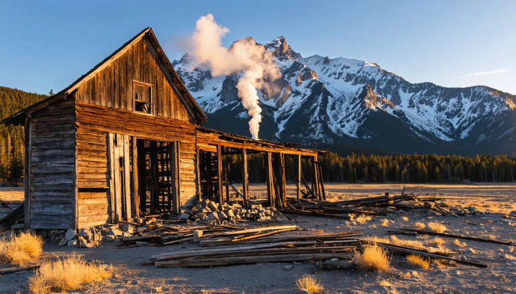
Montana’s Garnet Range: A Preserved Ghost Town Within Reach of Thermal Springs
If you’re traveling Montana’s hot‑springs corridor between Missoula and Deer Lodge, Garnet sits high in the Garnet Range less than thirty miles from thermal‑water resorts that drew frontier tourists during the same 1890s boom that built the mining camp.
Founded in 1895 at the head of First Chance Gulch, Garnet swelled to nearly a thousand residents crushing gold‑bearing quartz ore from the surrounding hard‑rock deposits.
Today the BLM preserves this cluster of original cabins, hotels, and commercial buildings as one of Montana’s most intact ghost towns—a time capsule you’ll reach via mountain roads that once carried ore wagons and miners seeking both fortune and warm‑water relief.
At its zenith in 1898, the town supported thirteen saloons alongside four hotels and general stores serving the booming mining population.
The community distinguished itself through family-oriented activities including a thriving schoolhouse that served over forty students at a time, dinner parties, and dances that set it apart from rougher mining camps.
Garnet’s Historic Mining Legacy
The Garnet Mountains north of present-day Phillipsburg witnessed their first gold seekers in the mid-1860s, when prospectors worked placer deposits with basic pans, rockers, and sluice boxes to capture free-floating gold from mountain streams.
The 1870s silver boom temporarily emptied the district, but the 1893 Silver Panic reversed that exodus. Displaced miners returned with hard rock technology that made deep ore extraction viable.
Samuel Ritchie’s 1895 strike at the Nancy Hanks mine catalyzed rapid expansion—Dr. Armistead Mitchell built a stamp mill, establishing infrastructure that transformed this camp into a thousand-person settlement by 1898.
Garnet mining’s historical significance peaked briefly before declining ore grades forced population collapse by 1905. The community had dwindled to around 150 miners working the remaining claims, and the town was completely abandoned by 1917.
Roosevelt’s 1934 gold price increase triggered temporary revival, but WWII’s dynamite restrictions ended operations permanently. A devastating fire in 1912 destroyed much of the town, accelerating the community’s decline from its already diminished population of just a couple hundred residents.
Hot Springs Corridor Access
Straddling western Montana’s thermal corridor roughly thirty miles east of Missoula, the Garnet Range positions its namesake ghost town within a broader recreational matrix that links historic mining sites to the region’s scattered hot springs.
You’ll reach Garnet via two main ghost town routes: Garnet Range Road branches eleven miles south from Highway 200, while Bear Gulch Road climbs from Interstate 90, forming a north–south access pair along the Garnet Back Country Byway.
Both routes remain open spring through fall for standard vehicles; winter narrows hot springs access and ghost town visits to snowmobile or ski travel across thirty miles of groomed trails.
The site opens daily 9:30 a.m.–4:30 p.m., charging modest entrance fees that fund preservation while serving day-trippers from Missoula, Seeley Lake, and Philipsburg. Soaking in mineral-rich pool waters delivers natural pain relief for muscles and joints, making thermal springs particularly appealing after hiking through historic mining districts. Hike-in access leads to Garnet Hot Springs from the ghost town area, with natural pools available dawn to dusk for visitors seeking a remote thermal soak after exploring the historic mining district.
Nevada’s High Desert: Ghost Towns Along the Geothermal Belt
You’ll find Nevada’s ghost towns scattered across the Basin and Range where miners chased silver and gold near the only reliable water in a punishing desert—springs fed by the same deep faults that drive geothermal activity.
Pine Grove’s collapsed cabins sit within miles of hot seeps in the Wassuk Range, Seven Troughs’ rusting stamp mills mark a brief boom in the Black Rock Desert’s thermal corridor, and Humboldt City’s stone foundations recall an 1860s supply hub along the river where emigrants once bathed at Gravelly Ford’s hot springs.
Each ruin tells the same story: prospectors needed water, and in northern Nevada’s high desert, thermal springs often provided the only year-round flow. The hot springs near these settlements drew not only miners but also visitors seeking mineral-rich waters, supporting resorts that flourished from the late 1800s to early 1900s before fading with the mines themselves. Fort Churchill stood guard nearby after 1860 to protect settlers and Pony Express routes following the Pyramid Lake War.
Pine Grove Mining Camp
When prospector William Wilson stumbled upon gold-bearing quartz in a steep canyon of the Pine Grove Hills in June 1866, he triggered a rush that would transform this remote corner of Lyon County into one of Nevada’s most substantial high-desert camps.
The settlement—initially called Wilsonville, later renamed Pine Grove after the local piñon groves—grew to 600 residents by the early 1870s.
Gold-bearing quartz veins on both canyon walls fed two principal operations: Wilson’s north-side workings and the Wheeler Mine three-quarters of a mile south. Together they’d generate roughly $8 million in bullion through stamp mills and arrastras.
Pine Grove’s mining history reveals unexpected progressivism—contemporary accounts document women working underground as skilled ore-judges, earning competitive $4 daily wages alongside men in 1901.
Seven Troughs Stamp Mills
While Pine Grove‘s operations relied on conventional arrastras and modest stamp mills to crush canyon-wall quartz, the Seven Troughs district—130 miles northeast across the sagebrush flats of Pershing County—developed into one of Nevada’s most mill-intensive boom camps.
By 1908, you’ll find records showing two ten-stamp mills processing ore that occasionally assayed at $100,000 per ton—among Nevada’s richest veins. The Kindergarten Mill, erected during winter 1907–08, anchored mining history here, later joined by the Coalition Cyanide Plant 300 feet downslope to rework tailings.
When the Coalition intersected water at the 1,600-foot level in 1917, flooding collapsed the district. The ambitious 100-ton Friedman mill at Tunnel Camp shut down December 31, 1934, leaving substantial ruins you can still explore today.
Humboldt City Stone Ruins
A sixty-house stone-walled camp rose in Humboldt Canyon during 1862–63, barely two years after French trader Louis Barbeau discovered silver here in spring 1860—making this one of Nevada’s earliest boom settlements outside the Comstock.
You’ll find Humboldt City’s ruins along a rocky dirt track climbing the eastern Humboldt Range from Imlay, where 500 residents once occupied 200 buildings amid speculation over assays running $400 to $2,700 per ton.
The district recorded over 1,000 silver claims before production collapsed around 1864.
Stone walls still mark the townsite where adobe, wood, and canvas roofs sheltered miners who abandoned the camp twice—first fleeing Paiute resistance in 1861, then economic reality three years later.
This mining legacy ended when the post office closed in 1869.
Eastern California and the High Sierra Corridor
The eastern escarpment of the Sierra Nevada cradles one of America’s densest concentrations of ghost towns, where mining fever transformed a barren corridor between Owens Valley and the High Sierra into a landscape of boom-and-bust settlements.
Bodie preservation maintains California’s official ghost town in “arrested decay“—buildings stocked with abandoned goods exactly as 10,000 residents left them after extracting $35 million in gold.
Above Lone Pine, Cerro Gordo history reveals how silver profits fueled Los Angeles’s early growth, with rusted equipment still clinging to steep mountainsides where whiskey once cost less than water.
You’ll find Bennettville’s restored bunkhouse at 10,000 feet, Dog Town’s stone foundations marking Mono County’s first settlement, and Ballarat’s saloons where miners—and those seeking to vanish—congregated before inevitable abandonment.
Utah and Idaho: Desert Ruins in Volcanic Country
Sandstone cliffs concealing silver veins and lava fields marking mineral-rich corridors define Utah and Idaho’s ghost town geography, where geological anomalies created fleeting wealth in landscapes that seemed designed to repel permanent settlement.
You’ll find Utah ghost towns scattered across the Carbon Corridor and Great Basin, where Silver Reef‘s sandstone deposits defied mining conventions during the 1870s boom.
Old Irontown vanished by 1876 when iron values collapsed. Thistle’s 1983 flooding proved nature claims these settlements back without warning.
Economic collapse and natural disaster both proved equally efficient at erasing human ambition from unforgiving terrain.
Capitol Reef’s Aldridge lasted barely a decade before floods erased it around 1900. Grafton’s 84 graves outnumber its former population substantially—disease and conflict extracted harsh prices.
Idaho desert ruins follow similar patterns across volcanic country, where thermal features drew prospectors who couldn’t sustain communities against environmental hostility and resource exhaustion.
Planning Your Visit: Access, Seasons, and Safety
Why do so many visitors underestimate the logistics of reaching ghost towns tucked beside remote hot springs?
The allure of exploring ghost towns in the Great Plains can quickly diminish when faced with the reality of their isolation. Navigating the dirt roads and sparse infrastructure requires careful planning and a reliable vehicle. Many are unprepared for the challenges that come with venturing into such forgotten places.
Road conditions shift drastically with seasons—graded dirt tracks become impassable mud troughs during monsoons, while high-elevation routes close entirely under snowpack until late June.
Seasonal access windows demand respect: arrive prepared or turn back.
Before you set out, consider these realities:
- Washouts erase roads overnight during spring melt and summer storms
- Mine shafts and unstable structures wait in shadowed ruins
- Scalding pools exceed 180°F near unregulated thermal vents
- GPS signals fail in deep canyons; carry paper maps
Pack for 40°F temperature swings, verify current closure orders with BLM offices, and respect artifact-protection laws.
Freedom means self-reliance—no rangers will rescue poor planning.
The Heritage Tourism Circuit: Combining Soaking and History
Across the Mountain West, more than two dozen historic mining camps and hot springs clusters sit within an hour’s drive of each other, creating natural heritage circuits that merge geothermal soaking with archival storytelling.
Colorado’s 800-mile Historic Hot Springs Loop demonstrates the model: you’ll traverse former rail depots, mining towns, and geothermal resorts on a multi-day itinerary that anchors boom-and-bust narratives in actual soak time.
Multi-day circuits weave abandoned depots and mining relics into geothermal itineraries, letting visitors soak where prospectors once gathered after long shifts underground.
California’s Eastern Sierra pairs Bodie State Historic Park—drawing 200,000 annual visitors to its preserved structures—with Benton Hot Springs’ 1940s inn.
Montana tourism boards explicitly recommend combining Bannack ghost town tours with nearby commercial pools.
These heritage trails let you chase gold-rush history by day and decompress in mineral water by evening, stabilizing visitor spending across seasons while preserving authentic soaking experiences.
Frequently Asked Questions
Are Ghost Towns Near Hot Springs Typically on Public or Private Land?
You’ll find most ghost towns near hot springs sit on mixed-ownership parcels—Montana alone manages several as state parks—meaning you’ll navigate both public access routes and private ownership boundaries when exploring these historic mining corridors.
Exploring ghost towns in Colorado reveals a fascinating glimpse into the past, where abandoned structures tell stories of prosperity and decline. Each town has its own unique history, often tied to the mining booms of the 19th century, and visiting them offers an adventure in both exploration and education. As you wander through these remnants, you may encounter artifacts and landscapes that showcase the resilience of communities that once thrived in this rugged terrain.
Can I Camp Overnight at Ghost Town Sites in the Mountain West?
Camping regulations usually prohibit overnighting directly in ghost town sites—they’re often day-use only. You’ll need to respect ghost town etiquette by camping on nearby public land, honoring closures, and checking local rules first.
What Permits or Fees Are Required to Visit These Ghost Towns?
Most ghost towns sit on federal land with no entry fee, but state parks like Bannack charge $5–8. You’ll need OHV permits for backcountry routes, and fee structures vary by managing agency and season.
Are There Guided Tours Available for Ghost Towns Near Hot Springs?
Yes, you’ll find guided exploration options at preserved sites like Virginia City and Bannack, where living-history programs highlight historical significance. Most ghost towns near hot springs also offer self-guided routes with interpretive materials for independent discovery.
Which Ghost Towns Have Cell Phone Service or Emergency Communication Options?
Most ghost towns near hot springs lack cell service, requiring you to bring satellite communication technology as essential safety measures. Check with local ranger stations beforehand—they’ll provide current connectivity details and emergency contact protocols for your specific destination.
References
- https://nvtami.com/top-10-ghost-towns-nevada-northwest/
- https://www.visitutah.com/articles/frisco-west-desert-ghost-town
- https://travelnevada.com/ghost-town/ghost-towns-near-reno/
- https://glaciermt.com/ghost-towns
- https://californiahighsierra.com/trips/explore-ghost-towns-of-the-high-sierra/
- https://garnetghosttown.org
- https://www.tripadvisor.com/ShowTopic-g45159-i8681-k2729787-Ghost_towns_Norris_Hot_Springs-Ennis_Montana.html
- https://visitmt.com/things-to-do/ghost-towns
- https://www.wsgs.wyo.gov/products/wsgs-2021-ip-22.pdf
- https://www.geologyin.com/2025/04/how-are-hot-springs-formed.html


