You’ll find several ghost towns near Katmai National Park, most importantly the abandoned Katmai village itself, buried under three feet of volcanic ash from the catastrophic 1912 Novarupta eruption. Douglas and Savonoski villages also vanished during this event, which ejected 13.5–15 cubic kilometers of magma and created the Valley of Ten Thousand Smokes. The eruption forced entire Sugpiat communities to relocate, ending their traditional way of life. Further exploration reveals how this disaster reshaped Alaska’s coastal settlements and created a haunting landscape of abandoned communities.
Key Takeaways
- Katmai village, a major trade hub since 1799, was buried under three feet of ash during the 1912 Novarupta eruption.
- Douglas village and Savonoski village vanished after the eruption, with Savonoski becoming the “Old Savonoski Site.”
- The 1912 eruption ejected 13.5–15 cubic kilometers of magma, creating a 2.5-kilometer-wide caldera at Mount Katmai.
- Residents relocated to New Savonoski after the eruption ended the traditional Sugpiat way of life in affected communities.
- The Valley of Ten Thousand Smokes formed from 11 cubic kilometers of ash-flow deposits following the eruption.
The 1912 Mount Katmai Eruption and Its Devastating Impact
On June 6, 1912, the largest volcanic eruption of the 20th century began on the Alaska Peninsula—not from Mount Katmai itself, but from Novarupta, a vent 10 kilometers to the west that would drain Katmai’s magma reservoir over the next 60 hours.
The eruption expelled 13.5–15 cubic kilometers of magma, collapsing Katmai’s summit by 5 cubic kilometers and creating a 2.5-kilometer-wide caldera.
You’ll find the volcanic aftermath staggering: hundreds of square miles buried under pumice and ash, Kodiak receiving 30 centimeters of fallout, and the Valley of Ten Thousand Smokes filled with 11 cubic kilometers of ash-flow deposits.
Earthquakes exceeding magnitude 6 shook the region repeatedly.
The Plinian eruption column rose over 100,000 feet, spreading ash as far as the Yukon Territory and affecting air quality across vast distances.
The ashfall immobilized life on Kodiak Island, causing widespread respiratory issues and contaminating water supplies.
Environmental recovery would take decades, as thick deposits stripped vegetation and transformed river valleys across the landscape.
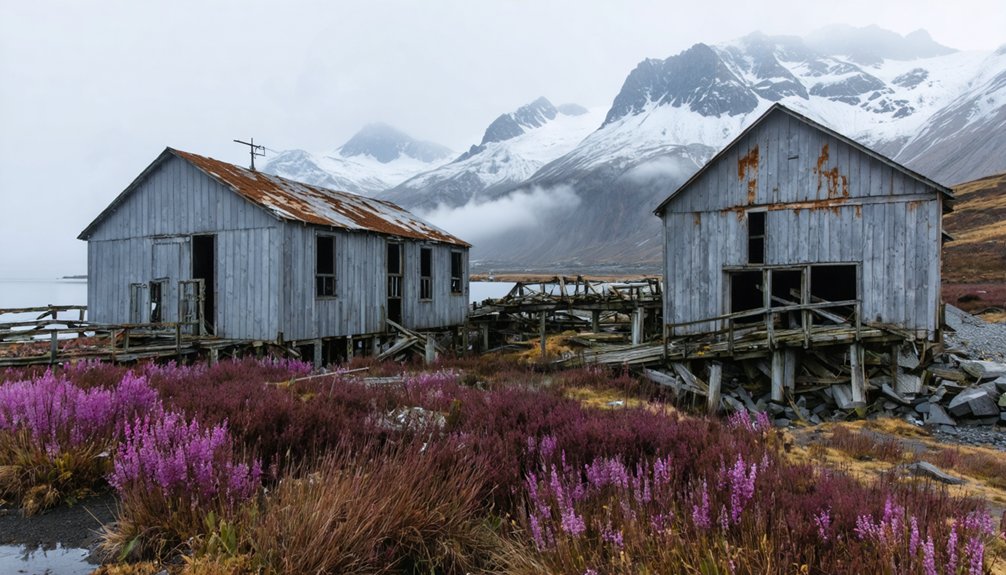
Katmai: A Town Buried and Abandoned Forever
When you examine the fate of Katmai village, you’ll find that the 1912 eruption delivered the final blow to a settlement already abandoned in the early 20th century as sea otter populations collapsed and trade shifted elsewhere.
The eruption buried the site under approximately three feet of volcanic ash, leveling structures and rendering the location permanently uninhabitable.
This physical obliteration transformed what had been a major Russian-American Company trade hub since 1799 into one of Alaska’s most thoroughly erased communities.
Before Russian contact in the mid-1700s, the region had supported indigenous settlements for thousands of years, with populations constructing pithouses and establishing seasonal hunting camps throughout the area.
The volcanic eruption disrupted local subsistence lifestyles so severely that residents relocated to New Savonoski, though some may have returned to the monument for traditional subsistence activities.
The 1912 Eruption
After sixty hours of cataclysmic violence beginning June 6, 1912, the Novarupta–Katmai eruption had expelled roughly 15 km³ of magma as tephra—the largest volcanic event of the 20th century by volume.
You’d have witnessed three days of total darkness as 17 km³ of ash fallout blanketed southcentral Alaska, burying villages and hunting grounds beneath feet of pumice.
Seismic activity was relentless—fourteen earthquakes measuring M 6–7 rattled the region while Mount Katmai’s summit collapsed into a 2.5-km-wide caldera.
On Kodiak Island, 100 miles distant, residents fled aboard the Revenue Cutter *Manning* as ash choked the air.
The eruption created the Valley of Ten Thousand Smokes and triggered a global volcanic haze that cooled the Northern Hemisphere’s 1912 summer.
The colder than average temperatures persisted for over six months, marking one of the most significant cooling events of the twentieth century.
Approximately 3,000 square miles lay buried beneath a foot or more of ash, transforming the landscape into a desolate wasteland.
Permanent Town Abandonment
Three communities vanished in 1912:
- Katmai village – Commercial hub since 1799, serving as the region’s economic heartbeat.
- Douglas village – Russian-American Company trading post from the nineteenth century.
- Savonoski village – Buried under ash and pumice, now documented as the “Old Savonoski Site.”
The economic decline had already begun before Novarupta erupted.
Trading posts closed ten years earlier, and the International Fur Seal Treaty halted sea otter hunting in 1911.
These once-thriving centers had become backwaters when volcanic devastation delivered the final blow, scattering survivors who never returned.
The eruption on June 6, 1912 marked the end of the traditional Sugpiat way of life in these communities.
Villages had also been established in the late nineteenth century at Severnosky and Kukak, expanding the region’s settlement network before the catastrophic eruption.
Afognak’s Struggle With Volcanic Ash
During the catastrophic Novarupta–Katmai eruption of June 1912, Afognak Island disappeared beneath a suffocating blanket of volcanic ash that buried the village site and transformed the landscape within hours.
You’d find approximately ten inches of ash smothering everything—crops, kelp beds, and mussel colonies died immediately. The ash impact extended beyond vegetation: dead seagulls and ducks littered beaches while fish floated in contaminated nearshore waters.
Wildlife mortality reached devastating levels as blinded rabbits, squirrels, and Kodiak bears starved, driven to village edges seeking food. Three days of darkness suffocated the region. Wells filled with ash, rivers became quicksand-like channels, and a foot-thick ash layer persisted in wooded areas, filling swamps and permanently altering drainage patterns. Residents sought refuge in churches as dense ash clouds and continuous earthquakes created an atmosphere of fear and uncertainty.
The eruption proved 10 times stronger than Mount Saint Helens in 1980, demonstrating the catastrophic power that reshaped the entire region. Lake cores document these discrete disturbance events that fundamentally reshaped Afognak’s watersheds and ecology.
Three Saints Bay: Destroyed by Earthquake and Tidal Wave in 1788
While volcanic ash devastated Afognak in 1912, Kodiak Island’s colonial history holds an earlier catastrophe that obliterated Russia’s first permanent foothold in Alaska.
Long before the 1912 eruption buried Afognak, a devastating 18th-century earthquake and tsunami erased Russia’s initial Alaskan colony from existence.
In 1784, Grigory Shelikhov established Three Saints Bay as the Russian Settlement headquarters, 63 miles southwest of present-day Kodiak. The sheltered harbor supported fur trade operations until July 1788, when an 8.0–8.6 magnitude earthquake struck the Alaska-Aleutian megathrust.
The Tsunami Damage proved catastrophic:
- 10-meter waves flooded the settlement, destroying infrastructure and forcing immediate evacuation
- Severe coastal subsidence rendered the harbor permanently compromised
- Month-long aftershocks and subsequent earthquakes before 1792 prevented rebuilding
Port Chatham (Portlock): From Salmon Cannery to Ghost Town

Sixteen miles south of Seldovia on the remote southern Kenai Peninsula, the cannery settlement of Portlock emerged in the early 20th century as an American fishing company’s processing hub for seasonal salmon runs.
Russian-Aleut and Sugpiaq workers formed the core workforce when the post office opened in 1921, formalizing the village’s existence. By 1940, census records documented 31 residents supporting cannery operations through docks, housing, and a schoolhouse.
You’ll find the settlement’s decline documented between 1950–1951 when the post office closed permanently.
While economic shifts and Alaska Route 1’s construction diverted commerce, later decades saw the Nantinaq legend—tales of a violent bipedal creature—attributed to 1940s disappearances and mutilated bodies.
Historical records cite practical abandonment causes, though sensational retellings persist.
Alaska’s Century of Natural Disasters and Abandoned Settlements
- The 1912 Novarupta eruption buried Katmai village under ash, ejecting 13–17 km³ of magma and forcing permanent relocation to Perryville.
- The 1964 M9.2 earthquake destroyed Chenega through tsunamis, killing one-third of residents and triggering abandonment of multiple Prince William Sound communities.
- The 1918 influenza pandemic annihilated entire villages, including York on the Seward Peninsula.
River flooding compounded these catastrophes, driving relocations from Old Minto and Mumtrak when channel migration made settlement untenable.
Kennecott Copper Mining Town: A National Historic Landmark
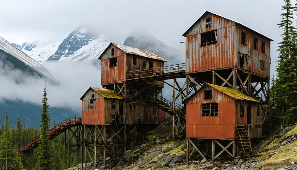
Two prospectors scrambling across Bonanza Ridge in 1900—Clarence Warner and “Tarantula Jack” Smith among them—stumbled upon one of the richest copper deposits ever documented in North America.
The ore graded over 70% pure copper, attracting J.P. Morgan and Guggenheim financing that transformed wilderness into industrial powerhouse. Between 1911 and 1938, Kennecott extracted over $200 million in copper, employing 600 miners who accessed deposits via a 196-mile railroad to Cordova.
Today you’ll find the Kennecott significance preserved within Wrangell–St. Elias National Park—2,839 acres of mill buildings, bunkhouses, and tram infrastructure designated a National Historic Landmark in 1978.
The multi-story concentration mill showcases integrated hard-rock mining technology that once dominated Alaska’s copper frontier.
Dyea and the Deadly Palm Sunday Avalanche of 1898
You’ll find Dyea near the head of the Lynn Canal, where it served as a primary staging town for over 30,000 stampeders bound for the Klondike goldfields via the Chilkoot Trail in 1897–1898.
On April 3, 1898—Palm Sunday—a massive snow avalanche swept the trail corridor north of Sheep Camp, killing over 70 young prospectors and packers in the deadliest single disaster of the gold rush era.
The catastrophe struck at the peak of Dyea’s prosperity, when the town housed between 3,500 and 8,000 residents, and it accelerated a shift in traffic toward the competing White Pass route out of Skagway.
Avalanche Devastates Gold Town
While thousands of stampeders climbed the Chilkoot Trail in pursuit of Yukon gold during spring 1898, unstable snowpack from heavy February–March storms accumulated on the steep eastern escarpment above the trail.
Sudden warm south winds on April 1–2 triggered catastrophic releases on Palm Sunday, April 3rd. The avalanche aftermath devastated this critical gold rush corridor:
- Multiple deadly slides struck between Sheep Camp and the Scales, with three fatal events on April 3rd alone.
- Over 65 confirmed deaths occurred, though contemporary reports ranged wildly from 54 to 96 fatalities.
- Infrastructure destruction severed the main supply route, burying tents, caches, and equipment under tons of debris.
Bodies were either shipped Outside for burial or interred at Dyea’s Slide Cemetery, while some victims remained forever entombed in the snowpack.
Dyea’s Decline After Disaster
The avalanche’s psychological and economic shockwaves compounded Dyea’s already precarious position as a gateway town.
Dyea’s Economy hemorrhaged as stampeder traffic diverted to Skagway following sensational press coverage of 60–70 deaths on the Chilkoot Trail. The Avalanche Aftermath saw merchants and freighting firms lose anticipated trade while townsite speculation halted abruptly.
Skagway promoters weaponized the disaster, highlighting dangers while their White Pass & Yukon Route railroad construction began weeks later in May 1898. You’ll find Dyea’s competitive parity vanished as rail service concentrated freight through Skagway, making Chilkoot tramways obsolete.
Pilgrim Hot Springs: From Orphanage Mission to Historic Site
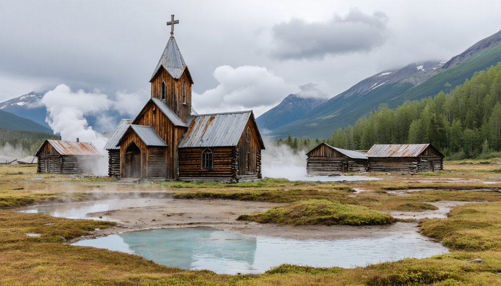
Long before Euro-American miners arrived seeking fortune and recreation, Indigenous Iñupiaq peoples knew this geothermal site as Unaaqtuq—a spiritually significant landscape where the Qawiaraqmiut and neighboring groups hunted, fished, and gathered seasonally for generations.
Unaaqtuq sustained Iñupiaq communities for generations before colonial extraction rebranded this sacred geothermal landscape for profit and religious conversion.
The Nome Gold Rush transformed it into Pilgrim Hot Springs, a roadhouse resort that burned in 1908. By 1917, Jesuits established Our Lady of Lourdes Orphanage, housing roughly 100 children annually:
- Geothermal heat enabled indoor plumbing and agriculture in Arctic conditions
- 1918 influenza epidemic orphans filled dormitories while mission staff suppressed Indigenous language
- Twenty-year operation ended in 1941 amid changing regional demographics
Today’s Historic Preservation efforts confront uncomfortable truths about Indigenous Heritage displacement and forced assimilation beneath this architecturally significant mission complex.
Planning Your Visit to Alaska’s Ghost Towns: Access and Safety Tips
Visiting Alaska’s ghost towns demands fundamentally different preparation than conventional heritage tourism.
You’ll face significant access challenges: most Katmai-area sites require floatplane charters from King Salmon or boat crossings through Shelikof Strait’s unpredictable waters. The realistic window runs mid-June through early September, and you’ll need 6–12 months to arrange air taxis and permits for Native-owned lands.
Essential safety precautions include bear spray and certified food storage—brown bear density here rivals anywhere on earth.
Structural hazards pervade abandoned canneries: expect rotten floors, collapsing roofs, and rusting metal. Coastal weather shifts violently, grounding aircraft and trapping boats for days.
Carry layered waterproof gear, updated topographic maps, GPS, and staged emergency supplies. Interior exploration of unstable buildings isn’t recommended without professional guidance.
Frequently Asked Questions
Can You Still Visit the Original Site of Katmai Town Today?
You can’t visit the original Katmai town—it sleeps beneath volcanic ash. The 1912 eruption erased the settlement permanently, transforming Katmai history into protected archeological layers rather than accessible town preservation sites.
What Wildlife Might Visitors Encounter Near These Ghost Town Locations?
You’ll encounter brown bears, moose, caribou, wolves, and marine mammals during wildlife spotting near ghost towns. Understanding animal behavior proves essential—bears concentrate along salmon streams while foxes frequent disturbed clearings around abandoned structures.
Are There Any Guided Tours Available to Katmai National Park Ghost Towns?
You’ll find virtually zero dedicated historical tours to ghost town sites in Katmai; most guided experiences focus on bear viewing and fishing, though custom operators occasionally include abandoned villages like Old Savonoski upon request.
If you’re interested in exploring ghost towns near Kenai Fjords National Park, you’ll discover fascinating remnants of the past intertwined with Alaska’s stunning landscapes. These abandoned locations tell stories of former inhabitants and the harsh realities they faced. Visiting such sites can provide a unique perspective on the region’s history, often highlighting the contrast between nature’s beauty and human endeavors.
How Long Does It Take to Reach These Ghost Towns From Anchorage?
You’ll need 6–8 hours one-way from Anchorage to reach Katmai ghost town sites, combining flights and ground transfers. Travel time varies with weather delays, though scenic routes over volcanic landscapes reward your independent spirit throughout the journey.
What Artifacts or Structures Remain at the Abandoned Katmai Town Site?
You’ll find prehistoric artifacts dating 6,000 years before present at old Katmai village’s south coast location. The 1912 eruption buried structures under massive ashfall, leaving limited physical evidence of this historically significant settlement’s archaeological discovery potential.
References
- https://live.laborstats.alaska.gov/sites/default/files/trends/may24art2_0.pdf
- https://thetundradrums.com/abandoned-ghost-towns-alaska-travel-guide/
- https://www.juneauempire.com/life/ghost-towns-scattered-across-the-alaska-map/
- https://www.alaska.org/detail/kennicott-mine-ghost-town-walking-tour
- https://en.wikipedia.org/wiki/List_of_ghost_towns_in_Alaska
- https://www.youtube.com/watch?v=xEr7heckIig
- https://alaskaitinerary.com/haunted-places-in-alaska/
- https://www.nps.gov/articles/aps-v11-i1-c2.htm
- https://avo.alaska.edu/eruption/novarupta-1912-6
- https://npshistory.com/publications/katm/jog-v28n7-1920.pdf


