You’ll find Memphis’s ghost towns hiding in plain sight—from Victorian Village‘s millionaire mansions just blocks from downtown to Ashlar Hall’s Gothic ruins on Central Avenue. Beyond the city limits, Tennessee’s TVA reservoirs swallowed entire communities like Big Barren and Old Johnsonville between 1933-1944, while Mississippi River landings such as Randolph vanished through erosion, Civil War destruction, and railroad competition. Forgotten county seats like Old Jefferson and Washington lost their courthouses and dissolved into memory, their political power migrating elsewhere as Tennessee’s geography reshaped itself around you.
Key Takeaways
- Victorian Village features preserved 1830s-1840s mansions like Mallory-Neely House, representing Memphis’s historic Millionaires’ Row with stunning Victorian architecture.
- Ashlar Hall, completed in 1896, stands as Gothic Revival castle ruins on Central Avenue, now attracting urban explorers despite chronic neglect.
- Randolph and other Mississippi River landings thrived on river commerce but declined due to erosion, Civil War destruction, and railroad competition.
- Tennessee Valley Authority projects submerged communities like Big Barren and Old Johnsonville beneath reservoirs between 1933 and 1944.
- Old Jefferson and Washington lost county seat status to competitors, leading to their decline as forgotten settlements across Tennessee.
Victorian Village: Memphis’s Historic Millionaires’ Row
During the economic boom of the 1830s and 1840s, Memphis’s wealthiest citizens—cotton magnates, riverboat tycoons, and banking elites—established their grand estates in what would become known as Millionaire’s Row.
Memphis’s cotton magnates, riverboat tycoons, and banking elites transformed the 1830s-1840s economic boom into an era of grand estates and opulent living.
You’ll find stunning examples of Victorian Architecture throughout the district, including French and Italianate Victorian, Greek Revival, and Queen Anne styles constructed between 1845 and 1890.
The neighborhood’s decline began when art schools relocated to Overton Park in 1959, but Historical Preservation efforts in the 1980s reversed the deterioration.
Today, you can explore surviving mansions like the 1852 Mallory-Neely House and the Greek Revival Pillow-McIntyre House, now functioning as museums and event venues. The James Lee House, also listed on the National Register of Historic Places, stands as another significant landmark in the district. The district was listed on the National Register on December 11, 1972.
This National Register-listed district stands as a tribute to Memphis’s gilded age prosperity.
Ashlar Hall: The Castle Ruins of Central Avenue
When Princeton-trained architect Robert Brinkley Snowden completed his Gothic Revival residence at 1397 Central Avenue in 1896, he created what would become one of Memphis’s most enigmatic landmarks.
This ashlar stone castle served Snowden until 1942, but maintenance costs eventually forced his heirs to abandon residential use.
The castle history reflects Memphis’s evolution through urban decay:
- 11,000 square feet with Italian stained glass and servants’ quarters
- Restaurant conversion in the 1960s, with lawns paved for parking
- Acquired by “Prince Mongo” in 1990 for nightclub operations
- Beach party venue created with hundreds of tons of imported sand
- Cycled through abandonment and commercial failures
The eccentric Mongo, who ran for Mayor of Memphis annually since 1978, transformed the historic mansion into The Castle Nightclub before legal troubles forced its closure in the late 1990s.
Despite recognition on the National Register of Historic Places in 1983, the property has suffered from chronic neglect and deterioration.
Today, Ashlar Hall stands as a crumbling monument to past grandeur, attracting urban explorers rather than the Memphis elite who once graced its halls.
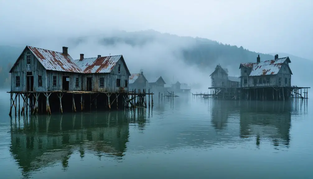
Submerged Communities: Tennessee’s Lost Towns Beneath the Reservoirs
Between 1933 and 1944, the Tennessee Valley Authority and U.S. Army Corps of Engineers permanently erased entire communities across Tennessee through reservoir construction.
You’ll find submerged settlements like Big Barren, where 25 residents died in the 1916 Clinch River flood before Norris Dam buried the town entirely in 1936.
Old Johnsonville, a Civil War river port, now lies beneath Kentucky Lake—350 residents relocated, their town reduced to underwater ruins occasionally visible during droughts.
Three hundred fifty souls abandoned their riverside homes as Kentucky Lake swallowed their Civil War-era town, leaving only ghostly foundations below.
Baker’s Forge vanished with 2,000 graves, including ten Revolutionary War veterans, relocated before impoundment.
Willow Grove disappeared under Dale Hollow Lake, its foundations emerging only in extreme low water.
Dandridge narrowly escaped flooding when local citizens appealed to Eleanor Roosevelt, prompting construction of a protective levee instead of complete inundation.
Similar patterns occurred nationwide, including Neversink, New York, where 340 residents were displaced in 1942 to create a reservoir for New York City’s drinking water supply.
These lost histories represent more than flooded land—they’re systematic government acquisition of private property, displacing thousands for hydroelectric power and flood control.
Vanished County Seats and Forgotten Settlements Across Tennessee
Tennessee’s county-seat system evolved through fierce political battles and economic geography, leaving behind a trail of once-powerful administrative centers reduced to obscure crossroads or vanished altogether.
These vanished settlements reveal how transportation routes, railroad politics, and financial collapse could erase entire governmental towns from Tennessee’s landscape, burying forgotten histories beneath interstates and farmland.
- Ooltewah lost its courthouse to fire in 1890, then watched James County dissolve entirely in 1920.
- Old Jefferson declined after Murfreesboro claimed Rutherford County’s seat in 1811, becoming nearly inaccessible ruins west of I-840.
- Washington in Rhea County surrendered power to railroad-connected Dayton, leaving only a preserved log cabin.
- Purdy battled rival railroad towns for McNairy County supremacy before losing its administrative role.
Court records, tax revenues, and political influence migrated, abandoning these once-vital centers. The Tennessee Supreme Court’s ruling initially protected James County from legislative abolition without voter consent, though this reprieve lasted only until citizens themselves voted 953 to 78 for dissolution in 1919. Chickamauga Dam flooded most of Harrison in 1940, submerging the former county seat beneath what became Harrison Bay.
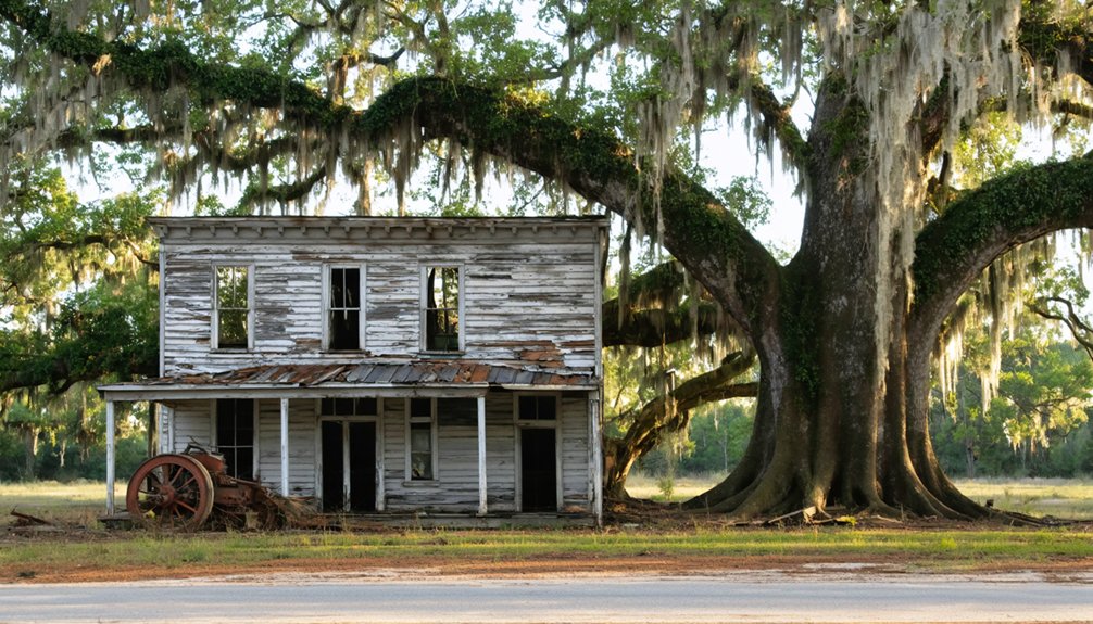
Mississippi River Landings: West Tennessee’s Disappeared Riverfront Hamlets
While courthouse battles determined administrative power in Tennessee’s interior, another kind of settlement rose and vanished along the state’s western edge, where the Mississippi River dictated economic survival.
Following the 1818 Chickasaw cession, dozens of landings sprouted along West Tennessee’s bluffs to handle booming river commerce—cotton bales, timber rafts, and livestock bound for downstream markets. Randolph alone recorded eighteen steamboat arrivals in one December 1834 week.
Yet these ghost landings proved fragile. The river’s relentless meandering undercut wharves, while channel shifts left once-busy hamlets stranded inland. Erosion and siltation dramatically reshaped the river banks and channels, dooming settlements built on unstable foundations. Civil War destruction compounded natural erosion; Sherman torched Randolph in 1862.
Railroad competition and engineered levees sealed their fate. Memphis thrived on the Fourth Chickasaw Bluff, its superior elevation and commercial advantages eclipsing rival landings. Today you’ll find only archaeological traces and historical markers where bustling riverfront hamlets once commanded the Mississippi’s trade.
Frequently Asked Questions
Are Any Ghost Towns Near Memphis Safe and Legal to Explore?
Like treasure maps leading to locked vaults, true ghost towns near Memphis aren’t accessible. You’ll find ghost town safety and legal exploration at Memphis’s Victorian Village historic district and haunted mansion tours—freedom within preserved boundaries.
How Far Do I Need to Drive From Memphis to Reach a Real Ghost Town?
You’ll need to drive 75–90 miles north to Gold Dust in Lauderdale County for your closest authentic ghost town road trip. For Tennessee’s most significant historical sites like Elkmont, expect 430+ miles eastward into Appalachia’s abandoned landscapes.
Can I Take Guided Tours of Tennessee’s Abandoned Ghost Town Sites?
You’ll find guided exploration mostly at preserved sites like Cades Cove and Elkmont in the Smokies, where rangers interpret historical significance. True abandoned structures remain off-limits due to safety concerns, protecting your freedom while limiting access.
What Caused Most Tennessee Ghost Towns to Be Abandoned?
Over 60% of Tennessee’s ghost towns disappeared due to economic decline after resource depletion—timber, coal, minerals—triggering population migration. You’ll find dam construction, highway rerouting, and lost county-seat status equally devastated communities across the state.
Are There Overnight Stays Available Near Tennessee Ghost Town Locations?
You’ll find ghost town accommodations near sites like Willow Grove and Tharpe, with historic lodging options ranging from lakeside cabins to campgrounds. These base camps let you explore Tennessee’s abandoned settlements independently across multiple days.
In your adventures, be sure to venture into the historic ghost towns in Gatlinburg, where remnants of the past tell stories of a different era. Each town holds unique charm and character, offering a glimpse into the lives once lived amidst the stunning wilderness of the Smoky Mountains. Exploring these locations provides a rich backdrop for photography and has become a favorite among history enthusiasts.
References
- https://en.wikipedia.org/wiki/List_of_ghost_towns_in_Tennessee
- https://www.tnvacation.com/trip-inspiration/articles/ghost-towns-tennessee
- https://carte-urbex.com/en/blogs/infos/top-10-abandoned-places-in-tennessee
- https://www.tnmagazine.org/19-ghost-towns-in-tennessee-that-are-not-underwater/
- https://www.geotab.com/ghost-towns/
- https://ilovememphisblog.com/hauntedmemphis
- https://www.memphisheritage.org/victorian-village-district/
- https://airial.travel/attractions/united-states/memphis/victorian-village-historic-district-4AarRv9j
- https://memphis.theportergroup.com/blog/victorian-village
- https://en.wikipedia.org/wiki/Victorian_Village