You’ll find six major ghost towns within 50 miles of Moab, each representing different economic eras. Cisco and Dewey collapsed when railroads and ferries became obsolete, while Castleton nearly rivaled Moab during its 1890s gold rush before the Panic of 1907 ended its ambitions. Sego thrived as Utah’s busiest coal camp until 1955, and Miner’s Basin clings to the La Sal Mountains at 10,000 feet, where fourteen years of mining yielded minimal returns. Valley City’s orchard dreams and the Pinhook conflict site represent other settlement failures worth exploring.
Key Takeaways
- Cisco, a former railroad town founded in the 1880s, declined after Interstate 70’s construction and now has only four residents.
- Castleton, 28 miles northeast of Moab, was a gold mining boomtown that rivaled Moab in 1895 before economic collapse.
- Sego, located in Sego Canyon, was Utah’s busiest coal camp in 1928, producing 1,500 tons daily before 1955 abandonment.
- Miner’s Basin, at 10,000 feet elevation, operated from 1889 to 1908, yielding only $15,000 in gold during its peak.
- Valley City, founded around 1905 as a farming community, collapsed due to financial mismanagement and orchard investment failures.
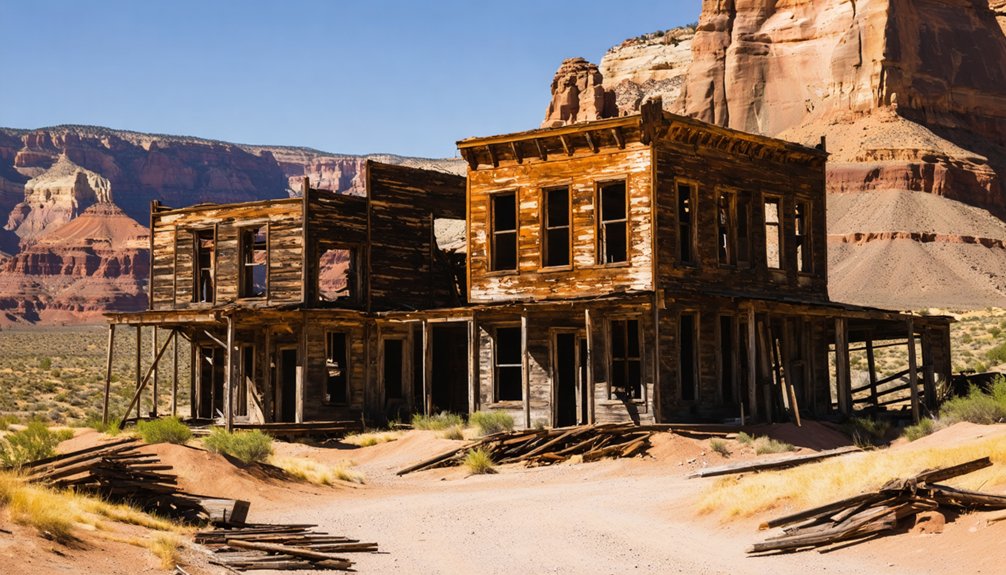
Cisco: Railroad Town Frozen in Time
Founded in the 1880s along the Denver & Rio Grande Western Railroad’s main line between Grand Junction, Colorado, and Salt Lake City, Utah, Cisco emerged as a critical watering stop for steam locomotives traversing the arid high desert.
Cisco history reveals a settlement shaped entirely by infrastructure: water tanks, treatment systems pumping from the Colorado River, and depot buildings that defined the townscape.
By the 1940s, 200 residents supported a diversified economy—oil and natural gas production made Cisco Utah’s largest energy producer while US 6/50 brought highway travelers to its motels and saloons.
At its 1940s zenith, Cisco’s 200 inhabitants serviced both Utah’s energy boom and cross-country motorists along the transcontinental highway.
The railroad legacy ended when diesel locomotives eliminated watering stops in the 1950s. Interstate 70’s construction five miles north delivered the final blow.
Today, four residents inhabit remnants of commercial buildings and railroad structures—a landscape stripped to its historical skeleton.
Dewey and the Lost Suspension Bridge
The Colorado River’s confluence with the Dolores River created one of southeast Utah’s few practical crossing points. Samuel King’s 1880s ferry operation transformed this geographical advantage into Dewey—a riverside settlement serving travelers, prospectors, and ranchers traversing between remote Grand County communities and western Colorado markets.
The community thrived around Richard Westwood’s county-commissioned ferry, with Martha Westwood’s boarding house feeding travelers and local ranchers running cattle to market across this crucial corridor.
Dewey history shifted dramatically in 1916 when engineers assembled Chicago-shipped steel components into the second-largest suspension bridge west of the Mississippi. The bridge engineering achievement rendered ferry operations obsolete overnight, triggering Dewey’s economic collapse.
Castleton: The Town That Almost Beat Moab
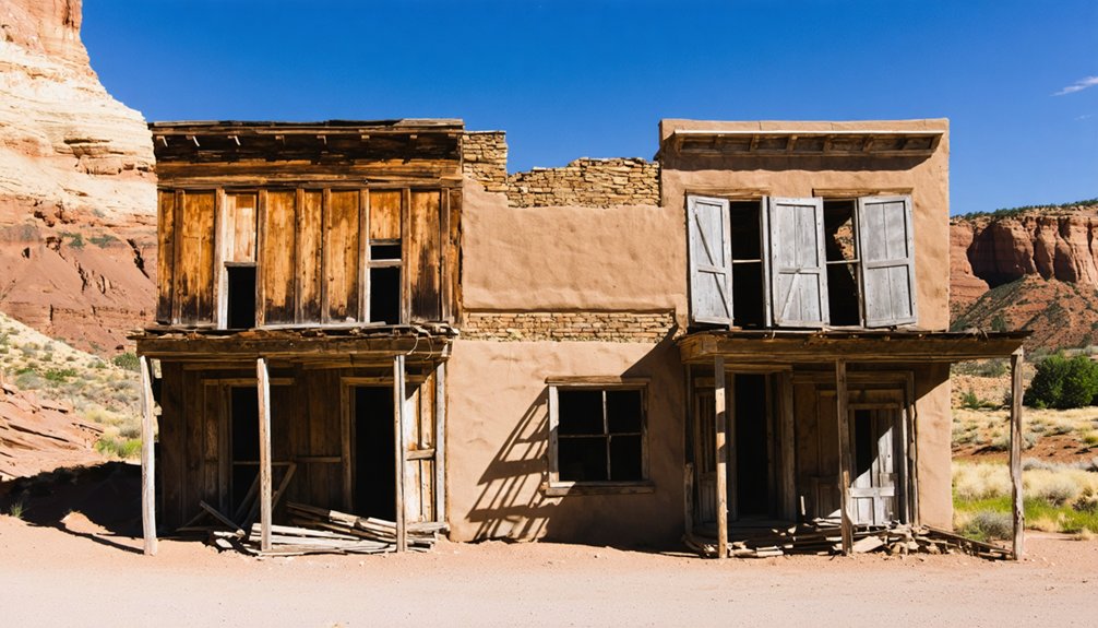
Twenty-eight miles northeast of Moab, where Castle Valley opens beneath the La Sal Mountains, placer miners and sheepherders established seasonal camps during the 1860s that would transform into Castleton—a supply town that briefly rivaled Moab itself for Grand County dominance.
When quartz gold discoveries at Miner’s Basin sparked an 1888 boom, Castleton’s rivalry with Moab became official. During Grand County’s 1890 organization, both towns competed for county seat designation.
By 1895, Castleton’s population exceeded Moab’s, sustained by freight operations, general stores, hotels, saloons, and mining offices.
The Panic of 1907 triggered Castleton’s economic decline when hard-rock mines shuttered. By 1910, most businesses had closed. The town’s population dwindled to just 30 residents by 1930.
Residents celebrated the Fourth of July with significant gatherings, as people traveled from various locations via wagons, horseback, and Model T cars to maintain community spirit.
Today, sandstone ruins hide among sagebrush near Spring Creek—remnants of what historian George Thompson called a “two-time loser” town.
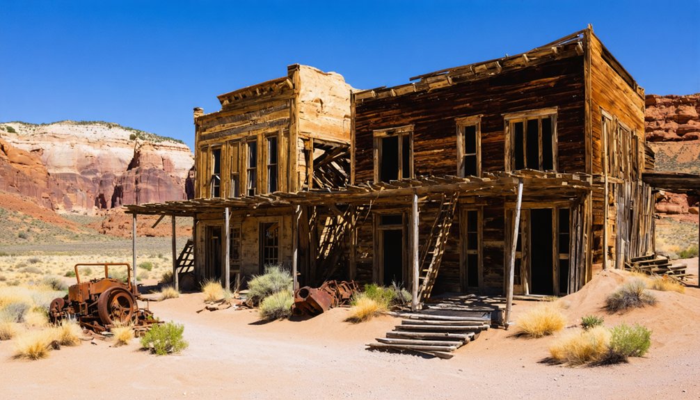
Sego: Coal Mining in the Book Cliffs
While Castleton’s ambitions collapsed in the high desert valleys, industrial forces reshaped the Book Cliffs thirty miles northwest.
You’ll find Sego Canyon five miles north of Thompson Springs, where rancher Harry Ballard discovered a massive anthracite seam in the early 1900s. The coal seam geology proved exceptional—the Neslen Formation contained fourteen feet of coal across 240,000 acres, enabling relatively shallow underground operations.
The camp changed names with each corporate takeover: Ballard became Neslen under American Fuel Company in 1911, then Sego in 1918. By May 1928, 150 men extracted 1,500 tons daily, making it Utah’s busiest coal camp.
Yet mining community hardships defined life here. A five-mile rail spur required constant repair after flash floods destroyed its dozen bridges, while diverse Italian, African American, Japanese, and Greek families endured chronic financial instability until abandonment in 1955. The town peaked at 500 residents with 125 miners employed in its operations. Italian families like the Coccios maintained winemaking traditions despite the harsh conditions and economic uncertainty.
High Country Ghosts: Miner’s Basin and the La Sal Mountains
You’ll find Miner’s Basin‘s remains at 10,000 feet elevation in a ravine above Castle Valley, where gold discovered on Mount Waas and Green Mountain in 1888 sparked a rush that brought 75 residents to this improbable alpine settlement by 1899.
The town’s fourteen-year lifespan—from establishment in 1889 to near-abandonment by 1908—demonstrates how quickly extractive economies collapsed when deposits proved less substantial than anticipated, yielding only $15,000 in gold between 1891 and 1893. The community infrastructure supported mining operations with a hotel, blacksmith, and two saloons serving the workers who endured the harsh conditions. By 1900, an advertisement sought 1,000 prospectors to renew mining efforts at Gold Basin, located below Mount Mellenthin.
Today you’ll encounter weathered building remnants and rusted machinery slowly disappearing into the landscape, accessible only by traversing the challenging terrain that once required prospectors to haul supplies and equipment to this remote high-country outpost.
Gold Rush Origins
When prospectors struck gold in the La Sal Mountains in 1888, they triggered a rush that would pull experienced miners from established Western camps into some of Utah’s most unforgiving high country.
The discoveries weren’t limited to placer gold—copper, silver, and gold-bearing quartz veins promised a multi-metal district that could sustain long-term hard-rock operations.
Regional newspapers hyped the La Sals throughout the 1890s, attracting both capital and labor to mineralized outcrops visible above Castle Valley.
By 1898, the formalized Miners Basin Mining District enabled systematic exploration and the application of proven mining techniques: adits, shafts, and lode claims replaced opportunistic surface prospecting.
The gold rush created economic expectations typical of the era—speculative fever backed by tangible ore values and comparisons to other modest but lucrative Utah camps.
Rugged Alpine Mining Life
At over 10,000 feet on Mt. Waas, you’ll find where hardy prospectors defied extreme alpine challenges to extract gold from Miners Basin’s unforgiving terrain.
By July 1899, sixty-seven souls—fifty-five men and twelve women—worked claims scattered across the flanks of Mt. Waas and Green Mountain. Their mining techniques focused on extracting gold-bearing gravel from deposits like the High Ore Claim and the significant Tornado discovery of 1896.
Seasonal operations defined life here. Winter snows forced evacuation, while summer months brought intense activity across Bachelor Basin’s remote sites.
Between 1891 and 1893, miners extracted roughly $15,000 in gold—nearly $504,000 today—before yields declined sharply.
Accessing Remote Mountain Ruins
Today’s explorers face a challenging journey to reach what those sixty-seven miners once called home.
You’ll depart the La Sal Mountain Loop Road near Geyser Pass, then navigate unsigned spur roads and unmarked trails through conifer forest to Miner’s Basin’s 9,500-foot elevation.
Remote exploration demands preparation: snowpack closes routes until late spring, and summer monsoons transform clay tracks into slick hazards within minutes.
High altitude access requires route-finding skills through reclaimed wagon roads choked by deadfall and erosion.
Once on-site, you’ll encounter scattered foundations, cellar depressions, and rusted machinery—a compact company-town footprint where cultural resource laws protect what remains.
Federal land managers discourage mine entry due to collapse risks, while preservation advocates emphasize low-impact visitation: photograph ruins, stay on existing paths, leave artifacts undisturbed.
Forgotten Settlements: Valley City, Pinhook, and Beyond
North of Moab’s established corridors, Valley City stands as a cautionary tale of speculative ambition in early twentieth-century Grand County. Founded around 1905, this farming venture promised settlers irrigated orchards and cultivated land—2,500 fruit trees and a two-story house marked the Grand Valley Land and Mineral Company’s initial investment.
Valley City history ended abruptly when a bank officer allegedly squandered funds on racehorses, forcing residents to relocate to Moab.
Meanwhile, the Pinhook conflict of June 15, 1881, transformed a La Sal Mountains tent village into a battle site. Eight white men fell in the clash with Native Americans, buried together in one grave.
Today you’ll find only historical markers where these settlements stood—Plainsfield, Mesa, and Elgin similarly vanished, their stories preserved solely through archival fragments.
Frequently Asked Questions
Are Ghost Town Sites Near Moab Safe to Visit With Children?
You’ll find fragile frameworks fraught with fall hazards. Ghost towns demand rigorous safety precautions—supervise children constantly near unstable structures, open mineshafts, and rusty debris. Remote locations lack emergency services, making responsible oversight non-negotiable for family exploration.
Exploring ghost towns around Mount Rainier can also uncover fascinating stories of the past, but each visit requires careful planning. Always ensure you have a reliable map and inform someone of your intended route, as cell service may be unreliable in these secluded areas. The haunting beauty of these abandoned places is captivating, yet they demand a deep respect for nature and history.
Do I Need Permits to Photograph Abandoned Buildings in These Areas?
Yes, you’ll need permits for commercial photography on public lands (BLM, NPS) regardless of payment. Photography ethics and legal restrictions blur—even personal shots sold later trigger requirements. Always check landowner permission on private property first.
What Is the Best Season to Explore Ghost Towns Near Moab?
Spring and fall offer *absolutely perfect* conditions for your ghost town explorations—best weather sits in the 70s–80s °F, granting you unrestricted access on dry roads while seasonal activities align beautifully with ideal photography light.
Can I Camp Overnight Near Any of These Ghost Town Locations?
You’ll find dispersed camping opportunities near several ghost towns on BLM land, though you should verify current camping regulations and overnight permits beforehand. Private property restrictions apply at some locations, so research each site’s specific access requirements.
Are There Guided Tours Available to Visit These Abandoned Sites?
You’ll find Moab outfitters offering backcountry 4×4 and UTV guided exploration to mining ruins and deserted townsites, while the Moab Museum runs interpretive programs on Cisco, Dewey, and Castleton—though many sites remain freely accessible for self-directed local tours.
References
- https://moabmuseum.org/program/grand-county-ghost-towns/
- https://www.roadtripryan.com/go/t/utah/moab/sego-ghost-town
- https://www.visitutah.com/things-to-do/history-culture/ghost-towns
- https://www.grandcountyutah.net/388/Ghost-Towns-Communities
- https://utahstories.com/2021/09/exploring-ghost-towns-royal-cisco-near-moab-utah/
- https://www.tripadvisor.com/Attraction_Review-g56952-d7037904-Reviews-Cisco_Ghosttown-Cisco_Utah.html
- https://www.moabhappenings.com/Archives/pioneer0310.htm
- https://www.onlyinyourstate.com/experiences/utah/cisco-ut
- https://www.legendsofamerica.com/ut-cisco/
- https://moabsunnews.com/2021/11/04/the-story-of-cisco-the-rise-fall-and-rise-again-of-a-small-utah-town/


