You’ll find at least five abandoned coal-mining settlements near Mount Rainier’s northern and western slopes, where bituminous coal extraction fueled a boom between the 1880s and 1930s. Melmont and Franklin anchor the Carbon River corridor—both accessible via muddy rail-grade trails leading to moss-covered foundations and sealed mine shafts fenced since 1984. Old Alder lies drowned beneath Alder Lake’s reservoir, while South Willis has surrendered to forest regrowth. The complete story of their rise, catastrophic fires, and preservation challenges unfolds below.
Key Takeaways
- Melmont, established in 1900, features moss-covered ruins accessible via a 3.8-mile trail from Carbonado along the Carbon River corridor.
- Franklin’s sealed mine shafts, surrounded by metal fencing from a 1970s underground fire, are reached via a two-mile abandoned railroad trail.
- Old Alder, drowned beneath Alder Lake in 1945, occasionally reveals remnants during reservoir drawdowns following the dam’s construction.
- Wilkeson showcases 1890s sandstone-brick beehive coke ovens visible from the roadside, representing accessible industrial ruins from coal mining’s peak era.
- South Willis, established by Northern Pacific Railway in the early 1880s, now sits obscured by forest regrowth after coal extraction ceased.
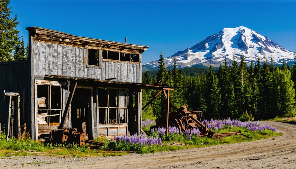
Melmont: Coal-Mining Ruins Along the Carbon River
Melmont’s abandoned coal works cling to the Carbon River valley where the Northwest Improvement Company, a Northern Pacific Railway subsidiary, staked its claim in 1900.
You’ll find scattered remnants of Melmont history across terraced hillsides—stone foundations, a dynamite shed along the old railroad grade, and the school’s basement carved into rock.
Coal mining sustained this settlement briefly before 1920s price collapses triggered complete abandonment. The 1905 bombing of the mine owner’s home adds darker layers to this site’s narrative, though documentation remains scarce.
Today’s ruins rest on Pierce County Parks and White River School District land. A wildfire in the 1920s destroyed the remaining structures, leaving only overgrown forest growth where homes and businesses once stood. When you visit, respect what’s left—these fragments belong to everyone seeking connection with Washington’s extractive past and the workers who shaped these slopes.
How to Hike the Melmont Ghost Town Trail
Before you tackle the Melmont Ghost Town Trail, understand that the Fairfax Bridge closure as of May 2025 fundamentally alters your approach.
Plan your route carefully—the Fairfax Bridge closure as of May 2025 requires accessing Melmont Ghost Town Trail exclusively from Carbonado.
You’ll need to access the 3.84-mile roundtrip route from Carbonado’s gravel lot, adding 6 miles to your journey.
Pack these hiking essentials:
- Sturdy boots and gaiters for persistent muddy conditions on the abandoned railroad grade
- Navigation awareness for the trail junction past the dynamite shed
- Camera for documenting bridge abutments, hotel foundations, and school basement ruins
- Leave-no-trace commitment honoring proper trail etiquette
- 2-3 hour window for exploring the four-football-field-sized townsite
The 304-foot elevation gain poses minimal challenge.
The trail remains snow-free year-round, making it accessible during any season you choose to visit.
Respect private property boundaries, report illegal camps to White River School District, and leave coal-mining artifacts undisturbed for future explorers seeking authentic historical encounters.
Original wood from the school was repurposed for Carbon River Ranch in the 1920s, erasing much of the structure that once educated mining families.
What You’ll Find at the Melmont Townsite Today
The Melmont townsite reveals itself as a sun-dappled meadow flanked by moss-shrouded stone remnants, where the Carbon River’s steep canyon walls frame what remains of this 1880s coal-era settlement.
You’ll encounter a moss-covered railroad retaining wall from the Northern Pacific grade, a roofless dynamite storage shed with intact rock walls, and scattered foundation traces marking former buildings.
The Melmont history unfolds through these fragmentary ruins—most wooden structures burned in an early-1920s forest fire, leaving primarily stone and concrete.
Visitor experience here embraces ghost town solitude: no services, interpretive signs, or restoration efforts intrude on the overgrown silence.
The old bridge abutment near the former hotel location and school basement foundations uphill reveal the town’s multi-level layout, while muddy surfaces and ATV impacts remind you this site belongs to the forest’s reclamation process. The Northwest Improvement Company established Melmont in 1902, and by 1918 the mines had yielded 900,000 tons of high-grade blacksmith coal before the town’s decline. Wooden remnants from the original school were recycled in the 1920s for construction at the nearby Carbon River Ranch.
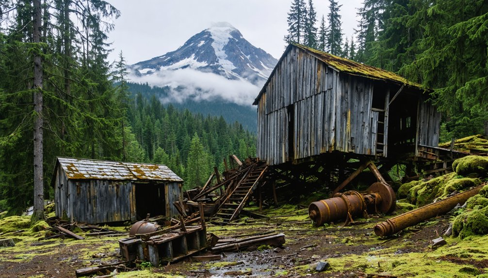
Franklin Ghost Town and Its Underground Mine Fire
Franklin’s coal seams created both the town’s fortune and its lingering danger—a 1970s explosion in the shuttered Franklin No. 12 mine ignited an underground fire that heated the adjacent Green River’s groundwater for years.
You’ll find the sealed mine shafts surrounded by metal fencing installed in 1984, concrete caps marking where miners once descended 500 feet below sea level through the Franklin No. 2 shaft.
The underground combustion has since subsided, though the river still flows warmer than typical Cascade tributaries where it passes through the former mining complex. The spontaneous combustion created steam vents and a hot spring that reached temperatures of 94 degrees in 1985.
The town was established in the 1880s when coal mining operations first began in this area along the Green River near Black Diamond.
Underground Fire Hazard History
Deep beneath Franklin’s network of coal tunnels, spontaneous combustion had been smoldering unnoticed for up to three days when the mine’s ventilation system catastrophically failed on August 24, 1894.
The underground fire ignited in refuse piles at breast 62, seven hundred feet below surface, transforming smoldering coal waste into a lethal furnace. When operators stopped the critical ventilation fan for fifteen minutes, toxic gases flooded the gangways.
Franklin’s coal seams presented inherent self-heating risks that challenged mining safety protocols:
- Coal screenings accumulated in breast 62 created ideal combustion conditions
- Smoldering shift to flashover occurred rapidly in confined spaces
- Ventilation disruption turned manageable fire into fatal catastrophe
- Asphyxiating gases trapped thirty-seven miners on lower levels
- Bodies found face-down in mud revealed desperate attempts to breathe
This disaster exposed Washington’s coal mining vulnerabilities. The Oregon Improvement Company’s mine fire became the second worst mining disaster in Washington state history, forever marking Franklin’s legacy with tragedy. The disaster left behind fourteen widows and thirty-eight fatherless children to face an uncertain future.
Accessing Franklin’s Mine Opening
Today’s visitors reach Franklin’s sealed mine shaft by following a two-mile trail along an abandoned railroad grade off Green River Gorge Road SE near Black Diamond.
You’ll navigate minimal elevation gain through overgrown brush until spotting a coal cart marked “Franklin” in white lettering—your junction point. The left spur climbs moderately toward the hillside shaft area.
Washington State Parks installed concrete seals and metal fencing around Franklin Mine in 1984, closing the 1,300-foot-deep vertical shaft that once extracted coal from 500 feet below sea level.
The 10-by-18-foot opening now sits behind heavy grating and perimeter barriers. Essential safety precautions include staying outside all fences, wearing sturdy footwear for muddy conditions, and respecting closures—these aren’t suggestions but requirements protecting you from lethal drops and unstable ground.
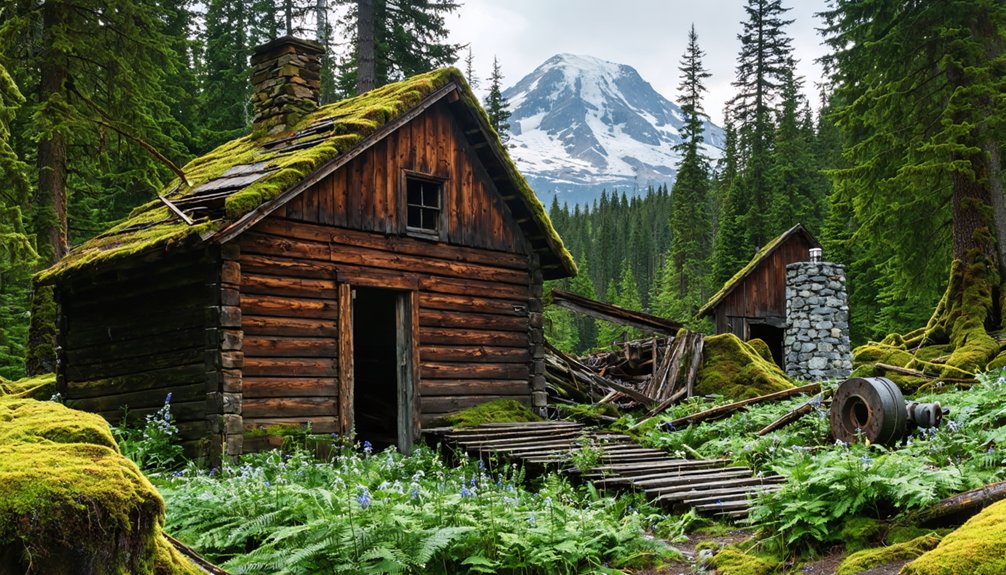
Old Alder, South Willis, and Other Vanished Settlements
If you venture south along the Nisqually River valley, you’ll encounter ghost towns claimed not by fire or economic collapse, but by deliberate flooding.
Old Alder, platted in 1905 as a logging and mining hub of 200 residents, vanished beneath Alder Lake in 1945 when Tacoma Power’s concrete arch dam impounded seven miles of the river.
During modern reservoir drawdowns, concrete foundations and road traces from the drowned townsite occasionally emerge from the lake bed, marking where families once operated sawmills, general stores, and a three-story schoolhouse before forced evacuation in 1942.
Reservoir-Drowned Old Alder
Beneath the placid waters of Alder Lake lies the original townsite of Alder, a logging and mining settlement that thrived along the Nisqually River’s banks from the late 1800s until its forced evacuation in 1942.
When you visit today, you’re looking at submerged history—a complete community drowned by dam construction.
The town’s remnants tell a distinctive story:
- Population origins: Tennessee, Kentucky, and Carolina emigrants carved homesteads from mountainous terrain
- Economic foundation: Logging operations supplemented by marginal vegetable farming
- Infrastructure lost: Three-story school, general store, scattered ranches—all abandoned
- Evacuation timeline: 1942 government orders preceded 1944 dam completion
- Permanent inundation: Alder Lake’s artificial expansion erased the settlement forever
You’ll find this drowned community accessible via State Route 7, where recreational waters now conceal what government projects claimed.
South Willis Ruins
The coal-powered ambitions of the Northern Pacific Railway carved South Willis from the forested slopes east of Wilkeson, where geologist Bailey Willis—whose name the camp bore—had surveyed promising seams within the Puget Group formations in the early 1880s.
You’ll find almost nothing today in section 22, Township 19 North, Range 6 East.
South Willis history parallels the boom-and-bust rhythm of Cascade foothill mining: company housing aligned with tramways, underground room-and-pillar workings extracting fuel for locomotives and steamships, then abandonment as cheaper energy displaced regional coal extraction.
Forest regrowth has reclaimed tipples and bunkers.
The settlement’s vanishing reflects broader resource exhaustion and market shifts that emptied similar camps throughout Pierce County’s once-vital coal belt northwest of Mount Rainier.
The Rise and Fall of Rainier’s Coal Country
Long before Mount Rainier became synonymous with alpine tourism, the Carbon River corridor churned with industrial ambition as coal companies carved networks of shafts and tunnels into the mountainside.
Between 1902 and 1918, Melmont’s underground operations extracted 900,000 tons from depths exceeding 600 feet. Nearby Fairfax engineered a remarkable 1.5-mile elevated flume to transport coal, though labor relations fractured in the late 1890s when owners cycled through Black and Japanese workers during disputes with white miners.
Key developments included:
- Melmont producing 4% of Pierce County’s coal output across six underground levels
- Fairfax utilizing chute-and-pillar methods with high-explosive blasting
- Northwest Improvement Company abandoning operations around 1918
- Fire destroying remaining Melmont townsite in early 1920s
- Federal regulatory pressure invalidating 24 mineral claims by 1913
Carbonado and Wilkeson: Living Reminders of the Coal Era
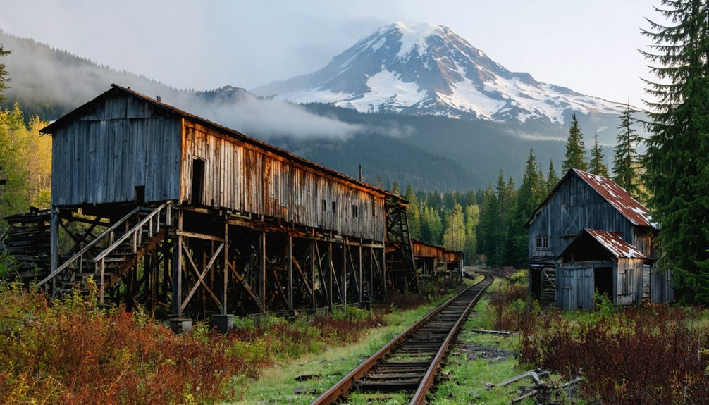
You’ll find Wilkeson’s sandstone-brick beehive coke ovens still standing near the town center, their coal-blackened domes marking where bituminous coal was transformed into metallurgical fuel for Tacoma’s smelters.
These 1890s-era ovens serve as your most accessible industrial ruins in the Carbon River valley, visible from the roadside without hiking into sealed mine territory.
Beyond Wilkeson’s preserved structures, the old rail grades and tramway corridors lead upstream toward more remote ghost settlements where nothing but foundation stones and slag heaps remain.
Historic Coke Ovens Remain
Beehive-shaped brick domes rise along Wilkeson’s old rail corridor, silent witnesses to an industrial era when coal and coke fueled Puget Sound’s smelters and foundries.
These ovens transformed bituminous coal into foundry-grade coke through 48–72 hours of oxygen-starved baking, creating the high-carbon fuel essential for metal refining.
At peak operation in the early 1900s, Wilkeson’s battery contained up to 160 ovens:
- Each oven held five tons of coal charged through top openings
- Six-foot-tall brick domes retained extreme heat for volatile burn-off
- Finished coke supplied Tacoma’s Ryan smelter and regional foundries
- Linear battery design enabled efficient rail loading and cycling
- Pierce County Register designation protects this industrial heritage site
Though partially collapsed and overgrown, these structures reveal Washington’s coke production legacy—tangible proof of the railroad-coal-smelter economy that shaped territorial development.
Gateway to Ghost Settlements
Two valley towns anchor the Carbon River corridor that once funneled coal, timber, and commerce toward Mount Rainier’s western flank.
Carbonado and Wilkeson evolved from company-dominated settlements into living reminders of Washington’s steam-era mining history, each retaining original housing, infrastructure, and landscape scars from decades of extraction.
You’ll find massive concrete cable anchors, slag piles, and mine openings marking Carbonado’s role as Pierce County’s largest coal producer until 1937.
Wilkeson served as the earlier gateway, its railroad spurs reaching deeper seams upriver.
Today both towns offer authentic ghost town exploration—residents still inhabit company houses while abandoned mine features dot the hillsides.
In addition to these lively remnants of the past, there are ghost towns to explore near Telluride that offer a glimpse into Colorado’s mining history. Many of these sites have been preserved, allowing visitors to wander through the ruins and imagine life during the gold rush era. Each haunting landscape tells a unique story, drawing adventurers and history buffs alike to uncover the secrets of these forgotten places.
Rail grades and supply routes continue beyond, leading toward vanished camps like Fairfax that pushed extraction to the park boundary itself.
Planning Your Ghost Town Adventure Near Mount Rainier
While most visitors to Mount Rainier focus on glaciated peaks and alpine meadows, the lowland approaches harbor a different kind of wilderness—one shaped by industry, abandonment, and the steady reclamation work of western Washington’s relentless rain and vegetation.
Your Melmont exploration requires realistic expectations about trail conditions and ghost town history. The 3.8-mile round trip follows muddy rail grades year-round, with autumn’s leaf drop revealing foundations most clearly.
Essential planning considerations:
- Check Mowich Lake Road and Highway 165 status for seasonal closures
- Expect 2–3 hours hiking time on slippery, root-laced terrain
- Respect Pierce County Parks boundaries and no-parking zones near Fairfax Bridge
- Leave artifacts undisturbed—concrete foundations and school basements are fragile
- Prepare for Carbon River flooding during heavy rainfall events
Winter snow affects higher elevations while keeping lowland routes accessible but treacherous.
The “Haunted Hike” Appeal of Abandoned Mining Camps
Beyond the documented industrial archaeology, these Carbon River valley ruins exert a pull rooted in atmosphere rather than history.
Fog-shrouded foundations, moss-choked coke ovens, and the constant roar of glacial melt create sensory conditions you’ll interpret as supernatural cues.
Tourism branding amplifies this—labels like “ghost town” prime you to expect haunted history before you arrive.
The sudden boom-to-bust timeline feeds ghostly legends: hundreds of miners vanished within decades, leaving only collapsing structures and scattered artifacts.
Fatal cave-ins—like Landsburg’s 1955 disaster—anchor restless-spirit narratives.
Night hikes intensify the effect: dripping water echoes through root-cracked concrete, wind creaks rusted machinery, and early alpine dusk turns remote basins into “end-of-the-world” sets.
You’re chasing freedom from urban predictability, drawn by landscapes where nature reclaims human ambition.
Safety Tips and Preservation Guidelines for Ghost Town Visitors
The allure of these isolated ruins demands concrete preparation, not just a romantic sense of adventure.
Essential safety gear includes first aid kits, navigation tools, and ample water for muddy terrain conditions. Cell service won’t reach you here, so travel with partners who can assist during emergencies.
Wildlife encounters require vigilance near these remote sites:
- Observe predators from distance; never approach or feed park animals
- Store food in bear canisters and designated bear-proof containers
- Make noise through clapping or yelling to announce your presence
- Keep scented items like toothpaste with food storage
- Leave artifacts undisturbed for historical preservation
Respect sealed mine shafts and fragile structures.
Stay on established trails—one misplaced step destroys vegetation requiring decades to recover.
Pack out everything you brought in.
Frequently Asked Questions
Are Dogs Allowed on the Melmont Ghost Town Trail?
Yes, you’re free to bring your leashed companion. Picture exploring 1920s coal-town ruins together on dog friendly trails outside park boundaries. Practice ghost town etiquette: control your dog, pack out waste, respect historical remains and muddy rail-grade conditions.
Can You Camp Overnight Near Any of These Ghost Town Sites?
Overnight camping isn’t permitted at Melmont or Franklin ghost town sites due to camping regulations on school district and day-use properties. You’ll find overnight options at established Mount Rainier National Park campgrounds or nearby Black Diamond lodging instead.
Is There Cell Phone Service at Melmont or Franklin?
Don’t count on cell service at either site. These steep river canyons create dead zones where coverage areas fade fast. You’ll need offline maps and self-reliance—the forested valleys shield signals completely.
Do I Need a Permit to Visit These Ghost Towns?
You won’t need special ghost-town permits—Melmont and Franklin follow standard day-hike permit requirements. Respect artifact-protection rules, pay Franklin’s $5 parking fee, and follow posted visiting guidelines preserving these Carbon River corridor remnants.
Are the Ghost Towns Wheelchair or Stroller Accessible?
Most ghost towns aren’t wheelchair access or stroller friendly—Melmont’s six-mile muddy rail grade and Copper City’s collapsed foundations present obstacles. Only Moncton near Rattlesnake Lake offers paved paths, giving you barrier-free exploration of Washington’s mining heritage.
References
- https://stateofwatourism.com/ghost-towns-of-washington-state/
- https://www.islands.com/1938500/franklin-ghost-town-washington-woodlands-waterfalls-abandoned-mountain-trail/
- https://visitrainier.com/get-spooked/
- https://visitrainier.com/melmont-ghost-town-2/
- https://610kona.com/melmont-ghost-town-wa/
- https://explorewashingtonstate.com/black-diamond-franklin-ghost-town/
- https://www.wta.org/go-hiking/hikes/melmont-ghost-town-hike
- https://pnwadventuresisters.wordpress.com/2018/01/15/melmont-ghost-town/
- https://www.youtube.com/watch?v=aMLKQsrPMcA
- https://en.wikipedia.org/wiki/Melmont


