You’ll find the ghost town landscape around Page quite different from Arizona’s famous mining corridors to the south. House Rock, located 60-70 miles northeast along U.S. Route 89A, stands as your closest option—a collection of weathered ranch buildings from the cattle-driving era rather than a mining boomtown. Most of Arizona’s 275+ documented ghost towns cluster in the northwest-central and southeastern regions, requiring substantial drives from Page, though multi-day road trips can connect you with legendary sites like Jerome, Oatman, and Ruby if you’re ready to explore further.
Key Takeaways
- House Rock Ghost Town, 60–70 miles northeast of Page along U.S. Route 89A, features scattered ranch buildings from cattle operations.
- Page is distant from Arizona’s primary ghost town corridors, with over 275 documented sites mainly in northwest-central and southeastern regions.
- Route 66 ghost towns like Oatman and Two Guns are 280 miles from Page, featuring mining remnants and historical attractions.
- Southern Mining Belt Loop offers a 900–1,200 mile circuit through historic sites including Ruby, Arizona’s best-preserved camp with 25 structures.
- Spring and fall provide ideal exploration conditions; pack water, fuel, and safety gear as remote ghost towns lack services.
House Rock: The Closest Ghost Town to Page
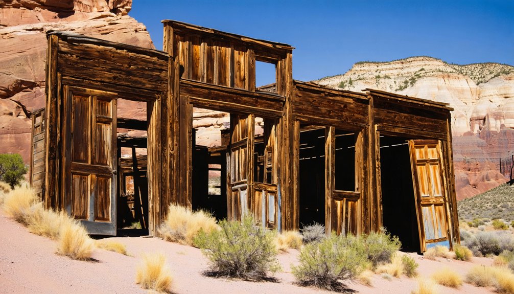
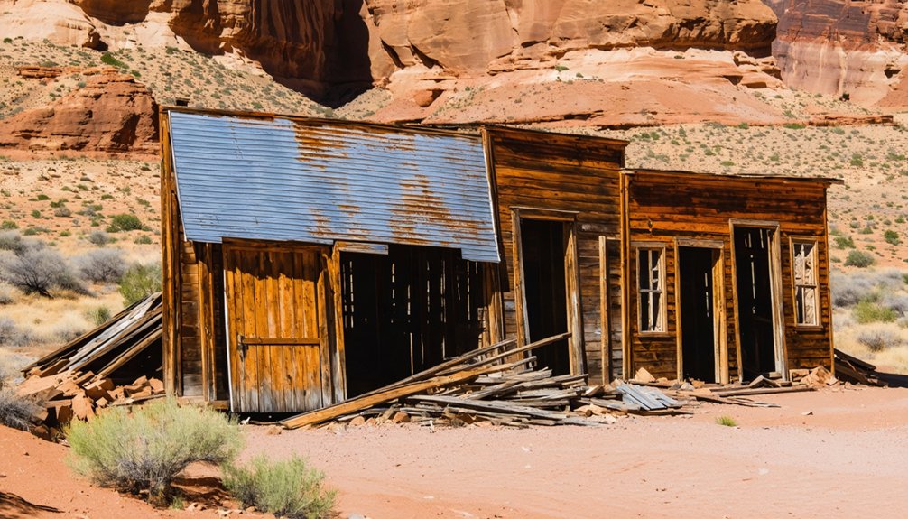
Tucked into the sweeping grasslands of House Rock Valley along U.S. Route 89A, you’ll find House Rock—the closest ghost town to Page, just 60–70 miles northeast.
Named after a prominent rock where John Wesley Powell’s 1871 expedition camped, this semi-abandoned settlement tells the story of Arizona Strip ranching life.
Unlike mining boomtowns, House Rock grew from cattle operations across the valley’s open range.
You’ll spot scattered ranch buildings, weathered foundations, and remnants of stock-driving days when 89A served as the main corridor between Kaibab Plateau and Marble Canyon.
Harsh high-desert conditions and dwindling markets gradually emptied the community.
Powell, who first explored Glen Canyon in 1869, documented the area’s unique geological features during his expeditions through this rugged territory.
Today, House Rock stands quietly along the highway—a tribute to ranchers who carved lives from unforgiving country.
Like many Arizona ghost towns, it draws history enthusiasts and adventurers seeking to experience the remnants of frontier settlement life.
Understanding the Ghost Town Landscape Around Page
While Page sits amid some of Arizona’s most dramatic landscapes—Lake Powell, Glen Canyon, and the Vermillion Cliffs—it stands notably distant from the state’s primary ghost town corridors.
You’ll find Arizona’s 275+ documented ghost towns concentrated in northwest-central and southeastern regions, tied to ghost town origins in the state’s mining history. The Commonwealth Mine in Pearce sparked gold rush settlement in 1894, while copper operations built communities like Gleeson to 500 residents by 1900.
These mining economies created cyclical booms and busts—Pearce swelled to 1,500 residents by 1919 before resource depletion triggered abandonment. The Ghost Town Trail Road now connects these abandoned settlements, offering a paved route between Pearce, Courtland, and Gleeson for visitors exploring this historic corridor.
The mining boom-and-bust cycle devastated communities like Pearce, which collapsed after ore deposits ran dry in the early 1900s.
The southeastern corridor also includes Tombstone, which reached a peak population of 15,000 during its mining heyday, making it one of Arizona’s largest frontier settlements. From Page’s northern position, you’re facing substantial travel distances to reach these historic mining corridors, where stone walls, jail structures, and weathered general stores still stand as evidence of Arizona’s frontier economy.
Multi-Day Ghost Town Road Trips From Page
You’ll find Page’s central location makes it an ideal hub for sweeping multi-day circuits that connect Arizona’s remote mining camps with Utah’s frontier settlements and Nevada’s silver-rush relics.
The classic southern route follows old copper-mining corridors through Jerome and Prescott before intercepting Route 66’s roadside ghost towns between Seligman and Kingman, while northern loops traverse the Arizona Strip’s vanished Mormon homesteads and ranching outposts. At Oatman, you can observe wild burros roaming freely through the streets, descendants of pack animals left behind by early miners.
Each circuit typically covers 300–900 miles and strings together 8–15 historic sites, letting you trace the region’s boom-and-bust cycles across three states in under a week. Private tour agencies based in Northern Arizona offer customizable ghost town itineraries with luxury transportation for small groups.
Southern Mining Belt Loop
For travelers seeking an in-depth exploration into Arizona’s boom-and-bust mining heritage, the Southern Mining Belt Loop offers a 900–1,200 mile circuit through the state’s most storied ore districts.
You’ll trace the arc of ghost town economics through Cochise County’s San Pedro Valley, where Fairbank’s railroad depot once served Tombstone’s silver rush, and Pearce briefly eclipsed its famous neighbor during the 1896 gold boom.
The route sweeps through the Patagonia Hills, where Harshaw’s 2,000 residents vanished after the Hermosa Mine closed, then continues to Ruby—Arizona’s best-preserved camp, with 25 roofed structures guarding the Mexican border.
This mining heritage journey reveals how ore prices, railroad access, and water availability determined which settlements thrived and which became wind-swept ruins along dusty backcountry roads.
Route 66 Ghost Towns
Page sits just 280 miles from one of America’s most ghost town-rich corridors: the 158-mile stretch of Route 66 between Seligman and Kingman, where the Mother Road’s bypassing in 1978 transformed thriving service communities into roadside relics overnight.
You’ll discover Oatman first, where ghost town architecture meets living history. Its 1902 saloon still serves drinks beneath stamped tin ceilings, while wild burros—descendants of prospectors’ pack animals—roam freely through streets lined with operational shops.
The town’s mining history echoes in every weathered timber.
Nearby Goldroad represents pure abandonment. Its headframes and stone foundations sit accessible yet untouched, offering unregulated exploration through collapsed mine shafts and crumbling bunkhouses.
Hackberry follows with its silver mining remnants, while Two Guns presents manufactured mystique around Apache Death Cave alongside authentic railroad depot ruins. Two Guns gained infamous notoriety for its violent past and multiple ownership disputes throughout the early twentieth century. The site marks the location of the last significant battle between Indians and the U.S. Army in 1882.
Arizona Strip Historic Sites
While Route 66’s ghost towns cluster in well-traveled corridors, the Arizona Strip’s abandoned settlements demand genuine expedition planning.
North of the Colorado River, you’ll navigate a patchwork of BLM and tribal lands where fuel stops disappear for hundred-mile stretches.
Old Paria’s eroded foundations along the Utah border tell stories of Mormon pioneers battling flash floods, while Mount Trumbull’s reconstructed schoolhouse marks where ranching families carved lives from the Uinkaret Plateau.
You’ll need high-clearance 4WD, detailed maps, and self-sufficiency—summer monsoons turn clay tracks into impassable gumbo within minutes.
Historic settlements like Tassi Ranch preserve stone corrals and spring developments from early desert cattle operations.
These remote sites reward those willing to venture beyond pavement into authentic frontier remnants.
Arizona’s Most Accessible Historic Mining Towns
While Page sits hours from most ghost towns, you’ll find Arizona’s most visitor-friendly mining sites closer to Phoenix and along old highways where preservation efforts have created walkable historic districts.
Jerome clings to Cleopatra Hill above the Verde Valley, its steep streets lined with galleries and restaurants now occupying former boarding houses and company buildings that once served 15,000 copper miners.
Oatman sprawls along a dusty stretch of original Route 66, where wild burros descended from miners’ pack animals wander between wooden storefronts and daily gunfight reenactments draw travelers making the classic highway pilgrimage.
Jerome’s Preserved Historic District
Perched on the northeast slope of Cleopatra Hill above Verde Valley, Jerome began as a copper mining camp in 1876 and grew into one of Arizona’s most prosperous industrial towns. At its peak, nearly 15,000 residents from over 30 nationalities called this vertical town home.
When mines closed in 1953, Jerome became the nation’s largest ghost town with only a few dozen holdouts remaining.
You’ll find Jerome’s historic preservation success story remarkable—the Jerome Historical Society negotiated with Phelps Dodge in 1956 to stop demolition, then purchased most of uptown to secure Main Street’s commercial buildings.
Today, this National Historic Landmark showcases authentic mining heritage through brick commercial blocks, terraced streets clinging to steep hillsides, and industrial ruins that tell stories of $1 billion in extracted copper, silver, and gold.
Oatman’s Route 66 Charm
Tucked into Arizona’s Black Mountains at 2,710 feet, Oatman sits directly on a preserved segment of historic Route 66, making it one of the state’s most accessible “living ghost towns” for modern travelers.
You’ll drive through a streetscape unchanged since the 1920s rebuilding after a devastating fire, passing wooden false-front storefronts and the 1902 Oatman Hotel.
Oatman history comes alive through staged gunfight reenactments and mine tours into original shafts where prospectors extracted $40 million in gold by 1941.
Wild burros—descendants of miners’ pack animals—roam freely, creating an unforgettable atmosphere.
Though Interstate 40’s bypass reduced the permanent population to just 102 residents, Route 66 nostalgia and Old West charm sustain this working community within its mining-era bones.
Planning Your Ghost Town Adventure From Page
The ghost towns scattered across the Arizona-Utah border country north of Page reward travelers who plan their excursions around the region’s demanding terrain and weather.
For Paria exploration, spring and fall bring moderate temperatures ideal for wandering among the abandoned buildings and colorful Chinle Formation badlands. You’ll need to check forecasts carefully—summer monsoons turn clay-rich roads into impassable slicks within minutes, while winter ice can close remote stretches.
Most sedans handle the gravel road to Pahreah in dry conditions, though high-clearance vehicles open deeper backcountry routes.
Pack all your water and fuel from Page or Kanab; these ruins offer nothing but history and solitude.
No services exist at these remote sites—bring every supply you need from the nearest towns.
Mid-morning light showcases the multi-hued cliffs beautifully for ghost town photography, while golden hour saturates the desert palette but risks night driving on unmarked tracks.
Safety and Responsible Exploration Tips
While the solitude of ghost towns like Paria draws adventurers seeking authentic frontier traces, the same remoteness that preserved these sites amplifies every hazard.
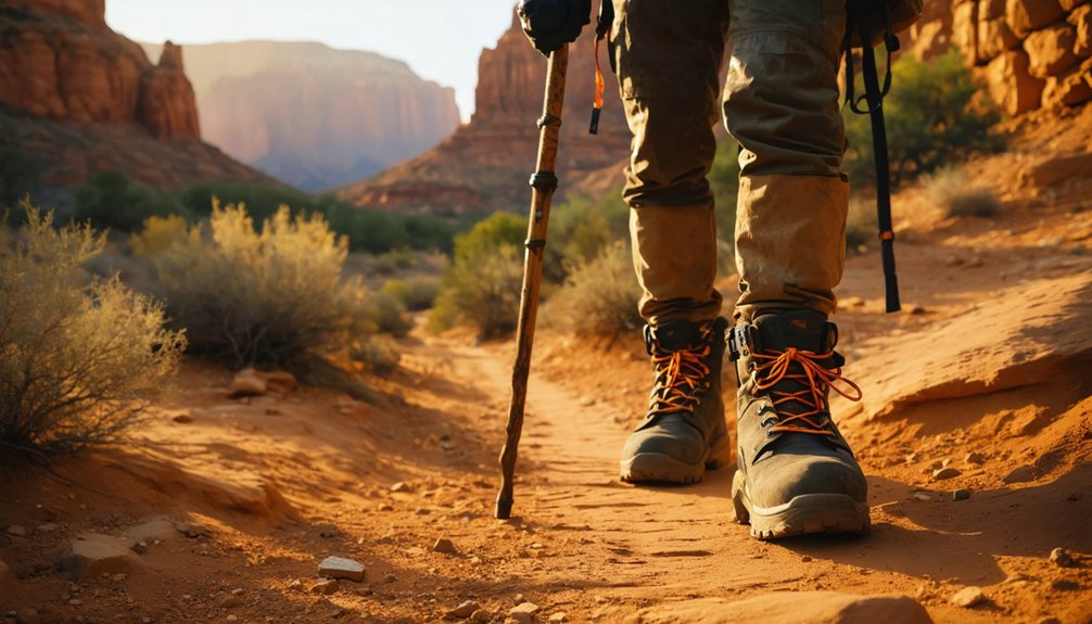
You’ll need solid safety gear—sturdy boots, navigation tools, and extra water—before venturing into areas where cell coverage vanishes and environmental hazards multiply.
Respect both your safety and these vanishing landmarks:
- Check structural integrity before entering any building; rotted floors and unstable walls collapse without warning.
- Maintain wildlife awareness around foundations and debris where snakes shelter.
- Verify legal restrictions and land status before exploring; many sites mix public and private parcels.
- Master navigation tips for unmarked roads that become impassable when wet.
Pack out everything you bring, leave artifacts untouched, and honor gravesites as you’d your own ancestors’ resting places.
Frequently Asked Questions
You won’t find classic ghost towns on Navajo Nation land near Page. While Navajo history includes abandoned settlements, they’re concentrated eastward in Navajo County. Nearby archaeological sites represent ancient pueblos, not mining-era ghost towns.
Can You Camp Overnight at House Rock or Other Ghost Towns?
You can’t camp at House Rock ghost town itself, but you’ll find dispersed BLM camping nearby along House Rock Valley Road. Follow camping regulations and assess ghost town safety—unstable structures and remote conditions demand self-reliance.
What Ghost Towns Existed Before Lake Powell Flooded Glen Canyon?
Before Lake Powell flooded Glen Canyon, you’d find Hite’s riverside orchards and short-lived Adairville among scattered settlements. Their historical significance pales beside 3,000-4,000 Indigenous sites—the real local legends now drowned beneath government waters.
Do Any Ghost Towns Near Page Offer Guided Tours or Museums?
No ghost towns immediately near Page offer guided exploration, but you’ll find museums and historical insights at Goldfield, Vulture City, and Jerome’s Gold King Mine—each requiring a multi-hour drive from your base.
Which Ghost Towns Are Best for Photographing Autumn Colors?
Jerome and the Oak Creek Canyon corridor offer your best autumn photography, where terraced mining ruins meet vibrant foliage—cottonwoods and maples turning gold against rusted relics create stunning compositions you won’t find elsewhere.
References
- https://en.wikipedia.org/wiki/List_of_ghost_towns_in_Arizona
- https://www.arizonahighways.com/article/arizona-ghost-towns
- https://southernarizonaguide.com/three-days-touring-se-az-fantastic-country/
- https://www.elitevrs.com/blog/discover-these-top-10-ghost-towns-arizona
- https://www.atlasobscura.com/things-to-do/arizona/ghost-towns
- https://www.newmexico.org/places-to-visit/ghost-towns/
- https://www.geotab.com/ghost-towns/
- https://www.tripadvisor.com/Attractions-g28924-Activities-c47-t14-Arizona.html
- https://goldfieldghosttown.com
- https://www.youtube.com/watch?v=zRKt9PyDt0U


