You’ll find several ghost towns within a two-hour drive of Portland, each telling a different story of Oregon’s frontier economy. Bridal Veil sits just 30 minutes east along the Historic Columbia River Highway, while Shaniko—the former “Wool Capital of the World”—is 140 miles southeast with preserved storefronts and a historic hotel. Boyd and Friend lie along US 197 south of The Dalles, showcasing abandoned grain elevators from the wheat boom era. Below, you’ll discover driving routes, photography tips, and what caused these communities to vanish.
Key Takeaways
- Bridal Veil, 30 minutes east of Portland, features Oregon’s first paper mill remnants, including a working post office and old cemetery.
- Shaniko, 140 miles southeast, was the “Wool Capital of the World” with preserved historic hotel, water tower, and original storefronts.
- Boyd, 10 miles south of The Dalles, showcases abandoned grain elevator and flour mill from its 1880s wheat-farming prosperity.
- A recommended 300-350 mile driving loop connects multiple ghost towns via I-84 and Highway 197, ideal for day trips.
- Visit late spring through fall for optimal conditions; verify property access and prioritize safety around unstable structures.
Bridal Veil: The Closest Ghost Town to Portland
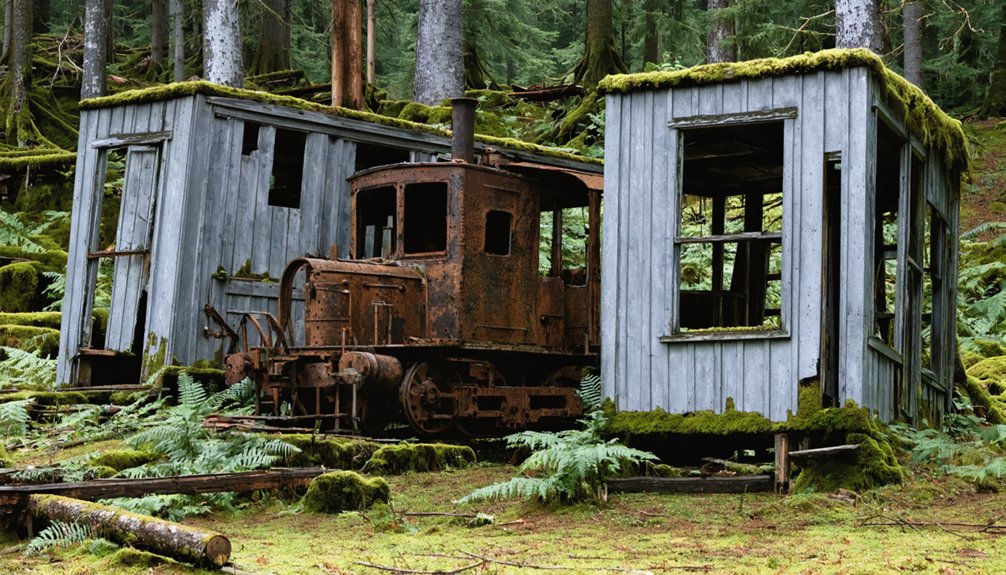
Just thirty minutes east of Portland along the Historic Columbia River Highway, Bridal Veil stands as the closest ghost town to the metro area—a near-abandoned mill settlement that rose and fell with Oregon’s early timber industry.
Established in 1886 around one of the state’s first paper mills, Bridal Veil history reveals a classic company town that once housed 150 residents who logged Larch Mountain’s timber.
Founded as a paper mill company town in 1886, Bridal Veil once supported 150 residents logging the slopes of Larch Mountain.
The town layout followed strict hierarchy: mill workers’ cottages clustered near the creek, managers’ homes set apart, plus a community hall, church, and post office.
After the 1936 mill fire ended operations, the population vanished.
Today you’ll find only scattered remnants—a tiny working post office, old cemetery, and a few surviving cottages marking where Oregon’s earliest lumber company town once thrived. The postal clerk operates from a converted century-old tool building, serving the area’s popular 97010 zip code. Each year, the post office receives thousands of wedding invitations from around the world, all seeking the romantic Bridal Veil postmark.
Shaniko: Oregon’s Wool Capital Frozen in Time
About 140 miles southeast of Portland, Shaniko rose as the “Wool Capital of the World” after its 1901 incorporation as the terminus of the Columbia Southern Railroad.
You’ll find a town that shipped over 3 million pounds of wool annually and reached peak sales exceeding $5 million by 1903–1904, making this short-line railroad one of the nation’s most productive.
The largest wool warehouse in Oregon was built here in 1901 to handle the massive volume of trade that made Shaniko a major commercial center.
The town’s rapid growth continued until the early 1910s when devastating fires in 1910 and 1911 destroyed much of the business district, accelerating its decline.
Today, the preserved hotel with its 18-inch brick walls, historic water tower, and original storefronts offer you a tangible connection to Oregon’s boom-and-bust railroad era before the 1911 opening of the Oregon Trunk Railway ended Shaniko’s dominance.
Historic Rail Hub Origins
When the Columbia Southern Railroad began construction at Biggs in 1897—approximately 100 miles east of Portland on the Columbia River—few could have predicted the remote junction point it would create in Oregon’s high desert.
The 69-mile route pushed through Sherman County, establishing stations at Wasco, Moro, Grass Valley, and Kent before reaching Shaniko in 1900. Though originally planned to extend to Prineville, the railroad history ended at this high-desert terminus instead.
Promoted by E.E. Lytle with encouragement from the Union Pacific, the railroad transformed Shaniko into a thriving wool shipping capital that would dominate U.S. markets for nearly a decade. The town’s prosperity was connected to The Dalles through the Oregon Railway and Navigation Company, which facilitated the transport of millions of pounds of fleece annually.
Wool Trade Boom Era
Between 1900 and 1910, Shaniko transformed from a dusty railroad terminus into what merchants and newspapers boldly proclaimed the “Wool Capital of the World”—a title the remote junction earned through staggering shipping volumes that positioned it second only to Portland in Oregon’s commercial hierarchy.
You’ll find warehouses here that once held 4 million pounds of wool simultaneously, receiving freight wagons from Burns, Bend, and Fossil three times yearly. In 1904 alone, wool production flowing through Shaniko generated over $5 million in sales.
This economic transformation drew 600 residents by 1910, but the Oregon Trunk Railway’s 1911 opening along the Deschutes River diverted shipments to Bend, collapsing Shaniko’s wool-shipping economy virtually overnight. The town’s prosperity began when the first train arrived on May 13, 1900, marking the start of its commercial boom. The town featured essential establishments including banks, saloons, and a schoolhouse that served the thriving wool trade community.
Preserved Buildings and Attractions
Standing on Shaniko’s dusty main street today, you’ll encounter an architectural time capsule where thick-walled brick buildings and weathered wooden structures remain virtually unchanged since the wool trade’s collapse in 1911.
The crown jewel is the Italian-style Shaniko Hotel, built 1900-1902 with massive brick walls, now offering destination weddings starting at $500. You’ll find the historic preservation extends beyond accommodations—the bright green schoolhouse, original jail, post office, and city hall all stand intact.
The Shaniko Preservation Guild operates a museum showcasing wool-era photographs and equipment collections. A relocated 1897 Bakeoven schoolhouse, transformed into a wedding chapel during the 1960s, demonstrates the town’s architectural significance through adaptive reuse. The Shaniko Sage Museum displays relics and maps that chronicle the lives of past residents and the town’s prosperous wool-trading era.
The iconic water tower, wool sheds, and wagon yard complete this remarkably preserved frontier settlement accessible to independent explorers. Old cars and buggies from the town’s prime era remain scattered throughout the grounds, adding to the authentic ghost town atmosphere.
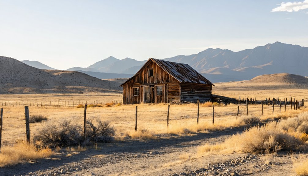
Boyd: A Forgotten Farming Settlement Along US 197
You’ll find Boyd’s remains tucked along US 197, roughly 10 miles south of The Dalles, where wheat farmers and millers built a thriving grain hub in the 1880s.
The town’s towering wooden granary, constructed in 1883 beside Fifteenmile Creek, still dominates the landscape as the most visible remnant of Boyd’s agricultural past.
Today’s driving loop along the highway offers quick roadside views of this structure and the creek crossing that once anchored a community of 150–200 residents before railroad abandonment in the 1930s ended its shipping role.
Wheat Farming and Milling
When Daniel Bolton arrived at Fifteenmile Creek in 1854, he immediately recognized the bottomland’s potential for wheat cultivation. Other settlers quickly followed, planting uplands surrounding the creek. By the 1850s, wheat dominated Boyd’s agricultural landscape.
You’ll find evidence of the area’s wheat heritage in the abandoned grain elevator still standing in town. T.P. Boyd and his sons operated a flour mill during the 1880s, adding value to locally grown grain. This milling history reflects Boyd’s prosperity during that era.
The Great Southern Railroad’s arrival in 1905 revolutionized market access, replacing arduous wagon transport. Farmers achieved impressive yields—40 bushels per acre by 1927, jumping to 60 bushels after fertilizer introduction.
Wheat commanded $4.50 per bushel at peak prices, fueling Boyd’s economic boom.
1883 Granary Remains
The 1883 wooden granary still towers above Fifteenmile Creek, forming Boyd’s most prominent surviving industrial landmark.
You’ll find these weathered remnants near the historic creek crossing, where teamsters once hauled wheat from upland farms for processing at T.P. Boyd’s mill. The granary architecture reflects late-19th-century vertical grain storage design, built to accumulate shipments for the Great Southern Railroad after 1905.
When the rail line abandoned Boyd in the 1930s and Highway 197 bypassed the town in 1923, the facility lost its economic purpose.
Today cottonwood trees and riparian vegetation surround the structure, contrasting sharply with the cleared wagon yards of its working past.
You can spot this grain storage relic from U.S. 197, standing sentinel over the repurposed farmland that replaced Boyd’s milling economy.
Driving Loop Highlights
From US 197’s rolling wheat country corridor, Boyd’s scattered remnants appear roughly 9 miles southeast of The Dalles, where a handful of occupied homes, weathered outbuildings, and the tall grain elevator cluster near Fifteenmile Creek’s east bank.
You’ll find this stop fits naturally into Gorge–Wapinitia driving loops that link multiple ghost towns along the historic Dalles–California route. The agricultural heritage still defines the landscape—wheat fields blanket former residential lots, cherry orchards occupy where the school and church once stood, and the original 1880s store site sits empty on the bluff.
One mile south, Star No. 23 Rebekah Lodge Cemetery preserves the town history through weathered headstones beneath black locust trees, marking pioneers who settled this wheat-farming crossroads from the 1850s onward.
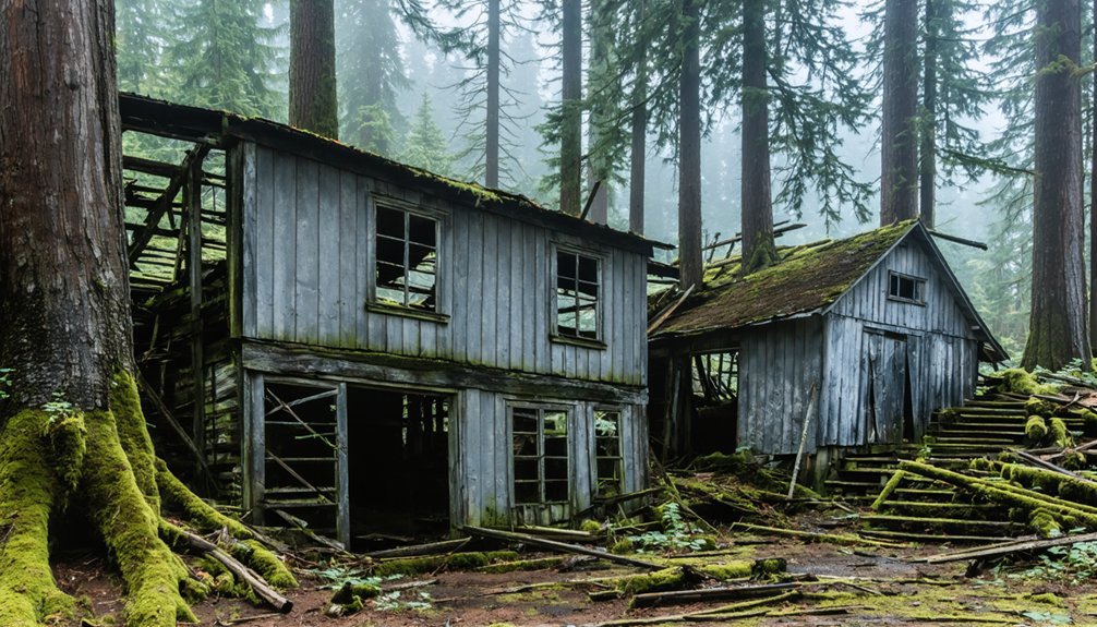
Friend: Remote Agricultural Outpost Turned Semi-Abandoned Town
Nestled in the dry, rolling wheat country of north-central Oregon’s Columbia Plateau, Friend stands roughly 100–110 miles east-southeast of Portland as one of Wasco County’s most remote semi-abandoned settlements.
You’ll find this near-ghost town at 2,300 feet elevation, where scattered farmsteads break endless grain fields.
Established in the early 1900s as a wheat-shipping point, Friend’s rail history centered on the Great Southern Railroad linking isolated homesteaders to The Dalles markets.
Grain warehouses and loading platforms anchored the small community through the 1910s–1920s peak.
When rail service ended mid-century, Friend couldn’t compete with highway transport and centralized elevators.
Agricultural decline followed mechanization and farm consolidation, emptying the town core.
Today you’ll discover derelict structures amid a handful of occupied properties—testament to the Columbia Plateau’s vanishing agricultural outposts.
Antelope: From Ranching Hub to Rajneeshpuram Controversy
You’ll find Antelope tucked into Wasco County‘s high desert, about two hours east of Portland, where it served north-central Oregon’s sheep and cattle ranches as a supply hub since the late 19th century.
By the early 1980s, this tiny retirement community of a few dozen residents faced an unprecedented upheaval when followers of Bhagwan Shree Rajneesh purchased the nearby 64,000-acre Big Muddy Ranch and transformed it into Rajneeshpuram—a utopian city that at its peak housed 15,000 people.
The arrival triggered a bitter political takeover that saw Rajneeshees move into Antelope en masse, seize control of the town council, and officially rename the century-old settlement “Rajneesh” in 1982.
Early Settlement and Decline
When Howard Maupin established a stage station about 1.5 miles northeast of present-day Antelope in 1863, he tapped into a transportation corridor that Indigenous peoples had traveled for generations.
The settlement thrived as a mining supply hub on The Dalles Military Road, serving nearly 10,000 fortune seekers rushing to Canyon City’s gold fields. Early transportation networks made Antelope essential for moving wool and freight from vast sheep and cattle operations like Muddy Ranch.
Community resilience shaped the town’s story. After fire destroyed nearly everything in 1894, residents rebuilt half a mile west for better road access.
The 1901 incorporation marked its commercial peak, but railroad construction soon diverted traffic elsewhere. By 1911, Antelope’s boom ended as Shaniko captured regional trade.
The Rajneeshpuram Takeover
The quiet ranching community of Antelope became ground zero for one of Oregon’s most contentious political and religious conflicts when followers of Indian guru Bhagwan Shree Rajneesh purchased the nearby 64,000-acre Big Muddy Ranch in 1981.
With fewer than 60 residents, you’d have witnessed rapid Antelope transformation as Rajneeshee tactics systematically dismantled local autonomy.
The hostile takeover unfolded through:
- Strategic property acquisitions flooding the town with commune members
- Voting bloc control defeating 1982 disincorporation attempts
- Electoral replacement of traditional officials with Rajneeshee leadership
- Intimidation campaigns including surveillance and harassment of holdout families
Planning Your Ghost Town Road Trip From Portland
Before you load the car, map out which cluster of ghost towns fits your schedule and tolerance for gravel roads.
A Wasco County loop—Portland to The Dalles, then US‑197 south through Boyd, Friend, Shaniko, and Antelope—covers 300–350 miles and works as a long day trip.
Understanding road trip logistics means planning for spotty cell coverage, limited fuel stops, and narrow county roads connecting sites of historical significance like Rajneeshpuram.
Late spring through fall offers snow‑free passes and longer daylight; winter demands flexible timing and chains.
Download offline maps, pack extra water, and respect private property in partially inhabited townlets.
For overnight freedom, push southeast from Shaniko toward Hardman, Galena, and Granite, where high‑desert solitude rewards those willing to venture deeper into Oregon’s backcountry.
What Caused Oregon’s Ghost Town Boom and Bust
Across Oregon’s high desert and forested valleys, ghost town origins mark the collision of explosive growth with economic fragility.
Exploring ghost towns near Bend Oregon offers a fascinating glimpse into the past. Each site tells stories of hope and hardship, reflecting the rise and fall of local economies. Adventure seekers and history buffs alike can uncover remnants of lives that once thrived in these now-abandoned locales.
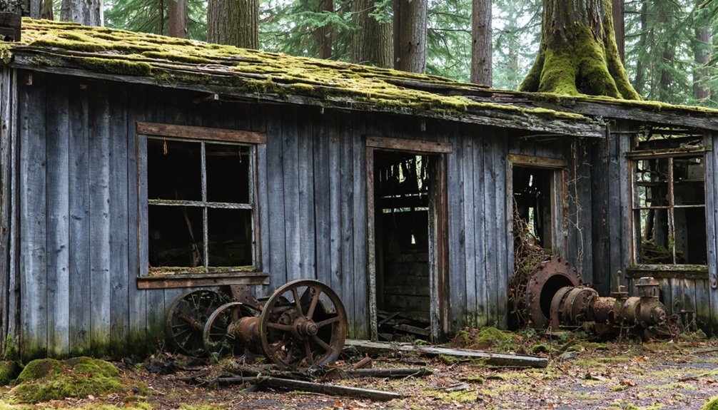
You’ll find that most settlements thrived on single industries—mines, mills, or railroads—leaving them vulnerable when those lifelines disappeared.
Understanding the forces behind their economic decline reveals a pattern repeated across dozens of communities near Portland.
Four primary drivers caused Oregon’s boom-and-bust cycle:
- Mining exhaustion – Gold and silver strikes built towns like Sumpter and Granite overnight, but ore depletion and falling metal prices triggered rapid abandonment.
- Timber depletion – Mill towns such as Whitney collapsed when nearby old-growth forests were logged out.
- Transportation shifts – Railroad bypasses and new highways diverted commerce away from hubs like Shaniko.
- Natural disasters – Fires, floods, and erosion accelerated the decline of already weakening settlements.
Best Routes and Driving Loops for Multiple Ghost Towns
Five distinct driving loops let you visit Oregon’s ghost towns efficiently, each offering different terrain, historical periods, and difficulty levels.
The Northern Route follows I-84 through Columbia Gorge to Highway 197, accessing Bridal Veil, Boyd, Friend, and Shaniko in 2.5 hours. Alternatively, take Highway 26’s Southern Route through Cascade Mountains for comparable drive time with Mount Hood views.
Two distinct northern paths converge on Shaniko—swift I-84 through the gorge or scenic Highway 26 beneath Mount Hood’s shadow.
The Wasco County Loop starts at The Dalles, connecting settlements of significant historical significance along US 197.
Eastern Oregon’s 106-mile Elkhorn Scenic Byway showcases Sumpter’s Valley Dredge and multiple mining communities.
Near Eugene, Mohawk Valley‘s logging towns demonstrate different-era ghost town preservation.
Each route grants you freedom to explore Oregon’s abandoned settlements while experiencing diverse landscapes and architectural remnants.
Photography Tips and What to Expect at Abandoned Sites
When you photograph Oregon’s ghost towns, you’ll find that wide establishing shots of weathered main streets capture the profound isolation these settlements now embody.
Early morning and late afternoon light creates long shadows that emphasize texture in peeling paint and warped wood.
Your photography techniques should include:
- Wide-angle lenses (14–24mm) for cramped interiors and dramatic sky inclusion
- Bracketed exposures for HDR blending when shooting bright exteriors with dark interiors
- Polarizing filters to manage reflections and deepen skies in dusty conditions
- Found objects as foreground elements (tools, bottles, furniture) for historical context
Before entering any structure, verify land ownership and access rules.
Many sites restrict tripod use or interior access following vandalism incidents.
Avoid unstable buildings entirely—deteriorated floors pose serious collapse risks.
Preservation Efforts and Living History in Oregon’s Ghost Towns
While many ghost towns crumble silently into Oregon’s landscape, a growing movement seeks to preserve these settlements as cultural archives rather than tourist curiosities.
You’ll find heritage preservation transforming sites like Golden—an Oregon State Heritage Site since 2011—where four original structures tell stories of 1890s mining communities.
The Maxville Heritage Interpretive Center demonstrates this approach, securing easements to protect multiracial logging camps that housed Black, Greek, Japanese, and white workers.
Oregon’s 256 documented ghost towns now receive state support, including $750,000 for preservation projects and traveling exhibits featuring “then and now” imagery.
These living history sites offer you authentic glimpses into frontier life through stabilized buildings and interpretive programs, not sanitized reconstructions.
Frequently Asked Questions
Are Ghost Town Visits Safe for Families With Young Children?
Ghost town visits can be safe if you choose maintained sites like Shaniko, take proper safety precautions with structures and terrain, supervise children closely around hazards, and plan family activities that avoid unstable buildings and remote areas.
Can You Legally Enter Abandoned Buildings at Oregon Ghost Towns?
No, you can’t legally enter without permission—Oregon’s abandoned property laws treat it as criminal trespassing. While urban exploration ethics emphasize respecting boundaries, property owners retain rights even over derelict structures, making unauthorized entry prosecutable.
Do Any Ghost Towns Near Portland Require Entrance Fees?
No entrance fees apply at ghost towns near Portland like Shaniko, Bridal Veil, or Antelope—you’ll find free street access throughout. However, you’ll pay separately for ghost town amenities like museums, lodging, or special events when available.
What Time of Year Is Best for Visiting Ghost Towns?
Strike while the iron’s hot during late spring through early fall for best seasons accessing Oregon’s ghost towns. You’ll enjoy passable roads, longer daylight, and open services, though weather considerations include summer heat and potential wildfire smoke during peak months.
Are There Guided Ghost Town Tours Available From Portland?
No dedicated guided tours to rural ghost towns depart from Portland; you’ll find only urban ghost walks covering local history downtown. True ghost towns like Shaniko require self-guided road trips you’ll navigate independently.
References
- https://www.nationaldaycalendar.com/lists/12-oregon-ghost-towns
- https://en.wikipedia.org/wiki/List_of_ghost_towns_in_Oregon
- https://www.visitoregon.com/oregon-ghost-towns/
- https://www.pdxmonthly.com/travel-and-outdoors/oregon-ghost-towns
- http://www.photographoregon.com/ghost-towns.html
- https://thatoregonlife.com/2016/04/road-trip-ghost-towns-eastern-oregon/
- https://traveloregon.com/things-to-do/culture-history/ghost-towns/
- https://sites.google.com/view/recreatingthecrh/historic-columbia-river-highway/bridal-veil/bridal-veil-oregon
- https://info.oregon.aaa.com/ghost-towns-of-oregon-and-idaho-experience-the-lore-history-and-intrigue-of-days-gone-by/
- https://www.pdxmonthly.com/travel-and-outdoors/2022/03/historic-bridal-veil-post-office-wedding-invitations


