You’ll find Idaho’s most dramatic ghost towns in Burke Canyon, just 90 miles east of Post Falls, where silver boomtowns like Burke and Gem once thrived in terrain so narrow that trains scraped building porches. The 1884 silver rush created settlements clinging to vertical canyon walls, with multi-story structures and ore processing facilities still visible today. You can explore the 72-mile Trail of the Coeur d’Alenes, which follows historic rail beds past mining artifacts, interpretive panels, and remarkably preserved remnants that reveal the engineering ingenuity required to extract over 60 million tons of ore from these rugged mountains.
Key Takeaways
- Burke, established in 1884 as a silver boomtown, peaked at 1,400 residents with unique canyon-constrained architecture and shared railroad-street layouts.
- Gem and satellite camps like Frisco, Black Bear, and Mace developed rapidly, with Mace losing over 20 people in a catastrophic 1910 avalanche.
- The 72-mile Trail of the Coeur d’Alenes follows historic rail beds, featuring interpretive panels and mining artifacts throughout the heritage corridor.
- Idaho’s ghost towns showcase unique vertical terrain architecture, including cantilevered mills and ore carts on cables, preserved by arid climate conditions.
- A Burke Canyon–Murray loop from Post Falls requires 2.5–3.5 hours driving, with essential supplies including printed maps, bear spray, and sturdy footwear.
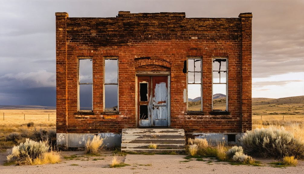
Burke: Silver Boomtown Squeezed Into a Canyon
In May 1884, prospectors working the rugged slopes above Canyon Creek struck rich silver–lead–zinc ore and staked the Tiger claim on the 2nd, followed three days later by the Poorman.
Within months, Burke emerged as a supply hub jammed into one of Idaho’s narrowest canyon architecture spaces. You’ll find it hard to believe: the town’s single street carried both railroad tracks and wagon traffic, with trains literally brushing building porches.
Burke’s single street impossibly squeezed together railroad tracks, wagon routes, and buildings—trains actually grazed the porches as they rumbled through town.
Constrained by sheer rock walls, miners built multi-story structures bridging the creek and straddling the rail line—pure space-saving ingenuity. More than 70 claims followed, and Burke’s mining heritage boomed.
Population peaked above 1,400 by 1912, sustained by the Tiger, Poorman, Hecla, and Hercules operations that defined Coeur d’Alene‘s legendary Silver Valley.
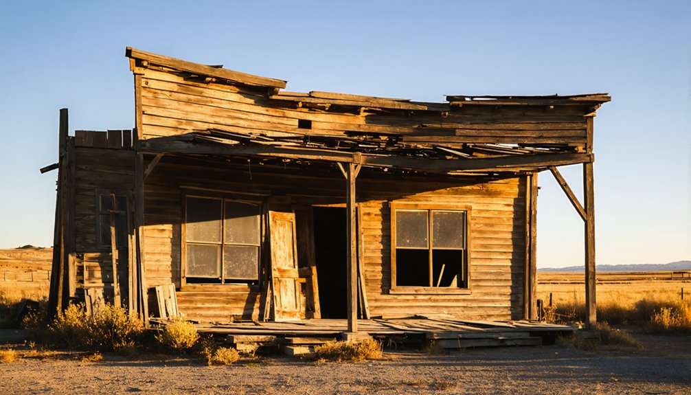
Gem and the Satellite Mining Camps of Burke Canyon
Within a year of Burke’s founding, Gem and a tight chain of satellite camps—Frisco, Black Bear, and Mace—filled nearly every usable bench and slope in Burke Canyon, turning the narrow chasm into a continuous industrial corridor.
You’ll find Gem‘s history tied directly to the silver-lead-zinc ore bodies discovered after 1884, part of over 70 claims staked along Canyon Creek.
Mining techniques included stamp mills, jigs, and vibrating tables that concentrated ore from underground workings before shipping concentrates down-canyon by rail.
Recovery rates sometimes fell below 75%, leaving behind toxic tailings that were deposited directly into Canyon Creek or scattered across the hillsides.
Mace alone housed 700+ single men in boardinghouses, crammed against canyon walls where 30-foot snow depths threatened avalanches.
Each camp functioned as a company town where miners worked 10-hour shifts for $3.50 daily, their livelihoods dependent on specific mill complexes with zero alternative employment.
On February 27, 1910, a catastrophic avalanche struck Mace, killing more than 20 people and marking one of the deadliest disasters in the canyon’s history.
Exploring the Coeur D’alene Mining District Heritage Corridor
Stretching 72 miles from the Montana border to the Coeur d’Alene Reservation boundary, the Trail of the Coeur d’Alenes follows the exact rail bed that once hauled concentrates from Burke, Gem, Wallace, and dozens of other canyon camps to smelters and steamboat landings downstream.
You’ll ride smooth asphalt over the route that moved over 60 million tons of ore and waste between the 1880s and 1968.
Interpretive waysides mark tunnel portals, mill sites, and loading platforms where narrow-gauge cars once lined up by the hundred.
Heritage interpretation panels detail labor strikes, corporate consolidations, and the engineering that made Silver Valley a national powerhouse.
Mining artifacts—rusted concentrator chutes, rail spikes, trestle timbers—still dot the corridor, offering tangible connections to the district’s layered industrial past.
The Northern Pacific Railroad’s standard-gauge line replaced the original narrow-gauge system in 1888, dramatically improving transport capacity for the region’s booming silver-lead production.
At its peak, the Bunker Hill Company employed thousands and produced one-third of the nation’s lead, cementing Silver Valley’s position as a cornerstone of American industrial metal production.
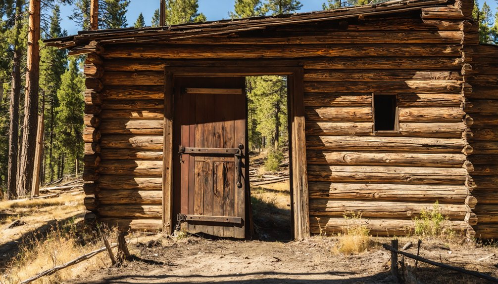
What Makes Idaho’s Ghost Towns Unique
Unlike ghost towns in Nevada’s flatlands or Arizona’s desert basins, Idaho’s abandoned mining camps occupy some of the West’s most unforgiving vertical terrain—narrow canyons where avalanches dictated street layouts, cirque bowls perched above 6,000 feet, and creek corridors so tight that mills and bunkhouses climbed hillsides in stacked tiers.
Idaho’s ghost towns cling to cliffs and canyon walls where geography shaped every street, mill, and bunkhouse placement.
This rugged geography forced unique architecture: ore carts suspended on cables, false-fronts anchored against cliff faces, and stamp mills cantilevered over streambeds.
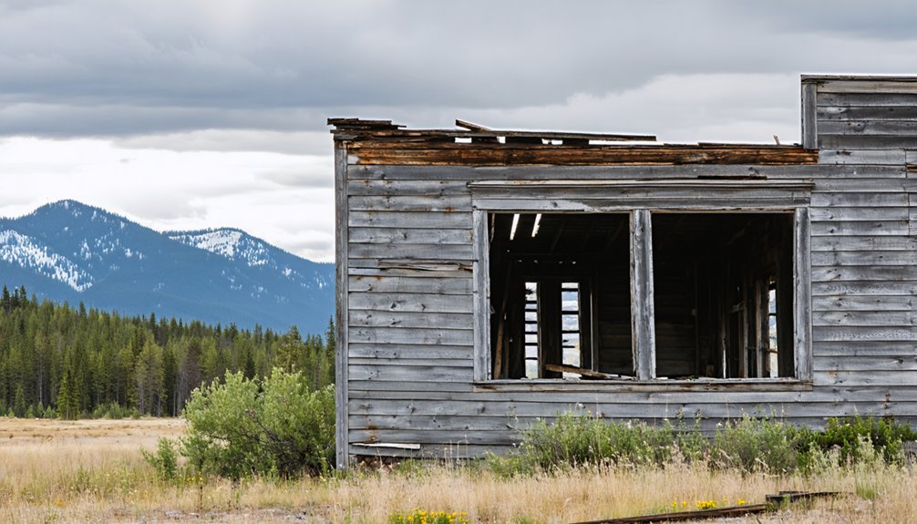
You’ll find cultural significance in Idaho’s arrested-decay preservation philosophy—Silver City’s weathered storefronts and Bayhorse’s mill works remain stabilized but unrestored, maintaining original materials rather than sanitized reconstructions.
Private stewardship by seasonal owners and overwintering caretakers keeps these sites authentic, avoiding corporate tourism’s homogenizing touch while preserving the raw evidence of hard-rock mining’s boom-and-bust cycles across Idaho’s mountain backbone.
The state’s arid climate plays a crucial role in maintaining these structures, naturally preserving wood, metal, and even fabric remnants that would deteriorate rapidly in more humid regions.
Towns like Custer feature staged interiors within original buildings, offering visitors glimpses into miners’ daily lives while maintaining structural authenticity.
Planning Your Day Trip From Post Falls
Understanding what sets these mountain mining camps apart from their southwestern counterparts helps explain why a visit from Post Falls demands more forethought than pointing your car toward the nearest ruin.
Trip logistics begin with your route: budget 2.5–3.5 hours of driving for the Burke Canyon–Murray loop via I‑90 east to Wallace, leaving three to five hours for exploration.
Launch early to dodge interstate traffic and maximize canyon daylight—steep walls darken sites faster than you’d expect.
Packing essentials include printed maps and offline GPS (cell coverage vanishes in canyons), bear spray for wildlife encounters, sturdy footwear for unstable ground, and a full fuel tank before leaving pavement.
Check seasonal road conditions; winter snowpack and spring washouts close narrow canyon routes entirely. Many sites feature buildings still standing despite decades of abandonment, while others have deteriorated to foundation remnants barely visible beneath overgrowth. These boomtowns flourished briefly before being abandoned when mine closures ended their economic lifeblood.
Mining History and Labor Legacy in North Idaho
- 1892 armed strike shut down Bunker Hill, ending with federal troops herding union miners into barbed-wire bullpens.
- Deep tunnels and toxic dust killed and maimed workers who’d no legal recourse in company-controlled towns.
- 1899 uprising again brought soldiers to crush organizing efforts.
- Western Federation of Miners rose from these valleys, forging tactics that echoed across western hard-rock camps.
You’re tracing the footsteps of men who refused to kneel.
Frequently Asked Questions
Are Ghost Town Tours Near Post Falls Safe for Children?
Guided tours emphasizing family safety on marked paths can work for older children, though you’ll navigate unstable structures, mine hazards, and rough terrain—hardly typical kid friendly activities unless you’re raising adventurous junior archaeologists willing to follow strict boundaries.
Can You Camp Overnight Near Burke Canyon Ghost Towns?
Overnight camping near Burke Canyon requires careful attention to camping regulations—most historic townsite land is private or state-controlled. You’ll find dispersed options on nearby BLM tracts if you follow ghost town etiquette and respect posted boundaries.
Do Any Ghost Towns Near Post Falls Have Restaurants or Lodging?
No true ghost towns near Post Falls offer services, but you’ll find excellent ghost town dining and lodging options in nearby Wallace and Kellogg—historic mining communities that serve as your base for exploring Burke Canyon’s authentic ruins.
To enhance your adventure, consider visiting some of the abandoned mining towns near Twin Falls, where remnants of the past create an intriguing atmosphere. These locations often provide a unique glimpse into the region’s rich mining history, along with breathtaking views of the surrounding landscape. As you stroll through the deserted streets, you can almost hear the echoes of the miners who once called these towns home.
What Photography Equipment Works Best for Capturing Mining Ruins?
You’ll want a weather-sealed camera body for dust protection, paired with smart lens selection—a 24–70mm zoom handles most shots. Tripod stability proves essential for low-light interiors and long exposures inside crumbling shafts and timber-framed structures.
Are Dogs Allowed at Burke Canyon Historic Sites?
Though federal pet policies don’t explicitly ban dogs, you’ll find leash requirements and de facto dog restrictions throughout Burke Canyon’s contaminated cleanup zones—keep your pet controlled near hazardous mine ruins and lead-contaminated soils.
References
- https://en.wikipedia.org/wiki/List_of_ghost_towns_in_Idaho
- https://www.thegoldminehotel.com/ghost-towns-and-haunted-places-in-idaho
- https://www.tripadvisor.com/Attraction_Review-g28933-d1775240-Reviews-Bonanza_and_Custer_Ghost_Town-Idaho.html
- https://pinintheatlas.com/travel-blogs/ghost-towns-of-idaho/
- https://www.youtube.com/watch?v=rTSZSlxTmbs
- https://visitnorthidaho.com/activity/burke-canyon/
- https://visitidaho.org/things-to-do/ghost-towns-mining-history/
- http://sfcompanion.blogspot.com/2020/06/burke-idaho-ready-for-almost-century-of.html
- https://freepages.history.rootsweb.com/~gtusa/usa/id/burke.htm
- https://cdabasin.idaho.gov/the-dirt-mining-in-burke-canyon/