You’ll find exceptional ghost towns within an hour’s drive of Salmon, Idaho, including Gilmore’s twenty weathered structures at 7,000 feet, Leesburg’s $40-million gold camp from 1867, and Bayhorse’s remarkably intact mill complex with nine beehive charcoal kilns. Shoup still clings to life with four year-round residents, while Yellowjacket’s five-story hotel frame stands as a monument to its thousand-person boom days. Plan for mid-June through October travel with high-clearance vehicles, extra fuel, and recovery gear—these remote sites reward preparation with authentic glimpses into Idaho’s hardrock mining heritage.
Key Takeaways
- Salmon, Idaho serves as a basecamp for exploring ghost towns in Lemhi County with essential services and historical resources available.
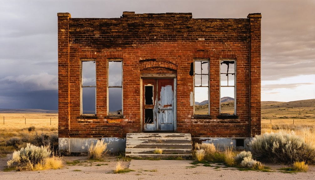
- Gilmore, a silver-lead mining town 60 miles south, features 20 dilapidated buildings abandoned after a 1927 power-plant explosion.
- Leesburg and Shoup were gold mining towns established in 1867 and 1881, with Shoup retaining only four year-round residents today.
- Bayhorse preserves fourteen original structures including charcoal kilns and the General Custer Mill, which extracted $8 million in gold.
- Exploration requires stout trucks, extra fuel, recovery gear, and travel between mid-June through late October for optimal conditions.
Gilmore: Silver-Lead Mining Town at 7,000 Feet
Sixty miles south of Salmon, where Highway 28 climbs toward Gilmore Summit and the Lemhi Range peaks tower beyond 11,000 feet, the remnants of Gilmore sit at 7,000 feet elevation—a silver-lead camp that once housed 600 residents and represented one of Idaho’s most ambitious high-country mining ventures.
You’ll find Gilmore history began with 1879 silver-lead discoveries, though the town didn’t boom until 1910 when the Gilmore & Pittsburgh Railroad finally reached this remote terminus.
Mining infrastructure grew rapidly: seven saloons, a hospital, power plant, and assay office served the community. On the timbered bench at Gilmore’s west edge, Ragtown emerged as a settlement of platform tents and crude shelters housing itinerant miners and their families. The 1927 power-plant explosion destroyed operations overnight, triggering mass exodus.
A single catastrophic blast in 1927 erased decades of mining ambition, scattering Gilmore’s 600 souls into Idaho’s high-country winds.
Today you can walk among scattered foundations and contemplate what survives when profit-driven enterprise meets unforgiving altitude and isolation. Around 20 dilapidated buildings remain scattered across the site, many standing on private property.
Leesburg: the Confederate Camp That Yielded $40 Million in Gold
The district ultimately produced $40 million in gold across decades of operation.
But that first winter tested every miner’s resolve: five-foot snows buried the camp, supplies ran out, and twelve men shoveled a toll trail through drifts until pack trains broke through March 8, 1867, ending weeks without fresh meat.
Gold veins formed primarily near the top of the granite batholith that makes up much of the region’s geology.
By 1870, as the richest placers played out, the population had declined to 180 residents.
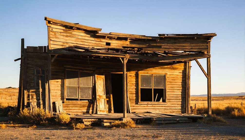
Shoup: Remote Salmon River Outpost Still Hanging On
While Leesburg’s Confederate prospectors braved winter snows at high elevation, another mining settlement took root twenty miles downriver in 1881, clinging to the steep canyon walls where the Salmon River cuts its legendary “River of No Return” gorge.
Named for George L. Shoup—Idaho’s last territorial and first state governor—this outpost served over 300 mining claims by the 1890s, supporting roughly 600 residents at its peak.
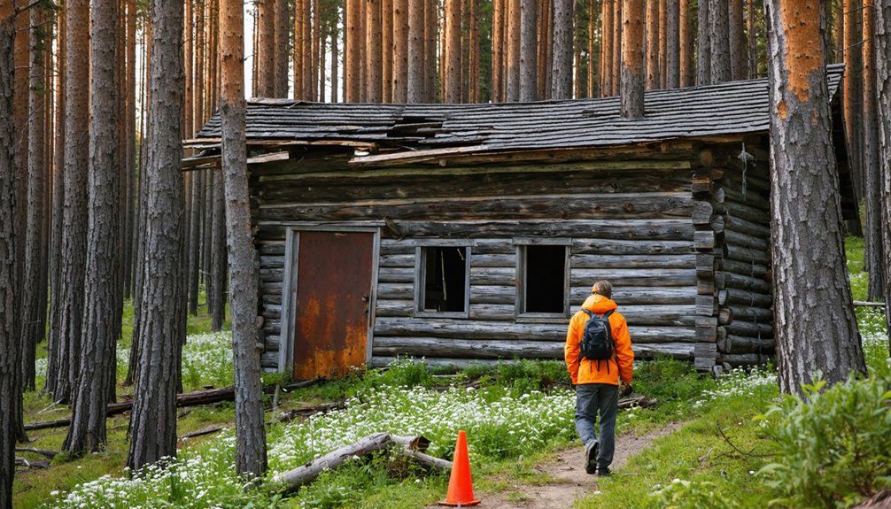
You’ll find Shoup history written in ruined cabins scattered along treacherous pack trails. Professional packers like Captain James B. Ellis navigated brutal terrain hauling ore and supplies before roads penetrated these canyons. Riverboats operated along the Salmon River for ferrying goods to support the mining operations.
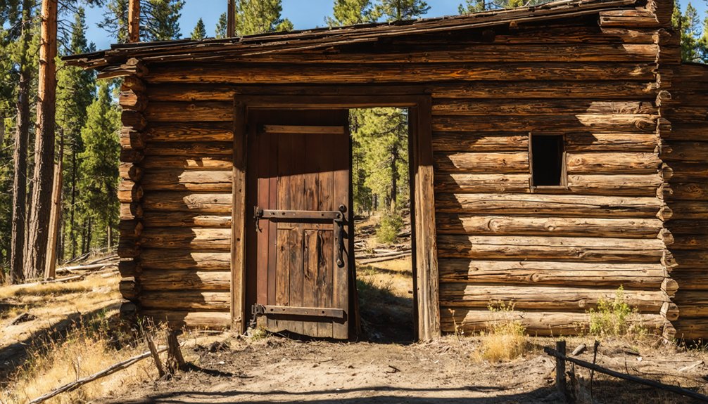
An old log schoolhouse now serves as lodging for visitors exploring the historic site.
Today only four year-round residents remain, maintaining the settlement for seasonal river runners and fishermen who’ve replaced freight traffic with recreation on the Salmon River.
Blackbird and Cobalt: Copper Mining in Rugged Terrain
Deep in the Salmon River Mountains, twenty miles southwest of Salmon, prospectors stumbled upon copper and cobalt deposits in 1893 that would spawn one of Idaho’s most isolated—and eventually most contaminated—mining districts.
Full-scale cobalt mining ramped up in 1949 when Cold War demand made this strategic metal worth extracting from rugged terrain marked by 6,000-foot elevation swings and steep canyons.
The company town of Cobalt housed 250 workers in Quonset huts along Panther Creek, supporting twelve-acre open pits and ten miles of underground workings until 1982’s final shutdown.
You’ll find a near-ghost town today—contaminated drainage eliminated Chinook salmon runs by the 1960s, earning Superfund status.
The site left behind 2 million cubic yards of mine tailings that required ongoing treatment to prevent catastrophic dam failure.
Water treatment operations continue indefinitely, with a plant collecting contaminated water and dredging heavy metal sludge that gets dried in open air basins.
Noranda auctioned off buildings in 1987, leaving minimal infrastructure for freedom-seeking souls drawn to remote country.
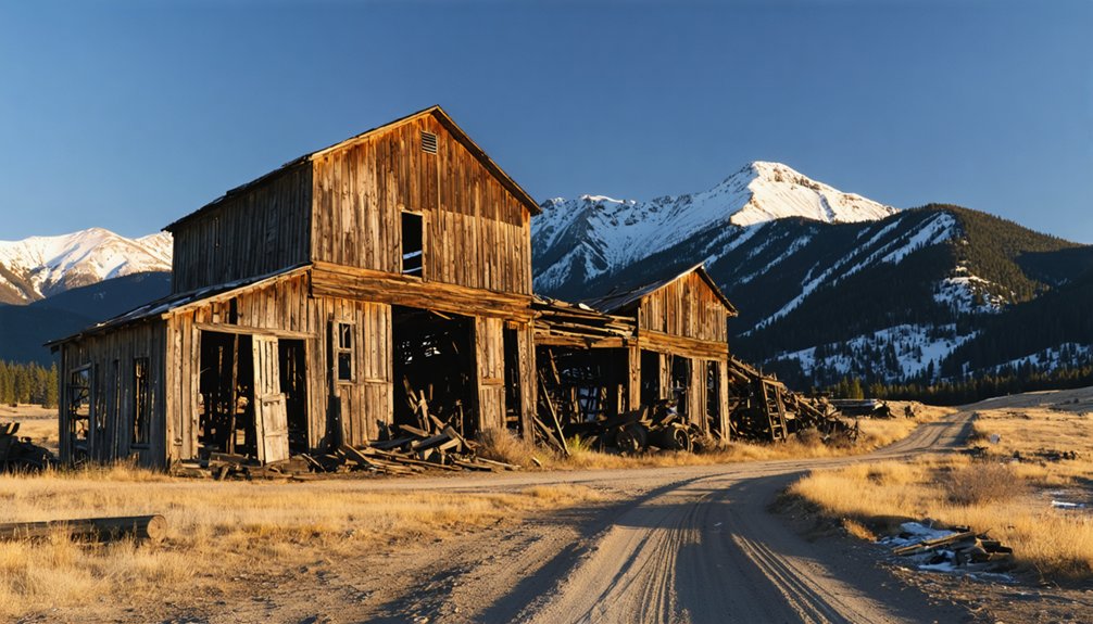
Yellowjacket and the Scattered Gold Camps
You’ll find Yellowjacket’s story begins in fall 1869 when a lone prospector discovered placer gold on a creek named after his miserable encounter with swarming wasps.
The remote camp swelled to 1,000 residents by the 1890s, complete with a water-powered mill fed by wooden flumes and ore tramways requiring eighty packhorses to haul their massive cables.
Though new investors built a five-story hotel in 1922 hoping to revive operations, the mine—later dubbed “one of the most overrated gold mines in Idaho”—had already proven its profits came only in unpredictable bursts.
Among the weathered remains, visitors can explore old cabins, a boardinghouse, and the skeletal framework of the stamp mill that once processed ore from the surrounding quartz mines.
Today, reaching Yellowjacket’s remains requires backcountry travel skills and a tough vehicle to navigate the rugged terrain of east central Idaho.
Yellowjacket’s Remote Mining History
Tucked into the rugged folds of the Salmon River Mountains, Yellowjacket emerged from a placer gold discovery along Yellowjacket Creek in 1868–1869 that pulled prospectors deep into Lemhi County’s backcountry wilderness.
You’ll find that early claims about riches rivaling Boise Basin turned out exaggerated—partly a prospector’s hoax—but gold-bearing quartz veins kept miners digging.
By the mid-1870s, stamp mills thundered in this roadless canyon, evolving into a 60-stamp operation with cyanidation plants and aerial trams.
Ghost town preservation efforts today focus on crumbling mill foundations and scattered cabin ruins that once supported hundreds.
The camp’s mining techniques shifted from simple gravity separation to complex chemical processing, yielding roughly $2.5 million before decline set in.
Supply trains navigated mountain trails for decades, underscoring the fierce independence required to survive here.
Access and Trail Conditions
Reaching Yellowjacket and the constellation of forgotten camps scattered across these high ridges demands careful preparation and a tolerance for slow, grinding miles on primitive mountain roads.
Forest Road 112 winds narrow and rough beyond Panther Creek, requiring high-clearance 4WD and forcing occasional backing maneuvers on shelf sections where two vehicles can’t pass.
Road conditions deteriorate quickly after storms—washouts and debris slides reshape the route each season.
Vehicle recommendations lean heavily toward stout trucks carrying extra fuel, full-size spares, and recovery gear; you’re hours from help.
Mid-June through late October offers the best window, when snowmelt subsides and trails dry enough for motorcycles and ATVs to probe deeper into the backcountry where crumbling cabins still mark long-silent claims.
Remaining Structures and Ruins
When you finally arrive at Yellowjacket after those bruising miles on Forest Road 112, the five-story hotel and boardinghouse anchors the entire site—a skeletal wooden tower that seems impossible to have survived this high and exposed for more than a century.
The yellowjacket architecture tells its own story: massive timber framing designed to house hundreds of miners during the boom.
Beyond the hotel, the mining infrastructure sprawls across hillsides—stamp mill foundations, ore tramway cables still draped between support towers, and wooden flume remnants that once powered the batteries.
Log cabins cluster in deteriorating rows, their stone chimneys standing like gravestones.
Meanwhile, Leesburg’s few surviving structures barely hint at the seven-thousand-person metropolis that once produced forty million in gold dust.
Bayhorse: One of the West’s Best-Preserved Mill Sites
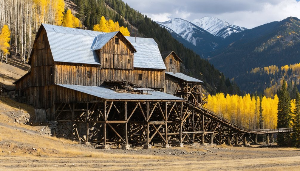
You’ll find Bayhorse remarkably intact for a ghost town—fourteen original structures still stand, including weathered mine buildings, a hotel, and shops with their distinctive flattened tin bucket roofing.
The site’s crown jewels are its defiant charcoal kilns and stone mill ruins, engineering marvels that have withstood over a century of Idaho winters since their abandonment in 1896.
Look carefully and you’ll spot the remnants of aerial tramways that once carried silver-lead ore from the Ramshorn and Beardsley mines down to the processing facilities below, physical evidence of the industrial ambition that drew 300-400 souls to this remote canyon in the 1880s.
Historic Stone Mill Ruins
The General Custer Mill rises from Bayhorse’s hillside in descending stair-step levels, its 30-stamp facility constructed in 1880 to process ore through gravity’s relentless pull.
You’ll find thick stone walls—nearly 24 inches at the Stonewall Ruin—that’ve weathered a century of abandonment better than their wooden counterparts.
The mining techniques here were ingeniously simple: ore entered at the top, tumbled through a grizzly, then jaw crusher, before water washed the pulverized rock downward through the millworks.
Between 1880 and 1888, this operation extracted $8 million in gold before costs exceeded returns in 1904.
Today’s historic preservation efforts include fresh wood supports at the entrance, though fallen sections reveal the original construction materials that made these structures nearly indestructible.
Charcoal Kilns and Tramways
Nine beehive-shaped charcoal kilns still stand on Bayhorse’s outskirts, their stone domes positioned downwind from the town to spare residents the acrid smoke that billowed during the early 1880s.
You’ll find these relics of charcoal production fed a 25-ton smelter, with 48 men cutting timber from surrounding slopes to produce 80,000 bushels annually. By 1885, cheaper coke from Ketchum rendered them obsolete—metallurgical progress always wins.
Equally impressive are the ore transport systems snaking down from hillside mines like Ramshorn and Beardsley.
Gravity-fed tramways and chutes replaced costly wagon hauls across brutal terrain, linking tunnels directly to the canyon’s mill and smelter. This integrated complex employed 200 workers at its peak, pouring 80 tons of bullion monthly before abandonment claimed it all.
Planning Your Ghost Town Adventure From Salmon
Since Salmon anchors the heart of Idaho’s ghost town corridor, establishing your basecamp here opens up efficient access to more than a dozen abandoned mining settlements scattered across Lemhi County and the Salmon-Challis National Forest.
Salmon serves as the ideal staging ground for exploring over a dozen ghost towns throughout Lemhi County’s historic mining landscape.
You’ll find essential services—fuel, groceries, outfitters—plus the Lemhi County Historical Museum, where rangers share local legends and maps detailing each site’s historical significance.
Plan your routes carefully: Gilmore lies 60 miles south via ID-28, while Leesburg requires traversing single-lane forest roads northwest. Fuel up before departing; stations disappear beyond town.
Peak season runs summer through early fall when snow clears high-elevation passes. Gravel roads slash average speeds, so budget extra time.
Check seasonal conditions at visitor centers—mud and snowpack frequently close routes outside late spring. Pack recovery gear and download offline maps before venturing into backcountry.
Exploring Responsibly: Access, Safety, and Preservation
Wandering through Idaho’s abandoned mining camps demands more than curiosity—it requires preparation, respect, and awareness of both natural hazards and cultural responsibilities.
At 6,375 feet elevation, Bonanza and Custer test your physical readiness in mountainous terrain. You’ll navigate deteriorating structures where mine shafts and unstable buildings pose real dangers—Shoup’s gold tours ended in 2004 for good reason.
Proper visitor etiquette means photographing without disturbing artifacts or altering historic sites. The National Register designation Custer received in 1981 underscores its historical significance, while privately-owned Bonanza demands you respect property boundaries.
River operators controlling Shoup access aren’t limiting your freedom—they’re protecting both visitors and irreplaceable remnants of Idaho’s mining heritage. Come prepared, tread carefully, take only photographs.
Frequently Asked Questions
What Is the Best Time of Year to Visit Ghost Towns Near Salmon?
Late May through September offers you’ll find the best balance of seasonal activities and weather considerations. Roads stay dry, Custer’s tours operate fully, and you’ll dodge winter closures while maximizing daylight for exploring remote mining sites.
Are There Guided Tours Available for the Ghost Town Sites?
The early bird catches the worm—you’ll find guided exploration at Custer Ghost Town during summer months, where knowledgeable guides reveal historical significance through restored buildings. River operators also provide exclusive access to Shoup’s mining heritage.
Can I Camp Overnight Near Any of the Ghost Towns?
You can camp overnight on surrounding public lands near most ghost towns, but check local camping regulations first and practice overnight safety—avoid historic structures, mine hazards, and private property like Bonanza without permission.
Do I Need Special Permits to Explore These Abandoned Mining Sites?
You’re free to wander publicly managed sites like Custer and Bayhorse without special permits for casual exploration—historical significance demands respect, though. Exploration safety rules prohibit entering fenced mines, removing artifacts, or disturbing active claims without permission.
Which Ghost Town Is Closest to Salmon for a Short Visit?
Shoup’s your closest ghost town for a short visit—just west along the Salmon River. I’ve found its riverside location and handful of structures make it perfect when you’re craving quick exploration without committing to backcountry roads.
References
- https://www.visitsalmonvalley.com/historic-adventures/ghost-towns/
- https://idaho-forged.com/idahos-ghost-towns-eerie-yet-approachable/
- https://www.thegoldminehotel.com/ghost-towns-and-haunted-places-in-idaho
- https://www.tripadvisor.com/Attraction_Review-g28933-d1775240-Reviews-Bonanza_and_Custer_Ghost_Town-Idaho.html
- https://www.youtube.com/watch?v=9W3h7mkq6ZE
- https://visitidaho.org/things-to-do/ghost-towns-mining-history/
- https://www.fs.usda.gov/r04/salmon-challis/recreation/discover-history/custer-ghost-town
- https://westernlivingjournal.com/ghost-town-ragtown-idaho-gilmores-itinerant-community/
- https://www.explore.com/1762330/gilmore-settled-rolling-hills-idaho-abandoned-gold-rush-ghost-town-gorgeous-hiking-views/
- https://www.youtube.com/watch?v=HjmBzSSojNU