You’ll find three authentic ghost towns less than 30 miles south of Santa Fe along the Turquoise Trail: Cerrillos, Golden, and Madrid. Cerrillos peaked at 3,000 residents in the 1880s but now houses fewer than 250 people among preserved adobe facades and 19 historically marked buildings. Golden’s 1830 San Francisco Catholic Church anchors its placer gold heritage from 1825, while Madrid’s coal operations ran from 1835 until 1954. Each settlement traces back to Indigenous turquoise mining traditions dating to the 900s CE, with detailed exploration routes and seasonal safety considerations outlined ahead.
Key Takeaways
- Cerrillos, Madrid, and Golden are historic mining towns located 28 miles south of Santa Fe along the Turquoise Trail.
- Cerrillos features 19 preserved buildings, a Turquoise Mining Museum, and dirt streets from its 1880s boom era.
- Madrid peaked as a coal mining town in 1928 before operations ceased in 1954 due to natural gas.
- Golden was established in 1879 after gold discovery, with the 1830 San Francisco Catholic Church as its centerpiece.
- Cerrillos Hills State Park offers 1,100 acres of trails past turquoise pits dating to the 900s CE.
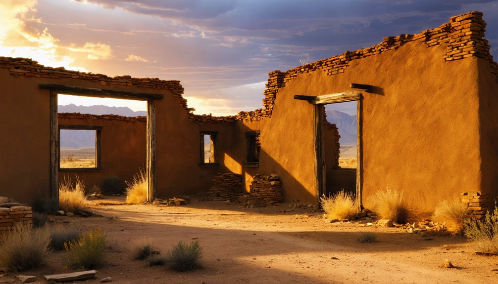
Cerrillos: A Living Snapshot of the Old West
Nestled in the rolling hills south of the Santa Fe River, Cerrillos stands as one of New Mexico’s most enduring mining settlements, its roots reaching back through three distinct eras of extraction and habitation.
Keres and Tano peoples mined turquoise here for a millennium before Spain established Real de los Cerrillos in 1695.
The railroad’s 1880 arrival sparked the town’s explosive transformation—nearly 3,000 prospectors flooded in, building 21 saloons, 4 hotels, and ornate structures like the 1888 Palace Hotel.
When the railroad arrived in 1880, Cerrillos exploded from quiet mining camp to bustling frontier town of nearly 3,000 prospectors.
Today’s population hovers around 90–250, yet Cerrillos history lives on through dirt streets and preserved adobe facades.
You’ll find interpretive plaques marking 19 buildings, while the Turquoise Mining Museum showcases hundreds of Old West artifacts, maintaining this semi-ghost town’s authentic character. The Simoni Store, purchased by Sarah Jones in 1892, served the community as a bar, drug store, and meat market before Tony Simoni acquired it in 1919 for $3,000.
Located approximately 28 miles south of Santa Fe, Cerrillos offers convenient access via State Road 14, also known as The Turquoise Trail, which connects visitors to nearby mining towns like Golden and Madrid.
Golden and Madrid: Twin Treasures of the Turquoise Trail
Twenty-four years before the California Gold Rush electrified the American West, prospectors discovered placer gold along Tuerto Creek in 1825, establishing the first documented gold rush west of the Mississippi River.
Golden history begins with these placer camps, which consolidated into a formal mining district by 1879. You’ll find the restored San Francisco Catholic Church—Golden’s architectural centerpiece since 1830—standing sentinel over scattered ruins and a handful of occupied structures.
Twenty-one residents now inhabit this semi-ghost settlement.
The Henderson General Store, successor to the 1918 Golden General Merchandise Store, continues serving visitors along the Turquoise Trail today.
Madrid legacy follows a parallel arc: coal deposits discovered in 1835 fueled a company town famous for Christmas displays visible from passing aircraft during the 1920s–1930s.
Natural gas’s postwar ascendance killed coal demand, shuttering Madrid’s mines by 1954.
The town reached its zenith in 1928, when Madrid’s coal operations shipped over 180,000 tons from the mining complex.
Mining Heritage and Indigenous Turquoise Traditions
Long before Madrid’s coal seams and Golden’s placers drew Euro-American prospectors, Indigenous miners worked the Cerrillos Hills for turquoise, transforming sacred geology into ceremonial wealth.
Puebloan extraction at Mount Chalchihuitl began in the 900s CE, using stone tools to reach veins linking water, sky, and rain in turquoise symbolism. These mines supplied trade networks stretching beyond the Rio Grande, while lead ores fueled ceramic glaze production.
Spanish colonizers redirected the district through forced labor in the 1600s, but the Pueblo Revolt of 1680 halted imperial control. The name “Cerrillos,” meaning “little hills,” was given by Spanish cattle ranchers during this colonial period. The arrival of the Atchison, Topeka and Santa Fe railroad in 1880 established a train station in Cerrillos, ushering in a new era of mineral extraction and transforming the quiet settlement into a bustling boom town.
Exploring Cerrillos Hills State Park and Historic Landmarks
Eleven hundred acres of piñon-studded ridges and open arroyos compose Cerrillos Hills State Park, where signed trails wind past turquoise pits worked continuously from the 900s CE through the early 1900s.
Centuries-old turquoise mining heritage threads through eleven hundred acres of piñon-covered ridges accessible via signed interpretive trails.
Your trail exploration reveals interpretive panels marking century-old mine shafts and ore-processing sites between 5,900 and 6,900 feet elevation.
Historic preservation efforts downtown protect 19 buildings with plaques documenting Cerrillos’ transformation from 1880s near-capital contender to semi-ghost settlement:
- St. Joseph’s Catholic Church (late 1800s) on First Street anchors the religious quarter
- Palace Hotel (1888) housed the boomtown’s doctor, dentist, and tailor
- Railroad spur structures (1892) mark the Coal Bank–Madrid transport corridor
- Mary Mining & Smelting Company smelter ruins span San Marcos Arroyo
Sweeping ridgeline vistas encompass the Sandia, Ortiz, Jemez, and Sangre de Cristo ranges framing your day-use adventure.
The park’s location along the Turquoise Trail National Scenic Byway connects this high-desert terrain directly to both Santa Fe and Albuquerque.
Spanish explorers originally called the area Sierra de San Mateo before discovering lead-silver deposits in 1581 that pueblo peoples had already been using in pottery glazes.
Planning Your Ghost Town Adventure: Access, Safety, and What to Expect
Because ghost town sites scatter across varied terrain and land-ownership patchworks between Santa Fe and Albuquerque, you’ll need advance route planning and realistic expectations about access conditions.
Most sites lie 20–60 minutes out along NM 14, reachable via two-lane pavement plus occasional dirt stretches—though monsoon mud and winter ice often close remote routes.
Ghost town exploration demands sturdy footwear, offline maps, and 2–4 liters of water daily; cell service disappears in canyons.
When venturing into abandoned sites around Seattle area, the atmosphere can be both eerie and captivating. Each location tells a story of its past, often hidden beneath layers of nature reclaiming the land. As you explore, remember to respect the remnants of history and tread lightly on these forgotten grounds.
Travel preparation includes checking land status, since trespass laws apply even at “abandoned” locations. Some locations like Hagan require guided tours only, as private ownership restricts independent access. Expect minimal infrastructure: no restrooms, fuel, or food at ruins themselves.
Unmarked mine shafts, unstable walls, and summer heat exceeding 90°F create serious hazards.
Spring and fall offer ideal conditions for safe, self-guided discovery. Carry extra water, food, and a first-aid kit for emergencies, as remote locations may lack assistance.
Frequently Asked Questions
Are There Any Ghost Towns Near Santa Fe With Civil War History?
You’ll discover Glorieta Pass, where Civil War forces clashed in 1862. Though not fully abandoned, this site along the Santa Fe Trail preserves Pigeon’s Ranch, standing defiantly near modern Highway 50’s encroachment.
Can I Legally Explore Old Mine Shafts in Abandoned Mining Towns?
No, you can’t legally explore old mine shafts—legal regulations prohibit entering abandoned workings on private, tribal, state, and federal lands throughout New Mexico, and mine safety agencies actively enforce trespass laws and closure orders.
Which Ghost Towns Near Santa Fe Are on Private Property?
Most ghost towns near Santa Fe sit on private property with strict access restrictions—Dawson explicitly bars visitors, while Bonanza City and Buckman remain on private parcels. You’ll need landowner permission before exploring these sites legally.
Are Bonanza City and Buckman Accessible to Visitors Today?
Bonanza City access requires advance arrangement since it’s a working film ranch with irregular tours, not open for casual visits. Buckman’s history ended decades ago—the townsite vanished, leaving no structures you can explore today.
What Film Locations in Cerrillos Can Visitors Recognize and Photograph?
You’ll recognize Cerrillos filming sites along First Street’s weathered storefronts from *Young Guns* (1988), Mary’s Bar from *Vampires* (1998), and Casa Grande Trading Post featured in famous movie series *Dark Winds* (2023–2025).
References
- https://www.newmexico.org/places-to-visit/ghost-towns/
- https://santafe.com/new-mexico-road-trip-ghost-towns/
- https://www.islands.com/1885626/cerrillos-situated-between-albuquerque-sante-fe-new-mexico-ghost-town-shops-art-historic-charm/
- https://compaslife.com/blogs/journal/abandoned-enchantment-ghost-towns-of-new-mexico-1
- https://www.santafe.org/blog/post/historic_cerrillos/
- https://www.youtube.com/watch?v=pGPjU65CHeE
- https://www.tripadvisor.com/ShowTopic-g60958-i228-k3574111-Ghost_towns_near_santa_fe-Santa_Fe_New_Mexico.html
- https://www.newmexico.org/places-to-visit/ghost-towns/map/
- https://en.wikipedia.org/wiki/List_of_ghost_towns_in_New_Mexico
- https://www.newmexicoghosttowns.net/cerrillos-nm


