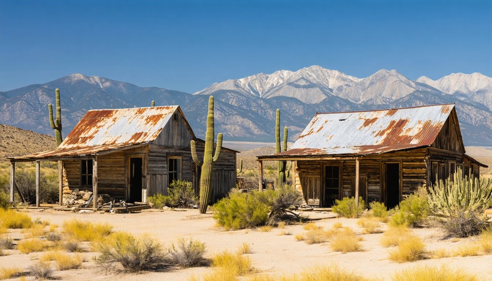
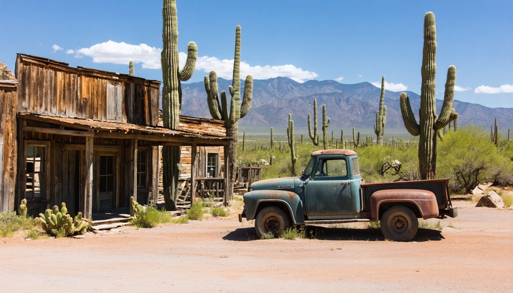
You’ll discover five fascinating ghost towns within easy driving distance of Sierra Vista, each telling a unique chapter of Arizona’s mining heritage. Fairbank served as the region’s critical railroad junction in the 1880s, while Charleston and Millville earned reputations as lawless mill towns processing Tombstone’s silver ore. Courtland boomed and busted within a decade after 1909’s copper discovery, and Gleeson’s restored jail—where prisoners were once chained to an oak tree—now stands as a museum. The complete Ghost Town Trail connects these historic settlements along an 18-mile route.
Key Takeaways
- Sierra Vista serves as an ideal base for exploring ghost towns in Cochise County, including Fairbank, Charleston, Millville, Courtland, and Gleeson.
- Fairbank was Arizona’s most critical railhead in 1881, serving as Tombstone’s primary supply gateway for silver mining operations.
- Charleston and Millville were twin mill towns that produced over $1.3 million in bullion during peak operations in 1881-1882.
- Courtland experienced a rapid copper boom starting in 1909, reaching 2,000 residents before declining by 1919 as ore was exhausted.
- The Ghost Town Trail offers an 18-mile driving route featuring five mining settlements, requiring proper vehicle preparation for mixed terrain.
Fairbank: Railroad Hub Turned Riverside Relic
Along the cottonwood-shaded banks of the San Pedro River, eight miles west of Tombstone, the settlement that became Fairbank started as a dusty crossroads called Junction City in the late 1870s.
When railroad construction arrived in 1881, you’d witness transformation into Arizona’s most critical railhead. Named for Chicago investor Nathaniel Kellogg Fairbank in 1883, this junction became where four railroads converged—connecting Tombstone’s silver wealth to national markets.
Four railroads converged at this dusty junction, transforming Fairbank into the vital commercial lifeline for Tombstone’s legendary silver mining operations.
Fairbank history centers on its railroad significance as Tombstone’s primary supply gateway, where ore wagons met steam locomotives daily. The 1900 train robbery attempt by Burt Alvord’s gang added frontier notoriety. During the shootout, lawman Jeff Davis Milton killed one bandit and wounded another while sustaining a serious arm injury. The wounded gang member, Three Fingered Jack Dunlop, later confessed before succumbing to his injuries.
Yet Tombstone’s 1886 mine flooding, devastating 1890 floods, and the 1901 Boquillas Land Company buyout eroded prosperity, leaving behind riverside ruins.
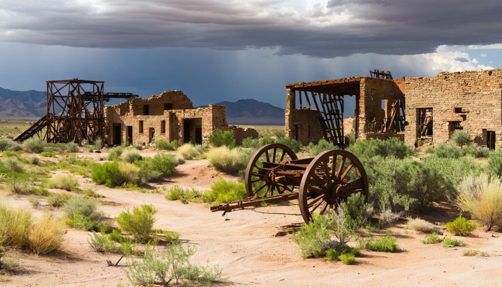
Charleston and Millville: Lawless Mill Towns of the San Pedro
About eight miles southwest of Tombstone, you’ll discover the paired ruins of Charleston and Millville, where up to six stamp mills once thundered along the San Pedro River processing Tombstone’s silver ore.
Charleston earned its reputation as “tougher and livelier than Tombstone” by serving the rough-edged mill workers who crossed the river bridge each day, while outlaw Frank Stilwell ran a saloon and the town attracted gunmen hoping to intercept shipments of refined silver bars. Remarkably, despite its lawless character, Charleston never suffered a successful robbery.
Despite Charleston’s “unenviable notoriety for diversified viciousness,” the town thrived until Tombstone’s 1886 mine flooding ended the need for riverside mills—a blow followed by the devastating 1887 Sonoran earthquake that toppled what remained. At its peak, Charleston supported over 400 residents with four restaurants, four saloons, five stores, and various services including a doctor and brewery, though notably the town never established a bank.
Twin Towns Processing Silver
When Tombstone’s silver bonanza outgrew the town’s meager water supply in the late 1870s, miners and investors turned their attention eight miles west to the San Pedro River, where reliable water flow could power the stamp mills needed to crush tons of ore.
Twin towns emerged on opposite banks—Millville housing the massive Gird and Corbin mills on the east side, Charleston serving as the residential and commercial hub on the west.
These silver processing powerhouses ran nearly around the clock, with sixteen-mule teams hauling 40,000 pounds of ore daily from Tombstone.
During peak operations in 1881-1882, the combined mills produced over $1.3 million in bullion.
Millville’s 400 residents and Charleston’s merchants, blacksmiths, and freighters built a thriving industrial corridor free from Tombstone’s constraints.
Richard Gird contracted Mormon workers to construct a critical dam in the Huachuca Mountains that collected water essential for the mill operations.
Life in Millville was tougher and livelier than even Tombstone itself, with the isolated mill town earning a reputation for lawlessness that surpassed its more famous neighbor.
Outlaws and Frontier Violence
While Tombstone earned its reputation as “the town too tough to die,” Charleston and Millville cultivated something darker—a well-deserved infamy as havens for outlaws and rustlers who found the mill towns’ isolation and lawless culture ideally suited to their enterprises.
You’ll find Charleston described in territorial records as a “nest of outlaws,” serving as an outlaw stronghold for the notorious Cochise County Cowboys. The Clanton Ranch, just five miles south, anchored this criminal network, hosting figures like Johnny Ringo, Curly Bill Brocius, and Frank Stilwell between cattle rustling operations and cross-border raids. The ranch itself had become a profitable cattle operation, with the Clantons claiming to have raised and purchased about 700 head of cattle in a single year.
Frontier violence flared regularly along the San Pedro, culminating in incidents like the 1882 murder of mining engineer M.R. Peel during a botched payroll robbery—grim reminders that Charleston’s mills processed more than silver. Nearby Fairbank witnessed its own dramatic confrontation in February 1900 when former lawmen Bill Stiles and Burt Alvord attempted to rob a Wells Fargo Express Box, only to be met by ex-Texas Ranger Jeff Milton in a gunfight that left both sides bloodied.
Ruins Along the River
Eight miles downriver from Tombstone, where the San Pedro’s perennial flow carved through mesquite bottomlands, Millville’s stamp mills rose in the late 1870s to solve a problem the silver boomtown couldn’t fix on its own—lack of water.
Charleston platted across the river as the workers’ town, surveyed into twenty-four blocks under Amos Stowe’s homestead claim.
By 1880, six stamp mills pounded ore day and night, their multi-level process crushing rock to powder for silver extraction—mill technology that demanded the river’s continuous supply.
The Gird and Corbin plants formed the industrial core, tied to river history stretching back to Hohokam petroglyphs upstream.
Mill workers faced short life spans from mercury exposure during the extraction process, operating without safety regulations as the plants ran around the clock.
When Tombstone’s mines flooded in 1886 and the 1887 earthquake shattered adobe walls, both towns emptied within three years.
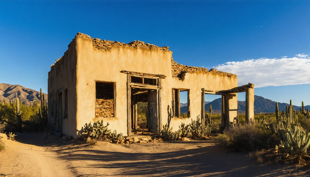
Pearce: The Commonwealth Mine’s Golden Legacy
In 1894, Cornish miner and cattleman James “Jimmy” Pearce struck pay dirt in the Sulphur Springs Valley—a discovery that would spawn one of Arizona’s richest silver camps. His Commonwealth claims assayed at $80 per ton in silver and $20 per ton in gold, attracting investors from across the U.S. and Europe.
In 1894, Jimmy Pearce’s Commonwealth claims assayed at $80 per ton in silver, drawing investors from two continents.
By 1898, a 60-stamp mill thundered beside the mine, and Pearce’s Prosperity drew 1,500 residents by 1919.
The Commonwealth produced over 1,000,000 tons of ore—roughly $8 million in silver and $2.5 million in gold—before closing in 1942. Beneath the surface, miners carved out approximately 20 miles of underground workings, creating a vast labyrinth that extracted the valley’s mineral wealth.
You’ll find Pearce’s Mining Heritage preserved in weathered buildings along dusty streets, silent witnesses to an era when monthly bullion shipments reached $100,000 and opportunity called men westward.
Courtland: Copper Boom and Rapid Bust
When prospectors traced a rich copper ore vein near Turquoise Hill in 1907–1908, they unknowingly set the clock ticking on one of Arizona’s briefest mining booms.
Courtland sprang from nothing in 1909, named after Courtland Young of the Great Western Copper Mining Company. You’d have witnessed 100 enthusiastic investors camping overnight before lot sales that February, and within weeks a post office anchored town development for 2,000 residents.
Four major companies—Great Western, Leadville, Calumet & Arizona, and Copper Queen—drove copper mining operations yielding ore graded at exceptional 7.5% Cu.
Twin railroads shuttled shipments to Douglas smelters until 1919, when shallow ore bodies exhausted themselves.
Courtland’s decade-long run proved that high-grade deposits and rapid growth guarantee nothing but spectacular collapse.
Gleeson: Turquoise, Copper, and a Legendary Jail
The town built infrastructure typical of frontier camps: school, hospital, saloon.
Fire destroyed two dozen structures in 1912, prompting rebuilds in fireproof adobe.
Jail history here began with prisoners chained to an oak tree, later replaced by wood, then concrete cells around 1910.
Today that restored concrete lockup serves as your window into hard-edged frontier justice.
The Ghost Town Trail: Your Complete Driving Route
You’ll find the Ghost Town Trail‘s most dramatic segment running 18 miles between Pearce and Courtland, where a 30-minute drive transports you through five mining settlements that once housed thousands of prospectors and families.
The route starts from Tombstone via State Route 80 to Camino San Rafael, then follows Gleeson Road for 14 miles before connecting to Ghost Town Trail—a mix of paved and dirt surfaces that demands attention to weather conditions and road quality.
Each stop reveals distinct layers of Cochise County’s mining heritage, from Pearce’s preserved main street to Courtland’s stark remains, with free access to most sites and monthly museum hours at Gleeson’s historic jail.
Pearce to Gleeson Route
Stretching roughly 15–18 miles through Southern Cochise County’s arid highlands, this unpaved segment connects three distinct chapters of Arizona’s mining saga in a single dirt-road journey.
You’ll trace Pearce history from gold-rush boomtown through Courtland’s vanished copper infrastructure to Gleeson mining camps where turquoise and copper once ruled.
The 25–30 minute drive reveals haunted mercantiles and phantom blacksmith sounds in Pearce, scattered foundations marking Courtland’s barren mid-route ruins, and Gleeson’s surviving jail museum standing guard over pioneer graves.
Each town’s lockup tells its own law-and-order story from wilder days. Commonwealth Mine fortunes built Pearce; John Gleeson’s copper strikes transformed Turquoise, Arizona into his namesake camp.
This graded-dirt corridor lets you chase ore-seam dreams at your own pace, unshackled from pavement and schedules.
Road Conditions and Access
Four distinct pavement-to-gravel shifts mark your journey into Cochise County’s ghost town backcountry, each one a threshold between modern convenience and frontier-era isolation.
The 34-mile Ghost Town Trail between Tombstone and Pearce remains passable for standard vehicles during dry conditions, though washboard surfaces test your suspension’s limits.
Road safety demands respect for Arizona’s monsoon season—flash floods transform benign washes into impassable torrents within minutes.
Vehicle preparation means more than checking tire pressure; you’ll need a full fuel tank, reliable cooling, and paper maps when digital navigation fails.
High-clearance trucks open up access to more remote sites like Mowry, where rutted tracks wind through mesquite thickets.
The “Stupid Motorist” law isn’t folklore—it’s a real fine for crossing flooded washes, reminding travelers that freedom requires wisdom.
What to See Where
Your wheels meet pavement again at Tombstone, the logical starting point for a 45-mile clockwise loop that strings together five ghost towns like beads on a timeline of Cochise County’s boom-and-bust legacy.
Fairbank greets you first with its 1881 railroad station, post office, and saloon—structures that whisper local legends through weathered walls. The schoolhouse-turned-museum reveals historical significance you’ll actually remember.
Continue to Gleeson, Courtland, and Pearce, where James Pearce’s 1894 gold discovery sparked the Commonwealth Mine. Millville rounds out your journey through riparian corridors and grasslands framed by mountain vistas.
Each stop offers self-guided exploration without rangers hovering over your shoulder—just you, crumbling foundations, and the freedom to interpret what remains of Arizona’s mining frontier.
Planning Your Ghost Town Adventure From Sierra Vista
Sierra Vista’s position at the edge of Cochise County’s mining frontier makes it an ideal base camp for exploring a network of ghost towns that chronicle southern Arizona’s boom-and-bust cycles from the 1880s through the 1920s.
Your ghost town exploration begins with route planning: cluster Fairbank, Charleston, and Millville along the San Pedro corridor for a full day, or dedicate separate time to the Pearce–Courtland–Gleeson loop northeast via US-191.
Budget 1–2 hours per site for walking, photography, and reading interpretive panels. Cooler months—late fall through early spring—offer the best conditions for multi-stop tours.
Historic preservation rules require staying on marked paths at BLM-managed Fairbank; respect private-land boundaries at Courtland and Gleeson. Friends of the San Pedro River lead periodic guided hikes, revealing hard-to-find Charleston and Millville ruins.
Frequently Asked Questions
Are Pets Allowed When Visiting Ghost Towns Near Sierra Vista?
Yes, you’ll find most ghost towns welcome leashed pets under BLM pet regulations, especially at Fairbank Historic Townsite. Check individual site pet friendly accommodations beforehand, since private mining lands occasionally restrict access for wildlife protection.
What Cell Phone Coverage Can I Expect in Remote Ghost Town Areas?
You’ll find cell service spotty to nonexistent—network reliability drops sharply beyond Sierra Vista’s towers. Verizon and AT&T work best on ridgelines, but expect dead zones in canyons where miners once worked freely without modern connectivity.
Can I Use Metal Detectors at Ghost Town Sites?
Metal detecting’s absolutely forbidden at most historic ghost town sites—you’ll need permission first. Respect metal detecting etiquette by checking regulations with land managers. Follow treasure hunting tips: always ask before sweeping, honoring our shared heritage.
Are Any Ghost Towns Wheelchair Accessible for Visitors With Mobility Limitations?
Fairbank Historic Townsite offers the best wheelchair accessibility among area ghost towns, though mobility limitations will restrict you to the restored schoolhouse and nearby paths—most ruins require walking uneven dirt trails through history.
Do I Need Special Permits to Photograph Ghost Town Structures?
You’ll need historical permissions and follow photography regulations depending on land status—personal snapshots on public sites like Fairbank are free, but commercial work requires permits, and private ghost towns demand advance authorization.
References
- https://www.arizonahighways.com/article/arizona-ghost-towns
- https://www.visittucson.org/blog/post/8-ghost-towns-of-southern-arizona/
- https://www.visitarizona.com/like-a-local/4-arizona-ghost-towns-you-may-have-never-heard-of
- https://southernarizonaguide.com/ghost-towns-southern-arizona/
- https://www.americansouthwest.net/ghost-towns.html
- https://www.explorecochise.com/ghost-towns/
- https://www.tripadvisor.com/Attraction_Review-g60778-d108693-Reviews-Fairbank_Historic_Townsite-Hereford_Arizona.html
- https://en.wikipedia.org/wiki/Charleston
- https://www.legendsofamerica.com/az-fairbank/
- https://winfirst.wixsite.com/arizonamininghistory/copy-of-clifton


