You’ll discover ghost towns like Mock, Rodna, and Sherman scattered across Spokane County’s agricultural hinterland, all within a two-hour drive. These settlements thrived from the 1890s through the 1930s as railroad hubs and farming outposts before economic shifts, droughts, and mechanization rendered them obsolete. Today, you can explore crumbling post office foundations, weathered schoolhouses, and cemetery headstones reclaimed by prairie grass. Below, you’ll find detailed histories, exact locations, and essential safety guidelines for visiting these vanished communities.
Key Takeaways
- Mock and Rodna were agricultural settlements in Spokane County that existed from the 1890s-1930s, serving dryland farmers and homesteaders.
- Sherman features a surviving old schoolhouse, one of the region’s most significant historical landmarks from its ghost town past.
- Nighthawk offers remnants of mining life, while towns like Elberton share similar agricultural decline patterns with neighboring communities.
- Railroad expansion by Great Northern and Oregon Railway shaped town development, with settlements thriving along tracks until economic shifts occurred.
- Foundation stones, cemetery headstones, and scattered artifacts mark former settlement sites, though prairie has reclaimed most physical structures.
Mock: A Vanished Settlement in Spokane County
Though barely a trace remains on today’s maps, Mock once occupied a corner of Spokane County‘s agricultural hinterland as a modest rural settlement serving the dryland farmers and homesteaders who carved out livelihoods in the region’s eastern reaches.
Active roughly between the 1890s and 1930s, this Mock settlement functioned as a small crossroads node—likely no more than a store, warehouse, or rail siding—where grain wagons converged before the long haul to Spokane’s markets.
Mock served as a humble gathering point where farmers brought their harvest before the journey to distant Spokane grain markets.
Farm consolidation and mechanization rendered such tiny service points obsolete, and Mock joined the ranks of vanished communities absorbed back into the rolling wheat fields.
Today, only historic plat maps and land records preserve its name, a quiet reflection of eastern Washington’s shifting rural economy. Unlike Mock, the Spokane ghost town near Custer was founded in 1890 following a significant mine discovery that would shape its early prosperity. The surrounding hills contained rich deposits of minerals including gold, silver, copper, zinc, mica, and graphite that fueled the town’s development.
Rodna: From Post Office to Prairie Ruins
You’ll find Rodna’s entire documented life span compressed into the nineteen years between its 1912 post office opening and 1931 closure, a brief window that captures both the hope of early dryland settlement and the harsh reality of farming the Channeled Scablands.
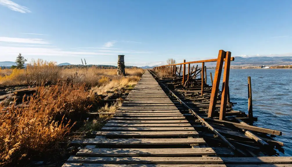
The railroad line that once carried mail and grain shipments through this southeastern Spokane County prairie now shares the landscape with basalt outcrops and sagebrush, the town itself reduced to scattered ruins across terrain that never supported intensive agriculture. Unlike the Spokane ghost town founded in 1890 for mining silver, Rodna never developed an industrial base beyond agricultural commerce.
What remains today offers almost no physical trace of the community—just archival records and a name attached to empty scabland, marking where marginal economics and thin soils erased a settlement before the Great Depression ended. The Spokane Mine operations had peaked until the 1940s when ore deposits were finally exhausted, outlasting Rodna’s agricultural experiment by more than a decade.
1912–1931: Rodna’s Active Years
Between 1912 and 1931, Rodna functioned as a modest service point in southeastern Spokane County’s scabland prairie, its official existence anchored by the post office that opened in the settlement’s founding year.
You’ll find Rodna’s history documented primarily through postal records and railroad maps—archival evidence of a hamlet that served dryland farmers working marginal basalt terrain. The rail siding handled outbound wheat and inbound supplies while the post office likely doubled as a mercantile, creating community dynamics typical of Channeled Scablands settlements.
Wagon roads radiated from this small cluster of buildings to surrounding homesteads, linking isolated families to mail, staples, and markets. Like Almota in Whitman County, whose post office operated from 1878 to 1961, Rodna’s postal service marked the lifespan of the community itself.
Agricultural Decline and Abandonment
When Rodna’s post office closed in 1931, it signaled the settlement’s functional death rather than a sudden collapse—the prairie hamlet had already been contracting as dryland wheat economics shifted against marginal scabland homesteads.
Rodna’s decline accelerated through the Depression as farmers abandoned properties that couldn’t sustain operations without rail access or irrigation infrastructure.
The agricultural impacts were brutal: thin topsoil and unpredictable rainfall made these eastern Washington holdings vulnerable to market fluctuations that better-positioned farms could weather.
By the late 1930s, whatever remained of Rodna had reverted to open rangeland.
Similar catastrophic events struck neighboring Elberton, where a fire in 1908 devastated the community and precipitated its eventual abandonment.
You’ll find no commemorative markers where the community once gathered—just wind-scrubbed prairie reclaiming what brief settlement had interrupted, the landscape indifferent to human aspirations that proved incompatible with its harsh realities.
What Remains Today
Today’s Rodna site reveals itself through absence rather than presence—scattered foundation stones and deteriorated building remnants barely interrupt the prairie grasses that have reclaimed what homesteaders briefly cultivated.
You’ll find the cemetery’s weathered headstones offering the clearest evidence of settlement, their inscriptions documenting families who called this place home between 1912 and 1931.
The post office building’s crumbling foundation marks where administrative functions once centered community life.
Archaeological findings include scattered domestic artifacts and traceable infrastructure pathways beneath vegetation cover.
While railroad corridors and road networks remain identifiable through landscape features, nearly a century of weather has erased most physical structures.
Rodna’s historical significance lies precisely in this transformation—documenting how quickly prairie reclaims territory when economic forces shift elsewhere.
Similar to Govan’s historic schoolhouse closed in the 1940s, Rodna’s educational structures have also succumbed to time and the elements.
The exploration experience reveals remnants that provide insight into former life, though caution remains warranted due to potential hazards like snakes that inhabit the overgrown areas.
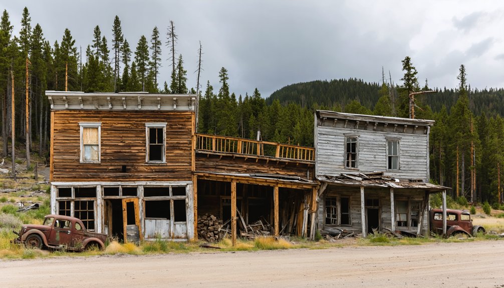
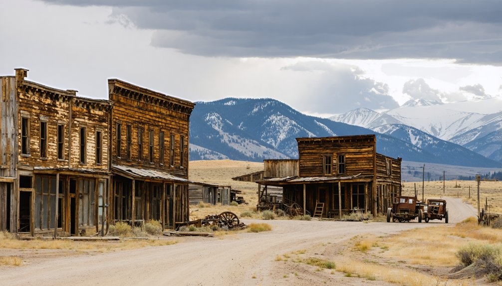
Sherman: A Preserved Snapshot of Homesteading History
Rising from the wheat fields of Lincoln County about fifteen minutes northeast of Govan, Sherman stands as one of eastern Washington’s most atmospheric ghost towns—a place where homesteading history hasn’t vanished but crystallized.
You’ll find a white country church still presiding over the landscape, its steeple pointing skyward above scattered foundations and the cemetery where Civil War veterans and their families rest.
The historical significance runs deeper than architecture—this wasn’t a mining camp but a genuine farming settlement born from 1880s–1890s federal homestead policies.
Community resilience shows in what survives: families who endured the brutal winter of 1889, survived on potatoes and salt, and built institutions that outlasted the town itself.
Behind the church, generations of families lie buried together in a cemetery overlooking the rolling farmland their ancestors worked.
The old schoolhouse remains a testament to the community’s commitment to education, standing as one of the town’s most significant surviving structures.
Sherman preserves that hard-won legacy in wood, stone, and memory.
Railroad Expansion and the Birth of Eastern Washington Towns
Settlement patterns followed the tracks with geometric precision.
James J. Hill’s Great Northern and Edward Harriman’s Oregon Railway & Navigation Company fought for dominance, and each new line spawned towns.
You’ll find these communities clustered along junctions and sidings where warehouses, hotels, and storefronts materialized almost overnight.
The Spokane and Inland Empire interurban extended this network further, electrifying connections to the Palouse.
Communities off these iron arteries withered; those alongside them thrived—until they didn’t.
Agricultural Booms and Busts That Shaped the Region
You’ll find that the wheat bonanzas of the late 1800s populated Eastern Washington’s plateaus with homesteaders who plowed the Palouse and Big Bend country using dryland farming techniques, shipping grain by wagon and steamboat before rail lines arrived.
By 1900 Washington exported roughly 70% of its wheat overseas, tying small farm towns near Spokane directly to volatile international markets and price swings.
When commodity crashes, droughts, and soil depletion hit, those same rail-dependent settlements couldn’t sustain their populations—leading to the farm consolidations and abandoned grain elevators you’ll see scattered across the landscape today.
Wheat and Homesteading Era
Between 1880 and 1915, wheat transformed the landscape around Spokane as homesteaders plowed millions of acres across the Columbia Plateau, Palouse, and Big Bend districts.
You’ll find that dryland-farming techniques and the Homestead Act opened marginal lands to families who staked 160- to 320-acre claims, betting everything on a single annual crop. Wheat cultivation flourished when prices climbed and rainfall cooperated, spawning dozens of service towns around grain elevators and implement dealers.
Yet homesteading challenges proved brutal. Debt-financed equipment, variable precipitation, and thin soils left little margin for error.
When drought struck in the 1910s and post-war prices collapsed, foreclosures emptied entire districts. Farms reverted to sagebrush, banks shuttered, and the towns that had served those wheat fields became ghosts.
Railroad Access and Decline
When Northern Pacific rails reached Spokane in 1881, they set in motion an economic transformation that would scatter ghost towns across the Columbia Plateau for the next fifty years.
You’ll find this railroad legacy embedded in every abandoned settlement—the Great Northern’s 1891 arrival and the Spokane, Portland & Seattle’s 1907 Columbia River route created booming freight hubs for mining and agriculture. These towns thrived as railway junction points, hauling Coeur d’Alene minerals and Inland Northwest wheat to coastal markets.
But economic shifts proved unforgiving. The 1929 crash devastated operations. Automobiles killed passenger service by the 1930s. Branch lines closed throughout the 1960s-70s.
When the rails stopped, communities vanished—their brick warehouses and wooden depots now standing as monuments to forgotten prosperity.
Why These Communities Lost Their Residents
As you explore the weathered foundations and overgrown streets of ghost towns scattered across the Spokane region, the reasons behind their abandonment reveal a convergence of economic, technological, and demographic forces that reshaped eastern Washington throughout the twentieth century.
Economic factors like agricultural mechanization, farm consolidation, and falling metal prices eliminated jobs in farming communities and mining camps.
When machines replaced hands and ore prices collapsed, entire towns built on farming and mining lost their reason to exist.
Transportation shifts proved equally devastating—Highway 2 bypassed trackside settlements, while improved automobiles let residents shop in Spokane rather than supporting local merchants.
Rail closures severed freight connections that once sustained isolated towns.
Meanwhile, younger generations migrated to urban centers, school consolidations removed community anchors, and volatile commodity markets triggered foreclosures.
These communities couldn’t adapt when their single economic purpose vanished.
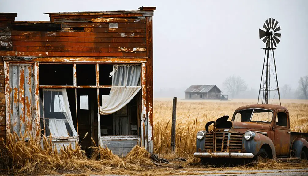
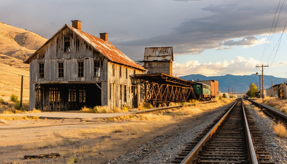
What Remains: Structures and Landmarks You Can Still See
The physical remnants of these abandoned settlements tell stories their former residents can no longer share.
You’ll discover abandoned architecture throughout Spokane’s ghost town, from the dual-purpose schoolhouse-church with its sheltered entryway to the concrete mine office foundation. The manager’s house once stood amid boilers, shaft-houses, and water towers.
At Sherman, 15 minutes northeast of Govan, you can explore a church, cemetery, and schoolhouse across wide-open terrain.
Nighthawk preserves its 1903 hotel, original schoolhouse, and mining office—testament to Washington’s oldest mining districts. The historical significance extends beyond structures: scattered glory holes, mill foundations, and James Shepard’s 1908 grave marker reveal the harsh realities of frontier mining life.
Recent fencing protects remaining buildings from further deterioration.
Planning Your Ghost Town Road Trip From Spokane

Careful preparation transforms a ghost town excursion from Spokane into a rewarding journey through eastern Washington’s forgotten communities.
Thorough planning turns your Spokane departure into an unforgettable exploration of eastern Washington’s abandoned frontier settlements.
Stock up on fuel, water, and supplies in Spokane before venturing into sparsely populated counties where services disappear for 60–120 miles. Download offline maps—cell coverage vanishes quickly along Highway 2 and remote Okanogan routes. Carry printed atlases and topographic maps for hike-in sites like Monte Cristo and Franklin.
Plan your route by clustering towns geographically: Lincoln County’s Sherman pairs well with Highway 2 loops, while Okanogan’s Molson demands a dedicated northern excursion.
Visit local historical societies for updated road conditions and historical research materials that enhance ghost town photography. Schedule trips between late spring and early fall to avoid snow closures in higher elevations, and always keep backup navigation tools ready.
Photography and Exploration Tips for Abandoned Sites
Documenting eastern Washington’s ghost towns requires matching your photographic approach to the high-desert geography and weathered architecture unique to these abandoned homestead and mining communities.
You’ll capture the most compelling images during golden hour when low sun accentuates wood grain and peeling paint, while overcast conditions reduce harsh contrast between pale grasslands and dark structures.
For ghost town photography, shoot RAW and bracket exposures to handle extreme dynamic range between bright skies and shadowed interiors.
Essential abandoned site exploration practices:
- Test floor stability visually before entering—look for sagging joists, water damage, and missing boards in century-old buildings
- Pack wide-angle and telephoto lenses to document both sweeping townscapes and architectural details like rusted signage and mining equipment
- Avoid open wells, loose railings, and unstable stairs common in deteriorated homesteads
Respecting Private Property and Staying Safe While Visiting
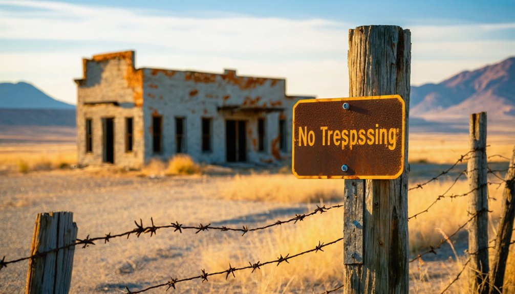
Essential safety precautions include avoiding entry into fenced structures with rotting floors, unmarked mine shafts, and collapsing roofs.
Stay clear of fenced areas—rotting floors, hidden mine shafts, and unstable roofs pose serious dangers to explorers.
Eastern Washington’s open terrain near Highway 2 offers limited services and emergency access, while summer wildfire closures frequently restrict travel.
Rattlesnakes, rusted debris, and extreme weather add risk.
Respecting restrictions preserves continued access; repeated violations trigger broader closures by landowners and agencies managing these fragile historic remnants.
Frequently Asked Questions
Are Any Ghost Towns Near Spokane Located on Public Land?
You’ll find most ghost towns near Spokane sit on private land, though roadside access along Highway 2 lets you photograph Govan’s abandoned structures from public right-of-way, preserving their historical significance without formal recreation designation.
Exploring historic sites near Vancouver Washington offers a different experience, where public access permits visitors to appreciate the remnants of early settlements and Native American heritage. With numerous trails and interpretive signs, you can delve deeper into the area’s storied past, making it an enriching day trip. Don’t forget to visit the local museums to gain further insights into the region’s history and cultural significance.
Can I Camp Overnight Near Sherman or Other Ghost Towns?
You’ll need to research specific camping regulations for each ghost town’s location, as most lack amenities and sit on private property. Public lands near historic sites sometimes permit dispersed camping, but you must verify current land ownership and local restrictions first.
Which Ghost Town Is Closest to Downtown Spokane by Driving Time?
Though precise records are scarce, Mock in Spokane County appears to be the closest ghost town by driving distance—likely under an hour from downtown. You’ll need county archives to pinpoint its exact location and confirm road access.
Do Any Ghost Towns Near Spokane Have Guided Tours Available?
No, ghost towns near Spokane don’t offer regular guided tours. You’ll explore independently, discovering historical significance and local legends through self-guided visits, interpretive signs, and occasional field trips organized by historical societies on limited dates.
What Is the Best Season to Visit Ghost Towns Near Spokane?
Late spring through early fall offers you perfect exploration conditions. Weather considerations like dry roads and comfortable temperatures make May–October ideal, while seasonal activities expand as volunteer-staffed museums open Memorial Day weekend through Labor Day.
References
- https://en.wikipedia.org/wiki/List_of_ghost_towns_in_Washington
- https://stateofwatourism.com/ghost-towns-of-washington-state/
- https://www.blackhillshikingbikingandmore.com/spokane-ghost-town
- https://www.cascadeloop.com/ghost-towns-and-haunted-places-in-the-washington-cascades
- https://www.southdakotamagazine.com/a-ghost-town-called-spokane
- https://www.youtube.com/watch?v=NUjJ2DaEv3Y
- https://dustinquasney.com/spokane-ghost-town/
- https://en.wikipedia.org/wiki/Rodna
- https://blackhillsatvdestinations.com/spokane-ghost-town/
- https://washingtonstate.fandom.com/wiki/Rodna