You’ll find over a dozen authentic ghost towns within 90 miles of Sun Valley, remnants of Idaho’s 1860s–1900s gold and silver rushes. Custer offers partially restored boardwalks and cabins from its 600-resident peak, while Bayhorse preserves a three-story stamp mill that processed $10 million in ore. Bonanza, Vienna, and Leesburg feature standing structures, mining equipment, and pioneer cemeteries at elevations reaching 8,700 feet. Most sites remain accessible late May through October via gravel roads through Sawtooth National Recreation Area, where detailed planning reveals the full scope of this mining corridor.
Key Takeaways
- Custer, Bonanza, and Bayhorse are the closest ghost towns, featuring preserved wooden structures, mills, and mining equipment from the 1870s-1890s gold rush.
- The Custer Motorway Adventure Road connects multiple ghost towns and includes the Yankee Fork Gold Dredge with interpretive exhibits on mining history.
- Bayhorse features well-preserved industrial infrastructure including a three-story stamp mill, Wells Fargo building, and charcoal kilns from ore-processing operations.
- Stanley serves as the main staging hub for ghost town day trips, offering access to multiple sites within Sawtooth National Recreation Area.
- Visit late May through October on gravel roads; bring offline maps and fuel due to remote locations without cell coverage.
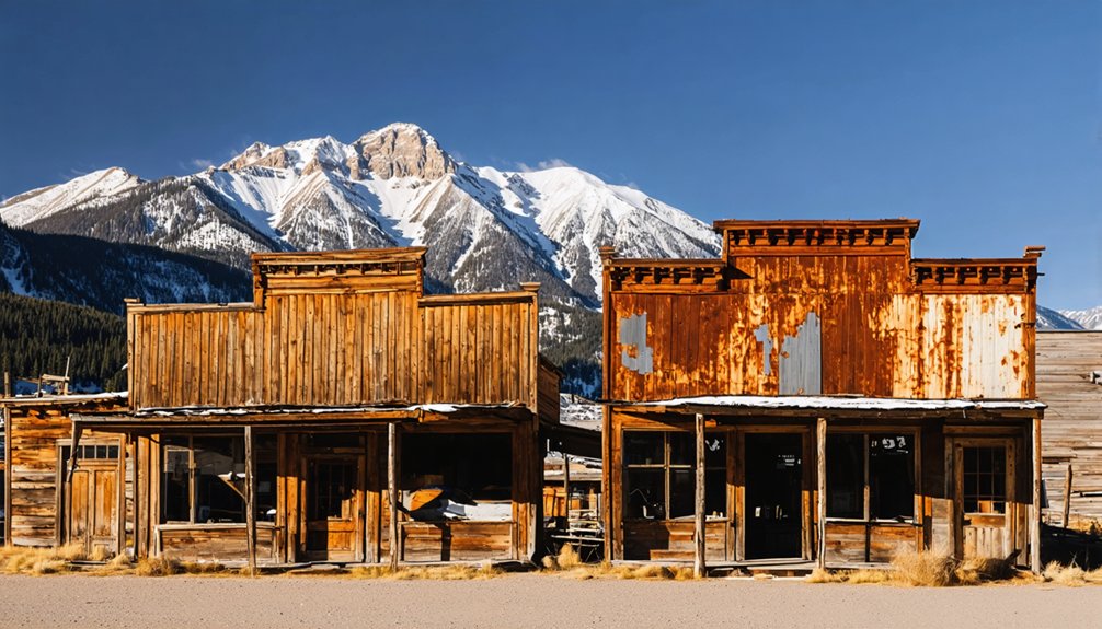
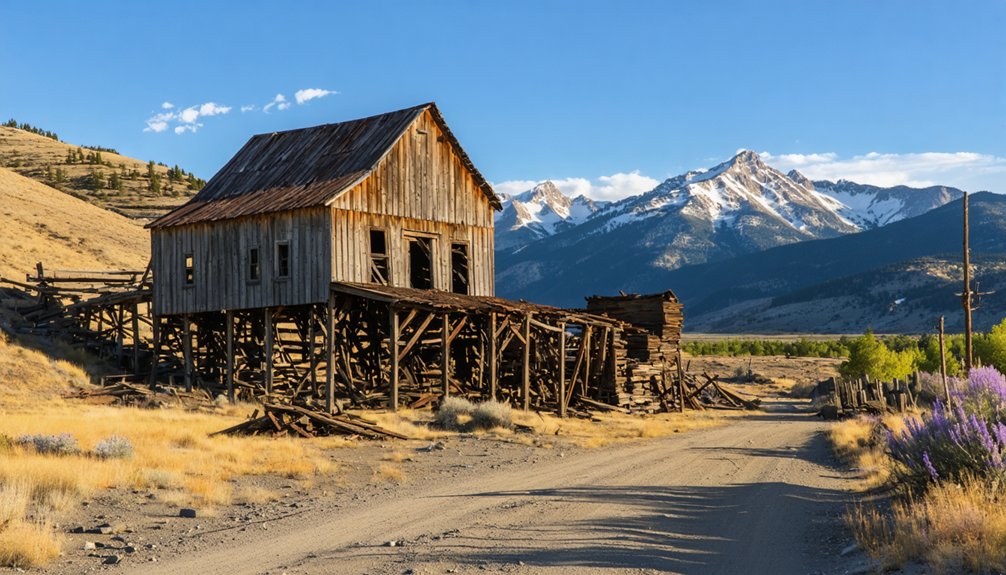
Custer: A Partially Restored Mining Hub Along Yankee Fork
When prospectors struck gold along Yankee Fork in early 1879, they founded Custer two miles north of Bonanza and named it after General George Armstrong Custer, whose name already graced a major mining claim discovered in 1876.
The one-street settlement quickly grew into a hub supporting the General Custer, Lucky Boy, and Black mines. By 1896, six hundred residents filled the town stretching from the General Custer Mill down to Chinatown, where Chinese workers lived and worked.
By 1896, six hundred residents called Custer home, their lives stretching from the mill to Chinatown along a single bustling street.
Custer history shows a complete mining community with saloons, hotels, a schoolhouse, and Miners Union Hall. The closure of the Lucky Boy Mine and General Custer Mill in 1904 marked the beginning of Custer’s decline, with the population dwindling to just twelve families by 1910.
Mining heritage preservation began when Challis National Forest acquired the site in 1966. Listed on the National Register in 1981, seven principal buildings now stand as monuments to Yankee Fork’s gold rush era. In 1990, Custer became the focus of the Yankee Fork Historic Area.
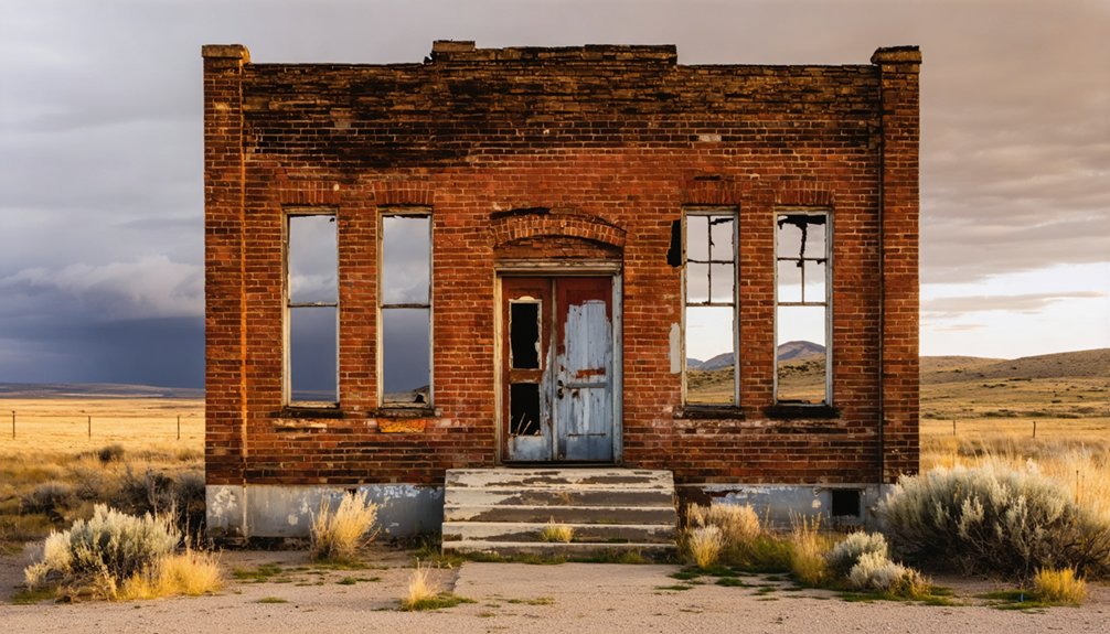
Bonanza: Privately Owned Ruins at 6,375 Feet
Two miles south of Custer, Bonanza staked its claim to Yankee Fork history in 1876–1877 when prospectors discovered the General Custer Mine and platted a townsite in the narrow river valley.
Promoter Charles Franklin sold lots for $40–$300, drawing over 600 residents by 1881 who built more than 100 businesses, a school, and tree-lined streets at 6,375 feet elevation.
Bonanza’s mining significance centered on servicing nearby Lucky Boy, Black, and General Custer operations rather than hosting mills. The 1879 toll road to Challis opened freight access across 80+ rugged miles.
Fires in 1889 and 1897 destroyed commercial blocks, driving residents to Custer and reducing population to 136 by 1890. The original buildings were destroyed in these fires, with only later structures remaining among the scattered ruins.
Like other ghost towns in the region, Bonanza stands as a historical remnant of the Wood River Valley’s mining booms during the 1880s-1890s when population numbers exceeded those of today.
Today you’ll find privately owned ruins marking where this high-elevation camp once thrived.
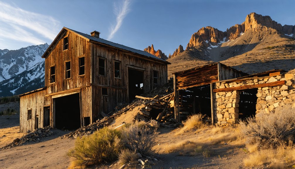
Bayhorse: Best-Preserved Silver Mill Site in the West
You’ll find Bayhorse’s industrial infrastructure remarkably intact compared to most Western ghost towns, with the Wells Fargo stone building still serving as one of the site’s best-preserved structures where silver bullion once awaited secure transport.
Beyond the townsite, several charcoal kilns represent some of Idaho’s finest surviving examples of this essential ore-processing technology.
The mill building itself stands complete despite missing its original machinery, while outdoor displays throughout the state park showcase authentic mining equipment that processed over $10 million in precious metals between 1877 and 1915.
The town reached its peak during the 1880s and 1890s, when approximately 300 residents supported a thriving community complete with saloons, boarding houses, and banks.
Mining operations continued at Bayhorse until 1925, long after the smelter’s closure in 1889.
Standing Stone Industrial Ruins
The three-story stamp mill rising against Bayhorse’s canyon wall stands as the most visually dominant industrial ruin in the district and ranks among the best-preserved historic silver mill sites in the interior West.
Built in 1882 with heavy timber framing and local stone masonry, you’ll find this gravity-fed mill stepping down the steep slope through successive crushing levels. The structure served the Ramshorn Mine and neighboring operations, processing over 30 tons daily at its 1880s peak when 200 men worked the district.
Industrial archaeology reveals 1920s flotation-process modifications beneath the surviving rooflines and board-and-batten siding. The mill infrastructure supported a community that reached approximately 400 residents during Bayhorse’s height as a mining hub. The mill’s gravity-fed design allowed rocks to be processed efficiently through multiple levels without additional mechanical power.
Today’s Land of the Yankee Fork State Park interprets these stabilized ruins as physical evidence of Idaho’s shift from small-scale prospecting to mechanized mining, making historical preservation tangible for visitors exploring mining-era freedom.
Charcoal Kilns and Equipment
Within two years of completing the 1880 smelter, Bayhorse’s mining companies constructed beehive charcoal kilns that employed forty-eight men to produce 80,000 bushels annually—fuel essential for processing the district’s lead and silver ore through local facilities rather than shipping to Salt Lake City.
These historical kiln designs represented self-sufficient operations that freed the district from external dependencies.
Charcoal production techniques sustained the smelter until 1885, when available coke from Ketchum rendered the kilns obsolete.
Workers abandoned these beehive structures by 1896 as mining declined.
You’ll find the kilns stood as evidence of miners’ determination to control their own processing capabilities, eliminating costly transportation and maintaining operational independence—values that defined remote Western mining communities seeking economic autonomy.
A tram system connected nearby operations like Skylark and Rams Horn mines, transporting ore to Bayhorse for processing through the district’s integrated infrastructure.
The Bayhorse Silver Mine, a past producing mine that remains operational today, contains a known mineralized zone stretching approximately 840 feet long.
Vienna and Sawtooth City: Backcountry Remnants Near the Salmon Headwaters
Deep in the backcountry near the headwaters of the Salmon River, Vienna and Sawtooth City emerged as twin mining camps after Levi Smiley’s prospecting party struck rich ore in May 1879.
Vienna history shows it became the Stanley Basin’s largest town, boasting over 200 buildings and a 20-stamp mill producing $40,000–$50,000 monthly by 1883.
Sawtooth City, eight miles away in Beaver Canyon, formally organized on November 29, 1879.
The camps featured:
- Vienna’s population reaching 800+ with newspapers, assay offices, and eastern capital investment
- Sawtooth City’s 600 residents supported by hotels, saloons, and the productive Pilgrim mine
- Combined district output around $250,000 before the 1892 Silver King mine fire
- Complete abandonment by 1900, leaving only scattered foundations and one deteriorated cabin
Muldoon, Galena, and the Forgotten Smelter Towns of Wood River Valley
While Vienna and Sawtooth City extracted wealth from the Stanley Basin’s remote headwaters, a parallel mining boom transformed the Wood River Valley into an industrial corridor of smelter towns that processed ore from dozens of silver and lead claims scattered across the region.
Muldoon history traces to 1881, when two 40-ton smelters and 23 charcoal kilns processed ore for 1,500 residents before collapsing at the 1887 sheriff’s auction.
Galena significance stems from David Ketchum’s early development in the 1870s–1880s, establishing one of the region’s first major mines along present-day Highway 75.
By 1893, contemporaries declared Wood River “deader than a lime fossil,” abandoning Muldoon, Galena, Broadford, Doniphan, Bolton, Bullion, and Gimlet.
You’ll find black slag piles and crumbling kiln walls marking these forgotten industrial centers.
Leesburg, Gibbonsville, and the Lemhi County Ghost Town Corridor
Beyond the Wood River Valley’s industrial smelter sites, Lemhi County’s eastern mountains harbor a distinct cluster of gold rush settlements that flourished during Idaho’s territorial period.
Leesburg’s ghost town history began with an 1866 strike along Napias Creek, where 7,000 prospectors extracted an estimated $40 million in gold. Confederate veterans named the settlement after General Robert E. Lee, establishing:
- 400+ miles of mining ditches channeling water for placer operations
- Stamp mills and main street infrastructure supporting peak populations
- Chinese mining camps continuing hand-tool extraction into the 1930s
- Weathered cabins and cemetery remains preserved since 1870s abandonment
Warren, Gilmore, and Nicholia complete this mining legacy corridor, where you’ll find authentic territorial-era structures documenting Idaho’s independent extraction economy.
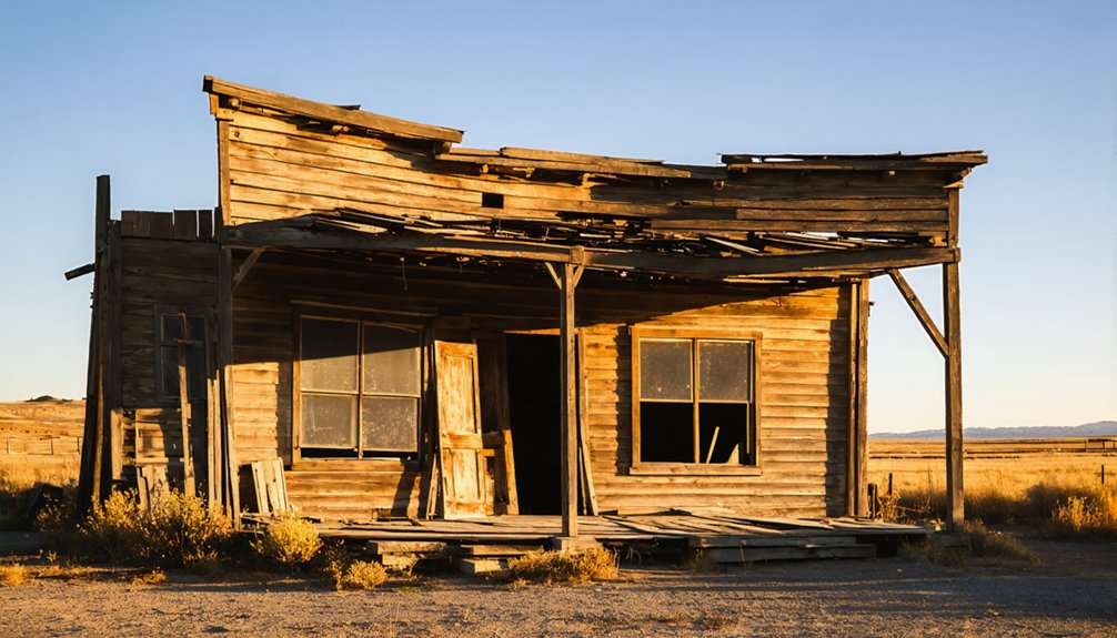
What to Expect: Cabins, Cemeteries, and Mining Relics
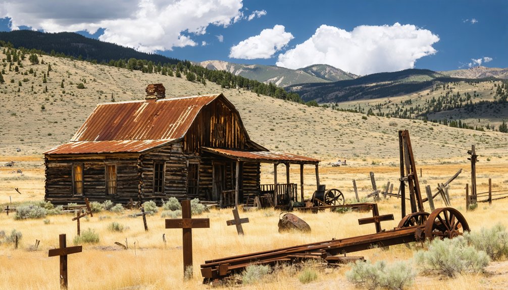
Three categories of physical remains define the Sun Valley ghost town experience: standing timber structures, scattered industrial machinery, and pioneer burial grounds that collectively document the region’s 1860s–1920s extraction economy.
Sun Valley’s ghost towns preserve three layers of mining-era evidence: decaying buildings, industrial relics, and frontier graveyards spanning six decades of Western expansion.
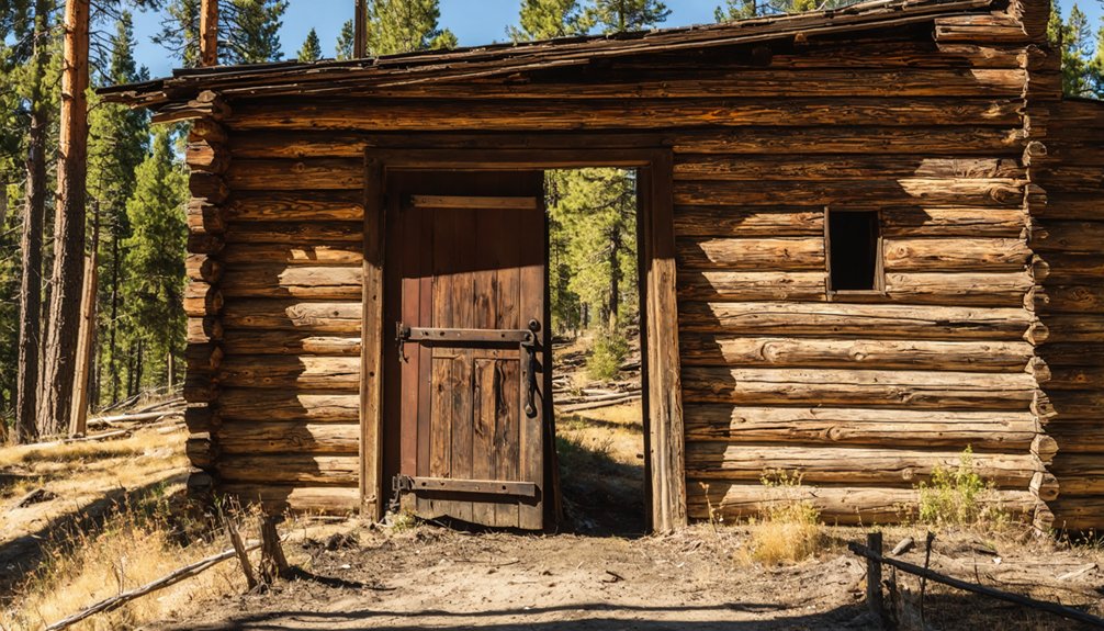
You’ll encounter log cabins, former saloons, and boarding houses in varying states of collapse—freeze–thaw cycles and rot leave most as partial walls rather than intact buildings.
Hillsides reveal abandoned mine adits, tailings piles, and rusted stamp-mill equipment marking silver and gold operations. Wagon roads still scar slopes where ore once traveled to processing sites.
Pioneer cemeteries offer stark historical significance: wooden markers tilt among unmarked graves, records incomplete, burial extents exceeding visible fences.
These “Boot Hills” often hold epidemic victims and violent deaths—fertile ground for local ghost stories. Expect adaptive reuse too; modern lodges sometimes occupy original townsites, blending contemporary use with historic footprints.
Planning Your Visit: Roads, Seasons, and Site Protection
Reaching these remote historic sites demands careful preparation because access roads vary from maintained gravel to primitive tracks that deteriorate quickly after storms.
Road conditions around Custer, Bonanza, and Bayhorse shift dramatically with weather, requiring high-clearance vehicles and sometimes 4WD. Seasonal access typically limits visits to late May through October, when snow clears from high-elevation passes and forest routes.
Essential planning considerations:
- Timing – Guided tours and open buildings operate only during summer months; shoulder seasons offer solitude but closed facilities.
- Navigation – Cell coverage disappears in canyons; carry offline maps and full fuel from Ketchum or Stanley.
- Regulations – Most sites sit within Sawtooth National Recreation Area and Salmon–Challis National Forest; stay on designated paths and leave artifacts untouched.
- Hazards – Wildlife, afternoon thunderstorms, and unpredictable road washouts require flexibility and emergency supplies.
Day Trips and Scenic Byways From Sun Valley
When you leave the Sun Valley basin for the high backcountry, the Custer Motorway Adventure Road becomes the primary corridor into the region’s ghost town country.
This historic stage route connects Custer and Bonanza ghost towns with the Yankee Fork Gold Dredge, following gravel segments through lodgepole forest and river canyons. You’ll find interpretive exhibits at the Land of the Yankee Fork State Park detailing gold-rush technology and homesteading patterns.
Combine scenic routes over Galena Summit into Sawtooth Valley with Stanley as your staging hub.
Day trips reach Indian Rock Shelter, early Forest Service stations, and walking tours through Ketchum, Hailey, and Challis. Shorter drives access Bullion, Sawtooth City, Vienna, and Boulder City—high-elevation camps illustrating boom-and-bust mining cycles.
Ghost town exploration pairs alpine overlooks with open-air museum experiences across Central Idaho’s hills.
Frequently Asked Questions
Are Any Ghost Towns Near Sun Valley Wheelchair Accessible?
Custer Ghost Town offers the best wheelchair accessibility among area sites, with accessible bathrooms and most museum buildings featuring ramps. You’ll find historical significance preserved through restored structures, though dirt streets remain challenging in wet conditions.
Can I Camp Overnight at Ghost Town Sites?
Unlike frontier prospectors pitching tents anywhere, you can’t camp inside ghost towns near Sun Valley. Camping regulations restrict overnight stays within historic sites, but ghost town amenities include nearby forest dispersed camping and designated campgrounds outside building areas.
Do Cell Phones Work at These Remote Ghost Towns?
You’ll rarely find reliable cell service at remote ghost towns near Sun Valley. Steep canyon topography blocks signals, creating severe connectivity issues even a few miles from Highway 75’s tower coverage along populated valleys.
Are Guided Tours Available Year-Round or Only in Summer?
Don’t count your chickens—guided tour options exist only during summer months at Custer Ghost Town, with buildings boarded up by September. Most nearby sites offer self-guided exploration, reflecting seasonal availability tied to mountain weather and road conditions.
Which Ghost Town Is Closest Driving Distance From Sun Valley?
Galena’s your closest ghost town, sitting just 23–26 miles north on ID-75. You’ll find minimal remains at this historical silver-mining site near Galena Summit, making it the quickest drive despite limited structures surviving today.
References
- https://idaho-forged.com/idahos-ghost-towns-eerie-yet-approachable/
- https://www.thegoldminehotel.com/ghost-towns-and-haunted-places-in-idaho
- https://history.idaho.gov/wp-content/uploads/2018/08/0064.pdf
- https://www.tripadvisor.com/Attraction_Review-g28933-d1775240-Reviews-Bonanza_and_Custer_Ghost_Town-Idaho.html
- https://visitsunvalley.com/why-sun-valley-is-the-original-mountain-town/
- https://visitidaho.org/things-to-do/ghost-towns-mining-history/
- https://en.wikipedia.org/wiki/List_of_ghost_towns_in_Idaho
- https://www.legendsofamerica.com/id-bonanzacuster/
- https://www.deseret.com/1998/6/28/19388263/the-ghost-towns-of-yankee-fork/
- https://www.wanderingidahoan.com/adventures/custer-city-ghost-town