You’ll discover Wickahoney’s volcanic-rock ruins just south in Owyhee County—an 1895 stage stop that linked Mountain Home to Nevada mining camps until 1911. Closer still, Rock Creek Station stands as Idaho’s first trading post west of Fort Hall, where emigrants who never reached Oregon rest in a pioneer cemetery behind the 1901 Stricker House. If you’re willing to drive 220 miles north, Bayhorse’s five stone beehive kilns and water-powered smelter processed over $10 million in silver ore. Each site holds archival secrets waiting beyond the trailhead.
Key Takeaways
- Wickahoney, built in 1895 from volcanic rock, served as a stagecoach stop in southern Owyhee County until 1911.
- Rock Creek Station, Idaho’s first trading post west of Fort Hall (1865), features a preserved store and pioneer cemetery.
- Bayhorse, a silver boomtown 200 miles northeast, contains five stone beehive kilns and extracted over $10 million in ores.
- Silver City in Owyhee County preserves 70 historic structures from the 1880s mining era with accessible ghost town exploration.
- Idaho City anchors the Boise Basin’s gold rush ghost town arc, part of southern and central Idaho’s ghost town belt.
Wickahoney: A Remote Stage Stop Lost to Time
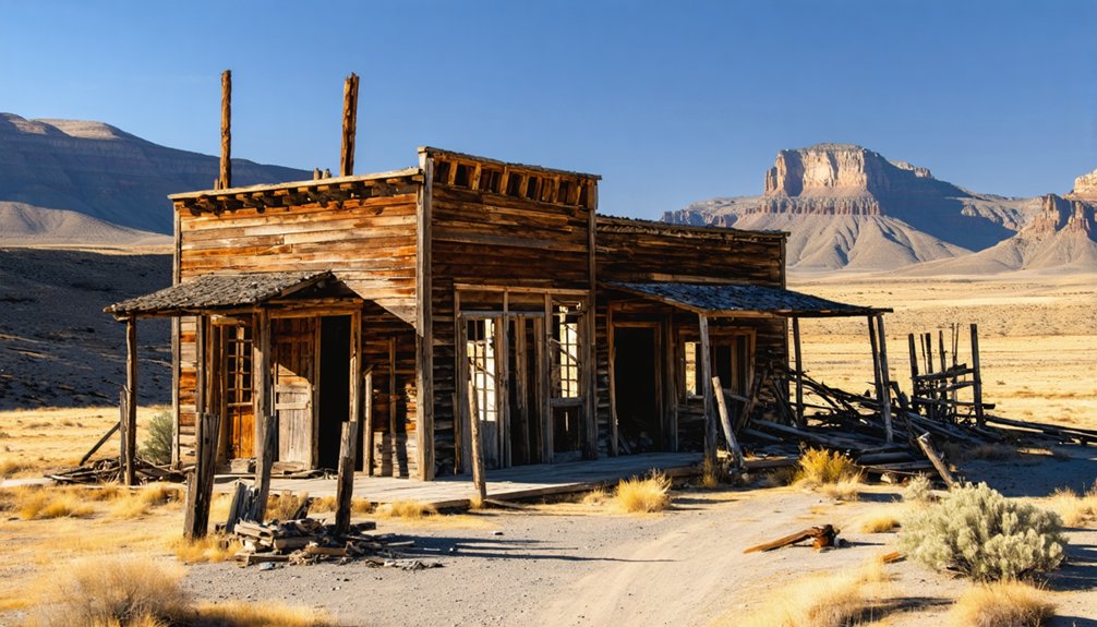
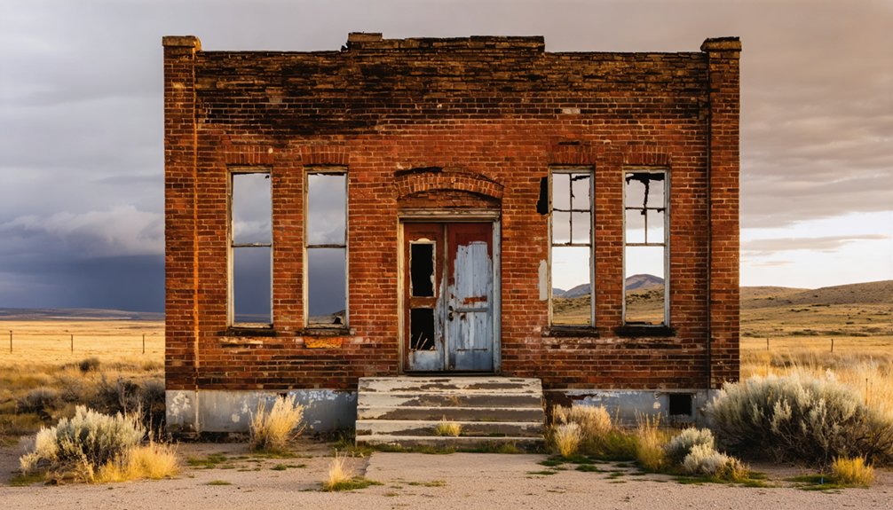
Deep in southern Owyhee County’s high desert, where sagebrush stretches endlessly beneath relentless sun and bitter wind, the lava rock ruins of Wickahoney mark a forgotten crossroads of Idaho’s frontier commerce.
You’ll find this 1895 stage stop positioned along Wickahoney Creek, where postmaster Dow Dunning built a seven-gabled station from local volcanic rock—one of only two such structures in Idaho.
Wickahoney history reveals it served vital stagecoach routes connecting Mountain Home to Mountain City’s Nevada mining camps from 1895 to 1911.
When Elko’s more efficient path drew traffic away, the post office shuttered and settlers dispersed.
Today, roofless walls stand as monuments to self-reliance, their isolation ironically preserving what abandonment couldn’t destroy.
The thick stone walls have endured over a century of scorching summers and freezing winters in this unforgiving landscape.
The site’s historical significance earned it a place on the National Register of Historic Places.
A six-foot cairn still marks the hilltop, guiding nobody.
Stricker Ranch and Rock Creek Station: Oregon Trail Echoes
You’ll find Rock Creek Station‘s remains marking where James Bascom built Idaho’s first trading post west of Fort Hall in 1865, a sprawling complex that served as saloon, dance hall, and polling place until Herman Stricker closed the store in 1897.
The pioneer cemetery behind the 1901 Stricker House holds emigrants who didn’t survive the final push to Boise, their weathered headstones recording cholera outbreaks and wagon accidents along this junction of the Oregon Trail and Kelton Freight Road. Among the historic structures still standing are two stone cellars that once stored supplies for weary travelers.
What began as the largest stage station between two military forts transformed into a lonely ranch homestead, its National Register listing in 1979 preserving only the store building and house from a settlement that once buzzed with freight wagons and Overland Stage coaches. The Idaho State Historical Society now owns the site, working with Friends of Stricker, Inc. to maintain the buildings and offer free admission with Sunday tours from 1 pm to 5 pm.
Historic Way Station Complex
Perched at the confluence of the Oregon Trail and the Kelton Freight Road, Rock Creek Station emerged in 1865 as the first trading post west of Fort Hall, transforming a remote high desert crossing into the largest stage station between Fort Hall and Fort Boise.
James Bascom built the Rock Creek Store that year, creating a hub where travelers found supplies, mail, whiskey, and rest. The historic significance earned National Register listing in 1979, though only the store and 1901 Stricker House survive today.
Preservation efforts by the Idaho State Historical Society and Idaho Heritage Trust—including grants in 1993, 2004, and 2006—keep these structures standing. An interpretive center now educates visitors on the history of the area and the site’s role in westward expansion.
You’ll find stone cellars, a pioneer cemetery, and reconstructed outbuildings marking where wagons once rolled through this essential waypoint. Similar stations along the trail route served multiple purposes, with some functioning as relay stations for the Pony Express during the brief but legendary mail service era.
Emigrant Graves and Folklore
Beyond the weathered walls of the Rock Creek Store, a small pioneer cemetery holds the unnamed and half-forgotten dead of the Oregon Trail corridor.
Emigrants who succumbed to cholera, dysentery, and wagon accidents lie beneath eroded markers—some graves entirely unmarked. With a 3–4% death rate along the trail, this junction of the Oregon and Kelton Freight Road saw its share of burials: stage employees, freighters, women, children.
Pioneer legends speak of mysterious lights drifting among headstones at dusk, voices carried on wind that shouldn’t exist. Modern “haunted night” events lean into these spectral encounters, framing the cemetery as a portal to the trail’s darkest hours.
Local folklore persists, connecting the land’s restless energy to those who never reached Oregon. The site, originally established as a stage station in 1865, served travelers along the critical mail route between Salt Lake and Walla Walla, witnessing countless passages through this unforgiving landscape.
Trail-Era Abandonment History
When Ben Holladay chose this junction in 1864 for a home station on his Overland Stage Line, he didn’t envision its abandonment three decades later—but the Rock Creek Station’s fate was sealed the moment railroads pushed into southern Idaho.
By 1897, Herman Stricker shuttered the store he’d operated since 1876, ending the trail abandonment cycle that had begun when freight traffic shifted to rail lines.
What remained possessed significant historical importance: the largest stage station between Fort Hall and Fort Boise reduced to ranch buildings.
The 1901 Stricker House marked transformation from waystation to homestead.
You’ll find this pattern repeated across Idaho’s emigrant corridors—once essential logistics nodes abandoned as iron rails replaced wagon ruts, leaving ghost stations scattered along forgotten trails.
Archaeological work beginning in 1980 uncovered building foundations and artifacts that revealed the material culture of these vanished way stations.
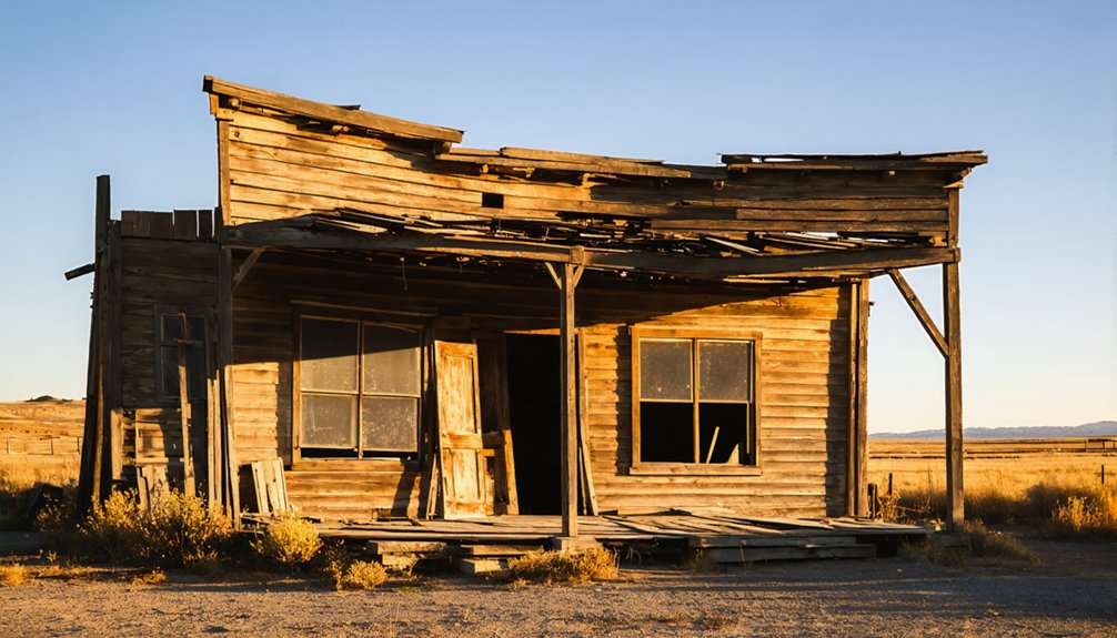
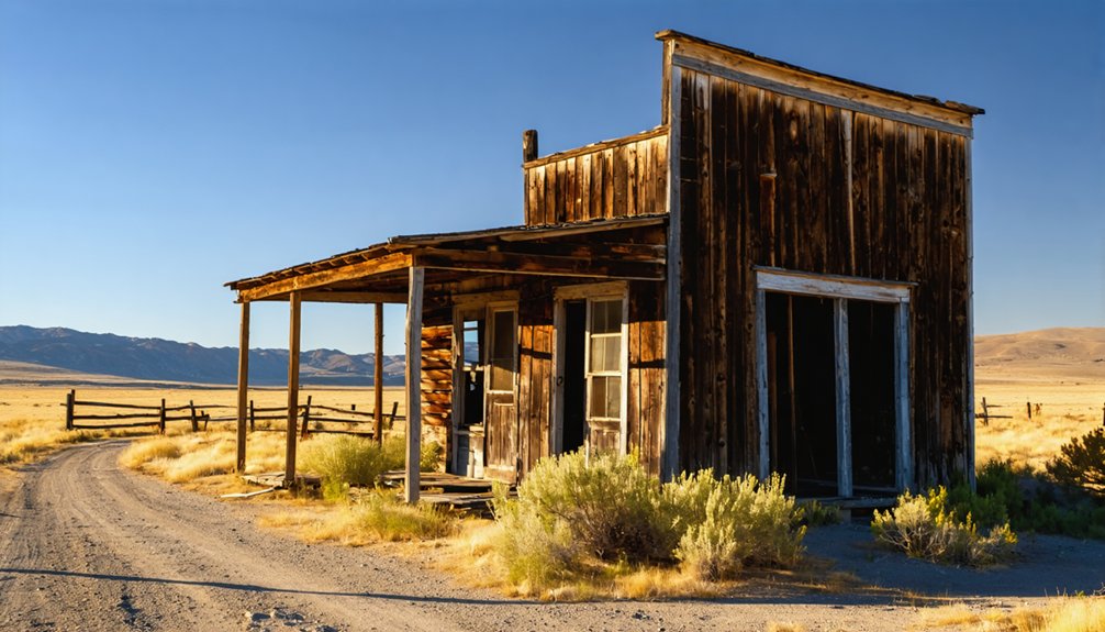
Bayhorse: Silver Canyon Boomtown Preserved in Stone
You’ll find Bayhorse roughly 200 miles northeast of Twin Falls, tucked into a remote canyon where five massive stone beehive kilns still stand sentinel over the ruins.
These 1880s charcoal kilns fed the town’s water-powered smelter that once processed over thirty tons of ore daily from the Ramshorn, Skylark, and half a dozen other mines that poured silver and lead from the surrounding hillsides.
The two-and-a-half-hour drive through central Idaho’s high country rewards you with one of the state’s most photographed ghost town sites, where stone foundations, mill timbers, and those brooding kilns create an industrial archaeological landscape frozen since the smelter’s final shutdown in 1897.
The town’s infrastructure once included a post office, smelter, and stamp mills that crushed ore continuously under heavy steel stamps, alongside dance halls, hotels, and saloons that served the bustling community.
The site became part of Idaho’s Land of Yankee Fork State Park when the land opened to the public in 2009, ensuring these historic mining remnants remain accessible for exploration.
Historic Mill and Kilns
The gravity-fed stamp mill clinging to Bayhorse’s canyon wall stands as a three-story tribute to 1880s industrial ingenuity. Built in 1882 as the Gilmer & Salisbury mill, it processed Ramshorn ore through successive crushing stages, letting gravity do the heavy lifting.
You’ll find ore dumped at the top, then crushed and concentrated as it descended through wooden chutes and bins. The 1920s brought flotation technology upgrades.
Nearby, six stone beehive kilns produced charcoal for silver-lead smelters until 1896, their dome shapes controlling airflow during wood carbonization.
These mining techniques extracted over $10 million in ores—6.3 million ounces of silver alone.
Today’s skeletal framework and standing kilns represent exceptional historic preservation, offering tangible proof of frontier-era metallurgical ambition.
Journey From Twin Falls
Bayhorse waits 220 miles north of Twin Falls, a full-day commitment that rewards determined explorers with Idaho’s best-preserved silver canyon.
Your ghost town exploration follows US-93 through country that shifts from sage flats to alpine passes, each mile adding historical significance to the journey.
The route unfolds in distinct stages:
- Shoshone to Galena Summit – climb through Sun Valley’s shift zone, topping out at 8,701 feet
- Stanley Basin descent – drop into the Salmon River watershed along ID-75’s Scenic Byway
- Final approach via Challis – turn onto the graded canyon road, entering Bayhorse’s rock-walled amphitheater at 6,400 feet
The narrow gorge concentrates mining history into a single viewshed—smelter, cabins, and Ramshorn headframe compressed against stone walls.
The Wider Ghost Town Belt of Southern and Central Idaho

Beyond the immediate Twin Falls vicinity, Southern and Central Idaho unfold as a continuous belt of ghost towns and near-abandoned mining camps that rank among the most concentrated in the American West.
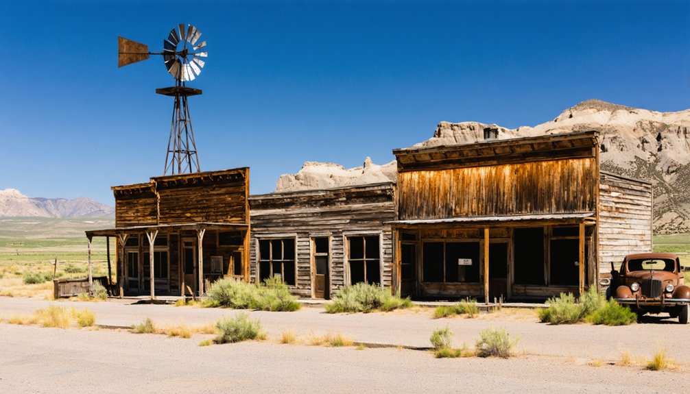
You’ll find Silver City—Owyhee County’s former seat—sheltering 70 historic structures and hundreds of mine workings from its 1880s peak of 2,500 souls. The Boise Basin arc radiates outward from Idaho City, where boardwalk streets mark the waning of one of the Pacific Northwest’s largest gold rushes.
Further north, Yellowjacket’s five-story hotel frame and stamp-mill ruins anchor a Lemhi County cluster of forgotten camps. This mining history traces a south-central corridor where boom-bust cycles, wilderness boundaries, and seasonal road closures have preserved an unmatched density of 19th-century ruins across federal forest and sagebrush.
Planning Your Ghost Town Road Trip From Twin Falls
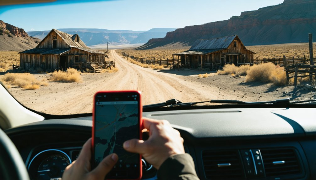
You’ll want a high-clearance vehicle, offline maps, and at least two gallons of extra water per person before you leave Twin Falls city limits—the 1890s miners who walked these same routes had fewer comforts but better instincts about weather and isolation.
Plan single-day trips around either a northern target like Bayhorse (3.5 hours one-way) or a southern desert site such as Wickahoney (2 hours plus 30 minutes on dirt), because attempting multiple distant ghost towns in one outing leaves no margin for flat tires or sudden thunderstorms.
Share your itinerary and return time with someone reliable; cell service vanishes in the same canyons where stage drivers once lit signal fires, and modern rescue can take hours to reach remote mining basins.
Essential Vehicle and Gear
Most ghost town roads radiating from Twin Falls haven’t seen a grader blade in decades, and the 1930s mining journals catalogued at the Idaho State Historical Society describe access routes that remain fundamentally unchanged—rocky, rutted, and unforgiving to low-clearance sedans.
Your vehicle maintenance checklist matters more than any GPS coordinates:
- High-clearance 4×4 with all-terrain tires—washboard roads near Bayhorse and Silver City demand ground clearance your crossover lacks.
- Full-size spare, jack, and tire-repair kit—punctures happen forty miles from the nearest garage, and cell towers don’t reach canyon bottoms.
- Three-hundred-mile fuel range plus emergency water—ghost town country offers zero services between widely spaced ranching towns.
Pack road trip essentials assuming you’re entirely self-reliant: paper maps, traction boards, recovery straps, first-aid supplies, and cold-weather layers for sudden elevation storms.
Route Planning and Timing
With your truck serviced and recovery gear stowed, the next challenge becomes deciding *which* ghost town to chase on a Saturday morning—and whether you’ll make it back to Twin Falls before dark.
Route efficiency dictates clustering nearby sites first: Stricker Ranch near Hansen makes a half-day jaunt, while Wickahoney demands five to six hours round-trip once you factor in Battle Creek Road’s rutted dirt segments.
Travel timing grows critical for Bayhorse and Custer–Bonanza, each sitting 3.5 hours north; departing at dawn stretches your daylight, but an overnight near Stanley eliminates the rushed math.
Summer’s fifteen-hour days forgive ambitious itineraries, yet winter shortens your window to eight hours—barely enough for one remote stop before highways ice over and stars replace your visibility.
Safety and Emergency Preparation
Because Idaho’s most evocative ghost towns perch on the far edge of rescue networks—Silver City at 6,200 feet, Bayhorse along gravel canyons a two-hour crawl from the nearest town—preparing for mechanical breakdown, sudden injury, or whiteout weather becomes as essential as your camera gear.
Emergency communication demands layered redundancy:
- Navigation toolkit: Paper topographic maps covering Twin Falls–to–ghost town corridors, GPS unit, compass, and offline downloads for backroads where cell signals vanish beneath canyon walls.
- Contact protocol: Brief a check-in partner on your route, party size, and return window; add a satellite messenger or PLB for high-elevation sites.
- Vehicle safety essentials: Full-size spare, jumper cables, tow strap, reflective triangles, tire-repair kit, extra coolant, and a fire extinguisher—plus a topped fuel tank, because ghost-town fuel stops closed in 1911.
Essential Gear and Safety Precautions for Remote Exploration
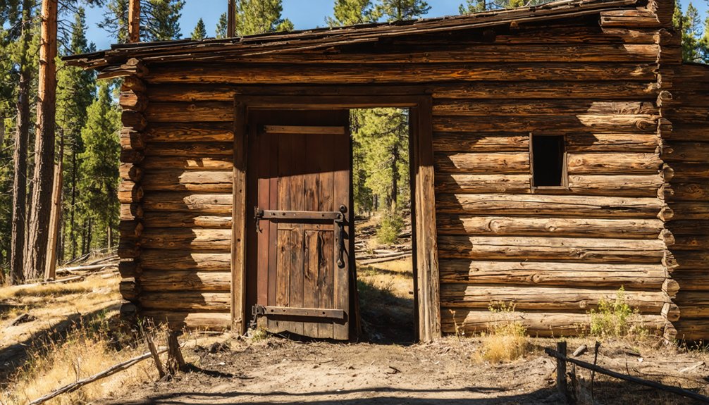
When you venture into Idaho’s ghost towns—weathered clusters of log cabins and crumbling brick assay offices perched between sagebrush flats and alpine ridges—you’re stepping into terrain that hasn’t changed much since the 1880s miners abandoned their claims.
Exploring ghost towns near Post Falls Idaho offers a glimpse into the region’s rich mining history. Each abandoned structure tells a story of the people who once sought fortune in these rugged landscapes. As you wander through these remnants, you can almost hear the echoes of the past lingering in the crisp mountain air.
Your exploration essentials start with a layered clothing system for temperature swings from the 40s to 80s, sturdy boots with ankle support for loose scree, and 3–4 liters of water daily.
Pack thorough safety gear: multi-tool, first-aid kit with blister care, sun protection for 6,000-foot elevations, and trekking poles for eroded trails.
Never enter unstable structures or mine shafts—rotting floors and hidden voids killed careless prospectors then and remain lethal now.
Check weather forecasts and carry emergency shelter; mountain storms materialize fast above sagebrush country.
Before you leave pavement behind on the graded gravel spur toward Bayhorse or the washboarded track climbing Mackay Mine Hill, understand that these routes follow the same engineering logic—and limitations—that governed ore wagons in 1885.
Steep shelf roads, narrow switchbacks, and crumbling shoulders demand backcountry navigation skills honed before you enter canyon shadows where cell service challenges begin.
Prepare with analog and offline systems:
- Download offline GPS maps covering numbered forest roads and unmarked mining spurs; satellite positioning works when networks don’t.
- Carry printed USGS topos marked with waypoints, turnarounds, and bailout junctions you’ve researched at home.
- Leave a written itinerary at your lodging—exact routes, check-in times—so someone knows which canyon holds you if you don’t return.
Staying Safe Around Unstable Structures and Mine Hazards
The weathered plank floor beneath a photographer’s boot in Bayhorse’s old Beardsley Mill gave no warning before it split in 2019, dropping him twelve feet onto a pile of rusted stamp-mill hardware; his fractured ankle and three-hour self-rescue became a cautionary dispatch on every Idaho ghost town forum that season.
A single misstep through rotted floorboards turned a routine photo expedition into a painful three-hour ordeal of self-rescue.
Ghost town safety starts with recognizing that rot, rust, and compromised foundations make every step a gamble. Mine hazards multiply the risk—thousands of Idaho’s abandoned shafts extend hundreds of feet down, often hidden by debris or vegetation.
Toxic dust from lead-contaminated tailings coats every surface, while underground workings harbor methane and carbon monoxide.
Stay outside deteriorating structures, never enter shafts or adits, and assume every surface is unstable until proven otherwise.
Respecting Historic Sites: Leave No Trace and Legal Guidelines
Although the temptation to pocket a square nail or rusted can opener from a collapsed cabin feels harmless, Idaho state law draws a hard line: artifacts on public land stay put.
Removing even small items risks fines and criminal charges, while undermining historic preservation for future explorers. Visitor etiquette at these sites means leaving every object, beam, and broken window exactly as you found it.
Core principles:
- Stay on established paths to prevent erosion and vegetation damage around fragile ruins.
- Pack out every scrap of trash—food wrappers attract wildlife and degrade the authentic setting.
- Honor posted closures and private boundaries; trespassing statutes apply even when structures are visible from public roads.
Carving initials or leaning on century-old timbers accelerates decay.
Respect the silence, the dust, and the stories frozen in place.
Rockhounding, Artifact Laws, and Private Property Boundaries
When you spot a glint of purple glass half-buried in the sagebrush near a crumbling assay office, your first instinct might be to slip it into your pocket as a souvenir—but that fragment likely represents a century-old bottle protected under the Archaeological Resources Protection Act, and pocketing it could cost you a federal citation.
Rockhounding regulations on BLM lands permit hand-tool collection of naturally occurring minerals for personal use, yet man-made artifacts remain strictly off-limits. Before exploring, verify private landownership boundaries through county records; many ghost-town parcels sit on ranch property or active mining claims where entry without permission constitutes trespassing.
Road rights-of-way don’t authorize wandering onto adjacent land. Legitimate collectors research claim status via BLM’s LR2000, secure landowner consent, and restrict themselves to common gemstones—never structural remnants or historic refuse.
Frequently Asked Questions
Are There Guided Ghost Town Tours Available From Twin Falls?
You’ll find ghost *stories* rather than ghost *towns* through local operators like Fright Night Ghost Tours’ horse-drawn carriages. Big Green Adventure Tours offers guided tours throughout Twin Falls’ surrounding regions, giving you exploration freedom.
Which Ghost Towns Near Twin Falls Are Best for Photography?
Bayhorse and Bonanza offer you the most dramatic abandoned structures for moody, texture-rich shots, while Custer’s restored streetscape captures historical significance through clean compositions—each location documented in Idaho State Historical Society archives since the 1870s mining era.
Can I Camp Overnight Near These Ghost Town Sites?
You’ll find dispersed camping allowed on surrounding BLM land near most sites, but camping regulations prohibit pitching tents directly on historic footprints. Overnight permits aren’t usually required, though you’ll respect fourteen-day limits and cultural-resource zones.
What Time of Year Is Best to Visit Ghost Towns?
Late August through October offers you the best seasons for exploration—historical records show 80% of Idaho’s mining roads become passable once snowmelt ends. Weather considerations include cooler mornings and clearer skies, perfect for your backcountry freedom.
Are Any Ghost Towns Wheelchair Accessible or Family-Friendly for Young Children?
Custer Ghost Town offers the best wheelchair accessibility among Idaho’s mining sites, with maintained paths and restrooms travelers confirm as accessible. You’ll find family activities through guided tours and the nearby Gold Dredge, perfect for young explorers.
References
- https://patch.com/idaho/boise/idaho-ghost-towns-you-need-see
- https://www.thegoldminehotel.com/ghost-towns-and-haunted-places-in-idaho
- https://www.tripadvisor.com/Attraction_Review-g28933-d1775240-Reviews-Bonanza_and_Custer_Ghost_Town-Idaho.html
- https://983thesnake.com/a-quartz-hotspot-and-ghost-town-await-north-of-twin-falls-id/
- https://visitidaho.org/things-to-do/ghost-towns-mining-history/
- https://en.wikipedia.org/wiki/List_of_ghost_towns_in_Idaho
- https://we3travel.com/idaho-wickahoney-forgotten-ghost-town-ruins-adventure-into-the-past/
- https://www.onlyinyourstate.com/state-pride/idaho/ghost-town-ruins-id
- https://landingaday.wordpress.com/2018/10/24/bruneau-and-wickahoney-idaho/
- https://en.wikipedia.org/wiki/Wickahoney_Post_Office_and_Stage_Station