You’ll find several ghost towns within two hours of Vancouver, Washington, shaped by logging disasters and mining booms. The Chelatchie-Amboy area preserves railroad grades from the 1902 Yacolt Burn’s salvage operations, while Monte Cristo’s weathered structures commemorate its 1890s silver rush that attracted Rockefeller’s investment. Franklin’s coal mining sites mark a legacy that peaked at 200,000 tons annually before 1922’s abandonment, and Moncton lies submerged beneath Rattlesnake Lake since 1915. These routes reveal the region’s complete boom-and-bust narrative through standing foundations and interpretive trails.
Key Takeaways
- Yacolt area features fragmentary logging camps and vanished river landings, with the name deriving from Klickitat word for “haunted place.”
- Chelatchie-Amboy contains abandoned railroad grades from early 1900s timber boom, operational until Weyerhaeuser exhausted reserves around 1925.
- Monte Cristo mining town, discovered in 1889, exceeded 1,000 residents by 1894 and attracted John D. Rockefeller’s investment.
- Moncton was flooded in 1915 for Cedar River Dam, submerging nearly 200 structures now beneath Rattlesnake Lake.
- Visit Monte Cristo from late spring through early fall; check ranger stations for road conditions and seasonal closures.
Understanding the Ghost Town Landscape Around Vancouver
When you search for ghost towns near Vancouver, Washington, you’ll quickly discover that this corner of the Pacific Northwest tells a different story than the skeletal mining camps that dot the eastern half of the state.
Instead of preserved boomtowns, you’ll find fragmentary logging camps, vanished river landings, and overgrown railroad sidings scattered across Clark, Cowlitz, and Skamania counties. These sites rarely offer standing structures—most exist as foundations reclaimed by forest or place-names on old maps.
The region’s ghost narratives run deeper than abandoned buildings, though. Indigenous connections shape the very meaning of haunted landscape here. Yacolt, for instance, derives from the Klickitat word for “haunted place,” rooted in stories of children lost in the woods long before Euro-American settlement. Unlike eastern Washington’s ghost towns that declined due to advancements in road infrastructure, southwestern settlements were primarily lost to logging industry shifts and river commerce changes. Alderdale, which operated a post office from 1907 to 1962, now stands barren in Klickitat County.
Cedar Creek and Clark County’s Abandoned Heritage Sites
You’ll find Clark County’s most accessible historical remnants at Cedar Creek Grist Mill, where George Woodham and his sons constructed Washington’s last fully operational grain-grinding facility in 1876.
The mill served farmers who traveled up to two days with grain wagons, and it still operates today as a working museum powered by its original 1886 James Leffel & Co. turbine.
Beyond Cedar Creek, the Chelatchie-Amboy corridor reveals scattered logging camp foundations and rail spurs from the early 1900s timber boom that once sustained entire communities in north Clark County.
The Friends of the Cedar Creek Grist Mill formed in the 1980s to revitalize the site through volunteer restoration efforts that replaced posts and beams using authentic methods.
The mill’s National Historic Site designation recognizes it as the only grain-grinding mill in Washington that maintains its original structural integrity.
Cedar Creek Grist Mill History
In 1876, migrant miller George Woodham and his two sons constructed Red Bird Mill on Cedar Creek in northern Clark County, harnessing the stream’s year-round flow to power a wooden waterwheel that drove grain-grinding machinery.
Farm families traveled two-day wagon treks to grind their harvests into flour and cornmeal. The mill upgraded to a 16-horsepower James Leffel turbine in 1886, boosting efficiency until industrial roller mills rendered small rural operations obsolete.
By mid-century, the abandoned structure faced demolition. Historic preservation advocates rescued the deteriorating mill in the late 1960s, stabilizing the original timber frame and restoring water-delivery works. Volunteer restoration crews extended the wooden flume 650 feet to restore water flow for the turbine. The mill’s grinding stones were imported from France, following a tradition established in American grist mills since the early 1800s.
Today it stands as Washington’s oldest surviving grist mill—a national landmark celebrating Cedar Creek’s frontier engineering and one of America’s few preserved water-powered grain mills.
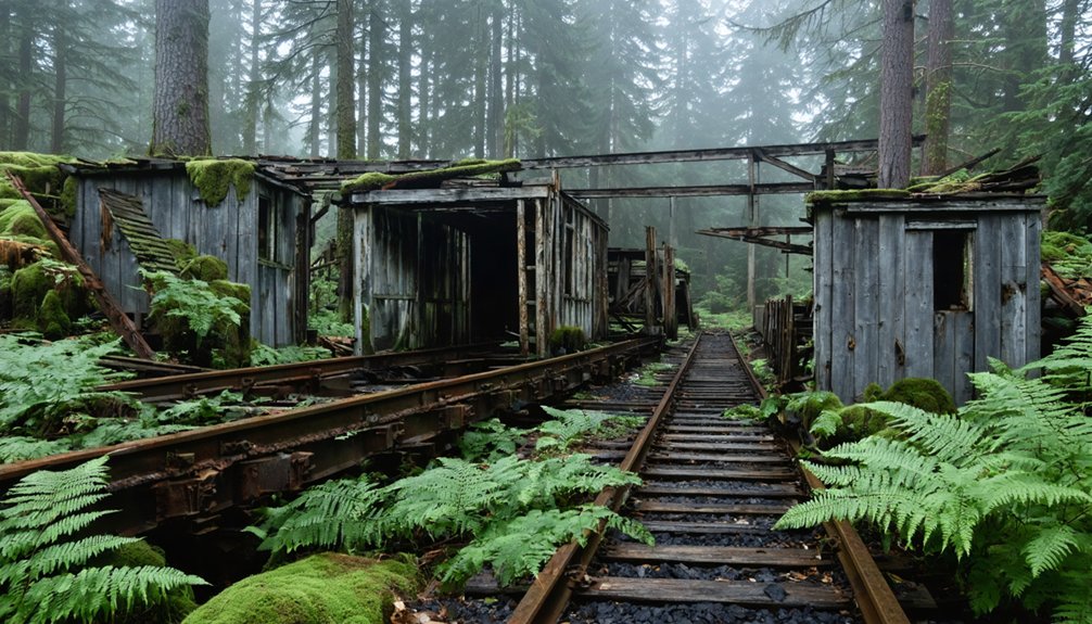
Chelatchie-Amboy Logging Remnants
While Cedar Creek’s grist mill showcases precision engineering at the water’s edge, the surrounding forests of northeast Clark County bear deeper scars from industrial extraction.
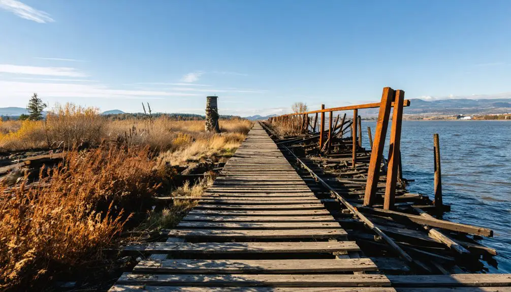
You’ll find Chelatchie Prairie and Amboy’s logging history written across abandoned railroad grades, decommissioned sidings, and stream corridors still recovering from decades of clearcutting. The 1902 Yacolt Burn triggered intense salvage operations that stripped thousands of charred snags by 1910, followed by systematic cutting until Weyerhaeuser exhausted its timber reserves around 1925.
Today’s industrial heritage includes overgrown spur lines serving International Paper’s massive plywood mill—operational from 1960 to 1979—and the heritage Chelatchie Prairie Railroad, which traces routes originally engineered for heavy log traffic. The line’s origins trace to L.M. Hidden’s 1886 survey route, when Vancouver businessmen envisioned a railroad to Yakima accessing timber stands and wheat-growing regions.
Embankments, loading areas, and slope failures mark where extraction took precedence over land stewardship. The railroad reached Brush Prairie by 1897, though bankruptcy halted further expansion until the line was eventually extended to Yacolt.
Chelatchie-Amboy Logging Remnants in North Clark County
A devastating wildfire in September 1902 set the stage for one of north Clark County’s most intensive logging booms. The Yacolt Burn scorched millions of board feet, prompting Weyerhaeuser’s Twin Falls Logging Company to construct extensive rail spurs into burned-over country near Amboy and Chelatchie.
By 1910, salvage operations had stripped fire-killed timber, and within two decades, loggers had cleared most accessible green stands. You’ll find remnants of this logging history throughout the area—abandoned rail grades, trestle sites, and the Rashford Spur camp landmark.
International Paper’s mills employed 600 workers until closing in 1979, marking the end of Chelatchie’s industrial heritage. The area’s economy had long fluctuated with lumber industry conditions, experiencing periodic slumps that left workers seeking alternative income. Today, Clark County preserves part of the original railroad as a heritage route threading through forested uplands. The North Clark Historical Museum displays historical saws and logging equipment that preserve the legacy of these operations.
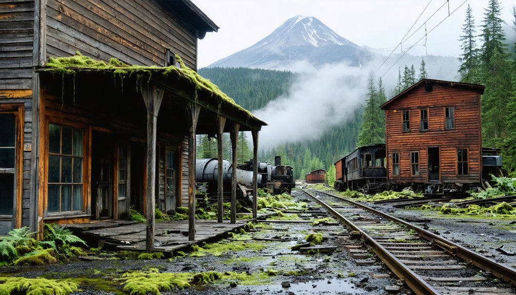
Monte Cristo: Washington’s Premier Mining Ghost Town
Deep in the Northern Cascade Mountains, Joseph Pearl and Frank Peabody stumbled upon silver ore in 1889 that would transform a remote valley into one of Washington’s most ambitious mining ventures.
By 1894, Monte Cristo boasted over 1,000 residents and attracted John D. Rockefeller’s investment syndicate, which acquired controlling interests for nearly half a million dollars.
Monte Cristo’s explosive growth caught the attention of America’s wealthiest investors, transforming a wilderness mining camp into a financial phenomenon.
Today’s ghost town preservation efforts reveal mining history through:
- Fifteen weathered structures standing sentinel among towering evergreens
- A 4-mile trail following the original miners’ route from Barlow Pass
- Interpretive signs marking where railroad yards once separated upper and lower towns
The 1897 flood devastated operations, forcing most residents to abandon their dreams.
You’ll find remnants of this boom-and-bust cycle accessible via Mountain Loop Highway, where freedom-seeking explorers can walk through authentic frontier ambition.
Franklin and the King County Coal Mining Legacy
While Monte Cristo’s silver dreams drew Rockefeller’s fortune to the Cascades, another extractive empire was taking shape in King County’s valleys.
You’ll find Franklin’s story embedded in coal—200,000 tons annually at its peak, shipped via railroad to San Francisco starting in 1885. The Oregon Improvement Company built this immigrant town with Welsh, English, Irish, Italian, and Scottish workers, later recruiting African Americans as strikebreakers during the bitter 1890 disputes.
The August 24, 1894 disaster claimed 37 miners fighting underground fire, marking Washington’s second-worst mining tragedy.
Franklin’s Demise came gradually: production slumped in 1908, operations ceased by 1922, and residents abandoned their company houses.
Today, this Mining Heritage survives only in historical records—a reflection of extraction’s human cost and coal country’s forgotten communities.
Moncton and the Submerged Town at Rattlesnake Lake
If you drive east from North Bend toward Snoqualmie Pass, you’ll find Rattlesnake Lake—a deceptively peaceful body of water that conceals the remains of Moncton, a railroad town flooded in 1915 when Seattle’s newly built Cedar River Dam allowed reservoir water to seep through porous hillsides.
The rising water crept upward at roughly a foot per day that May, forcing residents to evacuate by rowboat as their homes lifted off foundations and floated into what became a permanent lake.
Today, when water levels drop, you can spot building foundations, pilings, and other remnants of the condemned community along the shoreline—physical evidence of a town sacrificed to supply drinking water for a growing Seattle.
Dam Construction and Flooding
- Water rose from the ground at over a foot per day, transforming streets into channels.
- Residents evacuated belongings by rowboat and barge as houses floated off foundations like corks.
- Nearly 200 structures became half-submerged in the newly formed Rattlesnake Lake.
Seattle officials initially denied responsibility, claiming natural causes before eventually condemning properties as evidence mounted linking municipal negligence to this engineered disaster.
Visiting Submerged Town Remains
Today’s curious visitors to Rattlesnake Lake stand where Moncton’s main street once bustled with loggers, mill workers, and railroad crews—though the exact location of that street depends entirely on how much water currently fills the basin.
During late summer of dry years, you’ll spot exposed pilings, foundations, and submerged artifacts scattered across the exposed lakebed. Lakebed exploration reveals timbers, household items, and structural debris from buildings burned with kerosene in 1916. Several relocated houses still survive on higher ground nearby.
Watershed protection rules prohibit artifact removal and restrict motorized access. Soft silt creates treacherous footing, while rapidly changing water levels can trap unwary explorers.
Seattle Public Utilities maintains interpretive signage documenting the town’s layout, helping you visualize Moncton’s streets beneath the fluctuating surface.
Eastern Washington Ghost Towns Worth the Drive
Why do ghost town enthusiasts willing to venture three or more hours east from Vancouver find themselves so richly rewarded? The answer lies in authentic preservation and dramatic landscapes.
Molson history unfolds near the Canadian border, where $170,000 in early investment created a boomtown now maintained as Washington’s premier open-air museum since 1960. The Okanogan Highland cluster delivers multiple mining sites across forested ridgelines, while Elberton remnants dot Palouse wheat country where sawmill operations once thrived.
Washington’s eastern borderlands preserve a century of mineral wealth and timber legacy across three distinct geographic zones.
Picture yourself exploring:
- Gold-rush structures standing two miles from Canada in highland solitude
- Weathered buildings framed against rolling grain fields stretching to distant horizons
- Cloverland farming plateaus above the Snake River, where dryland agriculture tested pioneers’ resolve
These journeys reward freedom-seekers with unfiltered frontier narratives.
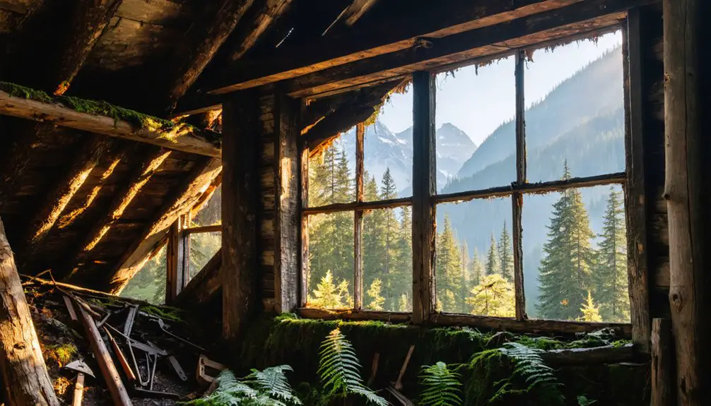
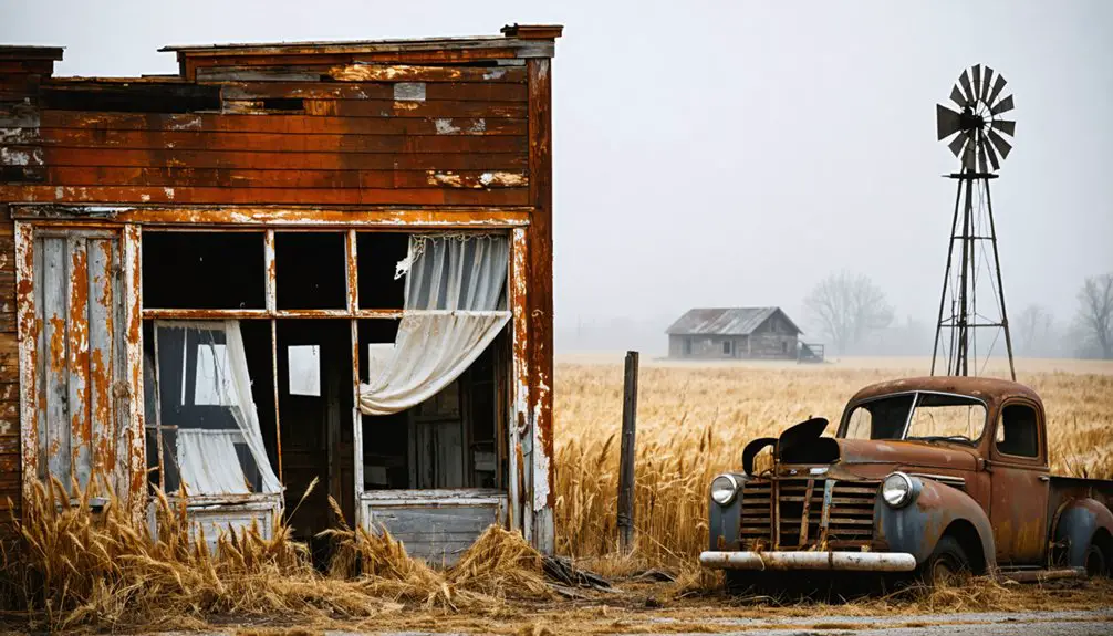
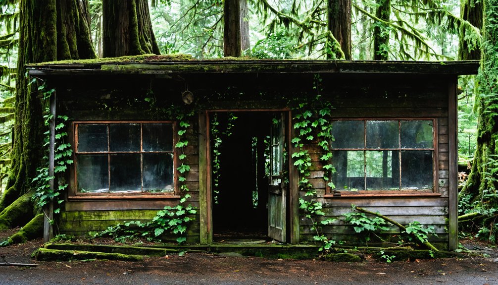
What Remains: Structures and Artifacts You’ll Encounter
Weathered foundations and rusted metal fragments form the primary vocabulary of Washington’s ghost town architecture, each artifact offering tangible evidence of communities that once hummed with daily commerce and domestic life.
You’ll discover grid-like street depressions overgrown with vegetation, concrete building pads marking former commercial blocks, and remnant sidewalks with embedded rails from early construction.
Schoolhouses stand as skeletal frames, while churches maintain their original steeples despite decades of abandonment.
Mining sites reveal collapsed ore bins and hoist frames surrounded by scattered machinery.
Cemetery headstones weather under towering marker trees, and scattered household debris—glass bottles, ceramics, stove parts—lies half-buried near foundation outlines.
These physical remnants represent ongoing historical preservation challenges, allowing you to piece together frontier narratives without museum mediation.
Planning Your Visit: Access, Seasons, and Safety

Before you set out to explore these abandoned communities, you’ll need to account for seasonal road closures that can restrict access to certain sites—particularly Monte Cristo, where the Mountain Loop Highway typically closes during winter months.
You should always check current conditions with local ranger stations or recreation departments, as unpaved forest roads and mountain routes can become impassable after heavy rain or snowfall.
Your safest visiting window runs from late spring through early fall, when roads remain open and weather conditions won’t strand you miles from your vehicle.
Road Conditions and Closures
While most ghost town enthusiasts focus on destination details, the journey itself often determines whether you’ll reach these abandoned sites at all.
Washington’s mountain passes face significant seasonal closures during winter months, particularly affecting access to Monte Cristo via Highway 2 and Franklin Ghost Town near Chinook Pass on Highway 410. Road maintenance schedules vary considerably across regions.
Key routes you’ll encounter:
- Highway 2 Scenic Byway – Winds through Mount Baker Snoqualmie National Forest with winter weather impacts
- Mountain Loop Highway – Provides seasonal access to Monte Cristo east of Granite Falls
- Highway 410 (Chinook Pass) – Routes to Franklin Ghost Town with elevation-dependent closures
Check current conditions before departing.
Eastern Washington sites like Molson off Highway 97 remain generally accessible year-round, though winter storms can temporarily affect any route.
Essential Safety Precautions
Exploring abandoned settlements demands more than curiosity—it requires treating these fragile sites as the outdoor hazard zones they are. You’ll face rotted floors, hidden mine shafts, and unstable structures that can collapse without warning.
Wear closed-toe boots, carry layers for sudden temperature drops, and pack plenty of water during summer heat exceeding 90°F. Before entering, verify land ownership—many townsites straddle private, timber company, and public boundaries where trespass laws apply.
When practicing ghost town photography, never disturb artifacts or enter posted areas; historical preservation depends on leaving everything intact.
Black bears and cougars inhabit forested access routes, so store food properly and avoid dawn or dusk hikes. Your safety and these sites’ longevity rest on respecting both natural hazards and legal boundaries.
Day Trip Routes and Itinerary Suggestions From Vancouver
Setting out from Vancouver, you’ll find three distinct route types that reveal the region’s abandoned and historical sites within a single day’s drive.
1. Columbia River Gorge Loop – Navigate SR-14 east through Camas and Washougal to North Bonneville, then cross to Cascade Locks.
You’ll encounter interpretive sites near Bonneville Dam, early road grades, and riverfront industrial relics. Total road time runs 2.5–3.5 hours with multiple stops available.
2. Southwest Washington Mining & Logging Remnants – Head north on I-5 toward Woodland, then venture east into foothill communities.
You’ll discover abandoned structures, company towns, and former rail corridors documenting the region’s logging history. Expect 2–4 hours exploring public forest roads.
3. Historic Forts & Haunted Vancouver Core – Walk Fort Vancouver National Historic Site and Officers Row, where military-era buildings host reports of apparitions and unexplained phenomena.
Frequently Asked Questions
Are Ghost Town Artifacts Legally Protected or Can I Collect Souvenirs?
Ghost town artifacts are legally protected under federal and state laws; collecting souvenirs isn’t allowed. You’ll face legal ramifications including fines and criminal charges. Artifact preservation trumps personal collecting—these sites demand your respect, not your souvenir hunting.
Which Ghost Towns Allow Overnight Camping Nearby or On-Site?
Monte Cristo, Fort Stevens, and Port Townsend’s forts offer you the best overnight options. You’ll find established campgrounds and dispersed camping near these sites, though camping regulations vary—check nearby facilities and forest-service rules before heading out.
Do Any Washington Ghost Towns Offer Guided Tours or Ranger Programs?
Most Washington ghost towns lack formal guided tours or ranger programs—you’ll find self-guided exploration at sites like Molson, Monte Cristo, and Northern State. Fort Vancouver offers NPS ranger programs, though it’s not technically a ghost town.
Can I Bring My Dog to Ghost Town Hiking Sites?
You can bring your dog to most dog friendly ghost town trails on Forest Service land if leashed, but verify site-specific rules first. Follow hiking tips like avoiding unstable structures and packing out waste.
Are Ghost Towns Accessible for Visitors With Limited Mobility?
While freedom to explore varies by location, you’ll find accessible routes at Northern State and Franklin ghost towns that accommodate mobility aids. Monte Cristo’s log crossing and terrain elsewhere may challenge wheelchair users.
References
- https://en.wikipedia.org/wiki/List_of_ghost_towns_in_Washington
- https://stateofwatourism.com/ghost-towns-of-washington-state/
- https://bestofthenorthwest.com/northwest-travel-ideas/northwest-ghost-towns/
- https://www.emeraldpalate.com/abandoned-places-in-washington/
- https://www.wta.org/go-outside/seasonal-hikes/fall-destinations/hidden-history-ghost-town-hikes
- https://www.atlasobscura.com/things-to-do/washington/abandoned
- https://map.proxi.co/r/Washington_Ghost_Towns
- https://www.opb.org/article/2023/10/29/washington-only-living-ghost-town-history-lingering-residents/
- https://www.youtube.com/watch?v=2Saj0oIS4tc
- https://explorewashingtonstate.com/barron-ghost-town-2/