You’ll find several ghost towns within driving distance of White Sands National Park in south-central New Mexico. Kingston, once home to 7,000 residents and 23 saloons, sits along the Black Range where silver strikes created instant boomtowns in 1882. Nearby Chloride grew from Harry Pye’s 1879 discovery, while Lake Valley preserves 10-12 original buildings under federal protection. White Oaks, founded in 1879, reached 4,000 residents as New Mexico’s second-largest city before mining collapsed. The article below explores each settlement’s unique architecture, violent frontier history, and preserved structures you can visit today.
Key Takeaways
- White Sands National Park in south-central New Mexico provides access to historic mining ghost towns via US-70, US-54, and I-25.
- Kingston boomed after 1882 silver strikes, reaching 7,000 residents before the 1893 silver crash caused rapid abandonment.
- Chloride grew to 3,000 residents by the early 1880s with 42 working mines before declining due to market collapse.
- Lake Valley preserves 10-12 late-1800s buildings with self-guided tours managed by the Bureau of Land Management.
- White Oaks reached 4,000 residents as New Mexico’s second-largest city during the 1880s gold rush near Jicarilla Mountains.
Location and Regional Access Routes
White Sands National Park anchors a vast desert corridor in south-central New Mexico where missile ranges, mountain-flanked basins, and century-old mining camps converge along a handful of principal highways.
Your access routes radiate from Alamogordo and the park’s visitor center through three cardinal arteries: US‑70 threading east–west between Las Cruces and the Tularosa Basin, US‑54 climbing north past Carrizozo toward central plateaus, and I‑25 tracing the Rio Grande rift beyond the western ranges.
Regional context matters here—military closures on US‑70, blowing dust across open flats, and monsoon flash floods on narrow state highways can reshape your itinerary without warning.
Each ghost town occupies a distinct niche in this mosaic: Organ guards the Mesilla Valley gateway, White Oaks perches above high-desert grasslands, and Monticello hides in secluded cottonwood canyons. The opening of White Sands Missile Range in 1945 transformed Organ from an abandoned mining camp into a service community for military personnel. Lincoln sits within striking distance to the northeast, site of the Lincoln County War and once home to Billy the Kid.
The Black Range Mining District Heritage
Beyond the well-mapped highway corridors, the Black Range rises along Percha Creek where Kingston’s stone foundations and false-fronted remnants mark one of New Mexico’s most volatile silver rushes.
The mining legacy began in 1882 when prospectors struck rich lodes at the Solitaire Mine, transforming wilderness into a settlement of 14 general stores, 24 saloons, and three competing newspapers.
Within months of discovery, pick-wielding prospectors carved a boomtown from unbroken wilderness with two dozen whiskey joints and three printing presses.
You’ll find historical preservation in structures like the Victorio Hotel and Percha Bank, where $7 million in silver once changed hands during the 1880s-1890s boom.
When Congress repealed the Silver Purchase Act in 1893, prices collapsed 90% overnight. Most miners abandoned their claims within months, leaving only a handful of residents who’ve maintained these weathered testimonials to boom-and-bust freedom.
The town’s church-to-saloon ratio stood at 1:22 until 1888, when miners finally constructed a permanent church to serve the predominantly male population.
Chloride: Silver Strikes and Frontier Chaos
When Harry Pye discovered silver chloride float in a remote canyon in 1879, he triggered one of New Mexico’s wildest boom-and-bust cycles—but never lived to profit from it, reportedly killed by Apaches before development began.
Within months, his “Pye Lode” claims drew thousands of prospectors and fortune-seekers who erected a tent city that formalized into Chloride, anchoring the Apache Mining District with 2,000–3,000 residents by the early 1880s.
You’ll find this wasn’t orderly Victorian expansion: the camp operated on hard-rock wages, saloon justice, and armed self-defense against Apache raids, range wars, and the routine violence of an isolated silver frontier where law enforcement remained largely ad hoc.
The boom sustained 42 working mines alongside an ore crusher, transforming the remote canyon into a full-scale industrial operation that defined the region’s economy through the mid-1890s. By 1881, the town supported eight saloons that served as the social and commercial heart of frontier life, alongside general stores, a butcher shop, and other essential businesses catering to the mining population.
Discovery and Early Growth
High in a Black Range canyon in 1879, English freighter Harry Pye spotted the glint of silver chloride ore while hauling army supplies between Hillsboro and Camp Ojo Caliente.
Pye’s Discovery remained relatively secret for two years while he assessed the mother lode’s quality. When he returned in 1881 with prospectors Forbes and Elliott to stake formal claims, word spread fast.
Hard-rock miners flooded the canyon, establishing a tent city initially called Pyetown, then Bromide, before settling on Chloride in 1880—named for the high-grade ore fueling the rush.
Chloride Growth accelerated rapidly as the Apache Mining District‘s nerve center. By the early 1880s, you’d find 1,000–2,000 residents, 100 permanent structures, eight saloons, three mercantile stores, and a school serving mining families. The town’s main artery, Wall Street thoroughfare, stretched sixty feet wide and was lined with shade trees and irrigation ditches. The community also supported restaurants, butcher shops, a candy store establishment, and various professional offices.
Violence and Lawless Frontier
The silver chloride that drew fortune-seekers to Chloride’s steep canyon also placed them squarely in the crosshairs of Apache resistance.
Chief Nana’s 1881 raid on the Pioneer Store—leaving two miners dead and livestock stolen—proved the town’s exposure to violent encounters that shaped daily survival.
You’d have found nine saloons serving a population of 2,000, a red-light district, and no church, fueling brawls and shootings among hard-drinking miners.
Frontier justice prevailed where formal law couldn’t reach. Remote from territorial centers and rail lines, Chloride relied on militia armories and armed freight convoys rather than courts or police.
Mining-claim disputes often ended in stand-offs, not writs—a proving ground for those willing to defend fortune with force.
The town’s founder, Harry Pye, met a violent end when Apaches killed him shortly after his silver chloride discovery. Today, visitors can explore Harry Pye’s Cabin, preserved as a window into the town’s turbulent origins.
Hillsboro: Gold Discovery and Rapid Growth
When prospectors Dan Dugan and Dave Stitzel discovered placer gold on Percha Creek in April 1877, they triggered one of New Mexico’s most significant mining booms.
Their Opportunity and Ready Pay claims became immediate producers, drawing hundreds of fortune-seekers to the east slopes of the Black Range Mountains within months.
1877 Gold Strike History
Gold fever transformed the eastern slopes of the Black Range Mountains in April 1877 when two prospectors, Dave Stitzel and Daniel Dugan, uncovered promising deposits along Percha Creek. Their stakes—the Opportunity and Ready Pay mines—ignited a gold rush that would sustain the region for a century.
You’ll find Hillsboro’s mining legacy began with primitive arrastras and evolved into sophisticated 10-stamp mills by 1881. The district’s extraordinary productivity yielded over 100,000 ounces of placer gold, placing it among only four New Mexico districts to reach this threshold.
By 1880, 400 miners worked the claims while the settlement expanded from tent camps to permanent adobe structures.
When silver markets crashed in the 1890s, gold-rich Hillsboro survived where others failed, maintaining its independence as Sierra County’s seat.
Mining Boom Population Surge
Within months of Stitzel and Dugan’s strike, Hillsboro transformed from empty canyon to functioning settlement.
You’d have found 400 miners working claims by 1880, extracting ore with arrastras and stamp mills that defined early mining techniques across the district. Four army companies patrolled the trails, protecting both claims and commerce.
Canvas tents gave way to adobe storefronts housing four saloons and four grocers—the backbone of boom-town community dynamics. Families arrived alongside prospectors, building permanent homes rather than temporary camps.
When Sierra County formed in 1884, Hillsboro won the county seat after fierce competition with Chloride, cementing its administrative dominance over a mineral-rich territory spanning four modern counties.
The 1892 courthouse symbolized what many refused to accept: this wasn’t just another flash-in-the-pan camp.
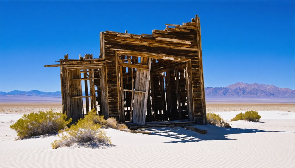
Lake Valley: Standing Structures and Walking Tours
Although the silver crash of 1893 emptied Lake Valley of its boom-town population, approximately 10 to 12 buildings from that late-1800s era remain standing today, offering visitors a tangible record of the community’s layout and architectural character.
The Bureau of Land Management protects the site, balancing historic preservation with public access through day-use permits and gate control. You’ll walk among weathered wooden and adobe houses, mining outbuildings, and notable structures like Kiel House—recognized for its architectural value by preservation experts.
Interpretive signs mark the former main street, railroad grade, and vanished structures now reduced to foundations. The self-guided tour operates during posted hours, letting you explore this uninhabited ghost town on foot without commercial intrusion or modern development diluting its 1880s mining-camp authenticity.
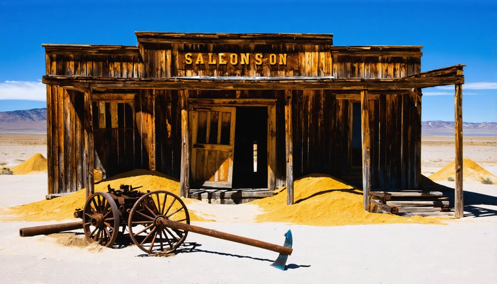
Kingston: From Percha City to Silver Boom
When miners staked the first tent store on Middle Percha Creek in June 1882, they couldn’t have predicted the settlement would outgrow Albuquerque within three years.
Jack Sheddon’s silver strike at the Iron King Mine transformed Percha City into Kingston, a ghost town that exemplifies New Mexico’s mining heritage. By 1885, over 7,000 residents packed this 6,224-foot elevation camp, supporting 30 operating mines and 23 saloons along streets where lot prices jumped from $15 to $5,000.
The Percha Bank reportedly held $7 million in silver at peak production. You’ll find traces of Mark Twain, Lillian Russell, and future Teapot Dome figures in Kingston’s records.
Then the 1893 silver collapse hit—prices dropped 90%, mines closed, and residents scattered to Arizona Territory within years.
White Oaks: Gold Veins and Cowboy Culture
Gold-bearing quartz veins in the Jicarilla Mountains sparked White Oaks into existence in 1879, when prospectors John Wilson, Jack Winters, and Harry Baxter staked claims near Baxter Mountain that would each sell for around $300,000.
Within three years, you’d find 4,000 residents making this New Mexico’s second-largest city after Santa Fe. Gold mining operations at the Homestake and other properties sustained prosperity through the mid-1890s, while Main Street evolved beyond saloons into a respectable frontier hub with an opera house, newspaper, and Victorian-style homes.
The town’s rough early years bred cowboy legends—Billy the Kid frequented White Oaks before a November 1880 posse chased him forty miles to a deadly standoff.
Orla: Railroad Town on the Texas Border
The railroad significance shaped everything until 1931, when merchant Hal Old relocated his store and post office a quarter-mile west to the new highway.
You’ll find this shift from rail to road transformed Orla’s identity.
Frequently Asked Questions
What Are the Best Times of Year to Visit These Ghost Towns?
Timing is everything—you’ll find ideal seasonal weather during late fall and early spring when mild temperatures favor exploration and photography tips favor golden-hour light on adobe ruins without summer’s heat or monsoon flash-flood risks blocking remote mining roads.
Are There Any Guided Tours Available for the Ghost Towns?
Yes, you’ll find guided ghost tours from Las Cruces and Alamogordo combining White Sands with Black Range mining districts. These day trips highlight each town’s historical significance through mining ruins, preserved structures, and Old West narratives.
Can You Camp Overnight Near Any of These Ghost Towns?
You won’t find camping freedom at these ghost towns—no overnight facilities exist due to abandoned infrastructure and private land. However, ghost town amenities include day-access walking tours, while camping regulations direct you to nearby Alamogordo lodging instead.
Exploring the ghost towns around Wind Cave National Park can provide a fascinating glimpse into the past. Many visitors are captivated by the history and stories that linger among the decaying structures. Whether you’re drawn to the allure of adventure or the photographic opportunities, these sites offer a unique experience off the typical tourist path.
What Safety Precautions Should Visitors Take When Exploring Abandoned Buildings?
Assess building stability before entering—test floors, avoid upper stories, and watch for collapse indicators. You’ll face wildlife hazards including rattlesnakes, scorpions, and nesting animals. Bring water, reliable lighting, and notify someone of your plans beforehand.
Are There Entrance Fees for Visiting These Ghost Town Sites?
Most ghost towns you’ll explore are free—no gates, no tickets—while individual museums or private buildings may request small donations. This entrance fee comparison shows ghost town accessibility favors wanderers over institutional barriers.
References
- https://www.newmexico.org/places-to-visit/ghost-towns/
- https://www.visitlascruces.com/blog/post/5-local-ghost-towns-you-dont-want-to-miss/
- https://www.scoutingny.com/nm-to-tx-white-sands-rockets-visiting-a-true-ghost-town-a-very-special-grave/
- https://ruidoso.com/ghost-towns-of-new-mexico/
- https://www.altaonline.com/dispatches/a61999061/ghost-towns-whitewashed-lauren-markham/
- https://www.newmexicomagazine.org/blog/post/abandoned-ghost-towns-new-mexico/
- https://www.tripadvisor.com/Attraction_Review-g47087-d4101000-Reviews-Lake_Valley_Historic_Townsite-Las_Cruces_New_Mexico.html
- https://www.youtube.com/watch?v=U4Jl0mjeghw
- https://www.newmexico.org/places-to-visit/ghost-towns/organ/
- https://www.tripadvisor.com/Attractions-g28952-Activities-c47-t14-New_Mexico.html


