You’ll find Northern Nevada’s ghost towns preserve 170 years of mining heritage across 500+ documented sites. Explore Pine Grove’s intact three-tiered settlement with its 1866 wooden structures, Humboldt City’s stone foundations from its 1860s silver boom, or the Seven Troughs District’s flood-ravaged ruins. Desert aridity maintains architectural remains—from Berlin’s 1880s stamp mill to Goldfield’s 1907 courthouse with original Tiffany lamps. October offers ideal visiting conditions along Highway 50’s accessible corridor, where methodical exploration reveals technological evolution from placer discoveries through microscopic gold extraction techniques that transformed regional settlement patterns and economic development.
Key Takeaways
- Pine Grove features nearly intact wooden structures including a hotel and stamp mill, with mines yielding $8 million before closing in 1918.
- Humboldt City peaked in 1863 with 500 residents and served as the last California Trail stop before Carson Sink.
- Seven Troughs District settlements housed 5,000 residents until devastating floods in 1912 and 1917 caused complete abandonment by mid-1930s.
- Belmont preserves 150-year-old structures while Goldfield contains nearly 50 historic buildings including an ornate 1907 courthouse with Tiffany lamps.
- Nevada ghost towns span 170 years of mining evolution, from 1849 placer discoveries to 1963 microscopic gold extraction technology.
Pine Grove: A Three-Tiered Settlement Frozen in Time
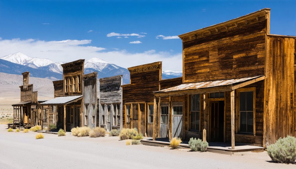
When William Wilson stumbled upon gold-bearing rock on the north side of a remote Nevada canyon in June 1866, he couldn’t have anticipated that his discovery would spawn one of the region’s most architecturally preserved ghost towns.
Pine Grove evolved into a three-tiered settlement stretching a mile through Pine Grove Canyon, ultimately accommodating 600 residents across five distinct sections. You’ll find nearly intact wooden structures, including a remarkably preserved hotel and stamp mill still resting on its original foundation.
The Wheeler and Wilson mines collectively extracted $8 million before operations ceased in 1918.
Today, you can explore abandoned cabins dotting the mountainside, where wild pony occasionally traverse canyon trails once traveled by twelve-horse freight teams. The settlement shares its name with numerous other locations across different regions, a common occurrence for places named after the pine trees that characterized their landscapes.
A cemetery overlooking the site contains dozens of unmarked graves documenting the settlement’s harsh frontier existence. Among the headstones, you’ll find the grave of Alice Maria Robinson, who died at age 15 and is remembered with a heartfelt epitaph.
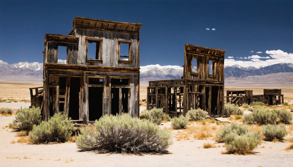
Humboldt City: From Picturesque Village to Extensive Ruins
You’ll find Humboldt City‘s trajectory from prosperous mining settlement to abandoned ruin remarkably compressed into a single decade. Louis Barbeau’s 1860 silver discovery in Humboldt Canyon triggered rapid development—500 residents, 200 buildings, and designation as the region’s first mining district by 1863—yet ore exhaustion by 1864 precipitated equally swift decline. The community featured two hotels, two saloons, and well-built homes with beautiful gardens along a stream that enhanced the town’s scenic character. The post office closed on November 30, 1869, marking the final administrative presence in the dying settlement. Today’s scattered rock walls, foundations, and collapsed mining operations represent all that survives of this once-picturesque village, accessible via deteriorating roads in Pershing County where no contemporary photographs document its brief prosperity.
Early Settlement and Prosperity
During spring 1860, French trader Louis Barbeau’s discovery of rich silver ore in the Humboldt mountain range triggered a migration that would transform a hostile Paiute territory into one of northern Nevada’s earliest mining centers.
You’ll find that Humboldt City‘s establishment in 1861 followed vital peace negotiations, enabling permanent settlement along a creek canyon six miles from the Humboldt River.
The community achieved remarkable prosperity by 1863, with 500 residents occupying 200 buildings—substantial stores, adobe houses, and hotels.
Its regional economic impact stemmed from over 1,000 silver discoveries between 1860-1869, while its strategic location provided historical transportation advantages as the California Trail‘s final stop before Carson Sink and terminus for the $40,000 Red Bluff wagon road, predating the Transcontinental Railroad‘s arrival.
The settlement’s infrastructure supported commerce through establishments including Coulter House and Iowa House, two saloons operated by local merchants, a blacksmith shop, and two stores carrying broad stock of goods for the mining community.
The town’s ideal climate conditions and natural springs provided reliable water sources that occasionally flooded the canyon streets during peak flow periods.
Decline and Remaining Structures
Although Humboldt City’s prosperity appeared secure in 1863 with five hundred residents occupying two hundred buildings—including the Coulter House and Iowa House hotels, two saloons, a blacksmith shop, stores, and a post office—the mining district’s foundation proved ephemeral. Mining decline accelerated after 1864 as ore discoveries ceased and silver production plummeted.
Infrastructure failure compounded the crisis when San Francisco investors abandoned their ambitious 61-mile Humboldt River ditch project, designed to power mills with a 250-foot waterfall.
You’ll find the town virtually emptied by 1869 when the post office transferred operations to Imlay. The post office officially closed on November 30, 1869.
Today’s landscape reveals:
- Stone foundations and deteriorating rock walls marking former residences
- Collapsed roofs on multiple structures throughout the canyon
- Scattered barbed wire indicating historical animal enclosures
Tunnel Camp: The Short-Lived Cyanide Mill Community
You’ll find Tunnel Camp’s remains approximately eight miles northeast of the Seven Troughs Mining District.
Nevada’s ambitious 1920s drainage operations left behind substantial archaeological evidence of failed engineering ambitions. The site preserves the foundations of a 100-ton cyanide processing facility, stamp mill equipment, and approximately thirty structural remnants that document the Seven Troughs Reorganized Mines Company’s ultimately unsuccessful attempt to access water-locked ore bodies through a 7,400-foot drainage tunnel. The power plant site still contains dugouts with remnants of old clothing and bunks from the workers who operated the diesel generators.
Beyond the industrial ruins, you can locate the cemetery below the townsite containing victims of the catastrophic 1912 flash flood that destroyed Mazuma. This disaster foreshadowed the district’s struggles with water management throughout subsequent mining operations. The tunnel’s positioning several hundred feet too high prevented proper drainage of the flooded mine, ultimately leading to the mill’s closure in 1934.
Nevada State Mining Operations
When Seven Troughs Reorganized Mines Company established Tunnel Camp in 1927 on the eastern flanks of the Seven Troughs Mountain Range, it salvaged structures from the abandoned Vernon townsite rather than constructing new buildings. This pragmatic approach created a thirty-structure settlement including store, bunkhouse, and bathhouse facilities.
The Deep Tunnel project, initiated in 1919, demonstrated ambitious mining technology designed to drain flooded mines across Seven Troughs, Coalition, Fairview, and Mazuma hills while serving as ore transport infrastructure. The tunnel construction was financed by investor L.A. Friedman with approximately $30 million in capital.
By 1929, engineers completed the 7,400-foot tunnel, complemented by a massive 100-ton Friedman ball mill and cyanide plant.
However, engineering miscalculation proved catastrophic:
- Tunnel missed drainage target by 500-700 feet above water level
- Insufficient ore recovery undermined milling operations
- Friedman Mill closed December 1934, ending community resilience
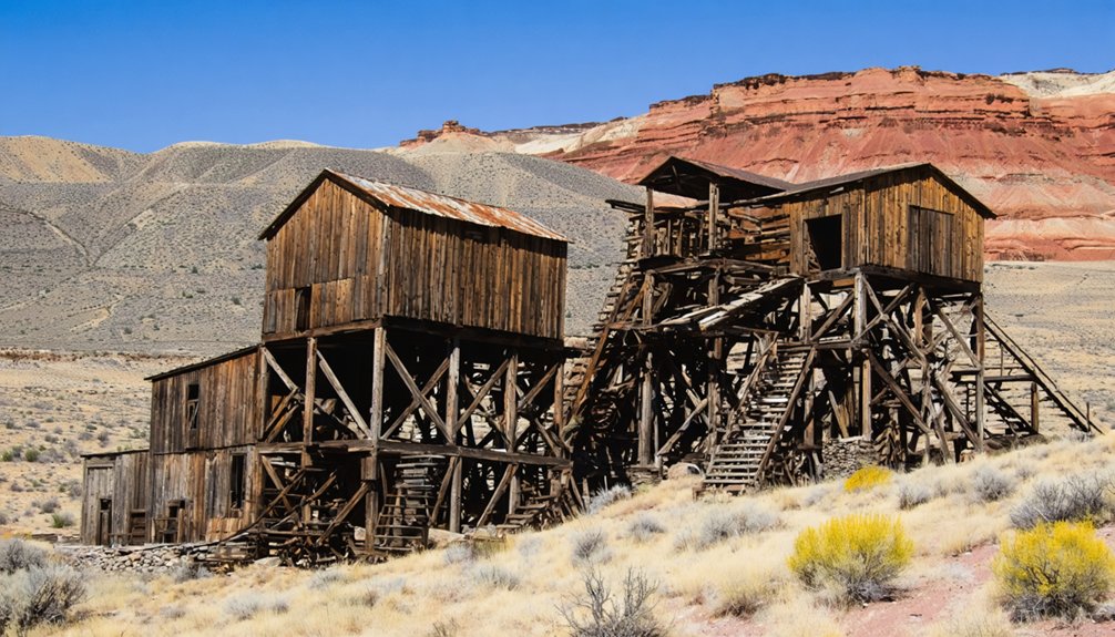
Remaining Structures and Architecture
The cyanide mill foundations dominate Tunnel Camp’s archaeological landscape, sprawling across terraced ground below skeletal iron remnants of the ambitious processing complex. You’ll find the 1930 ball mill‘s massive concrete base supporting ore hoppers and cyanide processing areas designed for flooded mine materials.
Within this foundation room stands the intact five-stamp mill, its iron front boldly stamped “Joshua Hendy Machine Works S.F.” – a post-1934 installation representing scaled-down operations after the main plant’s failure.
The brick powerhouse retains structural integrity, having housed three 120 h.p. Fairbanks-Morse diesels within galvanized steel walls.
Dugout cabins carved into hillsides demonstrate remarkable preservation, some showing recent occupation.
Below town, nine 1912 flood victims rest in a deteriorating cemetery – a sobering reminder of Nevada’s mining dangers requiring urgent structural preservation and historic architecture documentation.
Seven Troughs Flash Floods
During summer months when cloudbursts released torrential runoff across Nevada’s basins, Seven Troughs district faced catastrophic flooding that fundamentally altered its mining geography.
You’ll find no flood mitigation measures could withstand the 10-foot wall of water that struck the Cyanide Plant first, then obliterated Mazuma camp’s 100 residents downstream. The torrent, described as a liquid freight train, demonstrated river erosion’s devastating power through narrow canyons where mining infrastructure was concentrated.
Flood’s Physical Manifestations:
- Water wall height: A 10-foot surge transformed drainage channels into destructive corridors, overwhelming mill facilities positioned below Deep Tunnel portal.
- Mazuma’s erasure: Complete camp elimination—never rebuilt—exemplified how desert cloudbursts ended communities instantaneously.
- Infrastructure vulnerability: Canyon-based operations lacked escape routes when flash floods accelerated through confined spaces.
This disaster accelerated the district’s decline alongside insufficient ore production.
Jarbidge: Where Gold Rush History Still Lives
Along the remote Jarbidge River in Nevada’s far northern reaches, David S. Bourne’s 1909 gold prospecting efforts uncovered rich ore outcroppings at his North Star claim. You’ll find this discovery sparked one of the Old West’s final major rushes, drawing 1,500 men by March 1910.
The Elkoro Mining Company revolutionized operations through advanced mining technology—consolidating claims in 1918 and installing a 100-ton mill with electric power. This innovation propelled Jarbidge to lead Nevada’s gold production from 1919-1921, yielding $10 million through the early 1930s.
Despite a devastating 1919 fire that leveled the business district and eventual mine closures in the 1940s, you can still explore surviving structures that preserve this isolated community’s remarkable transformation from tent camps to Nevada’s premier gold-producing district.
Seven Troughs District: Flash Floods and Boomtown Dreams
You’ll find the Seven Troughs Mining District encompassed four distinct settlements—Seven Troughs, Vernon, Mazuma, and Farrell—established between 1906 and 1907 to serve a population that swelled to 5,000 during peak operations.
The district’s prosperity proved remarkably brief: catastrophic flash floods in 1912 devastated Mazuma and killed twenty residents.
While the 1917 flood at the Coalition Mine’s 1600-foot level inundated three miles of underground workings through cross-fissures.
Despite producing $2 million in gold between 1908 and 1918, successive flooding rendered drainage attempts futile, forcing complete abandonment by the mid-1930s.
Three Towns, One District
When prospectors stumbled upon gold-bearing ore in Seven Troughs Canyon during 1905, they couldn’t have anticipated the extraordinary boom that would follow. The canyon, named for Frank M. Ward’s 1894 sheep-watering troughs, would spawn four distinct settlements amid the native flora and rugged geological formations of Humboldt County.
By early 1907, the district supported three principal towns:
- Vernon served as the initial hub until August 1908, hosting the Seven Troughs Miner newspaper (1907-1910).
- Seven Troughs emerged as the most stable community, housing 350 residents with essential infrastructure including hotel, stores, and post office established July 18, 1907.
- Mazuma operated until the devastating 1912 flood claimed twenty lives, ending its brief existence.
This decentralized settlement pattern reflected miners’ fierce independence and proximity to their claims.
Mining’s End by Water
The Seven Troughs District’s prosperity would meet its demise not through ore depletion but through catastrophic water events that struck twice within five years.
In 1912, a giant flash flood obliterated Mazuma, killing twenty residents and damaging the Coalition Cyanide Plant. The deluge stunted production across all district operations, affecting processing facilities and mine shafts throughout the canyon.
Five years later, the Coalition Mine encountered devastating water flow at the 1,600-foot level, flooding three miles of underground workings within 400 feet of the surface. Multiple drainage attempts failed.
Without modern flood mitigation strategies or hydroelectric risks assessments, operators couldn’t counter nature’s assault. Both the Kindergarten Mill and Coalition Cyanide Plant closed permanently post-1917.
District mining ceased entirely by the mid-1930s, leaving only scattered ruins as *testament* to this water-destroyed enterprise.
Mazuma: Lost to Nature’s Fury
At the mouth of Seven Troughs Canyon in 1906, S.B. and Starr Hill established what would become one of northern Nevada’s most rapidly developing mining communities. Mazuma—named from Yiddish slang for money—boasted a bank, hotel, and bustling main street by 1908.
The geological formations surrounding this district held rich ore deposits that drew roughly 100 residents seeking fortune.
On July 18, 1912, a cloudburst struck Granite Peak. What followed became tragic local folklore:
- A twenty-foot wall of water roared down the canyon at 5:00 pm
- Cyanide from the destroyed Seven Troughs plant contaminated the floodwaters
- Eight confirmed deaths included the three Kehoe children
You’ll find only debris today. The post office closed months afterward, and survivors relocated to Tunnel Camp, leaving Mazuma to nature’s reclamation.
Unionville: A Semi-Abandoned Pershing County Relic
While Mazuma vanished beneath catastrophic floodwaters, Unionville’s story reflects a more gradual erosion of fortune—one measured in administrative losses, economic shifts, and population decline rather than sudden disaster.
You’ll find this canyon settlement’s indigenous history began when Paiute guides revealed silver deposits to Virginia City prospectors in 1861. Confederate sympathizers initially named it Dixie before Union supporters prevailed.
Unionville peaked at 1,000 residents by 1863, serving as Humboldt County’s seat until 1873.
The Arizona mine produced $2.7 million in silver through 1880, yet railroad bypasses and the 1872 fire devastated prospects.
Today’s twenty residents maintain cemetery grounds and historic structures, while surrounding areas support limited farming techniques.
You’re witnessing preservation through minimal intervention—architectural remnants documenting Nevada’s territorial evolution without administrative constraints.
Exploring the Mining Heritage of Northern Nevada
Northern Nevada’s mining heritage spans 170 years of technological evolution, from surface placer operations to microscopic gold extraction systems processing millions of tons annually.
You’ll discover how mining technology transformed regional economies through distinct phases: Mormon settlers’ 1849 placer discoveries, the Comstock Lode‘s revolutionary silver extraction methods, and Newmont’s 1963 identification of disseminated microscopic gold deposits requiring heap leaching innovations.
Economic impacts shaped settlement patterns across the territory:
- Eureka’s smelters consumed entire forests within a 30-mile radius, denuding surrounding hills for charcoal production between 1869-1890
- Tonopah’s $114,867,868 production from 1900-1920 financed railroad construction and cyanide mill installations by 1906
- Carlin Trend’s 2019 joint venture created the world’s largest gold mining complex with 22 combined operations
These technological advances enabled autonomous resource development across previously inaccessible terrain.
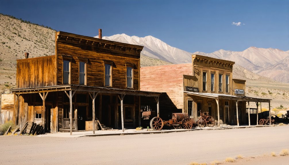
What to See: Preserved Structures and Historical Landmarks
Though decades of exposure have weathered their exteriors, Northern Nevada’s surviving structures demonstrate remarkable architectural resilience through material adaptation and climate advantage.
Fort Churchill’s adobe walls endure since 1861 due to arid desert conditions, while Berlin’s 30-stamp mill and machine shop preserve original mining equipment from the 1880s.
Desert aridity has preserved Fort Churchill’s adobe and Berlin’s industrial machinery for over a century where rainfall would have destroyed them.
You’ll find Belmont’s 150-year-old structures, though many lack roofs after timber-seeking prospectors stripped them during abandonment.
Goldfield maintains nearly 50 historic buildings, including its operational 1907 courthouse with Tiffany lamps.
Between documentary photography sessions, you’ll discover local cuisine in Goldfield’s remaining establishments.
Wildlife encounters occur frequently throughout these remote sites, where desert species reclaim abandoned homesteads.
Each structure represents autonomous settlement patterns, free from centralized urban planning constraints that defined Eastern development.
Planning Your Ghost Town Adventure in Northern Nevada
Successful exploration of Northern Nevada’s ghost towns requires methodical preparation that accounts for the region’s environmental extremes and infrastructural limitations.
You’ll need thorough navigation tools—interactive maps documenting over 500 locations with GPS coordinates ensure remote access to historically significant sites. October provides the most favorable conditions for ghost town preservation documentation, avoiding winter’s harsh temperatures and summer’s extreme heat.
Your vehicle must handle desert terrain, though most northern Nevada destinations remain accessible via standard routes like Highway 50.
Essential preparation elements include:
- Route verification through county-specific listings to identify access points like I-80 exit 231 for Galena or White Pine County Road 5 for Seven Troughs
- Desert emergency provisions accounting for isolation factors and communication limitations in remote areas
- Photography equipment for golden hour documentation and nighttime astrophotography opportunities at historically significant structures
Frequently Asked Questions
Are Ghost Towns in Northern Nevada Safe to Visit Alone?
Like Icarus flying solo toward the sun, you’ll face significant risks visiting alone. Historical preservation sites lack safety infrastructure, while wildlife encounters, structural collapses, and extreme isolation demand you travel prepared with companions, supplies, and emergency communication equipment.
Do I Need Special Permits to Explore These Abandoned Sites?
You won’t need permits for casual exploration of most public ghost town sites, but legal considerations demand respecting private property boundaries and preservation ethics prohibit disturbing artifacts, structures, or surface features during your independent visits.
What’s the Best Time of Year to Visit Northern Nevada Ghost Towns?
Fall offers you ideal conditions—comfortable temperatures enhance historical preservation documentation, clear skies provide superior photography tips opportunities, and reduced crowds let you freely explore archival details at sites like Munckton without summer’s oppressive heat or winter’s accessibility limitations.
Can I Take Artifacts or Souvenirs From These Ghost Towns?
No—you absolutely can’t take artifacts or souvenirs. Artifact removal violates federal law under BLM oversight. Souvenir ethics demand preservation over possession; these sites represent collective heritage. Removing relics destroys historical integrity for future generations seeking authentic western experiences.
Are There Guided Tours Available for Northern Nevada Ghost Towns?
Yes, you’ll find guided tours throughout northern Nevada’s ghost towns, from Reno’s haunted legends walks to Berlin’s ranger-led historical landmarks exploration. Multi-day packages and seasonal walking tours preserve authentic narratives while respecting these fragile archaeological sites.
Explorers seeking to uncover the past can venture into the abandoned mining towns in northern Nevada, where remnants of bustling communities still whisper stories of resilience and hardship. Each site tells a unique tale, reflecting the challenges faced by miners and their families during the gold rush era. As visitors wander through these historic landscapes, they are invited to imagine life in a time when the promise of fortune drew thousands to these now-desolate streets.
References
- https://nvtami.com/top-10-ghost-towns-nevada-northwest/
- https://en.wikipedia.org/wiki/List_of_ghost_towns_in_Nevada
- https://www.visittheusa.com/experience/6-nevada-ghost-towns-explore-if-you-dare
- https://travelnevada.com/ghost-town/ghost-towns-near-reno/
- https://www.atlasobscura.com/things-to-do/nevada/ghost-towns
- https://www.youtube.com/watch?v=eMc3JzSbD6k
- https://nvtami.com
- https://travelnevada.com/ghost-town/
- https://en.wikipedia.org/wiki/Pine_Grove
- https://www.youtube.com/watch?v=xF4NYVWB0ZM


