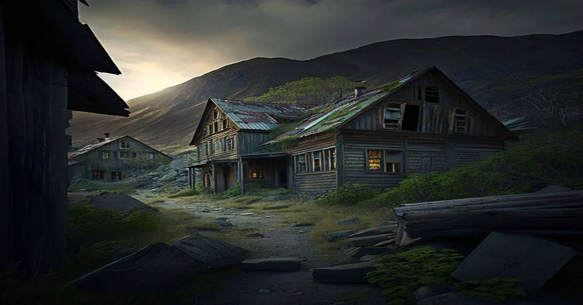
Leer, MI
County: Alpena
Zip Code: 49776
Latitude / Longitude: 45° 11′ 52″ N, 83° 44′ 22″ W
Elevation:
Time Zone: Eastern (EST) (UTC-5)
Established:
Disestablished:
Comments: Leer is an unincorporated community near the northern boundary of the township at 45°11’52″N 83°44’22″W The rural settlement was named after Lier, Norway, by the Norwegian immigrants who settled here. A post office operated from March 1901 until April 1910. Leer and the northern portion of Long Rapids Township is served by the Posen ZIP code of 49776.
Remains:
Current Status:
Remarks:
Lupton, MI
County: Ogemaw
Zip Code: 48635
Latitude / Longitude: 44° 25′ 52″ N, 84° 1′ 33″ W
Elevation:
Time Zone: Eastern (EST) (UTC-5)
Established:
Disestablished:
Comments: Lupton is an unincorporated community in the southeast corner of the township at 44°25’52″N 84°01’33″W. The Lupton ZIP code 48635 serves the eastern portion of the township as well as a portion of western Goodar Township to the east, eastern Hill Township to the southeast, western Cumming Township to the south and the northeast corner of Logan Township to the south of Hill Township and the northwest corner of Churchill Township to the south of Cumming Township. Lupton was first settled by several Quaker families from Ohio, including that of Emmor Lupton in 1880. It was first known as “Lane Heights” and given a post office as “Lane” in April 1881. A depot on the Detroit, Bay City and Alpena Railroad was opened in January 1893. The post office was renamed Lupton in June 1893.
Remains:
Current Status:
Remarks:
Mabel, MI
County:
Zip Code:
Latitude / Longitude:
Elevation:
Time Zone: Eastern (EST) (UTC-5)
Established:
Disestablished:
Comments:
Remains:
Current Status:
Remarks:
Mandan, MI
County: Keweena
Zip Code:
Latitude / Longitude: 47° 25′ 30″ N, 88° 0′ 56″ W
Elevation:
Time Zone: Eastern (EST) (UTC-5)
Established:
Disestablished:
Comments: Mandan is a ghost town in Grant Township, Keweenaw, Michigan, on US Highway 41, about twelve miles south of Copper Harbor. It was the site of the Mandan Mine and the Medora Mine, two copper mines which were organized in 1864 and worked intermittently until their abandonment in 1909. The town was served by the Keweenaw Central Railroad.
Remains:
Current Status:
Remarks:
Manseau, MI
County:
Zip Code:
Latitude / Longitude:
Elevation:
Time Zone: Eastern (EST) (UTC-5)
Established:
Disestablished:
Comments:
Remains:
Current Status:
Remarks:
Mansfield, MI
County: Iron
Zip Code:
Latitude / Longitude: 46°11’13″N 88°11’25″W
Elevation: 1,381 ft (421 m)
Time Zone: Eastern (EST) (UTC-5)
Established:
Disestablished:
Comments: Mansfield Township is a civil township of Iron in the U.S. state of Michigan. The population was 243 at the 2000 census. Mansfield Location is an unincorporated community in the township
Remains:
Current Status:
Remarks:
Marlborough, MI
County:
Zip Code:
Latitude / Longitude: 43°51’40″N 85°50’17″W
Elevation:
Time Zone: Eastern (EST) (UTC-5)
Established:
Disestablished:
Comments: The Marlborough Historic District is a cement factory located on James Road in Pleasant Plains Township, Michigan. It was designated a Michigan State Historic Site in 1971 and listed on the National Register of Historic Places in 1972.
Remains: In the 1890s, the Great Northern Portland Cement Company constructed a cement plant at this site to produce cement from the local marl. Production boomed, and in 1902, the company also began construction of a nearby village, dubbed Marlborough, for plant workers. By 1905, Marlborough had 400 citizens. However, problems quickly arose, as the produced cement was inferior, production was costly, and the enormous energy demands of the plant required construction of the largest power plant in the Lower Peninsula.
Current Status: The Great Northern Portland Cement Company entered receivership in 1906, and the village houses were sold for salvage. The plant was dynamited for scrap iron, and by 1910 only the ruins of the plant remained.
Remarks:
Mentha, MI
County:
Zip Code:
Latitude / Longitude: 42° 21′ 26″ N, 85° 46′ 29″ W
Elevation:
Time Zone: Eastern (EST) (UTC-5)
Established:
Disestablished:
Comments: Mentha is a ghost town, formerly known as a major source for peppermint for the production of mint oil by the company of Albert M. Todd. It was located at 42°21’26″N 85°46’29″W.
Remains:
Current Status:
Remarks:
Meredith, MI
County: Clare
Zip Code: 48624
Latitude / Longitude: 44° 7′ 50″ N, 84° 36′ 26″ W
Elevation:
Time Zone: Eastern (EST) (UTC-5)
Established:
Disestablished:
Comments: Meredith is an unincorporated community along the eastern boundary of the township with Sherman Township in Gladwin at 44°07’50″N 84°36’26″W. During the lumber boom of the late 1800s, the settlement had a population of as many as 1,800 people. A post office operated from January 14, 1884, until October 14, 1895.
Remains:
Current Status:
Remarks:
Metz, MI
County: Presque Isle
Zip Code:
Latitude / Longitude: 45°15’14″N 83°48’48″W
Elevation: 781 ft (238 m)
Time Zone: Eastern (EST) (UTC-5)
Established:
Disestablished:
Comments: Metz Township is a civil township of Presque Isle in the U.S. state of Michigan. The population was 331 at the 2000 census. Metz is a small unincorporated community within the township.
Remains:
Current Status: In October 1908, a large forest fire consumed 2,500,000 acres (10,000 km2) of Presque Isle, and most of the area of Metz. Killed were 26 men, women, and children, many of whom were on a train derailed by rails twisted from the fire.
Remarks:
Milton, MI
County: Macomb
Zip Code: 48047
Latitude / Longitude: 42° 41′ 21″ N, 82° 49′ 19″ W
Elevation: 607 ft (185 m)
Time Zone: Eastern (EST) (UTC-5)
Established:
Disestablished:
Comments: Milton is located at Gratiot Avenue and 24 Mile Road (42°41’21″N 82°49’19″W; Elevation: 607 ft./185 m.) and once was a station on the Grand Trunk Railroad. The first post office in the township was established here in 1837 in the house of Robert O. Milton, with the name of “New Haven Post Office”. This was moved to New Haven and Alfred D. Rice established another post office in Milton. That post office closed at some point and another was reopened in January 1856 with Edmund Matthews as postmaster. This office operated until July 1904. Milton was home to a school, three churches, a doctor, a blacksmith, and a couple of saloons.
Remains:
Current Status: The last saloon survived until 2004 when it was torn down, at that time it was known as the “Teddy Bear Bar.” The school, known as Milton School, was incorporated into another building which was torn down in 2002.
Remarks:
Mitchell, MI
County: Alcona
Zip Code: 48705
Latitude / Longitude: 44°42’50″N 83°47’55″W
Elevation: 886 ft (270 m)
Time Zone: Eastern (EST) (UTC-5)
Established:
Disestablished:
Comments: Mitchell Township is a civil township of Alcona in the U.S. state of Michigan. The population was 352 at the 2010 census.
Remains:
Current Status:
Remarks:
Mottville, MI
County: St. Joseph
Zip Code:
Latitude / Longitude: 41°47’22″N 85°43’51″W
Elevation: 794 ft (242 m)
Time Zone: Eastern (EST) (UTC-5)
Established:
Disestablished:
Comments: Mottville Township is a civil township of St. Joseph in the U.S. state of Michigan. The population was 1,499 at the 2000 census. US 12 runs through the township, and M-103 connects it with the Indiana state line.
Remains:
Current Status:
Remarks:
Nessen City, MI
County: Benzie
Zip Code:
Latitude / Longitude: 44°31’12″N 85°52’42″W
Elevation: 856 ft (261 m)
Time Zone: Eastern (EST) (UTC-5)
Established:
Disestablished:
Comments: Nessen City is an unincorporated community and census-designated place in Benzie, Michigan, United States. The population was 97 at the 2010 census.
Remains: Nessen City is an unincorporated community and census-designated place in Benzie, Michigan, United States. The population was 97 at the 2010 census.
Current Status: According to the United States Census Bureau, the CDP has a total area of 1.2 square miles (3.1 km2), all land.
Remarks:
Nicholsville, MI
County: Cass
Zip Code:
Latitude / Longitude: 42° 2′ 37″ N, 85° 53′ 46″ W
Elevation:
Time Zone: Eastern (EST) (UTC-5)
Established:
Disestablished:
Comments: Nicholsville was a historical settlement in the northeast part of the township between Finch Lake and Bunker Lake at 42°02’37″N 85°53’46″W. The first sawmill in the was built here in 1835 by Alexander Copley. Henry George built a grist mill in 1851, and the place was called “Georgetown”. He sold his interests to the Nichols brothers for whom the settlement was renamed in 1855. Jonathon Nichols operated a hotel here. The Rose Hill Cemetery nearby has also been known as “Little Prairie Ronde Cemetery” and “Nicholsville Cemetery”.
Remains:
Current Status:
Remarks:
Nonesuch Mine, MI
County: Ontonagon
Zip Code:
Latitude / Longitude: 46° 45′ 19″ N, 89° 37′ 11″ W
Elevation: 928 ft (283 m)
Time Zone: Eastern (EST) (UTC-5)
Established:
Disestablished:
Comments: The Nonesuch Mine is an abandoned copper mine and small ghost town in the southeast corner of the Porcupine Mountains State Park in Carp Lake Township, Ontonagon, near Silver City, Michigan, United States. The area was given its name soon after Ed Less discovered the Nonesuch vein of copper on the Little Iron River in 1865. The name refers to the occurrence of the copper in sandstone: “nonesuch” ore existed elsewhere in the Copper Country.
Remains: The life of Nonesuch was relatively short. It saw its first mining in 1867 and its last in 1912. The mine was opened and closed five different times, each under different ownership. The only time it made a profit was in the period 1879-1881.
Current Status: A US post office operated at Nonesuch from 1876 to 1887. Between 1881 and 1884 the town reached its peak with a population of about 300. The town included school with 30 students, as well as a boarding house, livery stable, markets, stage coach service, and a uniformed baseball team.
Remarks:
North Unity, MI
County:
Zip Code:
Latitude / Longitude:
Elevation:
Time Zone: Eastern (EST) (UTC-5)
Established:
Disestablished:
Comments:
Remains:
Current Status:
Remarks:
Omard, MI
County:
Zip Code:
Latitude / Longitude:
Elevation:
Time Zone: Eastern (EST) (UTC-5)
Established:
Disestablished:
Comments:
Remains:
Current Status:
Remarks:
Onominee, MI
County:
Zip Code:
Latitude / Longitude:
Elevation:
Time Zone: Eastern (EST) (UTC-5)
Established:
Disestablished:
Comments:
Remains:
Current Status:
Remarks:
Park Lake, MI
County:
Zip Code:
Latitude / Longitude:
Elevation:
Time Zone: Eastern (EST) (UTC-5)
Established:
Disestablished:
Comments:
Remains:
Current Status:
Remarks:
Peacock, MI
County: Lake
Zip Code: 49644
Latitude / Longitude: 44°1’44″N 85°51’46″W
Elevation: 1,007 ft (307 m)
Time Zone: Eastern (EST) (UTC-5)
Established:
Disestablished:
Comments: Peacock Township is a civil township of Lake in the U.S. state of Michigan. The population was 445 at the 2000 census.
Remains: Peacock was the name of a station on the Chicago and West Michigan Railroad (later known as the Pere Marquette Railway), 11 miles north of Baldwin. It was named for David J. Peacock, who became the first postmaster on April 15, 1897. The Peacock post office was discontinued in 1943.
Current Status:
Remarks:
Pennock, MI
County:
Zip Code:
Latitude / Longitude:
Elevation:
Time Zone: Eastern (EST) (UTC-5)
Established:
Disestablished:
Comments:
Remains:
Current Status:
Remarks:
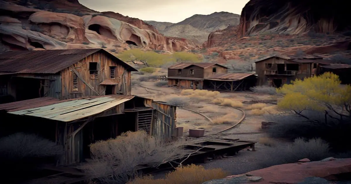
Pere Cheney, MI
County: Crawford
Zip Code: 48653
Latitude / Longitude: 44°34’39″N 84°38’16″W
Elevation: 1,201 ft (366 m)
Time Zone: Eastern (EST) (UTC-5)
Established:
Disestablished:
Comments: Pere Cheney, also called Cheney and Center Plains, was a village located in Crawford, Michigan in the late 19th century. It is located in Beaver Creek Township and was once a small lumbering town. Pere Cheney was the first community in Crawford, Michigan and was established by lumberjacks who trailed the Jackson, Lansing and Saginaw Railroad north headed for Mackinaw City. Established in 1874 around the sawmill of George M. Cheney, it served as the temporary seat when Crawford was officially organized in 1879, though it soon lost this distinction to the more heavily populated town of Grayling. It had a station on the Michigan Central Railroad called the Cheney depot, and a post office. The post office closed in 1912, and the village was abandoned in the early Twentieth century. It has since taken on the reputation of a ghost town.
Remains: Pere Cheney was established in 1873, as founder George Cheney received a land grant from the Michigan Central Railroad company to establish a stop along the railroad. A general store was established along with sawmills, carpenters, a doctor, hotel with a telegraph service and a post office. In the mid-1870s, the population was approximately 1,500 people. In 1893, diphtheria spread through the town, wiping out a great deal of the town’s population. Diphtheria recurred in 1897, by 1901 the town’s population fell to only 25 people and in 1917 there were only 18 people left in this once booming town. At that time, the land was sold off in a public auction and the town was declared a ghost town.
Current Status: If you were to visit Pere Cheney now it is quite difficult to find the cemetery. It is in the middle of the woods on a two track road, so unless you have a truck or bigger car it is difficult to reach without getting stuck. In March 2015, it was announced that there is plans to restore the cemetery to its former glory.[dead link] To this day, Pere Cheney remains Number 2 on the Top 10 Witch Graves in the Midwest, topped only by Bloody Mary of Indiana.
Remarks: The cemetery is owned by Beaver Creek Township, Michigan and is maintained by the township.
Pinnebog, MI
County: Huron
Zip Code:
Latitude / Longitude: 43° 56′ 7″ N, 83° 6′ 14″ W
Elevation: 607 ft (185 m)
Time Zone: Eastern (EST) (UTC-5)
Established:
Disestablished:
Comments: Pinnebog is a tiny unincorporated community in the southwest of the township, on the boundary with Meade Township at Kinde and Pinnebog roads
Remains:
Current Status:
Remarks:
Pinnepog, MI
County:
Zip Code:
Latitude / Longitude:
Elevation:
Time Zone: Eastern (EST) (UTC-5)
Established:
Disestablished:
Comments:
Remains:
Current Status:
Remarks:
Podunk, MI
County: Tuscola
Zip Code: 48746
Latitude / Longitude: 43°16’44″N 83°31’18″W
Elevation: 761 ft (232 m)
Time Zone: Eastern (EST) (UTC-5)
Established:
Disestablished:
Comments: The first recorded settler of Millington Township was E.E. Brainerd in December 1850. At this time, Millington Township was known as Podunk. Its name was later changed to Lanesville in 1860, and Millington in 1872.
Remains:
Current Status:
Remarks:
Pokagon, MI
County: Cass
Zip Code:
Latitude / Longitude: 41°56’27″N 86°10’14″W
Elevation: 751 ft (229 m)
Time Zone: Eastern (EST) (UTC-5)
Established:
Disestablished:
Comments: Pokagon Township is a civil township of Cass in the U.S. state of Michigan. The population was 2,029 at the 2010 census. The township includes the unincorporated communities of Pokagon and Sumnerville, adjacent to each other on M-51.
Remains: Pokagon Township is the location of the first public performance of the hymn “The Old Rugged Cross”. The township is also the birthplace of journalist Webb Miller.
Current Status:
Remarks:
Port Sheldon, MI
County: Ottawa
Zip Code: 49424
Latitude / Longitude: 42° 53′ 58″ N, 86° 11′ 59″ W
Elevation: 594 ft (181 m)
Time Zone: Eastern (EST) (UTC-5)
Established:
Disestablished:
Comments: Port Sheldon is an unincorporated community in the township at 42°53’58″N 86°11’59″W
Remains:
Current Status:
Remarks:
Potts, MI
County:
Zip Code:
Latitude / Longitude:
Elevation:
Time Zone: Eastern (EST) (UTC-5)
Established:
Disestablished:
Comments:
Remains:
Current Status:
Remarks:
Print, MI
County:
Zip Code:
Latitude / Longitude:
Elevation:
Time Zone: Eastern (EST) (UTC-5)
Established:
Disestablished:
Comments:
Remains:
Current Status:
Remarks:
Quinn, MI
County: Macomb
Zip Code:
Latitude / Longitude:
Elevation:
Time Zone: Eastern (EST) (UTC-5)
Established:
Disestablished:
Comments: The former settlement of Quinn, Michigan, was located in Clinton Township, Macomb, Michigan on Gratiot past mile marker 16, roughly in the area of 14 Mile and Quinn Road. Quinn Rd. is still a Clinton Township street crossing Gratiot.
Remains: Theodore Kath became Quinn’s first postmaster on December 10, 1869. The post office stayed open for just under four years, closing its doors on September 15, 1873 The 12th Michigan Infantry was begun under Colonel Francis Quinn at Niles in 1861. The Quinn family built a home on Gratiot in 1881 There were also reports of Underground Railroad activity in the area prior to the Civil War.
Current Status:
Remarks:
Rattle Run, MI
County: St. Clair
Zip Code:
Latitude / Longitude: 42° 51′ 59″ N, 82° 35′ 59″ W
Elevation: 630 ft (192 m)
Time Zone: Eastern (EST) (UTC-5)
Established:
Disestablished:
Comments: Rattle Run is an unincorporated community in the western part of the Township located at Gratiot Avenue and Rattle Run Road
Remains:
Current Status:
Remarks:
Rawsonville, MI
County: Wayne
Zip Code:
Latitude / Longitude: 42° 12′ 55″ N, 83° 33′ 6″ W
Elevation:
Time Zone: Eastern (EST) (UTC-5)
Established:
Disestablished:
Comments: Rawsonville, Michigan, also known as Snow’s Landing and Michigan City, is a ghost town in Van Buren Charter Township, Wayne and Ypsilanti Township, Washtenaw. The site of Rawsonville lies mostly under Belleville Lake across I-94 from Willow Run Airport. The village was flooded out in 1925 when the Eastern Michigan Edison Company built the French Landing Dam and Powerhouse on the Huron River.
Remains: In 1800, the first settler Henry Snow came to this location which was original called Snow’s Landing. In 1825, Ambline Rawson and his father arrived at the village. The community plat, as Michigan City by Amasah Rawson and two others, was filed on January 7, 1836. On November 14, 1838, The Van Buren post office was move to Rawsonville and assumed that name.
Current Status: On October 25, 1895, the post office was closed only to reopen on November 20, 1895 only to close again on February 28, 1902. By 1900, there were few residents here. In 1925, a dam was put in place on the Huron River placing most of the village under water of the new Belleville Lake. The only visual sign that a village was here at one time is the historical marker in front of the McDonald’s on Rawsonville Road and across from Grove Road.
Remarks: By the Civil War era, the village was doing well with grist mill, saw mill, a stove factory, and a wagon maker. With the building of the railroad, the community was bypassed hurting the industries there.
Sharon, MI
County: Washtenaw
Zip Code: 48158
Latitude / Longitude: 42°12’31″N 84°4’57″W
Elevation: 984 ft (300 m)
Time Zone: Eastern (EST) (UTC-5)
Established:
Disestablished:
Comments: Sharon Township is a civil township of Washtenaw in the U.S. state of Michigan. The population was 1,737 at the 2010 census.
Remains:
Current Status:
Remarks:
Shavehead, MI
County:
Zip Code:
Latitude / Longitude:
Elevation:
Time Zone: Eastern (EST) (UTC-5)
Established:
Disestablished:
Comments:
Remains:
Current Status:
Remarks:
Shelldrake, MI
County: Chippewa
Zip Code:
Latitude / Longitude: 46°40’40″N 85°02’01″W
Elevation:
Time Zone: Eastern (EST) (UTC-5)
Established:
1880s
Disestablished:
1920s
Comments: Shelldrake is a ghost town in Whitefish Township, Chippewa, Michigan, United States, about 8 miles (13 km) south of Whitefish Point, Michigan at the mouth of the Shelldrake River (also known as the Betsy River) on Whitefish Bay. It is listed on the Michigan Historic Register. Prior to European settlement it supported a seasonal Native American fishing village. In the 1890s and early 1900s, it was a thriving sawmill town during peak logging years on the Tahquamenon River watershed.
Remains:
Current Status: By the 1920s repeated fires and the decline of lumbering led to its demise. Today it is a privately owned ghost town with only a few weathered, original buildings.
Remarks: Take M-123 to Paradise to the intersection with Whitefish Point Road, continue straight on Whitefish Point Road for 3.7 miles (6.0 km), turn right on Superior Drive, travel 0.1 miles (0.16 km) to first curve, park and walk right/south on the trail intersecting Superior Drive for approximately 300 feet (91 m). The historic buildings and state marker are on the right of the trail facing Whitefish Bay.
Shiawassee Town, MI
County: Shiawassee
Zip Code:
Latitude / Longitude: 42° 55′ 46″ N, 84° 4′ 46″ W
Elevation: 830 ft (253 m)
Time Zone: Eastern (EST) (UTC-5)
Established:
Disestablished:
Comments: Shiawasseetown is an unincorporated community within the township at Bancroft and Bennington roads. 42°55’46″N 84°04’46″W Charles Bacon from Ohio started a company to buy and sell land here. A plat was filed and recorded in 1836. On July 12, 1837, Lemuel Brown, postmaster, opened the post office as Shiawassee. On May 26, 1857, the Office was renamed Shiawassee Town. The city was planned as a possible state capital with 90 city blocks, two town squares and a park. The Shiawassee River in the community was dammed in the early 1900s for power. Most of the development never materialized.
Remains:
Current Status:
Remarks:
Sigma, MI
County:
Zip Code:
Latitude / Longitude:
Elevation:
Time Zone: Eastern (EST) (UTC-5)
Established:
Disestablished:
Comments:
Remains:
Current Status:
Remarks:
Singapore, MI
County: Allegan
Zip Code:
Latitude / Longitude: 42° 40′ 40″ N, 86° 12′ 36″ W
Elevation:
Time Zone: Eastern (EST) (UTC-5)
Established:
Disestablished:
Comments: Singapore, perhaps Michigan’s most famous ghost town, is one of the casualties of the four great fires (Chicago, Holland, Peshtigo, and Manistee) that ravaged the northern midwest on October 8, 1871. Its ruins now lie buried beneath the sand dunes of the Lake Michigan shoreline at the mouth of the Kalamazoo River in Saugatuck Township, near the cities of Saugatuck and Douglas in Allegan.
Remains: Singapore, Michigan, was founded in 1836 by New York land speculator Oshea Wilder, who was hoping to build a port town to rival Chicago and Milwaukee. At its height, the town boasted of three mills, two hotels, several general stores, a renowned bank, and was home to Michigan’s first schoolhouse. In total, the town consisted of 23 buildings and two sawmills.
Current Status: Today, Singapore lives on only in the name of the Singapore Yacht Club, which is at one end of town. Just as the “cow kicking over the lantern” story was born out of the Great Chicago Fire, this event also gave birth to a legend. The story persists that one resident of Singapore refused to move, even as the sand enveloped his home. Eventually he had to enter and leave the dwelling by a second floor window, and he stayed until the sand reached the roof.
Remarks: The 40-Day Blizzard of 1842 might very well have wiped out the people of Singapore, had it not been for the shipwreck of the Milwaukie just off her shore. The food with which that ship was stocked nourished the people of Singapore until the blizzard blew over. After the fires which swept through Chicago, Holland, and Peshtigo in late 1871, Singapore was almost completely deforested supplying the three towns with lumber for rebuilding. Without the protective tree cover, the winds and sands coming off Lake Michigan quickly eroded the town into ruins and within four years had completely covered it over. The town was vacated by 1875.
South Assyria, MI
County:
Zip Code:
Latitude / Longitude:
Elevation:
Time Zone: Eastern (EST) (UTC-5)
Established:
Disestablished:
Comments:
Remains:
Current Status:
Remarks:
South Boardman, MI
County: Kalkaska
Zip Code:
Latitude / Longitude: 44° 38′ 29″ N, 85° 16′ 47″ W
Elevation: 1,010 ft (308 m)
Time Zone: Eastern (EST) (UTC-5)
Established:
Disestablished:
Comments: South Boardman is an unincorporated community near the center of the township at 44°38’29″N 85°16’47″W. It is approximately 8 miles (13 km) southwest of Kalkaska along US 131. As it was built through the area, the Grand Rapids and Indiana Railroad platted the settlement at the juncture of the rail line with the south branch of the Boardman River. Hamilton Stone bought the plat and with associates began operations in 1874, building a depot and hotel. A post office was established in June 1875. The South Boardman ZIP code, 49680, serves most of Boardman Township as well as portions of Kalkaska Township to the north, Orange Township to the east, and Springfield Township to the south.
Remains:
Current Status:
Remarks:
Springvale, MI
County: Emmet
Zip Code:
Latitude / Longitude: 45°21’9″N 84°47’30″W
Elevation: 856 ft (261 m)
Time Zone: Eastern (EST) (UTC-5)
Established:
Disestablished:
Comments: Springvale Township is a civil township of Emmet in the U.S. state of Michigan. The population was 1,727 at the 2000 census.
Remains:
Current Status:
Remarks:
Stittsville, MI
County:
Zip Code:
Latitude / Longitude:
Elevation:
Time Zone: Eastern (EST) (UTC-5)
Established:
Disestablished:
Comments:
Remains:
Current Status:
Remarks:
Stover, MI
County:
Zip Code:
Latitude / Longitude:
Elevation:
Time Zone: Eastern (EST) (UTC-5)
Established:
Disestablished:
Comments:
Remains:
Current Status:
Remarks:
Stratford, MI
County:
Zip Code:
Latitude / Longitude:
Elevation:
Time Zone: Eastern (EST) (UTC-5)
Established:
Disestablished:
Comments:
Remains:
Current Status:
Remarks:
Superior, MI
County:
Zip Code:
Latitude / Longitude:
Elevation:
Time Zone: Eastern (EST) (UTC-5)
Established:
Disestablished:
Comments:
Remains:
Current Status:
Remarks:
Temple, MI
County: Clare
Zip Code:
Latitude / Longitude: 44° 1′ 51″ N, 85° 1′ 42″ W
Elevation: 1,053 ft (321 m)
Time Zone: Eastern (EST) (UTC-5)
Established:
Disestablished:
Comments: Temple is an unincorporated community just off M-61 approximately 12 miles west of Harrison at 44°01’51″N 85°01’42″W. It was a station on the Toledo, Ann Arbor and North Michigan Railway and was founded in 1889 while the area was still a part of Winterfield Township on land given by Mary L. Campbell. For her, the settlement was first known as Campbell City. A post office named Temple, after Martin Temple, opened on April 21, 1890, with hotelman, Bert Trall, as the first postmaster. The office operated until August 12, 1966. Located along the Muskegon River, it was a bustling area when Michigan’s logging industry was in its prime, like many of lower Michigan’s former logging centers.
Remains:
Current Status:
Remarks:
Tunk, MI
County: Grand Traverse
Zip Code:
Latitude / Longitude: 44° 46′ 39.65″ N, 85° 21′ 10.99″ W
Elevation:
Time Zone: Eastern (EST) (UTC-5)
Established:
Disestablished:
Comments: Tunk is a ghost town northeast of Mabel
Remains:
Current Status:
Remarks:
Union, MI
County: Cass
Zip Code:
Latitude / Longitude: 41° 47′ 0″ N, 85° 52′ 0″ W
Elevation:
Time Zone: Eastern (EST) (UTC-5)
Established:
Disestablished:
Comments: Union 41°47’N 85°52’W is an unincorporated community in the southeast part of the township on US 12 at Union Rd. It has a post office.
Remains:
Current Status:
Remarks:
Vermilion, MI
County: Chippewa
Zip Code:
Latitude / Longitude: 46° 45′ 47″ N, 85° 8′ 56″ W
Elevation:
Time Zone: Eastern (EST) (UTC-5)
Established:
Disestablished:
Comments: Vermilion is an unincorporated community located at 46°45’47″N 85°08’56″W within the northern portion of the township along the shore of Lake Superior on Vermilion Point.
Remains:
Current Status:
Remarks:
Volinia, MI
County: Cass
Zip Code:
Latitude / Longitude: 42° 0′ 42″ N, 85° 57′ 17″ W
Elevation:
Time Zone: Eastern (EST) (UTC-5)
Established:
Disestablished:
Comments: Volina was a historical settlement in the township at 42°00’42″N 85°57’17″W. A post office was established in May 1834. The settlement was platted in 1836 by Levi Lawrence, David Hopkins, Obed Bunker and John Shaw. The post office closed in March 1838 and was reestablished in April 1840. In December 1851 the post office was moved and renamed “Pickett’s Corners”. The post office there closed in July 1862. The post office at Volina was restored in January 1863 and closed in October 1902.
Remains:
Current Status:
Remarks:
Watervale, MI
County:
Zip Code:
Latitude / Longitude: 44°33’14″N 86°13’4″W
Elevation:
Time Zone: Eastern (EST) (UTC-5)
Established: 1892
Disestablished:
Comments: The Watervale Historic District is a resort, originally constructed as a lumber camp, located at 975-1422 Watervale Road on the shore of Lower Herring Lake in Blaine Township, Michigan. It was designated a Michigan State Historic Site in 1991 and listed on the National Register of Historic Places in 2003.
Remains: Leo F. Hale began a logging and shipping operation in this area in the early 1890s. In 1893, Hale, along with William and Mary Vincent, platted out the village of Watervale on the south shore of Lower Herring Lake. They built about 20 houses, many of which were shacks. There were, however, at least eight painted frame houses. The village also contained a meat market, general store, and post office.
Current Status: The Watervale Historic District contains 16 buildings constructed between 1892 and 1927 sited along Watervale Road. The buildings include the former general store, a former boarding house now used as an inn, an assortment one- and two-story clapboard-covered houses and several early 20th century cottages.
Remarks: As the logging boom waned, Hale went bankrupt, and by 1900 had lost most of Watervale; it was eventually nearly abandoned. In 1917, Dr. Oscar H. Kraft of Chicago purchased the town and adjacent land to use as a resort for his family. He restored several buildings, and opened it that summer as a public resort. Kraft’s niece, Vera Noble, and her husband Vernon purchased the resort in 1960; Vera ran Watervale until her death in 2005, when it was passed on to her children.
Wekwagamaw, MI
County:
Zip Code:
Latitude / Longitude:
Elevation:
Time Zone: Eastern (EST) (UTC-5)
Established:
Disestablished:
Comments:
Remains:
Current Status:
Remarks:
Wetzell, MI
County:
Zip Code:
Latitude / Longitude:
Elevation:
Time Zone: Eastern (EST) (UTC-5)
Established:
Disestablished:
Comments:
Remains:
Current Status:
Remarks:
Whiskey Creek, MI
County:
Zip Code:
Latitude / Longitude:
Elevation:
Time Zone: Eastern (EST) (UTC-5)
Established:
Disestablished:
Comments:
Remains:
Current Status:
Remarks:
Whitefish Point, MI
County: Chippewa
Zip Code:
Latitude / Longitude: 46° 46′ 14″ N, 84° 57′ 24″ W
Elevation:
Time Zone: Eastern (EST) (UTC-5)
Established:
Disestablished:
Comments: Whitefish Point is an unincorporated community located at 46°46’14″N 84°57’24″W within the northeastern portion of the township along the shore of Lake Superior on Vermilion Point. The Great Lakes Shipwreck Museum, Whitefish Point Bird Observatory and Whitefish Point Light are located in Whitefish Point.
Remains:
Current Status:
Remarks:
Wilson, MI
County: Menominee
Zip Code: 49896
Latitude / Longitude: 45°42’19″N 87°26’17″W
Elevation: 794 ft (242 m)
Time Zone: Eastern (EST) (UTC-5)
Established:
Disestablished:
Comments: Wilson is an unincorporated community in Menominee, Michigan, United States. Wilson is located in Harris Township along U.S. Highway 2 (US 2), US 41 and the Canadian National Railway, 4.5 miles (7.2 km) east-northeast of Powers. Wilson has a post office with ZIP code 49896.
Remains: The Chicago and North Western Railway built a station at the community in 1872–73 to serve local charcoal kilns, which was originally called Ferry Switch. The first school in Wilson opened in 1881–82. A post office, originally called Myra, opened in the community on February 24, 1881; Daniel McIntyre was the first postmaster. The post office was renamed to Wilson on November 1, 1881, after local sawmill owner Frank D. Wilson, who then became postmaster. The railway station closed in 1950.
Current Status: The central buildings in the rural Wilson community are the Seventh-day Adventist Church and school. Wilson is home to the largest Adventist church in the Upper Peninsula of Michigan. The church also operates a Junior Academy, enrolling grades 1 – 10. Many of the descendants of those who helped to establish the community by building the church and school still live in the area.
Remarks: In the early 1900s, a group of Adventists from Wisconsin moved into the area and began farming. A church was erected in 1908 and services were originally held in French. The first minister was R.J. Bellows. In 1948, a furnace fire caused the church to be demolished, however, a new church was built and completed in 1949. A small area at the back of the church was partitioned off as a schoolroom, however, the space was inadequate and in 1947, a public school building was purchased from the Ford River Township and moved onto land across from the church. In 1964, the original school was torn down and a new three-room school with a gymnasium was built. The school is still in operation today.