Beebe River, NH
County:
Zip Code:
Latitude / Longitude: 43° 48′ 56.88 N, 71° 39′ 39.96 W
Elevation:
Time Zone: Eastern (EST) (UTC-5)
Established:
Disestablished:
Comments:
Remains:
Current Status:
Remarks:
Carrigain, NH
County: Grafton
Zip Code:
Latitude / Longitude: 44°05’37 N 71°26’48 W
Elevation: 4,683 ft (1,427 m)
Time Zone: Eastern (EST) (UTC-5)
Established:
Disestablished:
Comments: Mount Carrigain is a mountain located in Grafton County, New Hampshire. The mountain is named after Phillip Carrigain, NH Secretary of State (1805–10), and is on the south side of the Pemigewasset Wilderness, the source of the East Branch of the Pemigewasset River in the heart of the White Mountains, between Franconia Notch and Crawford Notch. Carrigain is flanked to the northeast beyond Carrigain’s Vose Spur by Mount Anderson and Mount Lowell across Carrigain Notch, and to the southwest by Mount Hancock. It has a fire tower at the summit, providing 360-degree views of the surrounding wilderness.
Remains:
Current Status:
Remarks:
Johnson & Little Canada, NH
County:
Zip Code:
Latitude / Longitude:
Elevation:
Time Zone: Eastern (EST) (UTC-5)
Established:
Disestablished:
Comments:
Remains:
Current Status:
Remarks:
Kilkenny, NH
County:
Zip Code:
Latitude / Longitude:
Elevation:
Time Zone: Eastern (EST) (UTC-5)
Established:
Disestablished:
Comments:
Remains:
Current Status:
Remarks:
Livermore, NH
County: Grafton
Zip Code:
Latitude / Longitude: 44° 4′ 28 N, 71° 22′ 38 W
Elevation:
Time Zone: Eastern (EST) (UTC-5)
Established: 1876
Disestablished: 1951
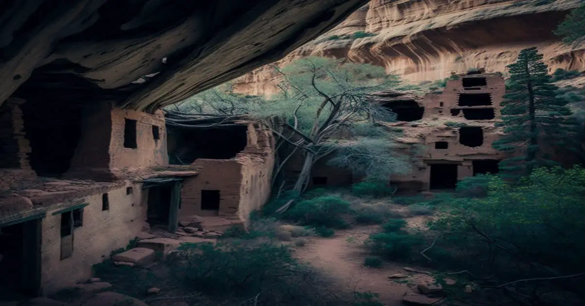
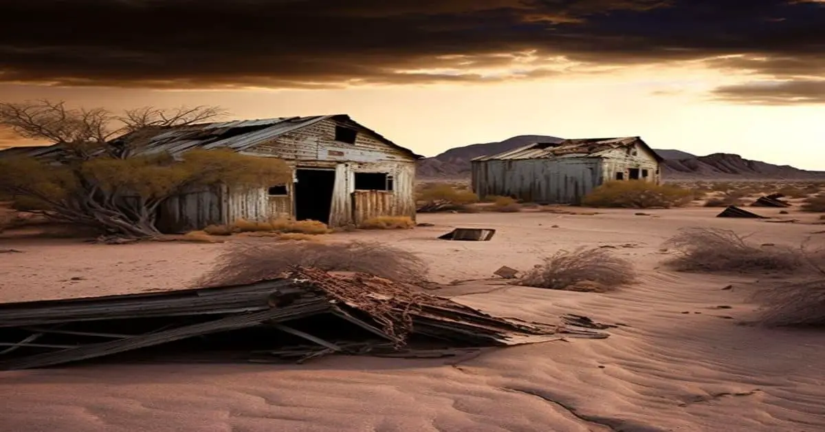
Comments: Livermore is an unincorporated civil township and ghost town in Grafton County, New Hampshire, United States. It was briefly inhabited as a logging town in the late 19th and early 20th centuries. The site of the former village is about 16 miles (26 km) west of North Conway, about 1.5 miles (2.4 km) from US Route 302 (the Crawford Notch Highway) via the U.S. Forest Service Sawyer River Road.
Remains:
Current Status: The logging operation was established by Daniel Saunders Jr. and Charles W. Saunders, members of the Saunders family. The town was named for Samuel Livermore, a former United States senator who was the grandfather of Daniel Saunders’ wife. The population was reported as 0 at the 2010 census.
Remarks:
Monson, NH
County:
Zip Code:
Latitude / Longitude:
Elevation:
Time Zone: Eastern (EST) (UTC-5)
Established:
Disestablished:
Comments:
Remains:
Current Status:
Remarks:
True Francestown, NH
County:
Zip Code:
Latitude / Longitude:
Elevation:
Time Zone: Eastern (EST) (UTC-5)
Established:
Disestablished:
Comments:
Remains:
Current Status:
Remarks:
Zealand, NH
County:
Zip Code:
Latitude / Longitude:
Elevation:
Time Zone: Eastern (EST) (UTC-5)
Established:
Disestablished:
Comments: Zealand is a former village that is located in the town’s remote eastern/northern section of town that is within the White Mountain National Forest.
Remains: The primary settlement in town, where 993 people resided at the 2010 census, is defined as the Lincoln census-designated place (CDP) and is located along New Hampshire Route 112 east of Interstate 93. The town also includes the former village sites of Stillwater and Zealand (sometimes known as Pullman) in the town’s remote eastern and northern sections respectively, which are now within the White Mountain National Forest.
Current Status: The town was settled about 1782. The 1790 census indicates that it had 22 inhabitants. Rocky soil yielded poor farming, but the area’s abundant timber, combined with water power to run sawmills on the Pemigewasset River and its East Branch, helped Lincoln develop into a center for logging. By 1853, the Merrimack River Lumber Company was operating. The railroad transported freight, and increasingly brought tourists to the beautiful mountain region. In 1892, James E. Henry bought approximately 100,000 acres (400 km2) of virgin timber and established a logging enterprise at what is today the center of Lincoln. In 1902, he built a pulp and paper mill. He erected the Lincoln House hotel in 1903, although a 1907 fire would nearly raze the community. Until he died in 1912, Henry controlled his company town, installing relatives in positions of civic authority.
Remarks: In 1764, Colonial Governor Benning Wentworth granted 32,456 acres (131.34 km2) to a group of approximately 70 land investors from Connecticut. Lincoln was named after Henry Fiennes Pelham-Clinton, 2nd Duke of Newcastle, 9th Earl of Lincoln – a cousin of the Wentworth governors. He held the position of the comptroller of customs for the port of London under George II and George III, which was important to trade between America and England.