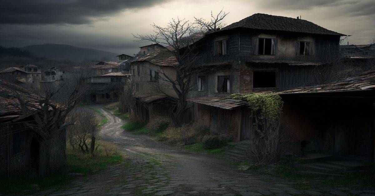
Batsto Village, NJ
County: Burlington
Zip Code:
Latitude / Longitude: 39°38’30 N 74°38’52 W
Elevation: 13 ft (4 m)
Time Zone: Eastern (EST) (UTC-5)
Established:
Disestablished:
Comments: Batsto Village (or simply Batsto) is a historic unincorporated community located on CR 542 within Washington Township in Burlington County, New Jersey, United States. It is located in Wharton State Forest in the south-central Pine Barrens and a part of the Pinelands National Reserve. It is listed on the New Jersey and National Register of Historic Places and is administered by the New Jersey Department of Environmental Protection’s Division of Parks & Forestry. The name is derived from the Swedish bastu, bathing place (also the Swedish word for Finnish sauna); the first bathers were probably the Lenni Lenape Native Americans.
Remains: In 1766, Charles Read, a well-known ironmaster, built the Batsto Iron Works along the Batsto River on the site of the future village. The area had an abundance of bog ore which could be mined from the area’s streams and rivers, and wood from the area’s forests were harvested for charcoal for smelting the ore. The rivers, despite their modest drop, were also harnessed for iron making.
Current Status: Today there are more than forty sites and structures, including the Batsto mansion, a sawmill, a 19th-century ore boat, a charcoal kiln, ice and milk houses, a carriage house and stable, a blacksmith and wheelwright shop, a gristmill, and a general store. The Post Office is still in operation, and collectors have stamps hand-canceled, with no zip code. The Batsto-Pleasant Mills United Methodist Church building erected in 1808 as the Batsto-Pleasant Mills Methodist Episcopal Church, is still active as a place of worship.
Remarks: 1766 First building built on the site of the future village.
Crossley, NJ
County:
Zip Code:
Latitude / Longitude:
Elevation:
Time Zone: Eastern (EST) (UTC-5)
Established:
Disestablished:
Comments:
Remains:
Current Status:
Remarks:
Double Trouble, NJ
County:
Zip Code:
Latitude / Longitude: 39°53’52.36 N 74°13’16.65 W
Elevation:
Time Zone: Eastern (EST) (UTC-5)
Established:
Disestablished:
Comments: Double Trouble State Park is located in Lacey and Berkeley Townships in Ocean County, in the U.S. state of New Jersey. The park was once the Double Trouble company’s company town. The park’s wilderness provides a unique insight into the Pine Barrens ecosystem. The park is operated and maintained by the New Jersey Division of Parks and Forestry.
Remains: The Double Trouble Historic Village was originally a cranberry farm and packing plant. The Double Trouble Company was formed to sell timber, millwork products, and cranberries. Many sawmills have been in the town since the mid-18th century. The village consists of cranberry bogs and fourteen restored historic structures dating from the late 19th century through the early 20th century including a general store, a schoolhouse, and houses. The sawmill was restored in 1995, and the cranberry sorting and packing house were completed in 1996.
Current Status: Cedar Creek’s headwaters start from the Greenwood Forest Management Area to its mouth at Barnegat Bay. Cedar Creek provides the water needed for cranberry culture and provides a source of water for wildlife. The Double Trouble State Park Nature Trail is a 1.5 miles (2.4 km) loop trail. (This trail is not rated by the New Jersey Department of Environmental Protection). The trail is part of the New Jersey Coastal Heritage Route.
Remarks:
Feltville Historic District, NJ
County:
Zip Code:
Latitude / Longitude: 40°40′53″N 74°23′13″W / 40.68139°N 74.38694°W / 40.68139
Elevation:
Time Zone: Eastern (EST) (UTC-5)
Established:
Disestablished:
Comments: The Feltville Historic District, located in the Watchung Reservation in Berkeley Heights, Union County, New Jersey, United States, is a historic area that contains several buildings dating to the 18th century. It is known locally as “Deserted Village.”
Remains: By 1850, about 175 people lived in Feltville, often four families in each of the larger houses and two in each of the smaller. Also in that year, a nondenominational “Union Church” with a resident pastor was active. After fifteen years, “King David” Felt sold the property, and after several successor businesses failed, the place became known as “the deserted village”.
Current Status: The district includes eight houses, a church, a carriage house, and a general house. Over the years the “deserted village of Feltville” was a mill town, a farming community, and a summer resort. Only three families remain as permanent residents, while the remainder of the site is open to visitors who wish to learn of its history or to simply enjoy the forested surroundings. In 1980 it was listed on the National Register of Historic Places.
Remarks: The first settler of this area was Peter Willcox, an Englishman who moved here from Long Island about 1736. The area then was a frontier. He built a sawmill, but it was demolished as more people came to the area.
Foul Rift, NJ
County:
Zip Code:
Latitude / Longitude:
Elevation:
Time Zone: Eastern (EST) (UTC-5)
Established:
Disestablished:
Comments:
Remains:
Current Status:
Remarks:
Island Beach, NJ
County: Ocean
Zip Code:
Latitude / Longitude: 39° 50′ 36.24 N, 74° 5′ 19.32 W
Elevation:
Time Zone: Eastern (EST) (UTC-5)
Established: 1933
Disestablished: 1965
Comments: Island Beach was a borough that existed in Ocean County, New Jersey, United States, from 1933 to 1965.
Remains: Island Beach was incorporated as a borough by an Act of the New Jersey Legislature on June 23, 1933, from portions of Berkeley Township, Lacey Township, and Ocean Township. The referendum that approved the borough’s formation was passed on August 18, 1933. Most of the land that made up the new borough — 2,694 acres (10.90 km2) worth — had been purchased by Henry Phipps, a partner of Andrew Carnegie, in 1926. Phipps had hired Francis Parkman Freeman to act as foreman of the Island Beach estate, and Freeman and his wife Augusta Huiell Seaman shared the various local government positions between them.
Current Status: The borough lasted until July 6, 1965, when it was absorbed into Berkeley Township. The territory now comprises Island Beach, State Park.
Remarks: The population reached a peak of 31 in the 1940 Census, and following a government-ordered evacuation during World War II the population had dropped off to 13 by 1950 and was down to 11 in the 1960 tally, the last before the borough was disincorporated.
Millbrook Village, NJ
County: Warren
Zip Code:
Latitude / Longitude: 41° 4′ 24 N, 74° 57′ 47 W
Elevation: 200 m (656 ft)
Time Zone: Eastern (EST) (UTC-5)
Established:
Disestablished:
Comments: Millbrook is an unincorporated community located within Hardwick Township in Warren County, New Jersey, United States.
Remains:
Current Status:
Remarks:
Ong’s Hat, NJ
County: Burlington
Zip Code:
Latitude / Longitude: 39°54′39″N 74°37′15″W / 39.91083°N 74.62083°W / 39.91083
Elevation: 30 m (98 ft)
Time Zone: Eastern (EST) (UTC-5)
Established:
Disestablished:
Comments: Ong’s Hat (also Ong) is an unincorporated community and ghost town in Pemberton Township, Burlington County, New Jersey, United States. It is located on Magnolia Road (County Route 644) west of the Four Mile Circle, where New Jersey Route 72 intersects with New Jersey Route 70. It is the northern terminus of the Batona Trail.
Remains: Although it was never more than one hut (“Ong’s Hut”) it still appeared on some maps as of 2006. A road in the area is named Ong’s Hat Road. It is also called the Buddtown-Ong’s Hat Road. It was completed in 1929, replacing an earlier dirt path. The name of the place may have originally been Ong’s Hut, referring to an overnight shelter built by a farmer of that name.
Current Status: The name of the area predates the revolutionary war. The location “Ong’s” appears on a 1778 map of Hessian encampments in New Jersey. According to Forgotten Towns of Southern New Jersey by Henry Charlton Beck, Ong’s Hat was a real village. According to Beck, around the 1860s, Ong’s Hat was a lively town and served as a social center for the surrounding area. It was known for the availability of alcohol and one of the first arrests of a bootlegger occurred at Ong’s Hat. Prizefighting was also popular.
Remarks: As a long-abandoned small settlement, Ong’s Hat remained obscure until its name and location were co-opted in a book called Ong’s Hat: The Beginning by Joseph Matheny, which was based on stories that had circulated on computer bulletin boards which held that a cult of outcast scientists opened an interdimensional gateway in Ong’s Hat. Matheny was not clear as to whether his book was intended as fact or fiction.
Port Elizabeth, NJ
County: Cumberland
Zip Code: 08348
Latitude / Longitude: 39°18′48″N 74°58′52″W / 39.31333°N 74.98111°W / 39.31333
Elevation: 13 ft (4 m)
Time Zone: Eastern (EST) (UTC-5)
Established:
Disestablished:
Comments: Port Elizabeth is an unincorporated community located within Maurice River Township in Cumberland County, New Jersey, United States. The area is served as United States Postal Service ZIP code 08348. As of the 2000 United States Census, the population for ZIP Code Tabulation Area 08348 was 455. Route 47 and Route 55 intersect in Port Elizabeth.
Remains: Port Elizabeth United Methodist Church, built in 1827 to replace Cumberland County’s first Methodist Church which was completed in 1786. John Boggs Hall, built in 1854 as the Port Elizabeth School, was moved to its present location in 1958 where it is used as the Sunday School and fellowship hall of Port Elizabeth United Methodist Church. Port Elizabeth Library, built in 1810 as a general store, was known as Lee Hall for some time until 1962 when it was the fellowship hall of Port Elizabeth Methodist Church.
Current Status: Eagle Glass Works Hotel, built around 1807 to house the Eagle Glass Works. St. Elizabeth of Hungary Roman Catholic Church, built in 1810 for the Eagle Glass Works workers, was moved to Goshen, NJ in 1878.
Remarks: Port Elizabeth, named for Elizabeth Clark Bodly, a Quaker and owner of lands on which Port Elizabeth lays, was laid out in 1785. In 1778, a dam was built on the Manumuskin River, drying out valuable lands for farmers, who flocked in. Further down the river wharves were built, giving Port Elizabeth the Port part of the name. By the early days of the American Revolution, the community was occupied by British troops. The bluffs provided safe haven for the troops, and an unobstructed lookout toward New Brunswick, enabling clear views of approaching Patriot forces.
Raritan Landing, NJ
County: Middlesex
Zip Code:
Latitude / Longitude: 40°30′38″N 74°27′23″W / 40.51056°N 74.45639°W / 40.51056
Elevation:
Time Zone: Eastern (EST) (UTC-5)
Established:
Disestablished:
Comments: Raritan Landing is a historic unincorporated community located within Piscataway Township in Middlesex County, New Jersey, the United States, which was once an inland port, the farthest upstream point ocean-going ships could reach along the Raritan River, across from New Brunswick. Begun in the early 18th century it remained vital until the mid 19th century when most of the port was abandoned.
Remains: The remains of the community now reside buried beneath Johnson Park on the south side of River Road, Remnants of the era, mostly the bluff overlooking the Raritan, include the Cornelius Low House, Metlar-Bodine House, and the Road Up Raritan Historic District and an archeological site. The nearby East Jersey Olde Towne Village is home to a permanent exhibition about the Raritan Landing.
Current Status: Raritan Landing emerged as a vital port community during the 1720s. It was situated at the farthest inland point on the Raritan River that could be navigated by merchant ships of the day. In its heyday, the Landing was the center for local trade and, along with New Brunswick, served as a hub for imports and exports to and from the Raritan Valley.
Remarks: Agricultural goods and lumber brought to Raritan Landing from throughout central New Jersey were stored in warehouses here, awaiting shipment to either New York or sometimes the Caribbean. Imported goods were off-loaded and taken by traders to stores and merchants throughout the area. The majority of the community existed between present-day River Road and the Raritan River, near the intersection of Landing Lane and River Road. By the 1740s, there were approximately 70 structures and more than 100 inhabitants.
South Cape May, NJ
County: Cape May
Zip Code:
Latitude / Longitude: 38° 55′ 58.8 N, 74° 56′ 31.2 W
Elevation:
Time Zone: Eastern (EST) (UTC-5)
Established: August 27, 1894
Disestablished: 1944-1945
Comments: South Cape May was a borough that existed in Cape May County, New Jersey, United States, from 1894 to 1945. First settled in 1840, it contained a Lucy-type elephant named Light of Asia. The borough was formed on August 27, 1894, from portions of Lower Township, based on the results of a referendum held six days earlier.
Remains: The borough was badly wrecked by the 1944 Great Atlantic Hurricane, which hit in September of that year. After the hurricane, the borough was dissolved as of April 30, 1945, and returned to Lower Township.
Current Status: Wrecked/dissolved by the hurricane.
Remarks: The remaining land not underwater is part of a bird sanctuary.
Walpack Center, NJ
County: Sussex
Zip Code: 07881
Latitude / Longitude: 41°09’32 N 74°52’49 W
Elevation: 138 m (453 ft)
Time Zone: Eastern (EST) (UTC-5)
Established:
Disestablished:
Comments: Wallpack Center (also known as Walpack Center) is an unincorporated community located within Walpack Township, Sussex County, New Jersey, United States. Wallpack Center is located in the Flat Brook Valley 6.7 miles (10.8 km) west of Branchville. Wallpack Center has a post office with ZIP code 07881.
Remains: Wallpack Center was established as a farming community in the mid-1800s. The community, which is located in a rural area, functioned as a service center for the surrounding farms. Due to its isolated location, the community only served farmers within its valley, which could not easily go to other communities for services. In the 1900s, the community declined as larger settlements were able to serve the farms in the region.
Current Status: The community presently includes the post office, a church, a former school used for storage, and six houses. These buildings were added to the National Register of Historic Places as the Wallpack Center Historic District.
Remarks:
Whitesbog Village, NJ
County:
Zip Code:
Latitude / Longitude: 39°53’27.66 N 74°34’46.63 W
Elevation:
Time Zone: Eastern (EST) (UTC-5)
Established: 1870
Disestablished:
Comments: The forest also contains Whitesbog Village, a historic company town, founded in the 1870s by Joseph J. White which was once one of the largest cranberry and blueberry farms in the state, active through the mid-20th century.
Remains: The cultivated blueberry, a hybrid of the native Vaccinium caesarian, was developed and commercialized here by Elizabeth Coleman White and Frank Coville. The now silent Whitesbog Village exemplifies the changes in agriculture in this state. The site has been leased to the nonprofit Whitesbog Preservation Trust for restoration.
Current Status:
Remarks: The Brendan T. Byrne State Forest (formerly the Lebanon State Forest) is a 37,242 acres (150.71 km2) state forest in the New Jersey Pine Barrens. Its protected acreage is split between Burlington and Ocean Counties.