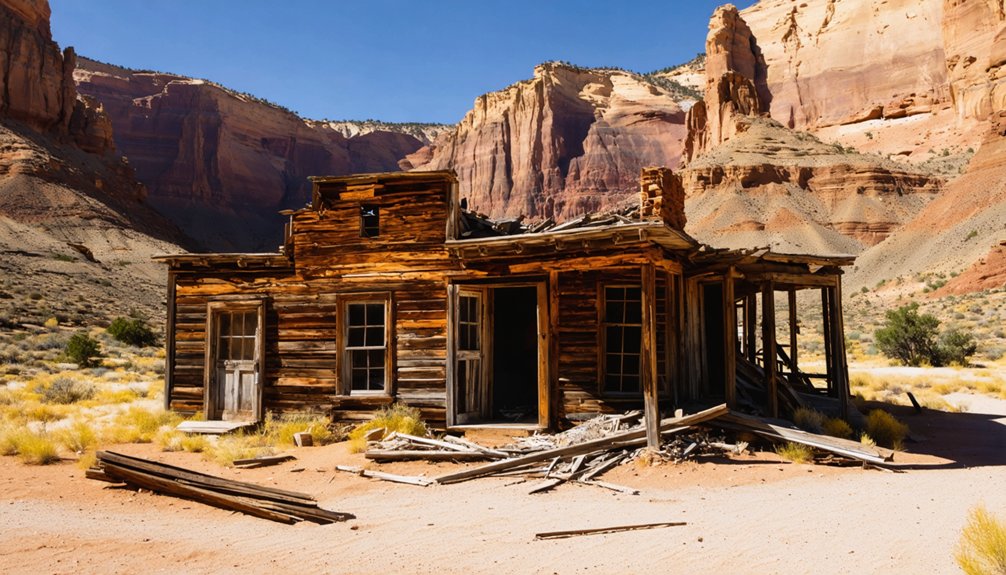
Utah’s ghost towns are gradually returning to the desert, with weathered timber structures collapsing into foundations and Aridisol soils slowly consuming mining infrastructure. You’ll find sites like Sego and Silver Reef displaying concrete remnants and rusted artifacts partially buried by windblown sand, while Rockport’s submerged buildings occasionally resurface during droughts. The reclamation process moves at geological timescales in Utah’s arid climate, where limited precipitation slows both decay and vegetation recovery. Each site preserves distinct archaeological evidence spanning from 1850s settlements through 1980s abandonments, offering insights into how natural forces methodically erase human endeavor.
Key Takeaways
- Desert landscape slowly reclaims mining scars over geological timescales, with Aridisols demonstrating extremely slow natural recovery processes.
- Drought at Rockport Reservoir exposed foundations and vehicles submerged since 1952, revealing previously hidden town remnants.
- Weathered buildings, concrete foundations, and industrial artifacts remain visible as nature gradually overtakes abandoned mining communities.
- Railroad cuts and burning coal seams persist as archaeological evidence spanning from 1850s settlement through 1980s abandonment.
- Sego’s remnants include deteriorating foundations and railroad infrastructure after the town declined following a 1949 fire.
Rockport Reservoir: A Drowned Settlement Resurfaces
The settlement that now lies beneath Rockport Reservoir endured four name changes before meeting its watery fate in 1957.
You’ll find this settlement history traces back to 1860, when pioneers established Crandall, later renamed Enoch City, then Rock Fort after they built protective walls during the Black Hawk War.
Finally becoming Rockport, the town housed 27 families until federal acquisition in 1952.
Twenty-seven families called Rockport home before the federal government acquired their town in 1952 to make way for the reservoir.
The Bureau of Reclamation constructed Wanship Dam between 1954-1957, creating a 62,100 acre-feet reservoir that completely submerged the town.
Under reservoir management, Utah State Parks established Rockport State Park in 1966.
Recent drought conditions have exposed this drowned community after six decades underwater, revealing foundations and lost vehicles—nature reclaiming what government authority once commandeered.
The reservoir currently sits at 26% capacity, unusually low for summer months, allowing Devon Dewey to capture drone images of the town’s old foundations and roads.
Before submersion, the population peaked at approximately 200 residents, making it a thriving community in its final years.
Silver Reef: Where Sandstone Held Precious Secrets
While water claimed Rockport, geological anomaly created Silver Reef’s fortune through circumstances that defied scientific consensus of the era.
You’ll find this ghost town challenged everything geologists believed—silver couldn’t exist in sandstone. Yet prospectors extracted 7.5 million ounces from over 450 mine openings between 1875 and 1891, producing $25 million in ore.
Silver mining here peaked at 2,000 residents by 1879, making it southern Utah’s largest settlement. Main Street stretched one mile with 100 businesses, five ore mills, and three dozen active mines.
But freedom came with volatility—the 1879 fire destroyed half the business district, labor disputes triggered mass arrests, and plummeting silver prices emptied the boomtown within five years. The town’s diverse community included a Native American encampment and Chinatown, reflecting the varied populations drawn to the mining frontier. The 1877 Wells Fargo Office, which once anchored the financial district, served as a residence until the late 1940s before becoming a museum.
Today, you’ll discover the world’s only commercial sandstone silver site, where museum artifacts document humanity’s relentless pursuit of fortune.
Eureka: From Mining Boom to Quiet Survivor
Unlike most Tintic Mining District settlements that vanished completely, Eureka transformed geological skepticism into enduring survival.
Eureka defied predictions of failure, evolving from a disputed mining claim into the Tintic District’s most resilient settlement.
When John Beck staked his controversial gulch claim in 1869, doubters couldn’t imagine this location would anchor a half-billion-dollar empire. You’ll find proof in four massive headframes still marking where the Big Four mines—Bullion Beck, Centennial Eureka, Eureka Hill, and Gemini—extracted fortunes from beneath 21 nationalities who’d converged here.
While the 1914 Centennial-Eureka disaster and Great Depression devastated neighboring camps into ghostly ruins, Eureka’s mining legacy persisted through adaptation.
Today’s 600 residents maintain this Eureka heritage amid National Register landmarks and haunted buildings. The Tintic Mining Museum preserves the district’s industrial past with mining relics and artifacts collected from throughout the region. You’re free to explore downtown’s authentic artifacts, though mine tunnels demand respect—toxic air and unstable passages don’t forgive carelessness. Historic buildings still standing testify to Eureka’s resilience as a bustling mining town that refused to fade entirely into abandonment.
Thistle: Utah’s Most Recent Ghost Town Tragedy
Eureka survived through adaptation and transformation, but not every Utah settlement could overcome nature’s catastrophic forces.
You’ll find Thistle’s remains in Spanish Fork Canyon, where the 1983 landslide disaster created Utah’s first presidentially declared catastrophe. Record precipitation, deep snowpack, and rapid snowmelt triggered a massive slide moving 3.5 feet per hour, eventually spanning 1000 feet wide and 200 feet thick.
The landslide aftermath devastated this former railroad hub: dammed rivers formed Thistle Lake, flooding the entire town and severing critical transportation routes. Direct damage exceeded $200 million, making it America’s costliest landslide. The lake created by the slide reached over 200 feet deep, transforming the Spanish Fork River valley into a massive reservoir.
Today you can glimpse water-ravaged remnants from highway pullouts—a red schoolhouse, half-sunken houses, and rusting infrastructure reclaimed by algae-filled ponds, evidence of nature’s uncompromising power over human settlement. A 2018 fire further diminished what little remained, destroying many structures that had survived the flooding, leaving even fewer traces of this once-thriving community.
Sego: Desert Ruins Near Moab’s Ancient Landscapes
You’ll find Sego’s most substantial architectural remnant in the stone walls of the American Fuel Company Store, standing as the primary structural survivor from the town’s 1910-1955 occupation period.
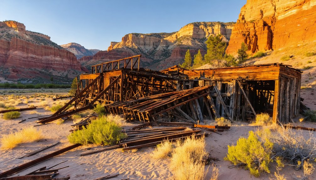
The visible ruins—including scattered foundations, cellars, and railroad infrastructure fragments—extend throughout Sego Canyon from the cemetery to the main settlement area, documenting the spatial organization of this coal camp that once housed several hundred miners of diverse ethnic backgrounds.
Desert conditions have accelerated reclamation since the 1955 abandonment, with the two-story boarding house collapsing between 2008 and 2011 while flash flooding systematically erased wooden structures that survived the initial decline.
The Denver and Rio Grande Western Railroad established a line through the canyon in the early 1900s, facilitating coal transportation that sustained the mining community until the industry’s eventual decline.
A devastating fire in 1949 destroyed essential mining equipment, marking a critical turning point in the town’s final years after operations had already ceased in 1947.
Coal Mining Company Store
When American Fuel Company constructed Sego’s general store in 1912, it established more than a retail outlet—the building served as the economic and social nucleus of this remote canyon settlement.
You’ll find this structure represented the company’s broader philosophy: substantial construction regardless of cost. The store operated alongside revolutionary infrastructure, including the first coal washer west of the Mississippi, pure water systems piping directly to homes, and a railroad spur connecting canyon operations to continental markets.
This company history reflects mining operations that prioritized worker welfare alongside productivity. The general store, boardinghouse, hotel, and club house created self-sufficiency five miles from Thompson Springs.
Visible Ruins and Remnants
The physical remnants of Sego Canyon reveal three distinct phases of architectural decay, each layer documenting the settlement’s progression from operational mining camp to complete abandonment.
Cemetery significance anchors your exploration through tangible mining heritage:
- Graveyard foundations – Wooden crosses and plastic flowers mark coal miners’ final resting places against eroded red rock walls, creating poignant evidence to forgotten lives.
- Stone company store – Standing 25-30 feet high, this red rock structure remains the only intact building, outlasting collapsed wooden boarding houses and scattered cabin ruins.
- Industrial artifacts – Railroad cuts, burning coal seams, and 1940s-era cars reveal operational infrastructure before flash floods destroyed remaining dwellings.
You’ll find dugouts and cellars scattered throughout, evidence of miners who built wherever they pleased—freedom manifested through improvised stone dwellings now crumbling into desert soil.
Accelerated Desert Reclamation Process
Unlike rapid restoration efforts at modern industrial sites, Sego’s desert landscape reclaims its mining scars through geological timescales—a process accelerated only marginally by intervention.
You’ll find that aridisols characteristic of Utah’s eastern deserts demonstrate stubbornly slow recovery—studies document minimal perennial plant establishment even five decades after human abandonment. The compacted, saline soils surrounding Sego’s ruins resist conventional revegetation methods that succeed elsewhere.
Modern reclamation research from nearby oil and gas operations reveals that soil amendments like biochar improve moisture retention in these unforgiving conditions, yet such interventions remain absent at abandoned ghost towns.
Desert vegetation here advances at nature’s pace, ungoverned by regulatory timelines or financial guarantees. Surface crusting and depleted organic matter guarantee Sego’s industrial footprint persists as monument—nature’s incremental erasure respecting no human schedule.
The Natural Reclamation Process in Utah’s Arid Climate
As mining operations withdraw from Utah’s desert landscapes, natural forces begin dismantling what prospectors left behind through processes dramatically shaped by the region’s arid climate.
You’ll find natural recovery unfolds differently here than in wetter regions, where hydrologic restoration must account for flash flooding patterns and limited precipitation cycles that both accelerate and complicate reclamation timelines.
The desert’s reclamation signature includes:
Desert reclamation unfolds through sediment burial, scattered vegetation marking human traces, and water’s slow reshaping of mining scars.
- Structural deterioration through silt accumulation burying buildings, equipment, and railroad infrastructure beneath layers of sediment
- Vegetation patterns where shade trees mark former settlements while native plants randomly colonize disturbed slopes
- Landform reformation as water damage reshapes contours around 10,000 abandoned mine openings
These processes transform extractive scars into integrated landscapes, though Utah’s harsh conditions slow the timeline considerably compared to humid environments.
Exploring What Remains: Foundations, Structures, and Artifacts
When you walk through Utah’s ghost towns today, you’ll encounter three distinct categories of physical evidence that document their rise and fall: the concrete and stone foundations that outline vanished communities, the weathered buildings that somehow survived decades of abandonment, and the scattered artifacts that reveal how people lived and worked.
These remains form an archaeological record spanning from the 1850s settlement period through the early twentieth-century mining booms to final abandonments in the 1980s. Each foundation mark, standing wall, and rusted tool provides specific documentation of Utah’s cycles of boom, decline, and nature’s gradual reclamation.
Visible Foundations and Roads
The physical remnants of Utah’s ghost towns tell stories through weathered stone and crumbling mortar.
You’ll discover foundational remnants across these abandoned settlements, where building outlines reveal former stores, hotels, and homes that once thrived.
At Mosida, concrete pumphouse walls stand defiant against time, while SilverCity’s foundations mark Dragon Canyon’s economic hub.
Ghostly roads wind through these sites, their wooden sidewalks rotting into earth at SilverReef.
Key Foundational Elements You’ll Encounter:
- Commercial Infrastructure – Wells Fargo building foundations, vault structures, and store remnants preserve economic history
- Residential Foundations – Settler home ruins and water-logged structures document daily life
- Industrial Remains – Equipment yards, mining tools, and beehive kilns showcase operational centers
These tangible markers let you piece together communities that flourished then vanished, offering unmediated access to Utah’s untamed past.
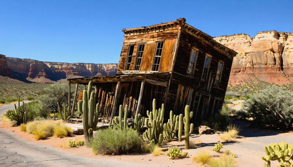
Historic Buildings Still Standing
Stone and timber structures persist across Utah’s ghost towns, offering architectural testimony to 19th-century settlement patterns and economic forces that shaped these communities.
You’ll find Old Irontown’s beehive charcoal oven standing as its most recognizable landmark, while Silver Reef’s 1877 Wells Fargo Building demonstrates historic preservation through its museum conversion, complete with original vault.
Grafton showcases architectural significance through five restored buildings—the adobe schoolhouse, church, and three pioneer homes—maintained by the Grafton Heritage Partnership. These structures reveal construction methods and spatial organization of frontier settlements.
At Iosepa, ancient shade trees mark the abandoned townsite, complemented by a cemetery and commemorative pavilion. Each building represents deliberate choices about materials, design, and community organization that you can still examine today.
Artifacts Left Behind
- Mining Operations: Scattered tools, furnace components, and Wells Fargo building foundations document silver and iron extraction methods from the mid-1800s.
- Community Infrastructure: Adobe foundations, mulberry tree remnants for silkworm cultivation, and cemetery markers reveal settlement patterns and agricultural experiments.
- Catastrophic Events: Thistle’s flood-displaced personal items and sediment-buried foundations illustrate nature’s sudden reclamation power over human establishment.
These physical traces let you reconstruct vanished worlds without institutional filters.
Preservation Efforts and Historic Registrations
Across Utah’s ghost town landscape, preservation initiatives have emerged to protect deteriorating structures and document vanishing histories before they disappear entirely.
You’ll find the Grafton Heritage Partnership Project leading restoration since 1997, installing new roofing and windows on the Russell Home and church while purchasing 150 acres to recreate settler experiences.
The Utah State Historic Preservation Office conducts directed work at sites like Kelton, where Dr. Chris Merritt oversees documentation efforts.
At sites like Kelton, the Utah State Historic Preservation Office conducts directed documentation work under Dr. Chris Merritt’s oversight.
At Old Iron Town, preservation challenges intensify as the beehive kiln requires mortar reinforcement every decade.
The Utah Ghost Town Project photographs and researches abandoned communities statewide, recognizing their historical significance.
These coordinated efforts combat vandalism and natural deterioration, ensuring you can still witness authentic remnants of Utah’s pioneering past.
Planning Your Visit to Utah’s Abandoned Communities
Before you commence exploring Utah’s ghost towns, you’ll need to understand that these remnants of 19th-century mining and settlement require careful planning due to their remote locations and varying accessibility.
Fall offers favorable conditions for discovery, allowing you to capture ghost town photography without extreme temperatures compromising your expedition.
Essential planning considerations:
- Begin with Grafton and Silver Reef – their historical significance and maintained access roads provide ideal introductions to desert exploration.
- Respect private property boundaries at sites like Iosepa, where access extends only to the cemetery and pavilion.
- Prepare for remote terrain – locations like Sego (6 miles from I-70) and Old Irontown within Dixie National Forest demand self-sufficiency and navigation skills.
These abandoned communities reward independent travelers who value authentic historical encounters over commercialized attractions.
Frequently Asked Questions
Are There Any Ghost Towns in Utah That Are Actually Haunted?
You’ll find haunted legends at Sego Ghost Town, where miners’ spirits reportedly roam the hills and cemetery. Ghost sightings occur frequently enough that locals recommend you visit only during daylight hours for safety.
Can You Legally Take Artifacts From Utah’s Abandoned Ghost Towns?
No, you can’t legally take artifacts from Utah’s ghost towns. Federal and state laws protect these sites, with artifact preservation mandated and legal implications including $2,000 fines, jail time, and forfeiture of collected items.
What Safety Hazards Should Visitors Watch for at Ghost Towns?
Watch for structural instability in decaying buildings, mine shaft collapses, and toxic gases underground. You’ll encounter wildlife in abandoned structures, unexploded ordinance, and legal risks from trespassing. Remote locations compound dangers without cell service or emergency access.
Which Utah Ghost Town Is Easiest to Reach by Car?
Grafton’s your gateway to liberation—just an hour’s journey along accessible routes near Hurricane. Like travelers finding freedom’s path, you’ll discover scenic drives through Virgin River valley, where historical documentation reveals nature reclaiming abandoned dreams.
Are Overnight Camping Visits Allowed at These Ghost Town Sites?
You’ll find overnight camping regulations vary by land ownership at Utah’s ghost towns. Most BLM and Forest Service sites don’t require overnight permits for dispersed camping, but you’re limited to 14-day stays per location.
References
- https://www.ksl.com/article/50243431/utah-ghost-town-reappears-as-a-result-of-drought
- https://www.visitutah.com/things-to-do/history-culture/ghost-towns
- https://www.axios.com/local/salt-lake-city/2024/09/03/utah-best-ghost-towns-mine-abandoned
- https://www.blm.gov/sites/default/files/uploads/AML_PUB_DecadeProgress.pdf
- https://www.familysearch.org/en/wiki/Utah_Ghost_Towns
- https://ogm.utah.gov/amr-home/
- https://opendata.gis.utah.gov/datasets/ghost-towns-in-utah/about
- https://allthatsinteresting.com/rockport-utah-ghost-town
- https://stateparks.utah.gov/parks/rockport/history/
- https://www.fox29.com/news/extreme-drought-uncovers-ghost-town-hidden-under-utah-reservoir


