Maryland’s ghost towns showcase nature’s relentless reclamation of abandoned industrial sites, with Daniels serving as a prime example where forests now consume what was once a thriving mill community of 90 families until Tropical Storm Agnes devastated the valley in 1972. You’ll find the Patapsco River slowly eroding remnants of churches, dams, and worker housing, while Mallows Bay’s shipwrecks have transformed into “floating forests” supporting entire ecosystems. These forgotten settlements—from Port Tobacco’s silted harbor to Conowingo’s drowned foundations—reveal how wilderness systematically reclaims human ambition when economic purpose vanishes and communities scatter.
Key Takeaways
- Daniels, within Patapsco Valley State Park, shows nature reclaiming abandoned textile mills, churches, and worker housing after 1972’s Tropical Storm Agnes.
- Mallows Bay features nearly 300 abandoned WWI-era ships transformed into “floating forests” supporting thriving plant and animal communities.
- Conowingo Dam’s 8,200-acre reservoir submerged an entire town, with foundations and streets exposed only during droughts as ghostly remnants.
- Port Tobacco Village declined from Maryland’s second-largest port to fewer than a dozen structures due to river siltation blocking maritime access.
- Harmony Grove faces ongoing erasure from highway expansion, representing communities lost to development while nature reclaims forgotten industrial sites.
The Rise and Fall of Daniels: From Thriving Mill Town to Abandoned Ruins
When Thomas Ely’s family arrived in 1810 to construct their textile mill along the Patapsco River, they couldn’t have anticipated that their settlement would endure multiple renamings, corporate ownership, and eventual erasure from Maryland’s landscape.
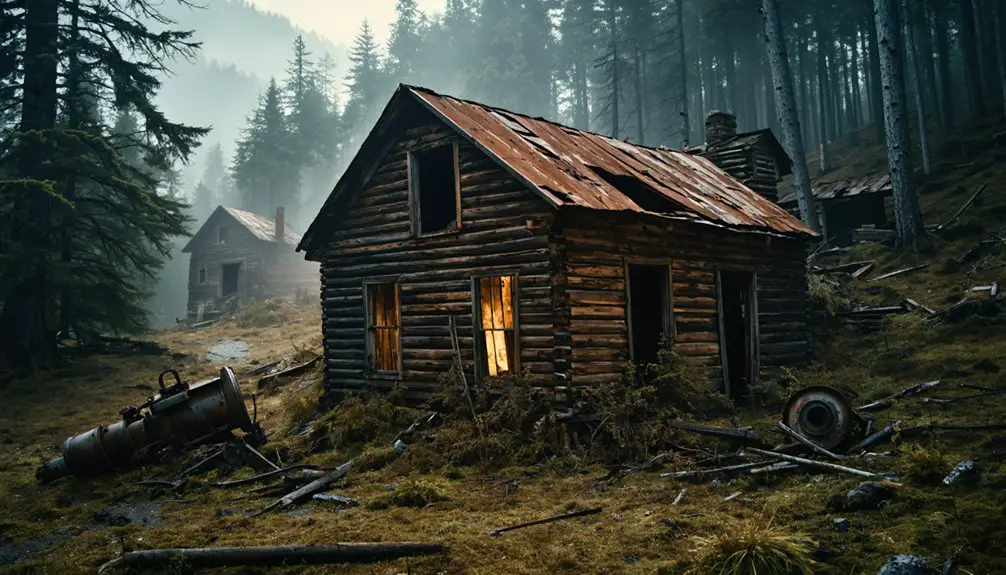
Elysville became Alberton in 1853 under the Gary family’s stewardship, then Daniels after C.R. Daniels Company’s 1940 acquisition. This industrial heritage supported 90 families by the late 1960s, complete with churches, schools, and rail connections.
A thriving mill town supporting 90 families, complete with churches, schools, and rail connections—before corporate ownership changed everything.
Yet corporate control proved precarious—the 1968 closure notice forced residents from their homes as the company demolished mill housing. Tropical Storm Agnes finished what corporate abandonment started in 1972, flooding the valley and scattering ruins. Today, the site exists as a disambiguation of locations, with various references to Daniels appearing across different contexts in regional records.
Community resilience couldn’t survive systematic displacement, leaving only vine-strangled remnants where independent millworkers once thrived. The crumbling stone ruins and decaying structures now bear graffiti marks, while weeds and vines overtake what remains of the abandoned settlement.
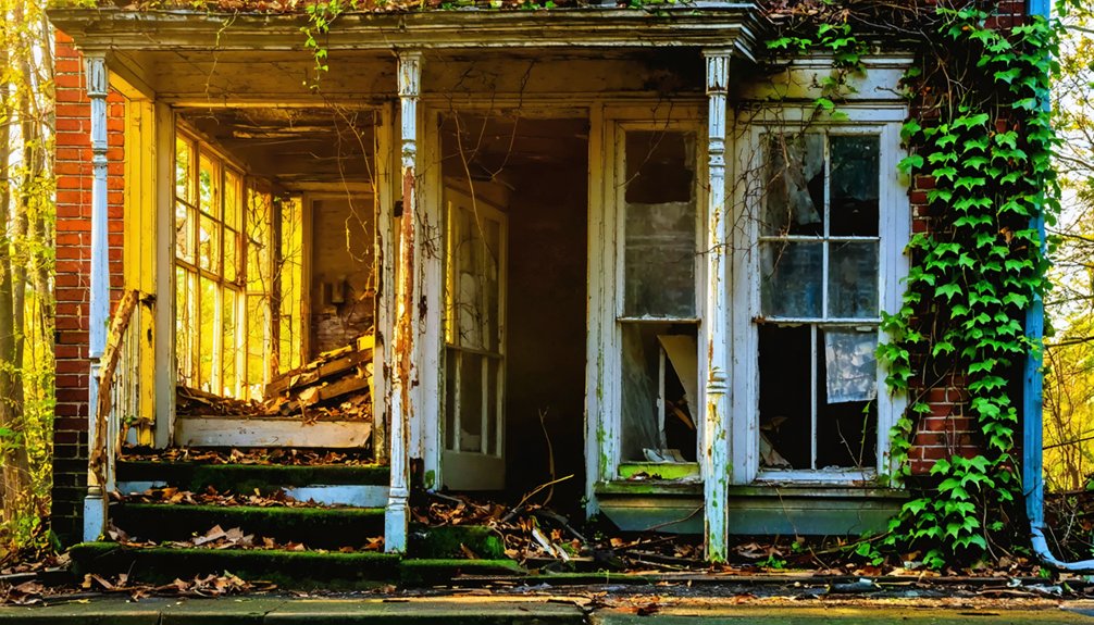
Saint Stanislaus Kostka Catholic Church: A Testament to Time and Tragedy
While corporate displacement emptied Daniels of its industrial workforce, another form of abandonment left Maryland’s Polish community without one of its most sacred landmarks.
Saint Stanislaus Kostka Catholic Church, born from Polish immigrants who settled Fells Point in 1868, represented more than faith—it embodied Polish Heritage itself.
After foundation troubles forced reconstruction in 1889, the Gothic structure stood as tribute to immigrant resilience and Architectural Significance.
But September 1926 brought devastating fire, reducing decades of community investment to charred ruins.
The Franciscan Conventuals had served the parish since 1905, helping Polish immigrants adjust to American life before the tragic blaze consumed their spiritual home.
You’ll find what remains in Patapsco Valley State Park, where ivy-covered trees now serve as organic columns within skeletal walls.
The adjacent cemetery, holding Civil War-era stones and WWI casualties, reminds you that nature respects neither architectural ambition nor collective memory.
A fire ring now sits in the center of the former church, where hikers gather for storytelling and campfire cooking—an ironic contrast to the flames that once destroyed this sacred space.
Pentecostal Holiness Church: Haunting Remnants Along the Patapsco
Long after Saint Stanislaus Kostka’s Gothic ambitions crumbled to fire, Daniels welcomed a different spiritual tradition to its valley floor.
You’ll find the Pentecostal Holiness Church‘s white ruins positioned along Alberton Road, established in 1940 when the mill town’s trajectory already pointed toward decline. Local inhabitants nicknamed it the “Holy Roller” church, acknowledging the congregation’s energetic Pentecostal Practices that echoed through the valley until 1968’s abandonment notice.
Tropical Storm Agnes delivered the final blow in June 1972, accelerating the Architectural Decay now visible beneath graffiti and encroaching vines. The catastrophic flooding necessitated airlifts for stranded families, demonstrating nature’s overwhelming power over the once-thriving company town. The C.R. Daniels Company had purchased all housing in 1940, creating a complete company town that would eventually face systematic demolition following the mill’s closure.
Today, you’ll cross the Patapsco River to reach these forsaken walls—crumbling stone draped in foliage, offering haunting testimony to both faith and nature’s relentless reclamation within what’s become Maryland’s most accessible ghost town.
Exploring the Physical Remains: Dams, Bridges, and Decaying Relics
Beyond the spiritual landmarks, Daniels reveals its industrial skeleton through scattered infrastructure that mapmakers documented before Agnes swept the valley.
You’ll find parking at Daniels Dam on Daniels Rd, where a plaque displays what stood before 1972’s floodwaters exposed dam remnants from the 1830s railroad era.
Bridge fragments lie visible across the Patapsco—pedestrian crossings that once connected both town sides now require swimming or hiking to reach.
Thomas Ely’s 1810 textile mill, which sustained 90 families until the late 1960s, exists only as stone ruins and graffiti-covered walls consumed by vines.
Abandoned vehicles from the 1950s rest where Agnes positioned them along old Alberton Road, marking a 2.5-mile fire access path through decaying foundations and rotting industrial relics. In nearby Kempton, the population declined from 850 to possibly 20, with only a storage facility and stable from the mining company still standing. Like many ghost towns throughout Maryland, Daniels sits among Appalachian counties where similar boom-and-bust cycles claimed entire communities.
Patapsco Valley State Park: Where History Meets Wilderness
Within Patapsco Valley State Park’s boundaries, you’ll find Daniels—a textile mill town that flourished from 1810 until its abandonment in the late 1960s, when ninety families departed after the mill’s closure.
The 1972 devastation from Tropical Storm Agnes transformed what remained into scattered ruins: foundations reclaimed by forest, vintage automobiles rusting along riverbanks, and a forgotten cemetery where children’s gravestones lie hidden beneath decades of growth.
Your hike along the old Alberton Road traces 2.7 miles of industrial memory, where stone remnants and overgrown infrastructure mark the shift from a thriving company town to wilderness. Among the surviving structures, visitors can explore the weathered walls of two partial churches that stand as monuments to the community’s former spiritual life. The town has been known by multiple names throughout its history, including Elysville and Alberton before settling on Daniels.
Daniels: Industrial Village Lost
Tucked along the Patapsco River in what’s now Maryland’s oldest state park, Daniels represents a textile town that cycled through three distinct identities before nature reclaimed it.
You’ll trace its evolution from Elysville (1830s) to Alberton (1853) to Daniels (1940), each name marking different ownership of the cotton mill that sustained 250 workers. The Gary family’s century-long stewardship ended when C.R. Daniels purchased the operation for $65,000, maintaining production until Tropical Storm Agnes destroyed everything in 1972.
Today, these abandoned structures showcase industrial heritage through crumbling foundations and scattered artifacts—a bright white bathtub, rusted vehicles, mill ruins.
The 4.5-mile Alberton Road Trail lets you explore this vanished community where workers’ housing stood until demolition began in 1968.
Ruins Along The River
Where the Patapsco River carved through Maryland’s industrial heartland, catastrophe became the great equalizer. Hurricane Agnes in 1972 transformed this valley into a war zone, cresting thirty feet above normal and erasing centuries of human ambition.
You’ll find Avalon Mill’s warehouse ruins, its coal chute still visible, though the mill itself burned in 1905. The swinging bridge that once connected workers to their livelihoods vanished beneath Agnes’s fury.
River remnants scatter the landscape—uprooted trees, suspended railroad tracks, a tank truck left as evidence of nature’s dominance. These industrial echoes persist in power house foundations and obscured dam sites, reminding you that wilderness always reclaims what civilization temporarily borrows.
Even St. Mary’s College succumbed, bulldozed by 2020.
Hiking Through Forgotten Roads
Since 1810, the abandoned roads threading through Patapsco Valley State Park have witnessed Maryland’s textile empire rise and collapse into ruins.
You’ll discover forgotten paths where mill workers once traveled daily, now reclaimed by forest and time. The 3.6-mile self-guided route along abandoned Alberton Road reveals hidden treasures of America’s industrial past.
Three primary trails reveal Daniels’ secrets:
- Grist Mill Trail (2.5 miles) – follows the Patapsco River to Orange Glove Flour Mill ruins
- Yellow-blazed hollow routes – wind through creek systems from Daniels Road entrance
- Alberton Rocks Trail (2.7 miles) – connects factory overlooks with church remnants
You’re walking where history dissolved.
These paths don’t require permits or guides—just curiosity and respect for landscapes where commerce once thrived, then vanished into Maryland’s wilderness.
Fort Carroll: A Civil War Island Fortress Turned Bird Sanctuary

Rising from the waters of the Patapsco River near the Francis Scott Key Bridge, Fort Carroll stands as a monument to military ambitions that outpaced necessity.
Designed by Robert E. Lee in 1848, this hexagonal fortress never fulfilled its intended purpose—walls remained half-finished by 1861, and its cannons never fired in anger.
Fort Carroll’s guns stayed silent through decades of service—a fortress whose greatest battles were fought only in the imaginations of its designers.
Through Spanish-American and both World Wars, it served diminished roles before the Army abandoned it in 1921.
Failed proposals included a prison and garish electric sign.
Today, Fort Carroll has found its truest purpose as a nature sanctuary, where crumbling brick archways and granite stairs shelter countless birds.
What military planners couldn’t complete, nature has reclaimed—transforming government property into something genuinely free.
Mallows Bay: America’s Largest Ship Graveyard and Marine Sanctuary
While Fort Carroll’s hexagonal walls crumbled in isolation, another monument to governmental miscalculation took shape fifteen miles downriver.
Mallows Bay became America’s largest ship graveyard when Woodrow Wilson’s Emergency Fleet—nearly 300 wooden steamships built too late for World War I—was systematically burned and abandoned here between 1925 and 1945.
What government deemed worthless, nature has reclaimed. The shipwreck ecology now hosts “floating forests” where decaying hulls support thriving plant and animal communities across 141 documented vessels.
Your tax dollars created this accidental sanctuary through three distinct failures:
- 1917-1919: Obsolete wooden ships built when steel was unavailable
- 1925-1931: Mass burning operations destroying navigation hazards
- 1942-1945: Metal salvage abandoning stripped wooden hulls
Today’s 18-square-mile marine sanctuary proves liberty emerges when bureaucratic control dissolves.
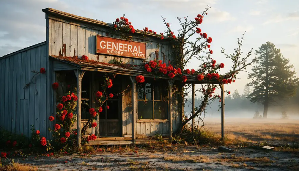
Port Tobacco Village: From Colonial Powerhouse to Forgotten Settlement

You’ll find Port Tobacco Village’s transformation particularly striking—from Maryland’s second-largest port in the mid-18th century to a settlement of fewer than a dozen structures by the early 20th century.
The town’s decline accelerated after river siltation blocked maritime access in the 1880s, followed by an 1892 fire that destroyed the courthouse and the 1895 relocation of the county seat to La Plata.
What remains today offers archaeologists and historians rare preserved evidence of colonial commerce, slavery-based economic systems, and the environmental forces that can erase entire communities from functional existence.
Colonial Era Significance
Long before Maryland’s western frontier towns emerged and faded, Port Tobacco Village commanded the colonial economy from its strategic position along the Potomac River’s tidal tributaries.
You’ll find its legacy embedded in three distinct power structures:
- Commercial dominance – second largest port after Annapolis, channeling tobacco and agricultural exports worldwide
- Administrative authority – Charles County’s governmental seat since 1658, featuring courthouse and prison
- Social hierarchy – enslaved Africans comprising 40% of Maryland’s population by 1750, supporting merchant wealth
Colonial architecture like Stagg Hall and the Chimney House still testifies to merchant prosperity, while economic shifts from international trade to agricultural stagnation foreshadowed the town’s eventual abandonment.
Patriots including Thomas Stone walked these streets when Port Tobacco represented Maryland’s commercial ambitions.
Decline and Population Loss
By the late 18th century, the same tidal river that built Port Tobacco’s commercial empire had begun destroying it through relentless siltation.
Clearcutting farmland and tobacco cultivation washed topsoil into the shipping channel, rendering it unnavigable for large trading vessels. Only smaller craft could access what had transformed from a premier port into marshland.
This environmental catastrophe triggered severe economic decline as Baltimore and other rivals captured Port Tobacco’s trade networks.
When the railroad bypassed the settlement in 1895 and the county seat relocated to La Plata that same year, population migration accelerated dramatically. The courthouse fire of 1892 had already delivered a crushing blow.
From 300 residents at its peak, Port Tobacco dwindled into obscurity, its dwellings and businesses abandoned as opportunity vanished.
Nature’s Gradual Takeover
As Port Tobacco’s commercial importance ebbed in the late 1800s, the natural landscape that once sustained it began reclaiming abandoned buildings and streets.
The very silting that ended maritime commerce paradoxically became an agent of historical resilience, preserving what progress would’ve destroyed.
You’ll find nature’s reclamation worked methodically through the settlement:
- River siltation sealed underwater archeological deposits from Native, colonial, and enslaved communities
- Vegetation growth around structures like the 1750s Chimney House and 1725 Catslide House created natural barriers
- Isolation from railroad development left intact sites that development-driven towns lost
Today’s thirteen residents inhabit what nature preserved.
The Port Tobacco Archeological Project now excavates layers of culture that siltation protected—an unexpected gift from environmental change.
More Forgotten Places: Conowingo, Harmony Grove, and Beyond
When the Conowingo Dam opened in 1928, it transformed the Susquehanna River valley and erased an entire community from Maryland’s landscape.
The original town of roughly 300 residents disappeared beneath an 8,200-acre reservoir. During extreme droughts, when water levels drop below 108 feet, you’ll find up to 35% of foundations and street remnants exposed—ghostly evidence of Conowingo history that won’t stay buried.
Harmony Grove suffered a different fate. This Frederick County milling town withered through industrial decline, then faced demolition in the 1960s-1970s for highway expansion.
Unlike Conowingo’s dramatic flooding, Harmony Grove simply ceased to exist through bureaucratic erasure.
You’ll discover similar forgotten communities throughout Maryland: Port Tobacco Village, Fort Ritchie’s evicted residents, and Naval Training Center Bainbridge—all reminders that official development rarely asks permission.
Frequently Asked Questions
Are Visitors Legally Allowed to Explore These Abandoned Maryland Ghost Towns?
You’ll face significant legal restrictions at most Maryland ghost towns since they’re on private property requiring owner permission. Public sites like Four Locks offer legitimate access, but exploration guidelines vary. Always verify permissions before visiting.
What Safety Precautions Should Hikers Take When Visiting These Ruins?
You’ll ironically need modern hiking essentials to explore these forgotten places. Pack water, wear sturdy boots, bring a buddy, inform others of your plans, and check weather forecasts—ghost town safety demands preparation despite their abandoned nature.
Can You Camp Overnight Near Daniels or Other Ghost Town Sites?
You can’t camp directly at Daniels ghost town, but nearby Hollofield Campground offers access within Patapsco Valley State Park. Camping regulations require 14-day maximum stays, while ghost town amenities remain minimal—just historical ruins accessible via day-use trails.
Are There Guided Tours Available for Maryland’s Abandoned Locations?
While you won’t find guided exploration specifically for abandoned ghost towns, Maryland’s established ghost tours offer historical insights through documented sites in Baltimore, Frederick, and the Eastern Shore, giving you freedom to explore paranormal histories independently afterward.
What Wildlife Might You Encounter While Exploring These Reclaimed Areas?
You’ll encounter diverse wildlife species during nature observation, including migratory birds nesting in ruins, waterfowl along rivers, herons and egrets at Fort Carroll, plus amphibians and mammals reclaiming these liberated spaces from human abandonment.
References
- https://www.abandonedspaces.com/uncategorized/now-entirely-reclaimed-nature-ghost-town-daniels-marylandwas-thriving-mill-town.html
- https://www.tripadvisor.com/Attraction_Review-g41131-d10035193-Reviews-Daniels_Ghost_Town-Ellicott_City_Maryland.html
- https://aqua.org/stories/2022-10-17-reclaimed-by-nature
- https://www.atlasobscura.com/places/daniels
- https://en.wikipedia.org/wiki/List_of_ghost_towns_in_Maryland
- https://chesapeake-inspired.com/haunted-maryland-trails/
- https://en.wikipedia.org/wiki/Daniels
- https://vitabrevis.americanancestors.org/2020/12/ghost-towns
- https://granitehistoricalsociety.org/?p=121
- https://www.hmdb.org/m.asp?m=71332