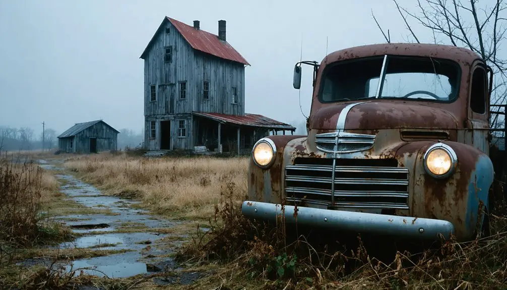
You’ll find Michigan’s ghost towns gradually disappearing beneath advancing forests, particularly in the Upper Peninsula where Central Mine’s 52-million-pound copper operation has been receding into wilderness since 1898. Nature’s reclaimed Kilmanagh, once a bustling 1861 crossroads, now hiding beneath dense forest after its 1904 post office closure. Port Oneida Village’s 3,400 acres and Fayette’s preserved industrial structures demonstrate varying preservation philosophies—some maintain historical integrity while others surrender to ecological progression. The documentation of these changes reveals how quickly Michigan’s landscape erases human intervention, transforming stamping mills, mineshafts, and homesteads into archaeological fragments that require careful exploration to fully understand.
Key Takeaways
- Central Mine’s industrial past is being erased by nature, with skeletal mineshafts and roofless structures consumed by forest growth.
- Kilmanagh’s remaining buildings are surrounded by dense forest after post office closure in 1904 and population decline to thirty.
- Port Oneida Village was completely abandoned by 1908 except for one residence after lumber trade ended from depleted forests.
- Freda Ghost Town features concrete foundations and a lone smokestack as remnants gradually reclaimed since the 1967 mill closure.
- Delaware Mine’s wilderness ruins show nature’s reclamation after underground flooding ended forty years of copper production in 1846.
Port Oneida Village: America’s Largest Rural Historic District Vanishing Into Sand
When Carsten and Elizabeth Burfiend claimed 275 acres west of Pyramid Point in 1852, they couldn’t have imagined their settlement would evolve into America’s largest rural historic district—a 3,400-acre expanse now quietly dissolving into the landscape of Sleeping Bear Dunes National Lakeshore.
Port Oneida’s rural heritage emerged through Thomas Kelderhouse’s 1862 dock and sawmill operations, attracting Prussian immigrants who built 150 farmsteads across Leelanau County’s shoreline. The community thrived until the 1890s when depleted forests ended the lumber trade. Farmers struggled with marginal conditions due to sandy soils and unreliable water supply, relying on potatoes as their primary cash crop. By 1908, only the Kelderhouse residence remained standing while the dock, blacksmith shop, post office, and general store had all been abandoned.
Fayette Historic Townsite: Industrial Heritage Meets Natural Beauty
The iron smelting empire that Fayette Brown established on Garden Peninsula in 1867 transformed Snail Shell Harbor into a thriving industrial settlement of 500 souls—immigrants from Canada, Finland, and Norway who operated two massive blast furnaces that converted Upper Peninsula ore into charcoal pig iron.
You’ll find that industrial resilience couldn’t overcome resource depletion when surrounding hardwood forests vanished by 1891, forcing closure.
The historical legacy survives through twenty original structures Michigan acquired in 1959, including the three-story warehouse, machine shop, and company store.
Michigan preserved twenty original structures from 1959, protecting the three-story warehouse, machine shop, and company store for future generations.
Today you can explore eleven museum buildings interpreting this autonomous community’s rise and fall without admission fees—just your Recreation Passport grants access to limestone cliffs, harbor vistas, and architectural remnants documenting nineteenth-century industrial ambition.
Educational programs serving grades 3-12 offer guided tours with interactive activities that encourage students to explore exhibit signs throughout the historic site.
Adventure seekers can navigate 3.5 miles of hiking trails that wind through forests and bluffs surrounding the abandoned townsite.
Freda Ghost Town: Copper Mining Relics Hidden in Wilderness
Perched on a sandstone bluff where the Copper Range Railroad once delivered tourists and ore wagons alike, Freda emerged in 1899 as one of Michigan’s most strategically positioned mining settlements—named for the daughter of its founding company owner and engineered to house 500 workers who’d operate the stamping mill below.
The Freda ruins you’ll discover today reveal Michigan’s Copper heritage through concrete foundations and a solitary smokestack rising above Lake Superior’s shoreline. This mill outlasted all competitors until 1967 through relentless technological adaptation.
You’re free to explore black stamp sand beaches where glittering glass fragments catch sunlight between metal relics, though respect the posted boundaries. Dispersed camping sites nestle within a couple of miles of the ruins for those seeking to extend their exploration of this historical landscape.
Red sandstone cliffs frame these industrial remnants—accessible evidence of extraction economies that shaped Michigan’s wilderness into productive landscapes before nature reclaimed its territory. The 253-foot stack remains the most prominent structure, serving as a navigational landmark for boat traffic on Lake Superior.
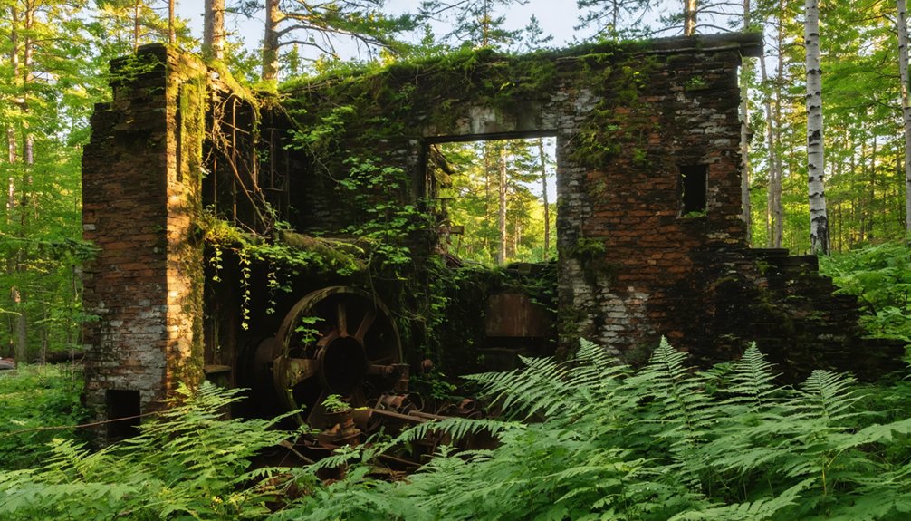
Delaware Mine: Underground Rivers and Forest-Claimed Shafts
You’ll find Delaware Mine’s transformation from 1846 boom town to wilderness ruin exemplifies Michigan’s copper country cycle of extraction and abandonment.
The mine’s underground rivers now flood workings that once yielded 7 million pounds of copper across forty years of unprofitable operation, while forest reclaims surface ruins where 1,200 residents built their lives around mining company infrastructure.
This site’s dual legacy—5,000-year-old prehistoric copper pits alongside 19th-century industrial failure—reveals how both ancient peoples and modern corporations struggled to profitably extract Keweenaw copper before nature reasserted dominance.
Only two buildings still stand along Highway 41, while historic structures face ongoing threats of demolition despite their value for photography and historical reflection.
Delaware’s recognition as the Snow Capital of the Midwest reflects the harsh climate that once challenged miners and now adds to the town’s ghost town mystique.
Mining Boom Heritage
Deep beneath Michigan’s Keweenaw Peninsula, forty years of archival records chronicle Delaware Mine’s transformation from speculative venture to cautionary tale in America’s first major mining boom.
You’ll find a copper heritage forged by investors like Horace Greeley, who poured hundreds of thousands into extracting 7 million pounds of copper from 1846 to 1887.
The mining legacy reveals both ambition and miscalculation—five shafts, ten levels, and 8 million tons processed, yet profitability remained elusive. Low ore yields couldn’t justify the infrastructure investment: an entire town, railroad connections to Lac La Belle, and stamp mills along the Little Montreal River.
Today’s self-guided underground tours let you walk 1,700 feet through original workings, confronting the stark reality of frontier capitalism’s calculated risks. Visitors navigate a descent of 100 feet of stairs through the #1 shaft to reach the preserved tunnels. Below the first level, flooded mine workings have become the domain of scuba diving historians who captured underwater videos in 2012-2013.
Nature’s Underground Reclamation
Where industrial ambition once dominated, water and wilderness now govern Delaware Mine’s abandoned depths.
You’ll find nine flooded levels creating subterranean pools where scuba diving historians conducted underwater exploration in 2012-2013, documenting preserved infrastructure 1,600 feet below surface. The Little Montreal River’s proximity accelerated water infiltration, transforming extraction chambers into submerged caverns through decades of abandonment.
Above ground, native forest reclaims what corporate mining claimed.
Walking trails now wind through timber-overtaken ruins where wooden beams weather beneath Michigan’s elements. This geological transformation extends beyond surface overgrowth—the Allouez Conglomerate formation undergoes natural oxidation while ancient fire-setting techniques left stress fractures facilitating modern water penetration.
You’re witnessing nature’s methodical erasure of industrial scars, proof that wilderness ultimately outlasts human enterprise.
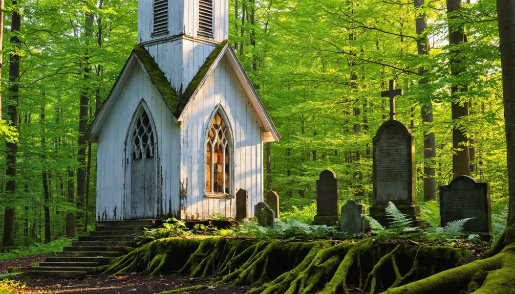
Central Mine: 146 Years of Nature’s Patient Reclamation
Since its final closure in 1898, Central Mine has stood as a tribute to nature’s methodical erasure of industrial ambition.
You’ll find skeletal mineshafts penetrating 3,000 feet beneath forest floor, where 52 million pounds of copper once flowed upward. The 1894 fault discovery on the 30th level sealed this copper legacy—the vein simply vanished into geological mystery.
Today’s landscape reveals how wilderness reclaims what extraction economies abandon. Thirteen houses and one 1868 Cornish church persist among roofless structures, their frames slowly surrendering to Michigan’s seasons.
What housed 1,200 residents during the 1880s now supports annual reunions of descendants, connecting mining history to present isolation. Nature doesn’t destroy these monuments—it absorbs them, transforming industrial scars into archaeological artifacts that document both human ambition and inevitable retreat.
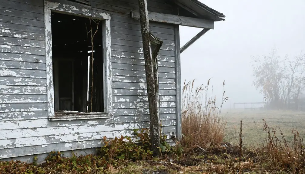
Kilmanagh: A Forgotten Crossroads in the Thumb Region
You’ll find Kilmanagh’s story begins in 1861 when Francis Thompson carved his homestead from Huron County’s dense forests, establishing what locals called Thompson’s Corner before the settlement adopted its Irish name in 1873.
The general store that John C. Liken built that same year became the community’s essential center, drawing lumbermen, sawmill workers, and farming families to this crossroads between Harbor Beach and Sebewaing.
Without rail access, the town peaked early and faded steadily—its post office closing in 1904, its population dwindling to thirty by 1905, until nature began reclaiming what agriculture had briefly sustained.
1861 Homesteader Origins
In 1861, Francis Thompson carved his homestead from the dense forests of Michigan’s Thumb Region, establishing what would become a modest but resilient crossroads community at the intersection of two county roads.
The Irish settler’s homesteader legacy began with simple self-reliance—clearing land, building shelter, and creating opportunity where wilderness once stood. You’ll find his influence embedded in the landscape itself; he named the creek flowing through his property Kilmanagh, meaning “river overflows” in Irish, honoring his homeland while forging something entirely new.
General Store Gathering Place
Thompson’s homestead needed more than farmland to survive—it required commerce. When John C. Liken constructed the general store in 1873, he created the settlement’s economic heart.
You’ll find this wasn’t just retail space—it forged community connections that bound isolated farming families across Michigan’s Thumb region. The store’s historical significance deepened as ownership passed from Liken to Rummel & Woldt, then through the Woldt family line until 1963.
For ninety years, farmers gathered here to exchange news, supplies, and labor. The building outlasted the 1881 Thumb Fire and the 1904 post office closure, standing as Kilmanagh’s last commercial anchor.
Today’s restoration efforts preserve what freedom-seeking pioneers built: a crossroads where self-reliant communities once thrived.
Nature Reclaims Farming Settlement
Where Thompson carved farmland from wilderness in 1861, the forest now returns to reclaim what settlers temporarily cleared. Nature’s encroachment surrounds Kilmanagh’s remaining structures—the restored general store, shuttered bank, and vintage gas pump stand as historical remnants amid advancing woodland.
You’ll find the same dense forest Thompson battled has steadily consumed abandoned farmsteads and commercial buildings along Bay Port Road.
This reclamation reveals settlement’s fragility without sustained economic purpose. When the post office closed and rail service never arrived, Kilmanagh couldn’t compete with neighboring towns. The 1963 general store closure accelerated abandonment, allowing second-growth forest to erase field boundaries and swallow outbuildings.
What remains demonstrates nature’s patient persistence—a lesson in temporary human dominion over landscape that ultimately reasserts its original character regardless of our infrastructure.
Exploring Michigan’s Abandoned Landscapes Safely
Although Michigan’s ghost towns offer compelling glimpses into the state’s industrial and settlement history, exploring these sites requires careful preparation and awareness of significant hazards. Hidden mineshafts and deteriorated structures pose real dangers in these overgrown landscapes.
Following exploration guidelines means prioritizing Class C and D sites with legal public access, like Fayette Historic Townsite and Port Oneida’s 2,000 acres. You’ll need proper footwear, detailed maps plotting Michigan’s 73 documented ghost towns, and supplies for remote areas lacking emergency services.
Essential safety precautions include traveling in groups through the Upper Peninsula’s 100+ abandoned settlements, avoiding unstable buildings, and staying on marked trails. Overgrown vegetation conceals rusting equipment and foundation hazards, making vigilance vital.
Consult locals for site-specific guidance and historical context that’ll enrich your autonomous exploration.
Preserving History While Embracing Natural Transformation
Michigan’s ghost towns exist in a spectrum between active preservation and natural reclamation, with each site representing different philosophies about how abandoned settlements should persist through time.
Fayette’s museum transformation and Old Victoria’s restoration exemplify deliberate historical preservation, where you’ll find maintained structures frozen in their original contexts.
Port Oneida balances both approaches—protecting buildings while accepting agricultural changes that altered the landscape’s purpose.
Singapore and Rawsonville represent nature’s authority over human construction, where Lake Michigan’s dunes and dam-created waters erase settlements entirely.
You’re witnessing competing values: control versus surrender, interpretation versus mystery.
These sites prove preservation doesn’t require fighting natural forces—sometimes the most authentic historical record emerges when wilderness reclaims what industry abandoned, creating archives written in sand and water.
Frequently Asked Questions
Are Any Michigan Ghost Towns Accessible During Winter Months?
You’ll find winter accessibility surprisingly good at several Michigan ghost towns. Freda, Delaware, and Central Mine remain open for ghost town exploration despite brutal Keweenaw conditions. Well-plowed roads let you venture freely, though hidden mineshafts demand caution.
Which Ghost Town Offers the Best Photography Opportunities Year-Round?
Port Oneida Village offers you the best year-round photography opportunities. Its 2,000 acres capture seasonal changes dramatically—from beach scenes to autumn foliage—while archival documentation and photography tips confirm its consistently accessible, diverse landscapes remain unmatched statewide.
Do I Need Permits to Explore These Abandoned Sites?
Permit requirements vary considerably by property ownership—you’ll need explicit permission for privately-owned sites displaying “Keep Out” signage, while state parks like Fayette offer established exploration regulations through official tours and self-guided access programs.
Are There Guided Tours Available for Michigan’s Ghost Towns?
Yes, you’ll find guided explorations at Fayette Historic State Park with structured walks through preserved buildings. For remote ghost towns, you’re free to explore independently, though historical insights come primarily through archival research and local documentation rather than formal tours.
What Wildlife Might I Encounter While Visiting These Locations?
You’ll encounter diverse wildlife sightings in these reclaimed areas, from black bears and moose to bald eagles and salamanders. Natural habitats in old mining ruins and surrounding forests support thriving populations adapting to abandoned human settlements.
References
- https://www.islands.com/2058656/best-abandoned-ghost-towns-hidden-michigan/
- https://www.youtube.com/watch?v=7-vjuqiGWJU
- https://www.visitkeweenaw.com/things-to-do/museums-history/ghost-towns/
- https://familydestinationsguide.com/abandoned-ghost-towns-michigan/
- https://www.upnorthmichigan.com/historic/portoneida.html
- https://www.nps.gov/slbe/learn/historyculture/pohistory.htm
- https://en.wikipedia.org/wiki/Port_Oneida_Rural_Historic_District
- https://npshistory.com/publications/slbe/brochures/port-oneida-driving-tour-2024.pdf
- https://glenarborsun.com/port-oneida-historic-landscape-plan-raises-question-of-preservation-vs-recreation/
- https://www.leelanau.com/nmj/land/port_oneida.html