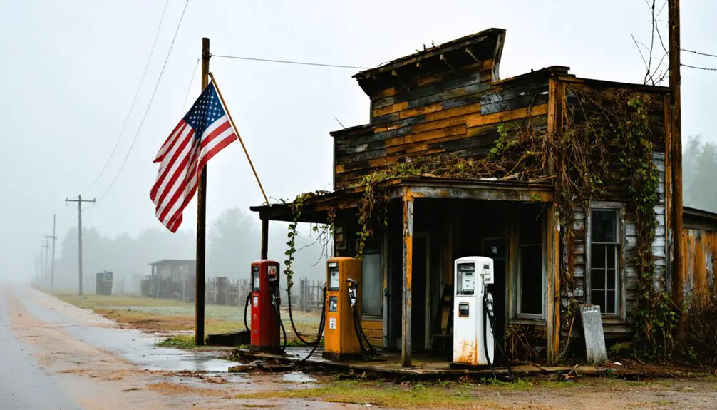
New York’s abandoned settlements tell stories of economic collapse and forced displacement, now disappearing beneath expanding forests. You’ll find Tahawus, where 1826 iron operations gave way to wilderness after 1989’s final closure, and Doodletown, cleared by eminent domain in 1965 after centuries of habitation. The state’s forest coverage has tripled since the 1800s to 18.6 million acres, steadily reclaiming these ghost towns through measured temperate-zone succession. Maintained trails now provide access to blast furnaces, foundation ruins, and canal remnants that reveal how quickly nature erases human ambition.
Key Takeaways
- Tahawus, a 19th-century mining town, was abandoned in 1989 after titanium operations ceased, leaving wilderness to reclaim industrial structures.
- Doodletown residents were displaced through eminent domain in 1965; only foundation ruins remain amid Bear Mountain’s reclaimed wilderness.
- Camp Beechwood, abandoned in 1996, now features deteriorating structures overtaken by dense woodland near Lake Ontario.
- Genesee Valley Canal, obsolete since 1878, has been transformed by nature into a greenway with visible stone lock remnants.
- New York’s forest coverage tripled from 6 million to 18.6 million acres, accelerating nature’s reclamation of abandoned settlements.
Tahawus: From Mining Boom to Mountain Wilderness
After its initial iron mining operations faltered in the mid-1800s, Tahawus underwent a remarkable transformation that would cement its place in American history.
The Preston Ponds Club leased this remote village in 1876, replacing deteriorating structures with elegant cottages for wealthy hunters seeking untamed wilderness.
Wealthy sportsmen transformed this abandoned mining outpost into an exclusive wilderness retreat through the Preston Ponds Club’s 1876 lease.
You’ll find Tahawus history deeply intertwined with Theodore Roosevelt’s midnight ride—when Vice President Roosevelt received news of McKinley’s assassination here in 1901, racing through darkness to assume the presidency.
WWII’s titanium demands briefly revived mining, displacing club members until 1989’s final abandonment.
The village’s origins trace back to 1826 when Archibald McIntyre and David Henderson discovered the site, establishing the initial mining operation that would support a thriving community complete with farms, furnaces, and mills.
Mining operations continued until 1962 when employees were transferred to Newcomb, marking the end of the town’s industrial era.
Today, wilderness reclamation progresses as the Open Space Institute manages this 10,000-acre tract, preserving MacNaughton Cottage while nature steadily reclaims what human ambition built and abandoned.
The Rise and Fall of Iron Ore Operations
You’ll find that New York’s iron mining industry traced its origins to bog deposits and weathered rock in the Hudson Highlands, where local refineries transformed limonite into essential tools and weapons.
As operations expanded statewide through the 19th century, the discovery of superior magnetite deposits in the Adirondacks propelled the region to produce 25% of the nation’s iron during the Civil War.
The Mineville operations in Essex County exemplified this boom, extracting over 13 million tons by 1906 before Superior Range competition and shifting markets triggered an inevitable decline that left once-thriving communities abandoned. Between 1880 and 1918, the state’s mines produced 23 million tons of iron ore valued at $73 million.
Split Rock Mountain’s operations utilized Ore Bed Harbor’s deep-water port to ship extracted magnetite directly to distant markets, though excessive titanium content ultimately rendered the mine unprofitable by 1888.
Tahawus Mining Community Beginnings
In 1826, iron ore deposits along the Upper Hudson’s banks caught the attention of entrepreneurs Archibald McIntyre and David Henderson, setting in motion one of the Adirondacks’ earliest industrial ventures. They founded the Adirondack Iron Works Company, constructing a complete settlement initially called McIntyre.
You’ll find evidence of their ambition in the mining legacy they left behind—blast furnaces, forges, sixteen dwellings, and even the region’s first organized state bank.
The village, renamed Adirondac around 1840, operated sporadically until 1858 when economic pressures forced closure.
What makes Tahawus history remarkable isn’t just its industrial past, but its transformation. After abandonment, the Preston Ponds Club leased the land in 1876, converting worker housing into elite hunting cottages.
The wilderness reclaimed what iron extraction had temporarily tamed. By the late 1800s, the area became popular among affluent hunters seeking Adirondack game. The blast furnace operations that once drove the community’s economy had been operational since the mid-1800s, representing a crucial period of iron production in the region.
Economic Decline and Abandonment
The same economic forces that transformed Tahawus from industrial outpost to wilderness retreat eventually consumed New York’s entire iron mining enterprise. By the mid-19th century, you’d witness the empire crumbling under unstoppable pressures:
- Depleted reserves made Rossie’s once-inexhaustible deposits economically unviable.
- Western competition from Michigan and Minnesota mines devastated regional markets.
- Financial panics, particularly 1893’s collapse, delivered mortal blows to struggling operations.
- Technological obsolescence rendered Adirondack facilities industrial dinosaurs.
The economic impacts reverberated through entire communities.
When Benson Mines closed in 1978, 365 workers lost livelihoods, and school enrollment plummeted from 1,400 to 625 students.
The mine had contributed over $400,000 annually in taxes for local infrastructure before its closure.
The diminished ore quality that plagued Rossie’s mines in the mid-19th century forced a painful economic transition toward agriculture and small-scale manufacturing.
Despite this devastation, community resilience emerged as former mining towns reinvented themselves, embracing the wilderness reclaiming their abandoned infrastructure.
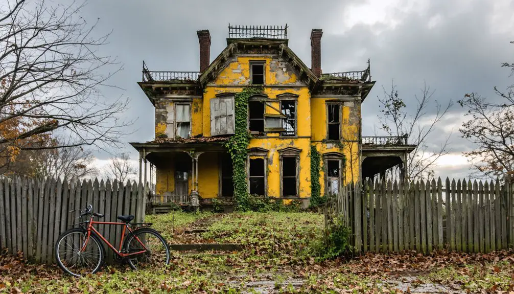
Doodletown: A Revolutionary War Settlement Lost to Progress
You’ll find that Doodletown’s transformation from thriving community to parkland reflects a common 20th-century pattern where rural settlements gave way to recreational development.
By the 1920s, approximately 70 homes housed families of loggers and miners who’d maintained continuous habitation since 1762, yet the park commission’s systematic land purchases beginning that same decade foreshadowed the town’s demise.
The 1964 ultimatum—accept buyout terms or face condemnation—forced remaining residents from properties their families had occupied for generations, clearing the valley for a ski resort that never materialized. By 1965, eminent domain was invoked to complete the acquisition of all remaining land.
The settlement’s strategic importance during the Revolutionary War became evident when British forces marched through in October 1777, splitting into two wings at Doodletown to attack Forts Montgomery and Clinton under General Sir Henry Clinton’s command.
Peak Community of 1920s
By the 1920s, Doodletown had evolved into a thriving mountain hamlet where logging crews and miners formed the economic backbone of a community that had witnessed nearly two centuries of American history.
You’d have found a self-sufficient settlement where families sustained themselves through determination and resourcefulness.
The hamlet’s peak featured:
- 70 homes sheltering generations of independent-minded residents
- A church serving as the community’s spiritual center
- A school educating children in the mountain valley
- Local businesses supporting daily needs and trade
Community interactions flourished at this rural crossroads, strengthened by proximity to Iona Island’s employment opportunities.
Small-scale agriculture supplemented logging and mining income, allowing residents to maintain their autonomous lifestyle.
This mountain refuge represented the enduring American spirit of self-reliance before progress demanded its sacrifice.
Eminent Domain Acquisition Process
During the 1920s, while Doodletown residents celebrated their community’s peak, the Palisades Interstate Park Commission had already begun purchasing surrounding properties, setting in motion a forty-year acquisition strategy that would erase the settlement from the landscape.
The commission systematically targeted the isolated mining and logging hamlet, gradually buying available plots to expand their parkland holdings. By 1964, the state delivered an ultimatum to remaining residents: accept a buyout or face condemnation.
When voluntary land acquisition proved insufficient, the state exercised eminent domain in 1965, seizing all remaining properties. Bulldozers immediately leveled seventy homes, the church, and school—ostensibly for a ski resort that never materialized.
Today, you’ll find only crumbled staircases and foundation outlines where families once thrived.
When Eminent Domain Creates Ghost Towns
When New York City’s Board of Water Supply condemned approximately 12,000 acres in the Catskills for the Ashokan Reservoir, it displaced 2,300 residents and erased entire communities from the landscape.
This eminent domain action destroyed over a century ago created one of New York’s largest forced ghost towns.
The scale of destruction included:
- 500 homes demolished across twelve settlements
- Thirty-five stores, ten churches, and eight mills razed
- Cemeteries relocated at $15 per grave
- Four hamlets completely submerged underwater
Community resistance emerged through newspaper accounts and family histories documenting residents who refused to leave.
Property foundations remain visible today, with archaeological surveys revealing undocumented farms the city never recorded.
Descendants still carry bitter memories of this state-sponsored displacement.
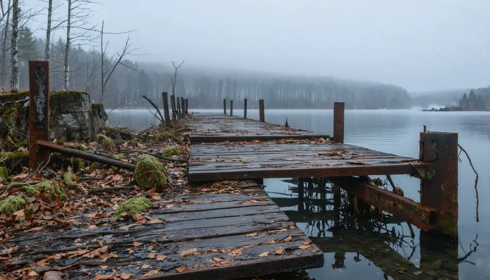
Rochester’s Hidden Woodland: The Genesee Valley Canal Site
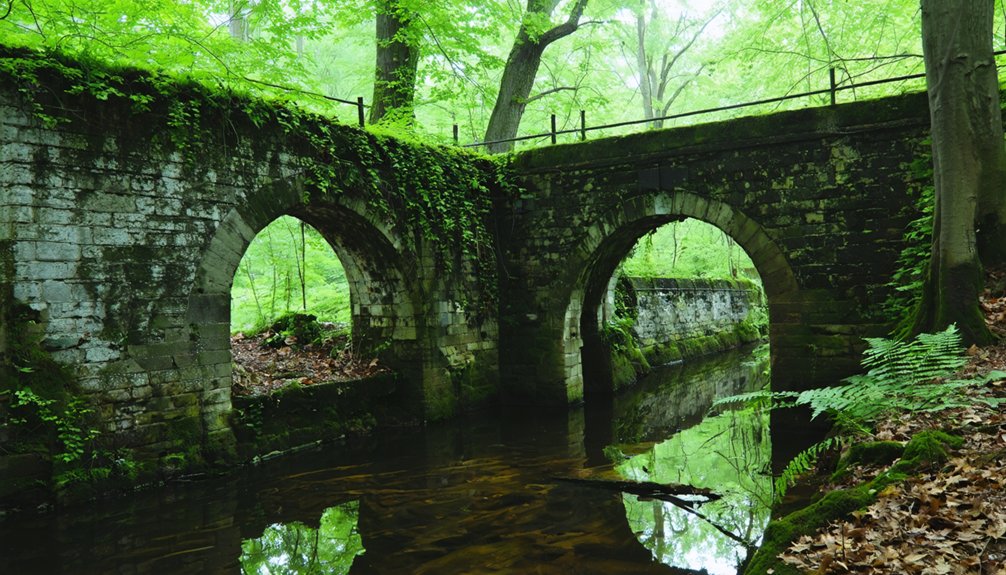
Though walkers now traverse the Genesee Valley Greenway through quiet woodlands south of Rochester, few recognize they’re following one of New York’s most ambitious engineering failures.
Today’s peaceful trail conceals yesterday’s costly dream—an engineering marvel that couldn’t outrun progress.
The $6.7 million Genesee Valley Canal operated just 38 years before railroads rendered it obsolete in 1878. What began in 1837 as hand-dug waterway linking Erie Canal to Pennsylvania’s resources became railroad right-of-way by 1880, then abandoned entirely by the 1960s.
Today nature’s reclamation transforms this hidden history into freedom’s pathway. You’ll find Lock 42 and other stone remnants emerging through vegetation, evidence to 124 miles of 19th-century labor.
The greenway preserves what commerce abandoned—a transportation corridor where forests now replace the packet boats that once carried Pennsylvania coal to Rochester’s mills.
Urban Forests Reclaiming Forgotten Neighborhoods
- Manhattan’s 1st Avenue lot became dense forest within five years.
- Brooklyn’s Gravesend wedge evolved from illegal junkyard to untamed parkland.
- Glen Cove’s Welwyn greenhouses crumbled amid encroaching vegetation.
- Bear Mountain’s Doodle Town vanished as wilderness reclaimed hamlet structures.
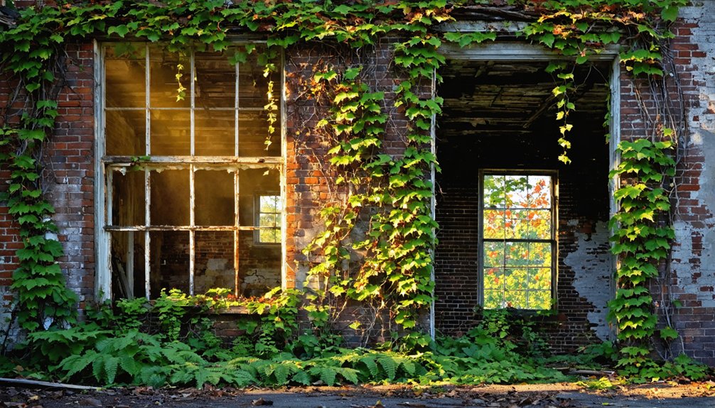
These sites prove nature doesn’t negotiate—it simply returns when human presence weakens, converting pavement and brick into thriving ecosystems beyond regulatory reach.
The Abandoned Girl Scout Camp in Beechwood State Park
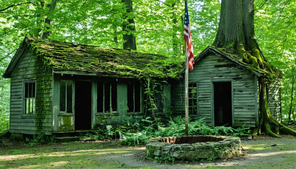
You’ll find Camp Beechwood’s ruins along Maxwell Bay’s western shore, where Girl Scouts earned badges from 1929 until abandonment in 1996.
The property’s structures—an Olympic-sized pool, mess hall, dock, and lean-tos—now decay beneath advancing vegetation, their deterioration accelerated by rising Lake Ontario waters and decades of deferred maintenance.
Historical records document how this 150-acre site transformed from a thriving summer camp into a state preserve where nature systematically reclaims buildings that once hosted thousands of young campers.
Camp Structures and Decay
Since Camp Beechwood’s closure in 1996, the once-vibrant Girl Scout facility has succumbed to structural deterioration that mirrors the environmental forces which originally drove its abandonment.
You’ll discover nature reclamation overwhelming human construction across the 150-acre property.
The buildings reveal progressive decay through:
- Roof leaks compromising structural integrity throughout multiple facilities
- Vandalism accelerating deterioration beyond normal age-related breakdown
- Boarded-up structures still accessible to explorers and occasional campers
- Several buildings approaching complete collapse, presenting serious safety hazards
Despite their condition, these remnants remain legally open for exploration.
Camp preservation efforts never materialized after New York State’s acquisition, as budget constraints prevented planned improvements.
The deteriorating structures stand as monuments to abandoned institutional ambitions, slowly surrendering to the forest’s patient reclamation.
Vegetation Overtaking Buildings
After the 1996 abandonment, Camp Beechwood‘s 250-acre landscape entered an uncontrolled succession cycle that transformed manicured grounds into dense woodland.
You’ll find invasive species like European buckthorn, Norway maple, and Japanese barberry dominating forested sectors, while honeysuckle and multiflora rose replaced native understory vegetation.
The vegetation encroachment accelerated dramatically after state acquisition in 1999, when maintenance ceased entirely.
By 2010, SUNY’s environmental assessment documented shelter structures completely swallowed by thick vines covering roofs and walls.
Building decay enabled water infiltration, creating ideal conditions for internal plant growth.
Purple loosestrife, goldenrod, and swallowwort naturalized throughout the property, creating dense ground coverage that obscured access to remaining structures.
Native American beech trees, the property’s namesake, continue dispersing seeds alongside expanding pine and hemlock groves that reclaim formerly maintained camp areas.
Exploring the Abandoned Grounds
Where else in New York can you legally explore dozens of decaying mid-century structures within an active state park? Beechwood offers unrestricted access to abandoned structures from its Girl Scout era:
- Pioneer Lodge and Highland halls – massive gathering spaces where nature reclamation advances through broken windows
- Theater area and lean-to sites – stages once echoing with campfire songs now silent under canopy growth
- In-ground pool complex – cracked concrete monuments to 1960s optimism slowly returning to earth
- Cliff lodge overlooks – commanding Lake Ontario vistas from weathered foundations
You’ll navigate maintained trails through this 434-acre preserve where ecological succession actively dismantles human ambition.
While some buildings risk collapse, most remain accessible under town management—tangible evidence of how quickly infrastructure vanishes without constant intervention.
Camp Santanoni: Tragedy and Transformation
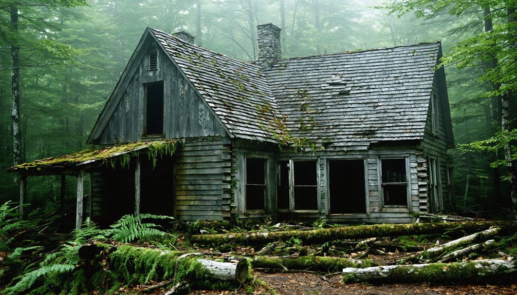
Tragedy struck when fire destroyed the massive dairy and horse barn, ending the farm’s livestock operations.
You’ll find surviving ruins alongside intact structures like the stone dairy and Artists Studio, showcasing the architectural legacy.
After the Pruyn family sold in 1953, New York State acquired the property in 1972.
Today, you can explore this National Historic Landmark, where nature reclaims what ambition built.
How Climate Shapes the Speed of Nature’s Return
While tropical climates can reclaim abandoned settlements within decades, New York’s temperate zones tell a different story of preservation and gradual transformation.
You’ll find climate effects dramatically influence how nature reconsumes human spaces through distinct patterns:
- Temperature variations slow decomposition rates, preserving Tahawus mining structures since 1962 abandonment.
- Winter freezes protect soil nutrients while delaying vegetation growth on Doodletown foundations.
- Drought extremes reduced native groundcover by 31% in 2024, hindering forest floor regeneration.
- Pest invasions like emerald ash borers killed 76 trees by 2024, creating canopy gaps.
New York’s forests expanded from 6 million acres in the 1800s to 18.6 million today, demonstrating how temperate conditions enable measured reclamation rather than tropical-speed consumption.
Exploring the Preserved Ruins: Public Access Today
Today’s ghost town explorers discover unprecedented access to New York’s abandoned settlements, where state agencies have transformed once-restricted ruins into public heritage sites.
The Adirondack Park Agency opened Tahawus in 2003, offering public hiking through industrial remnants including the 1854 McIntyre Blast Furnace and MacNaughton Cottage.
Since 2003, Tahawus has welcomed hikers to explore 19th-century industrial ruins including the historic McIntyre Blast Furnace and MacNaughton Cottage.
You’ll find preserved structures at Camp Santanoni, where restoration efforts in the 2000s revitalized the 1893 Great Camp for year-round exploration.
Doodletown’s concrete stairs and stone foundations remain accessible via trails near Route 9W, maintained by the Friends of Doodletown.
Even Frontier Town’s carnival-era architecture stands available for exploration near Exit 29.
These managed sites balance preservation with unrestricted access, letting you experience authentic historical landscapes without bureaucratic barriers.
Frequently Asked Questions
Is It Legal to Remove Artifacts From These Abandoned Sites?
Removing artifacts isn’t legal without permission—you’ll face serious legal consequences regardless of abandonment. Artifact preservation laws protect historical context on private, state, and federal lands. Written authorization and proper archaeological documentation remain essential for lawful recovery.
Are There Safety Hazards When Exploring Ghost Town Ruins?
Yes, you’ll face significant safety hazards during urban exploration. Archival evidence documents structural collapses, toxic exposures, and concealed shafts in deteriorating ruins. Essential safety precautions include sturdy footwear, respirators, and informing others of your location beforehand.
What Wildlife Now Inhabits These Abandoned New York Locations?
You’ll find diverse wildlife observations across these sites: herons, egrets, and ibis thrive on High Island and Shooter’s Island, while seagulls inhabit Chimney Sweep Islands. Ecosystem restoration enabled rattlesnakes’ resurgence at Overlook Mountain’s ruins.
Can You Camp Overnight at These Ghost Town Sites?
Freedom’s boundaries exist here: you can’t legally camp overnight at these sites. Camping regulations strictly prohibit it at North Brother Island and Doodletown, while overnight permits aren’t available for Tahawus or Pottersville’s day-use areas.
Do Any Former Residents Still Visit These Abandoned Communities?
Yes, former residents return to Doodletown annually for community gatherings at the cemetery. You’ll find them reminiscing fifty years after evacuation, demonstrating how human connections persist despite nature’s relentless reclamation and governmental displacement of their ancestral settlement.
References
- https://www.onlyinyourstate.com/experiences/new-york/abandoned-places-ny
- https://www.youtube.com/watch?v=HPCJ634_-a8
- https://secretnyc.co/tahawus-ny-forgotton-ghost-town-halloween-season/
- https://visitadirondacks.com/fall/abandoned-places-ghost-towns
- https://www.atlasobscura.com/places/doodletown
- https://943litefm.com/abandoned-ghost-towns-new-york/
- https://www.youtube.com/watch?v=Nw2j2-YSknU
- https://myfamilytravels.com/new-york-road-trips-that-pass-through-ghost-towns
- https://secretnyc.co/tahawus-ghost-town-ny/
- https://www.untappedcities.com/the-history-of-tahawus-once-a-thriving-mining-community-now-an-adirondack-ghost-town/