You’ll find Arkansas’s best fall ghost towns along winding Ozark backroads, where Rush’s crumbling zinc smelters stand against autumn foliage and Eros’s weathered schoolhouse emerges from golden prairie grass. Monte Ne’s submerged ruins reveal themselves during seasonal droughts, while Bruno’s Baptist Church watches over 1800s gravestones beneath crimson maples. I’ve walked Graysonia’s concrete foundations when morning frost still clings to the ruins—there’s something unforgettable about exploring these forgotten settlements when the air turns crisp and the crowds disappear, especially once you understand each location’s unique story and most suitable viewing conditions.
Key Takeaways
- Rush Ghost Town offers Arkansas’s premier zinc mining heritage site with interpretive trails through ore mills and mine entrances within Buffalo National River.
- Eros features a National Register school, general store ruins, and pioneer cemetery amid golden prairie grasses ideal for autumn exploration.
- Bruno combines tangible 1800s history at its Baptist Church and cemetery with local legends and ghost stories along Ten Mile Creek Bottoms.
- Graysonia showcases concrete ruins from a 1907 timber company town along the Antoine River, reflecting Arkansas’s railroad and industry legacy.
- Fall visits benefit from crisp air, autumn flora, and golden fields, with proper footwear recommended for rocky terrain exploration.
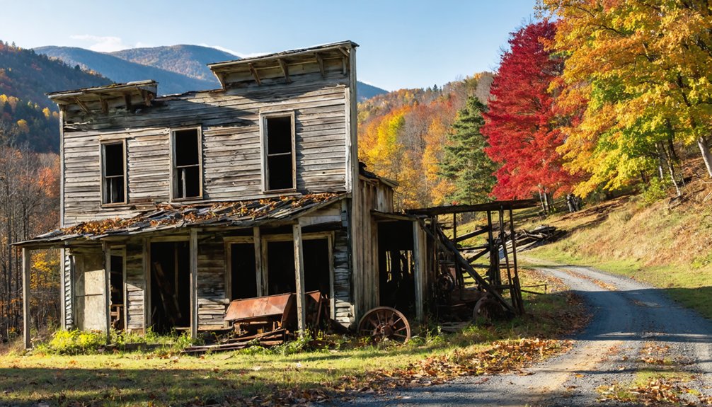
Rush Ghost Town: Arkansas’s Zinc Mining Capital
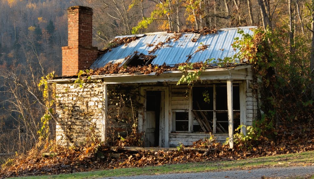
Tucked into the wooded hills along Rush Creek in Marion County, Rush Ghost Town stands as Arkansas’s most significant zinc mining relic—and the only authentic ghost town between the Mississippi River and the Rockies.
You’ll discover what local legends claim began with silver but became something far more valuable: zinc oxide.
The Morning Star Mine‘s massive 13,000-pound nugget won international acclaim at world’s fairs, while ten companies extracted fortune from these hills during WWI’s peak.
Today’s interpretive trail lets you explore crumbling ore mills, mine entrances, and the 1886 smelter—Arkansas’s oldest mining structure.
Historical preservation efforts within Buffalo National River protect these remnants, though you’ll want proper footwear for rocky terrain.
Watch for deer among the ruins while imagining when thousands called this wilderness home.
The Taylor-Medley Store served residents until 1956, marking one of the last operational businesses before the town’s final abandonment.
At its zenith, this prosperous mining town supported nearly 5,000 residents who rushed here seeking fortune in the mineral-rich hills.
Monte Ne: The Submerged Resort Community
Beneath Beaver Lake’s surface lies Monte Ne, William Hope Harvey’s extravagant 1901 resort that once boasted Arkansas’s first golf course and indoor pool before floodwaters claimed it in the 1960s.
You’ll want to visit during fall’s low water levels, when the lake retreats to expose limestone foundations, staircases, and the amphitheater’s retaining wall—ghostly remnants of hotels that hosted gondola rides and presidential conventions. Harvey, a free silver supporter who moved to Arkansas in 1900, purchased 320 acres to develop this ambitious community. The Rogers Historical Museum preserves artifacts from the site, including Harvey’s death mask and a model of his unfinished pyramid—a monument he envisioned to outlast civilization itself.
The resort’s last visible landmark, a crumbling tower that survived underwater for decades, met its end in February 2023 when officials demolished it, closing Monte Ne’s final chapter above the waterline.
Historic Resort Under Water
When autumn winds sweep across Beaver Lake’s surface, they ripple above what was once Arkansas’s most ambitious resort destination—Monte Ne, a gilded-age community that now rests beneath 50 feet of water.
You’ll discover a place where historical preservation meets water recreation in the most unusual way.
During extreme droughts, you can witness foundations emerging from the depths:
- Missouri Row’s stone fireplace and chimney standing sentinel
- Oklahoma Row’s crumbling hotel foundations
- Submerged amphitheater ruins
- Hotel Monte Ne’s skeletal remains
- Retaining walls that once bordered manicured grounds
William Hope Harvey’s 1901 vision featured imported Venetian gondolas, Arkansas’s first indoor pool, and elaborate entertainment venues.
The resort’s heyday included hosting Arkansas’s only presidential convention in 1931, when Harvey’s Liberty Party gathered delegates in this remote Ozark destination.
The construction of Beaver Lake in the 1960s ultimately sealed the town’s fate, flooding the remaining structures and transforming the resort into an underwater ghost town.
Today, you’re free to kayak above ballrooms where guests once danced, exploring a ghost town that refused to disappear completely.
Low Lake Level Revelations
As Beaver Lake recedes during drought conditions, you’ll witness an eerie transformation—stone foundations and weathered chimneys rising like ghosts from the water’s surface. Oklahoma Row’s basement walls emerge first, followed by Missouri Row’s fireplace standing sentinel over submerged memories.
At the boat launch, limestone structures reveal wooden staircases where resort guests once descended—their fashion history now only captured in museum photographs. The amphitheater’s retaining walls appear during extreme low water, offering rare glimpses into Harvey’s architectural ambitions.
Time your botanical exploration of the shoreline carefully; water levels fluctuate unpredictably. You’ll find remnants of stone bridges and foundations that housed Arkansas’s first indoor pool. These ruins represent freedom from conventional development—a visionary’s dream preserved accidentally by flooding, accessible only to those who venture here when nature permits.
Final Structure’s 2023 Demolition
After nearly sixty years beneath Beaver Lake’s surface, the Oklahoma Tower met its final end on February 21, 2023, when contractors dismantled the three-story concrete sentinel that had survived decades of flooding.
Conservation challenges ultimately outweighed the structure’s architectural significance.
You’ll understand why when you consider:
- Trespassers breaching security fences for dangerous exploration
- Vandals leaving graffiti across deteriorating concrete surfaces
- Continuous lake water exposure weakening structural integrity
- Health hazards from crumbling materials threatening visitors
- Increased liability concerns despite preservation attempts
The Corps collaborated with Shiloh Museum and Rogers Historical Museum to salvage materials documenting Monte Ne’s legacy before demolition began February 13th.
The resort once featured the world’s largest log hotels, designed by A. O. Clarke, attracting visitors from across the nation for over two decades.
While Oklahoma Row and Tower are gone, Missouri Row foundations remain visible during low water—your last chance to witness William Harvey’s ambitious 1900 resort dream firsthand. Many visitors gathered to see the historic tower during its final days as the demolition process moved quickly.
Eros: Remnants of a Farming Settlement
You’ll find Eros scattered across quiet farmland northeast of Harrison, where a weathered school building, an old general store, and a pioneer cemetery mark what remains of this 19th-century agricultural settlement.
The autumn landscape transforms your hour-long exploration into something special—golden prairie grasses frame the aging structures while crisp air makes the walk between sites comfortable. The old school building stands on the National Register of Historic Places after careful restoration efforts.
Pack your camera and wear sturdy boots, as you’ll be crossing uneven terrain to document these physical remnants of Marion County’s farming heritage. Morning visits reward you with frost flowers blooming on cold surfaces, a natural phenomenon visible during autumn’s temperature drops.
Scattered Historical Structure Remains
Where time erased an entire community, Eros now exists as little more than whispers in the landscape. You’ll discover abandoned homesteads marked only by overgrown foundations that nature’s steadily reclaiming.
The settlement’s agricultural past reveals itself through scattered evidence of farming life that once sustained a hundred souls.
As you explore, you’ll encounter:
- Collapsed barn timbers jutting from wild grasses
- Stone well bases half-swallowed by creeping vines
- Weathered wooden fence posts leaning at odd angles
- Cellar depressions where families once stored provisions
- Rusted farm implements resting in forgotten tool shed foundations
Fall’s golden light transforms these fragments into something almost sacred. You’re free to wander where access permits, though respect private land boundaries.
There’s no marked trail—just your curiosity leading you through what remains.
Fall Hiking Through Farmland
Beyond Eros’s scattered foundations, the surrounding farmland opens into trails that lead you through Arkansas’s agricultural heartland transformed by autumn. You’ll traverse rolling fields where small farms and cow pastures tell farmstead stories of generations who worked this land.
The Williams Hollow Trail cuts through 8.7 miles of terrain where sandy pines give way to dense hardwood forests, their leaves ablaze with autumn harvest colors.
Start at Lost Valley’s accessible paths, then venture deeper into box canyons where high bluffs shelter you from wind.
The Tanyard site reveals historical tannery remnants—tangible connections to settlers who lived off this land.
Dense vegetation creates cool corridors even during warmer fall days, while blooming dogwoods and misty mornings add atmospheric depth to your exploration of these forgotten agricultural communities.
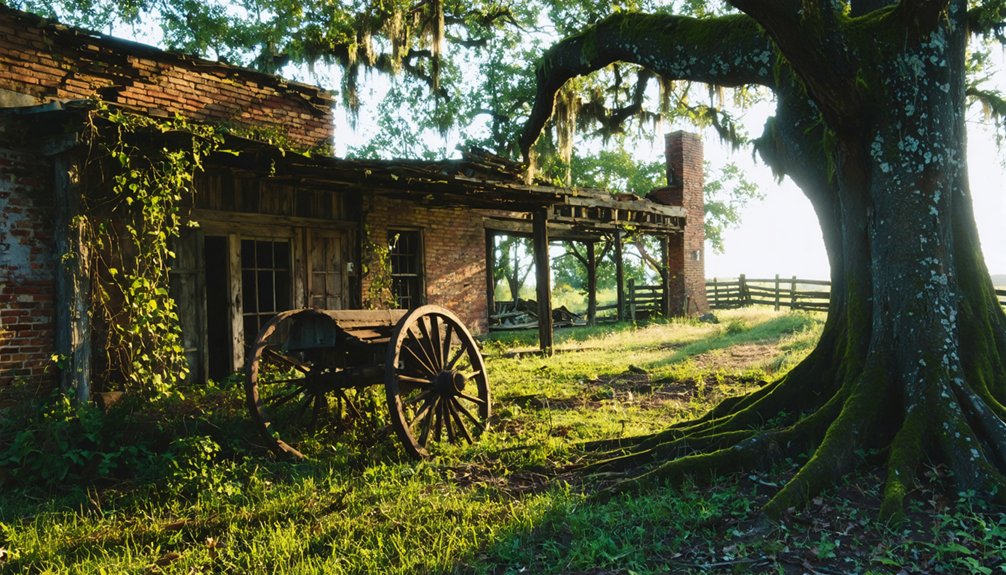
Bruno: Rural Ruins in the Ozark Mountains
Deep in the Ozark Mountains of Marion County, Bruno sits quietly along Ten Mile Creek Bottoms like a whisper from another century. You’ll find this unincorporated community off Highway 65—take Junction 235’s left fork and follow the winding road into history.
What awaits your exploration:
- Bruno Baptist Church standing sentinel over scattered ruins
- Cemetery with gravestones marking lives from the 1800s
- Remnants of a once-thriving town of 600+ residents
- Local legends and ghost stories dating back generations
- Free access for roughly an hour of discovery
This faded farming community offers supernatural tales alongside tangible history. The paranormal activity reports have persisted for decades, documented in archives and featured across ghost town media.
Combine your visit with nearby Eros for a full day of rural exploration through Arkansas’s forgotten corners.
Zinc: Mining Heritage in Marion County
While prospectors in the 1880s mistook the green-tinged rocks for silver, what they’d actually stumbled upon would transform Marion County into one of Arkansas’s most significant mining districts. The Rush Creek area became ground zero for zinc mining after Uncle Alf Hampton’s discovery, eventually boasting over 120 mines.
You’ll find remnants of Morning Star Mine, where workers once hauled out smithsonite masses weighing over 12,000 pounds—one specimen even won Chicago World’s Fair’s blue ribbon.
Today’s Rush stands as a testament to four boom periods that shaped these hills. Most mines now sit on federal land, making ghost town preservation both a blessing and a restriction. You can’t collect specimens anymore, but you’ll walk paths where WWI-era miners once chased “turkey fat” ore through 600-foot tunnels carved into Everton Dolomite.
Graysonia: Timber and Railroad History
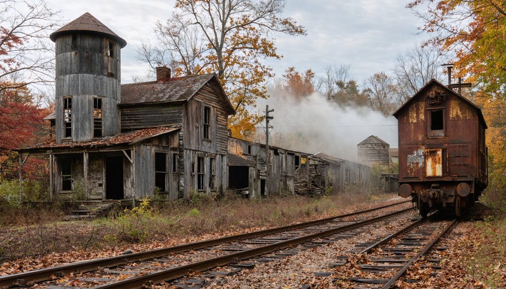
Along the muddy banks of the Antoine River, William Grayson’s lumber empire rose from necessity when his crews had stripped Daleville’s forests bare by 1907.
You’ll find Graysonia’s story emblematic of Arkansas’s timber industry—a thousand souls dependent on virgin forests and railroad expansion into Clark County’s wilderness.
The company town offered surprising amenities:
- Free electricity from the sawmill generator
- Distilled drinking water piped directly to homes
- Three hotels serving transient lumber workers
- Ice plant producing 25 tons daily
- Nearly 200 company-owned houses
Today, concrete remnants mark where prosperity once thrived. The 1931 closure erased most structures, though a brief cinnabar mining rush delayed complete abandonment.
You’ll discover freedom in exploring these crumbling foundations—tangible proof that even mighty enterprises can’t outlast nature’s finite resources.
Planning Your Fall Ghost Town Adventure
How do you transform curiosity about Arkansas’s abandoned settlements into a successful autumn expedition? Start with Rush Historic District’s maintained trails—the Morning Star Loop offers quick access while Monte Cristo Trail provides moderate challenge through weathered structures.
Rush Historic District bridges curiosity and adventure through accessible trails that wind past Arkansas’s weathered mining settlements draped in autumn color.
You’ll navigate past buildings where vines snake through empty windows and trees pierce foundations, all framed by seasonal foliage painting the Ozarks brilliant gold and crimson.
Distance viewing protects these fragile sites while keeping you safe from unstable structures. The National Park Service’s interpretive signs guide your self-exploration at locations like East Calico Historic District.
Listen for wildlife sightings—birdsong and rustling leaves compose your soundtrack. Pack water, wear sturdy boots, and arrive early when morning light illuminates the White River’s colorful bluffs, transforming forgotten settlements into atmospheric autumn destinations.
Frequently Asked Questions
Are These Ghost Towns Safe to Explore With Children?
You’ll find family friendly trails at Rush and Old Davidsonville that’re safe for kids when you maintain distance from buildings. Despite haunted legends, real dangers include unstable structures and mine shafts—stick to marked paths for adventure without risk.
Do I Need Special Permits to Visit Arkansas Ghost Towns?
You don’t need permits to visit Arkansas ghost towns like Rush—they’re free and open to explore. You’ll discover local history through interpretive trails while preservation efforts maintain these sites safely, letting you roam and experience frontier heritage freely.
As you continue your adventure, consider seeking out abandoned sites to explore in Arkansas, where remnants of the past tell unique stories. Each location holds a piece of the state’s rich history, inviting you to uncover hidden treasures and appreciate the beauty of forgotten places. Whether it’s an old mill or a decaying church, you’ll find that these explorations offer a glimpse into the lives once lived in these now-silent settings.
What Photography Equipment Works Best for Capturing Ghost Town Ruins?
You’ll want a wide-angle lens (16-35mm) and sturdy tripod for low-light long exposures. Essential camera accessories include a reliable torch for dark interiors, plus dust masks and gloves. These lighting techniques capture Arkansas’s haunting decay perfectly.
Are There Guided Tours Available for Arkansas Ghost Towns?
Uncover Arkansas’s ghostly past through guided tours that blend historic preservation with local legends. You’ll discover haunted locations across Little Rock, Eureka Springs, and Rogers, where knowledgeable guides share documented stories while you explore at your own adventurous pace.
As you delve into the mysteries of the past, consider planning a trip to explore the fall foliage spots in Arkansas. The stunning landscapes not only provide a picturesque backdrop but also enhance the eerie atmosphere of the stories you’ll hear. Each vibrant leaf transforms the natural beauty of Arkansas into a canvas of history, making it the perfect time to experience both the haunting tales and the breathtaking scenery.
Can I Camp Overnight Near These Ghost Town Locations?
You’ll find primitive camping at Rush Ghost Town near Buffalo National River, where hidden histories meet starlit freedom. Eros and Booger Hollow lack facilities, but nearby Ozark lands offer dispersed sites perfect for chasing haunted legends independently.
References
- https://www.ghosttowns.com/states/ar/ar.html
- https://arkansasfrontier.com/ghost-towns-in-arkansas/303766/
- http://freepages.rootsweb.com/~gtusa/history/usa/ar.htm
- https://www.axios.com/local/nw-arkansas/2024/01/02/arkansas-ghost-towns-mapped
- https://www.youtube.com/playlist?list=PL4jqwLUrhjNQTUht0FCp8mnQYi_DNiUWU
- https://kkyr.com/arkansas-top-5-ghost-towns/
- https://www.youtube.com/watch?v=U4kJjjbcnMM
- https://www.uaex.uada.edu/environment-nature/musings-on-nature-blog/posts/ghost-towns.aspx
- https://encyclopediaofarkansas.net/entries/rush-ghost-town-marion-county-1270/
- https://www.barefoottraveler.com/rush.html