You’ll find Hawaii’s most haunting ghost towns on the Big Island, where October’s mild 80°F days make exploring comfortable. Kalapana and Kaimu lie frozen beneath 50-60 feet of black lava from Kilauea’s 1990 eruption, while ancient Kaupulehu vanished under Hualalai’s 1801 flow. Wander Kalawao’s eerie foundations at Kalaupapa, or discover Puʻuhonua o Hōnaunau‘s sacred stone temples and fishponds that showcase ingenious Hawaiian engineering. Fall’s smaller crowds let you experience these volcanic-buried villages and coral-stone ruins with an intimacy that reveals their layered stories.
Key Takeaways
- Kaupulehu offers views of lava-buried fishing village ruins from 1801, with geological features and ancient fishpond remains visible along transformed coastline.
- Kalaupapa National Historical Park preserves Kalawao’s historical structures from the 19th-century leper colony, maintaining 8,000 patients’ poignant history.
- Early October provides ideal weather with mid-80s°F temperatures, fewer crowds, and better accommodation deals for exploring abandoned Hawaiian communities.
- Kalapana and Kaimu display lava-frozen relics from 1990 eruptions, including preserved mailboxes and foundations buried under 50-60 feet of volcanic rock.
- Book haunted legends tours early as fall popularity increases; tours explore ghost stories and cultural histories at ancient ruins and burial sites.
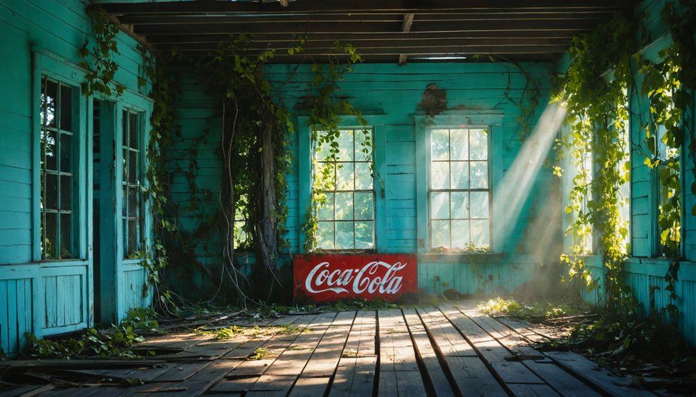
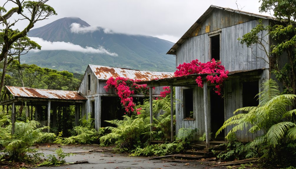
Honoka’a: From Sugar Plantation to Charming Historic Town
This town’s community transformation from sugar powerhouse to cultural haven happened overnight when Hamakua Sugar Company harvested its final crop in 1994.
Rather than fading into obscurity, locals reinvented their future.
When the sugar mills went silent, this community refused to disappear—they built something entirely new from what remained.
Today’s entrepreneurs have transformed plantation-era structures into galleries and cafés, while the annual Hamakua Music Festival keeps October lively.
The town’s main street Māmane developed during the 1870s as Honoka’a grew to become the third-largest town in the region.
The Honokaʻa Heritage Center, opened in July 2021, preserves plantation-era photographs and artifacts in a building dating back to 1927.
It’s authenticity without the tourist trap—pure Hawaiian resilience.
Waipi’o Valley: The Valley of the Kings
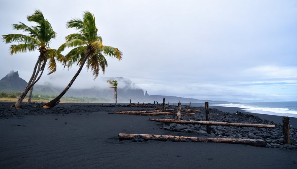
Where Hawaiʻi Island’s northeastern cliffs plunge 2,000 feet into a mile-wide expanse of wild taro and cascading waterfalls, Waipi’o Valley—”curving water”—holds the mana of kings in its black sand and burial caves.
You’ll descend into Kamehameha’s boyhood home, where ancient trade routes once connected 10,000 souls farming terraced kalo patches. Traditional Hawaiian rituals still echo through temples and puʻuhonua carved into these walls.
The 1946 tsunami swept away villages that Chinese immigrants built after royal lands passed to sugar interests. Rice paddies flourished here until 1927, when the last harvest marked the end of an agricultural era that had temporarily surpassed even taro cultivation. Perennial streams continue flowing through the valley floor, nourishing the wild vegetation that has reclaimed former farmlands. Today fewer than 100 people remain among five meandering streams.
Yet this ghost town breathes differently—not abandoned from failure, but protected by isolation. Those sacred cliffs still guard aliʻi burial caves, and the kingdom’s old capital refuses complete surrender.
Kalapana: A Town Frozen in Time by Lava
While Waipi’o’s cliffs preserved their sacred ground through sheer inaccessibility, Kalapana met a different fate—entombment by the very force that built these islands. You’ll trek across volcanic landscapes where Pu’u’ō’ō’s 1990 flows swallowed an entire community whole, burying homes, roads, and cherished gathering places beneath sixty feet of molten rock.
The lava covered streets you’ll walk over once hummed with life—children playing, neighbors sharing stories on lanais. When flows breached the escarpment that June, residents watched helplessly as their village disappeared beneath black stone.
Today, you’ll find frozen reminders: a mailbox jutting through basalt, buried foundations mapping ghostly neighborhoods. Though Kilauea’s episodic eruption activity continues through 2025 with fountain heights sometimes exceeding 1,000 feet, recent eruptions have remained confined to the summit region within Hawaiʻi Volcanoes National Park. The Pu’u’ō’ō eruption lasted an extraordinary 35 years from 1983, making it one of Kīlauea’s longest eruptive episodes.
Fall’s cooler temperatures make exploring these harsh expanses bearable. Park rangers guide you through this stark testament to nature’s absolute power over our temporary claims to permanence.
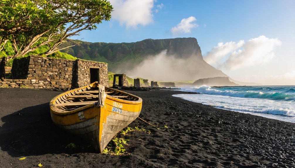
Kaimu: Buried Beneath Kilauea’s 1990 Eruption
Just two miles from Kalapana’s frozen streets, Kaimu’s story unfolds with devastating precision—a chronicle of destruction measured in days rather than decades. You’ll find where Kilauea’s molten fury erased an entire town in 1990, burying its legendary black sand beach under fifty feet of fresh rock.
The lava formations here tell a compressed tale: breakouts from the Kupaianaha vent reached Kaimu Bay on July 29th, swallowed half the beach by August 2nd, then consumed everything by September’s end. By late July, advancing flows had pushed within 400 meters of homes near Kaimu, as lava entered the ocean at multiple points and spread eastward along the bay. The bay itself was filled within four days after new breakout activity began near the Woodchip tube on September 24, with fresh ocean entries forming 200 meters beyond the original shoreline.
Today, you can hike trails across these youngest lava fields, tracing where 716 homes once stood. The volcanic history beneath your feet is merely three decades old—a blink in geological time, yet long enough for nature to reclaim this obliterated coastline.
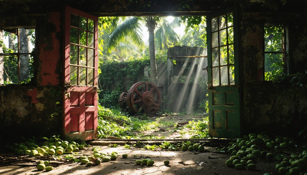
Kaupule: Ancient Village Lost to the 1801 Lava Flow
Along Hawaii’s Kona Coast, the thriving village of Kaupulehu once hummed with the daily rhythms of pre-contact Hawaiian life—fishermen hauling in their catch, families tending taro patches, and children playing on black sand beaches.
In 1801, Hualalai volcano shattered this ancient community when molten lava poured down from vents nearly 6,000 feet above, burying homes, heiau, and fishponds beneath a river of shiny black basalt studded with olivine crystals.
The Kaupulehu flow also carried rare mantle xenoliths—fragments of peridotite, pyroxenite, and gabbro torn from deep within the Earth—offering scientists a glimpse into the planet’s interior structure.
You’ll find the village’s ghost beneath your feet as you walk the hardened flow between Kona Village Resort and Keahole Point, where the lava pushed the shoreline a full mile into the Pacific. This shield volcano, which rises to 8,278 feet elevation, has covered over half its surface with lava flows less than 3,000 years old, making it one of Hawaii’s most geologically active landscapes.
Pre-Contact Hawaiian Community
Deep in the Kekaha region of North Kona, the ancient village of Kaʻūpūlehu thrived along Hawaiʻi Island’s west coast long before Captain Cook’s ships appeared on the horizon. Founded by Kapoi, a gifted fisherman and healer, this settlement drew people from across the islands seeking his renowned abilities.
You’ll find remnants of kauhale compounds scattered near freshwater springs and anchialine ponds, where families built their hale noa sleeping houses.
The community flourished through Hawaiian maritime trade, with fishing villages dotting the shoreline. Sacred burial sites and cave-spring complexes reveal the spiritual depth of these early inhabitants.
High aliʻi Kameʻeiamoku made his residence here in 1790, marking the village’s significance.
Then tragedy struck—a devastating smallpox epidemic claimed Kapoi and countless others, forcing survivors to abandon their ancestral home forever.
The 1801 Eruption
When Hualalai volcano roared to life in 1800, molten rock burst from fissures high on the mountain’s slopes, forever altering the landscape where Kaʻūpūlehu’s residents had built their lives.
Two massive lava flows—Kaupulehu and Huehue—snaked down the mountain, one originating from 1,650 meters elevation and stretching 16 kilometers to the sea.
You’ll spot volcanic formations marked by shiny black surfaces and glittering olivine crystals embedded in the rock.
The flows buried coastal villages and filled Kamehameha’s legendary three-mile-long fish pond.
Today, orange-hued stone reveals where lava met ocean.
Look closely and you’ll find lava encrusted xenoliths—fragments of Earth’s mantle torn loose and carried to the surface, offering you a glimpse into the planet’s fiery depths.
Buried Beneath Lava
The Kaupulehu flow didn’t just reshape the coastline—it erased entire communities in its path. As you explore Hualalai’s northwest rift zone today, you’re walking over Hawaiian villages that vanished beneath fluid alkalic basalt in 1801.
The most significant loss was Kamehameha’s Pāʻaiea fishpond—three miles long, one-and-a-half miles wide—now buried under multicolored volcanic formations where lava met ocean water.
You’ll spot orange-hued rock marking these interaction sites, evidence of a thriving coastal community swallowed whole. The flow’s lava encrusted artifacts include mantle-sourced xenolith nodules scattered throughout.
At fall’s cooler 64°F temperatures, you can hike private Hualalai trails to witness this geological cemetery, where seawalls, anchialine pools, and village layouts remain hidden beneath your feet.
Kalawa: Ghostly Foundations of a Relocated Community
Windswept and isolated, Kalawao clings to the eastern edge of Molokaʻi’s Kalaupapa Peninsula like a scar that won’t fade. You’ll find only ghostly building foundations where thousands once lived in forced exile after 1866’s leprosy isolation decree.
Father Damien transformed this desperate place—building homes, churches, water systems—before authorities relocated everyone westward to Kalaupapa in 1894.
Father Damien’s compassionate labor—constructing shelter, worship spaces, and vital infrastructure—briefly illuminated Kalawao’s darkness before its 1894 abandonment.
Today’s historical preservation efforts maintain these haunting outlines within Kalaupapa National Historical Park. You’ll sense the cultural significance walking among ruins where over 8,000 patients were banished from their islands.
The sheer pali cliffs that once trapped them now frame your view of what remains: a living ghost town testifying to Hawaii’s painful past, where human resilience bloomed despite isolation’s cruelty.
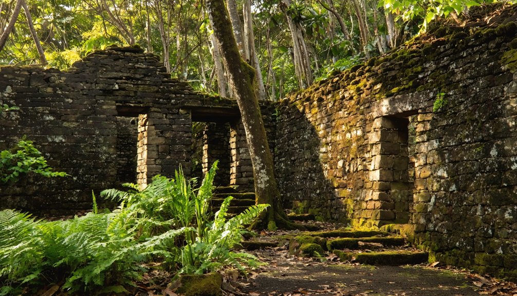
PuʻUhonua O Honaunau: Sacred Sanctuary of Ancient Hawaii
Unlike Kalawao’s tragic isolation, another Hawaiian sanctuary offered hope to those who needed it most. At Puʻuhonua O Hōnaunau, you’ll discover where kapu breakers and defeated warriors found redemption behind a massive 12-foot wall. Protected by Lono, god of life, this sacred ground granted pardons through Hawaiian spiritual practices—no blood could be shed here.
You’ll walk past the Hale o Keawe temple, where traditional burial sites held bones of 23 aliʻi chiefs, their mana radiating through wooden kiʻi guardians. The brackish fishponds still function as ancient refrigerators, fed by underground streams.
When you visit at sunset, you’ll understand why Hawaii’s flag flies alone here—this 180-acre sanctuary preserves something beyond American jurisdiction: the living spirit of kapu-era Hawaii, where second chances meant survival.
Ancient Fishing Villages and Settlements Across the Big Island
You’ll discover the Big Island’s coastal ruins tell stories through carved petroglyphs etched into lava fields, where ancient Hawaiians recorded their ceremonies, births, and victories in stone.
The engineering genius of traditional fishponds reveals itself in interconnected systems like those at Kalahuipua’a, where seven ponds once mixed freshwater springs with ocean tides to cultivate fish that fed Kamehameha’s armies.
Walk among the unmortared lava rock platforms at Lapakahi, and you’re standing where families cooked their meals, mended nets, and watched the horizon for returning canoes over six centuries ago.
Petroglyphs and Ceremonial Sites
Along the sun-scorched western coast of the Big Island, ancient fishing villages lie frozen in time, their black lava stone walls tracing the daily rhythms of Hawaiian life from centuries past.
You’ll discover petroglyph symbols carved into lava fields at Kalahuipuaʻa, where warriors and fishermen left their marks for 800 years.
Walk the trails at dawn and you’ll spot ceremonial structures that powered community life—Lapakahi’s fishing shrine to Kuʻula still stands guard over the coast, surrounded by rock salt pans where families evaporated seawater into paʻakai for mountain trading.
The stone game boards remain too, worn smooth by countless hands playing konane under tropical stars.
These aren’t sterile museum pieces—they’re portals to pre-contact Hawaii, where ocean and land shaped everything.
Ancient Fishpond Engineering Methods
The most impressive engineering achievements in these abandoned villages weren’t temples or homes—they were the massive stone fishponds that turned nearshore waters into underwater farms.
These ancient fishponds stand as engineering marvels that rival any modern aquaculture system. You’ll find kuapā walls where builders interlocked stones with coral, creating barriers that withstood Pacific swells through sloped designs that dissipated wave energy.
The genius lay in their mākāhā gates—wooden structures that let juveniles swim in but trapped mature fish.
Stream-mouth locations pulled nutrients from upland taro fields, cultivating algae that fed mullet and milkfish like underwater cattle.
At their peak, 360 ponds produced two million pounds annually—a food security system we’ve never matched.
Lava Rock Platform Dwellings
Walking across the Big Island’s ancient settlements, you’ll notice how Hawaiian builders transformed jagged lava fields into thriving communities through sheer ingenuity. These lava rock platform dwellings showcase prehistoric architecture that defied volcanic terrain’s challenges.
You can explore Puʻuhonua o Hōnaunau’s 12th-century Great Wall, where ancient builders stacked massive lava slabs using the paʻo technique—no mortar, just precision.
At Kaloko-Honokōhau, stone platforms from A.D. 900-1000 once supported 200-400 people’s wooden homes with thatched roofs.
The haka haka method filled wall interiors with stone rubble, creating structures that’ve outlasted wooden temples destroyed in 1819. These platforms remain scattered across leeward coasts and ridges, testament to Hawaiians who carved civilization from molten rock, establishing self-sufficient communities long before modern infrastructure existed.
Best Times and Tips for Visiting Hawaii’s Ghost Towns in Fall
When planning your ghost town adventures across Hawaii this fall, you’ll discover that early October offers the sweet spot of ideal conditions.
As you explore maui’s vibrant fall foliage spots, be sure to bring your camera to capture the stunning colors. Each location offers a unique perspective of the island’s natural beauty, making for unforgettable memories. Take your time to immerse yourself in the scenery, and don’t forget to enjoy the local flavors at nearby eateries.
Coastal temperatures hover in the pleasant mid-80s°F during the day before dipping to the low 70s°F at night.
During fall’s shoulder season, Hawaii’s ghost towns bask in comfortable mid-80s days that cool to pleasant 70s each evening.
Fewer crowds mean you can wander through abandoned sugar mill ruins and weathered plantation buildings without jostling for photos or parking spots.
Pack rain gear for Hilo-side explorations, where sudden downpours can drench historic sites like Honoka’a’s shuttered sugar company district.
You’ll find better deals on accommodations and rentals during this shoulder season, stretching your budget for guided experiences.
Consider booking haunted legends tours early—they fill quickly despite increased availability.
These preservation efforts protect crumbling structures while sharing stories of workers who once called these forgotten places home.
Frequently Asked Questions
Are Guided Tours Available for Visiting Hawaii’s Ghost Town Sites?
Guided tours don’t typically cover Hawaii’s remote ghost town sites. You’ll find operators focusing on urban haunted locations instead, missing the historical significance and preservation efforts of abandoned villages where you’d experience authentic cultural freedom and exploration.
For those seeking a unique adventure, explore the abandoned towns of Hawaii and witness the remnants of a once-thriving community. These hidden gems offer a glimpse into the past, where the echoes of history resonate through the crumbling structures and overgrown landscapes. As you wander through these deserted streets, you may uncover stories that reflect the resilience and spirit of the islands.
What Safety Precautions Should Visitors Take When Exploring Lava-Covered Areas?
You’ll need proper footwear and hazard awareness—stay on marked trails, avoid closed areas, and respect warning signs. Pack N95 respirators, wear sturdy boots and long pants, carry water, and maintain distance from lava flows and toxic gases.
Do I Need Permits to Access Any Big Island Ghost Towns?
Most Big Island ghost towns need only standard National Park passes ($20-80) for sites with cultural significance. You’ll explore freely without special permits, though some areas require basic DLNR hiking permits for historical preservation zones.
Can I See Petroglyphs at Multiple Ghost Town Locations?
You’ll discover ancient carvings at multiple locations across Big Island’s abandoned sites. Historic symbols marking lava fields tell stories of vanished communities, from coastal settlements to forgotten villages, each preserving Hawaii’s rich cultural heritage through enduring petroglyphs.
Which Ghost Towns Are Wheelchair Accessible or Family-Friendly?
You’ll find Hilo Town Haunts and Honolulu Haunts fully wheelchair accessible with stroller-friendly paths, where local legends come alive through historical preservation. Pu’uhonua o Honaunau’s accessible terrain lets families explore ancient petroglyphs and ceremonial sites together freely.
References
- https://nvtami.com/2023/04/26/big-island-hawaii-ghost-towns/
- https://www.americanghostwalks.com/7-creepiest-urban-legends-and-ghost-stories-from-hawaii
- https://www.youtube.com/watch?v=3tGSM9Xl-4M
- https://www.mysteries-of-hawaii.com/blog
- https://freepages.rootsweb.com/~gtusa/history/usa/hi.htm
- https://www.atlasobscura.com/things-to-do/hawaii/abandoned
- https://www.youtube.com/watch?v=tFXNMehIb5s
- https://lymanmuseum.org/exhibits/archive-special-exhibits/honokaa-sugar-company/
- https://imagesofoldhawaii.com/hamakua-in-the-1880s/
- https://www.youtube.com/watch?v=akeYVsc2c24