You’ll discover Hawaii’s “ghost towns” aren’t dusty Western relics—they’re sacred valleys like Waipi’o, where royal tombs hide behind 2,000-foot cliffs and a 1946 tsunami scattered its inhabitants. Visit Kalaupapa’s peninsula, where 8,000 Hansen’s disease patients lived in exile beneath towering sea cliffs, or walk across Kaupulehu’s blackened lava fields, where an entire village lies entombed beneath the 1801 flow. These abandoned places pulse with mana, ancestral stories, and volcanic power that continues reshaping the islands today.
Key Takeaways
- Waipi’o Valley features royal tombs, ancient heiaus, and fishponds accessible via steep road, with few remaining residents after 1946 tsunami damage.
- Pu’uhonua O Honaunau preserves sacred temple platforms, royal fishponds, and coastal village sites within a 420-acre historic park.
- Kaupulehu village site offers walkable blackened lava fields from 1801 eruption that destroyed the thriving coastal Hawaiian community.
- Honoka’a transformed from a bustling 1920s sugar plantation town to tourist destination featuring historic Mamane Street architecture and farmers’ markets.
- Kalaupapa peninsula contains settlements where over 8,000 Hansen’s disease patients lived in exile from 1866 to 1969, accessible by tour.
Waipi’o Valley: The Valley of the Kings
Carved deep into the Hamakua Coast of the Big Island, Waipi’o Valley stretches one mile wide and plunges six miles inland, where 2,000-foot cliffs rise like ancient sentinels guarding Hawaii’s most sacred ground. You’ll find yourself walking among the ghosts of 10,000 souls who once cultivated the island’s largest wetland taro terraces.
Ancient legends whisper through abandoned lo’i patches where Kamehameha I fought his first naval battle in 1780. The 1946 tsunami swept through these curved waters—waipi’o means “curved water”—driving out nearly everyone.
Springs at the canyon’s head once tapped high-level confined waters, deepening the valley more rapidly than neighboring Waimanu and creating the dramatic inland gorge you see today. Access requires navigating a steep, narrow roadway that demands four-wheel drive vehicles, making this one of Hawaii’s most challenging valleys to reach. Today, fewer than 100 residents remain among the royal tombs hidden in secret caves, the crumbling heiaus, and moss-covered fishponds. Multiple waterfalls cascade down the valley’s fingers, their mist shrouding this Valley of the Kings in eternal mystery.
Honoka’a: From Sugar Town to Tourist Destination
Perched on the windward slopes above Waipi’o Valley, Honoka’a rose from cane fields in 1873 to become the Big Island’s second-largest town by the 1920s—a bustling hub where plantation whistles marked the rhythm of life and nine different immigrant communities transformed raw volcanic soil into emerald carpets of sugar.
You’ll discover this sugar industry heritage along Mamane Street, where historic town architecture still stands—weathered wood-frame buildings housing family stores that’ve served travelers since before the 1946 tsunami reshaped Hawai’i’s coastline. Construction materials were floated in from ships to nearby Haina landing, where workers hauled lumber and supplies up the steep coastal road to build the town’s distinctive double-wall structures.
When the last plantation closed in 1994, Honoka’a refused to fade. The community had already begun diversifying decades earlier, operating as the world’s oldest macadamia producer since 1916, when the nuts were first planted as a reforestation project at higher elevations. Today you’ll find macadamia orchards replacing cane fields, the restored People’s Theatre hosting performances instead of silent films, and farmers’ markets celebrating the freedom that comes from agricultural diversity beyond monoculture.
Pu’uhonua O Honaunau: Ancient Sanctuary and Royal Grounds
You’ll walk grounds where warriors who lost battles and civilians who violated sacred laws found absolute refuge. The 965-foot Great Wall, constructed without mortar and standing 12 feet high, separates royal grounds from the sanctuary.
Within the Hale o Keawe Heiau, carved kiʻi images guard where 23 chiefs’ bones once rested, their mana protecting this sacred space.
This ancient architecture embodies spiritual symbolism—every stone platform, every wooden guardian speaks of laws that governed life and death. Those who reached the puʻuhonua underwent a ceremony of absolution performed by priests, which restored them to society and allowed them to return home safely.
Today, you’ll explore 500-year-old structures where Hawaiian flags fly alone, honoring traditions that predate Western contact. The 420-acre park encompasses royal fishponds, temple platforms, and coastal village sites that reveal the complex society that thrived here.
Hālawa Valley: A Sacred Landscape of Memory
The 1946 tsunami silenced everything. Water surged 1.7 miles inland, erasing generations in minutes.
Today, only one survivor remains—Anakala, who fled up those steep guardian ridges as a child. The valley stands empty now, its fishponds quiet, its chiefs’ bloodlines scattered.
Yet the mana persists, waiting. Modern infrastructure now cuts through this sacred landscape, where the H-3 freeway traverses terrain once reserved for ali’i and ancient heiau. His son Greg now carries forward the cultural preservation mission, ensuring the traditions of Hawaii’s first Polynesian landing site endure beyond the silence.
Kalaupapa and Kalawao: Settlements of Isolation and Resilience
You’ll discover two settlements on Moloka’i’s remote northern peninsula where forced isolation once imprisoned over 8,000 Hansen’s disease patients between 1866 and 1969.
Walking through Kalawao’s windswept eastern shores and Kalaupapa’s gentler western coast, you’re treading ground where families were torn apart—mothers separated from babies, children from parents—all under a law that severed every tie to their former lives. The settlements rest on a peninsula created by Puuuao volcano’s eruption approximately 230,000 to 300,000 years ago, forming the island’s distinctive flat triangular shape.
These living memorials honor both the suffering of those exiled and the extraordinary courage of volunteers like Father Damien who chose to share their isolation. Today’s quiet community includes former patients who chose to remain after sulfone drugs effectively cured the disease in 1946, transforming this once-isolated peninsula into a place of voluntary residence and peaceful reflection.
Forced Isolation and Disease
Perched on a remote peninsula where towering cliffs plunge into the Pacific, Kalaupapa tells one of Hawaii’s most haunting stories of suffering and resilience. In 1865, King Kamehameha V approved legislation that would exile thousands diagnosed with leprosy, stripping them of their freedom and severing families.
Colonial impact devastated Native Hawaiians, whose traditional healing practices were dismissed as authorities forced the afflicted into isolation beginning January 6, 1866.
You’ll discover how over 1,200 people—men, women, and children—were banished to these windswept shores, cut off by 1,600-foot cliffs. They faced inadequate shelter, food, and medical care, expected to survive in abandoned homes.
Many families chose to hide their sick rather than face this brutal separation. The isolation wouldn’t officially end until 1969.
Living Memorials of Sacrifice
When Father Damien stepped onto Kalaupapa’s shores in 1873, he found a community abandoned by the world yet fiercely determined to survive. Alongside Mother Marianne Cope and Brother Joseph Dutton, he transformed isolation into sanctuary—building homes, extending water lines from Waikolu Valley, creating space for Hawaiian healing amid colonial legacy’s cruel separation.
You’ll discover rock walls marking graves where over 8,000 Native Hawaiians were exiled until 1969. The kokua helpers who chose exile with their loved ones embody profound sacrifice.
Today’s residents—fewer than four former patients—remain by choice, their presence transforming Kalaupapa into living testimony. They’ve opened these sacred grounds so you’ll understand their moʻolelo, breaking stigma through truth.
Walk these pathways respectfully; you’re witnessing resilience that refused extinction.
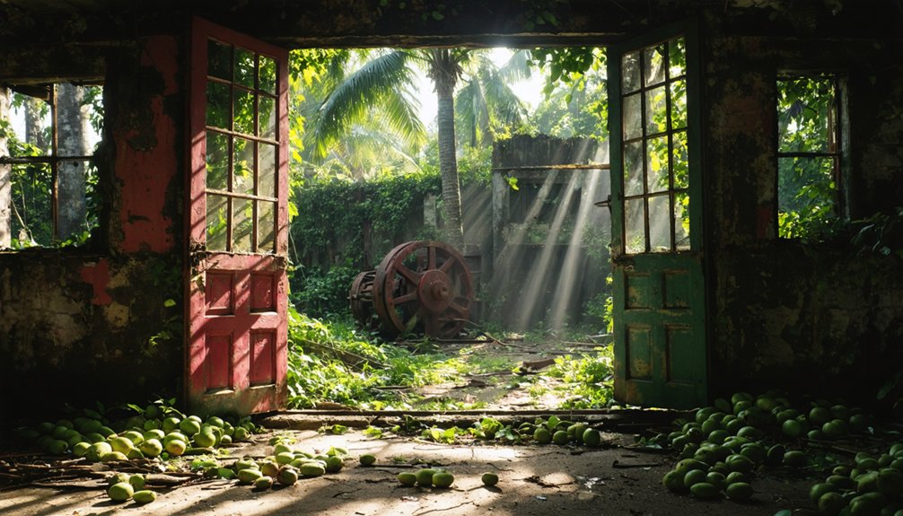
Kaupule: The Village Buried by Lava
You’ll find few traces of Kaupule today, where ancient Hawaiian families once cultivated taro patches and built their hale beneath swaying palms along the coast.
In 1801, Mauna Loa’s rivers of molten rock consumed everything—homes, temples, and centuries of village life—entombing this thriving community beneath layers of hardened pāhoehoe lava.
Now, when you stand on this blackened expanse, you’re walking atop a time capsule of pre-contact Hawaiian culture, forever preserved in volcanic stone.
Pre-Contact Village Life
Long before Captain Cook’s ships appeared on the horizon in 1778, Kaupulehu thrived as a bustling coastal village in the Kona district, its inhabitants moving through daily rhythms shaped entirely by the ahupua’a system. You’d have witnessed maka’āinana commoners tending irrigated kalo terraces inland while others practiced ancient fishing techniques along the shore, crafting bone hooks and cowry shell lures for octopus.
The kapu system structured everything—ali’i chiefs commanded through divine bloodlines, kahuna priests maintained heiau temples, and outcasts remained invisible. Traditional storytelling preserved mo’olelo like Ka’ahupahau’s protection of fishermen, while sweet potato and breadfruit sustained families.
This self-sufficient world extended from reef to mountain, each zone providing specific resources that kept the community thriving without outside contact.
The 1801 Lava Flow
As Hualalai volcano stirred to life in 1801, five separate vents split open along its northwest rift zone, releasing rivers of molten rock that would forever transform the Kona coastline.
You’ll find where the Huehue flow buried Ka’ili’ili Village and filled Pā’aiea fishpond—three miles of thriving community swallowed beneath pahoehoe and a’a lava formations.
The flow carved a 10.8-kilometer tube system as it rushed seaward, entering the ocean along a four-mile front and creating distinctive orange-hued rock where fire met water.
Today, you can explore this catastrophic event through submerged exploration, diving 130 feet down to witness pillow lava formations frozen in their violent birth.
Petroglyphs carved into the cooled flow tell of survivors reclaiming this transformed landscape, their resilience etched permanently into volcanic glass.
Buried Beneath Hardened Lava
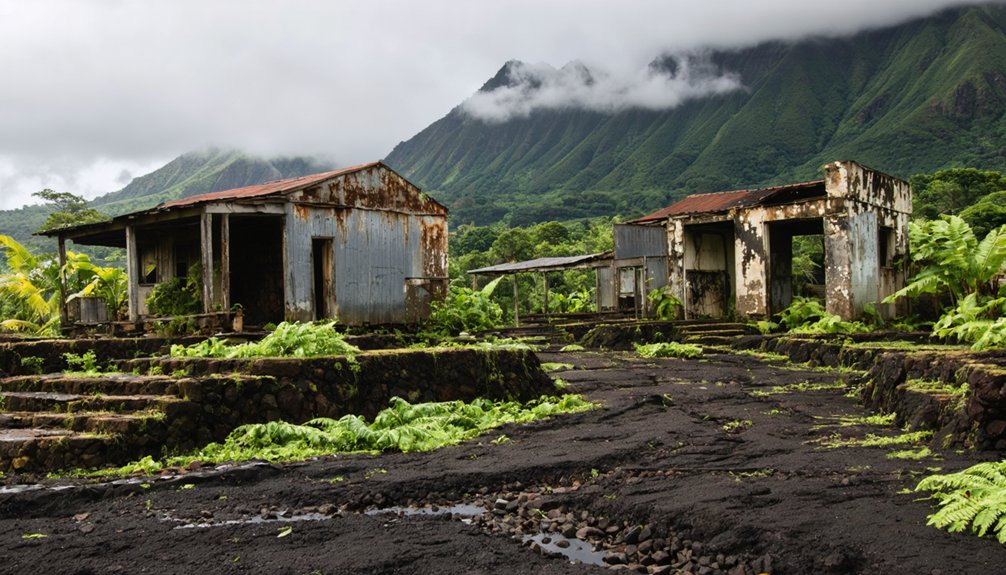
When Kīlauea’s east rift zone erupted on the night of May 13, 2018, molten rock spilled across sugar cane fields above Kapoho, beginning a relentless advance that would erase an entire community from Hawaii’s map.
You’ll find no trace of the hundreds of homes that once dotted Vacationland Hawaii and Kapoho Beach Lots—only hardened lava formations stretching toward the sea.
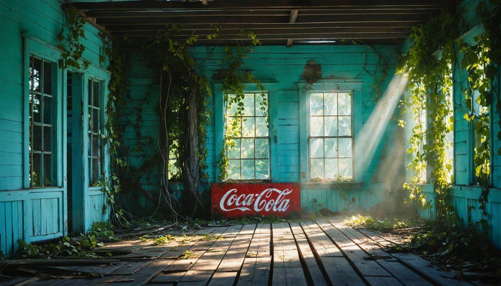
The remnants of abandoned towns in Hawaii stand as silent witnesses to a bygone era. Over time, nature has reclaimed these areas, turning former residential spots into fascinating landscapes filled with volcanic rock and vibrant vegetation. Exploring these sites offers a unique glimpse into the island’s complex history and the resilience of its environment.
The allure of abandoned places in Hawaii draws adventurers and history buffs alike, eager to uncover the stories hidden within the crumbling structures. Each site reveals a narrative shaped by the island’s ever-changing landscape and history, making them intriguing destinations for those seeking the extraordinary. Visiting these locations not only enriches our understanding of Hawaii’s past but also highlights the delicate balance between human habitation and nature’s reclaiming force.
Desperate efforts to divert the flow with earthen barricades and water spraying proved futile. By June 4th, the molten river reached Kapoho Bay on an 800-meter front, boiling away Green Lake days earlier.
The lava created a new coastal delta extending 1,100 meters into the ocean, permanently altering this landscape.
Today’s stark volcanic history serves as testament to nature’s unstoppable force over human settlement.
Planning Your Visit to Hawaii’s Historic Abandoned Sites
Before you venture into Hawaii’s forgotten places, understand that these sites demand more than casual curiosity—they require respect, preparation, and cultural sensitivity. Book Waipi’o Valley shuttles or Kalaupapa tours weeks ahead, as access remains strictly controlled.
Puʻuhonua o Hōnaunau operates 7 AM-5 PM daily with mandatory entry fees. Modern amenities vanish at remote locations like Polihale—pack water, sun protection, and emergency supplies.
Haunted legends surrounding night marchers aren’t mere folklore; locals take these warnings seriously near ancient battle sites. If you encounter spiritual processions, lie face down immediately.
Never enter unmarked heiau or disturb lava rock structures. Check weather alerts before exploring tsunami-prone valleys or unstable lava zones where Kaimū once stood.
Respect “kapu” signs—they’re protecting both you and sacred Hawaiian heritage that predates Western contact by centuries.
Frequently Asked Questions
What Is the Best Time of Year to Visit Hawaiian Ghost Towns?
Visit during shoulder seasons—April through May or September through October—when Hawaii’s forgotten settlements reveal their stories most intimately. You’ll find historical preservation efforts accessible, fewer crowds, and local legends whispered through sun-drenched ruins under perfect skies.
Exploring annual festivals in Kalaupapa offers a unique glimpse into the rich cultural heritage of the area. These gatherings celebrate the resilience and spirit of the community, drawing both locals and visitors to partake in traditional music, dance, and cuisine. As you immerse yourself in the festivities, you’ll gain a deeper appreciation for the island’s history and the enduring connections among its inhabitants.
Are Guided Tours Required to Access These Abandoned Hawaiian Settlements?
You won’t need guided tours for most Hawaiian ghost towns—they’re freely accessible. However, watch for private access restrictions at places like Coco Palms Resort and Kalaupapa. Tour restrictions rarely apply; you’ll explore independently amid jungle-reclaimed ruins.
Some of the most captivating ghost towns to explore in Hawaii offer a glimpse into the islands’ rich history. You can wander through the remnants of once-thriving communities, taking in the beauty of nature reclaiming these spaces. Each location tells a unique story, inviting adventurers to step back in time and discover the echoes of the past.
Among these sites, ghostly tales from Kalaupapa island linger in the air, where the history of its leprosy settlement intertwines with haunting legends. Visitors often report eerie sensations and encounters that seem to resonate with the spirits of those who once inhabited the island. As you traverse its landscapes, the stories of resilience and sorrow add an unsettling depth to the beauty around you.
Can I Take Photos at Sacred Hawaiian Sites and Burial Grounds?
While you’re enthusiastic to capture these moments, photography’s generally prohibited at Hawaiian sacred sites and burial grounds. Cultural sensitivity demands you seek photography permissions beforehand—though many locations restrict cameras entirely to honor ancestral spirits resting within these ancient spaces.
What Safety Precautions Should I Take When Exploring Abandoned Hawaiian Villages?
You’ll need sturdy footwear, a buddy system, and first-aid supplies while trekking unstable structures. Respect the haunting history by staying on trails, obtaining permission, and honoring cultural preservation through kānāwai laws protecting these sacred spaces.
How Much Time Should I Allocate for Visiting Multiple Ghost Towns?
Allocate full days per island—not hours. You’ll need proper exploration gear for rugged terrain and adherence to local guidelines. Big Island clusters demand 10-12 hours; Kalaupapa’s sacred grounds require half-day permits, respecting cultural boundaries while satisfying your wanderlust.
References
- https://nvtami.com/2023/04/26/big-island-hawaii-ghost-towns/
- https://www.youtube.com/watch?v=fgRQT3tH6Q4
- https://www.youtube.com/watch?v=3tGSM9Xl-4M
- https://activityauthority.com/ghost-stories-hawaii/
- https://www.geotab.com/ghost-towns/
- https://www.honolulumagazine.com/our-favorite-ghost-stories-about-haunted-places-on-oahu/
- https://www.mysteries-of-hawaii.com/blog
- https://freepages.rootsweb.com/~gtusa/history/usa/hi.htm
- https://environment-hawaii.org/?p=3600
- https://imagesofoldhawaii.com/waipio-hamakua-hawaiʻi/