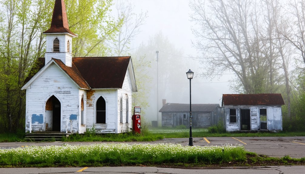
You’ll find Wisconsin’s most evocative ghost towns awakening with spring wildflowers at Fort Crawford in Prairie du Chien, where Zachary Taylor once commanded stone bastions, and Cooksville, the “town that time forgot,” preserved in 1860s architecture after railroads passed it by. Explore Dover’s prairie grasses hiding streets once walked by 700 settlers, or Ceresco’s utopian experiment site near Ripon. Spring’s mild temperatures make trekking to remote Ulao and Gratiot’s Grove ideal, where limestone buildings and lakeside ruins hold darker presidential secrets and lead-mining legacies waiting beyond these weathered thresholds.
Key Takeaways
- Cooksville is Wisconsin’s “town that time forgot,” featuring preserved 19th-century structures including churches, a general store, and stone bridge.
- Dover site near Mazomanie offers prairie grounds marking streets where 700 settlers abandoned their town following 1853 railroad bypass.
- Fort Crawford in Prairie du Chien includes museum exhibits and archaeological foundations from the 1816 frontier military post.
- Fort Howard historical markers in Green Bay commemorate Wisconsin’s first American fortification, built in 1816 and dismantled by 1863.
- Ceresco near Ripon preserves remnants of an 1844 utopian community experiment that disbanded by 1850 despite economic success.
Fort Howard: A War of 1812 Military Outpost Along the Fox River
The Fox River curves through Green Bay like a liquid highway to the past, and along its west bank once stood Fort Howard—Wisconsin’s first American fortification and a sentinel guarding the essential waterway connecting the Great Lakes to the Mississippi River. Built in 1816 after the War of 1812, this outpost relied on Native alliances for survival.
Menominee Chief Tomah negotiated peace among pro-British residents, while guide Augustin Grignon led troops through uncharted territory. The fort’s military architecture evolved from rough-hewn logs to proper wood-frame structures by the 1830s, its three-acre garrison featuring stockade walls and a guardhouse entrance.
Future president Zachary Taylor commanded here in 1817. The garrison served multiple roles beyond defense, with fort personnel administering government functions and negotiating treaties with Native communities. The fort was abandoned in 1820, then rebuilt in the 1830s before being abandoned again in 1840. You’ll find only historical markers now—the fort was dismantled by 1863, leaving whispers of frontier independence along these riverbanks.
Fort Crawford: Zachary Taylor’s Command Post in Prairie Du Chien
You’ll find traces of Zachary Taylor’s frontier command at Prairie du Chien, where the future president led Fort Crawford through its most turbulent years before winning the White House.
The original 1816 fortification couldn’t withstand the Mississippi’s floods, so soldiers rebuilt it on higher ground between 1829 and 1835—creating two distinct archaeological footprints across the landscape.
Today, where officers once drilled troops and negotiated with tribal leaders, locals swim in a municipal pool constructed within the second fort’s foundations, turning military parade grounds into summer recreation.
The reconstructed hospital building from the 1930s now houses the Fort Crawford Museum, where visitors can explore Dr. Beaumont’s medical experiments and the fort’s role in frontier medicine. The site hosted the 1825 Treaty of Prairie du Chien, one of the nation’s largest Native American councils that shaped territorial boundaries across the region.
Taylor’s Presidential Military Legacy
Perched fifty feet above the Mississippi River’s churning waters, Fort Crawford became Zachary Taylor‘s proving ground long before he’d claim the presidency.
From 1829 to 1837, you’ll find where America’s 12th president honed military strategies that’d define his career—commanding troops through the Black Hawk War, negotiating tribal disputes, and securing the wild frontier’s essential river junction.
His presidential influence took root here, where he transformed a flood-ravaged outpost into a stone fortress by 1835.
Jefferson Davis served under him as lieutenant, witnessing firsthand the leadership that’d shape a nation.
Taylor’s command enforced freedom of commerce, protected settlers pushing westward, and maintained peace through strength—a philosophy he’d carry straight to the White House, forged in Wisconsin’s untamed borderlands.
The fort’s position commanded routes south to the Gulf of Mexico and pathways stretching west toward the Rocky Mountains, making it indispensable for continental expansion.
The fort operated as a military garrison until approximately 1856, maintaining American control over the upper Mississippi River’s strategic corridor.
Reconstruction Near Prairie Du Chien
When floodwaters swept through Fort Crawford in 1826, they didn’t just claim buildings—they forced a complete reimagining of frontier fortifications.
You’ll discover how soldiers evacuated to Fort Snelling, abandoning their waterlogged outpost until 1829, when construction began on higher ground. The rebuilt fort emerged in 1835 as something far more strategic—a command center where Native American treaties shaped the upper Mississippi’s future.
Here’s what makes this reconstruction remarkable: it transformed Prairie du Chien from a vulnerable wooden square into a stone bastion commanding both the Mississippi and Wisconsin Rivers.
Walk these grounds where Zachary Taylor once stationed troops, and you’re standing where frontier security met diplomatic necessity. The original 1816 structure featured tall blockhouses at the Northwest and Southeast corners, designed to provide commanding defensive positions across the vulnerable approaches.
The upgraded fortification didn’t just prevent flooding—it anchored America’s push westward, turning natural disaster into military advantage. During the Civil War, the 6th Regiment Wisconsin Volunteer Infantry formed here before being sent to Virginia, as local volunteers transformed the fort into a training ground for Union troops.
Municipal Pool Repurposing History
The stone foundations that once anchored Zachary Taylor’s command post now lie beneath an unexpected successor—a municipal swimming pool where Prairie du Chien residents have splashed through summer heat since the mid-20th century. This urban renewal transformed military grounds into recreational space, where children’s laughter replaced drill sergeants’ commands.
You’ll find it remarkable how bricks from the 1835 fort became homes and storefronts throughout town after John Lawler purchased the abandoned fortification in 1868.
The pool represents more than aquatic entertainment—it’s become a community gathering place where locals share stories beneath summer skies, unknowingly treading water above blockhouse remnants and parade grounds where soldiers once enforced frontier peace. The fort had already been decommissioned in 1856 after outliving its usefulness as a frontier post, well before its stone buildings were repurposed for the growing town.
History literally flows beneath modern leisure, connecting generations through repurposed earth.
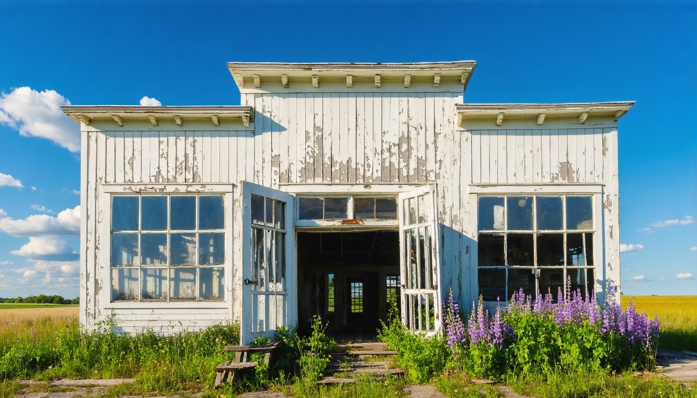
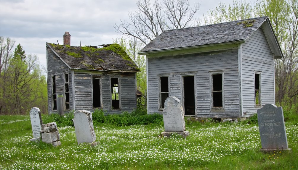
Dover and Cooksville: Towns Left Behind by the Railroad Era
You’ll find Dover and Cooksville standing as stark monuments to a single economic force that reshaped Wisconsin’s landscape: the railroad’s route.
When the Milwaukee Road chose Mazomanie over Dover in the 1850s, residents packed their belongings and followed the steam whistle, leaving behind empty storefronts and silent streets that reached zero population by 1870.
Cooksville met a similar fate when tracks bypassed it for Evansville, though scattered foundations and the old mill still cling to Rock County soil, whispering stories of prosperity cut short by iron rails laid miles away.
Dover’s history traces back to immigrants from Liverpool, who arrived as part of the British Temperance Emigration Society seeking new opportunities in Wisconsin’s frontier.
Railroad Bypass Economics Impact
Mid-century ambitions collapsed into weathered stone when the Panic of 1857 tore through southern Wisconsin’s railroad dreams.
You’ll find evidence of these broken promises etched across Cooksville’s landscape—a stone culvert bridge constructed for tracks that never arrived, vermilion brick houses anchoring a community that couldn’t follow fortune elsewhere.
Railroad economics reshaped community development through three stark transformations:
- Tracks rerouted north toward Minnesota Junction, bypassing Cooksville’s 200 souls entirely.
- Stoughton and Edgerton captured the commerce that could’ve been theirs.
- Norwegian settlers arrived in the 1870s to farm, not to build empires.
What economic collapse destroyed, it also preserved.
Without railroad wealth flooding in, Cooksville never modernized—freezing mid-19th century architecture in place, earning its designation as Wisconsin’s “town that time forgot.”
Dover’s Decline and Relocation
When Milwaukee Road surveyors chose Mazomanie over Dover in 1853, they didn’t just reroute rails—they erased an entire community from Wisconsin’s future.
You’ll find nothing but prairie grass where 700 settlers once built their dreams. Families packed wagons and followed the steel westward, abandoning Captain John J. Trowbridge‘s carefully platted streets within months.
Cooksville’s Surviving Historic Structures
- The 1847 general store where Masonic rituals still echo from its 1864 upper addition.
- Twin churches—Congregational (1879) and Lutheran (1897)—flanking the public square.
- A reconstructed blacksmith shop breathing life into vanished trades.
Preservation efforts transformed these 35 buildings into a National Register district by 1973.
The railroad’s rejection became Cooksville’s salvation, freezing time while progress thundered past, leaving you this authentic portal to Wisconsin’s pioneer spirit.
Ceresco: A Utopian Experiment in Present-Day Ripon
On a spring day in 1844, Warren Chase stood among the rolling prairies of Fond du Lac County with nineteen men, a boy, and a vision that defied the American individualist spirit. They’d come to build Ceresco—named for the goddess of harvest—where utopian communities promised escape from industrial capitalism’s grinding wheels.
You’ll find their legacy in present-day Ripon, where a historical marker and reconstructed longhouse stand testament to this audacious experiment.
At its peak, 200 souls embraced communal living across 1,600 acres, sharing wheat profits and collective dining halls. But rigid hierarchy strangled freedom. By 1850, members had scattered, choosing autonomy over enforced unity.
The commune failed socially yet succeeded economically—a paradox you’ll contemplate while walking Ceresco Park’s grounds, where individualism ultimately reclaimed collective dreams.
Voree and Zarahemla: Mormon Settlements in Wisconsin’s Countryside
While Warren Chase’s utopian dreamers abandoned hierarchy for freedom in Ceresco, another religious experiment took root sixty miles southeast along the White River’s banks. In 1844, James J. Strang founded Voree—”garden of peace”—attracting followers who’d break from Nauvoo’s mainstream Mormon leadership.
You’ll discover ancient artifacts here: mysterious plates excavated beneath a tree’s roots, claimed as Rajah Manchore’s prophetic record. The spiritual symbolism ran deep in Strang’s vision of a grand temple.
What remains today:
- A cornerstone laid in 1847 where limestone blocks were meant to rise into the world’s greatest temple
- The meetinghouse on Mormon Road, headquarters of the continuing Strangite church
- Memorial grounds maintained as sacred gathering space
The temple never rose beyond its foundation—Strang’s death in 1856 ended his autonomous religious kingdom.
Belmont: Wisconsin Territory’s Short-Lived Capital
In 1836, ambition collided with frontier reality when a village perched on three rolling hills became the seat of an empire stretching from Lake Michigan to the Missouri River. Belmont’s reign lasted merely forty-six days.
Governor Henry Dodge arrived that September, and by December, the territorial legislature had chosen Madison—conveniently located on lobbyist James Doty’s land. The exodus was swift and merciless.
Today, two weathered buildings survive where 22,000 souls once looked for governance. The Council House, rescued from its fate as a livestock barn, stands alongside the Supreme Court House.
While urban legends and ghost stories swirl around flashier abandoned towns, Belmont’s phantoms are subtler: the whisper of lost opportunity, the echo of Wisconsin’s briefest capital dream dissolving into prairie wind.
Gratiot’s Grove: A Lead Mining Settlement in Lafayette County
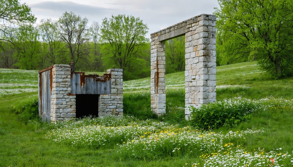
Lead fever gripped southwestern Wisconsin in the 1820s, and the Gratiot brothers knew opportunity when they saw it. Henry and Jean Pierre established Wisconsin’s first successful lead operation at Gratiot’s Grove in 1826, their mining technology transforming raw wilderness into a bustling settlement of sixty workers and six furnaces.
What remains today:
- The magnificent two-story limestone Gratiot House, its Georgian façade standing solitary against rolling hills
- Fort Gratiot’s earthworks, where families sheltered during the Black Hawk War
- Scattered foundations where furnaces once blazed through frontier nights
Tribal relations proved essential—Catherine Myott helped secure mining rights from the Winnebago, and Henry’s French heritage earned their trust.
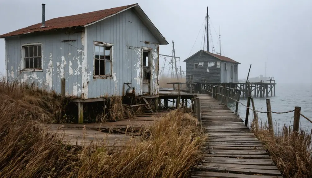
Ulao: a Small Town With a Dark Presidential Connection
From lead-hungry miners in southwestern hills, we shift north to Lake Michigan’s windswept shores, where a different fortune drew settlers—and where a future assassin spent his boyhood.
Port Ulao thrived in 1847 as a refueling station for wood-burning steamships. Young Charles Guiteau called this bustling port home from ages nine to fourteen, living in a cream city brick house that still stands among five surviving structures.
A future president’s assassin spent his formative years in this lakeside refueling port, now reduced to five weathered buildings.
When his mother died in 1855, his father abandoned Ulao—and years later, Guiteau would shoot President Garfield.
Coal-powered ships killed the town’s economy.
Today, you’ll find ghost town tourism centered around the Ghost Town Tavern, where fish fries and steaks are served beneath 200-foot bluffs.
Presidential history lurks in these ravines, just twenty minutes from Milwaukee’s edge.
Imalone: From Gas Station Settlement to Bible Camp Destination
While presidential darkness haunts Ulao’s ravines, another Wisconsin ghost town earned its legacy through sheer absurdity. You’ll find Imalone in Rusk County’s Thornapple area, where local legends spin tales about a gas station attendant who birthed a town’s identity with two words: “I’m alone.”
When a salesman asked for the settlement’s name, Bill Granger—left minding Snowball Anderson’s station—simply stated his solitary condition. Ghost stories now whisper through its remains.
Picture what’s left:
- Crumbling bible camp cabins where Rev. Olaf Newhagen once hosted summer faithful from three states
- A deteriorating concrete stave silo standing sentinel over abandoned dreams
- The skeletal Wagon Wheel bar marking where loggers once gathered
Frequently Asked Questions
What Are the Best Months to Visit Wisconsin Ghost Towns in Spring?
April through May offer you the best ghost town exploration, when spring wildflowers bloom among crumbling historic architecture. You’ll discover Wisconsin’s abandoned sites awakening from winter, with mild temperatures perfect for wandering forgotten streets and photographing haunting beauty.
Are Wisconsin Ghost Towns Accessible for Families With Young Children?
Yes, Wisconsin ghost towns welcome families with young children. You’ll discover wildlife sightings among abandoned structures and capture incredible photos. These open-air adventures offer freedom to explore at your own pace, creating unforgettable memories through authentic historical storytelling and natural beauty.
exploring wisconsin’s historic ghost towns allows visitors to step back in time and appreciate the remnants of bygone eras. Each site tells its own unique story, inviting you to connect with the past while surrounded by stunning landscapes. The experience is not only educational but also a thrilling adventure for all ages.
Do Any Wisconsin Ghost Towns Offer Guided Tours or Visitor Centers?
You’ll discover guided ghost tours throughout Wisconsin’s haunted historical landmarks, from Door County’s Trolley of the Doomed to Bayfield’s waterfront walks. Preservation efforts maintain visitor centers in Green Bay and Nekoosa, where spirits and stories await your spring exploration.
What Safety Precautions Should Visitors Take When Exploring Ghost Towns?
You’ll need proper safety gear like sturdy boots and flashlights before venturing in. Practice constant hazard awareness—watch for unstable floors, crumbling walls, and hidden dangers. Respect boundaries, obtain permission, and always tell someone your exploration plans.
Are There Admission Fees to Visit These Historic Ghost Town Sites?
Most authentic ghost towns don’t charge entrance fees—you’ll find crumbling foundations and weathered ruins accessible to wanderers like you. Unlike commercial haunted attractions with membership costs, these forgotten places welcome explorers seeking unscripted adventures freely.
References
- https://en.wikipedia.org/wiki/List_of_ghost_towns_in_Wisconsin
- https://www.ghosttowns.com/states/wi/wi.html
- https://www.onlyinyourstate.com/experiences/wisconsin/ghost-towns-wi
- https://pbswisconsin.org/news-item/southern-wisconsins-ghost-towns-leave-behind-vital-stories/
- https://en.wiktionary.org/wiki/Category:en:Ghost_towns_in_Wisconsin
- http://shunpikingtoheaven.blogspot.com/2016/05/a-wisconsin-ghost-town.html
- https://www.wisconsinhistory.org/Records/Image/IM116137
- https://www.youtube.com/watch?v=hyvSTpgwddA
- https://kids.kiddle.co/List_of_ghost_towns_in_Wisconsin
- https://www.wisconsinhistory.org/Records/Article/CS392