You’ll find Vermont’s most accessible ghost towns come alive in summer when trails dry out and forest shade cools your exploration. Visit Greenbank’s Hollow in Danville for preserved mill foundations and a restored covered bridge, or trek to mysterious Glastenbury where logging ruins and paranormal legends intertwine. Somerset’s scattered cellars near the mountain reservoir and Ricker Basin’s stone walls offer quieter discoveries, while West Castleton’s slate quarry remains rest within Bomoseen State Park. Each site reveals distinct chapters of Vermont’s vanished communities, their stories waiting among the wildflowers and weathered foundations.
Key Takeaways
- Glastenbury features ruins of kilns, abandoned machinery, and a historic railroad, plus paranormal legends and mysterious disappearances from 1945-1950.
- Greenbank’s Hollow in Danville offers preserved foundations, a restored covered bridge, and visible cellar holes from an 1885 mill town fire.
- Somerset contains scattered stone foundations and cellars amid forest trails near a scenic mountain reservoir, disincorporated in 1937.
- Ricker Basin in Green Mountain National Forest has stone walls, cemetery plots, and the deteriorating Almeran Goodell farmhouse from 1816.
- West Castleton in Bomoseen State Park displays slate quarry ruins, cellar holes, and mill foundations from its immigrant-worked industrial past.
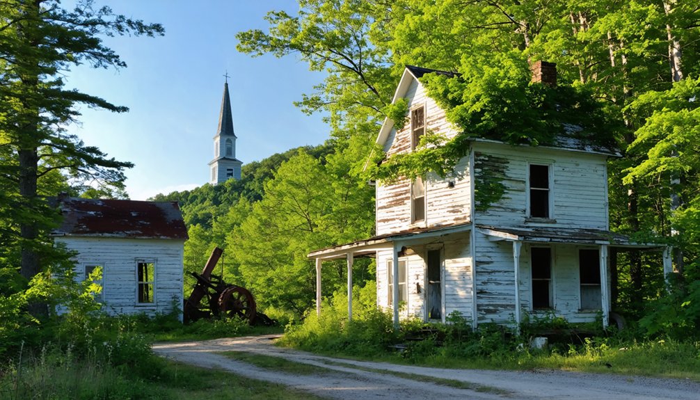
Greenbank’s Hollow: a Preserved Mill Town With Covered Bridge Charm
Tucked into the hills of southern Danville, Greenbank’s Hollow tells the story of Vermont’s industrial rise and sudden fall through its scattered foundations and restored covered bridge.
You’ll walk among abandoned structures where 45 workers once produced 700 yards of cloth daily, powering Civil War uniforms for Union soldiers.
The 1885 fire that consumed this thriving mill town blazed so intensely that Saint Johnsbury residents spotted it five miles away.
Today, the Danville Historical Society’s preserved site lets you explore cellar holes and granite foundations marking the boarding house, post office, and Benjamin Greenbank’s own residence.
The mill’s operations supported nearly 15,000 sheep farmers across the region, creating an economic network that extended far beyond the hollow’s borders.
The surrounding landscape sits within Vermont’s Green Mountains, ancient peaks once comparable to the Himalayas that have been smoothed by hundreds of millions of years of erosion into today’s rolling hills and creek beds.
While haunted legends don’t dominate this ghost town’s narrative, the wilderness-reclaimed remnants speak powerfully enough—testament to how quickly prosperity vanishes when industry departs.
Glastenbury: Vermont’s Most Mysterious Abandoned Settlement
Glastenbury’s story unfolds from its 1880s logging boom—when 241 residents worked the railroad and charcoal kilns—through its dark transformation into Vermont’s most haunted ghost town.
You’ll find this remote Bennington County wilderness holds both tangible ruins at Fayville and unsettling legends, including five unexplained disappearances between 1945 and 1950 that earned the area its “Bennington Triangle” nickname.
Summer hiking along the Long Trail offers access to these abandoned settlements, though the rugged terrain and persistent mysteries demand both preparation and respect. The town’s economy collapsed after a major flood in 1898 combined with erosion from extensive logging operations. The 22.3-mile trek across two days starts from Route 9 east of Woodford, leading adventurers through vast wilderness where Glastenbury Mountain rises to 3,748 feet.
Peak Lumber Town Era
During the 1870s and 1880s, Vermont’s lumber boom transformed this remote mountain settlement into a thriving industrial hub that would define the town’s brief golden age.
You’ll find remnants of twelve brick charcoal kilns that once lined these cleared hillsides, alongside abandoned machinery that fueled Glastenbury’s population surge to 241 residents in 1880.
The Bennington-Glastenbury Railroad—America’s steepest at 250 feet per mile—hauled timber and charcoal down the mountain until 1889.
South Glastenbury became the operation’s nerve center, where you can still trace foundations of the massive loggers’ boardinghouse and company store. The settlement centered at The Forks, where Bolles Brook splits and the community built its one-room schoolhouse alongside homes and a meetinghouse.
In the northwest corner, the village of Faville flourished with its own homes, schools, and sawmills during this prosperous period.
Today, these ruins inspire haunted legends, though the real story lies in how quickly industrial prosperity vanished once mature trees disappeared, leaving behind Vermont’s most enigmatic ghost town.
lifetime experiences in Vermont’s ghost towns often reveal the echoes of a once-thriving community. Visitors can explore the crumbling structures and witness the remnants of a bygone era. Each step through these abandoned places tells a story of resilience and transformation over the decades.
Disappearances and Paranormal Tales
Beyond the crumbling kilns and abandoned railroad beds, Glastenbury’s reputation transforms from forgotten lumber town into Vermont’s most haunted landscape. You’ll find yourself walking trails where five people vanished between 1945 and 1950, including 18-year-old Paula Welden who disappeared on the Long Trail. This incident prompted Vermont to establish its State Police.
Indigenous legends warned of dangers here long before colonists arrived—the Abanaki refused hunting on Glastenbury Mountain, speaking of a “human eating rock” and converging winds creating treacherous conditions.
This historical folklore continues drawing paranormal enthusiasts who report Bigfoot sightings, unexplained lights, and energy vortexes. Local superstition warns visitors not to wear red in the area, a cautionary tale directly tied to Paula Welden’s disappearance while wearing a red parka.
Summer hiking means confronting these mysteries yourself. The town’s brief charcoal industry following the Civil War left behind the very kilns and structures now reclaimed by forest. Whether you’re skeptical or believer, Glastenbury’s documented disappearances and centuries-old warnings create an atmosphere unlike any ghost town you’ll explore.
Summer Trail Access Tips
The mysteries that draw you to Glastenbury demand careful planning before you set foot on its overgrown trails. You’ll need detailed maps or GPS since the remote wilderness spans multiple unmarked boundaries across several towns.
Pack essentials: sturdy boots for rocky terrain, ample water, and insect repellent for summer bugs. Cell service fails here, so inform others of your route before departing.
Trail safety requires checking forecasts—sudden weather shifts strike Glastenbury Mountain’s elevation without warning. Avoid trails after rain; erosion from 1870s logging creates unstable ground and hidden hazards. Early colonists heard indigenous stories of human-eating rocks and strange phenomena in this region.
Dense regrowth limits visibility, and wildlife encounters increase in this uninhabited territory. Travel with companions rather than solo, and start early mornings to navigate the faint paths leading to South Glastenbury’s ruins via old logging roads from Bennington. The area’s reputation stems partly from multiple unexplained disappearances between 1945 and 1950, earning it the nickname “Bennington Triangle.”
Somerset: Hidden Foundations Near a Tranquil Mountain Reservoir
Chartered in 1761 across some of Vermont’s most unforgiving terrain, Somerset never stood much chance at prosperity. You’ll find its hidden foundations scattered through the woods near Somerset Reservoir, where logging once sustained 321 residents before timber exhaustion triggered complete abandonment.
The Vermont General Assembly disincorporated the town in 1937 after its population vanished.
Today, you’re free to explore abandoned structures along forested trails—stone cellars slowly reclaiming themselves into the mountainside. The tranquil reservoir provides a serene backdrop for discovery, though local legends warn of the Bennington Triangle’s mysterious disappearances between 1945-1950.
You’ll encounter old wells, forgotten footpaths, and cairns marking former settlement boundaries. Summer offers ideal conditions for wandering this ghost town’s remains, where history dissolves back into wilderness.
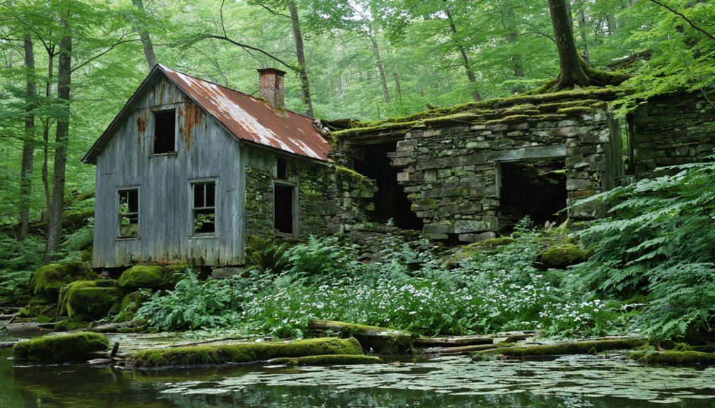
Ricker Basin: Stone Cellars and Forgotten Footpaths
Nestled within Green Mountain National Forest near Little River State Park, Ricker Basin tells the story of 50 families who carved out an existence on Ricker Mountain’s southeastern slopes starting in 1816. You’ll discover cellar holes marking former farms and sawmills across 4,000 acres where settlers battled rocky soil and steep terrain.
The mid-1800s railroad brought temporary prosperity, but poverty persisted until the devastating 1927 flood sealed the community’s fate. When Waterbury Dam rose in 1938, it submerged what remained.
Today’s summer hikes reveal historical preservation through stone walls, cemetery plots, and forgotten roads reclaimed by forest restoration. You’ll even find the dilapidated Almeran Goodell farmhouse off-trail.
These unspoiled surroundings offer freedom to explore Vermont’s resilient past on your own terms.
Smith Family Farms: Rural Homesteads Marked by Memorial
You’ll find the scattered stone foundations of the Smith family’s former homesteads throughout Tunbridge and Sharon, remnants of their frequent moves between 1791 and 1816.
The most significant site sits on 68 acres in Sharon, where a modern monument marks the birthplace of Joseph Smith Jr., born December 23, 1805, during one of the family’s rental periods.
Summer visits reveal how these struggling Vermont farmers—clearing land, enduring crop failures, and ultimately losing their 300-400 acre compound to debt—left behind only cellar holes and memorials where thriving homesteads once stood.
Scattered Stone Foundation Remnants
Scattered stone-lined cellar holes and weathered foundation remnants mark where the Smith and Mack families carved out their homesteads from Vermont’s forested hills in the early 1800s. You’ll discover these silent testimonies to pioneer determination as you wander paths once connecting abandoned cabins and farm outbuildings.
The log structures vanished long ago, reclaimed by forest, but their stone footprints persist. Historic markers stand alongside these foundations, noting where Joseph Smith entered the world in 1805 before his family’s 1816 departure for New York.
Summer’s growth frames these remnants beautifully, allowing you to trace the farmstead’s layout and imagine the self-sufficient existence these families briefly sustained.
It’s tangible history you can touch—unvarnished evidence of Vermont’s agricultural past and the hardships that scattered these rural communities.
Modern Church Commemorates Settlers
While stone foundations tell part of the story, the Smith family’s memorial sites in Sharon and beyond reveal how religious institutions preserve Vermont’s pioneer settlements. You’ll find the LDS Church has maintained Joseph Smith Jr.’s birthplace monument since the early 1900s, protecting 68 acres of original farmland where the family rented from 1805 to 1808.
The Palmyra, New York site showcases authentic settler architecture—a reconstructed log home verified through 1982 archaeological digs, complete with root cellar. Historic preservation efforts in the 1990s restored the frame house where sons learned coopering and stone wall construction.
These memorial farms demonstrate how 14-by-10-foot huts evolved into 300-acre compounds, offering you tangible connections to Vermont’s self-sufficient homesteading era. Free tours run throughout summer months.
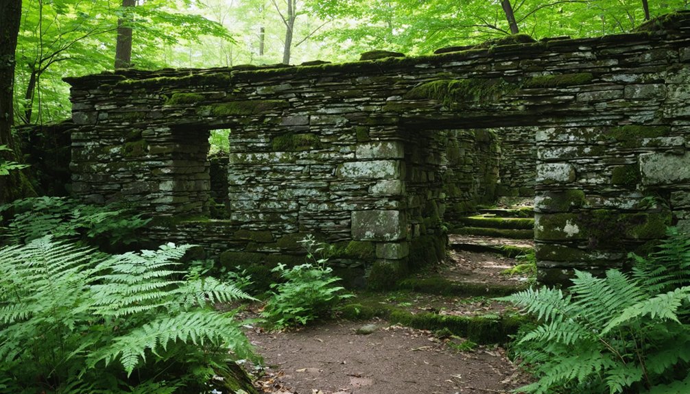
West Castleton: A Faded Community Within Bomoseen State Park
Deep within Bomoseen State Park’s forested trails lie the weathered remains of West Castleton, a once-thriving slate company town that vanished almost overnight during the Great Depression.
You’ll discover industrial relics scattered throughout the Slate History Trail—crumbling cellar holes, abandoned quarry gables, and mill foundations now overtaken by maple saplings and goldenrod.
These ruins tell immigrant stories of Irish, Italian, and Slavic workers who endured ten-hour days extracting slate from Cedar Mountain for under $2 daily.
The 1929 crash ended it all when exhausted deposits and vanished demand shuttered operations completely. By the 1930s, everyone had left.
Today you’re free to explore this silent testament to Vermont’s industrial past.
Local legend claims phantom rowboats still drift toward West Castleton Bay on full-moon nights.
Planning Your Summer Ghost Town Adventure in Vermont
Before you venture into Vermont’s abandoned settlements, you’ll need to prepare for terrain that ranges from easy forest walks to challenging backcountry scrambles.
Spring and fall offer ideal conditions, though summer post-Labor Day brings stunning wildflower blooms along trails to sites like Madame Sherri’s ruins. Pack essentials: sturdy boots, navigation tools, and enough water for extended explorations.
Inform someone of your plans, especially when heading into Glastenbury’s remote sections where daylight becomes essential. Mountain views reward your effort at elevated sites like Hhogback, but watch for unstable structures and unmarked mine shafts. Verify public access beforehand—some ghost towns sit on private property requiring permission.
Choose daylight hours for maximum safety, and never explore abandoned buildings alone in Vermont’s backcountry.
Frequently Asked Questions
Are Pets Allowed When Exploring Vermont’s Ghost Town Sites in Summer?
Ghost towns typically lack formal pet policies since they’re abandoned sites. You’ll need to research individual locations for access rules. Focus on pet safety during summer exploration, and review vacation pet policies at your chosen lodging beforehand.
What Essential Gear Should I Bring for Ghost Town Hiking Trips?
Don’t venture unprepared into Vermont’s forgotten settlements. Essential gear includes topographic maps, sturdy boots, navigation tools, and layered clothing. These hiking essentials guarantee you’ll safely explore Glastenbury’s ruins while handling summer’s unpredictable mountain weather and unmarked trails independently.
Do I Need Permits to Visit Abandoned Settlements in Vermont?
You don’t need permits for most Vermont ghost towns on public land, but you’ll want to verify boundaries between federal forests and private property. Historical preservation sites may have specific access rules worth checking beforehand.
Exploring abandoned villages in Vermont can lead to fascinating discoveries about the state’s past. Many of these sites feature remnants of old architecture and offer a glimpse into the lives of those who once inhabited the area. As you wander through the overgrown paths, be sure to take note of the rich history that surrounds you.
Winter explorations in Vermont ghost towns reveal even more about the region’s intriguing past, with snow-covered landscapes adding a mystical charm to the decaying structures. Each town holds stories waiting to be uncovered, often accompanied by the haunting beauty of nature reclaiming its space. As you delve deeper into these frozen remnants, the silence of winter amplifies the echoes of history that linger in the air.
Are Ghost Town Sites Wheelchair Accessible for Visitors With Mobility Limitations?
wheelchair accessibility at Vermont’s ghost towns is severely limited. Mobility challenges from steep trails, slate rubble, and rugged terrain make most sites inaccessible except possibly West Castleton’s museum area with motorized wheelchairs.
Can I Camp Overnight Near Any of These Ghost Town Locations?
You can camp overnight at Little River and Bomoseen State Parks near ghost town trails. Both offer designated campsites with summer reservations, providing excellent photography opportunities at dawn and access to historical ghost stories around evening campfires.
References
- https://kids.kiddle.co/List_of_ghost_towns_in_Vermont
- https://www.youtube.com/watch?v=2fvPo9iQC-w
- https://greenmountainpeaks.com/2025/10/16/top-haunted-locations-in-vermont-for-brave-souls/
- http://www.onlyinyourstate.com/experiences/vermont/ghost-town-vt
- https://www.geotab.com/ghost-towns/
- https://myfamilytravels.com/supposedly-boring-vermont-towns-hiding-some-truly-strange-landmarks
- https://obscurevermont.com/tag/ruins/
- https://www.youtube.com/watch?v=YrQNbrIrNT8
- https://wend.ca/?p=83940
- https://www.atlasobscura.com/places/the-forgotten-village-at-greenbanks-hollow-danville-vermont


