You’ll find Utah’s ghost towns scattered across desert valleys and mountain slopes, where weathered adobe walls and rusting mining equipment tell stories of boom-and-bust dreams. Visit Grafton’s photogenic pioneer cabins along the Virgin River, explore Silver Reef’s sandstone silver mines, or walk among Frisco’s 23 saloon sites and beehive kilns. Thistle lies buried beneath a 1983 landslide, while Iosepa’s Hawaiian cemetery hosts Memorial Day celebrations with leis and hula. Each abandoned settlement reveals distinct chapters of frontier ambition, from railroad stops to gold rushes, waiting beyond the sagebrush.
Key Takeaways
- Grafton Ghost Town features weathered adobe walls from 1859 Mormon pioneers, preserved by the National Park Service since 1933.
- Silver Reef produced over seven million ounces of silver and retains Wells Fargo museum and a historic Catholic Church.
- Frisco was a mining boomtown with 6,000 residents, featuring beehive kilns, cemetery, and remnants from the Horn Silver Mine.
- Thistle was buried by a 1983 landslide, with interpretive signs explaining the disaster and limited visible structures through brush.
- Iosepa preserves Hawaiian Mormon heritage from 1889-1917, with an active cemetery and annual Memorial Day cultural celebrations.
Grafton Ghost Town
When December winds swept across southern Utah in 1859, a group of Mormon pioneers led by Nathan Tenney drove their wagons into virgin territory along the Virgin River, establishing what they initially called Wheeler.
You’ll find this settlement’s Grafton history etched into every weathered adobe wall and forgotten doorway.
The 1862 flood swept away their first attempt at taming this land, forcing survivors to rebuild upstream. They renamed it Grafton, but nature wasn’t finished testing their resolve.
These pioneer stories speak of Indian conflicts that emptied the town in 1866, then gradual abandonment as families sought easier ground. The Hurricane Canal completion in 1906 opened better farmland downstream, drawing families away and beginning Grafton’s transformation into a ghost town.
The last residents left in 1945, though the National Park Service had already purchased the land in 1933 to preserve this remnant of pioneer settlement life.
Silver Reef Ghost Town
While Grafton’s farmers battled floods and isolation in Utah’s Dixie, prospectors seventeen miles northwest were chasing a geological impossibility that would rewrite mining history. You’ll discover Silver Reef, where silver defied conventional wisdom by appearing in sandstone—a phenomenon “experts” claimed couldn’t exist.
Silver in sandstone—a geological impossibility that stumped experts and sparked a mining revolution in Utah’s desert.
After John Kemple’s 1866 discovery, the 1875 Pioche Silver Stampede transformed “Rockpile” into a roaring camp of 2,000 souls chasing fortune at 4,000 feet.
Walk past the Wells Fargo building—now a museum preserving this mining history—and imagine six mills processing over a million dollars annually. Chinese laborers built their own autonomous community here, complete with a mayor.
Ghost town preservation efforts showcase hand-blown bottles, carpentry tools, and the remnants of ambition. The Catholic Church stood as the only church in town, uniquely sharing its space with Presbyterian worshippers for services. Salt Lake City’s Walker brothers provided crucial financing to prospector William T. Barbee, who staked 21 claims and founded Bonanza City. Before flooding and price crashes silenced the drills in 1891, these “impossible” mines yielded seven million ounces of silver.
Old Iron Town
You’ll find Old Iron Town’s haunting remains 23 miles east of Cedar City, where a towering stone beehive kiln still dominates the landscape like a sentinel from Utah’s industrial past.
The charcoal-blackened walls and crumbling foundry chimney tell the story of Mormon pioneers who produced up to seven tons of pig iron daily in the 1870s. Their ambitious dreams of self-sufficiency are now reduced to weathered stone and rusted machinery. By 1876, the arrival of cheaper eastern iron via railroad to Salt Lake made local production economically unviable, forcing the operation to shut down.
Unlike most ghost towns, modern homes dot the surrounding area, creating an uncanny contrast between preserved 19th-century ruins and contemporary life. The site earned recognition on the National Register of Historic Places in 1971 and is now managed by the Sons of the Utah Pioneers.
Historic Mining Site Remains
Deep in the Dixie National Forest, twenty-four miles southwest of Cedar City, the skeletal remains of Old Iron Town rise from the high desert like monuments to Utah’s ambitious industrial past. You’ll walk among towering blast furnace chimneys and crumbling foundry walls where 97 pioneers once forged 800 pounds of iron every eight hours.
The industrial archaeology tells a story of self-reliance—Brigham Young’s vision to free Utah from eastern dependence. Preservation techniques have maintained the pioneer cabin ruins and grinding arastra where juniper became charcoal to fuel impossible dreams.
Two interpretive trails wind through this National Register site, letting you touch history without restrictions. The short mile-long Old Iron Town Trail features interpretive plaques explaining the kiln, furnace, foundry, and Erastra operations that once drove this industrial outpost. The beehive-shaped kiln stands as one of the most distinctive remnants, though it requires ongoing repairs to preserve its unique structure. Protected by Frontier Homestead State Park Museum since 1971, these ruins stand unfenced where possible, inviting exploration.
Iconic Beehive Oven Structure
Among the weathered ruins, a single beehive kiln stands nearly intact—a brick monument to the ingenuity that kept these furnaces burning. You’ll find this 20-foot-tall parabolic dome represents eastern kiln restoration techniques brought west during the Mormon Iron Mission.
The historical architecture reveals practical genius: vents circling the base every three feet controlled airflow, while two strategic openings—one for feeding juniper and pinyon pine, another for ash removal—maintained the twelve-day charcoal-making process.
Workers transformed 50 bushels of wood into fuel for one ton of iron ore through oxygen-deprived smoldering. Southern Utah’s abundant juniper trees provided essential fuel for these early furnaces, supporting the charcoal production that powered the ironworks. The charcoal produced in these kilns was essential for the furnace that could process 2,500 pounds of iron ore at a time.
Today, you’re free to explore this National Register landmark along Iron Mission State Park’s nature trail, where brick walls still bear their original stucco plaster—testament to craftsmanship that once powered a frontier economy.
Active Community Setting
Today’s Old Iron Town blends ghost town mystique with living community—a dozen modern homes dot the landscape where 97 pioneers once hammered out frontier industry.
You’ll discover this isn’t a roped-off museum piece but a breathing settlement where residents’ porches overlook charcoal kilns and foundry foundations.
Local community revitalization has transformed the site into something rare: a ghost town you can explore while neighbors tend their gardens nearby.
The Frontier Homestead State Park Museum maintains walking trails threading between historic ruins and contemporary dwellings, creating an unexpected dialogue between past and present.
Contemporary cultural events occasionally bring visitors to picnic pavilions near century-old slag heaps, where interpretive signs explain how limestone once separated impurities from molten ore—a visceral reminder that freedom-seeking pioneers built empires in Utah’s unforgiving desert.
Thistle Ghost Town
Unlike most ghost towns that gradually faded away, Thistle met its end in a matter of days when a catastrophic landslide buried the community beneath earth and water in April 1983.
Thistle didn’t fade slowly like other ghost towns—a massive landslide swallowed it whole in mere days during April 1983.
You’ll witness America’s costliest landslide aftermath from U.S. Route 6/89 pullouts, where half-submerged structures emerge like tombstones from the engineered landscape.
The slide moved at 3.5 feet per hour, giving residents just two hours to flee before floodwaters consumed their homes.
Today, you’ll spot the red schoolhouse and crumbling machine shop through roadside brush—haunting reminders that town preservation wasn’t an option when nature reclaimed this railroad stop.
Interpretive signs explain how record snowmelt transformed a thriving 1920s community into Utah’s most dramatic ghost town, visible yet forever beyond reach.
Iosepa Ghost Town
You’ll discover something extraordinary in Skull Valley—a Hawaiian settlement that bloomed in Utah’s desert from 1889 to 1917, where Mormon converts from the Pacific carved out a home they named Iosepa after Joseph Smith.
The harsh climate and discrimination made life brutally difficult for these 46 pioneers and those who followed, yet their legacy endures in weathered gravestones and petroglyphs of sea turtles etched onto Story Rock.
Each Memorial Day weekend, hundreds of descendants return to drape the cemetery with leis and seashells, roast pigs in earthen pits, and dance hula where their ancestors once struggled to survive.
Hawaiian Settlement History
Deep in Skull Valley’s harsh desert landscape, a remarkable chapter of Utah’s history unfolded when 46 Hawaiian Latter-day Saints stepped off a train on August 28, 1889, carrying hopes of building a new home far from the discrimination they’d faced in Salt Lake Valley. They named their settlement Iosepa—Hawaiian for “Joseph”—honoring church leader Joseph F. Smith, who’d served missions in their homeland.
This wasn’t mere relocation; it was cultural preservation against impossible odds. Through scorching summers and brutal winters, they transformed barren land into thriving farms using irrigation from the Stansbury Mountains.
Hawaiian culture flourished here, with children speaking their native tongue and families maintaining island traditions. The settlement’s influence spread beyond their borders—by 1911, Iosepa earned recognition as Utah’s “most progressive city,” proving that determination transcends geography.
Memorial Day Commemorations
Each Memorial Day, the desert silence of Skull Valley breaks as descendants and visitors gather at Iosepa Cemetery, where wilted lei drape over rock piles marking eighty graves beneath the relentless Utah sun.
You’ll witness cultural heritage alive in this unlikely place—Hawaiian flowers honoring Polynesian converts who’ve rested here since 1889, with burials continuing as recently as 2019.
Memorial traditions echo through ceremonies at this National Register site, where over 200 souls endured brutal winters and disease far from their island home.
During commemorations, you can explore scattered foundations and seek out Story Rock‘s petroglyphs depicting palm trees and canoes—intimate reminders of settlers who pronounced their town “Yo-see-pa” and maintained lu’aus in the desert until 1917.
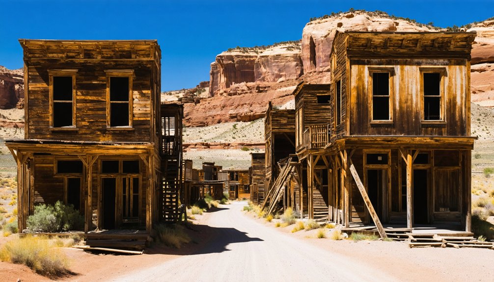
Frisco Ghost Town
Nestled against the stark San Francisco Mountains, Frisco once roared with the chaos of 6,000 fortune seekers who transformed this remote Utah valley into what many called the wildest town in the Great Basin.
Six thousand fortune seekers once transformed this remote Utah valley into the Great Basin’s wildest boomtown.
You’ll find the legendary Horn Silver Mine‘s gaping 900-foot pit, where mining technology extracted over $60 million in precious metals before the catastrophic 1885 cave-in silenced the operation.
Twenty-three saloons once lined these streets where violence claimed lives nightly.
Today’s ghost town preservation efforts protect the iconic beehive charcoal kilns and sprawling cemetery—Utah’s largest at its peak.
Drive fifteen miles west of Milford along UT-21 to explore rusting equipment, stone foundations, and timber-braced shafts scattered across juniper-covered hills, where solitude replaces the chaos.
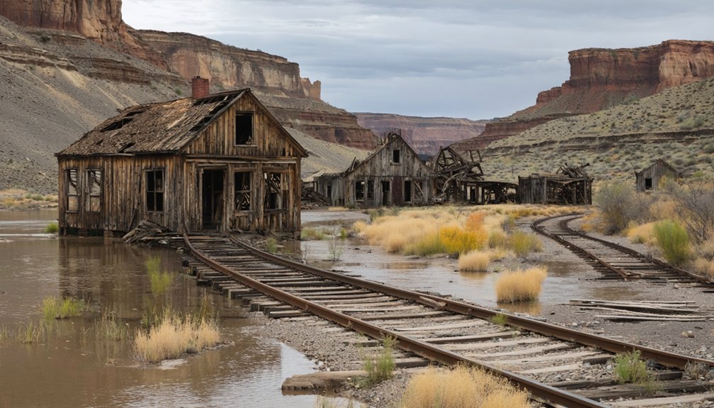
Cisco Ghost Town
Where the Book Cliffs meet the Colorado River valley, Cisco’s sun-bleached remains sprawl across the desert floor like scattered dominoes—a railroad town that lived and died by water.
Founded in the 1880s to refuel steam locomotives, this ghost town peaked at 200 residents before diesel engines and Interstate 70 rendered it obsolete.
You’ll discover approximately 100 weathered structures among local flora like sagebrush and juniper, with wildlife sightings of ravens and coyotes weaving through abandoned buildings.
Access it via Old Highway 6/50 between I-70 exits 204 and 214.
Key relics include:
- Original post office and general store
- Rusting oil equipment from the 1924 boom
- One-room schoolhouse where ranchers’ children learned
Film crews chose Cisco for Vanishing Point and *Thelma and Louise*—testaments to its cinematic desolation.
Sego Ghost Town
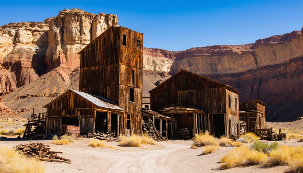
Deep in Sego Canyon, thirty miles north of Cisco, Henry Ballard stumbled upon a vein of anthracite coal in 1908 that would transform a landscape of ancient rock art into one of Utah’s most ambitious mining ventures.
One coal discovery in 1908 reshaped an ancient canyon into Utah’s boldest industrial gamble against the desert.
You’ll find remnants of this million-dollar operation scattered across the canyon floor—crumbling stone walls of the company store, collapsed boarding houses, and rusted mining equipment slowly surrendering to desert winds.
The mining history here tells stories of Italian, Greek, Japanese, and African American miners who carved lives from unforgiving rock until 1955.
Today, ghost town preservation efforts protect what fire and floods couldn’t destroy. You’ll walk past foundations where diverse communities once thrived, trace old railroad cuts through sagebrush, and stand in a fenced cemetery overlooking the canyon’s haunting beauty.
Ophir Ghost Town
You’ll find Ophir nestled in a canyon on the Oquirrh Mountains’ west slope, just 45 minutes southwest of Salt Lake City.
Where 6,000 fortune-seekers once crowded wooden boardwalks and stone storefronts after soldiers discovered silver in 1870. Named for King Solomon’s legendary mines, this biblical reference proved fitting as the town boomed with saloons, theaters, and two schools before the ore ran dry and residents scattered.
Leaving behind authentic structures, including an underground store carved with its original 1870s signage. Today, volunteers open historic buildings each Saturday in summer, inviting you to walk through preserved schoolhouses and explore a century-old train car that now serves as a visitor center.
Location and Historical Background
Nestled in the shadow of the Oquirrh Mountains’ western slope, Ophir clings to the walls of what was once called Bates Canyon, approximately 25 miles southwest of Tooele in Utah’s rugged backcountry.
You’ll find this remote canyon accessible by road from Rush Valley, where settlement origins trace back to 1865 when Camp Douglas soldiers discovered silver and lead outcrops glinting in the rock.
The mining history exploded on January 1, 1870, when prospectors officially established Ophir, naming it after the biblical town that supplied King Solomon’s legendary wealth.
Within months, the ore strikes proved so rich that:
- 6,000 fortune-seekers flooded the canyon during the 1870s boom
- Silver poured from the mines until depletion around 1880
- Today, only 38 residents remain in this disincorporated ghost town
The prosperity burned bright but brief.
Notable Structures and Features
Unlike most ghost towns where abandoned buildings crumble where they stood, Ophir’s surviving structures have been gathered into a carefully curated outdoor museum that transforms your visit into a walk through preserved history.
You’ll discover the reconstructed schoolhouse positioned up the hill, its period furnishings visible through weathered windows.
The post office—once a 1930s boys’ clubhouse—displays original desks along the circular path.
Historic architecture shines through the town hall’s double doors and adjacent fire hall, representing the mining boom era.
A shoe shop and other commercial buildings cluster together, furnished with era-appropriate items.
The old caboose serves as your visitor center, while pavilions and walkways connect these outdoor exhibits.
Behind the schoolhouse, you’ll find parking that makes exploring these relocated treasures entirely accessible.
Visiting Tips and Accessibility
When planning your journey to Ophir, factor in the scenic 45-minute drive west from Lehi or hour-long trek southwest from Salt Lake City that winds through sagebrush flats past Fairfield before climbing into the canyon. You’ll discover a living ghost town where 25-38 residents still call home, making respect for private property essential.
Visitor tips for your exploration:
- Park near the pavilion at the hill’s bottom, where you’ll find picnic tables and restrooms.
- Buildings open Saturdays 12-3pm (extended 11am-3pm May-September); peer through windows on Sundays.
- Leave dogs at home—this watershed protection area prohibits pets to safeguard water quality.
Accessibility challenges include mountainside terrain and unpaved areas, though paved paths circle the main attractions.
The self-guided tour costs nothing, though donations support volunteer caretakers preserving this canyon refuge.
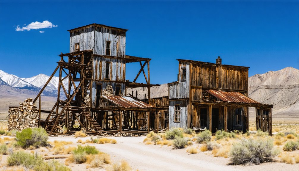
Mercur Ghost Town
Deep in the Oquirrh Mountains, Mercur rose and fell three times before vanishing entirely from Utah’s landscape.
You’ll find only a steep cemetery trail where 6,000 souls once bustled through town. The graveyard holds 100 departed—forty marked by rock ovals, twenty surrounded by weathered picket fences, and one solitary carved headstone standing guard over the forgotten.
This was Utah’s greatest gold producer, yielding 2.5 million ounces through revolutionary mining techniques that combined cyanide processing with lime improvements.
Fire consumed it twice—1896 and 1902—each blaze devouring wooden structures in narrow streets where water couldn’t reach.
Town conservation efforts never materialized.
Frequently Asked Questions
Do I Need a Permit to Visit Utah Ghost Towns?
You’ll need permits for ghost towns on federal lands where historical preservation matters most. Access restrictions vary—roadside ruins stay permit-free, but places like Pahreah require advance reservations. Trust lands demand right-of-entry permits beyond casual visits.
Are Utah Ghost Towns Safe to Explore With Children?
Want adventure without danger? You’ll find safe ghost towns offering historical preservation and photography opportunities—stick to maintained sites like Grafton. Avoid abandoned mines, sealed structures, and private property. Bring water, supervise kids closely, and respect boundaries for everyone’s safety.
What Is the Best Time of Year to Visit Utah Ghost Towns?
You’ll find spring and fall shoulder seasons ideal—March through April and October deliver mild weather, fewer crowds, and stunning photography opportunities among historical ruins. The golden light perfectly captures weathered structures while you explore freely without summer’s oppressive heat.
Can I Camp Overnight Near Utah Ghost Towns?
You’ll find free dispersed camping near most Utah ghost towns on BLM lands, respecting historical preservation zones. Photography opportunities await at dawn, though you can’t camp at protected sites like Grafton. Stay 14 days maximum per location.
Are There Guided Tours Available for Utah Ghost Towns?
Yes, you’ll find guided tours throughout Utah’s ghost towns, from Grafton’s paranormal adventures to Salt Lake’s haunted walks. These experiences blend historical preservation with incredible photography opportunities, letting you explore weathered ruins and capture haunting stories at your own pace.
For those seeking a more personal adventure, exploring abandoned places in Utah can be equally rewarding. The vast landscapes are dotted with remnants of past lives, and each site has its own unique story waiting to be uncovered. Whether you’re a photographer, historian, or simply a curious wanderer, these forgotten spaces offer a glimpse into a different time.
References
- https://www.utahsadventurefamily.com/5-ghost-towns-in-utah-for-families/
- https://www.atlasobscura.com/things-to-do/utah/ghost-towns
- https://www.visitutah.com/things-to-do/history-culture/ghost-towns
- https://www.ksl.com/article/51308628/restored-utah-ghost-towns-that-should-be-on-your-summer-travel-bucket-list
- https://www.youtube.com/watch?v=FLdClYRU0bY
- https://www.familysearch.org/en/wiki/Utah_Ghost_Towns
- https://opendata.gis.utah.gov/datasets/ghost-towns-in-utah/about
- http://www.expeditionutah.com/forum/index.php?forums/ghost-town-database.83/
- https://graftonheritage.org/history-settlement/
- https://www.hannahhendersontravel.com/grafton-ghost-town-utah/


