You’ll find Pennsylvania’s ghost towns especially atmospheric in winter, when snow reveals hidden foundations and ice coats abandoned structures. Trek the 36-mile Ghost Town Trail past coal tipple ruins, or explore Concrete City‘s skeletal housing blocks used for firefighter training. Visit Corydon when the Allegheny Reservoir drains, exposing an entire submerged town’s streets and church foundations. Alvira’s 149 buried munition bunkers emerge from snowdrifts, while Pithole City‘s oil-boom cellar holes create haunting silhouettes against white landscapes. The details below disclose each location’s unique winter exploration opportunities.
Key Takeaways
- Ghost Town Trail in Cambria County offers 36 miles of year-round access for hiking, biking, and cross-country skiing through coal country ruins.
- Pithole City in Venango County features snow-covered cellar holes from the 1800s oil boom with a reconstructed diorama at the visitor center.
- Rausch Gap requires a 3.5-mile Appalachian Trail hike, where winter snow reveals stone foundations, mine entrances, and railroad remnants.
- Corydon emerges from drained Allegheny Reservoir in winter, exposing foundation remnants, streets, a colonial graveyard, and old railroad tunnels.
- Concrete City’s skeletal structures remain accessible year-round in Luzerne County, illustrating early 20th-century industrial housing failures.
Ghost Town Trail in Cambria County
When winter’s hush settles over Pennsylvania’s coal country, the Ghost Town Trail transforms into a 36-mile corridor of frozen history that’ll transport you through abandoned settlements where miners once carved their livelihoods from the earth.
Step into Pennsylvania’s frozen past where ghostly mining towns whisper tales of hardship and hope along 36 miles of history.
You’ll pedal or hike past massive iron furnaces at Vintondale, their cold stone silhouettes stark against December skies, while Blacklick Creek freezes alongside your path.
Trail maintenance keeps the crushed limestone surface accessible year-round, perfect for cross-country skiing when snow blankets the route.
From scenic viewpoints near Wehrum and Bracken, you’ll spot coal tipple ruins emerging from bare winter forests—ghostly reminders of boom-and-bust towns like Lackawanna No. 3 and Beulah.
The trail welcomes approximately 80,000 users annually, making it one of Pennsylvania’s most beloved recreational destinations even in the quieter winter months.
Originally established in 1991 on abandoned railroad right-of-way, the trail has expanded over the decades to connect communities from Black Lick to Ebensburg.
Pack layers and explore freely; winter’s solitude offers uninterrupted communion with this National Recreation Trail’s haunting industrial heritage.
Corydon in Warren County
As winter drains the Allegheny Reservoir to its lowest levels, you’ll discover something remarkable: an entire drowned town emerging from the depths like a time capsule. Corydon’s paved main street materializes with yellow paint still visible, defying decades underwater since Kinzua Dam’s construction in 1964.
You’ll walk among house foundations where 646 residents once thrived during the town’s 1900 peak. The Reformed Church stands sentinel over this landscape of historical preservation.
While exploring, you’ll also find the Presbyterian Church cemetery, which reveals colonial-era headstones—among Warren County’s oldest.
Winter exploration here isn’t just about abandoned buildings; it’s about witnessing history reclaimed from bureaucratic flooding. Like Petroleum Centre, which once hosted President Ulysses S. Grant in 1871 before its abandonment, Corydon represents Pennsylvania’s pattern of boom-and-bust communities. Warren County harbors other mysteries too, including the Fred Mack farm ghost from 1881 in nearby Glade Township, now part of the region’s haunted legends.
Trek the old railroad tunnels, trace vanished streets, and experience freedom in its purest form: walking where officials declared you couldn’t.
Scotia in Centre County
You’ll find Scotia’s skeletal concrete ore washer rising from the snow-dusted Scotia Barrens like the ribcage of an industrial giant—I still remember the first time I rounded the bend and saw those towers framing a winter sky so blue it hurt.
The ruins sit within State Game Lands #176, where frozen trails wind past tailing piles and abandoned ore pits, perfect for snowshoeing when the ground hardens in January.
Pack layers and a trail map, since the barrens’ open pine landscape offers little wind protection, and you’ll want to explore beyond the main structures to the foundations scattered near 10 Acre Pond. Winter reveals concrete slabs and bolts from industrial equipment that summer vegetation typically conceals, offering clearer views of the processing facility’s footprint. The area’s distinctive microclimate creates colder conditions than surrounding woodlands, fostering uncommon vegetation that adds an otherworldly quality to winter exploration.
Industrial Ore Washer Ruins
Deep in State Game Lands 176, towering concrete slabs rise twenty feet above the forest floor—skeletal remnants of Andrew Carnegie’s ambitious iron ore venture. You’ll discover the WWII-era washer’s engine room foundation and massive drums that once hauled ore cars upward via extended cables. The industrial heritage speaks through deteriorating concrete berms that retained washing mud and railroad grades scarred into the landscape.
Winter transforms ruins exploration here—snow accentuates open-pit scars and structural outlines against bare trees. Follow trails past the ore washer skeleton to 10 Acre Pond’s water-pumping remnants. You’re free to wander these hunting grounds year-round, though vegetation clearing by historical societies has enhanced visibility. The 1880s washer site, bisected by Range Road, offers additional discovery. Among the scattered foundations, you can identify remains of approximately a dozen company houses, including duplexes where workers once lived during Scotia’s mining heyday. The region’s industrial past echoes stories like the 1936 Williamsporter rail accident near Sunbury, where historical incidents shaped Central Pennsylvania communities.
Bring sturdy boots; uneven terrain rewards the adventurous.
State Game Lands Access
The Pennsylvania Game Commission maintains 6,211 acres of State Game Lands 176 in Centre County, where Scotia’s industrial past merges with the state’s largest pitch pine and scrub oak barrens ecosystem.
You’ll find designated routes ranging from half-mile walks to 2.6-mile treks connecting multiple access points. Exit Interstate 99 at Grays Woods, head south on Grays Woods Boulevard, then left onto Scotia Road—0.75 miles brings you to Scotia Range Road’s stone entrance.
Winter wildlife thrives here: ruffed grouse, American woodcock, and golden-winged warblers inhabit preserved habitats. The area serves as a vital groundwater source for the region while supporting diverse wildlife populations.
Trail preservation efforts maintain this distinct microclimate zone’s ecological integrity. You can hike, run, hunt, and birdwatch freely, but remember—mountain biking’s prohibited, and metal detecting violates regulations. The Mapping Center provides search and discovery tools to help you navigate State Game Land resources and print customized maps for your visit.
The terrain’s rugged character demands self-reliance; no official address exists, so GPS coordinates guide your exploration.
Scotia Barrens Winter Trails
Andrew Carnegie’s abandoned iron empire sprawls across 5.87 miles of winter-primed trails where industrial ghosts meet ecological resurrection.
You’ll navigate through a frost pocket’s microclimate effects, where cold air settles into sandy soil and creates Pennsylvania’s rarest pitch pine barrens—an ecosystem born from industrial devastation.
Pack 4-6 inches of snow and you’ve got exceptional cross-country skiing terrain.
The ore washer foundation’s earthen ramps offer elevated vantage points over this barren landscape, where tailing piles stand as monuments to 1880s ambition.
Grab the Purple Lizard Scotia map before exploring unmarked paths through this unique wildlife habitat.
Check hunting schedules before December—trails close early October through mid-January.
Post-muzzleloader season, you’ll have this forgotten boomtown to yourself, where freedom-seekers discover that industrial failure created ecological triumph.
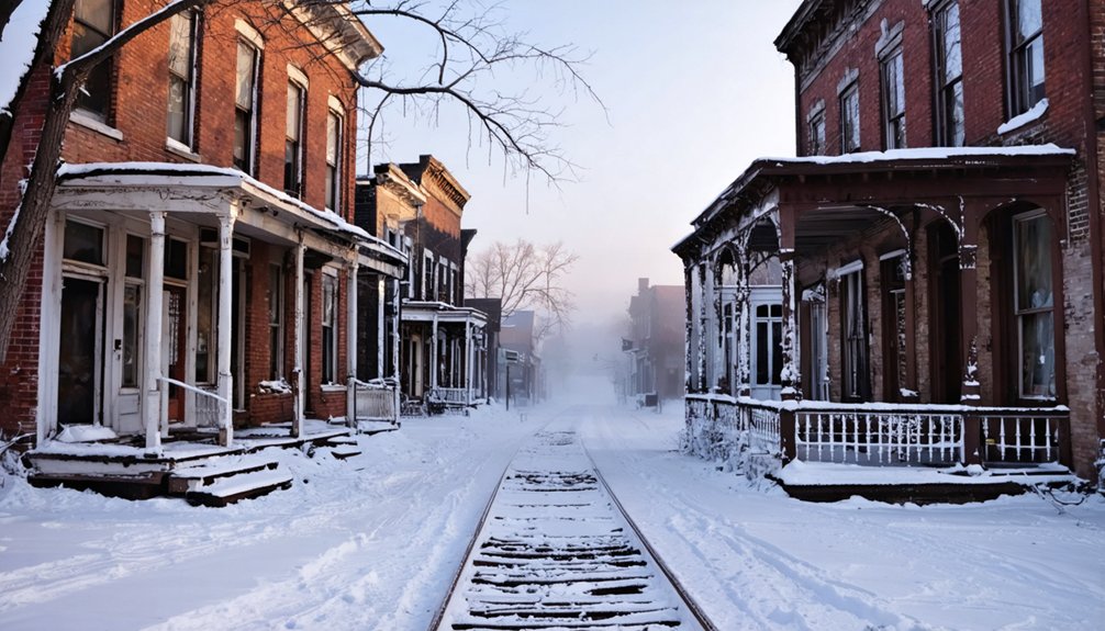
Frick’s Lock in Chester County
You’ll find Frick’s Lock frozen in time along the defunct Schuylkill Canal, where 1700s and 1800s buildings stand empty after residents evacuated for the nearby nuclear plant in the early 1980s.
This National Register Historic District earned official recognition in 2003, preserving an intact village that once thrived on coal transport before abandonment turned it into one of Pennsylvania’s most authentic ghost towns.
exploring the history of loraine reveals the stories of its past residents and the impact of industry on their lives. Many of the buildings still standing tell tales of a vibrant community that played a crucial role in the region’s development. As visitors wander the streets, they can almost hear the echoes of laughter and the hustle of daily life that once filled this enchanting place.
The 18-acre site remains private property, so you’ll need to wait for the East Coventry Historical Commission‘s rare free tours—checking their winter schedule is essential before making the trip.
Historic District Recognition
Nestled along the winding Schuylkill River in northeast East Coventry Township, Chester County, this abandoned village earned its place on the National Register of Historic Places in 2003. The 18-acre site’s historic preservation status recognizes its archaeological significance as a tangible link to Pennsylvania’s canal-era heritage.
You’ll find remnants of the Schuylkill Navigation System here—Locks #54 and #55 that once controlled river traffic through the 1800s. Though it’s private property, the district’s designation safeguards structures and foundations from Pennsylvania’s transportation evolution.
The ghost town preserves layers of history: canal workers’ homes, railroad infrastructure, and even traces of the Four Pines Camp emergency housing. This recognition ensures future generations can explore authentic remnants of industrial America’s rise and fall.
Abandoned Village Along Canal
The Schuylkill Canal’s abandoned waterway tells stories through its crumbling locks and silent towpaths, but Frick’s Lock village brings those stories to life in three dimensions. You’ll find eighteen acres of authentic 1700s and 1800s structures standing empty since the early 1980s, when Limerick Nuclear Power Plant‘s construction displaced the last residents.
The canal history here runs deep—Locks #54 and #55 once facilitated over a million tons of coal annually toward Philadelphia.
While ghost stories naturally swirl around these vacant buildings, the real chills come from walking through doorways where families lived for two centuries.
East Coventry Historical Commission offers free tours several times yearly, letting you explore this frozen-in-time settlement without trespassing concerns.
Access and Ownership Status
Despite its haunting appeal, Frick’s Lock remains strictly off-limits except during sanctioned tours. You’ll find ownership restrictions firmly in place, as this 18-acre historic district is private property despite its National Register status since 2003.
The East Coventry Historical Commission controls access, offering free guided tours just a few times yearly—your only legal window into this preserved time capsule.
Private preservation has its trade-offs. While you can’t wander freely through the 1700s-era buildings, scheduled tours provide rich historical context you’d miss exploring alone.
Mark your calendar for these rare opportunities, as the eerie atmosphere of empty structures makes the wait worthwhile.
Consider visiting nearby Hopewell Furnace between tours to satisfy your craving for authentic 18th and 19th-century Pennsylvania history.
Concrete City in Luzerne County
Winter reveals the skeletal beauty of these structures—dampness and drafts made them uninhabitable, forcing abandonment in 1924.
Today, winter preservation efforts by the Luzerne County Volunteer Fireman’s Association keep this training ground accessible.
You’re free to explore near Wilkes-Barre, though the same structural defects that drove residents away still echo through empty rooms.
Celestia in Muncy Valley
You’ll find yourself walking the frozen grounds where Peter Armstrong once convinced 300 followers they’d purchased plots in heaven itself for just $10 each. The remnants scattered across this 1850s utopian settlement tell the story of a millennialist community that raised sheep, tapped maples, and waited for Christ’s return in Sullivan County’s mountains.
Today, crumbling foundations peek through winter snow near a small lake, marking where believers built their sacred town—only to watch it sold for taxes at $33.72 in 1876.
Utopian Community Origins
When Peter E. Armstrong purchased 181 acres for just $450 in 1850, he wasn’t simply buying land—he was claiming wilderness for divine purpose.
This Philadelphia millennialist sought isolation in Sullivan County’s rolling hills, inspired by biblical rapture prophecy.
He named his sanctuary Celestia, envisioning a refuge where believers could await Christ’s second coming, free from societal constraints.
Armstrong’s utopian ideals transformed into ambitious reality:
- 300+ lots plotted at $10 each for fellow seekers
- Daystar newspaper reached every U.S. post office, advertising their vision
- Massive temple designed for 144,000 faithful followers
- Self-sustaining economy through sheep wool and maple syrup production
Religious communes like Celestia embodied America’s frontier spirit—where determined souls carved out alternative societies beyond governmental reach, living according to their own prophetic convictions.
Lake and Foundation Remnants
Today, Celestia exists only as scattered stone foundations and crumbling walls hidden among Sullivan County‘s dense forests along Route 42 near Laporte.
You’ll discover remnants of Armstrong’s home, meeting house, and small dwellings laid out in precise squares matching the original town plan.
Historic preservation efforts have marked sites for archaeological excavation, including a latticed front stoop house with lingering shrubbery.
Old roads still cut through the wilderness, revealing foundations of sawmills, brick manufactories, and blacksmith shops.
Winter transforms this landscape—snow outlines forgotten pathways and highlights stone remains against frozen forest.
The nearby lake, once called Lewis Lake, adds to the site’s haunting beauty.
Bring your camera to capture these ruins of freedom-seekers who dared deed their land to God.
Alvira in Union County
Deep in Union County’s winter woods, the vanished town of Alvira tells one of Pennsylvania’s most haunting stories—a thriving community erased in days for a war effort that barely lasted a year.
In 1942, the government seized over 8,500 acres, displacing 400 residents who never reclaimed their land despite promises.
You’ll find chilling remnants throughout State Game Lands 252:
- 149 igloo-shaped munition bunkers hidden among snow-dusted trees
- Three cemeteries where displaced families still tend graves
- Concrete foundations marking vanished homes and businesses
- Stone Church relocated within Allenwood Federal Prison walls
Winter’s bare branches reveal what summer conceals.
This isn’t just historical preservation—it’s witnessing how land reclamation transformed private property into public hunting grounds, leaving only shadows of a community that challenged government overreach too late.
Yellow Dog Village in Blair County
While Alvira’s story centers on government seizure, Yellow Dog Village tells a darker tale of corporate control—where workers surrendered their rights to unionize in exchange for a roof over their heads.
You’ll find this 1912 company town near Worthington, where 26 crumbling buildings whisper stories of exploitation disguised as opportunity. Winter strips away the vegetation, revealing original basement pantries and moss-covered roofs frozen in time.
The new owners embrace historical preservation through paid tours that blend ghost storytelling with authentic exploration.
You’ll walk streets where miners once lived under restrictive contracts, their legacy now a cautionary tale about trading freedom for security.
Despite the 2008 E. coli outbreak and decades of decline, this privately-owned site offers you unfiltered access to Appalachia’s industrial past—no corporate sanitization included.
Pithole City in Venango County
Imagine a town that burned brighter than a struck match—15,000 souls flooding into farm fields within six months, only to vanish just as quickly into Pennsylvania’s oil-soaked history. Pithole City’s winter landscape reveals what feverish ambition leaves behind: snow-covered archaeological excavations where 57 hotels once stood, mown streets tracing a phantom grid across empty fields.
You’ll find historical preservation at its most haunting here. The visitor center’s 200-figure diorama resurrects what fire and pipelines destroyed—a boomtown that handled more mail than most Pennsylvania cities, where whiskey flowed cheaper than water.
Walk the interpretive trail where cellar holes mark vanished saloons and banks.
- Winter snow emphasizes the street layout against bare ground
- Indoor diorama provides detailed context without freezing outside
- Remote location ensures solitary exploration
- Land that sold for $2 million once cost $4.37
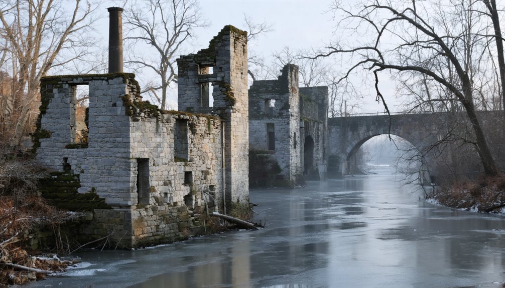
Rausch Gap in Schuylkill County
Unlike Pithole’s fleeting oil fever, Rausch Gap burned coal for eighty years before sliding into St. Anthony’s Wilderness.
Eighty years of coal smoke and labor, then silence—Rausch Gap surrendered to the wilderness that now reclaims its bones.
You’ll hike 3.5 miles along the Appalachian Trail to reach stone foundations where 1,000 miners once lived. Dr. Benjamin Kugler‘s railroad headquarters thrived here until 1872, when operations shifted to Pine Grove.
Winter strips away summer’s concealing growth, revealing mine entrances and building sites with stark clarity.
Historical preservation efforts maintain interpretive signs guiding you through the skeletal town.
The folklore legends run deep—locals whisper about the Weeping Woman with blood-stained hands, wandering where a grief-stricken switch operator’s wife allegedly caused a fatal train crash.
You’ll find a shelter, spring, and outhouse at this popular camping spot.
Pack accordingly; this remote valley demands self-reliance and respect.
Frequently Asked Questions
What Safety Precautions Should I Take When Visiting Ghost Towns in Winter?
You’ll need proper winter clothing layers and sturdy boots for exploring abandoned structures. Stick to visible trails, tell someone your plans, and bring emergency supplies. These forgotten places demand respect—frostbite doesn’t care about your adventure spirit.
Are Pets Allowed at Pennsylvania Ghost Town Sites During Winter Visits?
Pet-friendly policies vary by site, so you’ll need to check each ghost town’s winter visitation rules beforehand. Most outdoor locations welcome leashed dogs, letting you explore freely together while discovering Pennsylvania’s abandoned landscapes during crisp winter adventures.
Do I Need Special Permits to Explore Ghost Towns in Winter?
You’re free to roam most Pennsylvania ghost towns without permits—state forest sites welcome wanderers year-round. However, winter’s icy terrain challenges demand preparation. Historic landmarks like Yellow Dog Village require paid tours, but countless ruins await your unfettered exploration.
What Photography Equipment Works Best for Winter Ghost Town Documentation?
You’ll want wide-angle lenses for sweeping abandonment scenes and fast primes for low-light interiors. Winter lens options include weather-sealed telephoto glass, while thermal camera benefits reveal hidden structural heat signatures and wildlife others miss completely.
Are Guided Tours Available for Pennsylvania Ghost Towns During Winter Months?
You’ll find limited guided ghost town tours in winter, though self-guided options through Pennsylvania Lumber Museum let you explore freely. Historical preservation sites like Scotia remain accessible year-round, where local legends come alive through your own discovery.
References
- https://www.visitjohnstownpa.com/whats-happening-in-johnstown/the-ghost-town-trail-a-ghost-town-no-more
- https://www.youtube.com/watch?v=_u5MUuwynhw
- https://uncoveringpa.com/ghost-towns-in-pa
- https://visitpago.com/ghost-towns-of-the-clarion-river-corridor-lily-pond/
- https://pabucketlist.com/exploring-the-ghost-town-of-scotia-near-state-college-pa/
- https://www.visitpa.com/blog/post/abandoned-places-pennsylvania/
- https://weconservepa.org/blog/pennsylvania-names-the-ghost-town-trail-as-2020-trail-of-the-year/
- https://en.wikipedia.org/wiki/Ghost_Town_Trail
- https://indianacountyparks.org/our-trails/ghost-town-trail/
- https://www.cambriaconservationrecreation.com/ghost-town-trail/


