You’ll find Tennessee’s best winter ghost towns offer hauntingly beautiful experiences when snow blankets their abandoned structures. Explore Elkmont’s 70 snow-covered buildings in the Smokies, visible along Fighting Creek Gap Road, or visit Hales Bar Dam’s powerhouse marina where limestone gorges frame the frozen Tennessee River. Randolph’s Civil War earthworks emerge starkly against winter’s bare landscape on Mississippi River bluffs, while Port Royal’s 1790s stone foundations and Masonic Lodge stand eerily preserved. December through February provides the clearest views of underwater Loyston’s streets when lake levels drop, and winter’s stripped vegetation reveals hidden foundations at all sites that summer foliage conceals.
Key Takeaways
- Elkmont Ghost Town features 70 snow-covered Craftsman-style buildings along Fighting Creek Gap Road, ideal for winter exploration on solitary trails.
- Hales Bar Dam’s abandoned powerhouse on the Tennessee River offers haunted legends and dramatic limestone gorge views in winter fog.
- Loyston’s submerged foundations beneath Norris Lake become visible during low winter water levels, revealing streets and town remnants.
- Port Royal’s 1790s stone foundations and Trail of Tears site provide historical exploration opportunities with digital resources for winter visitors.
- Randolph’s Fort earthworks and Civil War ruins appear more visible in winter, offering six-mile river views from Second Chickasaw Bluffs.
Elkmont Ghost Town: A Snowy Retreat in the Smokies
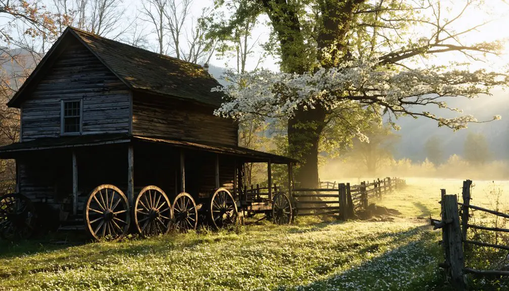
Nestled deep in the Great Smoky Mountains, Elkmont’s weathered cabins and silent hotel stand as haunting reminders of a bygone era when this now-quiet hollow buzzed with loggers, vacationers, and Knoxville’s elite.
You’ll find this abandoned settlement along Fighting Creek Gap Road, where 70 buildings once stood when it gained National Register status in 1994.
Winter transforms Elkmont into something magical—snow blankets the crumbling structures, and you’ll have the trails mostly to yourself.
While architectural restoration continues on select cottages, most remain frozen in time since the 1992 lease expirations.
The art preservation efforts haven’t reached everything, giving you authentic exploration opportunities.
Park for free and wander through what was once Sevier County’s second-largest town, now reclaimed by nature’s quiet grip.
The site’s origins trace back to Robert Trentham’s 1830s purchase, when this land first transitioned from wilderness to settlement before eventually becoming the resort community whose bones you see today.
As you explore, you’ll notice exposed wood ceilings and rough-hewn log construction that reflect the early 1900s Craftsman style and back-to-nature movement that inspired these vacation retreats.
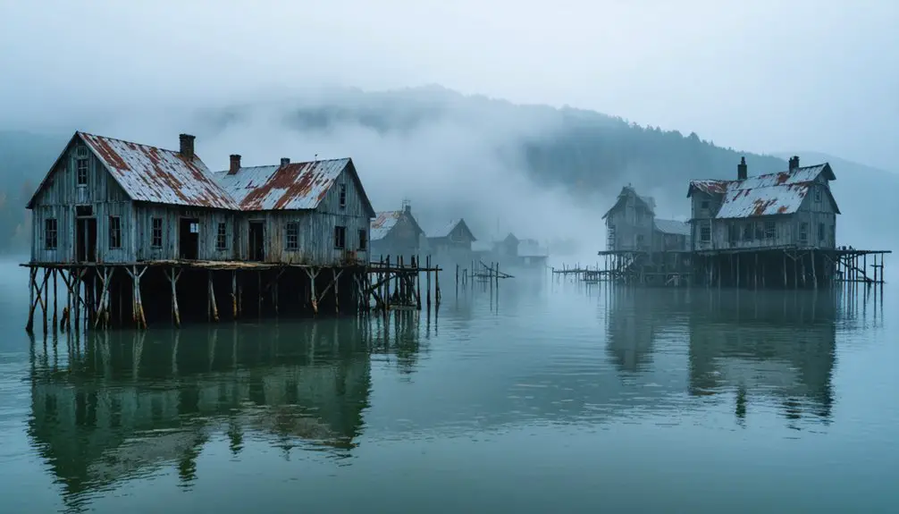
Hales Bar Dam: Where Spirits Meet the Tennessee River
Where the Tennessee River carves through Marion County’s limestone gorge, the skeletal powerhouse of Hales Bar Dam rises from the water like a monument to ambition gone wrong. Built between 1905 and 1913, this engineering marvel turned nightmare couldn’t escape its foundation’s curse—persistent leaks forced its abandonment in 1967.
Winter reveals what summer obscures:
- The surviving powerhouse, now a marina boathouse, where worker deaths during construction fuel haunted legends
- Submerged graveyards beneath Nickajack Reservoir, including Spanish Flu victims never exhumed
- Cherokee Chief Dragging Canoe’s curse, tied to the 1775 Treaty of Sycamore Shoals
You’ll find engineering failures etched in crumbling concrete and legends whispered across cold waters. The dam’s 60 by 260-foot lock once held the world’s highest lift at 41 feet, a technological triumph undermined by the very geology it tried to tame. Cost overruns ballooned from $2 million to nearly $10 million, equivalent to $237 million today. The isolation intensifies everything—this isn’t packaged tourism; it’s raw history meeting the river’s relentless flow.
Loyston Sunken Town: An Underwater Mystery at Big Ridge
From river-cursed dams to deliberate drowning—Tennessee’s sunken towns tell different stories. Loyston didn’t fade naturally—the TVA deliberately flooded it in 1936 for Norris Dam, forcing 70 residents from their homes.
You’ll find this submerged landmark beneath Norris Lake’s mile-wide Loyston Sea, near Big Ridge State Park. Before flooding, photographer Lewis Hine documented everything: the Sharps Station Methodist Church, filling stations, everyday life.
Those underwater archaeology records make Loyston hauntingly tangible—you can actually envision what’s below.
Winter’s low water levels sometimes reveal foundations and streets. Launch from Big Ridge’s boat ramps and explore these submerged landmarks carefully.
The displaced families rebuilt nearby at New Loyston, but their drowned town remains accessible, waiting beneath the surface for curious explorers willing to challenge government-sanctioned erasure. Originally settled in the 1800s by the Stookesbury Family, the community would later be renamed after John Loy, who established a foundry that helped the town become a vital trading hub. Above the water, cemeteries on hills preserve the memory of Loyston’s residents, their gravestones overlooking the lake that swallowed their homes.
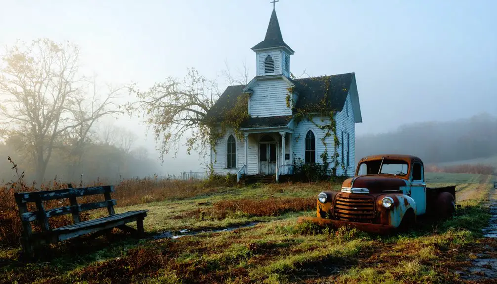
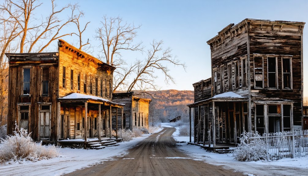
Port Royal: Tennessee’s Forgotten Convention Town
While most Tennessee ghost towns vanished without ceremony, Port Royal wielded genuine political power before its slow fade. Founded in 1797 where the Red River meets the Great Western Road, this thirty-acre settlement thrived as a tobacco hub where dark-fired leaves served as currency and flatboats departed for New Orleans by the dozens.
What You’ll Discover:
- Stone foundations from the 1790s scattered throughout Tennessee’s second-smallest state park.
- The 1859 Masonic Lodge featuring a preserved brick with an enslaved worker’s thumbprint.
- A certified 300-yard section of the original Trail of Tears, where 10,000 Cherokee spent their final night in Tennessee.
- An 1887 steel bridge connecting the town’s historical roadway across the Red River.
Economic decline arrived with railroads, ending urban development. The last residents departed in 1984, leaving you free to explore this authenticated historical crossroads. For the full experience, use modern browsers like Chrome or Firefox when accessing digital park resources before your visit.
Randolph: Civil War Ruins Along the Mississippi
You’ll find Randolph’s story etched in the Mississippi River bluffs themselves—twice burned by Union forces, this once-thriving cotton port now stands as a haunting monument to Civil War devastation.
Winter’s bare trees reveal Fort Randolph’s earthwork remnants more clearly than any other season, while the cold months bring lower river levels that expose shoreline artifacts from the steamboat era. Before Memphis eclipsed it, Randolph shipped more cotton than Memphis during the 1830s, when steamboats arrived daily at its strategic landing near the Hatchie River.
From its position 100 feet above the river on the Second Chickasaw Bluffs, Confederate troops could spot approaching Union vessels six miles in either direction, making Fort Randolph a crucial observation point throughout the war.
Pack binoculars to scan the bluffs from the modern riverbank, and wear sturdy boots for traversing the ravines that erosion has carved into these historic fortifications over 160 years.
Destruction and Resilient History
Standing on the windswept bluffs of Randolph today, you’ll find it hard to imagine that this quiet stretch of riverbank once rivaled Memphis itself. In 1862, General Sherman’s retaliation transformed this thriving river town into ashes and folklore stories. The destruction came after Confederate guerrillas fired on a Union packet boat, sealing Randolph’s fate.
What makes this ghost town remarkable:
- Natural forces conspired with war – the Mississippi River literally ate away at the sandy bluffs, creating 30-foot “giant steps” and ravines locals called “the devil’s cellar.”
- Sherman spared one church and dwelling from the flames, monuments to restraint amid destruction.
- Nathan Bedford Forrest trained here before becoming a Confederate legend, adding layers to the site’s complex urban legends.
You’re free to explore these resilient ruins year-round.
Winter River Exploration Tips
When winter fog rolls off the Mississippi River at Randolph, the 100-foot Second Chickasaw Bluff transforms into something from a Civil War daguerreotype. You’ll command six-mile views upstream and downstream from this natural fortress, understanding immediately why Confederates chose this spot for Fort Randolph.
The bluff formation reveals a dramatic geological theater—river erosion has undermined the banks, creating giant earthen steps dropping 20-30 feet. French explorers mapped these formations in the 1600s, and you’re walking the same vantage points Confederate sentries used to spot Union steamboats.
Winter’s your season here. The 1,300-foot riverfront sits empty, letting you explore Fort Wright’s earthworks without crowds. Pack provisions—this rural outpost offers no amenities. The “devil’s cellar” ravines demand careful footing, but the elevated perspective delivers unmatched river solitude.
Shakerag: Hidden Trails in Prentice Cooper State Forest
You’ll find Shakerag marked on the official Prentice Cooper map, a historic site nestled among the forest’s bluff trails just 15 minutes from downtown Chattanooga.
Winter offers ideal conditions for exploring this abandoned community—bare trees reveal old foundations and remnants that summer foliage conceals, while cooler temperatures make the moderate-to-strenuous hikes more comfortable.
Access the site via West Brow Road and Tower Drive, then branch onto connecting trails like the Cumberland Trail segments, keeping your boots ready for stream crossings that can swell after winter rains.
Accessing the Abandoned Community
Nestled within the 24,459 acres of Prentice Cooper State Forest, the abandoned community of Shakerag awaits discovery just ten miles west of Chattanooga. You’ll find Mullins Cove Road cutting through the northern gorge, offering your primary route into this forgotten mining settlement.
The forest opens daily from sunrise to sunset, and winter’s your best ally—bare trees reveal historical landmarks you’d miss in summer’s dense foliage.
Three essentials for exploring Shakerag:
- Navigate at 25 mph through forest roads to spot stone foundations and mine infrastructure.
- Download the Cultural Heritage Mining Trail Guide before you lose cell service.
- Bring your camera for coke ovens and worker housing ruins along the roadside.
Site preservation means respecting these remnants from David McNabb’s 1880s coal operation. The incline plane traces and tipple foundations tell stories bureaucrats never will.
Winter Trail Hiking Tips
Before you lace up for Shakerag’s hidden trails, understand that winter transforms Prentice Cooper’s backcountry into a landscape of exposed geometry—stone staircases slick with morning frost, Indian Rockhouse’s approach demanding deliberate footwork on each ancient step.
You’ll need waterproof boots with aggressive tread; Short Creek doesn’t care about your schedule when temperatures drop. Microspikes aren’t optional—they’re your insurance policy against ice-glazed boulders.
Check hunting closures before departing. Nothing kills adventure faster than locked gates at trailheads.
Layer strategically: moisture-wicking base, insulating mid-layer, waterproof shell. Winter strips away summer hiking’s forgiveness—no wildflower blooming to distract from poor preparation.
Four Bridges and The Gear Closet stock affordable traction devices.
Davis Pond Campground stays open year-round. Hunter Check Station doesn’t. Plan accordingly, move deliberately, and leave before 8 PM gate closures trap you.
Historic Ruins and Remnants
When David McNabb carved his coal empire into Walden’s Ridge in the early 1880s, he didn’t just build mines—he built a vertical city connected by a 4,000-foot incline railway plunging toward the Tennessee River.
Today’s industrial archaeology reveals Shakerag’s skeleton through stone foundations scattered across 457 acres of Prentice Cooper State Forest.
What You’ll Discover:
- Tipple ruins and coke oven remains where coal fueled America’s railroad expansion
- Incline plane traces visible from Mullins Cove Road—follow the ghost railroad’s path
- Two-story hotel foundations and church stones marking where miners built their lives
Heritage preservation here means minimal intervention. Navigate via Mullins Cove Road, three miles from Tennessee River Gorge Island Cabins.
These National Register-listed ruins let you explore unfiltered history without guardrails or guided tours.
Best Times to Explore Tennessee’s Abandoned Sites in Winter
Timing your ghost town exploration in Tennessee requires balancing weather conditions against crowd levels and site accessibility. December offers the sweet spot—you’ll catch Winterfest’s magical atmosphere while avoiding summer’s suffocating crowds. Sure, roads like Roaring Fork Motor Trail and Rich Mountain Road stay locked until spring, but accessible sites like Elkmont become yours to wander.
January and February bring absolute solitude, though some ghost tours shut down completely.
Higher elevations deliver stunning snow photography opportunities when peaks wear their white crowns, while winter wildlife leaves clearer tracks through abandoned settlements. Pack layers and waterproof boots—Tennessee’s winter weather shifts without warning.
Those crumbling chimneys and restored cabins photograph beautifully against bare trees, and you won’t dodge selfie-sticks or chattering tour groups while communing with the past.
What to Pack for Your Winter Ghost Town Adventures
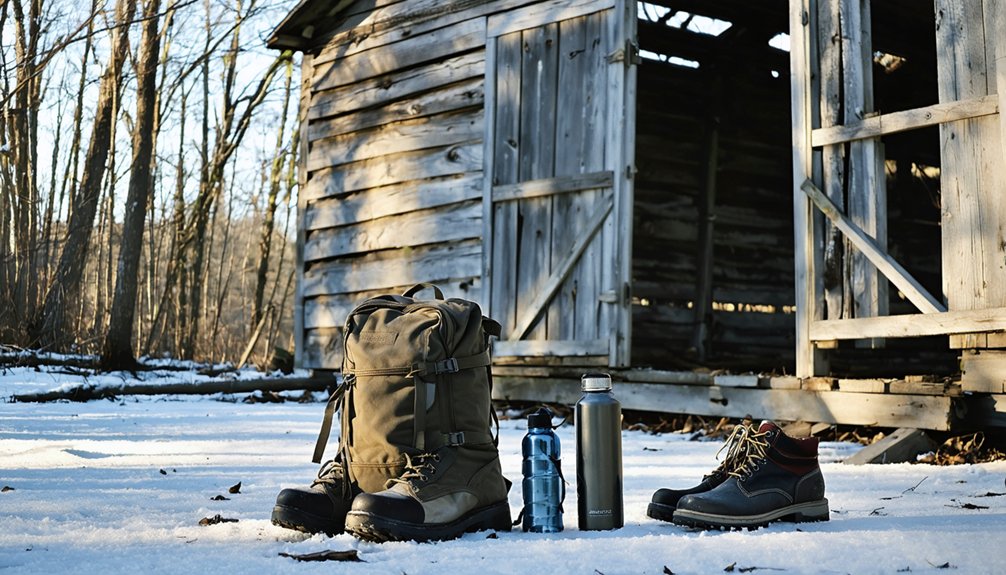
Tennessee’s winter ghost towns demand serious gear—these crumbling settlements won’t forgive amateur mistakes when temperatures plummet and afternoon drizzle transforms into ice. Your seasonal clothing strategy separates memorable adventures from hypothermic nightmares.
Essential Winter Ghost Town Gear:
- Layering System – Pack wicking base layers, fleece mid-layers, and waterproof shell jackets. Tennessee’s humidity penetrates everything, so synthetic materials trump cotton every time.
- Traction Equipment – Microspikes transform treacherous moss-covered foundations into navigable terrain. Collapsed structures hide black ice beneath rotting floorboards.
- Navigation Backup – GPS, compass, and physical maps prevent wrong turns into abandoned mine shafts. Cell service dies where ghost towns thrive.
Your safety precautions matter more than Instagram shots. Bring headlamps, first-aid kits, and emergency shelter—decaying buildings offer zero protection when weather turns hostile.
Paranormal Encounters: Stories From Tennessee’s Ghost Towns
Beyond the practical concerns of waterproof boots and backup navigation, these abandoned settlements harbor something far more unsettling—encounters that defy rational explanation.
At Bell Witch Cave, you’ll find America’s most documented paranormal event, where Kate Batts’ malevolent spirit physically attacked the Bell family in 1817. Visitors still report floating orbs and phantom animals stalking the darkness.
Elkmont’s decaying resort buildings echo with whispers from former residents, while spectral sightings manifest as shadows drifting through overgrown paths. Urban legends persist about spirits refusing to leave their mountain sanctuary.
Hales Bar Dam’s flooded Long Cemetery keeps its dead beneath the water—construction workers report unexplained phenomena near the powerhouse.
At Cades Cove, you’ll hear voices echoing through the Primitive Baptist Church and witness mysterious lights near pioneer cemeteries, testament to lives claimed by Tennessee’s unforgiving wilderness.
Preserving History: Conservation Efforts at Tennessee’s Historic Sites
When you explore Tennessee’s ghost towns, you’re witnessing active conservation efforts:
- Federal Preservation Grants cover 60% of survey costs, helping document crumbling structures before they disappear completely.
- Historic Cemetery Preservation Program protects burial grounds in abandoned settlements, honoring those who built these communities.
- Certified Local Government partnerships provide technical expertise and funding for restoration projects.
The Tennessee Historical Commission’s $2 million Historic Property Fund transforms decaying buildings into accessible landmarks.
You’re not just visiting ruins—you’re supporting restoration work that keeps authentic Tennessee history alive for future adventurers seeking connection with the past.
Frequently Asked Questions
Are Pets Allowed at Tennessee Ghost Town Sites During Winter Months?
You’ll find pet policies at Elkmont Ghost Town allow leashed dogs in campgrounds and roads year-round. Winter rules don’t restrict access, but you’re prohibited from hiking most trails. Keep your furry friend warm and close.
Which Ghost Towns Offer Wheelchair Accessibility for Winter Visitors?
Elkmont Ghost Town offers wheelchair accessibility with 16 restored cabins viewable from your vehicle. You’ll appreciate the historical preservation efforts along accessible routes, though guided tours remain limited. Drive through Daisy Town for unobstructed winter exploration and total freedom.
Do Any Ghost Towns Require Entrance Fees or Permits?
You’ll only pay Great Smoky Mountains National Park’s entrance fee for Elkmont Ghost Town—no additional permits needed. Historical preservation efforts keep it free to explore, though wildlife considerations mean respecting posted boundaries. Other Tennessee ghost towns remain unmarked and permit-free.
Are Overnight Camping Options Available Near These Tennessee Ghost Towns?
You’ll find excellent camping near most Tennessee ghost towns. Pack proper camping gear for winter weather—Big Ridge State Park near Loyston and Elkmont Campground offer heated facilities. Both accept reservations and stay open year-round for adventurous explorers.
What Cell Phone Coverage Can Visitors Expect at These Locations?
You’ll find ironic “ghost” cell service matching these ghost towns—network coverage vanishes in Smokies’ valleys and Watauga’s hollows. Pack offline maps and embrace digital freedom; these remote sites offer liberation from constant connectivity while exploring Tennessee’s abandoned history.
References
- https://www.tnvacation.com/trip-inspiration/articles/ghost-towns-tennessee
- https://www.youtube.com/watch?v=aZkTdeGGeVQ
- https://kiddingaroundgreenville.com/elkmont-ghost-town
- https://www.pigeonforge.com/elkmont-ghost-town/
- https://roadtrippers.com/magazine/abandoned-ghost-town-smoky-mountains/
- https://hikinginthesmokymountains.com/blog/elkmont-ghost-town-restoration/
- https://www.tnmagazine.org/19-ghost-towns-in-tennessee-that-are-not-underwater/
- https://smokymountainnationalpark.com/blog/fun-facts-about-elkmont-ghost-town/
- https://en.wikipedia.org/wiki/Elkmont
- https://www.atlasobscura.com/places/elkmont-historic-district