You’ll find Wisconsin’s most hauntingly beautiful ghost towns scattered between the Mississippi and Lake Michigan shores, where Fort Crawford’s stone foundations now cradle a swimming pool and Cooksville’s 35 preserved buildings whisper tales of Norwegian settlers. Dover’s weathered gravestones mark the dreams of British temperance emigrants, while Ceresco’s 208-foot “Long House” stands as proof to utopian experiments gone quiet. Each abandoned settlement along the Wisconsin River holds architectural treasures and forgotten stories waiting to reveal their secrets.
Key Takeaways
- Cooksville features 35 preserved buildings including a Norwegian Lutheran Church, Greek Revival homes, and a cemetery with graves dating to 1766.
- Dover was founded by British temperance emigrants in the 1840s and contains original log foundations, weathered gravestones, and interpretive signs.
- Ceresco, established in 1844, showcases utopian communal living with its famous 208-foot “Long House” and collective agricultural structures.
- Abandoned waterway communities include Shot Tower, Gratiot’s Grove, British Hollow, and Nelson Dewey’s farm village along historic river routes.
- Fort Crawford transformed from military fort to Civil War hospital to municipal pool, incorporating original foundations and archaeological remnants.
Fort Howard: Green Bay’s Malaria-Stricken Military Outpost
When American troops rowed up the Fox River in August 1816, they found themselves at the mouth of a waterway that had already witnessed over a century of colonial ambition.
The Fox River’s waters carried more than soldiers northward—they bore the weight of a century’s worth of imperial dreams.
You’ll discover how this strategic post, built atop French and British fortifications, became a cautionary tale of expansion’s hidden costs.
The garrison’s commanders—including future president Zachary Taylor—watched helplessly as malaria decimated their ranks by 1820, forcing retreat to higher ground.
What makes Fort Howard compelling isn’t just its military history, but how it represents a pattern you’ll recognize: ancient burial sites disturbed, Indigenous land rights negotiated through chiefs like Tomah, and ultimately, nature reclaiming what ambition couldn’t sustain.
The fort’s position on the Fox River made it a strategic gateway connecting Lake Michigan to inland territories, linking distant posts like Fort Mackinac and Fort Dearborn.
The abandoned fort was rebuilt in 1830s before being deserted once more in 1840, a cycle of occupation that reflected shifting military priorities across the expanding frontier.
Today, three weathered structures stand as reminders of empire’s fragility.
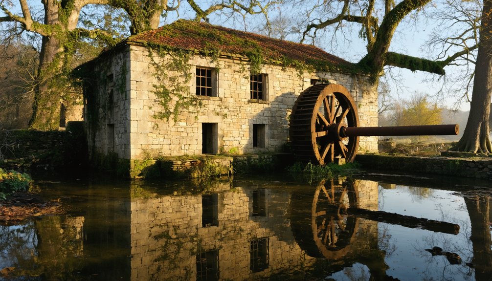
Fort Crawford: From Military Base to Municipal Pool
You’ll find Fort Crawford’s story etched into the bluffs overlooking the Mississippi River, where Zachary Taylor once commanded troops at this strategic chokepoint controlling water traffic between the upper and lower territories.
The fort’s wooden walls and blockhouses guarded Prairie du Chien through treaty negotiations with thousands of Native Americans, the Black Hawk War, and cholera outbreaks that claimed soldiers and civilians alike. Built by American troops in 1816, the square fortification stretched 340 feet per side and rose on the ashes of Fort Shelby from the War of 1812.
The original fort suffered from flooding and deterioration, prompting construction of a second Fort Crawford on higher ground beginning in 1829, completed in 1835 using quarried limestone.
Today, where sentries once watched for threats along the river, local children splash in a municipal swimming pool—the ultimate transformation from military vigilance to summer recreation.
Zachary Taylor’s Command Era
The summer heat of 1829 brought more than humidity to Prairie du Chien—it brought Colonel Zachary Taylor and a vision for an impregnable frontier stronghold. You’ll discover how Taylor’s rural architecture transformed this elevated plain into a limestone fortress, with soldiers quarrying stone while defending against Black Hawk’s warriors.
His exploration strategies connected three critical garrisons through military roads you can still trace today.
Taylor’s command shaped history through:
- Completion of stone barracks by December 1830 despite harsh Wisconsin winters
- Receipt of Black Hawk’s surrender on August 27, 1832 at the fort’s entrance
- Construction of military roads linking Fort Crawford to Fort Winnebago and Fort Howard
- Enforcement of Ho-Chunk relocation to Iowa reservations in 1840
- Transformation into Swift United States Army General Hospital treating 1,468 soldiers during the Civil War
The hospital operated in two separate locations—a three-story hotel building constructed in 1857 south of Fort Crawford and military barracks—due to space constraints during its year of operation from November 1864 to late 1865. While troops enforced removal policies, Dr. William Beaumont conducted 56 experiments on digestion at the original fort, establishing foundational principles of modern digestive science.
Mississippi River Strategic Location
Taylor’s military vision succeeded partly because he understood what the first garrison commanders learned through hardship: Fort Crawford’s power came from its Mississippi River position.
You’re standing where three waterways converged—the Mississippi, Wisconsin River, and trans-Mississippi routes stretching toward Iowa. This junction controlled river trade flowing from eastern Iowa streams, where fur trappers brought pelts to Prairie du Chien’s bustling markets.
The original 1816 fort sat too low, vulnerable to floods that drove troops north in 1826. When soldiers returned, they’d witnessed how strategic positioning meant everything. By 1829, plans emerged to rebuild with limestone on higher ground, moving the fort approximately 50 feet above the river’s elevation to prevent future flooding.
Soldiers occupied the rebuilt garrison until approximately 1856, when the military’s focus shifted away from the upper Mississippi frontier. Archaeological excavations in 1999 uncovered foundations of seven rooms, revealing remnants of the daily routines that once defined this strategic outpost.
Historic Transformation to Pool
After Zachary Taylor’s troops marched away for the last time on June 9, 1856, Fort Crawford’s limestone walls stood silent—but not for long. The Civil War breathed new life into the abandoned post when Swift United States Army General Hospital opened in November 1864, treating 1,468 wounded soldiers.
You’ll discover how railroad agent John Lawler purchased the fort in 1868, transforming military quarters into civilian dwellings. The original fort, completed in 1817, had featured timber construction with stone bases and corner blockhouses equipped with cannons for defense.
Archaeological techniques uncovered during 1999 construction revealed:
- Massive garrison foundations from the 1829-1856 era beneath Beaumont Road
- Concrete stripping exposing Second Fort Crawford’s hidden architecture
- Mississippi Valley Archaeology Center’s extensive Phase III excavation
- Integration of historic remains into modern municipal pool development
- Artifacts preservation linking Jefferson Davis and Black Hawk War soldiers
Today, you’re swimming above history itself.
Belmont: Wisconsin’s Coldest Capital Experiment
When land speculator John Atchison arrived from Galena, Illinois in 1835, he envisioned Belmont as Wisconsin Territory’s gleaming political centerpiece—a “beautiful mountain” rising from three distinctive hills in the region’s most populous lead mining district.
Reality delivered a brutal awakening. The 1836 legislature convened in half-finished frame buildings where representatives slept on floors, wrapped in their coats against Wisconsin’s unforgiving winter. After just 46 humiliating days, lawmakers fled—first to Burlington, then Madison.
The capital’s abandonment triggered swift economic decline. When railroads bypassed the original settlement, residents simply left. The grand Council House became a livestock barn. Belmont’s fate exemplified how failed strategic plans doomed settlements across the Wisconsin Territory.
Today, you’ll find redemption through historic preservation. The Wisconsin Historical Society maintains the First Capitol Historic Site three miles northwest of modern Belmont, where those weathered buildings still stand—monuments to spectacular governmental failure.
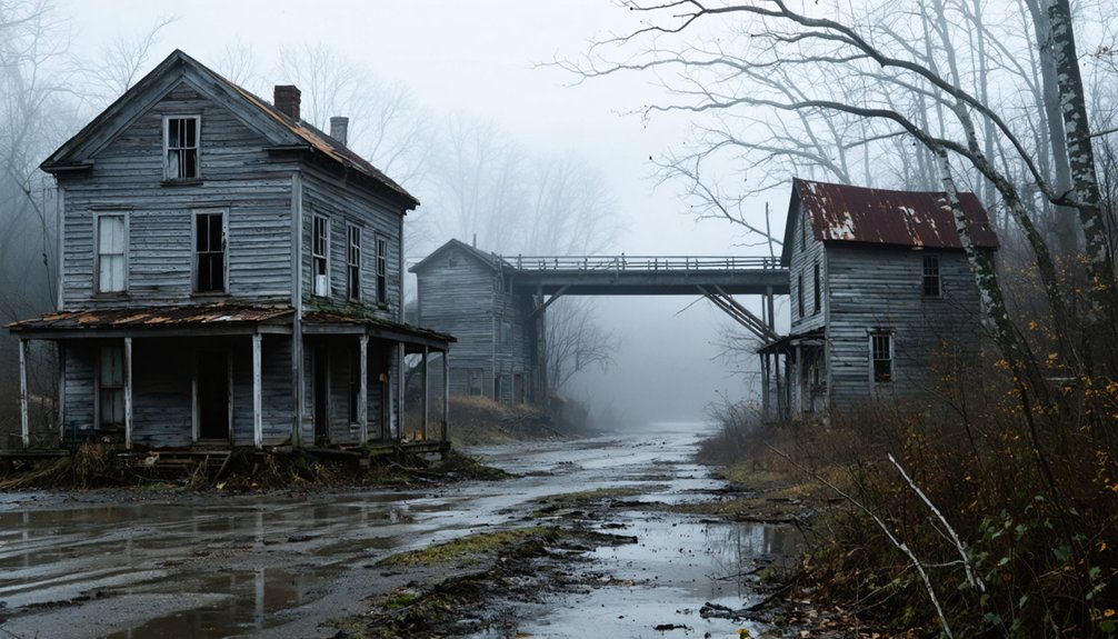
Cooksville: The Mill Town That Time Forgot
Their vermilion brick buildings—Greek Revival structures more reminiscent of medieval architecture than former trading posts—anchored the settlement when railroads bypassed them in 1857.
While neighboring towns relocated house-by-house, Cooksville’s solid masonry stayed put.
Today’s Historic District preserves freedom from progress:
- 35 buildings including the 1886 schoolhouse-turned-yoga-studio
- Norwegian Lutheran Church (rebuilt 1897)
- Cemetery with graves dating to 1766
- Original flour mill and blacksmith remains
- Public square once echoing with livestock auctions
Dover: A Failed Temperance Colony
You’ll find Dover’s origins in an ambitious 1840s social experiment, when the British Temperance Emigration Society sent hundreds of Liverpool families across the Atlantic to establish an alcohol-free utopia in the Wisconsin wilderness.
By 1870, the railroad’s iron tracks bypassed Dover entirely, luring its population to nearby Mazomanie and leaving behind only weathered gravestones and crumbling foundations in the tall prairie grass.
Today, you can walk these quiet fields southwest of modern Mazomanie, where cemetery markers bearing English surnames stand as silent monuments to a colony that couldn’t survive progress.
British Temperance Society Origins
As Britain’s temperance movement gained momentum in the early 1840s, reformers in Liverpool hatched an ambitious plan that would stretch across the Atlantic. The British Temperance Emigration Society envisioned something radical: a New World settlement where British immigrants could build alcohol-free lives far from England’s gin-soaked streets.
Their vision took shape when Charles Wilson arrived in Wisconsin Territory on Christmas Day 1843, accompanied by Joshua Rhodes and Alfred Senier. These pioneers found shelter in an abandoned wigwam near present-day Dover, preparing for the wave to come.
The Society’s Founding Principles:
- Secure American land exclusively for temperance-minded emigrants
- Create self-sustaining communities free from liquor’s influence
- Provide structured support through authorized agents
- Establish infrastructure before settlers arrived
- Maintain oversight from Liverpool headquarters
Railroad Bypass Sealed Fate
The idealistic settlement that Charles Wilson and his fellow temperance advocates carved from the Wisconsin wilderness seemed destined for success through the 1850s. Then railway development shattered those dreams.
When railroad companies plotted their iron paths across Wisconsin, Dover didn’t make the cut. The tracks bypassed the community entirely, choosing more profitable routes that left the temperance colony stranded in commercial isolation.
You can still sense the desperation that must’ve gripped residents as they watched neighboring towns boom with freight wagons and passenger trains. The economic impact proved catastrophic. Without rail access, Dover’s merchants couldn’t compete. Farmers couldn’t ship their goods.
Cemetery and Markers Remain
Walking through Dover’s overgrown cemetery feels like stumbling into Wisconsin’s temperance dreams frozen in stone. Unlike medieval castles with their underground tunnels preserving grandeur, Dover’s physical remnants are humble—weathered markers standing sixty rods northeast of where that first wigwam sheltered three hopeful agents on Christmas Day 1843.
You’ll find these tangible fragments of ambition:
- Historical marker commemorating 700 British settlers who arrived in 1844
- Original gravestones marking colonists who died during the 1846 sickness outbreak
- Cemetery grounds near the old schoolhouse site
- Visible foundation traces from log houses built before spring 1844
- Interpretive signs explaining the British Temperance Emigration Society’s failed experiment
These silent witnesses tell stories of tradespeople-turned-farmers who exchanged English cities for Wisconsin prairie, only to meet poverty, disease, and abandonment.
Ceresco: The Goddess of Harvest’s Commune
On May 25, 1844, at precisely 5 pm, nineteen determined men and one seven-year-old boy stepped onto 600 acres of raw Wisconsin land with radical dreams of communal living. They’d rejected aristocratic landownership for Charles Fourier’s vision.
They named their settlement Ceresco after the Roman harvest goddess.
You’ll find these pioneers weren’t playing at utopia—they planted 100 acres of winter wheat that first season and built a 208-foot “Long House” sheltering thirty families. Their communal living philosophies translated into shared meals, collective child-rearing from age two, and compensation by contribution rather than cash.
Hidden Settlements Along the Wisconsin River
Long before highways carved through Wisconsin’s countryside, the river whispered promises of prosperity to settlers who staked their futures along its muddy banks.
You’ll find abandoned homesteads where lead miners and shot tower operators once thrived, their fortunes rising and falling with river navigation’s dominance. These waterway communities dissolved when railroads chose different routes, leaving behind ghostly footprints.
Lost settlements that defined Wisconsin River commerce:
- Shot Tower’s community relocated multiple times chasing water-powered industrial dreams
- Gratiot’s Grove vanished as lead veins emptied beneath Lafayette County soil
- British Hollow housed hundreds of miners dependent on river transport
- Nelson Dewey’s farm village peaked in the 1890s before fading
- Sinipee’s Mississippi River settlement collapsed when malaria swept through wetlands
These river-born towns couldn’t survive progress’s inevitable march.
Planning Your Wisconsin Ghost Town Adventure
Discovery awaits among Wisconsin’s forgotten settlements, but preparation separates memorable exploration from misadventure. You’ll need sturdy hiking boots for overgrown paths where urban legends whisper through abandoned doorways, plus GPS devices since cell towers don’t reach these remote corners.
Preparation transforms ghost town adventures from reckless wandering into purposeful discovery across Wisconsin’s cell-tower-free wilderness.
Pack your essentials—flashlight, camera, water, first-aid kit—before chasing archaeological discoveries along historic railroad routes.
Time your expedition for late spring through early fall when accessible roads lead to over 100 documented sites. September’s foliage transforms scenic drives into gold-draped corridors.
Inform someone of your itinerary, carry bear spray in northern counties, and respect private property boundaries.
Download offline maps, check GNIS databases for coordinates, and venture out weekday mornings to claim these phantom settlements as your own unbounded frontier.
Frequently Asked Questions
Are Any Wisconsin Ghost Towns Privately Owned or Restricted From Public Access?
Yes, several Wisconsin ghost towns sit on private land where you’ll face access restrictions. You can’t freely explore these abandoned places without permission—private ownership means trespassing charges could end your adventure before it starts.
Among the most intriguing spots to discover are the historic ghost towns in Wisconsin, which offer a glimpse into the state’s past. Each site is steeped in history, with remnants of structures that tell stories of once-thriving communities. For those willing to seek out these hidden gems legally, the rewards can be both enlightening and profound.
What Safety Precautions Should Visitors Take When Exploring Abandoned Structures?
You’ll need proper safety gear—sturdy boots, gloves, and a hard hat—before entering crumbling structures. Watch for unstable floors, asbestos, and lead paint. Historical preservation matters, but your safety comes first when exploring these forgotten places.
Can Ghost Town Artifacts Be Legally Collected or Removed From Sites?
You can’t legally pocket ghost town treasures from public lands without permits—legal regulations protect these historic sites. However, artifact preservation allows collecting on private property with owner permission, where you’re free to explore and document Wisconsin’s forgotten past responsibly.
Which Wisconsin Ghost Towns Offer the Best Photography Opportunities Year-Round?
You’ll find Gratiot’s Grove and Voree offering exceptional photography hotspots year-round, with historical preservation maintaining their photogenic structures. Both sites deliver dramatic seasonal contrasts—summer wildflowers to winter desolation—while accessible roads let you capture atmospheric shots whenever inspiration strikes.
Are There Guided Tours Available for Visiting Multiple Ghost Towns?
No dedicated guided tours connect Wisconsin’s ghost towns through multi-town excursions. You’ll find 90-minute haunted city tours in places like Baraboo, but authentic abandoned settlements require your own self-directed exploration between isolated sites scattered statewide.
References
- https://www.ghosttowns.com/states/wi/wi.html
- https://www.onlyinyourstate.com/experiences/wisconsin/ghost-towns-wi
- http://freepages.rootsweb.com/~gtusa/history/usa/wi.htm
- https://pbswisconsin.org/news-item/southern-wisconsins-ghost-towns-leave-behind-vital-stories/
- https://en.wiktionary.org/wiki/Category:en:Ghost_towns_in_Wisconsin
- http://shunpikingtoheaven.blogspot.com/2016/05/a-wisconsin-ghost-town.html
- https://www.wisconsinhistory.org/Records/Image/IM116137
- https://kids.kiddle.co/List_of_ghost_towns_in_Wisconsin
- https://ss.sites.mtu.edu/mhugl/2015/10/11/fort-howard/
- https://www.hmdb.org/m.asp?m=43816