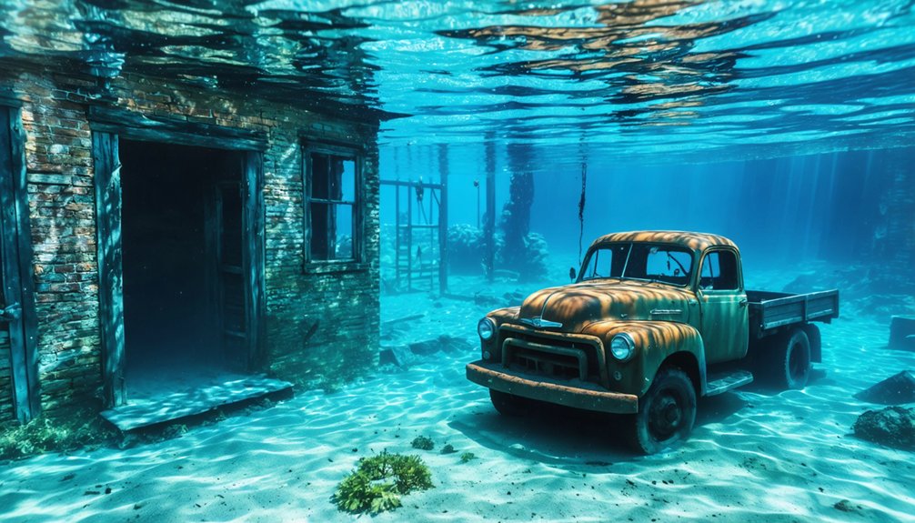
You’ll find California’s most significant submerged ghost towns beneath four reservoirs: Whiskey Flat (renamed Kernville before its 1952 relocation) under Lake Isabella, Mormon Island—once home to 2,500 residents—flooded by Folsom Dam in 1955, Old Kernville demolished in 1948 and submerged in 1953, and Millerton buried under Friant Dam’s reservoir in 1942. During severe droughts, water levels drop dramatically, exposing foundations, artifacts, and bridge remnants that reveal these communities’ Gold Rush heritage and the infrastructure projects that displaced them.
Key Takeaways
- California submerged several towns including Whiskey Flat, Mormon Island, Old Kernville, and Millerton beneath reservoirs created by dam construction projects.
- These towns now rest under lakes like Isabella, Folsom, and Millerton, with relics visible only during severe droughts and low water.
- Mormon Island supported 2,500 residents during the Gold Rush before Folsom Dam flooded it in 1955, exposing artifacts during recent droughts.
- Old Kernville was demolished in 1948 and submerged in 1953 beneath Isabella Dam’s 570,000 acre-feet reservoir, now permanently inaccessible.
- Millerton became flooded in 1942 by Friant Dam, burying the Fresno County seat and Yokuts tribal heritage beneath a 15-mile reservoir.
Whiskey Flat: The Town That Became Kernville Before Disappearing
When ‘Lovely’ Rogers tracked his stray mule from Keysville in 1860, he stumbled upon the Big Blue Ledge—a discovery that would transform the Kern River Valley into one of California’s most significant gold rush sites.
Over 35,000 miners flooded the area, creating a settlement initially called Rogersville.
By 1863, you’d find it renamed Whiskey Flat after Adam Hamilton’s profitable saloon—two whiskey barrels topped with a plank serving thirsty prospectors.
The town’s evolution continued when objections prompted another name change to Kernville in 1864.
Hamilton had relocated from Quartzburg, another mining camp established earlier in 1860, before founding his whiskey operation in what would become Kernville.
The original town relocated in 1952 due to the risk of reservoir flooding.
Today, mining relics and town legends rest beneath Lake Isabella‘s waters, submerged since the 1954 dam construction.
When reservoir levels drop, you’ll spot foundations of this gold rush community.
The Whiskey Flat Days festival preserves these stories annually.
Mormon Island: A Prosperous Mining Settlement Lost to Folsom Lake
At its 1853 zenith, Mormon Island supported approximately 2,500 residents with four hotels, seven saloons, fifteen businesses, and regular stage service connecting it to Sacramento.
The settlement’s stone foundations, capped wells, and structural debris now rest beneath Folsom Lake, submerged since the dam’s 1955 completion. The Mormon Island Mining Association had invested in hydraulic works including canals and dams to alter the American River’s course near the settlement.
When drought conditions lower the reservoir’s water level, you’ll find these physical remnants exposed along the original gravel bar location three miles east of Folsom. The name Mormon Island also refers to multiple other geographical locations, requiring disambiguation in historical records.
Peak Population and Infrastructure
Mormon Island’s transformation from a modest hunting camp to a bustling settlement occurred with remarkable speed. You’ll find that by summer 1848, the site supported 200-300 miners, growing to over 2,500 residents by 1853.
This population sustained seven saloons, four hotels, and five general merchandise stores. The settlement’s historic architecture included essential infrastructure: a post office (established 1851), school, bakery, two blacksmiths, and even a winery.
Mining techniques drove this prosperity, with the settlement’s unique man-made canal creating the “island” designation while facilitating gold extraction operations. You’d have encountered Sam Brannan’s store, which controversially required miners’ tithing. Brannan would later become California’s first millionaire and serve as a senator.
The town functioned as a critical stage line stop between Sacramento and Coloma until its population dwindled to zero by 1880, decades before Folsom Lake’s waters claimed it. The community’s vibrant social life included the first ball in the Sacramento area, held on December 25, 1849.
Drought Reveals Lost Landmarks
Less than a decade after Mormon Island’s founding, fire swept through the settlement and destroyed much of the town’s infrastructure. You’ll find that the community never recovered, and crime accelerated its decline before Folsom Dam construction sealed its fate in 1955.
When California’s drought conditions dropped water levels in 2007, the reservoir revealed building foundations, bricks, pottery fragments, and an arched bridge structure. The town’s center lies 70 feet underwater, requiring levels to drop another 90 feet for complete visibility.
Ancient forests now surround the exposed ruins where miners once used river navigation along the American River’s forks. At its peak in 1853, Mormon Island was a gold rush boomtown with a population of 2,500, featuring saloons, hotels, and active gold mines. Major exposures occurred in 2015 and 2021. You can hike one mile to view artifacts during droughts, though removing items from this State Recreation Area remains illegal. The Mormon Island Cemetery was relocated to a hillside along Green Valley Road before the flooding, with family members and church records guiding the exhumation process.
Old Kernville: The Original Gold Rush Community Beneath Isabella Dam
Deep beneath Isabella Reservoir‘s 11,200-acre surface lies the original town of Kernville, a gold rush settlement that flourished in the Kern River Valley during the 1860s.
Before its deliberate destruction and submersion in 1953, the town was a vibrant community. You’ll find evidence of this community displacement in over 1,300 photographs documenting the town’s 1948 demolition—five years before Isabella Dam’s completion forced both Kernville and Lake Isabella to higher ground.
The 1870 census reveals a diverse mining community: 79% male, with significant Chinese (12%), Mexican (9%), and Irish (7%) populations working precious metal claims. Construction of the dam necessitated new road construction above the original townsite.
Today, underwater archaeology remains impossible at this site. The former townsite rests permanently submerged beneath Kern County’s largest reservoir. Its cultural resources are inaccessible except through historical records and a lakeside marker indicating where freedom-seeking miners once staked their claims. The reservoir can hold up to 570,000 acre-feet of water, ensuring the original town remains deeply buried beneath the surface.
Millerton: Submerged by Progress Along the San Joaquin River
You’ll find Millerton’s story begins with Friant Dam’s completion in 1942, when the 319-foot structure submerged the former Fresno County seat beneath what became a 15-mile-long reservoir.
The site holds significance beyond dam engineering—it encompasses Yokuts tribal heritage now resting underwater and marks a calculated sacrifice of community for Central Valley Project water distribution.
When lake levels drop, you can observe the SS Relief floating restroom near the original townsite, serving as one of the few physical remnants of this deliberate inundation.
Friant Dam Construction History
When groundwater over-pumping threatened California’s agricultural future in 1919, planners envisioned the Central Valley Project as a state-funded solution to the crisis.
The Great Depression derailed state financing, prompting federal intervention when President Roosevelt approved Friant Dam construction in 1935.
You’ll find this historic engineering marvel broke ground November 5, 1939, with Griffith and Bent Companies securing an $8.7 million contract. Their 1,500-person crew poured first concrete July 29, 1940, achieving peak placement rates of 5,500 cubic yards daily by March 1941.
Despite wartime constraints, workers completed the structure by June 1942, creating Millerton Lake’s 520,500-acre-foot capacity.
The dam’s environmental impact proved severe—dried riverbed sections devastated salmon populations while submerging Millerton beneath the reservoir, though it irrigated 15,000 Valley farms.
Yokuts Heritage and Legends
For over 8,000 years before Friant Dam’s completion, Yokuts peoples inhabited the San Joaquin Valley’s fertile riverbanks, creating one of pre-Columbian North America’s most densely populated regions. The San Joaquin River sustained their civilization through indigenous fishing practices, with Chinook salmon populations reaching 200,000-500,000 adults annually. Yokuts storytelling preserved ecological knowledge about snowmelt-fed flows and the critical “June Rise” that enabled navigation and spawning cycles.
Key elements of Yokuts river heritage:
- Native trails along the river preceded Millerton Road’s modern route
- Central Valley’s largest spring-run Chinook salmon population thrived here
- Salmon runs functioned as a “superhighway” through their territories
- Oral traditions documented seasonal flood patterns essential for sustenance
Their displacement began fifty years before dam construction, driven by water diversion and railroad expansion.
SS Relief Restroom Landmark
The submersion of Millerton beneath the San Joaquin River created Millerton Lake, a 4,900-acre reservoir that now hosts over 300,000 annual visitors who navigate waters concealing the historic town’s foundations.
Floating restrooms like Lake Casitas’s S.S. Relief represent essential reservoir infrastructure for unrestricted water access. Casitas Municipal Water District deployed this $50,000 facility in 1991, addressing sailors’ complaints about constant docking interruptions.
The structure features two airline-style units with contained flushing systems, withstanding 80 m.p.h. winds while anchored in swimming-prohibited waters.
California maintains over 100 active floating lavatories across 260-plus installations since the 1970s. These boat-accessible facilities support thousands who choose extended time on open water, exemplifying how modern engineering adapts to regulatory constraints without limiting recreational freedom in submerged historic zones.
Salton Sea’s Abandoned Resorts: From Paradise to Desolation
During the 1950s and 1960s, Salton Sea emerged as Southern California’s premier desert resort destination, drawing over 1.5 million visitors annually to communities like Bombay Beach, Salton City, North Shore, and Desert Shores.
Paradise in the desert: 1.5 million annual visitors flocked to Salton Sea’s yacht clubs and resort communities during its 1950s-60s heyday.
You’ll find remnants of a $20 million investment that created yacht clubs, marinas, and entertainment venues where Frank Sinatra and the Beach Boys once performed.
Timeline of Collapse:
- 1970s Flooding – Devastating floods destroyed shoreline infrastructure and entire towns.
- Agricultural Contamination – Salt and pesticide runoff poisoned fish populations and created toxic conditions.
- 1981 Marina Destruction – Marine Paradise’s jetty collapsed, ending recreational boating.
- Ecological Decline – Rising salinity and algae blooms triggered massive die-offs.
Urban decay now defines these once-thriving communities, where abandoned buildings stand as monuments to environmental catastrophe and lost freedom.
When the Waters Recede: Drought Reveals California’s Sunken Past
While environmental contamination drove abandonment at Salton Sea, California’s other submerged settlements face periodic exposure through drought cycles. Lake Isabella’s drop to 8% capacity reveals Whiskey Flats after 70 years underwater, while Folsom Lake’s record lows expose Mormon Island’s foundations, rock walls, and ancient artifacts normally beneath 60 feet of water.
Old Kernville surfaces where 55 feet of water existed in 2018. These Gold Rush-era towns, sacrificed for 1950s dam construction, emerge as climate change and overuse accelerate reservoir depletion.
Lake Mead reached its lowest elevation since filling—327 meters. Experts estimate 90% of California’s gold remains submerged in these reservoirs, potentially including underground tunnels from 1800s mining operations. Yet water’s value now exceeds untapped mineral wealth.
Frequently Asked Questions
Can You Scuba Dive or Snorkel to Explore the Submerged Towns?
No, you can’t scuba dive these sites. Submerged structures remain perpetually prohibited—wildlife refuge regulations, unsafe conditions, and permanently poor underwater visibility prevent access. You’ll only explore during drought-exposed periods when marine life encounters don’t apply to these freshwater reservoirs.
Were Residents Compensated When Their Towns Were Flooded for Dam Construction?
Compensation policies varied by project, though records remain incomplete. You’ll find Kennett residents sold land to the government, but resettlement challenges weren’t documented for Millerton or Whiskeytown, suggesting inconsistent federal oversight of displacement procedures.
Are There Organized Tours to Visit These Underwater Ghost Towns?
You’ll find no organized tours available—these sites lack historical preservation infrastructure and tourist safety protocols. You’re free to explore independently at Lake Almanor and Whiskeytown, though you’ll need proper certification and equipment for safe exploration.
What Happened to the Buildings and Belongings Left Behind When Towns Flooded?
Your freedom to explore history ends where water claimed everything. Buildings and belongings were abandoned in place, creating submerged archaeological sites. Historical preservation occurs only through documentation—Environmental impact studies show structures deteriorating underwater, inaccessible to you.
Is It Legal to Remove Artifacts From Exposed Ghost Town Sites?
No, you can’t legally remove artifacts from exposed ghost town sites. Federal and state laws protect cultural heritage at these locations, treating removal as artifact theft with penalties reaching $250,000 in fines plus possible jail time.
The history of Wrights, California ghost town reveals a rich tapestry of stories and lives once lived in what is now a quiet relic. Many visitors flock to the area not only to explore its remnants but also to understand the significance of maintaining these sites for future generations. Preserving such locations is crucial, as they hold invaluable lessons about our past and the legacies left behind.
References
- https://vinepair.com/booze-news/california-whiskey-flat-underwater/
- https://www.ksl.com/article/35922070/3-underwater-ghost-towns-uncovered-by-drought
- https://www.themodernpostcard.com/the-salton-sea-a-ghost-of-former-glory-in-the-california-desert/
- https://en.wikipedia.org/wiki/Mormon_Island
- https://www.youtube.com/watch?v=tzAEhn1O5xM
- https://thekidshouldseethis.com/post/folsom-lake-mormon-island-lost-gold-rush-ghost-town-underwater
- https://ohp.parks.ca.gov/listedresources/Detail/132
- https://www.latimes.com/archives/la-xpm-1987-02-01-tr-78-story.html
- https://en.wikipedia.org/wiki/Kernville_(former_town)
- https://www.youtube.com/watch?v=xUKZ6QTlunk


