Connecticut’s largest man-made lakes conceal entire communities deliberately flooded for hydroelectric development. You’ll find Jerusalem Village beneath Candlewood Lake, submerged in 1928 when over 100 structures—including a grist mill, school, and homes—were systematically dismantled or burned. Divers encounter preserved stone foundations, road networks, Model T Fords, and agricultural machinery at 40-foot depths. Barkhamsted Hollow met a similar fate in 1940 beneath the Barkhamsted Reservoir. These underwater archaeological sites contain masonry remains, cemetery relocations, and infrastructure traces that document Depression-era displacement through eminent domain. Further exploration reveals the engineering ambitions and human costs behind these submerged landscapes.
Key Takeaways
- Jerusalem Village lies submerged beneath Candlewood Lake after deliberate flooding in the late 1920s for hydroelectric development.
- Over 100 structures including foundations, mills, schools, and homes remain preserved on the lake floor at 40-foot depths.
- Divers explore underwater artifacts like Model T Fords, farm equipment, stone walls, and the original road network connecting towns.
- The flooding displaced 35 families and required cemetery exhumations to create Connecticut’s largest lake covering 5,420 acres.
- Scuba access requires permits due to private ownership, with visibility challenges limiting exploration of Depression-era settlement remains.
The Flooded Village of Jerusalem Beneath Candlewood Lake
Beneath the serene waters of Candlewood Lake lies the submerged settlement of Jerusalem, a once-thriving village in Connecticut’s Rocky River Valley that was deliberately flooded in the late 1920s.
You’ll find structural foundations, stone walls, and remnants of a grist mill, school, and residential dwellings preserved beneath 429 feet elevation. The 1928 flooding event left buildings standing—some burned to foundations—creating an accessible archaeological site for scuba divers.
Beneath 429 feet of water, Jerusalem’s foundations, mill remains, and charred structures create an eerie underwater archaeological preserve for modern divers.
Ancient artifacts from Chief Squantz’s tribes, including arrowheads and pottery, remain documented in the area. Underwater flora now colonizes the preserved structures, while submerged roads connecting Brookfield, New Milford, and New Fairfield remain intact. Divers have discovered Model T Fords and plane wreckage that accumulated in the lake over the decades.
You’re witnessing a deliberate cultural sacrifice: over 100 relocated structures enabling hydroelectric development. The reservoir spans 61 miles of shoreline with numerous coves and islands dotting its expanse.
Valley Forge: A Welsh Settlement Lost to the Saugatuck Reservoir
The historical record contains no archaeological or documentary evidence of a Welsh settlement named Valley Forge submerged beneath Connecticut‘s Saugatuck Reservoir.
Claims attributing Welsh immigrant displacement to this reservoir’s 1932-1942 construction contradict archival data, which identifies Valley Forge exclusively as Pennsylvania’s 1777-1778 Continental Army encampment site and an associated ironworks community. The Pennsylvania site was established by Quaker industrialists in 1742 and surrounded by farmland inhabited by Welsh Quaker farmers, Germans, and Swedes. The encampment housed soldiers from all 13 colonies except South Carolina and Georgia, alongside approximately 400 women and children.
You’ll find Connecticut’s “Valley Forge” refers solely to Redding’s 1778-1779 military encampment—a nickname derived from comparable winter hardships, not a flooded Welsh village requiring compensation assessments.
As the chill of winter sets in, outdoor enthusiasts often seek out unique adventures. One intriguing option is the winter exploration of New Hampshire ghost towns, where remnants of past lives tell stories of resilience and forgotten dreams. These solitary landscapes offer a haunting beauty, inviting visitors to ponder the histories that lie just beneath the snow.
Welsh Immigrants Settle Valley
During the early 18th century, Welsh Quaker colonists established agricultural settlements across the Valley Forge area, transforming indigenous Lenape territories into proto-industrial farmsteads through systematic land clearance and infrastructural development.
You’ll find cultural heritage preserved through archaeological investigation of the 1742 Mount Joy Iron Forge, where the Potts family engineered extensive ironworks and milling operations. The settlers leveraged exceptional agricultural soils north of the Schuylkill River’s confluence with Valley Creek, cultivating wheat, rye, hay, and Indian corn while maintaining livestock populations of cattle, sheep, and swine. Despite the harsh winter conditions that would later characterize military encampments in Connecticut, these agricultural communities established resilient patterns of settlement that sustained both civilian and military populations throughout the Revolutionary era. Similar to Connecticut’s encampments, soldiers at Valley Forge faced severe hardships including inadequate clothing and blankets that prompted formal grievances to military leadership.
Inadequate Compensation for Displacement
Centuries after Welsh Quakers transformed this Connecticut valley into a thriving agricultural and manufacturing settlement, the Bridgeport Hydraulic Company initiated systematic land acquisition along the Saugatuck River’s tributaries around 1920, targeting a 635-acre impoundment site at 283 feet elevation.
Depression-era families surrendered property rights willingly, while affluent landowners rejected compensation they considered inadequate for homestead displacement.
Connecticut’s General Assembly granted the corporation condemnation authority in 1927, enabling seizure of 4,500 of 5,000 required acres by 1936.
You’ll find the town received merely $40,000 in 1938 for infrastructural damages.
The reservoir’s projected 12-billion-gallon capacity became the paramount liquid asset, overshadowing resident opposition.
Courts systematically dismissed property rights claims, establishing precedent that would echo through subsequent eminent domain controversies across Connecticut’s water-dependent municipalities.
The flooding erased Valley Forge’s physical presence, submerging homes and businesses beneath the Saugatuck Reservoir’s cool waters to meet Fairfield County’s expanding industrial water demands.
Today, stone foundations and remnants of the lost community remain visible beneath the reservoir’s surface, tangible markers of the displaced settlement.
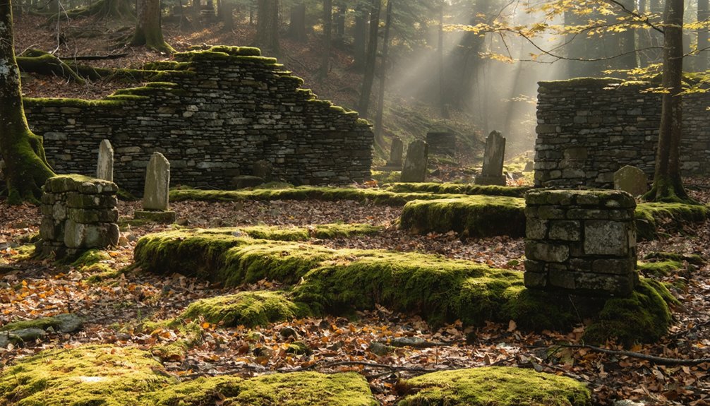
Barkhamsted Hollow and the Creation of Connecticut’s Largest Water Supply
As Connecticut’s population surged in the early twentieth century, the state legislature received an application in 1929 to construct what would become the Barkhamsted Reservoir—the state’s largest water supply infrastructure project.
You’ll find approval came in 1933, establishing the Metropolitan District Commission to manage Hartford’s water expansion. The agency systematically acquired 80 properties throughout the 1930s, displacing over 1,000 residents from Barkhamsted Hollow.
Construction of the Saville Dam commenced in August 1934, with the earthen structure stemming the Farmington River’s east branch by 1940. The dam was named after chief engineer Caleb Mills Saville, who oversaw the project’s completion.
The reservoir first delivered water to Hartford on December 21, 1944, eventually reaching 30 billion gallons capacity in 1948. The project required 20 miles of highway to be relocated and four cemeteries containing 1,300 interments to be removed.
This infrastructure fundamentally altered regional aquatic ecosystems while establishing unprecedented water quality standards for Connecticut’s metropolitan areas.
Underwater Remnants: What Lies Beneath the Surface
You’ll find structural remains from Barkhamsted Hollow’s inundation preserved beneath the reservoir’s surface, including building foundations, bridge abutments, and roadbed traces.
Archaeological documentation reveals these submerged features maintain spatial relationships similar to the original settlement pattern, with stone foundations marking former residential and commercial structures.
Abandoned agricultural equipment and vehicle remnants scattered across the reservoir floor provide additional material evidence of the community’s rapid displacement during reservoir construction.
Preserved Buildings and Bridges
Beneath Candlewood Lake’s surface, over 100 displaced structures from Jerusalem Village have left archaeological signatures that document Connecticut’s largest reservoir construction project. You’ll find covered bridges, a grist mill, and school building foundations preserved on the lake floor since 1928.
Fisherman stories report snagging lines on submerged structures that now serve as wildlife habitats for bass and pike populations. Masonry and brick-built remnants remain traceable despite 10-foot visibility conditions requiring tactile navigation.
The pre-modern road network connecting Brookfield and New Milford persists underwater, enabling systematic documentation of the original village layout. These intact foundations provide uncompromised records of Depression-era rural infrastructure, offering you direct access to Connecticut’s settlement patterns without modern disturbance or commercial development restrictions.
Abandoned Vehicles and Equipment
Beyond architectural foundations, Candlewood Lake’s reservoir bed contains substantial vehicular and mechanical assemblages from the 1928 inundation event. You’ll find Model T Fords and farm equipment abandoned by relocated inhabitants, now accessible through marine archaeology expeditions launched from Brookfield dive facilities. These submerged ecosystems preserve machinery from Jerusalem Village’s grist mill operations and agricultural infrastructure.
Gardner Lake similarly reveals forced-relocation artifacts, including an entire dwelling that broke through winter ice during transport. Saugatuck Reservoir’s drought-exposed strata display fence posts and threaded materials from 1938 flooding.
Documentation includes post-creation aircraft wreckage and military vehicles at undisclosed locations. Modern low-water events expose fragmented automotive remains, providing archaeological evidence of rapid 1920s-1930s displacement. You’re witnessing tangible proof of government-mandated relocations preserved beneath Connecticut’s reservoir surfaces.
Roads and Foundation Traces
Where modern recreational boaters navigate open water, submerged road networks from Connecticut’s pre-reservoir settlements create navigable archaeological corridors for technical divers conducting historical documentation. You’ll find traceable routes connecting Brookfield and New Milford with New Fairfield beneath Candlewood Lake, established when over 5,000 acres flooded between 1926-1928.
Underwater topography reveals masonry foundations from 100+ demolished Jerusalem village structures, burned to ground level before inundation yet leaving intact stone bases. Road infrastructure remains sufficiently preserved for navigation and settlement pattern analysis.
Preservation techniques employed by modern archaeological divers document these artifacts at 40-foot average depths, mapping routes that followed river corridors before Connecticut Light & Power’s reservoir projects. Foundation traces provide tangible evidence of residential communities erased for hydroelectric development, offering you unprecedented access to submerged historical landscapes.
Engineering Ambitions: Building Connecticut’s Man-Made Lakes
On July 15, 1926, the Connecticut Light & Power Company board authorized what would become the nation’s first large-scale pumped storage hydroelectric facility—an engineering venture that would permanently submerge 5,420 acres across five municipalities.
Hydroelectric development required a 13-foot-diameter pipe pumping Housatonic River water to an elevated reservoir, with gravitational flow through penstocks generating electricity during peak demand.
The system pumped river water upward through massive pipes, then released it downward through turbines when electricity demand peaked.
Land acquisition proceeded through eminent domain, displacing 35 families whose holdings predated the Revolution.
The U.G.I Contracting Company mobilized 1,400 laborers who cleared 4,500 acres, demolished 100 structures, and exhumed cemetery remains for $1 per body.
Construction teams completed the 952-foot-wide, 100-foot-high dam in 26 months.
Pumping commenced February 25, 1928, creating Candlewood Lake’s 16-mile expanse by September 29, 1928—a $6 million transformation of inhabited valleys into industrial infrastructure.
Displacement and Compensation: The Human Cost of Progress
While Connecticut Light & Power Company touted engineering innovation, the human infrastructure it erased remains documented in acquisition records and archaeological surveys.
You’ll find stark contrasts in compensation practices: Candlewood’s 35 families received fair market rates through voluntary contracts, while Valley Forge’s Welsh settlement inhabitants got pennies on the dollar—corporate theft disguised as progress.
Workers earned $1 per exhumed body from relocated graveyards.
The ecological impact extended beyond 5,000 cleared acres; entire urban architecture systems now rest underwater—roads, churches, stores submerged across multiple sites.
Barkhamsted Hollow’s 1940 flooding split townships, destroying community networks.
These weren’t mere land transactions but systematic dismantling of generational homesteads, where abandoned farm equipment and burned foundations mark sites of forced exodus under eminent domain’s shadow.
Exploring Connecticut’s Submerged History Today
Beneath Candlewood Lake‘s 5,520-acre surface, divers access pre-1928 infrastructure through permitted entry points at New Fairfield and Sherman boat launches, where local Brookfield dive shops coordinate scuba expeditions to submerged road networks linking former Brookfield, New Milford, and New Fairfield settlements.
You’ll find *ideal* visibility during late summer drawdowns when water quality improves and lake ecology shifts expose masonry foundations, Model T Fords, and covered bridge remnants at depths reaching 80 feet.
Saugatuck Reservoir’s seasonal maintenance drawdowns reveal Valley Forge village ruins without scuba certification—hiking trails provide surface-level access to exposed building outlines.
At Barkhamsted Reservoir, you’ll trace the flooded Barkhamsted Hollow along shoreline paths, where relocated structures mark 1940 inundation boundaries.
Private ownership complicates certain sites; Candlewood Lake Authority permits and Bridgeport Hydraulic Company permissions remain mandatory for legal exploration.
Frequently Asked Questions
Are There Other Submerged Towns in Connecticut Besides These Three Villages?
No other submerged settlements exist in Connecticut’s waters—you’ve discovered them all! Aerial photography and historical records confirm only Jerusalem village, Candlewood Lake’s foundations, and Gardner Lake’s sunken house constitute Connecticut’s complete underwater archaeological inventory.
Can Recreational Divers Legally Explore the Underwater Ruins of These Towns?
You’ll find legal restrictions vary considerably: Candlewood Lake permits recreational diving at submerged archaeological sites, while Saugatuck and Barkhamsted reservoirs prohibit access due to watershed protection regulations and diver safety concerns from utility companies.
Do Water Levels Ever Drop Low Enough to Expose the Ruins?
Drought’s revelation rarely occurs—Saugatuck’s 2025 drawdown exposed Valley Forge foundations, demonstrating environmental impact on historical preservation. You’ll find Candlewood and Barkhamsted maintain stable hydroelectric levels, keeping archaeological strata submerged. True exposure remains exceptional, not routine.
Were Any Human Remains Left Behind When These Villages Were Flooded?
No human remains were intentionally left behind. You’ll find workers relocated graveyards before flooding, though preservation challenges exist. The archaeological significance lies in submerged structures and artifacts, not bodies—all documented relocations occurred despite minimal compensation for displaced residents.
What Happened to the Descendants of Families Displaced From These Towns?
You’ll find genealogical mysteries remain largely undocumented. Family displacement records weren’t systematically preserved when Candlewood Lake formed. Archaeological surveys prioritized structural remnants over tracking relocated populations, leaving descendants’ histories unexcavated—requiring independent archival research to reconstruct migration patterns.
References
- https://www.onlyinyourstate.com/state-pride/connecticut/underwater-village-ct
- https://www.youtube.com/watch?v=RODeJvoS7NE
- https://www.damnedct.com/what-lurks-beneath/
- https://en.wikipedia.org/wiki/Barkhamsted_Hollow
- https://i95rock.com/discovering-the-lost-town-of-jerusalem-a-fascinating-dive-into-candlewood-lakes-history/
- https://wanderwisdom.com/news/abandoned-town-ct-reservoir
- https://candlewoodlakeauthority.org/History-of-the-Lake
- https://candlewoodlakelife.com/blog/a-history-of-candlewood-lake/
- https://en.wikipedia.org/wiki/Valley_Forge
- https://www.nps.gov/vafo/learn/historyculture/valley-forge-history-and-significance.htm