Georgia’s reservoir systems conceal at least fifteen documented towns submerged between 1913 and 1958, when dam projects flooded over 151,000 acres. You’ll find entire settlements like Etowah beneath Lake Allatoona, Petersburg under Clarks Hill Lake, and seven Cherokee towns lost to Tellico and Calderwood Lakes. These sites include visible foundations, cemeteries, and infrastructure that emerge during droughts. Over 700 families were displaced from Lake Lanier alone, with communities like Oscarville‘s 1,100+ Black residents receiving zero compensation. The full archaeological record and exploration methods reveal considerably more complexity.
Key Takeaways
- Georgia’s major dams built between 1910-1958 submerged entire towns including Burton, Petersburg, Etowah, and Andersonville under created reservoirs.
- Petersburg, an 1786 tobacco hub, now lies beneath Clarks Hill Lake with ruins accessible as a park site.
- Seven Cherokee towns with deep cultural significance were flooded under Tellico and Calderwood Lakes, erasing indigenous heritage.
- Over 700 families were displaced for Lake Lanier alone, with Oscarville’s 1,100+ Black residents receiving zero compensation.
- Submerged structures become visible during droughts, revealing foundations, chimneys, and roads for exploration despite underwater hazards.
The Dam Projects That Changed Georgia’s Landscape
Between 1910 and 1958, Georgia’s river systems underwent radical transformation as engineers constructed multiple dam complexes that permanently altered the state’s topography and submerged entire communities beneath millions of acre-feet of water.
You’ll find five major projects dominating this period: Tallulah Falls (1913), Clark Hill (1954), Hartwell (1960s), and Buford Dam creating Lake Lanier (1956-1958).
These developments generated 166,420 kilowatts collectively while flooding 151,063 acres of land and water.
The Corps of Engineers and Georgia Power Company drove these initiatives, citing flood control, hydroelectricity, and Atlanta’s water supply as justification. North Georgia lacked lakes prior to these modern dam projects, making the transformation even more dramatic.
The town of Burton vanished completely beneath 2,775 acres of Lake Burton when its dam was completed in 1919.
However, ecological impacts received minimal consideration during planning phases.
Indigenous history and existing settlements like Petersburg and Andersonville disappeared permanently beneath reservoir waters, their cultural significance sacrificed for centralized power generation and government-controlled resource management.
Etowah: A Town Erased by Allatoona Dam
When Mark Anthony Cooper departed political life, he established Etowah in Bartow County as an industrial settlement centered on iron production. The town developed systematic infrastructure, documented municipal agreements, and established residential districts.
Construction of Allatoona Dam prioritized hydroelectric generation and water management over preservation of existing settlements. The flooded landscape contains structures, crossroads, and community records inaccessible to property owners whose families maintained generational ties to the region.
Beneath reservoir waters lie inaccessible structures and records, severing property owners from their families’ generational ties to the region.
Official documentation supersedes oral tradition, although local legends preserve memories of the town’s layout and industrial operations. Archaeological discoveries beneath reservoir waters remain limited due to access restrictions. Archeologist Lisa Russell uncovers the lost history of these submerged communities through detailed historical research. These submerged locations are now heavily buried and lost, with exact sites unknown to the public.
Etowah’s deliberate submersion represents government-directed displacement rather than natural catastrophe. It exemplifies forty-plus North Georgia communities erased through federal dam projects, demonstrating systematic removal of established populations for centralized infrastructure objectives.
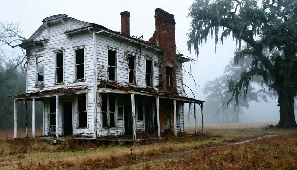
Petersburg: From Thriving Frontier City to Underwater Ruin
Petersburg stood as Georgia’s third-largest town in the early 1800s, operating as a critical tobacco inspection center where flat-bottom “Petersburg Boats” transported goods downstream from the Broad River Valley.
The settlement’s decline began in the 1820s when westward expansion devalued land, cotton replaced tobacco, and railroads bypassed the location in favor of Augusta. Periodic yellow fever outbreaks further reduced the population during this decline.
You’ll find the town’s foundations beneath J. Strom Thurmond Lake at Bobby Brown State Park, where relocated graves and visible ruins during low water levels document this frontier city’s transformation from commercial hub to submerged archaeological site. The town had experienced devastating floods before its submersion, including the Yazoo Freshet of 1796 when water levels rose from 35 to 40 feet, submerging parts of the settlement and washing away bridges.
Petersburg’s Prosperous Early Days
At the junction of the Broad and Savannah rivers, Dionysius Oliver established Petersburg in 1786, naming the settlement after his Virginia birthplace and positioning it on the site of the earlier community of Dartmouth.
The town’s strategic location in upper Georgia’s Broad River Valley attracted Virginian and Carolinian tobacco planters, transforming it into a commercial powerhouse.
Petersburg’s prosperity rested on four foundations:
- Tobacco warehouses serving as inspection stations for casked produce
- Pole boat connections to Augusta along the Savannah River
- Historical architecture including two-story commercial buildings
- Distinguished settlers like Governor William Wyatt Bibb and Judge Charles Tait
Oliver divided the town into eighty-six half-acre lots initially, selling all lots and adjacent lands between 1786 and 1808 to eager investors from Georgia, South Carolina, and Northern states.
General George Matthews brought Virginians and Carolinians to the area in 1784, helping to establish the initial wave of settlement that would become Petersburg.
Visiting the Submerged Ruins
During the 1820s, land values plummeted throughout Petersburg as economic conditions deteriorated, initiating a prolonged decline that would ultimately doom the settlement.
By the early 1950s, the U.S. Army Corps of Engineers flooded the already-abandoned site for Clarks Hill Reservoir construction, now J. Strom Thurmond Lake.
You’ll find Bobby Brown State Park manages these ruins as a premier historical attraction in Elbert County.
When lake levels drop markedly, you can access visible foundations from the lakeshore.
The site draws thousands annually seeking authentic lake heritage experiences.
A 1988 multi-disciplinary investigation by maritime historians and archaeologists documented submerged features.
Scuba divers conducting underwater exploration reveal dozens of Georgia’s historic sites beneath these waters, alongside fellow submerged towns Lisbon and Vienna.
The town’s final structures, chimneys, disappeared beneath the rising reservoir waters as the flooding completed.
The Submerged Cherokee Heritage of North Georgia
Beneath North Georgia’s expansive reservoir systems lie seven major Cherokee townsites—Chota, Tanasi, Toqua, Tomotley, Citico, Mialoqua, and Tuskegee—now submerged under Tellico and Calderwood Lakes following the damming of Little Tennessee River sections. These sites represent the deepest regional Cherokee traditions, erased when twentieth-century infrastructure projects prioritized hydroelectric power over cultural preservation.
The scope of heritage loss includes:
- Carters Lake: Submerged Coosawattee Valley, former Cherokee Nation capitol area
- Nickajack Lake: Flooded numerous Cherokee settlements
- Lake Jocassee/Keowee: Covered sites following 1973 Whitewater River damming
- Fontana Lake: Formed through 1930s land appropriation
Lake Jocassee’s name derives from the Cherokee language, meaning “Place of the Lost One”, a haunting reflection of the indigenous communities now beneath its emerald waters.
Underwater archaeology remains limited at these locations.
The submerged heritage sites remain largely unexplored, their cultural significance obscured beneath reservoir waters with minimal archaeological documentation or recovery efforts.
Local mythsspersist regarding unsettled souls haunting submerged areas—testament to forcible displacement that mirrors earlier Cherokee removal policies, now perpetuated through permanent inundation.
Communities Displaced: The Human Cost of Progress
You’ll find documented evidence of over 700 families displaced from their homes during Lake Lanier’s construction alone, representing systematic community erasure across North Georgia’s 40+ reservoir projects.
Government contractors targeted economically vulnerable towns like Petersburg—once Georgia’s third-largest city—where industrial decline had already weakened residents’ capacity to resist eminent domain proceedings.
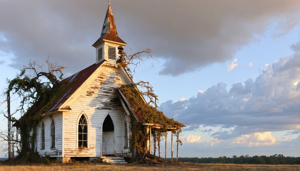
The human cost extended beyond property loss: schoolboys arrived by busloads to disinter graves at Lake Chatuge, relocating entire cemeteries.
Elderly residents like 78-year-old Eliza Brock wielded shotguns against land-clearing operations at Lake Hartwell.
Families Forced From Homes
When Lake Lanier’s waters began rising in 1950, more than 700 families watched their homes, farms, and communities disappear beneath the surface—a pattern of displacement that had already swept across the Southeast through hydroelectric development projects orchestrated by the Tennessee Valley Authority and the U.S. Army Corps of Engineers.
Relocation hardships varied by community:
- Oscarville residents: 1,100+ Black residents lost livelihoods; most received zero compensation
- Petersburg families: Abandoned Georgia’s third-largest city as economic decline preceded deliberate flooding
- Lake Martin evacuees: Hundreds displaced across Alabama with inadequate payment
- Documented land theft: Only 24 of Forsyth County’s Black landowners recorded legitimate sales; others lost property without legal transfer documents
You’ll find strategic targeting of “dying communities” minimized political resistance while maximizing governmental control.
Graveyards Relocated, Communities Erased
Before Lake Lanier’s waters submerged homes and farmland, crews systematically relocated 20 cemeteries containing thousands of graves—a massive logistical operation that required disinterring remains, documenting burial sites, and transferring bodies to higher ground.
You’ll find this pattern repeated across North Georgia’s forty artificial lakes, where more than seven hundred families lost their homes without meaningful negotiation rights.
Engineers deliberately selected economically declining settlements like Petersburg—once Georgia’s third-largest city—to minimize political resistance.
Oscarville, a thriving Black community of 1,100 residents, vanished entirely beneath the waves.
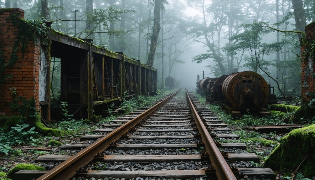
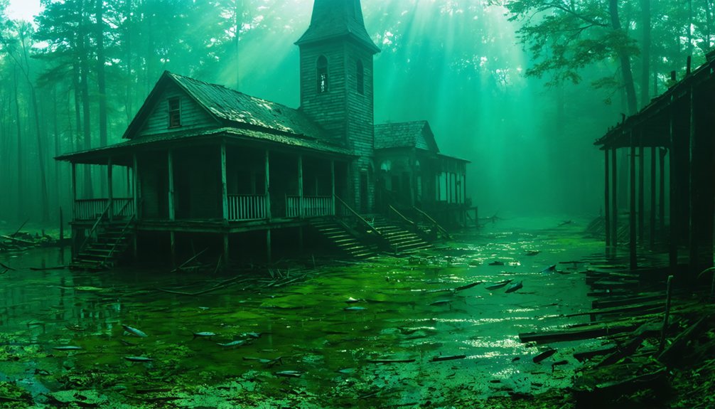
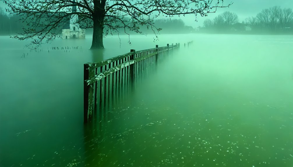
Today’s underwater ecosystems contain foundations, roads, and forgotten infrastructure that occasionally surface during droughts, offering ghostly reminders of historical preservation failures and the communities your government deemed expendable for flood control and hydroelectric power.
Visiting Georgia’s Sunken Towns Today
Although decades have passed since their submersion, Georgia’s underwater ghost towns remain accessible to modern explorers through scuba diving and drought-cycle observation. Water level fluctuations periodically expose foundations, streets, and structural remnants from Oscarville, Jamestown, and Helena.
Marine archaeology enthusiasts document these sites independently, though you’ll navigate undemolished structures creating significant underwater hazards.
Access Methods for Sunken Towns:
- Certified scuba diving at Lake Lanier and Blue Ridge Lake reveals building foundations and walls.
- Extreme drought periods lower water levels, exposing previously submerged structures to surface view.
- Self-directed exploration without restrictions at sites like Loyston and Helena ruins.
- Historical documentation efforts preserve evidence before water returns.
You’re responsible for understanding risks: over 200 deaths occurred 1994-2020 from underwater debris encounters at these locations.
Frequently Asked Questions
Can Scuba Divers Legally Explore the Submerged Town Ruins in Georgia’s Lakes?
Ever wondered what lies beneath Georgia’s surface? You can legally scuba dive these submerged ruins under Army Corps recreational guidelines. Practice marine conservation while capturing underwater photography of historical remnants—no permits needed for non-commercial exploration of these accessible ghost towns.
Were Residents Compensated Fairly When Their Towns Were Flooded for Dam Projects?
Historical displacement records show you’ll find inadequate compensation was typical. Flood impact devastated families—Oscarville residents received insufficient payment, while Etowah and Coosawattee communities lack documented compensation details, revealing government’s disregard for property rights.
What Artifacts Have Been Recovered From Georgia’s Underwater Ghost Towns?
What’s been found beneath Georgia’s waters? You’ll discover archaeological discoveries include 722 prehistoric lithics and 246 historical artifacts from Thurmond Lake surveys, plus brick pillars, bridge piers, and grave markers documented through systematic underwater documentation efforts.
Are There Any Plans to Drain These Lakes and Preserve the Towns?
No drainage plans exist for Georgia’s submerged towns. You’ll find historical preservation remains unfeasible due to ecological impact concerns and the lakes’ critical flood control functions. The Army Corps prioritizes dam operations over underwater town restoration efforts.
How Many Total Towns Were Submerged Across All of Georgia’s Dam Projects?
You’ll find dozens of communities were submerged statewide, though exact counts aren’t documented. Historical preservation took a backseat to hydroelectric development’s environmental impact, as the Corps and authorities prioritized dam construction over recording every displaced settlement.
References
- https://yesterdaysamerica.com/history-submerged-georgias-drowned-towns/
- https://lisamrussell.net/underwater-ghost-towns/
- https://www.blueridgeoutdoors.com/go-outside/sunken-secrets-the-underwater-ghost-towns-of-the-blue-ridge/
- https://www.georgiaencyclopedia.org/articles/history-archaeology/petersburg/
- https://rabunhistory.org/articles/electricity-for-atlanta-six-hydroelectric-dams-a-submerged-town-and-silenced-waterfalls/
- https://lakehartwellguide.com/exploring-the-ghost-town-of-andersonville-lake-hartwells-sunken-mystery/
- https://www.sas.usace.army.mil/About/Divisions-and-Offices/Operations-Division/J-Strom-Thurmond-Dam-and-Lake/History/Pictorial-Timeline/
- https://en.wikipedia.org/wiki/Lake_Lanier
- https://www.youtube.com/watch?v=dBYHqt2CSW4
- https://cincinnatilibrary.bibliocommons.com/v2/record/S170C3764768