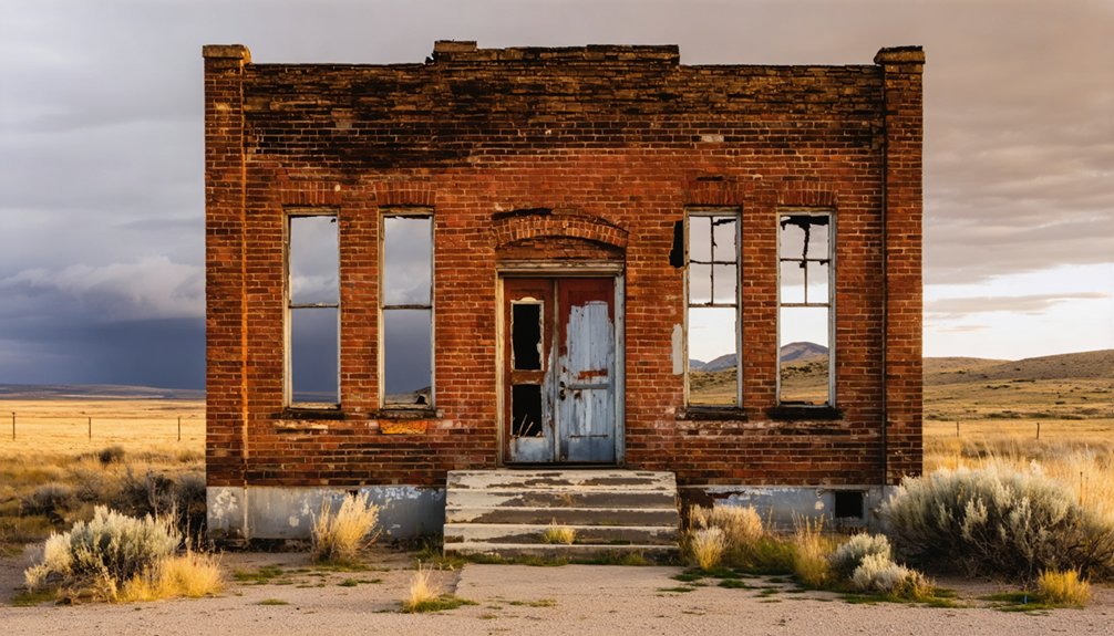
Idaho harbors two submerged ghost towns with starkly different histories. Roosevelt, flooded in 1909 after a catastrophic landslide dammed Monumental Creek, lies beneath Roosevelt Lake 85 miles northeast of Cascade. American Falls met its watery fate through human intervention—the entire town relocated systematically in the 1920s before federal dam construction submerged the original site. You’ll find Roosevelt’s remains scattered underwater, while American Falls’ concrete sidewalks and foundations emerge when reservoir levels drop to five percent capacity, revealing artifacts from both communities’ gold rush origins.
Key Takeaways
- Roosevelt became an underwater ghost town in 1909 when a massive landslide created a natural dam, flooding the entire settlement within eight hours.
- The landslide formed Roosevelt Lake, preserving the townsite 85 miles northeast of Cascade with scattered artifacts and foundations visible during low water.
- American Falls was systematically relocated to higher ground in the 1920s before dam construction, leaving underwater remnants beneath the reservoir.
- When American Falls reservoir drops to five percent capacity, concrete sidewalks, colored glass, and stone features become visible on the lakebed.
- Roosevelt’s natural disaster contrasts with American Falls’ planned relocation, representing different causes of submersion: environmental catastrophe versus federal engineering projects.
American Falls: A Planned Relocation Before the Flood
When the U.S. Bureau of Reclamation launched the American Falls Dam project in the 1920s, you’ll find one of history’s most ambitious relocation efforts.
The original town sat directly on the Snake River floodplain, facing inevitable submersion once the reservoir filled. Unlike typical ghost towns abandoned to rising waters, American Falls underwent systematic town planning.
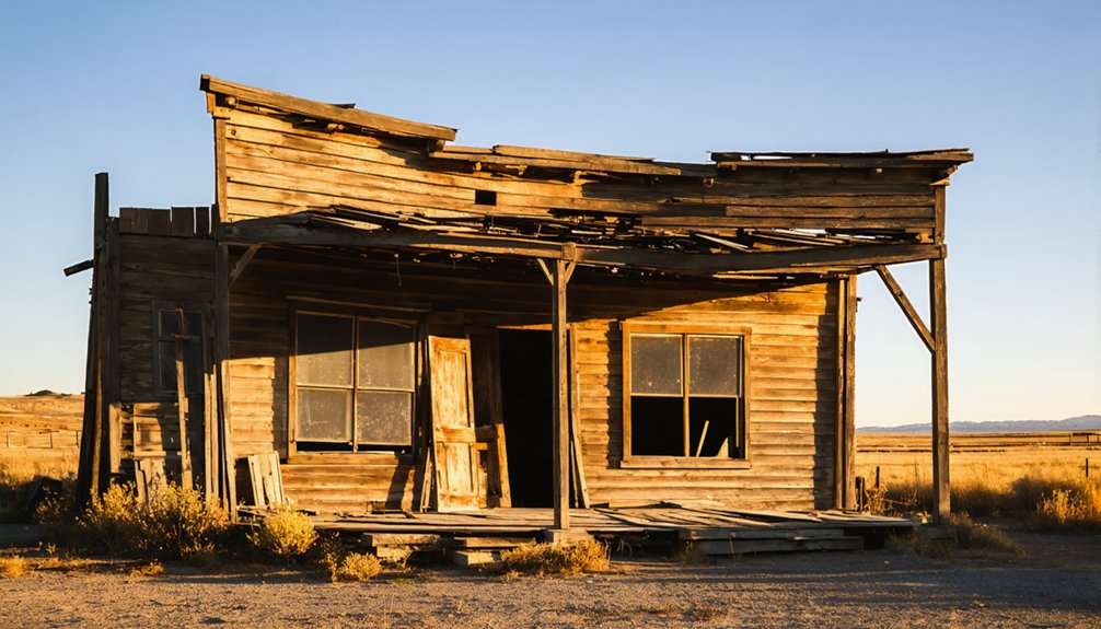
Over 300 structures were relocated to higher ground through government coordination—residents chose to move buildings on wheels or sell by 1925’s end.
This floodplain architecture challenge required multiple moving outfits, particularly for the Gardiner Hotel.
The dam’s April 1926 completion, 60 days early, created Power County’s irrigation lifeline.
The community’s railroad infrastructure was also relocated to higher ground, ensuring transportation continuity for the reestablished town.
The completed dam measured 94 feet high and stretched 5,277 feet wide across the Snake River.
You’re witnessing Idaho’s unique “designed community,” where strategic planning prevented underwater abandonment, establishing a fully operational townsite above reservoir level.
What Remains Beneath American Falls Reservoir
The systematic relocation preserved the community above ground, yet substantial archaeological evidence remains submerged beneath 56,000 acre-feet of reservoir water.
When the reservoir drops to five percent capacity, you’ll observe concrete sidewalks carved with original homeowners’ initials and colored glass fragments from former city bars. Stone landscaping features and home foundations create visible footprints across the exposed lakebed.
The Oneida grain elevator stands as the most prominent surviving structure, overlooking these submerged remnants.
Underwater archaeology reveals sediment layers protecting artifacts from the town’s pre-1927 existence. The Bureau of Reclamation began this massive undertaking in 1925, ultimately relocating nearly 350 residents and 60 businesses to higher ground. American Falls remains Idaho’s only underwater ghost town, making exploration unlike any other historical site in the state.
Recent low water levels enabled drone documentation of these features, providing rare opportunities to examine what the Bureau of Reclamation left behind when creating Idaho’s largest Snake River storage facility.
Roosevelt’s Rise During the Gold Rush Era
The Thunder Mountain gold discovery of 1894 sparked one of Idaho’s most dramatic mining rushes, with Roosevelt emerging as the district’s primary settlement by early 1902.
You’ll find the town’s explosive growth resulted from the Caswell brothers’ initial recovery of $245 in gold over eight days—equivalent to approximately $7,000 in today’s currency—and subsequent promotional claims that Thunder Mountain would become America’s largest gold producer.
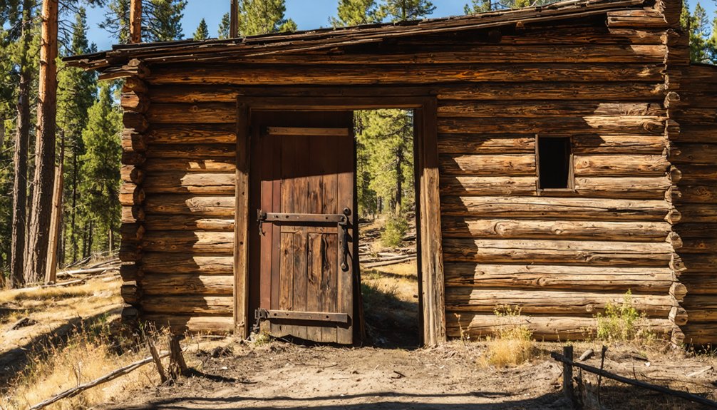
Within months of the rush beginning, Roosevelt’s population swelled to exceed 7,000 inhabitants, transforming 42 tents and four log structures into a substantial commercial center supporting thousands of miners. By summer 1902, the town’s infrastructure expanded to include 14 saloons, 10 stores, and various shops serving the mining community. The mountain earned its distinctive name from lightning strikes sounding like thunder during storms over the peaks.
Thunder Mountain Gold Boom
Gold-bearing outcrops on Thunder Mountain attracted prospectors as early as 1867, though Indian territory designations forced their immediate withdrawal.
You’ll find the breakthrough came in 1894 when gold traced from Mule Creek’s mouth led back to Thunder Mountain’s source.
The Caswell brothers extracted $245 in eight days during 1895, scaling operations to $4,000 by 1899.
Mining engineering assessments proved critical—H.E. Taylor noted geological similarities to Cripple Creek, predicting Thunder Mountain would become Idaho’s premier gold camp.
The Dewey Mine dominated production, yielding over $500,000 after E.H. Dewey’s initial $100,000 investment.
A 40-stamp mill processed up to 120 tons of ore daily near the mines, supporting the region’s large-scale operations.
However, surface enrichment from rhyolite mud slides misled developers about deposit depth.
The frenzy attracted an estimated 20,000 people nationwide heading to the district during the peak of the rush.
Population Exceeds 7,000
News of the Thunder Mountain strike triggered one of Idaho’s most dramatic population surges, with Roosevelt emerging as the district’s primary settlement hub. You’ll find documented evidence that transient populations exceeded 7,000 during the 1902 rush, with up to 3,000 miners simultaneously occupying the region.
By 1904, Roosevelt claimed status as the district’s largest town, sustained by fourteen saloons and ten stores operating from forty-two tents and four log structures. The settlement included essential infrastructure such as a post office, stores, saloons, a hotel, clinic, and assay office serving the bustling mining community.
The seasonal influx continued through 1908, yet this concentrated human activity created unforeseen consequences. Timber removal for millworks eliminated natural snowslide barriers on slopes characterized by geological instability and volcanic mud deposits. These modifications introduced severe hydrological impacts, as deforestation altered drainage patterns along Monumental Creek’s tributaries—conditions that would prove catastrophic when unprecedented snowmelt occurred in 1909. The entire mining district operated under W.H. Dewey’s direction, who had initiated significant mining operations after gold’s discovery in Thunder Mountain.
The Natural Disaster That Claimed Roosevelt
How does an entire town vanish beneath the waters of an artificial lake created not by human engineering, but by nature’s catastrophic intervention? In spring 1909, geological triggers converged when unusually heavy rainfall destabilized already-weakened terrain from years of hydraulic mining.
Nature’s revenge arrived slowly in 1909 when rainfall and mining erosion conspired to bury Roosevelt beneath an unplanned lake.
A massive landslide—three miles long and 200 feet high—blocked Monumental Creek, while a sixty-five-foot mud wall formed where Mule Creek merged with it. Within eight hours, Roosevelt’s streets held three feet of water.
The environmental impact unfolded methodically: buildings floated rather than sank, and complete submersion occurred over months as backed-up creeks filled the valley.
You’ll find this wasn’t instantaneous destruction—residents had days to evacuate as the slow-motion catastrophe transformed their town into Roosevelt Lake.
Exploring the Submerged Ruins of Roosevelt Lake
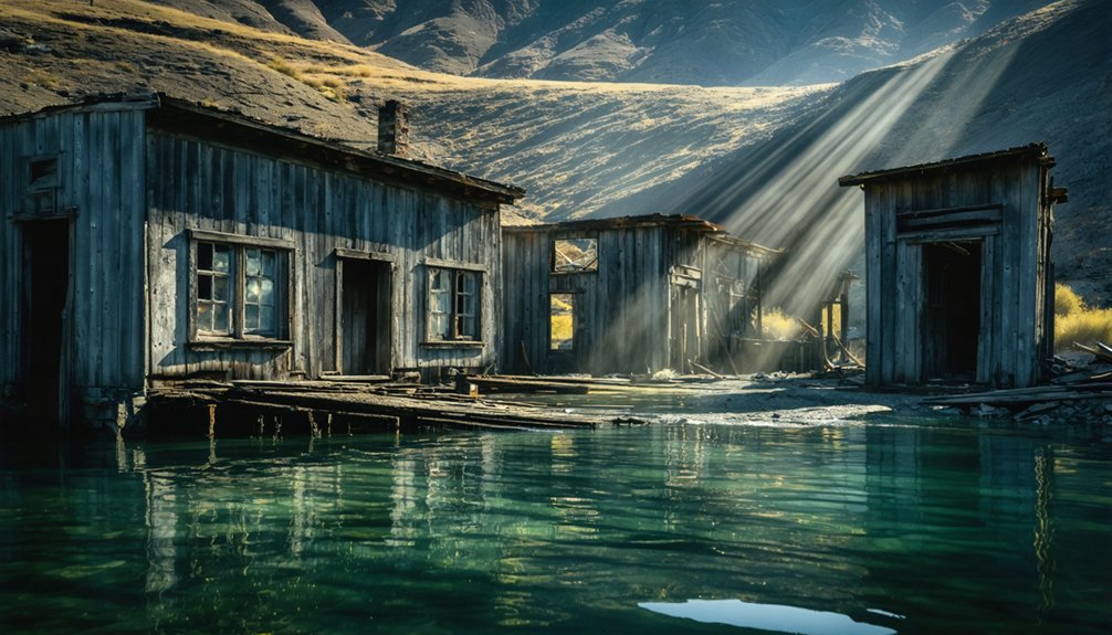
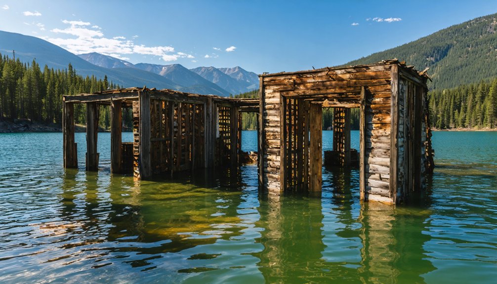
The geological event that created Roosevelt Lake has preserved an unusual archaeological site now accessible to underwater explorers and surface observers. You’ll find building foundations visible when water clarity and light conditions align ideally.
The site, located 85 miles northeast of Cascade in Valley County, offers exploration opportunities during low water periods via boat access across calm surface conditions.
Underwater exploration reveals minimal intact structures after 100+ years of submersion. You’ll observe scattered boards from disintegrated buildings and occasional surfaced resident items, though submerged artifacts remain scarce.
Historical photographs from Western Mining History website document pre-submersion conditions.
The former Monumental Creek townsite operates as an intriguing underwater ghost town, where natural dam formation in 1909 created permanent preservation conditions for this Thunder Mountain area settlement.
Tales of Two Towns: Different Paths to Submersion
You’ll find that Roosevelt and American Falls represent fundamentally different mechanisms of town submersion in Idaho’s history. Roosevelt’s destruction occurred through natural catastrophe—hydraulic mining destabilized terrain that collapsed during heavy rainfall in the 1890s, burying the 7,000-resident town under mud and water within days.
In contrast, American Falls underwent systematic relocation between 1925-1927 as the Bureau of Reclamation’s dam project created a reservoir, allowing residents to move their entire settlement rather than flee disaster.
American Falls: Planned Relocation
Unlike most submerged settlements that met their fate through unplanned flooding, American Falls orchestrated North America’s first complete municipal relocation in response to federal dam construction.
When the U.S. Bureau of Reclamation built the 94-foot-high American Falls Dam in the 1920s, you’d witness 344 residents, 46 businesses, and critical infrastructure systematically transferred to higher ground.
The urban planning process sorted buildings by quality into three designated neighborhoods around a new town square, creating what authorities termed a “designed community.”
This government-mandated project addressed irrigation shortages but demonstrated the environmental impact of large-scale water management on established settlements.
Today, the 103-foot Oneida Milling and Elevator Company grain elevator remains visible above the reservoir, while the original townsite emerges during low-water periods.
Roosevelt: Natural Disaster Destruction
While American Falls residents methodically relocated under federal oversight, Roosevelt’s 7,000 inhabitants faced a catastrophic natural disaster triggered by their own mining operations. You’ll find this Thunder Mountain District supply hub exemplifies unregulated mining environmental consequences.
Hydraulic operations destabilized surrounding terrain throughout the early 1900s boom, when over 10,000 received mail at the post office.
In spring 1909, heavy rains initiated a three-mile landslide from Mule Creek, creating a 200-foot-high natural dam across Monumental Creek. Waters rose gradually over months—streets held three feet within eight hours. No casualties occurred during this slow-motion catastrophe.
Buildings floated on Roosevelt Lake for decades, with remnants still visible underwater today. You won’t find organized flood recovery here; the site remains submerged in Frank Church Wilderness, accessible only to those willing to trek Idaho’s primitive backcountry.
Though separated by only 150 miles, American Falls and Roosevelt descended into permanent submersion through fundamentally opposed mechanisms that reveal Idaho’s complex relationship with water management. You’ll find American Falls represents deliberate governmental action—bureaucratic planning displaced an entire community for irrigation infrastructure and hydroelectric development.
Roosevelt’s fate emerged from uncontrolled environmental consequences: hydraulic mining destabilized terrain, triggering catastrophic landslides within 48 hours.
Both towns shared gold rush origins in Idaho’s legendary boom era, yet their cultural impact diverged sharply. American Falls’ controlled relocation preserved community continuity through systematic engineering.
Roosevelt’s residents fled with minimal possessions, their town vanishing beneath spontaneous geological collapse. These contrasting narratives demonstrate how human intervention and natural forces equally shaped Idaho’s landscape, leaving submerged monuments to progress and disaster alike.
Frequently Asked Questions
Are There Other Underwater Ghost Towns in Idaho Besides American Falls and Roosevelt?
No other underwater ghost towns exist in Idaho beyond American Falls and Roosevelt Lake. You’ll find these sites offer unique opportunities for historical preservation research and wildlife conservation studies within their protected reservoir ecosystems.
Can You Legally Dive or Swim in American Falls Reservoir and Roosevelt Lake?
You can legally swim and dive at American Falls Reservoir year-round, but you’ll need proper safety precautions for cold water risks. Avoid marked exclusion zones and dam areas where illegal diving occurs, and always follow commercial diving regulations if applicable.
Were There Any Deaths During the Roosevelt Landslides or American Falls Relocation?
No deaths occurred during Roosevelt’s wave-generating landslides despite geological instability creating 65-foot tsunamis. American Falls relocation likewise produced no recorded fatalities, though flooding hazards from concurrent Eastern Idaho events affected 50,000 acres regionally.
What Happened to the Original American Falls Dam After the Town Relocated?
The original 1926 dam deteriorated over decades, prompting historical engineering solutions. You’ll find it was demolished after a larger replacement structure was completed downstream in 1978, addressing environmental impact concerns and structural deficiencies.
How Do Water Levels at These Sites Vary Throughout the Year?
You’ll find seasonal water fluctuations create summer lows exposing American Falls foundations, while winter brings deeper submersion. Roosevelt Lake’s rainfall impact from historic landslides maintains consistent levels, with visibility depending on calm conditions rather than predictable seasonal patterns.
References
- https://www.onlyinyourstate.com/trip-ideas/idaho/id-underwater-ghost-town
- https://1043wowcountry.com/idaho-has-its-own-atlantis-explore-the-underwater-ghost-town/
- https://mix106radio.com/explore-idahos-atlantis-the-ghost-town-now-underwater/
- https://www.britannica.com/place/Silver-City-ghost-Idaho
- https://www.youtube.com/watch?v=fLcGX5bAZl0
- https://newsradio1310.com/idahos-underwater-ghost-town-in-idaho-falls/
- https://history.idaho.gov/wp-content/uploads/2018/09/American_Falls_Idaho_Relocated_Townsite_64500955.pdf
- https://www.eastidahonews.com/2025/08/american-falls-celebrates-100-years-since-its-historic-move/
- https://www.youtube.com/watch?v=d9nYlFQj_E0
- https://mix106radio.com/idaho-town-was-relocated-twice/