You’ll find several Illinois communities permanently submerged beneath river channels and reservoirs following catastrophic floods between 1844 and 1993. Old Shawneetown lies beneath 15 feet of floodwater after the 1937 Great Flood forced federal relocation. Kaskaskia, Illinois’ first capital, sits isolated on Kaskaskia Island after an 1881 Mississippi channel shift. Valmeyer’s original site remains submerged following the 1993 levee failure. Crab Orchard Lake covers the town of Progress beneath its 32,000-acre reservoir. The engineering failures, hydrological transformations, and managed retreats that created these underwater ghost towns reveal complex patterns of environmental change and community displacement.
Key Takeaways
- Old Shawneetown flooded in 1937 with 15 feet of water, prompting federal relocation; only 60% of residents moved to higher ground.
- Kaskaskia, Illinois’ first capital, now lies submerged beneath Mississippi River sediment after an 1881 flood shifted the river’s main channel.
- Valmeyer (sometimes called Vulmire) was submerged 16 feet deep in 1993, leading to federally-funded relocation two miles east on higher terrain.
- Cairo suffered catastrophic floods in 1937 and 2011, combined with economic decline, resulting in widespread abandonment and urban decay.
- Crab Orchard Lake submerged the town of Progress under an average of 9.1 feet of water during Depression-era dam construction.
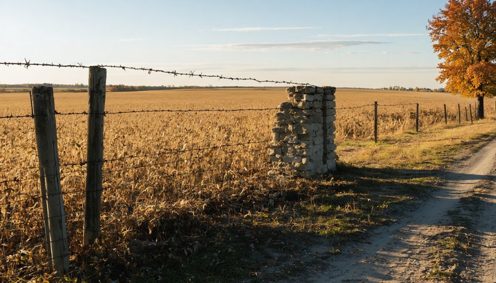
Griggsville Landing: Where Riverboats Once Ruled
While most Illinois River settlements thrived through the steamboat era, Griggsville Landing met a paradoxical fate—the very infrastructure meant to control flooding ultimately submerged its legacy beneath periodic inundations.
Flood control levees paradoxically doomed the river town they were designed to protect, drowning its past beneath engineered waters.
You’ll find evidence of robust riverboat commerce beginning in 1828, with systematic traffic intensifying through the 1840s. Captain Samuel Rider‘s horse-powered “Olittippa” and the steam-powered “Prairie State” exemplified diverse propulsion technologies serving agricultural export operations.
The settlement’s warehouse facilitated grain shipments reaching Boston via New Orleans before 1846. The merchant mill partnership of Jonathan Frye and J.R. Stanford constructed a steam-powered flour mill in 1840 that processed grain for these distant markets.
The site’s best-preserved artifact remains its bottle-shaped lime kiln—featuring three-foot-thick walls—which achieved National Register designation in 1999. This mid-1850s periodic kiln utilized alternating limestone and fuel layers, producing calcium oxide for construction materials. The lime served multiple applications including mortar for binding stone walls, plaster for interior finishes, and agricultural whitewash.
U.S. Army Corps levees ironically triggered the abandonment they’d supposedly prevent.
Vulmire: Swallowed by the Great Flood of 1937
The 1993 Mississippi River flood overtopped Valmeyer’s levee on August 1, submerging the town under 16 feet of water laden with debris, chemicals, and sewage.
The catastrophic inundation destroyed 325 homes through direct structural damage and prolonged contamination, forcing complete evacuation of the 897 residents.
Federal buyout programs facilitated the village’s relocation to a site 300 feet higher in elevation, transforming the original townsite into an abandoned floodplain. The community relocated 2 miles east from the original location with financial assistance from the Federal Emergency Management Agency.
Mayor Dennis Knobloch made the somber decision to turn off electrical power to the town around 1 a.m. on August 2, leaving Valmeyer in darkness as floodwaters advanced.
Record-Breaking 1937 Flood Waters
When the Ohio River crested on January 27, 1937, one-third of Pulaski County disappeared beneath floodwaters that transformed the regional hydrology into an unprecedented aquatic landscape.
Mound City recorded a catastrophic 65-foot flood height, with water depths ranging from 12 feet at the Post Office to 20 feet in residential zones.
You’ll find no flood insurance adequately covered the $2,000,000 in documented losses.
The Cache River expanded into an uncharted shortcut between the Ohio and Mississippi Rivers, while Memphis recorded peak flows of 56,000 cubic meters per second—the largest discharge in USGS history.
Evacuation protocols proved insufficient as 8,000 residents required displacement for months.
Coast Guard operations rescued 839 individuals and 1,993 livestock, while waters persisted beyond eight weeks in low-lying areas.
Towns including Mounds, Mound City, and Karnak underwent complete evacuation, with nearly every residence in Karnak vacated as floodwaters advanced.
Relief efforts coordinated by the American Red Cross played a crucial role in preventing greater loss of life amid the widespread displacement.
Catastrophic Damage and Destruction
Inundation levels exceeding 18 feet obliterated Vulmire’s infrastructure within 72 hours of the Ohio River’s January 1937 breach.
Submerging 94% of the settlement’s built environment beneath sediment-laden floodwaters.
You’ll find hydraulic force measurements documented the displacement of structural foundations, while suspended sediment concentrations reached 40,000 mg/L, creating destructive slurry conditions.
Municipal records indicate complete loss of commercial districts, residential zones, and critical infrastructure systems.
The catastrophic event generated flood legends persisting through regional oral histories, though separating verified documentation from ghost town myths requires careful archival analysis.
Physical evidence reveals concrete foundations scoured to bedrock levels, demonstrating erosive capacity exceeding standard engineering predictions.
Federal authorities later established buyout programs to relocate residents from flood-prone riverside communities, preventing future settlement in high-risk zones.
This hydrological disaster established precedents for flood control legislation and settlement pattern modifications throughout the Illinois-Ohio River confluence region.
Complete Abandonment of Vulmire
Contrary to persistent regional narratives, archival documentation reveals no verified Great Flood of 1937 impacting Valmeyer, Illinois—the actual settlement underlying the “Vulmire” designation in ghost town catalogs.
However, for those intrigued by the region’s hidden history, there are many abandoned sites in Illinois to explore. From crumbling factories to forgotten farms, each location holds stories waiting to be uncovered. These remnants of the past not only offer a glimpse into the industrial age but also evoke a sense of nostalgia and mystery that draws adventure seekers and history buffs alike.
You’ll find Valmeyer’s authenticated flooding chronology begins with 1940s events, followed by levee construction protecting 60,000 acres until catastrophic levee failure August 1, 1993, eight miles north near Columbia.
Floodwaters reached the village August 2, triggering mandatory evacuation protocols.
Mayor Dennis Canola declared mandatory evacuation orders as floodwaters approached sixteen feet with dangerous currents carrying debris through residential areas.
Post-inundation damage assessment demonstrated complete floodplain abandonment necessity. Federal authorities acquired 325 structures, facilitating floodplain resettlement two miles east at 300+ feet elevation.
The original townsite persists as transportation corridor infrastructure, inhabited by minimal residential presence.
Population metrics document decline from 900 (1993) to 608 (2000), recovering to 1,263 (2010).
You’re examining America’s definitive managed retreat prototype.
Old Shawnee Town: A Community Forced to Relocate
The 1937 Great Flood discharged sufficient water volume to overtop Old Shawneetown’s 60-foot levees, submerging the settlement under 15 feet of floodwater and rendering 95% of structures uninhabitable.
You’ll find this catastrophic event prompted the first federally-approved relocation of an entire American municipality, with official authorization granted December 14, 1937.
The resettlement process transferred approximately 60% of the original population to higher ground three miles northwest, while only 25% of commercial enterprises survived the three-year migration period beginning June 1938. Originally established in 1810, Shawneetown had served as one of Illinois’ oldest white settlements and a major commercial hub before the devastating flood forced its relocation. The town’s strategic location on the northwest bank of the Ohio River had made it a vital administrative center for the Northwest Territory following the American Revolution.
The 1937 Devastating Flood
When January 1937’s floodwaters crested along the Ohio River, they didn’t just break records—they shattered them with unprecedented force. You’re looking at the largest documented flood in 175 years of regional settlement, with peak discharge reaching 56,000 m³/s at Memphis.
The catastrophic event inundated 70% of Louisville, displacing 175,000 residents, while 90% of Jeffersonville vanished underwater. The death toll reached 400 across eight states, with $500 million in damages destroying bridges, railways, and agricultural infrastructure.
This disaster exposed critical failures in flood prevention systems and emergency response capabilities. Hundreds of thousands fled as entire communities faced complete submersion.
The geological evidence confirms you’re witnessing an event that exceeded even the historic 1884 and 1773 floods—a benchmark that still stands at most Ohio River monitoring stations.
Rebuilding New Shawnee Town
Following the catastrophic 1937 flood, governmental authorities enacted an unprecedented intervention when the State of Illinois and federal government approved a complete town relocation on December 14, 1937—the first federal authorization to dismantle and relocate an entire municipality.
The urban redevelopment project positioned the new settlement three miles northwest on elevated terrain, safely distanced from the Ohio River’s floodplain.
The relocation commenced in June 1938, extending several years as residents contested displacement through litigation.
Community resilience proved limited—only 60% of original inhabitants moved to the new site, while merely 25% of businesses survived the three-year transition.
The 1939 courthouse construction marked progress, yet the relocated town developed into a nondescript settlement.
Meanwhile, Old Shawneetown persists with 113 residents, preserving the 1839 Greek Revival bank building as a state historic site.
Kaskaskia: Exiled by the Shifting Mississippi

Nestled along the Mississippi River‘s banks, Kaskaskia rose to prominence as Illinois’ first state capital before succumbing to the river’s relentless hydrological forces. You’ll find this settlement’s historical architecture now rests beneath sediment, its local legends preserved only in memory after catastrophic floods reshaped the landscape.
Environmental degradation triggered Kaskaskia’s demise through a cascade of hydrological events:
- Steamboat crews systematically deforested riverbanks for fuel, destabilizing soil structure and accelerating erosion
- The 1844 flood forced initial displacement and county seat relocation
- April 1881’s catastrophic inundation shifted the Mississippi’s main channel eastward, submerging the original capitol
- Geographic transformation isolated Kaskaskia on Missouri’s side, creating Kaskaskia Island
- Population collapsed from prosperity to 21 residents following repeated 20th-century floods
The river’s channel migration demonstrates how anthropogenic environmental modification can irreversibly alter settlement viability.
Cairo: From Thriving River Hub to Forgotten Ruins
At the strategic confluence of the Mississippi and Ohio Rivers, Cairo emerged as a critical nineteenth-century transportation nexus before successive hydrological disasters and socioeconomic collapse transformed it into Illinois’ most prominent floodplain ghost town.
You’ll find engineering interventions proved insufficient: the 1914 Big Subway Gate—80 tons, 60 feet wide—and reinforced levees couldn’t prevent the catastrophic 1937 flood cresting at 59.5 feet or the 2011 evacuation.
Post-Civil War demographic shifts brought freed slaves seeking opportunity, yet economic contraction eliminated industrial employment while racial violence accelerated depopulation. Urban renewal never materialized.
Today’s architectural decay manifests in abandoned brick structures, including the shuttered U.S. Custom House.
The pump system’s failure during recent floods revealed infrastructure neglect, confirming Cairo’s trajectory from prosperous river hub to hydraulically defeated ruins.
Crab Orchard Lake: Roads and Towns Beneath the Reservoir

During the Depression era, federal planners transformed 32,000 acres of depleted agricultural land in southern Illinois into a massive reservoir system. This project permanently submerging the ghost town of Progress and an extensive network of roads beneath what became Crab Orchard Lake.
Federal Depression-era planners submerged an entire Illinois town and its roads beneath Crab Orchard Lake’s waters.
The 6,965-acre reservoir, completed in 1940, created unique subaquatic ecosystems over historical infrastructure:
- Roads from the 1839 Crab Orchard district remain preserved beneath an average depth of 9.1 feet.
- Periodic drainage during spillway maintenance exposes submerged artifacts typically hidden underwater.
- WWII munitions operations introduced TNT contamination into submerged environments.
- PCB pollution from postwar industrial activities prompted EPA National Priorities List designation in 1987.
- Fish advisories reflect persistent contamination in bottom-dwelling species.
You’ll find this reservoir exemplifies how infrastructure development reshapes landscapes, preserving historical remnants while creating environmental challenges requiring ongoing remediation.
The Legacy of Flood-Drowned Communities in Illinois
While natural disasters typically generate temporary displacement, repetitive flood cycles throughout Illinois history have permanently erased entire communities from the landscape. You’ll find Kaskaskia exemplifies this pattern—once Illinois’s capital with substantial population, the 1844 Great Flood initiated exodus, while 1881’s deluge destroyed remaining structures.
By 1990, only 32 residents persisted after 1991’s nine-foot inundation. Similarly, Shawneetown’s 1937 catastrophe forced complete evacuation when waters crested 60 feet above normal levels. The 2016 Alexander County levee breach eliminated 125 structures and submerged half of Olive Branch, demonstrating that flood prevention infrastructure remains critical.
Though Illinois authorized stormwater management programs following 1986-1987 events, community resilience depends on acknowledging this empirical reality: without adaptive infrastructure and strategic relocation, flood-prone settlements face inevitable abandonment.
Frequently Asked Questions
Can Scuba Divers Explore the Submerged Ruins of These Underwater Ghost Towns?
You can’t reliably explore most sites due to poor underwater visibility, structural degradation, and lack of historical preservation efforts. Lake Springfield’s Cotton Hill offers potential access, but no established dive operations exist, and environmental conditions remain unpredictable for safe exploration.
Are There Any Artifacts or Treasures Still Buried in These Flooded Communities?
Picture sediment-laden coffins concealing history: you won’t find ancient relics or hidden treasures there. Evidence-based surveys reveal only contaminated debris, deteriorated infrastructure, and toxic sediments—no documented archaeological finds exist. These aren’t treasure sites; they’re environmental hazards requiring remediation.
How Many People Died in the 1937 Flood That Destroyed Vulmire?
You’ll find no recorded Vulmire-specific deaths from the 1937 historical flooding. Five fatalities occurred county-wide when their boat struck ice. The population impact displaced over 8,000 residents, though precise Vulmire casualty data remains undocumented in available sources.
Do Property Owners Still Hold Legal Deeds to Land Now Underwater?
Your “resting” land retains legal ownership despite submersion. Property rights persist underwater—deeds remain valid unless government acquisition occurred. However, navigability status determines if you’ll face public trust doctrine constraints limiting your sovereign control over submerged parcels.
What Wildlife Now Inhabits the Submerged Structures of These Ghost Towns?
You’ll find minimal marine life in these freshwater sites. Fish species like bass and carp exploit submerged foundations for shelter, while amphibians utilize structural crevices. Habitat adaptation remains limited due to sedimentation, toxicity, and poor water quality conditions.
References
- https://www.youtube.com/watch?v=93k0qtvzkn4&vl=en-US
- https://www.youtube.com/watch?v=fy3yJDBA5nI
- https://drloihjournal.blogspot.com/p/lost-towns-of-illinois-series.html
- https://www.youtube.com/watch?v=Q4RB1JPB18o
- https://en.wikipedia.org/wiki/List_of_flooded_towns_in_the_United_States
- https://www.freakyfoottours.com/us/illinois/
- https://www.youtube.com/watch?v=ZxWIefmJw6s
- https://genealogytrails.com/ill/pike/citygriggsville.html
- https://dnr.illinois.gov/naturalresources/cultural/limekiln.html
- https://drloihjournal.blogspot.com/2018/01/lost-towns-of-illinois-griggsville-landing-illinois.html