You’ll find several ghost towns submerged beneath Louisiana’s waters, including communities around Toledo Bend Reservoir like Pine Flat and Robinson Bend, deliberately flooded in 1969 with minimal compensation to residents. East Krotz Springs disappeared under the Morganza Spillway‘s operations in 1973 and 2011, while Elliot City was evacuated in 1939 for spillway construction. La Balize, France’s 1699 strategic outpost, succumbed to repeated hurricanes by 1865. Descendants preserve these histories through reunions, manuscripts, and relocated cemeteries, maintaining cultural memory where physical landscapes have vanished beneath reservoirs and coastal erosion.
Key Takeaways
- Toledo Bend Reservoir submerged Pine Flat, Robinson Bend, and Time, Texas after 1964, displacing over 100 families with minimal compensation.
- East Krotz Springs lies underwater in Atchafalaya National Wildlife Refuge, submerged by Morganza Spillway operations in 1973 and 2011.
- Elliot City was evacuated in 1939 for Morganza Spillway construction and now sits beneath US Route 190 with no remaining traces.
- La Balize, Louisiana’s first French outpost from 1699, was repeatedly destroyed by hurricanes and permanently submerged in 1865.
- Torras flooded in 1912 displacing 17,000 residents and declined after railroad relocation, leaving no structures at the former junction site.
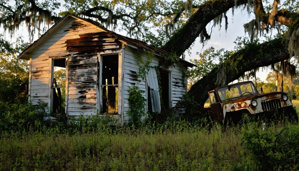
Toledo Bend Reservoir: Communities Lost to Progress
When construction crews broke ground on Toledo Bend Dam in May 1964, they set in motion an engineering triumph that would erase entire communities from Louisiana’s landscape.
You’ll find that Pine Flat’s 50 homes, Robinson Bend’s 30-40 Black families, and Time, Texas disappeared beneath 186,000 acres of water by 1969.
Three Louisiana communities—Pine Flat, Robinson Bend, and Time, Texas—vanished forever beneath Toledo Bend’s massive reservoir by 1969.
Cultural preservation proved minimal—displaced residents received just $1,900 per home, while floodplain agriculture and ancestral lands vanished without federal oversight.
The reservoir submerged over 100 archaeological sites, including Caddoan settlements, with only identified cemeteries relocated to higher ground.
Today’s droughts expose forgotten burial grounds, revealing what authorities overlooked.
Communities from Barlake to Kites Landing exist now only in memory, their sacrifice enabling Louisiana’s hydroelectric ambitions.
The Sabine River Authority wielded eminent domain to acquire properties, offering approximately $125 per acre for land that families had cultivated for generations.
The $70 million project was completed without federal assistance, relying instead on state cooperation between Texas and Louisiana authorities.
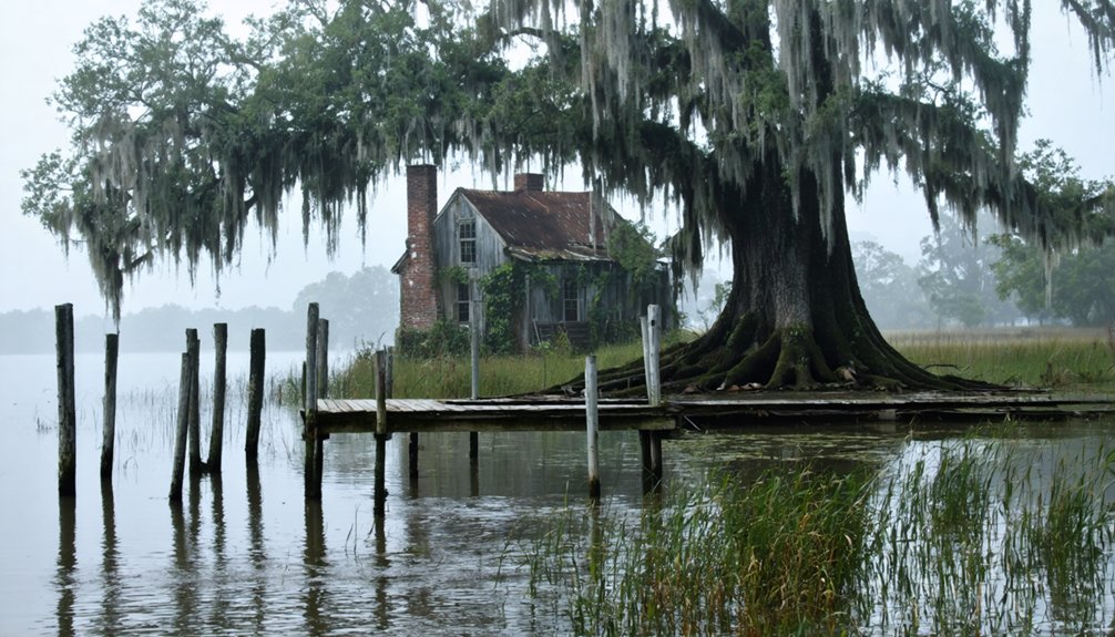
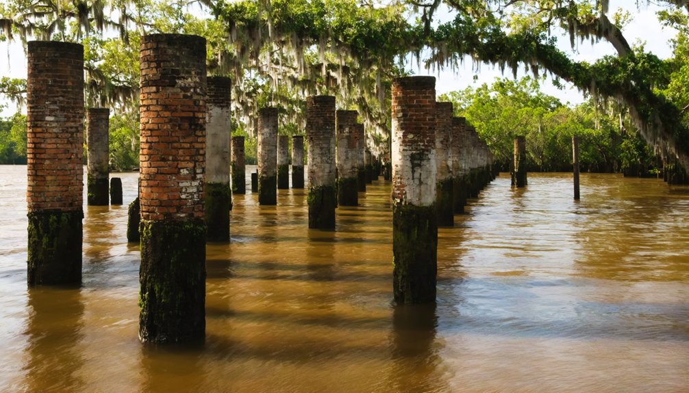
Bayou Chene: Vanished by Flood and Engineering
After Congress passed the 1876 Timber Act to finance levee construction through cypress swamp sales, swampers and lumberjacks established Bayou Chene deep in Louisiana’s Atchafalaya Basin. You’ll find this Cultural Heritage now buried beneath twelve feet of silt—erased by engineering decisions that prioritized New Orleans over isolated settlements.
The 1927 flood convinced the Army Corps to construct a spillway directly through Bayou Chene’s location, displacing 60,000 people. Subsequent levee construction and river dredging intensified Environmental Impact through recurrent flooding. By 1953, the post office closed, triggering the loss of many homes and businesses as the community became uninhabitable. Today, APTIM’s floodgate structure at Bayou Chene protects 30,000 residents across six Louisiana parishes from the same Atchafalaya River backwater flooding that once destroyed the historic settlement.
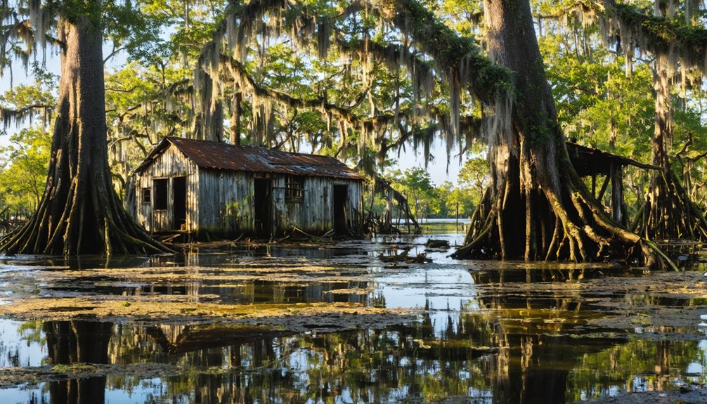
East Krotz Springs: From Lumber Town to Watery Grave
Along the east bank of the Atchafalaya River at Bayou Sherman’s mouth, lumbermen established Latania—later renamed East Krotz Springs—to harvest the region’s cypress stands during the early 1900s.
You’ll find nothing remains of this lumber mill town that once thrived in Pointe Coupee Parish’s 1st Ward, directly across from Krotz Springs at coordinates 30°32’12.87″N, 91°44’24.59″W.
The Atchafalaya’s levees broke in 1912 and 1913, foreshadowing the town’s eventual destruction. When the Morganza Spillway system was completed in 1939, East Krotz Springs fell within its flood zone. The spillway opens during high Mississippi River water to prevent flooding in major downstream cities like Baton Rouge and New Orleans.
The 1973 and 2011 Morganza gate openings submerged everything completely. River flow changes that reshaped the Atchafalaya’s course accelerated the town’s decline and ultimate abandonment. Today, only submerged trees and occasional boat wrecks mark this ghost town‘s watery grave within the Atchafalaya National Wildlife Refuge, preserving evidence of Louisiana’s disappeared settlements.
Elliot City: Sacrificed for the Morganza Spillway
Six miles west of Livonia in Pointe Coupee Parish’s 10th Ward, Elliot City met its demise not through natural disaster but through federal engineering decisions. You’ll find US Route 190 now covers this former lumber community at coordinates 30°33′21.4″N 91°39′44.9″W, where residents were forcibly evacuated in 1939 for Morganza Spillway construction.
A Louisiana lumber town erased by federal decree, now buried beneath highway asphalt and spillway floodwaters since 1939.
Before government intervention, Elliot City had already endured Atchafalaya River flooding in 1912 and 1913 from Torras crevasse backwater. The 1927 McCrea crevasse brought additional floodwaters to the already vulnerable settlement. The town’s location near an inactive WWII bombing range from the U.S. Army Air Corps adds another layer to its forgotten history.
The community’s sacrifice enabled flood control infrastructure protecting downstream populations, though at freedom’s expense for displaced residents.
When spillway gates opened in 1973 and 2011, the site submerged completely. No traces remain of this ghost town, now perpetually threatened by land subsidence and controlled flooding within the spillway’s floodway levee system—a permanent reminder of engineered displacement.
La Balize: The Persistent Settlement at the River’s Mouth
You’ll find La Balize established in 1699 as France’s first strategic outpost in Louisiana—a wooden fort and lighthouse tower positioned where the Mississippi River met the Gulf to control all upriver passage.
This settlement endured catastrophic hurricanes in 1740, 1778, 1819, 1860, and 1865, each time either rebuilding at new locations or relocating entirely, demonstrating remarkable persistence until final abandonment.
The site functioned primarily as essential quarters for river pilots who navigated ships through the delta’s treacherous shifting passages, sandbars, and currents that made guided entry to New Orleans mandatory. A community of approximately 400 Americans lived in plank shacks built on stilts, moored against the persistent threat of storms, enduring harsh conditions amid miasmas and fevers. Residents traversed the settlement using plank footpaths connecting structures positioned on piles surrounded by water, slime, and towering reeds.
France’s First Louisiana Outpost
When French explorer Robert de La Salle claimed the Mississippi River delta in 1682, he recognized what would become one of colonial Louisiana’s most strategically essential—and perpetually threatened—settlements.
By 1699, France erected a simple wooden fort to control river passage, establishing the first permanent outpost at what became known as La Balize.
The 1720 engineer reports documented a 250-by-120-foot compound on Isle of Tolouse, housing soldiers, slaves, and priests—early historical immigration to Louisiana’s treacherous delta.
A 62-foot wooden pyramid rose above the marshes by 1721 as a navigation beacon.
Yet coastal erosion and shifting delta currents forced constant relocations, foreshadowing the site’s eventual disappearance beneath Gulf waters—a pattern that would define this settlement’s three-century struggle against nature’s relentless advance.
Hurricanes and Repeated Destruction
Although France designed La Balize as a permanent sentinel over the Mississippi’s mouth, the settlement’s location condemned it to perpetual reconstruction. You’ll find that hurricanes destroyed this strategic outpost repeatedly from 1740 onward, forcing residents to relocate five miles northwest by 1752.
The 1860 hurricane season proved catastrophic: August’s storm brought 10-foot surges, while September’s hurricane generated six-foot tides that finally ended La Balize’s existence. Without modern flood control infrastructure, settlers couldn’t combat the Mississippi’s dynamic hydrology and coastal erosion that continuously reshaped the delta.
Each relocation documented nature’s relentless erosion of human attempts at permanence. By 1865, hurricanes had obliterated all remaining traces, demonstrating that freedom from governmental oversight couldn’t overcome environmental forces governing Louisiana’s coast.
River Pilots’ Temporary Quarters
Since Robert de La Salle identified the Mississippi River’s mouth as strategically critical in 1682, French colonizers established La Balize in 1699 with a wooden fort and lighthouse-type tower to control river passage.
You’ll find that river pilots maintained temporary quarters here through centuries of rebuilding, their expertise in ship navigation proving economically essential for accessing New Orleans. These pilot homes evolved from permanent family dwellings housing up to 800 residents to functional work facilities.
The Crescent River Port Pilots’ Association continued operating temporary quarters into the modern era, even after the devastating 1860 hurricane forced relocation to Pilottown.
Steam tugboats enhanced pilots’ maneuvering capabilities, while temporary housing, weather stations, and oil tanks supported offshore operations, preserving Louisiana’s maritime independence despite nature’s persistent assault.
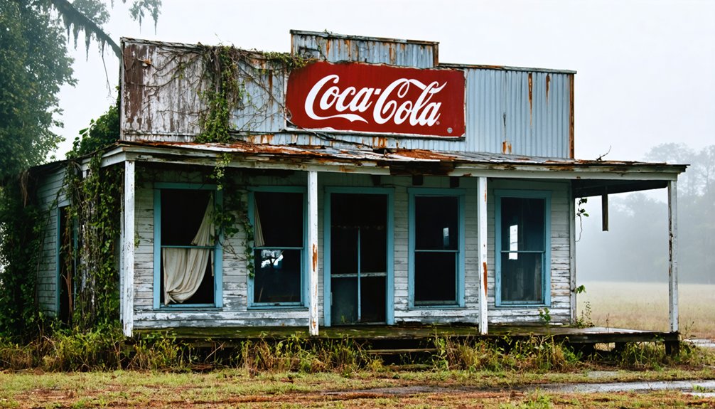
Torras: A Would-Be Shipping Hub Swept Away
While optimism drove Joseph Torras to establish his namesake town in 1902 at the northeast corner of Pointe Coupee Parish, geography ultimately determined its fate. You’ll find that Torras’s strategic position at the Texas & Pacific Railroad junction and Lower Old River promised significant economic impact as a shipping hub between the Mississippi, Red, and Atchafalaya Rivers.
However, the May 1, 1912 flood breached the levee directly fronting the town, displacing 17,000 parish residents and killing at least 28. Despite demonstrating remarkable disaster resilience by rebuilding and surviving 1927’s devastating flood, Torras couldn’t overcome railroad relocation.
When the tracks moved, the town’s commercial purpose vanished. Today, no structures remain to mark where this once-promising community stood.
Preserving the Memory of Louisiana’s Submerged Past
You’ll find descendants of Toledo Bend’s submerged communities actively documenting their heritage through reunions, Facebook groups, and manuscripts like McGraw’s “What Went Under,” which preserves pre-reservoir landscapes and family connections.
These grassroots preservation efforts matter because approximately 10 family cemeteries remain unidentified beneath 110 feet of water, making oral histories and archival documentation the primary means of maintaining community memory.
Unlike Bayou Chene and Elliot City—buried under silt with no surface markers—Toledo Bend’s organized descendant networks demonstrate how systematic story collection safeguards the historical record when physical sites become permanently inaccessible.
Documenting Lost Community Stories
When communities vanish beneath reservoir waters, the physical landscape isn’t the only casualty—collective memory faces erasure without deliberate preservation efforts.
You’ll find descendants combating this loss through systematic documentation. The manuscript “What Went Under” recorded pre-submersion family histories and landscapes, preserving who lived where before displacement.
Since 2018, the Facebook group “What Went Under (the Water of Toledo Bend Reservoir)” has enabled descendants to share recollections and maintain cultural impact across generations.
Oral history from grandparents provides firsthand accounts of daily life on Main Street before submersion.
These preservation initiatives ensure that communities like Pine Flat, Robinson Bend, and Fairdale remain accessible through documented narratives rather than campfire folklore alone.
Without such efforts, these histories would disappear as completely as the towns themselves.
Archaeological and Memorial Efforts
As reservoir waters claimed communities across Louisiana, cemetery preservation emerged as the most urgent archaeological priority during displacement operations. You’ll find the Sabine River Authority coordinated systematic exhumation and reinterment of graves into pine boxes, transferring them to higher ground while maintaining original burial configurations.
This preserved your ability to locate ancestral sites and maintain familial connections despite geographic disruption.
Approximately ten burial grounds remained submerged when authorities couldn’t identify descendants. These sites now form underwater ecosystems where maritime folklore intersects with factual displacement history. Documentation efforts like McGraw’s “What Went Under” manuscript created archival records detailing family relationships and precise locations of lost communities.
The stories of these submerged sites often evoke the mysterious allure of the lost islands of Hawaii’s coast, drawing interest from historians and explorers alike. As researchers delve deeper into these underwater realms, they uncover not only artifacts but also narratives that bridge the past with the present. Each discovery sheds light on the cultural significance of these areas, enriching our understanding of Hawaii’s diverse heritage.
Digital platforms expanded access to these preservation materials, ensuring you can trace your connection to submerged landscapes beneath Toledo Bend Reservoir and other flooded sites.
Frequently Asked Questions
Can Divers Legally Explore the Underwater Remains of These Submerged Towns?
You can explore most submerged Louisiana towns without explicit legal restrictions, though you’ll encounter limitations near active flood control systems. Preservation efforts don’t specifically protect these sites, but you should respect underwater cultural heritage and private property boundaries.
Are There Maps Showing Exact Locations of Buildings Beneath the Water?
No exhaustive underwater maps exist showing exact building locations. You’ll find historic preservation efforts focus on pre-submersion documentation rather than detailed sonar surveys, as environmental impact assessments prioritize flood management over archaeological mapping of submerged structures.
What Personal Belongings Were Left Behind When Families Evacuated These Towns?
You’ll find haunted memories of abandoned possessions like grave markers, home foundations, and personal effects submerged below Toledo Bend. Families left behind furniture, clothing, and household items when forced relocations displaced hundreds during 1960s reservoir construction.
Do Fish and Wildlife Now Inhabit the Submerged Structures and Foundations?
Yes, you’ll find submerged structures function as artificial reefs supporting diverse aquatic species. These marine ecosystems harbor fish, crayfish, and crustaceans while archaeological discoveries reveal how abandoned foundations create protected habitats enabling wildlife populations to thrive independently.
Have Any Artifacts Been Recovered From These Underwater Ghost Towns?
Archaeological discoveries remain remarkably rare—you’ll find limited artifact documentation despite decades of exploration. Historical artifacts were allegedly collected, but they lack peer-reviewed validation or detailed cataloging, leaving you with more questions than verified evidence about Louisiana’s submerged structures.
References
- https://1033thegoat.com/louisiana-towns-under-toledo-bend-reservoir/
- https://973thedawg.com/17-ghost-towns-in-louisiana/
- https://texashighways.com/culture/history/the-lost-underwater-towns-of-texas/
- https://en.wikipedia.org/wiki/Elliot_City
- https://www.youtube.com/watch?v=Ek7uzJY4S2c
- https://www.ezhomesearch.com/blog/ghost-towns-in-louisiana/
- https://en.wikipedia.org/wiki/Toledo_Bend_Reservoir
- https://tpwmagazine.com/archive/2011/feb/legend/
- https://www.youtube.com/watch?v=bMOwRY5An30
- https://www.texasescapes.com/EastTexasTowns/Time-Texas.htm