New Jersey’s reservoirs conceal entire displaced communities beneath their surfaces. When officials constructed the Round Valley and Jersey City reservoirs between 1966 and 1971, they flooded over 2,350 acres, submerging colonial homes, farmsteads, schools, and churches after relocating graves of Revolutionary War heroes. You’ll find these ruins 60-180 feet underwater, where building foundations and old roadways now serve as archaeological sites and aquatic habitats. The reservoirs’ 26 documented fatalities since 1971 have spawned supernatural folklore connecting tragic incidents to the displaced residents’ spirits, while periodic droughts expose previously hidden infrastructure that validates the region’s haunted reputation.
Key Takeaways
- Three dams flooded 2,350 acres between 1966-1971, submerging entire communities with homes, schools, churches, and infrastructure still visible underwater.
- Old Boonton’s colonial structures lie 60 feet deep in Jersey City Reservoir, accessible to divers exploring foundations and pathways.
- Displaced residents received minimal compensation before flooding; graves were relocated but buildings and roads remain submerged as archaeological sites.
- Periodic droughts expose hidden foundations, roads, and artifacts from over two dozen submerged farms and settlements.
- Submerged ruins now serve as aquatic habitats while fueling local folklore about ghostly apparitions and the reservoir’s haunted reputation.
The Flooded Farmlands of Round Valley Reservoir
Before Round Valley Reservoir became New Jersey’s largest water storage facility in 1971, the circular basin sustained a thriving agricultural community that cultivated its fertile soil for generations.
The 1929 Great Depression and subsequent three-year drought devastated these farmlands, yet families persisted until state-mandated displacement in 1960.
Residents received minimal compensation and nearby housing options that often separated families, though many expressed opposition to selling their properties.
You’ll find that construction of three dams along the valley’s borders initiated a five-year flooding process beginning in 1966, ultimately submerging 2,350 acres beneath 55 billion gallons of water reaching 180-foot depths.
The New Jersey Water Authority created the reservoir to supply water to Lebanon Township and surrounding areas in Hunterdon County.
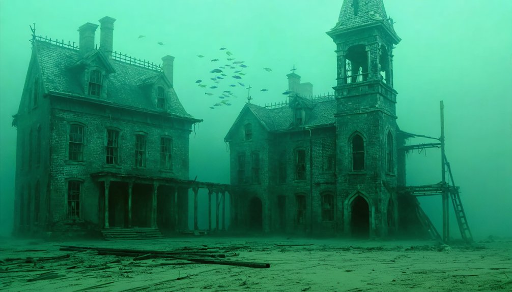
Today’s submerged infrastructure—including school ruins, church remains, and house foundations positioned 1,500-1,800 feet offshore—serves as artificial habitat supporting aquatic wildlife.
The reservoir now maintains southernmost naturally reproducing lake trout populations while providing drought relief for central New Jersey.
What Lies Beneath: Exploring the Submerged Ruins
The reservoir’s surface conceals an archaeological landscape of structural remnants that document pre-inundation settlement patterns across multiple New Jersey water bodies. You’ll find building foundations 1,500-1,800 feet from Round Valley’s shore, where tree stumps and demolished structures create underwater archaeological sites.
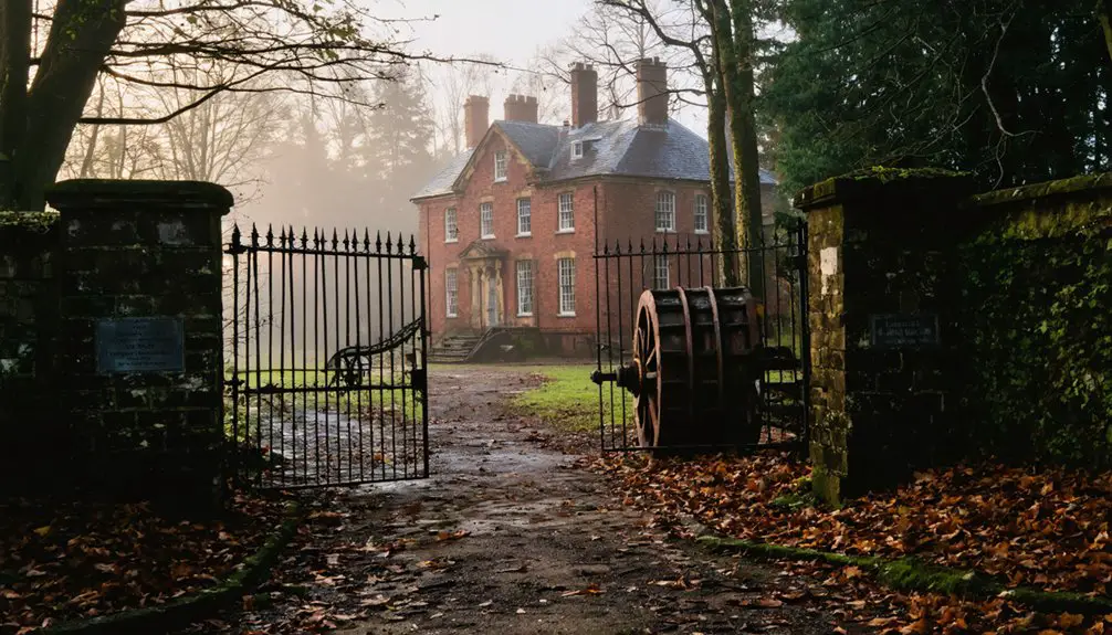
At 60 feet beneath Jersey City Reservoir, Old Boonton’s colonial-era homes and Samuel Ogden’s Revolutionary War-era estate remain accessible to divers. These submerged pathways and structural remains constitute tangible evidence of displacement, where 16 relocated homes and demolished barns mark governmental authority over private property rights. The area served as Native American hunting ground before European settlement transformed the landscape. The reservoir’s construction required meticulous grave re-interment, with Revolutionary War heroes’ remains relocated before the flooding began.
While severe droughts occasionally expose ancient artifacts, archaeologists have systematically removed preserved materials. Video documentation from diving expeditions provides ongoing research opportunities, though Round Valley’s 180-foot maximum depth and variable visibility conditions present technical challenges for exhaustive surveys.
The Bermuda Triangle of New Jersey: Unexplained Disappearances
Since 1971, Round Valley Reservoir has accumulated 26 documented fatalities and six unrecovered bodies, earning its designation as New Jersey’s “Bermuda Triangle” through a pattern of drownings and disappearances that exceed statistical norms for comparable recreational water bodies.
You’ll find maritime navigation becomes compromised when sudden fog banks reduce visibility to near-zero conditions without warning. Underwater acoustics at 180-foot depths create disorienting sound patterns that confuse swimmers and boaters attempting to locate shorelines.
Safety procedure violations remain the primary causative factor, though locals attribute unexplained vanishings to displaced residents’ spirits. Scuba divers continue to explore the depths, discovering remnants of old buildings that remain visible beneath the surface.
The reservoir’s haunted reputation stems from its origins as Native American hunting grounds and Revolutionary War territory—historical layers that amplify supernatural folklore surrounding unrecovered victims who disappeared beneath 55 billion gallons of water.
Old Boonton: The Village 60 Feet Below the Surface
Sixty feet beneath Jersey City Reservoir‘s surface lies Old Boonton, a village founded in 1747 that succumbed to municipal water expansion between 1902 and 1903. You’ll find no historical preservation here—Jersey City Water Supply Company razed everything during an eight-year clearance operation.
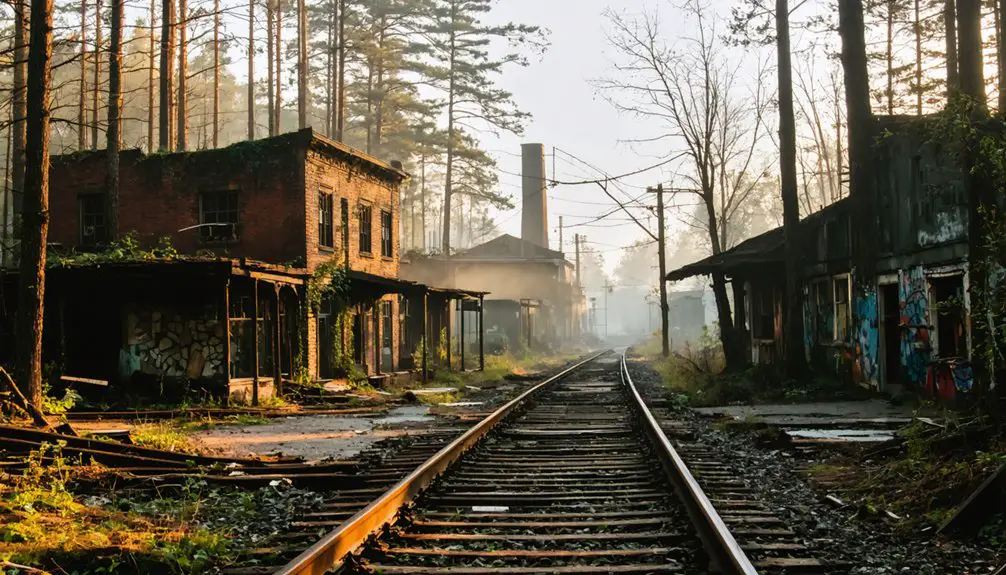
Workers demolished private homes, churches, and factories by hand, using horses and small steam engines to haul debris. The site’s industrial heritage, including ironworks powered by the 36-foot Boonton Falls, vanished completely.
Only foundation remnants and stone boundary walls remain submerged. The environmental impact was absolute: a thriving community erased for 40 million gallons of daily water capacity.
Owner Fitz Gibbon received $85,000 compensation while workers faced deadly conditions—Armenian laborer Herbert Joseph died during dam construction in 1903. Nearby Powerville faced a similar fate when proposals emerged in 1903 to build a 28-foot high dam, creating a reservoir that would have flooded Rockaway Valley across 4.6 square miles. The original settlement was named after Thomas Boon, a colonial governor of New Jersey in the late 1700s.
Legends and Sightings of the Sunken Communities
When reservoirs flood historic settlements, displaced communities leave behind more than submerged foundations—they generate persistent folklore that merges documented tragedy with supernatural speculation.
You’ll find compelling examples at Round Valley Reservoir, where 26 drownings since 1971 earned it the nickname “Bermuda Triangle of New Jersey.” Marine archaeology confirms visible building foundations beneath the surface, validating partial elements of local legends. Divers report discovering submerged graves and structural remnants that fuel ghostly apparitions narratives.
The Pine Barrens’ Mullica River presents different spectral accounts: hooded figures emerging on cloudless nights, attributed to Joe Mulliner’s 1850 exhumation. Meanwhile, fog conditions over reservoirs create optical phenomena that observers interpret as 18th-century buildings materializing from depths. During winter drawdowns for repairs, previously hidden roads and foundations occasionally surface, intensifying speculation about what else remains concealed.
These sightings reflect historical displacement bitterness, transforming state-mandated relocations into enduring revenge folklore. The original Round Valley farming community comprised over two dozen homes along one main road before the late 1950s dam construction forced relocation.
Frequently Asked Questions
Are There Other Underwater Ghost Towns in New Jersey Besides These Two?
Based on available evidence, you won’t find other documented underwater ghost towns in New Jersey beyond these two. Historical preservation records and environmental impact studies don’t confirm additional submerged communities, though extensive archival research remains incomplete.
Exploring different regions can lead to unique discoveries, much like seeking out dogfriendly spots in South Carolina. These locations not only welcome pets but also offer beautiful scenery and enjoyable activities for both dogs and their owners. Finding the right places enhances the overall experience of traveling with furry companions.
Can Recreational Divers Legally Access the Submerged Structures at Round Valley?
Yes, you can legally access Round Valley’s submerged structures. No legal restrictions prohibit recreational diving to the foundations. However, you must prioritize dive safety given the site’s extreme depths and documented fatalities in these challenging waters.
What Happened to the Cemeteries When the Valleys Were Flooded?
Out of sight, out of mind—you’ll find no documentation of flooded cemeteries at Round Valley. Historical records don’t mention grave relocations, suggesting preservation challenges weren’t addressed or no burial grounds existed pre-flooding, leaving this question frustratingly unanswered.
How Do Round Valley and Old Boonton Compare to Similar Reservoirs Nationwide?
Round Valley’s 180-foot depth and Boonton’s submerged architecture mirror nationwide reservoir ecosystems like Lake Lanier and Shasta Lake, though you’ll find they displaced fewer communities. Their drowning rates and technical diving access patterns align with comparable flooded-valley sites.
Were Residents Fairly Compensated When Forced to Relocate for Reservoir Construction?
You’ll find fair compensation remains questionable—residents faced relocation challenges with land-only buyouts, no documented adequate payouts, and forced removals despite local opposition. Evidence suggests minimal support beyond property acquisition, undermining true equitable treatment for displaced communities.
References
- https://www.onlyinyourstate.com/experiences/new-jersey/underwater-ghost-town-nj
- https://nj1015.com/new-jerseys-mysterious-hidden-underwater-town/
- https://morristowngreen.com/2022/03/25/the-lost-village-of-old-boonton-its-history-and-disappearance-beneath-the-waters-of-the-rockaway-river/
- https://www.youtube.com/watch?v=Z_Dvvo9wGXY
- https://www.youtube.com/watch?v=mhkUyQh_P60
- https://en.wikipedia.org/wiki/List_of_flooded_towns_in_the_United_States
- https://www.onlyinyourstate.com/nature/new-jersey/bucolic-village-reservoir-nj
- https://en.wikipedia.org/wiki/Round_Valley_Reservoir
- https://www.scubadiving.com/submerged-town-round-valley-lebanon-new-jersey
- https://www.youtube.com/watch?v=_eRA1OeaCUc