You’ll discover entire communities beneath Midwest reservoirs, deliberately flooded for hydroelectric development between the 1920s and 1960s. Michigan’s Rawsonville (submerged 1925), North Dakota’s eight Fort Berthold communities (1956), and Missouri’s five Lake of the Ozarks towns represent over 150,000 acres of inhabited land sacrificed for infrastructure. Sites like Oasis, Missouri rest 100 feet underwater with preserved architecture, while relocated structures—including Mark Twain’s birthplace cabin—avoided submersion through documented preservation efforts. Advanced technical diving and underwater archaeology now provide access to these historically significant locations, revealing the substantial cultural cost of regional power generation.
Key Takeaways
- Rawsonville, Michigan, founded in 1800, was submerged in 1925 by a hydroelectric dam creating Belleville Lake.
- Lake Sakakawea in North Dakota submerged eight Native communities in 1956, displacing over 1,700 indigenous people.
- Bagnell Dam flooded five Missouri towns including Old Linn Creek between 1929-1931, creating Lake of the Ozarks.
- Oasis, Missouri lies 100 feet underwater in Table Rock Lake, attracting technical divers to explore preserved architecture.
- Florida, Victor, and Stoutsville were inundated by reservoirs, now serving as underwater archaeology sites in the Midwest.
Rawsonville, Michigan: A Civil War Era Settlement Lost to Hydroelectric Progress
When Henry Snow arrived at his namesake landing in 1800, he established what would become one of Michigan’s earliest settlements along the Huron River—a community that would flourish, fade, and ultimately disappear beneath the waters of a man-made reservoir.
From frontier promise to underwater tomb, Rawsonville’s journey mirrors countless American settlements lost to progress and ambition.
You’ll find Rawsonville’s story documented through its 1836 incorporation and Civil War-era prosperity, when mills, factories, and saloons served its growing population.
However, railroad bypass triggered economic collapse by the 1880s, reducing the settlement to near-ghost town status by 1900.
Detroit Edison’s 1925 hydroelectric dam created Belleville Lake, submerging village remnants. The French Landing dam permanently buried the original townsite beneath the lake’s waters.
While modern urban expansion continues westward on original townsite land, Michigan’s 1983 historic designation preserves this cultural heritage.
Sawmills, general stores, and factories remain entombed beneath the reservoir’s surface.
Lake Sakakawea’s Eight Drowned Communities and the Displacement of Fort Berthold Reservation
The Garrison Dam’s completion in 1956 transformed the Missouri River Valley into Lake Sakakawea, North Dakota’s largest reservoir, while simultaneously submerging eight Native American communities and displacing over 1,700 members of the Mandan, Hidatsa, and Arikara Nation from Fort Berthold Reservation.
You’ll find Elbowoods, Sanish, Red Butte, Lucky Mound, Nishu, Beaver Creek, Independence, Shell Creek, and Charging Eagle now rest beneath 155,000 acres of water. The flooding destroyed 94-98% of the reservation’s arable land, erasing schools, hospitals, and homes. Built for flood control and hydroelectric power generation, the dam prioritized downstream infrastructure over indigenous land rights.
Tribal sovereignty meant nothing when leaders’ alternative proposals were rejected. The government’s promised irrigation projects never materialized, compounding the cultural loss of sacred sites and traditional subsistence patterns. This systematic displacement fundamentally altered indigenous lifeways, creating lasting economic hardship and justified resentment that persists today. Standing as the 5th largest earthen dam in the world, the structure created a reservoir stretching 178 miles long and up to six miles wide.
Missouri’s Lake of the Ozarks: Five Towns Sacrificed for Recreation and Power
Between 1929 and 1931, Union Electric Company’s construction of Bagnell Dam erased five Osage River Valley communities—Old Linn Creek, Irontown, Arnholdt’s Mill, Gladstone, and Ha Ha Tonka—submerging them beneath what would become Missouri’s Lake of the Ozarks.
The 148-foot dam required acquiring 60,000 acres through purchases and eminent domain, despite legal resistance from residents like Morgan M. Moulder.
Union Electric systematically cleared structures, burned wooden buildings, demolished stone foundations, and relocated cemeteries.
Old Linn Creek, Camden County’s seat since 1841, now lies under 40 feet of water.
The ecological impacts transformed Ha Ha Tonka’s pristine spring into turbid lake water.
Only Irontown’s iron smelter and Old Linn Creek cemetery remain visible, preserving fragments of cultural heritage.
Property owners received compensation at fair market price, though many considered it insufficient given the loss of family heritage and ancestral lands.
These communities were sacrificed for hydroelectric power and recreation, displacing residents whose trauma persists in local folklore.
Visitors report paranormal activity, including tales of hearing a church bell ringing beneath the waters of Linn Creek Cove.
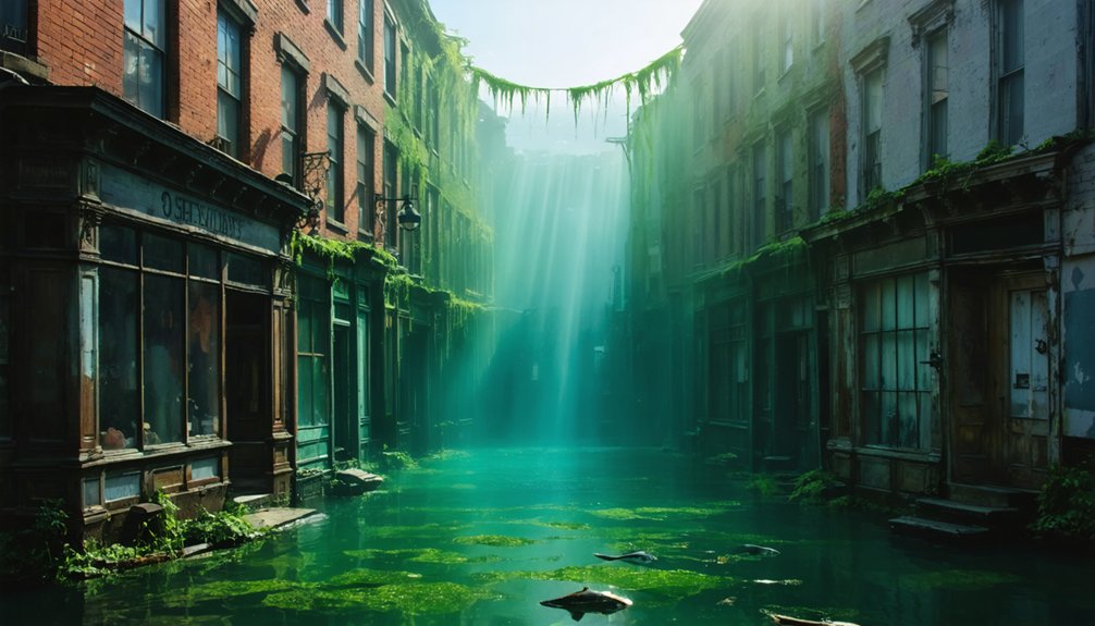
Oasis, Missouri: A Preserved Main Street 100 Feet Below Table Rock Lake
Nestled along Long Creek’s banks at the base of Goat Hill, the village of Oasis—originally called Cedar Valley—once attracted tourists to its scenic position in Taney County’s Ozark Mountains.
Before Table Rock Dam’s 1958 completion submerged it beneath 100 feet of water, this area was a popular destination.
You’ll find exceptional underwater archaeology here, where the main street’s submerged architecture remains remarkably preserved. Advanced divers can explore foundations, building rubble, and a partially intact wooden church at depths reaching 75-115 feet.
The one-lane bridge’s north pillar sits at 115 feet, requiring decompression protocols for 30-minute bottom times.
Table Rock Lake’s clear visibility makes Oasis accessible for technical diving training. Over 15 area dive shops utilize these submerged structures. The site attracts divers traveling from across the Midwest, with some journeying hundreds of miles to experience this unique open-water training location.
While exploring the site, you’ll notice that the relocated cemetery rests at Cedar Valley Church on Route 65—your only above-water connection to this drowned community. The word “oasis” itself entered English from Greek, borrowed from the ancient Egyptian term wḥ3t, reflecting the historical significance of such gathering places near water sources.
Mark Twain’s Birthplace and Other Salt River Valley Towns Beneath the Waters
When Congress authorized the Clarence Cannon Dam in 1962, the resulting Mark Twain Lake reservoir submerged multiple Salt River Valley communities beneath 55,000 acres of water.
Unlike Twain’s birthplace cabin—which had been relocated to higher ground in 1930, decades before the dam’s construction—most structures in the flood zone faced permanent inundation.
You’ll find that preservation efforts focused on documenting and relocating significant buildings before the 1984 reservoir filling, though many historic sites from the 1830s settlement era now rest beneath 100 feet of water. The relocated cabin now serves as an educational site at the Mark Twain Birthplace State Historic Site, where visitors can learn about the author’s early years and 19th-century Missouri life. The small two-room cabin, which once sheltered Twain’s parents, siblings, and an enslaved teenager, is now preserved inside a museum building that protects it from the elements.
Congressional Hydroelectric Development Plans
Following years of devastating floods along the Salt River, the Flood Control Act of 28 June 1938 authorized construction of a dam and reservoir near Joanna, Missouri, as part of the broader flood control strategy for the Upper Mississippi River Basin.
Representative Clarence Cannon championed this project for 42 years until Section 203 of the Flood Control Act of 23 October 1962 authorized multi-purpose development including hydroelectric power generation.
Construction began in 1966, creating a facility capable of producing 58 megawatts through two generators—enough electricity for 20,000 residents.
The project required acquiring 54,762 acres in fee title, submerging entire communities beneath what became Mark Twain Lake.
You’ll find limited historical preservation efforts preceded inundation, leaving significant underwater archaeology sites unexplored where Missouri’s Salt River Valley settlements once stood.
Relocated Structures and Preservation
Before construction began on Clarence Cannon Dam in 1966, preservation efforts focused primarily on Mark Twain’s birthplace cabin—a two-room structure where Samuel Langhorne Clemens was born on November 30, 1835, in Florida, Missouri.
Architectural relocation moved the cabin in June 1930 to 37352 Shrine Road, safeguarding it from eventual submersion under Mark Twain Lake.
Museum preservation at the state historic site includes Twain’s handwritten *Tom Sawyer* manuscript, first editions, and Connecticut home furnishings.
While Florida and neighboring towns Victor and Stoutsville were partially submerged by reservoir waters, the cabin’s relocation guaranteed historical continuity.
You’ll find a granite monument marking the original cabin site in Florida village, though the preserved structure now resides within a modern museum building at Mark Twain Birthplace State Historic Site, maintained by Missouri Department of Natural Resources.
Clark Lake’s Artificial Underwater Graveyard: Michigan’s Salvaged Vessel Collection
Unlike traditional ghost towns, Clark Lake’s underwater graveyard emerged through deliberate salvage operations conducted by professional divers who consolidated decades of sunken watercraft into a single site.
You’ll find this collection 60 yards offshore from Columbia Township Park’s west end, where vessels rest at depths ranging from 15 to 27 feet.
The assemblage includes boats, jet skis, boat lifts, a snowmobile, sleds, and platforms—all recovered from scattered locations across the lake and repositioned to create Michigan’s only artificial underwater vessel repository.
Professional Divers’ Salvage Operations
Beneath Clark Lake’s surface, approximately 60 yards off the west end near Columbia Township Park, professional divers have established an artificial underwater graveyard that consolidates decades of salvaged vessels and aquatic equipment.
This underwater archaeology project transformed scattered wreckage into a centralized collection spanning 15 to 27 feet deep. You’ll find boats, jet skis, snowmobiles, sleds, and platforms recovered from various lake zones—evidence of marine preservation efforts that simultaneously removed accumulated debris from the lakebed.
The salvage operations enhanced water quality for swimmers and improved conditions for recreational divers exploring Clark Lake’s underwater environment.
If you’re diving the site south of Jackson in Jackson County, Michigan, bring your underwater camera to document these preserved artifacts.
This freedom-oriented approach maintains lake safety while creating accessible exploration opportunities.
Depths and Location Details
The graveyard spans depths from 15 to 27 feet below Clark Lake’s surface, creating a vertical range that accommodates recreational diving certifications while maintaining consistent submersion.
You’ll find this collection 60 yards off the west end near Columbia Township Park in Jackson County, Michigan.
The underwater topography creates natural variation in depth across the site, positioning salvaged vessels at intervals that prevent surface disturbance while maximizing visibility for exploration.
The concentrated arrangement transforms scattered debris into a documented site you can navigate independently.
Lakebed ecosystems have begun integrating with the metal structures, establishing biological communities around hulls and frameworks.
You’re free to explore this accumulation of boats, jet skis, and platforms using standard diving equipment and underwater cameras during favorable summer conditions.
Decades of Recovered Vessels
Since 1969, Michigan’s waters have yielded vessels spanning three centuries of maritime history, establishing a precedent for underwater archaeological recovery that balances historical preservation with public access. The Alvin Clark’s extraction required three thousand dives and innovative techniques—pressurized water jets freed the schooner from clay at 45-foot depths.
You’ll find its 1972 National Register listing reflects controlled recovery methods: eight months of live steam drying prevented deterioration. Today’s framework protects remaining wrecks differently. The 1980 preserve legislation imposes felony penalties for disturbing shipwreck artifacts, recognizing that underwater ecosystems maintain pristine conditions naturally.
Lake Michigan’s oxygen-poor environment preserves materials better than museum storage. You’re witnessing a shift—from salvage operations to in-situ conservation, where 6,000 documented wrecks remain accessible yet legally protected for future exploration.
Exploring the Submerged Ruins: Diving Opportunities and Historical Preservation
While recreational divers typically explore natural formations or shipwrecks, the Midwest’s reservoir-submerged ghost towns offer distinctive archaeological dive sites that merge historical preservation with water recreation.
In addition to the wonders found in the Midwest, abandoned towns submerged in New York reveal tales of communities lost to time. These underwater remnants create a unique backdrop for divers eager to discover the stories hidden beneath the surface. Each dive can uncover artifacts and structures that chronicle the lives of those who once inhabited these now-quiet locales.
Submerged ghost towns transform historical preservation into interactive underwater archaeology, offering divers direct access to Midwest’s reservoir-flooded communities.
You’ll find Clark Lake’s intentional underwater graveyard features salvaged boats and platforms at 15-27 feet, where divers simultaneously cleaned debris while creating accessible dive sites.
Table Rock Lake’s Oasis village remains intact 100 feet below surface with above-average visibility conditions.
The submerged architecture at Belleville Lake’s Rawsonville ruins presents primarily sand and silt—no structured foundations survive, though Michigan Historical Markers document the site’s location.
These dive sites let you engage directly with marine ecology while accessing tangible historical remnants.
Unlike surface-level museum exhibits, you’re free to investigate where towns actually stood, experiencing preservation through direct environmental interaction rather than institutional mediation.
Frequently Asked Questions
Can You Legally Remove Artifacts From Underwater Ghost Towns in the Midwest?
You can’t legally dive down and pocket artifacts—federal and state legal regulations strictly prohibit unauthorized removal. Historical preservation laws protect submerged cultural resources, requiring permits and professional oversight. Violating these rules risks hefty fines and criminal charges against your freedoms.
What Safety Precautions Are Required When Diving Submerged Town Sites?
You’ll need proper diving gear including redundant air supplies, cutting tools, and thermal protection. Master buoyancy control to avoid disturbing sediment, maintain buddy contact, respect marine life, and follow the rule of thirds for gas management.
How Do Water Levels Affect Visibility of Underwater Town Structures?
Water levels release hidden history like keys to forgotten doors. When levels drop, you’ll find sediment buildup obscures details, while water clarity improves with exposure. Drastically low conditions reveal structures normally invisible—your chance to document preservation needs before waters return.
Are There Maps Showing Exact Locations of Submerged Buildings and Streets?
You’ll find limited precise maps of submerged structures. Historical cartography from pre-flooding surveys exists, but modern mapping techniques face challenges underwater. Local historical societies hold the best pre-inundation records, enabling you to independently locate specific buildings and streets.
What Happens to Cemeteries When Towns Are Intentionally Flooded for Dams?
Graves don’t simply vanish beneath the waves—you’ll find cemeteries are typically exhumed and relocated before flooding, balancing historic preservation with dam construction. However, some remain submerged, creating lasting ecological impact and restricting your access to ancestral sites.
References
- https://99wfmk.com/atlantisrawsonville2017/
- https://wmmq.com/the-underwater-ghost-village-of-clark-lake/
- https://us1033.com/uncovering-north-dakotas-underwater-ghost-towns/
- https://kxkx.com/towns-submerged-missouri-lakes/
- https://www.youtube.com/watch?v=aCFmBsgJfAM
- https://en.wikipedia.org/wiki/List_of_flooded_towns_in_the_United_States
- https://www.youtube.com/watch?v=ZxWIefmJw6s
- http://www.onlyinyourstate.com/experiences/oklahoma/underwater-city-ok
- https://www.onlyinyourstate.com/state-pride/michigan/underwater-ghost-town-mi
- https://travelswithabandon.com/2018/07/29/adventure-6-plainfield-kensington-rawsonville/


