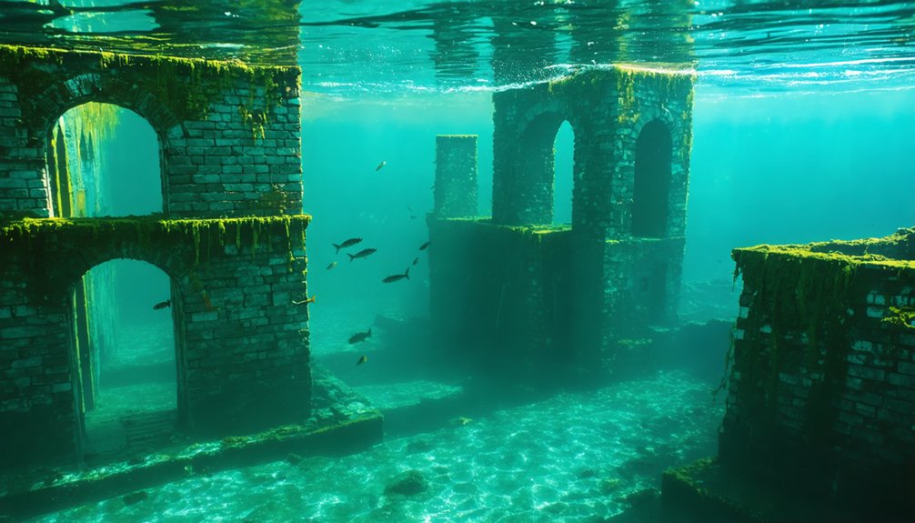
You’ll find Utah’s most notable underwater ghost towns at Rockport Reservoir, where the original settlement was deliberately flooded in 1957 after dam construction displaced 30 families, and at Thistle, catastrophically submerged by a 1983 landslide that deposited debris 130 feet high and created a reservoir reaching 170-foot depths. Recent drought conditions have dropped Rockport’s capacity to historic lows of 26–29%, exposing foundations, roadways, and artifacts submerged for 64 years. The state’s severe water crisis creates ephemeral documentation windows for these sacrificed communities.
Key Takeaways
- Rockport, established in 1860, was submerged in 1957 by Rockport Reservoir after displacing 30 families for water infrastructure.
- Thistle, a vital 1880s railroad junction, was flooded in 1983 by a massive landslide creating a natural dam.
- Severe drought has exposed 64 years of submerged foundations, roads, and artifacts at historic lows in Rockport Reservoir.
- Preserved structures like schoolhouses and chapels were relocated; cemeteries remain on higher ground above flood zones.
- These underwater ghost towns symbolize communities sacrificed for regional water management and provide archaeological documentation opportunities.
Rockport: A Town Renamed Through Time
When European-American settlers established Crandall in 1860 at the mouth of Three Mile Canyon, they couldn’t have anticipated their community would cycle through three distinct names before disappearing beneath reservoir waters a century later.
You’ll find the settlement’s evolution documented through its nomenclature: Enoch City in 1861, Rock Fort in 1867 following construction of defensive walls during the Black Hawk War, and finally Rockport after dismantling those fortifications in the 1870s.
The community supported between 100-200 residents at its peak before population decline began in the 1940s.
The federal government’s 1952 land acquisition triggered systematic town relocation efforts.
Preservationists salvaged key historical architecture—the schoolhouse and cooperative building relocated to Lagoon Amusement Park’s Pioneer Village, while the chapel found sanctuary at Rockport State Park.
The cemetery remained accessible on higher ground, ensuring ancestral connections survived submersion.
Drone photography revealed roads and foundations that remained visible despite being submerged for over six decades.
The Wanship Dam and the Drowning of Rockport
Between 1954 and 1957, the Bureau of Reclamation’s construction of Wanship Dam—a 150-foot-high, 2,000-foot-long structure—permanently submerged Rockport beneath the rising waters of the newly formed reservoir.
You’ll find that 27 families vacated their homes after the government finalized land acquisition in 1952. Though preservationists successfully relocated the schoolhouse and chapel before inundation occurred.
The severe Utah drought that lowered reservoir levels decades later exposed the town’s foundations and artifacts, prompting Summit County to collect these submerged remnants for historical documentation and public exhibition. Wanship Reservoir regulates the Weber River alongside Lost Creek, East Canyon, and Smith and Morehouse reservoirs. The reservoir currently sits at 26% capacity, revealing faint outlines of old buildings and roads that remained hidden underwater for over five decades.
Construction and Town Submersion
Following federal acquisition of Rockport through eminent domain in 1952, the Bureau of Reclamation initiated construction of the Wanship Dam in 1954.
The displacement of nearly 30 families occurred as a result, who had maintained the town’s population of approximately 200 residents for a century. The structure rose over 150 feet high and stretched 2,000 feet across Weber Valley, 1.5 miles south of Wanship.
By 1957, completion triggered immediate flooding of the valley floor. The flooding occurred five years after the White House approved the dam project.
Historical preservation efforts salvaged only the schoolhouse and chapel, relocating them to Lagoon Amusement Park‘s Pioneer Village. Everything else—homes, productive farmland, the rock fortification from the Black Hawk War—disappeared beneath Rockport Reservoir’s waters.
The ecological impacts were permanent: a functioning agricultural community and century-old settlement erased for water storage and recreation purposes under the Weber Basin Project. The project simultaneously created other reservoirs including Willard Bay, Pineview, Causey, East Canyon, and Lost Creek.
Drought Reveals Lost Foundations
As drought conditions intensified across Utah starting in 2021, Rockport Reservoir’s water levels dropped dramatically.
This exposure revealed foundations and remnants that had remained submerged for over six decades. You’ll find archaeological remains of home foundations, street layouts, and infrastructure materializing along the receding shoreline—physical evidence of federal displacement decisions made in 1952.
National media documented this environmental recovery, though the term “ghost town” romanticizes what represents forced relocation under eminent domain.
The exposed structures offer you tangible proof of government power exercised over private property and communities. These ruins demonstrate how central planning prioritized regional water distribution over established agricultural settlements, permanently altering land use through dam construction that eliminated individual property rights for collective resource management objectives.
The Wanship Dam, which created Rockport Reservoir, was finished in 1957 following decades of planning under the Central Utah Project.
The Weber Basin Project now serves water to over 500,000 people and irrigates more than 90,000 acres across the Wasatch Front region.
Extreme Drought Reveals What Was Lost
In September 2021, you could observe Rockport’s structural foundations emerging from Rockport Reservoir after water levels plummeted to 25% capacity—the lowest point in 64 years.
The extreme drought affecting 88.1% of Utah exposed roads and home foundations that had remained submerged since the town’s flooding in 1957. Reservoir storage can preserve water across multiple years, but extended drought periods eventually deplete even these reserves, forcing water levels to historic lows.
This unprecedented exposure provided the first documented opportunity to record and analyze the physical remnants of the settlement before subsequent water level recovery obscured them again.
Rockport’s Foundations Resurface Again
During Utah’s most severe drought conditions in recorded history, Rockport’s submerged foundations broke through the reservoir’s surface for the first time in 64 years.
You’ll find the reservoir at just 29% capacity, exposing concrete foundations, home sites, and road networks that disappeared when the dam’s gates closed in 1952.
This environmental impact has created an unexpected opportunity for historical preservation documentation before water levels rise again.
From designated overlooks, you can observe the original town grid where 27 families once lived.
The Bureau of Reclamation’s data confirms this marks the lowest water level since filling began.
You’re advised that muddy conditions persist around exposed structures, and the boat ramp remains temporarily closed.
The town’s cemetery remains accessible on a hill above the waterline, having never been submerged during the reservoir’s creation.
With 88.1% of Utah experiencing extreme drought, these remnants offer tangible evidence of communities sacrificed for water infrastructure.
Reservoir Drops 53 Percent
Rockport’s exposed foundations represent just one data point in Utah’s statewide water crisis.
You’re witnessing thirty-two of Utah’s largest forty-two reservoirs dropping below 55% capacity, with overall storage declining from 64% to 53% in one year. Moon Lake’s collapse from 63% to 18% capacity and Echo Reservoir’s plummet from 99% to 53% since June demonstrate failures in water management.
Reservoirs are being drawn down at double normal rates, fundamentally altering reservoir ecology. With 94% of the state experiencing drought—up from 20% last year—and snowpack at a twenty-five-year low, you’re facing systemic collapse.
The state’s dependence on 95% snowpack-derived water supply means you’ll need immediate conservation action and agricultural reforms to preserve remaining reserves.
Drought Uncovers Buried History
When drone operator Devon Dewey flew over Rockport Reservoir on September 11, 2021, his footage documented what sixty-four years of submersion had concealed: the geometric patterns of foundations, roadways, and structural remnants from a town that housed 200 residents across 27 families. The reservoir had dropped to 25-29% capacity—its lowest level since 1957—exposing archaeological evidence that prolonged inundation transforms into ancient artifacts.
You’re witnessing how extreme drought conditions, affecting 88.1% of Utah and 2.8 million residents, inadvertently function as excavation events. The exposed foundations reveal not just built environments but disrupted underground ecosystems where aquatic life displaced terrestrial habitats. This intersection of climate crisis and historical preservation demonstrates how environmental stress exposes what centralized water management buried—your access to suppressed community histories.
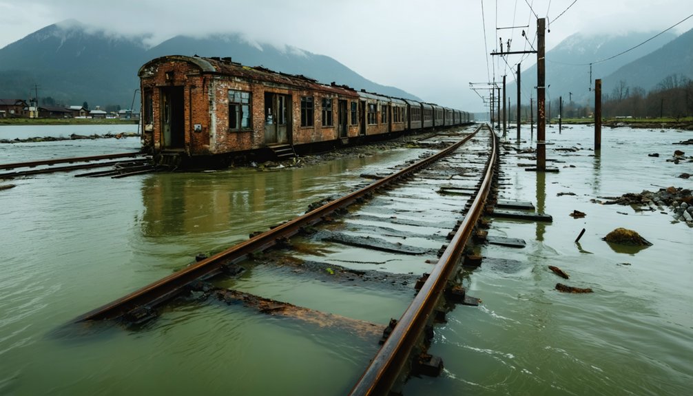
Thistle: Railroad Junction Turned Disaster Site
Though settlement began modestly in the 1880s, Thistle evolved into Utah’s most strategically important railroad junction by the early twentieth century.
You’ll find that two major rail lines—the Denver and Rio Grande Western and Utah Railway—converged here under a 1913 joint operating agreement covering 71.95 miles of track. The junction facilitated railroad logistics between Salt Lake City, Denver, and southern Utah’s coal counties, while U.S. Highways 89 and 6 intersected nearby.
By 1917, over 1,600 residents supported engine houses, coaling stations, and railroad shops. Helper engines stationed at Thistle assisted trains ascending Soldier Summit’s steep grade.
However, the 1983 landslide buried this critical infrastructure, triggering legal disputes over responsibilities and marking the town’s community decline into complete abandonment.
The 1983 Landslide That Changed Everything
After record-breaking precipitation in fall 1982 combined with deep winter snowpack and unseasonably warm spring temperatures, the Spanish Fork Canyon experienced catastrophic geological failure in April 1983.
The mountain moved at two feet per hour, reaching maximum speeds of 3.5 feet per hour. Within days, debris grew 130 feet high and traveled three miles down the canyon, completely damming the Spanish Fork River.
The natural dam created a reservoir that reached 90 feet deep initially, expanding to 170 feet by May.
Twenty-two families received two-hour evacuation notices as water submerged Thistle entirely.
This landslide aftermath resulted in over $200 million in damages—America’s costliest. Flood recovery required Utah’s first Presidential disaster declaration, severing Denver-Salt Lake rail service and closing highways for nearly a year.
What Remains Above and Below the Water
The catastrophic events that created these submerged landscapes left behind archaeological records that appear and disappear with water levels.
You’ll find Rockport’s foundations emerging annually during drawdowns, while Thistle’s lone hilltop house stands defiant above swampy remnants.
St. Thomas reveals its ice cream parlor chimney when Lake Mead drops—the heart of town rests 90 feet down normally.
Archaeological findings documented across these sites include:
- Floor joists, walls, and cisterns preserved in mudrock matrices
- Historic artifacts relocated to Pioneer Village before Rockport’s flooding
- Exhumed cemetery remains from pre-flood evacuation protocols
Erosion effects complicate preservation—crumbling foundations and exposed road remnants deteriorate with each exposure cycle.
Mormon Island’s ruins fluctuate between visibility and 90-foot depths, creating ephemeral windows for documentation before water reclaims these testaments to displaced communities.
Visiting Utah’s Submerged Ghost Towns Today
Accessing these submerged archaeological sites requires understanding seasonal water fluctuations and regional drought patterns that dictate visibility windows.
Timing your exploration to low-water seasons unlocks hidden structures otherwise concealed beneath reservoir surfaces and fluctuating shorelines.
You’ll find Rockport Reservoir near I-80 in Summit County, where water level changes annually reveal at least one building—during severe droughts, the entire townsite emerges.
Thistle’s ruins sit along Route 89 in Spanish Fork Canyon, partially submerged in swampy conditions with one elevated house remaining most visible.
Local legends surrounding these sites attract freedom-seekers willing to explore off-grid locations, though Thistle’s easy-to-miss structures demand intentional stops.
For preserved artifacts without water access challenges, visit Rockport’s relocated items at Pioneer Village inside Lagoon.
Plan visits during documented low-water periods for ideal archaeological observation.
Frequently Asked Questions
Are There Other Submerged Ghost Towns in Utah Besides Rockport and Thistle?
No other submerged ghost towns exist in Utah’s records besides Rockport and Thistle. You’ll find these sites face preservation challenges from water erosion, yet they’ve created unique tourism opportunities for documenting infrastructure remains during drought-exposed periods.
exploring peerless ghost town history reveals not just the remnants of past communities but also the stories of resilience and change. Visitors can immerse themselves in the rich narratives that these submerged locations offer, gaining insights into the lives of those who once thrived there. As tourists venture into these sites, they contribute to the ongoing preservation efforts, ensuring that this unique chapter of history is not forgotten.
Can Divers Legally Explore the Underwater Ruins of These Ghost Towns?
You can’t legally dive these sites due to state park regulations, private property restrictions, and diving safety concerns. Legal regulations prohibit unauthorized submersion activities, while swampy conditions and preservation laws protect these historically significant locations from disturbance.
What Happened to the Residents Who Were Forced to Leave These Towns?
You’ll find resident stories scattered through historical preservation records: families received government buyouts, relocated nearby towns, or moved west. The Pace family’s five-generation legacy and relocated buildings at Lagoon demonstrate their resilience and adaptation.
Will Rockport Remain Visible or Will Rising Water Levels Submerge It Again?
What goes down must come up—you’ll see Rockport’s visibility fluctuate with water level predictions tied to precipitation cycles. Environmental impact from drought exposes foundations temporarily, but rising reservoir levels will submerge them again, restricting your access to snorkeling only.
Are There Any Artifacts or Historical Items Recovered From These Underwater Sites?
You won’t find underwater archaeology efforts here—historical preservation focused on relocating artifacts *before* submersion. Rockport’s items went to Pioneer Village, while Thistle families salvaged belongings during evacuation. Exposed foundations remain untouched, preserving structural evidence naturally.
References
- https://icmglt.org/utah-ghost-town-reemerges-after-60-years-underwater-revealing-a-glimmer-of-history/
- https://www.utahsadventurefamily.com/thistle-ghost-town/
- https://fujixweekly.com/2019/02/01/house-underwater-thistle-utah/
- https://www.atlasobscura.com/places/thistle-ghost-town
- https://www.youtube.com/watch?v=dtGv-aXeTZ8
- https://ksub590.com/ixp/1126/p/utah-reservoir-hides-underwater-ghost-town/
- https://www.fox29.com/news/extreme-drought-uncovers-ghost-town-hidden-under-utah-reservoir
- https://www.businessinsider.com/forgotten-town-utah-resurfaced-after-it-was-submerged-in-water-2021-9
- https://www.ksl.com/article/50243431/utah-ghost-town-reappears-as-a-result-of-drought
- https://star981.com/utah-reservoir-hides-underwater-ghost-town/


